Saltar al contenido principal
icon-intereses-naturaleza

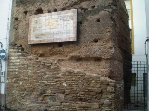
Walls of Andújar

Submitted by brandcode_deweloper on
Id
320995
Descripción
Descripción larga

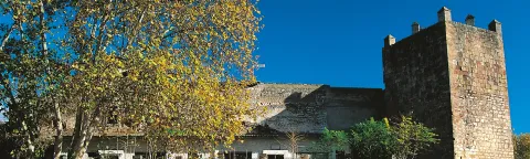
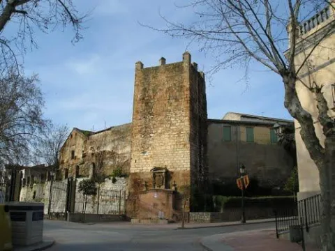
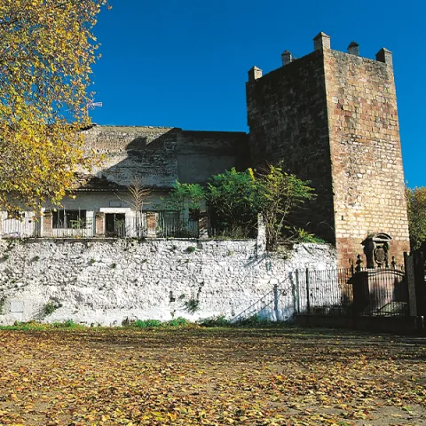
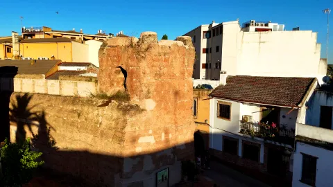
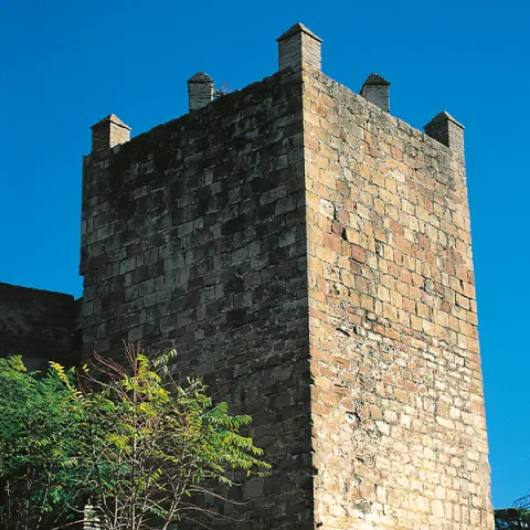
El castillo de Arjonilla está formado por una torre de planta cuadrangular de sillarejo, de 17 m de altura, estructurada en tres plantas abovedadas, más terraza dotada de merlatura y almenas; conserva el tramo de escalera que comunica la segunda planta con la terraza, que se encuentra embutida en el muro noroeste. El torreón fue objeto de transformaciones internas, entre las que habría que destacar la demolición del lienzo original para articular una entrada en recodo al interior de la fortaleza, con arco apuntado de ladrillo. Se añadieron también las escaleras adosadas al muro sureste que comunican las plantas 2ª y 3ª, cegando parcialmente una puerta. 

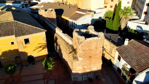
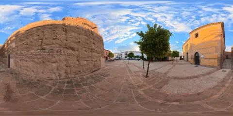
A esta torre se adosó un recinto amurallado de tendencia cuadrangular, que en su flanco norte se adelanta para unirse a la torre, dando lugar a un polígono de siete lados. Sus ángulos estarían protegidos por torres de planta circular, de las que se conserva la de su extremo noreste. Las murallas contarían con caminos de ronda almenados a los que se accedería a través de rampas.

En el interior del recinto se ha documentado un posible torreón, se trata de una estructura de planta cuadrangular de 12 x 12 m, con adosamientos y refuerzos en su lado oeste, de la que sólo se conservan los cimientos. Este basamento ha sido relacionado con la cimentación de su Torre del Homenaje, que para algunos autores pudo resultar de la habilitación de la antigua torre de alquería para estos fines. Estudios futuros deberán determinar si su origen es anterior o posterior a la actual fortaleza.

La fortificación continuará ocupada una vez perdida su función militar, erigiéndose edificios que han dejado vestigios en su interior. En un primer momento, probablemente a mediados del siglo XVI, sería utilizado como lugar de enterramiento, ya que se han hallado numerosos osarios construidos en ladrillo y excavados en la base geológica. 

A esta necrópolis se superponen dos grandes edificios rectangulares que apoyan en el muro sureste de la fortificación. El resto de muros, en los que se abren estrechas puertas, fueron levantados con pequeñas piedras mezcladas con barro. Parecen datar de los siglos XVI y XVII.

Posteriormente se construyeron otras dependencias de funcionalidad desconocida, compartimentadas mediante muros de piedra y cal y canto o de ladrillo. Revocadas de yeso blanco, en las paredes se abren vanos con pilares para soportar arcadas de ladrillo. Entre estas estructuras existiría un espacio abierto o patio con un empedrado de cantos de río.

Pero la transformación más agresiva se corresponde con la demolición del muro sur del recinto para comunicar la fortaleza con un edificio residencial nobiliario, que contaría con una instalación industrial, concretamente una almazara para la obtención de aceite de oliva. La instalación de canales de ladrillo atravesando los edificios y dependencias anteriores, quizá relacionados con el nuevo uso industrial que adquiere la fortificación, indica que todos ellos se encontraban ya en desuso o demolidos. 

Finalmente, el recinto formaría parte de un antiguo grupo escolar y de un antiguo cuartel de la Guardia Civil.

La aparición de dos sarcófagos visigodos en las inmediaciones de Arjonilla, en el paraje popularmente conocido como Las Herrerías o cortijo del Mono (uno de ellos integrado en el altar de la Parroquia de la Encarnación y el otro expuesto en el Museo Provincial de Jaén), y de una lápida funeraria de mediados del s. VII que actualmente se encuentra desaparecida, apuntan a la existencia de un lugar de culto cristiano junto a una necrópolis de cierta importancia. La población de este asentamiento visigodo, cercano a Arjonilla, podría haberse visto mermada por la inestabilidad causada por los enfrentamientos entre la aristocracia local y los musulmanes recién llegados, y haber abandonado el lugar huyendo a cotas más elevadas o a lugares fortificados.

Arjonilla no aparece citada en las fuentes escritas islámicas, lo que sumado a la ausencia de un registro arqueológico parece indicar que debió ser un emplazamiento rural de relativa importancia. El origen de Arjonilla pudo estar en una pequeña alquería, ocupada entre los siglos VIII-XI, supeditada a Aryûna (Arjona), en la cual, a partir del s. XI con el surgimiento de los diferentes reinos de taifas y las invasiones almorávides y almohades, ante la necesidad de defender a su población de las agresiones externas, pudo reforzarse con la construcción de una primera fortificación, la cual pudo materializarse con la edificación de una torre de alquería, o bien cercar la población con un sencillo recinto de muralla.  

La conquista castellana de este territorio se produjo en 1244, lo que nos hace suponer que temporalmente se integraría en el Concejo de Arjona. No obstante, en 1282, Sancho IV concede el lugar de Arjonilla al arcediano de Úbeda, Gonzalo Pérez, separándola administrativamente de Arjona, aunque en 1331 fue vendida de nuevo a Arjona. En 1397 se encontraba dentro de las posesiones de Ruy López Dávalos. Sin embargo, en los documentos referentes a todos estos hechos no queda constancia de la existencia de una fortificación en esta población. El primer documento con una referencia a la misma, fue emitido durante el reinado de Juan II, en el que se exige a la Orden de Calatrava morar y reconstruir el Castillo de Arjonilla. Estos datos corroboran la permuta que el monarca castellano efectuó en 1434 con la Orden Militar de Calatrava, al cambiar los poblados de Maqueda, San Silvestre y Colmenar por Arjona, Arjonilla, La Figuera, Recena y ¾ partes de Jimena, poblaciones que a partir de este momento se integrarían en el gran señorío que esta institución ha consolidado en el sector suroccidental del antiguo reino de Jaén. En 1553 el emperador Carlos I le concedería el título de Villa.

Todos estos datos apuntan a que la fortaleza debió ser ampliada y reestructurada entre finales del siglo XIII y principios del XIV, principalmente a partir del momento en que Arjonilla se integró en los dominios calatravos.  

Entre los siglos XVI y XVII, la existencia de la ermita de Santa Catalina en el interior del recinto parece estar relacionada con su uso como necrópolis. No descartándose la posibilidad de que esta, también pudiera corresponderse con el espacio de culto erigido por los calatravos en el interior de la fortaleza. El castillo continuó en uso, ya desprovisto de su función defensiva, sufriendo profundas transformaciones, sobre todo tras el siglo XVII cuando se incorpora a la casa del Marqués de la Merced.

LEYENDAS

Macías el enamorado. Macías paje del marqués de Villena y Doña Elvira, dama de la marquesa, se enamoraron manteniéndolo durante un tiempo sus amores en secreto, hasta que, en ausencia del joven, su señor caso a Doña Elvira con Hernán Pérez de Vadillo, marqués de Porcuna. Enloquecido, Macías comenzó a cantar su pena rondando la casa de Doña Elvira. Su marido, celoso, lo denunció ante el marqués, quien ordenó encarcelarlo en la torre del castillo de Arjonilla.

Pero el trovador continuó cantado y sus cánticos se extendieron por la ciudad llegando a oídos del marqués de Porcuna que, loco de ira le lanzó un venablo a través de la ventana de su celda. Macías cayó herido de muerte. Se le enterró en la iglesia de Santa Catalina de Arjonilla y en su losa se podía leer “aquí yace Macías el Enamorado”. Se dice que todavía hoy se puede ver una figura femenina vestida de blanco deslizarse por las murallas del castillo hasta llegar a la mazmorra donde pereció Macías.

Breve descripción

Arjonilla is located in the Western countryside of Alto Guadalquivir, in an area of little relief and flanked by streams. Its castle, of Christian structure and configuration, could have its origin in an ancient Islamic fortification, probably almohade. This fortress is structured in a walled enclosure that preserves two towers: a circular skimmer and a 17 m high quadrangular floor tower, structured on three vaulted floors, which overlooks on a sunny terrace and opens access to the interior of the fortress. Within the enclosure, different vestiges are preserved, including the base of a possible turret, which has been identified with the remains of the Tower of Homage, as well as the foundations of various buildings, next to the corridors that articulated the different spaces enabled within the fortress.
La Campiña del Alto Guadalquivir was characterized by a rural population scattered around Roman villas and the subsequent Islamic houses. Although in the vicinity of Arjonilla there must have been a Visigodic settlement, its origin must be related to one of those small Islamic rural settlements, which emerged between the VIII- XI centuries. Supported to madinat Aryûna (Arjona), its first defensive elements would date from the Almohad era, in all likelihood a tower of alquería, but it will be after the Spanish conquest, around 1244, that it will be when the fortress that has come to this day is built. In this fortification the tradition places the stage of the prison and death of Macias el Enamorado, whose loves inspired works by Lope de Vega, "Porfiar to die" and Mariano José de Larra, "El doncel de Don Enrique el Doliente."
Telecomunicaciones
Teléfono de contacto
953 504 959
Correo electrónico
turismo@ayto-andujar.es
Ubicación
Código Postal
23740
Latitud
38.034960
Longitud
-4.050580
Dirección
C/ Luis Vives
Distrito
Municipio
Ubicación en el mapa
POINT (-4.05058 38.03496)
Tipos de punto de interés
Imágenes carrusel
imagen
Image
Castillos_ruta_andujar2.jpg
Imagen principal
Desactivado
imagen
Image
murallas_andujar2.jpg
Imagen principal
Desactivado
imagen
Image
Murallas de Andújar
Imagen principal
Desactivado
imagen
Image
Murallas de Andújar
Imagen principal
Desactivado
imagen
Image
Murallas de Andújar
Imagen principal
Desactivado
Imágenes cabecera
imagen
Image
CyB_Andujar_01
Imagen principal
Activado
imagen
Image
CyB_Andujar_02
Imagen principal
Desactivado
Horario
24 h.
Experiencia 360
Image
CyB_Andujar
Image
CyB_Andujar
Loading map
Preparing points of interest and routes...

Moralejos

Submitted by brandcode_deweloper on
Id
919022
Descripción
Descripción larga

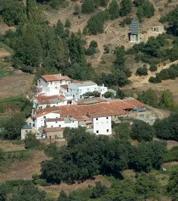
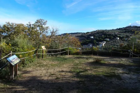
Lacquered walls and old wooden windows resist the passage of time miraculously. The gardens, which remain active, are arranged next to the houses alternating with some meadows. On the other side of the Trujala River is the Mount Navalhora and to the far away we see the unmistakable silhouette of the Navalperal.

Through the path PR-A 198 you will enjoy the landscape and you can approach Segura la Vieja, the settlement prior to the current Segura de la Sierra, which has an impressive view of the area.

Breve descripción

A serpenteous road leads us to the bottom of the valley in which the village of Moralejos is located, consisting of two groups of houses. A spectacular house of stone view welcomes us.

Ubicación
Latitud
38.302980
Longitud
-2.624380
Distrito
Ubicación en el mapa
POINT (-2.62438 38.30298)
Tipos de punto de interés
Imágenes carrusel
imagen
Image
moralejos.jpeg
Imagen principal
Desactivado
Imágenes cabecera
imagen
Image
00007371.jpg
Imagen principal
Activado
Loading map
Preparing points of interest and routes...
Marcas de calidad

Natural Monument Quejigo del Amo o del Carbón

Submitted by brandcode_deweloper on
Id
2193220
Descripción
Descripción larga

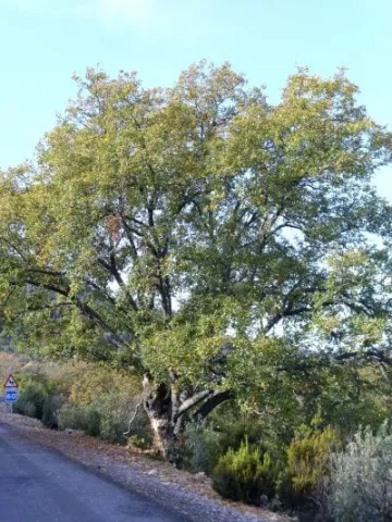
The complaint is one of the most representative trees of Mediterranean vegetation, especially of those territories with a subhumid climate. A few kilometers from the municipality ofValdepeñas de Jaénis found a centenary of this species, the Natural MonumentCoal Complaints.

Breve descripción

Located in the municipality of Valdepeñas de Jaén, this example of Quercus faginea Lam., representative of the native Mediterranean vegetation, is considered one of the largest dimensions of the Andalusian territory.

Ubicación
Latitud
37.594050
Longitud
-3.727670
Distrito
Ubicación en el mapa
POINT (-3.72767 37.59405)
Tipos de punto de interés
Imágenes carrusel
imagen
Image
PB120096.JPG
Imagen principal
Desactivado
imagen
Image
Quercus_faginea-400x533.jpg
Imagen principal
Desactivado
imagen
Image
Natu347.jpg
Imagen principal
Desactivado
Imágenes cabecera
imagen
Image
Natu014.jpg
Imagen principal
Activado
Microsite al que pertenece
Loading map
Preparing points of interest and routes...

Natural Monument Los Órganos de Despeñaperros

Submitted by brandcode_deweloper on
Id
5867289
Descripción
Descripción larga

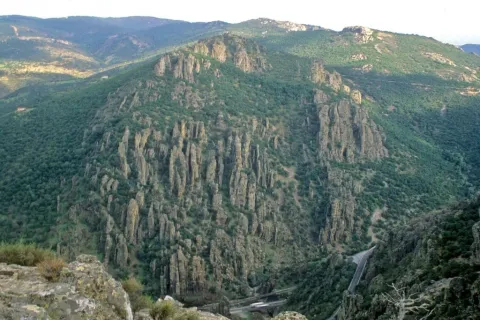
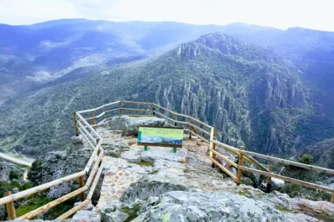
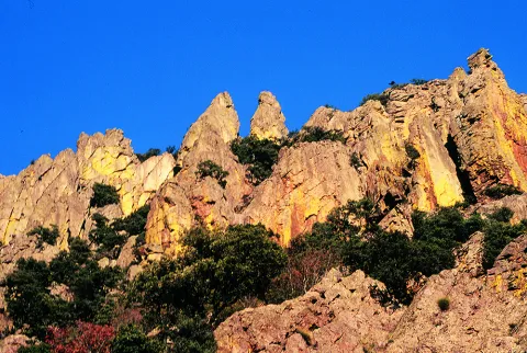
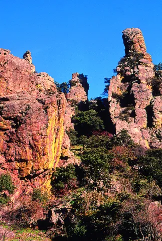
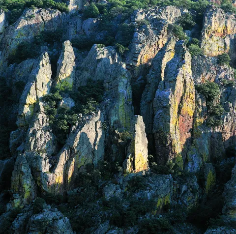
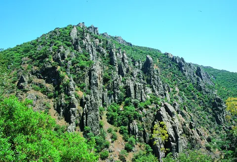
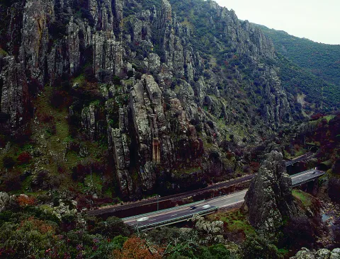
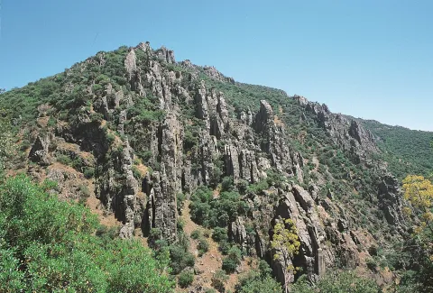
From the nearby viewpoint you can see this monument, whose origin is surprising. 500 million years ago the whole area was covered by the sea, though with little depth, so it was filled with sands and clays brought by the rivers that were flowing there from the Iberian plateau. It was 300 million years ago that the forces of the land made these lands emerge and since then, the erosion of the river, the rains and the wind have been sculpting the relief, creating beautiful forms like these organs. On these rocks, oaks, alcornoques and shrubs have found their substrate, forming a Mediterranean forest in which they inhabit ginets, chickpeas and numerous rapaces.

Breve descripción

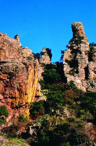
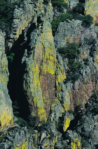
Declared Natural Monument of Andalusia. This Natural Monument is one of the most prominent places in the Despeñacolos Parade, where a set of huge rock columns are raised that resemble the tubes of an organ of a large cathedral. The beauty of this site increases the chromatic contrast of the rock grey with the intense yellow and orange of the different species of lichens that survive here.

Ubicación
Código Postal
23213
Latitud
38.411329
Longitud
-3.559652
Distrito
Municipio
Ubicación en el mapa
POINT (-3.559652 38.411329)
Tipos de punto de interés
Imágenes carrusel
imagen
Image
DESPENAPERROS%20%281%29.jpg
Imagen principal
Desactivado
imagen
Image
1615_MI_01.jpg
Imagen principal
Desactivado
imagen
Image
Natu020.jpg
Imagen principal
Desactivado
imagen
Image
Natu009.jpg
Imagen principal
Desactivado
imagen
Image
Natu066.jpg
Imagen principal
Desactivado
imagen
Image
Natu099.jpg
Imagen principal
Desactivado
imagen
Image
Natu392.jpg
Imagen principal
Desactivado
imagen
Image
Natu368.jpg
Imagen principal
Desactivado
imagen
Image
Natu331.jpg
Imagen principal
Desactivado
imagen
Image
Natu220.jpg
Imagen principal
Desactivado
imagen
Image
Natu160.jpg
Imagen principal
Desactivado
imagen
Image
Natu239.jpg
Imagen principal
Desactivado
Imágenes cabecera
imagen
Image
Parque_Natural_Despexaperros_3%20%281%29.jpg
Imagen principal
Activado
Loading map
Preparing points of interest and routes...

Natural Monument Huellas de Dinosaurio de Santisteban del Puerto

Submitted by brandcode_deweloper on
Id
2193311
Descripción
Descripción larga

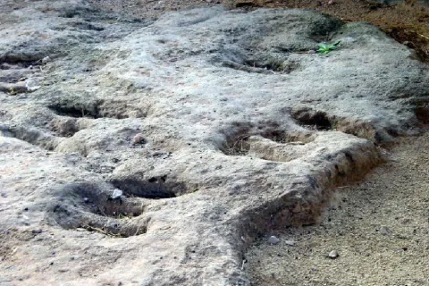
In this paleontological field there are a series of 24 tracks up to nine centimeters deep belonging to the Triassic bipedic dinosaurs. Prints on red clays, possibly belonging to the Arcosauri group, are more than 230 million years old. It is a very enigmatic field, since the almost parallel placement of the fingers and above all the central finger shorter than the two sides, make them, for now, unique in the world.

These tracks, also known as icnites, are not easy to locate, because for their formation there have to be several environmental conditions. Among them, the material on which these animals walked was different from the material on which it was later deposited. Almost certainly, these prints were printed on sediments of a river bed or lagoon to, later, be covered by some other material that allowed it to be preserved until today.

The shape of the prints reveals that these dinosaurs were walking on two legs, with movements similar to those of a kangaroo. You can even know data such as its approximate size and weight, age and social habits. The arrangement of the 24 icnites in the same direction suggests the scene of a group of animals heading to some particular place.

The remains of pollen or vegetation, also fossilized, reveal environmental conditions very different from the present ones, where the vegetation was made up of coniferous, palm and ferns, which were encouraged by a warmer and damp climate than the present.

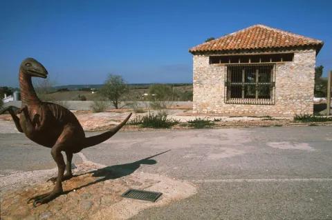
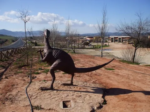
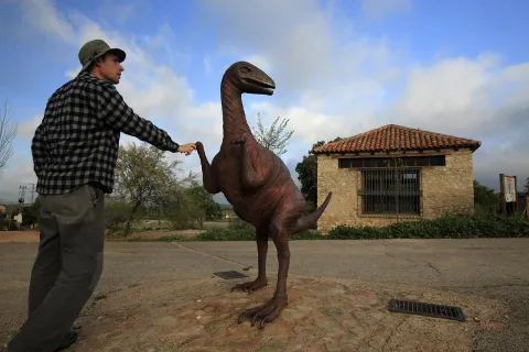
In the place a kind of cabin has been raised that protects them from unnecessary wear. A metal sculpture that reminds the "owner" of the prints has also been placed next to the prints. It should be mentioned that in the vicinity there are also interesting cave paintings, such as the Apolinary Cave dating from the Copper Age; all of them are very similar to those found in the nearby natural spaces of Despeñacolos and La Cimbarra.
More information by phone: 953 368 800

Breve descripción

This Natural Monument of the Dynosaur Footprints of Santisteban del Puerto transports to those who visit him to a very remote past, when man still did not walk on earth. Located one kilometre from the city centre of Santisteban del Puerto, the district of El Condado, it is one of the two icnite sites located in Andalusia.

Ubicación
Latitud
38.248435
Longitud
-3.206190
Dirección
Carretera A-312, km. 51,300
Distrito
Ubicación en el mapa
POINT (-3.20619 38.248435)
Tipos de punto de interés
Imágenes carrusel
imagen
Image
huellas%20de%20dinosaurios1%20%281%29.jpg
Imagen principal
Desactivado
imagen
Image
A7_05_05_D.jpg
Imagen principal
Desactivado
imagen
Image
image_248107%20%281%29.jpeg
Imagen principal
Desactivado
Imágenes cabecera
imagen
Image
Monumentos_naturales_3.jpg
Imagen principal
Activado
Microsite al que pertenece
Loading map
Preparing points of interest and routes...

Natural Monument El Piélago

Submitted by brandcode_deweloper on
Id
2193369
Descripción
Descripción larga

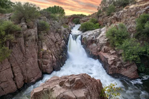
The "Natural Monument the Pat" is located to the north of the municipality of Linares. To get to it you have to follow the A-312 autonomous road towards Arquillos, after the station of Vadollano we find a detour to the left - Vilch- that leads us directly to the site.

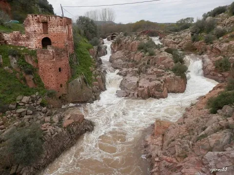
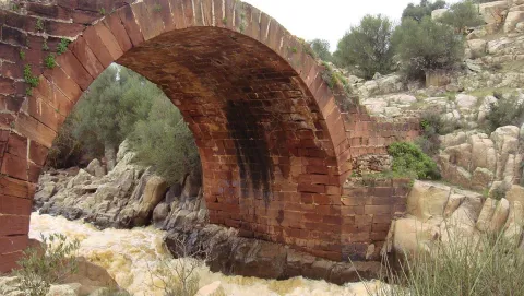
This is an area of special landscape and historical interest, since the beauty of the route of the river Guarrizas is joined by the existence of the Roman bridge of Vadollano, which is part of the route of the Via Augusta.

Just below the Roman bridge, we found the ruins of what was a chocolate factory, which used the driving force of the river water to generate energy.

Breve descripción

Area: 67,149 m ²

A place of special landscape interest whose uniqueness lies in the presence of a riverbank forest, a rich fauna and elements of enormous geological value, as well as the remains of a bridge and a Roman-era road.

Ubicación
Latitud
37.890735
Longitud
-3.565822
Distrito
Municipio
Ubicación en el mapa
POINT (-3.565822 37.890735)
Tipos de punto de interés
Imágenes carrusel
imagen
Image
el-pielago-jpg
Imagen principal
Desactivado
imagen
Image
linares3.jpg
Imagen principal
Desactivado
Imágenes cabecera
imagen
Image
1200px-El_Pi%C3%A9lago.jpg
Imagen principal
Activado
Microsite al que pertenece
Loading map
Preparing points of interest and routes...

Natural Monument El olivo de Fuentebuena

Submitted by brandcode_deweloper on
Id
6726352
Descripción
Descripción larga

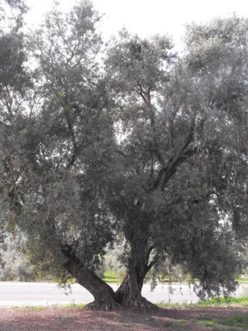
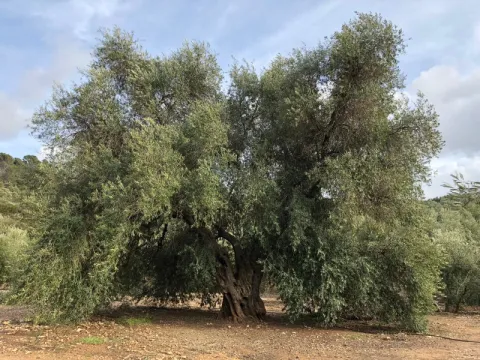
If by anything it is characterized by Jaén it is by its olive trees. There are very old people and there are also large ones (which is not about their age) spread over different municipalities in the provincial geography. The uniqueness of the Arroyo del Ojanco olive tree lies, rather than its age, in its gigantic dimensions, so it has been proposed to be declared a Natural Monument of Andalusia. It is said that it is the largest olive tree in the world, and possibly it is, because the figures that cast its measures, referred to in the tab at the beginning of the article, tell us of a single copy. This should be added to its productive capacity, which is around 600 kg. olive per campaign (an adult irrigated olive tree usually does not reach 70 kg).


The two large branches (2.10 and 2.80 m of perimeter) that are bifurcan from its thick fuse bear all the weight of the cup, which becomes of such magnitude - especially when the fruit develops - which forces its dense foliage to rest on the ground at many ends of the cup. Anyway, everything in this portentous specimen is Guinness record.


So long a centenary history has generated some legendary accounts around this olive tree, as it was planted in the Roman era (which indeed built a magnificent villa a few hundred metres from Fuentebuena) or by friars after the Christian reconquest of these lands. Another version states that its size, so different from that of the olive trees around it, is because it was born from a blessed bouquet on a Palm Sunday.

To access the Fuentebuena olive, you have to go from the urban core of Arroyo del Ojanco to the local road JV-7.005 towards Beas de Segura. As you pass the crossing of Prados de Armijo, the olive tree is about 50 metres from the road.

Breve descripción

The millennial olive tree of Fuentebuena, declared by the Junta de Andalucía Monumento Natural, is one of the symbols of Arroyo del Ojanco. This is a privileged vestige that has resisted so many generations between corns and bandages, between ice of raw winters and summers of extenuating dryness.

Ubicación
Latitud
38.320028
Longitud
-2.905589
Distrito
Municipio
Ubicación en el mapa
POINT (-2.905589 38.320028)
Imágenes carrusel
imagen
Image
olivo.jpg
Imagen principal
Desactivado
imagen
Image
Oliva-de-Fuentebuena.jpg
Imagen principal
Desactivado
imagen
Image
DSCN3042.JPG
Imagen principal
Desactivado
Imágenes cabecera
imagen
Image
Olivo-de-Fuentebuena20180317-01.jpg
Imagen principal
Activado
Microsite al que pertenece
Loading map
Preparing points of interest and routes...

Natural Monument Forest de la Bañizuela

Submitted by brandcode_deweloper on
Id
6498414
Descripción
Descripción larga

Here we can observe plant species such as the whining, coscoja, peach, yellow jasmine, clematides, madreselva and so to complete a multitude of trees and shrubs among which the Arrayan de La Bañizuela, a unique specimen, stands out. The arrayan or myrtle usually has an arbustive bearing, but the one we find in the Bañizuela Forest stands out precisely for its large size and the thickness of its trunk, more specific to a tree than to a bush. Another element that has made possible the recognition of this space as a natural monument has been the characteristic of its soil: limestones, dolomies and margocalizas belonging to the Jurassic period.

Breve descripción

The area called the Bañizuela Forest, located in Torre del Campo (Jaén) in an old garden of about two hectares of extension, now dominated by a rich Mediterranean forest mass in which we enjoy very old specimens.

Ubicación
Código Postal
23640
Latitud
37.756350
Longitud
-3.897150
Distrito
Municipio
Ubicación en el mapa
POINT (-3.89715 37.75635)
Tipos de punto de interés
Imágenes carrusel
imagen
Image
230_MN_05%20%281%29.jpg
Imagen principal
Desactivado
imagen
Image
1511_MI_02.jpg
Imagen principal
Desactivado
imagen
Image
230_MN_02.jpg
Imagen principal
Desactivado
Imágenes cabecera
imagen
Image
1511_MI_01.jpg
Imagen principal
Activado
Microsite al que pertenece
Loading map
Preparing points of interest and routes...

Monument to the Sacred Heart of Jesus

Submitted by brandcode_deweloper on
Id
4485539
Descripción
Descripción larga

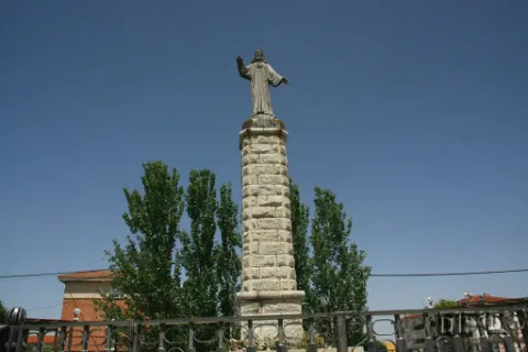
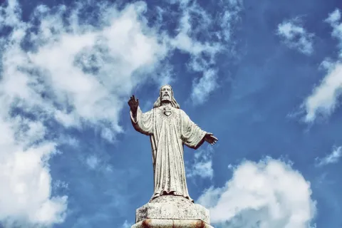
The history of this sculpture and of the reason for its construction is due to the fact that in the 19th century, devotion to this image grew significantly, with Mayor Lucas Guillén being very devoted to it.

Therefore, after the destruction of religious images in 1937, it was decided by popular vote to erect this sculpture based on works such as the Christ of the Corcovate of Rio de Janeiro or the Sacred Heart of Jesus of the Cerro de los Angeles in Madrid.

It was performed by the Sales de La Carolina brothers in 1950.

Breve descripción

Located on the promenade that bears its same name, this sculpture is located on a high pillar and surrounded by a fence.

Telecomunicaciones
Sitio web
www.guarroman.es/ciudad/conoce-la-ciudad/edificios-y-monumentos/
Teléfono de contacto
953 615 004 / 953 615 306
Ubicación
Código Postal
23210
Latitud
38.184060
Longitud
-3.685480
Distrito
Municipio
Ubicación en el mapa
POINT (-3.68548 38.18406)
Tipos de punto de interés
Imágenes carrusel
imagen
Image
Monumento%20al%20Sagrado%20Coraz%C3%B3n%20de%20Jes%C3%BAs.jpg
Imagen principal
Desactivado
Imágenes cabecera
imagen
Image
Monumento%20al%20Sagrado%20Coraz%C3%B3n%20de%20Jes%C3%BAs.jpg
Imagen principal
Activado
Loading map
Preparing points of interest and routes...

Monument to San Francisco de Asís

Submitted by brandcode_deweloper on
Id
6613855
Descripción
Breve descripción

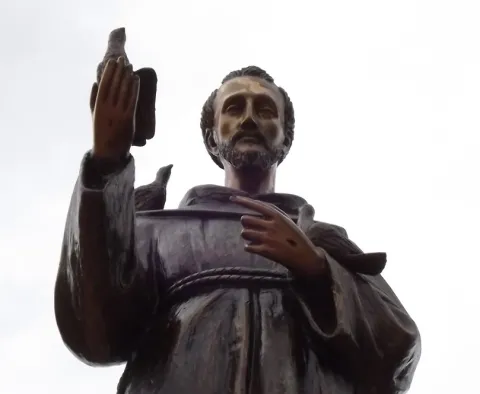
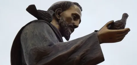
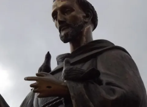
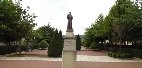
The saint is placed on three square-floor bodies. In the second body we find an inscription with the year of construction and on the third body, in a pyramidal form, we find a carving of round bouquet of San Francisco de Assis, bound with the sayal of the Franciscan, bound with a three-knots cord that represent the vows of poverty, chastity and obedience. He has a hand standing on his heart and a pigeon with the other. In both hands we can observe the stigmas.

Telecomunicaciones
Sitio web
www.arroyodelojanco.es
Teléfono de contacto
953 420 002
Ubicación
Código Postal
23340
Latitud
38.317030
Longitud
-2.899600
Distrito
Municipio
Ubicación en el mapa
POINT (-2.8996 38.31703)
Tipos de punto de interés
Imágenes carrusel
imagen
Image
1369231662%20%281%29.jpg
Imagen principal
Desactivado
imagen
Image
1369231661.jpg
Imagen principal
Desactivado
imagen
Image
1369231660.jpg
Imagen principal
Desactivado
Imágenes cabecera
imagen
Image
1369231659%20%281%29.jpg
Imagen principal
Activado
Loading map
Preparing points of interest and routes...