Saltar al contenido principal
icon-intereses-naturaleza

Monument to los mineros

Submitted by brandcode_deweloper on
Id
4485591
Descripción
Descripción larga

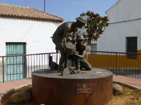
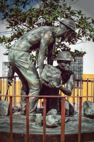
This work by Javier Ruiz Abel is a tribute to those granadino and almerian miners who in the late 19th and early 20th century came to work in the mines of the Linares - La Carolina district, of which in our municipal term we have some unique examples.

Telecomunicaciones
Sitio web
www.guarroman.es/ciudad/conoce-la-ciudad/edificios-y-monumentos/
Ubicación
Código Postal
23210
Latitud
38.181480
Longitud
-3.687920
Distrito
Municipio
Ubicación en el mapa
POINT (-3.68792 38.18148)
Tipos de punto de interés
Imágenes carrusel
imagen
Image
wmonumento%20mineros.jpg
Imagen principal
Desactivado
Imágenes cabecera
imagen
Image
Monumento%20a%20los%20mineros.jpg
Imagen principal
Activado
Loading map
Preparing points of interest and routes...
Monument to la Batalla de las Navas de Tolosa.

Submitted by brandcode_deweloper on
Id
4383810
Descripción
Breve descripción

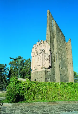
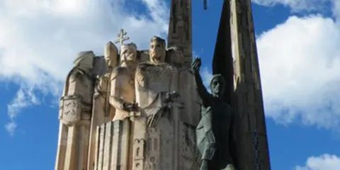
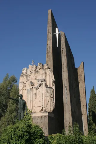
The Monument to the Battle is a memorial to the great battles in the province of Jaén, the Battle of the Navas de Tolosa and the Battle of Bailén. It is located in the provincial capital, in the centre of the Plaza de las Batallas, on the Paseo de la Estación, in front of the Parque de la Concordia and the Government Subdelegation.

Telecomunicaciones
Sitio web
www.redjaen.es
Teléfono de contacto
953 660 255
Correo electrónico
info@lacarolina.es
Ubicación
Código Postal
23200
Latitud
38.277920
Longitud
-3.606620
Dirección
C/ Alemania, 2
Distrito
Municipio
Ubicación en el mapa
POINT (-3.60662 38.27792)
Tipos de punto de interés
Imágenes carrusel
imagen
Image
Mon073.jpg
Imagen principal
Desactivado
imagen
Image
monumento-batalla-navas-de-tolosa4jpg__940x620_q83_1284x642_q75_middle.jpg
Imagen principal
Desactivado
Imágenes cabecera
imagen
Image
navasdetolosamonument.jpg
Imagen principal
Activado
Loading map
Preparing points of interest and routes...
Monument to Jorge Manrique

Submitted by brandcode_deweloper on
Id
657289
Descripción
Descripción larga

These lines correspond to the Treaty of the Mountain, studied by the Duke of Almazan, a document that some researchers attribute to Jorge Manrique. To talk about the 15th century in the Sierra de Segura is to talk about the Manrique family and the border period. A situation in which attacks and responses by Christians and Muslims were frequent. This danger and the border situation can only be seen by entering Segura de la Sierra: remains of walls, towers, entrance doors and on top of the hill, the watchful castle.

The Visits Books of the Order of Santiago described in the late 15th century the castle of Segura de la Sierra as a military compound with weapons to face a siege or, if necessary, to organize a village to attack the enemy. We cannot forget that in 1434 Rodrigo Manrique organized a village to conquer Huécar in the Altiplano granadino.

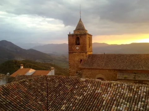
In Segura de la Sierra, taking advantage of this privileged position and under the security offered by its walls is where Jorge Manrique was raised under the care of his mother, Mrs. Mencía de Figueroa, in the house that still today is preserved five hundred years later.

Breve descripción

A candle on an oak table, a tintero with a pen and a half-write piece of paper. A figure draws attention to the rest of the room dedicated to the Manrique family on the second floor of the tower of tribute in the castle of Segura. Jorge Manrique is a character closely linked to Segura de la Sierra. If we were to imagine the poet in front of the paper, we might think that the text might start like this: "remind me to be very noble, Mr. Brother, having once said, in they are closer to mockery, you will see if you wanted me to write something about the work of the Montaria."

Ubicación
Latitud
38.298857
Longitud
-2.651877
Distrito
Ubicación en el mapa
POINT (-2.651877 38.298857)
Tipos de punto de interés
Imágenes carrusel
imagen
Image
6%20%283%29.jpg
Imagen principal
Desactivado
imagen
Image
10633135523_4ee3bea4f5_b.jpg
Imagen principal
Desactivado
imagen
Image
Segura_de_la_Sierra_PM_091668_E.jpg
Imagen principal
Desactivado
Loading map
Preparing points of interest and routes...
Marcas de calidad

Monument to Félix Rodríguez de la Fuente

Submitted by brandcode_deweloper on
Id
8108303
Descripción
Descripción larga

Built in 1980

Breve descripción
Source dedicated to the memory of Félix Rodríguez de la Fuente, a lover of nature. It has a tile plate where the honorado and the year of construction are named.
Telecomunicaciones
Teléfono de contacto
953 566 001
Ubicación
Código Postal
23658
Latitud
37.746690
Longitud
-3.906610
Dirección
Camino de la Sierra, 1
Distrito
Municipio
Ubicación en el mapa
POINT (-3.90661 37.74669)
Tipos de punto de interés
Imágenes carrusel
imagen
Image
Monumento%20a%20F%C3%A9lix%20Rodr%C3%ADguez%20de%20la%20Fuente3.jpg
Imagen principal
Desactivado
Imágenes cabecera
imagen
Image
Monumento%20a%20F%C3%A9lix%20Rodr%C3%ADguez%20de%20la%20Fuente.jpg
Imagen principal
Activado
Loading map
Preparing points of interest and routes...

Mount Salfaraf

Submitted by brandcode_deweloper on
Id
5709823
Descripción
Breve descripción

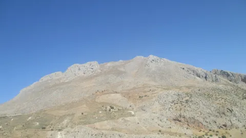
The elevation of Salfaraf is a residual relief of the tectonic unit of the tabular shed of the plateau which, as a witness hill, is independent from the surrounding area, causing a landscape milestone, with a large visual basin.

The topographic contrast with the surrounding terrain and the altitude above 1000 m make it easily identifiable.

Coronado by shrubs and isolated feet of oak and cashew, it is occupied almost until its summit by olive groves that constitute the main use, also being remarkable the minor hunting. From its peak there are interesting views of other milestones such as the Guadalmena reservoir, the Yelmo or Segura de la Sierra.

Ubicación
Latitud
37.772886
Longitud
-3.788329
Ubicación en el mapa
POINT (-3.788329 37.772886)
Tipos de punto de interés
Imágenes cabecera
imagen
Image
Monte%20Salfaraf.jpg
Imagen principal
Activado
Microsite al que pertenece
Loading map
Preparing points of interest and routes...
Mount La Sierra

Submitted by brandcode_deweloper on
Id
2190681
Descripción
Descripción larga

The mountain is surrounded by two convergent valleys: that of the Quibrajano River (where the Protected Species Recovery Centre is located) and the Hazadillas Canyon, with a recreational fit equipped with grills, tables, banks, recreational furniture, fountains, kiosk, etc., as well as other facilities.

This natural space is used as a place of leisure and leisure by the people of Jaén, given its proximity to the city.

Breve descripción

The Monte la Sierra peri-urban park conforms to the mountain of the same name, of 2,720 hectares and property of the City of Jaén, consonated with the Council of Environment of the Junta de Andalucía, which is located in the municipal term of Jaén.

Ubicación
Latitud
37.653790
Longitud
-3.713720
Distrito
Municipio
Ubicación en el mapa
POINT (-3.71372 37.65379)
Tipos de punto de interés
Imágenes carrusel
imagen
Image
Natu284%20%281%29.jpg
Imagen principal
Desactivado
imagen
Image
Natu248%20%282%29.jpg
Imagen principal
Desactivado
Imágenes cabecera
imagen
Image
Ca%C3%B1ada_Hazadillas01_24J.jpg
Imagen principal
Activado
Microsite al que pertenece
Loading map
Preparing points of interest and routes...
Mount Cuarto de Ardal

Submitted by brandcode_deweloper on
Id
8095030
Descripción
Descripción larga

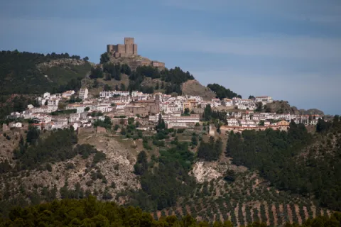
At 1440 m high is the MONTE ARDAL, which can be accessed by the road that reaches San Bartolomé, to the crossing that is moving to the left. It is a classroom of nature located in a forest shelter, with views of the village, the surrounding mountains,... in addition to the shelter, there is also a recreation area, adapted don barbecues, tables, and covered by a porch.

Breve descripción

Northof the term, there is a mountain, theArdal Room, in which the oaks, together with the retama, predominate, the albar thorn, wild rosals, juniper, ivy and madreselva. An ideal ground for the cicnetic species of major hunting (boar, deer, corzo...), and also of pastures, especially for the cattle of ligia.

Telecomunicaciones
Correo electrónico
ayuntamiento@genave.es
Ubicación
Código Postal
23392
Latitud
38.429970
Longitud
-2.733050
Distrito
Municipio
Ubicación en el mapa
POINT (-2.73305 38.42997)
Imágenes carrusel
imagen
Image
Cuarto%20de%20Ardal%2C2.JPG
Imagen principal
Desactivado
Imágenes cabecera
imagen
Image
Cuarto%20de%20Ardal%2C%20%281%29.jpg
Imagen principal
Activado
Loading map
Preparing points of interest and routes...

Mount Aznaitín

Submitted by brandcode_deweloper on
Id
5693260
Descripción
Descripción larga

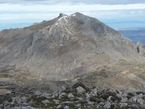
In the Aznaitín, some plant endemisms typical of Sierra Magina are maintained. At its summit the municipal terms of Jimena, Torres and Albanchez de Mágina, whose populations are located at their feet, as do the prehistoric caves, where the former inhabitants left their mark for posterity. Not in vain the Aznaitin impregnated the pupil of Antonio Machado from the far Baeza and incorporated him into his poetry.

Breve descripción

The Az-Naitín (Nathin in local dialect) is a mountain located in Sierra Magina, Jaén, Spain. The origin of the toponymy in Arabic would be Isnatin or Asnatin, and it is noted that it can come from its ancient name in ibero as Neitin, which refers to the great iberous god Neton, the god of Thunder and fire, which according to the legend dwells in the mountain. It has a special visual appeal, especially from the East side or from the Guadalquivir valley. It has a considerable altitude, 1745 m, which allows to see much of the province of Jaén.

Ubicación
Latitud
37.841370
Longitud
-3.476880
Distrito
Municipio
Ubicación en el mapa
POINT (-3.47688 37.84137)
Tipos de punto de interés
Imágenes carrusel
imagen
Image
3.jpg
Imagen principal
Desactivado
Imágenes cabecera
imagen
Image
4.jpg
Imagen principal
Activado
Microsite al que pertenece
Loading map
Preparing points of interest and routes...

Monastery of Montesión

Submitted by brandcode_deweloper on
Id
918965
Descripción
Descripción larga

This is evident in the lack of materials and in the lack of furniture. Only the chapel with a Latin cross floor and a dome in which some frescoes are still preserved stand out.

The difficulties of the 17th century may have motivated the foundation of this monastery especially at a time when bad crops, hunger and bad weather caused the emergence of epidemics of the feared plague. The order of San Antonio Abad was dedicated to the healing of the sick and the fear of contagion caused these buildings to be far from the populations. Along with the plague, the economic crisis, the rise in prices, wars and in general the hardships led to an increase in the clergy and religious foundations in a context in which the Monarchy offered a contradictory vision that oscillated from splendor and misery or boom and decline.

Breve descripción

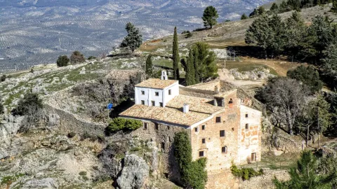
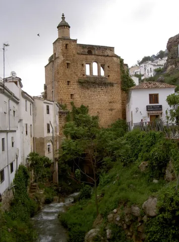
Soledad and remoteness are the adjectives that come to mind when we are next to the Monastery, in Cazorla. Every year, on the last Sunday of September a rosemary makes Montesión come back to life, as during the year there was only one person in it, the danger of ruin in the building being constant. The visitor can appreciate different stages in its construction although its foundation dates back to 1625. The monasteries under the advocation of St. Paul and St. Anthony Abad highlighted for their poverty and austerity as you can see if you approach Montession.

Ubicación
Latitud
37.912893
Longitud
-3.003887
Municipio
Ubicación en el mapa
POINT (-3.003887 37.912893)
Tipos de punto de interés
Imágenes carrusel
imagen
Image
maxresdefault.jpg
Imagen principal
Desactivado
imagen
Image
857187Master.jpg
Imagen principal
Desactivado
Imágenes cabecera
imagen
Image
2%20%283%29%20%281%29.jpg
Imagen principal
Activado
Loading map
Preparing points of interest and routes...
Marcas de calidad

Flour Mill and Frondosa Naturaleza Interpretation Centre

Submitted by brandcode_deweloper on
Id
2343514
Descripción
Breve descripción

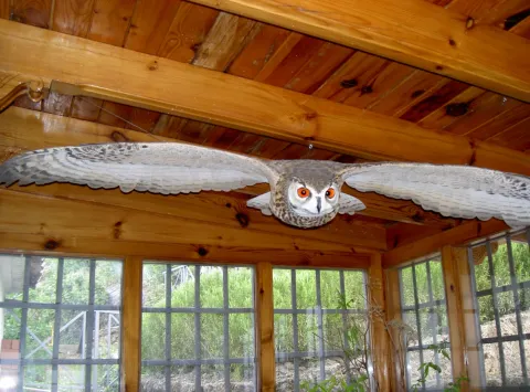
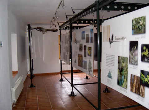
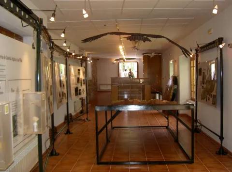
Frondosa Nature contains, among other elements, audiovisual, olfactory panels, images and sounds of the flora and fauna of this protected natural space, bird reproductions and a model of the Natural Park of Cazorla, Segura and the Villas.

Telecomunicaciones
Sitio web
www.almagaia.eu
Teléfono de contacto
953 721 330
Correo electrónico
info@almagaia.es
Ubicación
Nombre
La Casa de la Luz.
Código Postal
23470
Latitud
37.905224
Longitud
-2.998526
Dirección
Camino del Ángel, 7-9
Municipio
Ubicación en el mapa
POINT (-2.998526 37.905224)
Tipos de punto de interés
Imágenes carrusel
imagen
Image
PICT5925.jpg
Imagen principal
Desactivado
imagen
Image
PICT5929.jpg
Imagen principal
Desactivado
imagen
Image
PICT5927.jpg
Imagen principal
Desactivado
imagen
Image
PICT5926.jpg
Imagen principal
Desactivado
Imágenes cabecera
imagen
Image
PICT5936.jpg
Imagen principal
Activado
Horario
10: 30 - 13: 30 and 16: 00 - 19: 00.
Loading map
Preparing points of interest and routes...