Saltar al contenido principal
icon-intereses-naturaleza

Lagoon Honda

Submitted by brandcode_deweloper on
Id
7009935
Descripción
Descripción larga

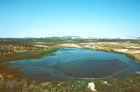
It has an area of 65 hectares, as well as an additional protection area around it of 220 hectares.

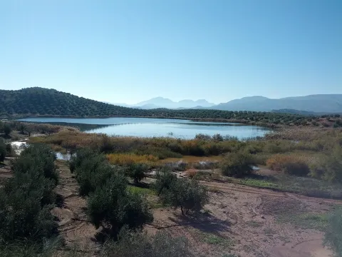
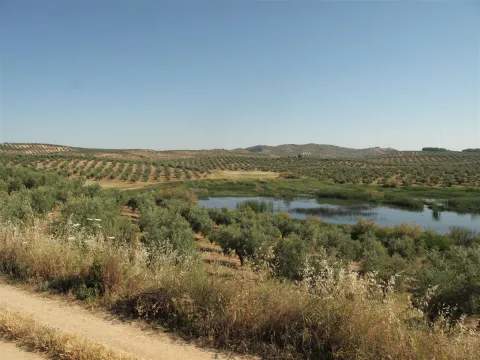
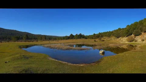
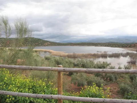
Laguna Honda is a humid, endemic area that is flooded with the first rains of autumn and remains as such until spring, with a small river mass, making it a seasonal lagoon although a small stream, which comes from the Sierra de Orbes, provides water flow.

This lagoon has a high saline content, caused by the materials of the substrate as well as the washing of adjacent land.

Vegetation

The area is surrounded by agricultural land of rainforest olive trees, highlighting its perilagunar palustre vegetation of eneas (typha dominguensis), carrizos (phragmites australis) and juncos. One of the primitive and still preserved plant varieties in this reserve is tarage.

Fauna

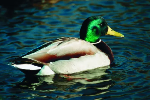
The main species that are located in Laguna Honda are vertebrates, always with a temporary or seasonal character, highlighting the aquatics, such as the hens (gallinula chloropus), easily recognizable because it emits a strong graznada, the common focal (fulica atra), which has the white peak and black plumage or the real anade (anas platyrhnchos), which has a yellow peak and is known as a common duck.

Breve descripción

This Nature Reserve is located to the south-west of the province of Jaén, in the area of Tumbalagraja, very close to the Casariche cortijo, passing very close to the line of the old railway Linares- Puente Genil, today Via Verde del Eil, between the Sierra Orbes, the Cambrón and the Desgarradero, and limiting with the province of Córdoba.
Ubicación
Latitud
37.600710
Longitud
-4.143600
Distrito
Municipio
Ubicación en el mapa
POINT (-4.1436 37.60071)
Tipos de punto de interés
Imágenes carrusel
imagen
Image
lagunaonda%20%281%29.jpg
Imagen principal
Desactivado
imagen
Image
ondalaguna.jpeg
Imagen principal
Desactivado
Imágenes cabecera
imagen
Image
1.jpg
Imagen principal
Activado
Loading map
Preparing points of interest and routes...

Lagoon Grande

Submitted by brandcode_deweloper on
Id
7010098
Descripción
Descripción larga

It covers an area of about 206 ha., including the lagoon itself and a protection perimeter of 500 metres.

The vegetation it presents is typical of a wetland, with the presence of eneas (typha domingensis) and carrizos (phagmites australis). As for tree species, the white acacia (populus alba), taray (African tamarix) and strawberry (fraximus angustifolia), even in isolation, is highlighted. The rest of the area is dominated by olive groves.

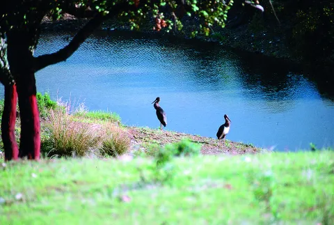
As for the present fauna, there is a particular interest in the presence of typical wetland birds: common fences (as it grows), spoon duck (as clypeata), common porron (aythya ferina), small zumpullin (tachybaptus rufilollis), cold anade (as strepera), real anade (as platyrhynchos). In spring, many of these species move to their nesting area, remaining only those that do so in this area: storks (himantopus himantopus), the chorlitero chico (charandrius dubius) and the water cock (gallinula chloropus).

There are also the presence of non-aquatic birds, such as the common charcoal (parus major), the common pineapple (coelebs fridge), the capirotated curling (silvia atricapilla), the black head curling (silvia melanocephala), the common myrtle (turdus merula), the common cernícalo (falco tinnunculus), the common mouse (butyo buteo), the calcada eagle and the lagoon (circuls aeruginosus).

The mammals are minor, although the gineta (genetta genetta) and the badger (meles meles) stand out. As for amphibians, the gallipato (pleurodeles waltl), the southern ranite (hyla meridionalis), the San Antón ranite (hyla arborea), the common frog (rana ridibunda) and the common toad (bufo bufo) stand out.

Breve descripción

It is a wetland near Baeza, about 2 Km. the Guadalquivir River, but about 80 meters above its level. This is an easy-to-contend space in which man has acted deeply: in fact, his origin is in agricultural activity, since his waters are used for irrigation and feed on a system of waterfalls, with a relatively high salinity. At present, it has no agricultural use, although it continues to be used as a water warehouse.

Ubicación
Latitud
37.932130
Longitud
-3.559140
Municipio
Ubicación en el mapa
POINT (-3.55914 37.93213)
Tipos de punto de interés
Imágenes carrusel
imagen
Image
lagunagrande1.jpeg
Imagen principal
Desactivado
Imágenes cabecera
imagen
Image
lagunagrande.jpeg
Imagen principal
Activado
Microsite al que pertenece
Loading map
Preparing points of interest and routes...

Lagoon of the Chinche

Submitted by brandcode_deweloper on
Id
2190731
Descripción
Descripción larga

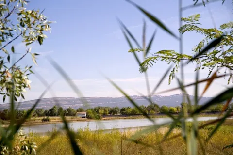
Its importance is increased, as in the case of Laguna Honda, due to the shortage of wet areas in the province. Natural vegetation has been transformed and only remains of perilagunar vegetation remain. The most common species are carrizo, swordsman and tarage. The fauna of this nature reserve of 6.5 hectares of extension, as such, and 39 hectares of protection area, is related to that of the neighbouring Laguna del Conde or Salobral in the province of Córdoba.
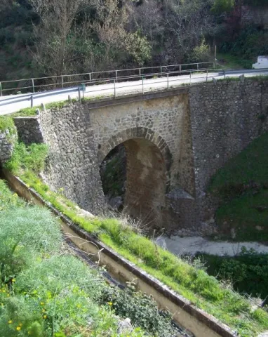
Surrounded by olive groves, it has a small natural vegetation of spadaws, reeds and carrizos. Among the aquatic birds, the occasional presence of pink flamingos, storks, royal anades and whistles and red ducks and spoon stands out. As for the terrestrial fauna, the rabbit and the red partridge abound in the area.

Breve descripción

On a relief of soft profiles is raised this lagoon of endorreic nature fed by the surface runoff. The wetland, located in the south-west Jiennense, is surrounded by agricultural land and olive groves.

Ubicación
Latitud
37.614040
Longitud
-4.152960
Distrito
Municipio
Ubicación en el mapa
POINT (-4.15296 37.61404)
Tipos de punto de interés
Imágenes carrusel
imagen
Image
20_RN_01%20%282%29.jpg
Imagen principal
Desactivado
imagen
Image
laguna-chinche%20%282%29.jpeg
Imagen principal
Desactivado
imagen
Image
Natu045.jpg
Imagen principal
Desactivado
Imágenes cabecera
imagen
Image
Natu043.jpg
Imagen principal
Activado
Microsite al que pertenece
Loading map
Preparing points of interest and routes...

Lagoon of las Casillas y laguna de las Navas

Submitted by brandcode_deweloper on
Id
4885202
Descripción
Breve descripción

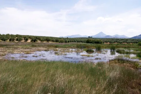
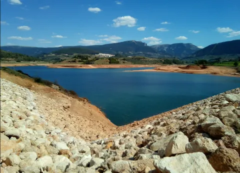
They are seasonal lagoons located in the western part of the municipality. Since 2007 they have been registered in the inventory of wetlands in Andalusia. These two lagoons are ideal for the observation of aquatic and amphibian birds at some times of the year.

Ubicación
Código Postal
23650
Latitud
37.761010
Longitud
-3.951102
Distrito
Municipio
Ubicación en el mapa
POINT (-3.951102 37.76101)
Imágenes carrusel
imagen
Image
lagunanavas.png
Imagen principal
Desactivado
Imágenes cabecera
imagen
Image
4%20%283%29.jpg
Imagen principal
Activado
Microsite al que pertenece
Loading map
Preparing points of interest and routes...

La Toba

Submitted by brandcode_deweloper on
Id
659826
Descripción
Descripción larga

Through the Toba passes the path GR 147, so we can travel some sections either in the direction of Santiago de la Espada, or in the direction of the Casicas del Río Segura. You can also gain unforgettable views over the Segura Valley if you go up the forest track of Awake-up.

Breve descripción

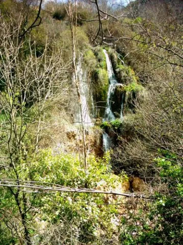
The water catches the senses in the village of Toba. Its spread in some of its streets, freshness, its surrounding sound are guaranteed if you visit this delicious village. You can't miss the birth of the Toba, right next to the village, with a cave you can access inside if you're not afraid of cold water.

Ubicación
Latitud
38.118220
Longitud
-2.670100
Ubicación en el mapa
POINT (-2.6701 38.11822)
Tipos de punto de interés
Imágenes carrusel
imagen
Image
600_image_2.jpg
Imagen principal
Desactivado
imagen
Image
600_image_3.jpg
Imagen principal
Desactivado
Imágenes cabecera
imagen
Image
La_Toba-Fuentetoba-03.jpg
Imagen principal
Activado
Loading map
Preparing points of interest and routes...

La Puente

Submitted by brandcode_deweloper on
Id
912688
Descripción
Descripción larga

Cobos not only had territorial jurisdiction over these populations, but also exercised strong control over all of them of their Councils and their inhabitants.

In Torres, apart from certain actions to preserve the medieval castle, the Council planned various works throughout the 16th century, such as the capitular houses, the posite, the reform of the parish temple and a bridge, absolutely necessary to unite the town with the site of the Fuenmayor, where the mills of the secretary Cobos were located, by which the neighbors were required to pass. In the population, the only one who had a privilege to build mills was Cobos and his wife, Maria de Mendoza. Their control assured them of a safe income, so it was absolutely necessary to keep the bridge in good condition.

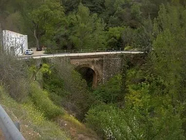
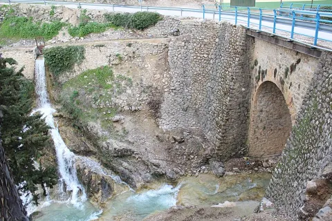
Dead Cobos, Mrs. Maria de Mendoza, through his butler Bartolomé Ximénez, ordered the Council to make a new bridge, as the old man was destroyed by a heavy storm. The project was carried out by Andrés de Vandelvira, an architect at the service of the family of Cobos. According to María José Sánchez Lozano the works began in 1561, and the following year the Council agreed that all that was left to rise from it should be done according to the trace of Andrés de Vandelvira: "(...) I saw what is left to be made of the work of the bridge that is to be done in the river of the said villa for the passage of the mills of the bread of his lordship (...) command that everything that is left to be made of the bridge be done by the trace that has given Andrés de Vandelvira (...). The bridge, which is currently preserved, although removed, is made of stone and has a single half-point eye rather high, as the ravine on which it rises is very deep in this area.

Vandelvira draws a bridge without great pretensions, without decorative attachments, in which security and permanence in time must take precedence over other aspects. Vandelvira will be an experienced bridge builder, sometimes simple as this one of Torres, others of great architectural and engineering monumental, such as those raised on the channels of the Guadalmena, Guadalimar (Ariza) and Guadalquivir (Mazuecos) rivers.

Breve descripción

In 1539 the Secretary of Charles V, the ubetense Don Francisco de los Cobos, acquired the villas of Canena and Torres, which were alienated by the Crown to the Military Orders of Santiago and Calatrava. With this double purchase he rounded Cobos his heritage; years earlier, in 1537 he also made it with the villa of Sabiote, head of his large lordship, completed with the acquisition of Jimena and Recena by his wife Maria de Mendoza.

Telecomunicaciones
Sitio web
www.torresturismo.es
Teléfono de contacto
953 363 011
Correo electrónico
info@torresturismo.es
Ubicación
Código Postal
23540
Latitud
37.786140
Longitud
-3.509730
Distrito
Municipio
Ubicación en el mapa
POINT (-3.50973 37.78614)
Tipos de punto de interés
Imágenes carrusel
imagen
Image
La%20Puente%202.jpg
Imagen principal
Desactivado
imagen
Image
La%20Puente.jpg
Imagen principal
Desactivado
Imágenes cabecera
imagen
Image
800px-La_Puente%2C_Torres_24J_02.jpg
Imagen principal
Activado
Microsite al que pertenece
Loading map
Preparing points of interest and routes...

La Peñuela

Submitted by brandcode_deweloper on
Id
4555271
Descripción
Descripción larga

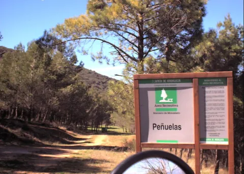
It is a cozy road and recreational area, which has a lookout from where to enjoy stunning views. It also has shadow areas and a water source.

Location: Very close to the urban core.

Distance: 2.5 km.

Medium: Tourism vehicle.

Access route: Through a dirt lane that leaves directly from the city centre.

Ubicación
Código Postal
23130
Latitud
37.597850
Longitud
-3.622070
Distrito
Municipio
Ubicación en el mapa
POINT (-3.62207 37.59785)
Tipos de punto de interés
Imágenes carrusel
imagen
Image
pe%C3%B1uela1.png
Imagen principal
Desactivado
Imágenes cabecera
imagen
Image
pe%C3%B1uela.png
Imagen principal
Activado
Microsite al que pertenece
Loading map
Preparing points of interest and routes...

La Lambra

Submitted by brandcode_deweloper on
Id
4554840
Descripción
Descripción larga

From this place you can see thePantano de Giribola,Caves and Castle of Giribolaand the municipality of Vilches. Nearby we can find some cortijos such as:The Lambra,Mirabuens,The CologneandLa Casería.

The ground is limestone and reddish. The vegetation that covers it is typically Mediterranean with species such as the oak, the lentisco, the retama, the olive thyme, the spatter, the steppe jara, the brown and the cuckoo.

Until a few years ago, on spring and summer Sundays it was a very busy place. The Sunday of Resurrection was difficult to find a shadow of free oak or chaparro, because almost all the people of Canena, Rus and other villages camped that day to enjoy a day of field.

Breve descripción

It is a Natural Area located in the municipal term of Rus, it is an ideal place to enjoy a day of countryside. Located on the flat, most of this land is private property, although free to anyone so that you can spend a nice day.

Telecomunicaciones
Teléfono de contacto
953 127 115
Ubicación
Código Postal
23430
Latitud
38.076950
Longitud
-3.488750
Dirección
Carretera Canena-Arquillos, km. 3
Municipio
Ubicación en el mapa
POINT (-3.48875 38.07695)
Tipos de punto de interés
Imágenes carrusel
imagen
Image
paraje-la-lambra.jpg
Imagen principal
Desactivado
Imágenes cabecera
imagen
Image
galeria_inicio_05.jpg
Imagen principal
Activado
Microsite al que pertenece
Loading map
Preparing points of interest and routes...

La Laguna

Submitted by brandcode_deweloper on
Id
5928867
Descripción
Breve descripción

The Laguna de Siles is approximately 150 m in diameter and 3 m in maximum depth depending on the station. To access La Laguna, from the municipality of Siles, an indicative lane is taken in the direction of El Puntal. At one of the crosses to the left, a lane goes straight to the place, and is very well identified with signs.

Ubicación
Latitud
38.377901
Longitud
-2.537913
Distrito
Municipio
Ubicación en el mapa
POINT (-2.537913 38.377901)
Imágenes carrusel
imagen
Image
4.jpg
Imagen principal
Desactivado
Imágenes cabecera
imagen
Image
pantanosiles.png
Imagen principal
Activado
Loading map
Preparing points of interest and routes...

La Hueta

Submitted by brandcode_deweloper on
Id
659691
Descripción
Descripción larga

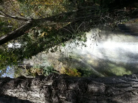
In the vicinity of the Hueta there are waterfalls and a lagoon that we suggest you discover. Very close to the Hueta there are other villages such as Puente Honda and you can even approach the ruins of the castle of the same name.

Breve descripción

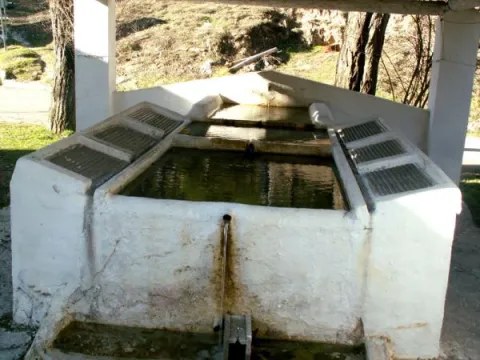
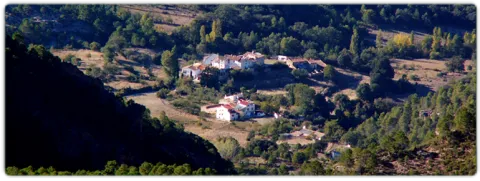
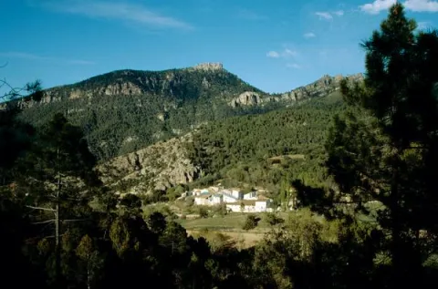
After going down a very sinuous road we reach a small valley in which La Hueta is located, which is divided into two neighborhoods. In the centre of the village you will find a laundry and a small garden with the image of the virgin of Fatima. From the set stands out the landscape that surrounds the village, highlighting at the bottom the hill of Bucentaina with the spectacular Piedra del Agujero, in a sea of pine trees sauté with complaints and oaks, which contrasts with the areas adapted to the cultivation next to the village.

Ubicación
Latitud
38.318022
Longitud
-2.661052
Distrito
Municipio
Ubicación en el mapa
POINT (-2.661052 38.318022)
Tipos de punto de interés
Imágenes carrusel
imagen
Image
599_img.png
Imagen principal
Desactivado
imagen
Image
599_image_1.jpg
Imagen principal
Desactivado
Imágenes cabecera
imagen
Image
aldeahueta.png
Imagen principal
Activado
Loading map
Preparing points of interest and routes...
Marcas de calidad