Saltar al contenido principal
icon-intereses-naturaleza

La Fuente del Vergao

Submitted by brandcode_deweloper on
Id
4742245
Descripción
Breve descripción

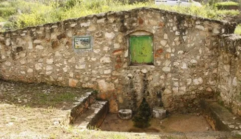
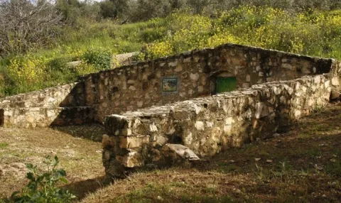
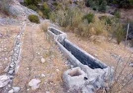
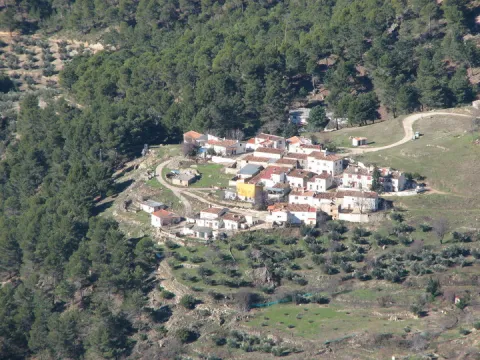
The source of El Vergao is a public source whose existence has been known at least since 1752. It is a source of alcoba that was in use until 1966, when the municipality was provided with the drinking water network. It is located next to the road of El Vergao.

Ubicación
Latitud
38.183511
Longitud
-3.313678
Distrito
Municipio
Ubicación en el mapa
POINT (-3.313678 38.183511)
Tipos de punto de interés
Imágenes carrusel
imagen
Image
unnamed.jpg
Imagen principal
Desactivado
imagen
Image
La%20Fuente%20del%20Vergao.jpg
Imagen principal
Desactivado
Imágenes cabecera
imagen
Image
7.jpg
Imagen principal
Activado
Loading map
Preparing points of interest and routes...

La Hermitage of Santa María Magdalena

Submitted by brandcode_deweloper on
Id
4619189
Descripción
Descripción larga

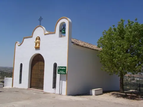
It features a simple half-point arch cover with two small side voids imitating saetas. On the top we find a hornadine with the image of Mary Magdalena and on a side a small body of swordsman.

Breve descripción

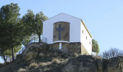
On July 14, 1990, the new hermitage of Santa María Magdalena was opened and blessed; it is located on the hill of Maquiz, where the old one was and which is quoted in the 16th century.

Telecomunicaciones
Sitio web
https://mengibarturismo.com/
Teléfono de contacto
677 222 285
Correo electrónico
turismo@aytomengibar.com
Ubicación
Código Postal
23620
Latitud
37.968050
Longitud
-3.808780
Dirección
Carretera A-6000 a Villargordo, desvío por el camino de Los Chorrillos
Distrito
Municipio
Ubicación en el mapa
POINT (-3.80878 37.96805)
Tipos de punto de interés
Imágenes carrusel
imagen
Image
La%20Ermita%20de%20Santa%20Mar%C3%ADa%20Magdalena.jpg
Imagen principal
Desactivado
Imágenes cabecera
imagen
Image
ermita-de-la-malena-mengibar.jpg
Imagen principal
Activado
Microsite al que pertenece
Loading map
Preparing points of interest and routes...

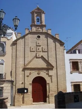
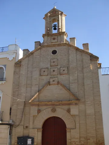
La Hermitage of Jesús

Submitted by brandcode_deweloper on
Id
4969981
Descripción
Breve descripción

Built in the17th century, retains the cover of its only floor with canyon vault with lunetes. The 18th century facade stands out for its monocrous simplicity of the brick, the ascending verticality of lines and the articulation of spaces. From its interior to highlight theJesus' shrimpwith paintings of this century in the vault.

Telecomunicaciones
Sitio web
www.arjonilla.es/el-municipio/patrimonio-historico.html
Correo electrónico
alcaldia@ayuntamientodearjonilla.es
Ubicación
Código Postal
23750
Latitud
37.974440
Longitud
-4.107590
Dirección
Plaza de la Encarnación, s/n
Distrito
Municipio
Ubicación en el mapa
POINT (-4.10759 37.97444)
Tipos de punto de interés
Imágenes carrusel
imagen
Image
Ermita%20de%20Jes%C3%BAs%20en%20arjonilla.jpg
Imagen principal
Desactivado
Imágenes cabecera
imagen
Image
ermita%20%281%29.jpg
Imagen principal
Activado
Microsite al que pertenece
Loading map
Preparing points of interest and routes...

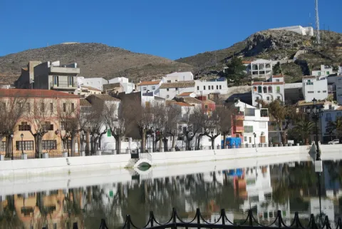
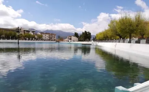
The Pond

Submitted by brandcode_deweloper on
Id
4658699
Descripción
Descripción larga

This spring has never been enough to fertilize all the lands that extend on a decreasing level towards the Guadalbullion River. On the other hand, the years of drought have always been very numerous, in which the volume of this source was significantly reduced, because the piezometric surface of the aquifer located to the north of the population, which gives rise to the Charca spring, is linked to driving through galleries with siphoning phenomena.

Breve descripción

La Charca is a reservoir that collects the waters of the birth of the Fuente de la Reja from medieval times. In the beginning it was a simple dam with a containment stone wall and gates that regulated the water output through an intricate network of miles of waterfalls. These irrigated the orchard and olive lands located to the south of the urban core, distributed in banks. The higher caces served as a southern limit to the population, thus delimiting the urban growth of Pegalajar.

Ubicación
Código Postal
23110
Latitud
37.739660
Longitud
-3.644450
Distrito
Municipio
Ubicación en el mapa
POINT (-3.64445 37.73966)
Imágenes carrusel
imagen
Image
lacharca.jpg
Imagen principal
Desactivado
Imágenes cabecera
imagen
Image
charca-kM3F-U501644234364StF-624x385%40Ideal.jpg
Imagen principal
Activado
Microsite al que pertenece
Loading map
Preparing points of interest and routes...

La Cerradilla

Submitted by brandcode_deweloper on
Id
8094084
Descripción
Descripción larga

Location: To the north-east of the city centre, very close to it and at the limits of the Natural Park of Cazorla, Segura and Las Villas.

Distance: 3 km.

Medium: On foot.

Access route: By a road that leaves directly from the city centre towards Los Rinnes.

Breve descripción

To the north-east of the city centre, very close to it and at the limits of the Natural Park of Cazorla, Segura and Las Villas, beautiful natural enclave that stands out for the presence of a natural water source, as well as the remains of an Arab castle.

Telecomunicaciones
Sitio web
www.huesa.es/el-municipio/patrimonio-natural.html
Correo electrónico
huesa@promojaen.es
Ubicación
Código Postal
23487
Latitud
37.764200
Longitud
-3.077910
Municipio
Ubicación en el mapa
POINT (-3.07791 37.7642)
Tipos de punto de interés
Imágenes carrusel
imagen
Image
Rinc%C3%B3n%20Alto%20.%20La%20Cerradilla.%20%281%29.jpg
Imagen principal
Desactivado
Loading map
Preparing points of interest and routes...

The Big House

Submitted by brandcode_deweloper on
Id
4571299
Descripción
Descripción larga

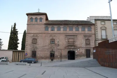
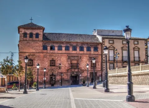
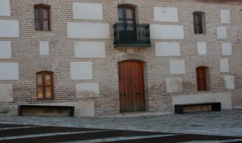
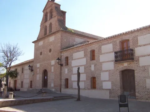
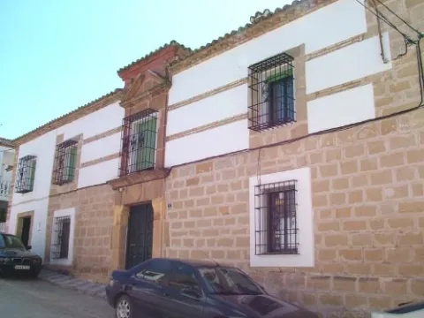
It is actually a wide rectangle, divided into three floors in height and with an airful turret-view on the east side - or left side. Very common typology in Granada, especially in the neighborhoods of San Jerónimo, San Matías and la Magdalena. Although, unlike here, it does not present a porticated and blasphemed courtyard in its centralizer, which leads us to think that it would not in its origin be a foundation of a family - more or less aristocratic - for its particular residence, so we suspect it would have another purpose.

The same similarity with the granadine is also given from a constructive point of view. Thus, if brick is used for the wall walls, for the structural elements, jambas, dintels and frontons, the quarry is used - in this case the asperon so abundant in the place - and the latter are the elements that define it from the stylistic point of view.

As a result, we are facing an interesting example of a typical house of the full baroque - the second half of the XVII-, where there is still a very strong presence of the elements of Mudejar tradition, the façade being very well resolved, because of its interior only highlights the dome on the pechines that originally topped the staircase.

On the first floor, whose cover of the apainelated arch does not appear by focusing the set, its beautiful intellized windows, crowned by beautiful curved and broken fronts, stand out. In the second, the most noble, the rhythms are changed, as they are small intellized windows with the same type of front, except that located on the door which is a large balcony framed by a beautiful alfice, also being in both bodies of a high quality the grate. Finally, a large, flying cornice separates them from the last with a proliferation of semicircular windows.

A number of hypotheses have been set aside on the promoters of its construction. At some times we thought it might be the great plateau that the first Marquis de la Rambla ordered to raise in the town, from which we even have several works payments. However, by some documents it seems to be deduced that it was built by the albaceas and employers of the foundation created by Mother Martha of Jesus - the so-called Almagro House - from the place - to also use it as a table to house travellers and carriages, which with their income would help to cover the expenses of the Hospital of Mercy.

Breve descripción

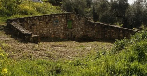
The so-called Casa Grande is located flanking the southern side of the Plaza de Bajo - a popular name -, wide public space, which works and performs functions that a larger square of any Spanish village.

Telecomunicaciones
Sitio web
www.cabradelsantocristo.org/monumentos/la-casa-grande/
Teléfono de contacto
953 397 002
Correo electrónico
info@aytocabradelsantocristo.com
Ubicación
Latitud
37.704510
Longitud
-3.285770
Distrito
Ubicación en el mapa
POINT (-3.28577 37.70451)
Tipos de punto de interés
Imágenes carrusel
imagen
Image
casa-grande-cabradelsantocristo-400x267.jpg
Imagen principal
Desactivado
Imágenes cabecera
imagen
Image
11.jpg
Imagen principal
Activado
Microsite al que pertenece
Loading map
Preparing points of interest and routes...

The Priest's House

Submitted by brandcode_deweloper on
Id
6547993
Descripción
Breve descripción

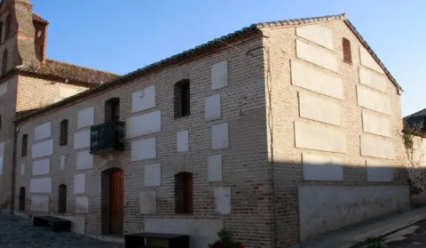
Located on the side of the church, the house of the priest is currently in the process of restoration after a time of abandonment.

Telecomunicaciones
Sitio web
www.aldeaquemada.com
Teléfono de contacto
680 104 199
Correo electrónico
turismo.aldeaquemada@gmail.com
Ubicación
Código Postal
23215
Latitud
38.412170
Longitud
-3.371710
Dirección
C/ Miguel Hernández, 4
Distrito
Municipio
Ubicación en el mapa
POINT (-3.37171 38.41217)
Tipos de punto de interés
Imágenes carrusel
imagen
Image
1.jpg
Imagen principal
Desactivado
Imágenes cabecera
imagen
Image
3.jpg
Imagen principal
Activado
Loading map
Preparing points of interest and routes...

The Civil Commander's House

Submitted by brandcode_deweloper on
Id
6549854
Descripción
Breve descripción

In the church, this house has had several functions, some of which are the City Council and currently the home of the retired. For many years it was used as a poultry of braves during the holidays.

Telecomunicaciones
Sitio web
www.aldeaquemada.com
Teléfono de contacto
680 104 199
Correo electrónico
turismo.aldeaquemada@gmail.com
Ubicación
Código Postal
23215
Latitud
38.411930
Longitud
-3.371660
Dirección
C/ Miguel Hernández, 4
Distrito
Municipio
Ubicación en el mapa
POINT (-3.37166 38.41193)
Tipos de punto de interés
Imágenes carrusel
imagen
Image
1001176.jpg
Imagen principal
Desactivado
Imágenes cabecera
imagen
Image
Aldeaquemada%20-%20Iglesia%20%281%29.jpg
Imagen principal
Activado
Loading map
Preparing points of interest and routes...

The Carrillera House

Submitted by brandcode_deweloper on
Id
4444747
Descripción
Descripción larga

It is the oldest and largest house in the town, sent to build in the year 1,760. It was used as a house of the Carrillera and the posio, where food was stored to distribute to the people in the years of scarcity and drought.

It was also believed that the inquisition was established there because his shield was on the facade, but after successive studies the researchers concluded that the Court of the Inquisition was in another house and that only one member of it lived there. This house, other ancient people and the Church, are united by underground tunnels that come out of its wells and lead to the outskirts of the village.

Breve descripción

It is the oldest and largest house in the town, sent to build in the year 1,760. Known as Casa de la Carrillera or Casa Grande of the 17th century. It was used as a home of the Carrillera and the posio, where food was stored to distribute to the village in the years of scarcity and drought.

Telecomunicaciones
Sitio web
www.cazalilla.es/el-municipio/patrimonio-historico.html
Teléfono de contacto
953 537 131
Correo electrónico
castalla@cazalilla.es
Ubicación
Código Postal
23628
Latitud
37.984340
Longitud
-3.881640
Dirección
C/ Donantes de Sangre, 12
Distrito
Municipio
Ubicación en el mapa
POINT (-3.88164 37.98434)
Tipos de punto de interés
Imágenes cabecera
imagen
Image
casa-carrilera.jpg
Imagen principal
Activado
Loading map
Preparing points of interest and routes...

The Chaplaincy

Submitted by brandcode_deweloper on
Id
659644
Descripción
Descripción larga

A small hermitage, which at the time made the school, brings to our head memories of past times. Its position allows it to have a privileged view over the nearby mountains, which you can know more in depth if you do the circular path of the Yelmo Chico, the PR-A 150 that part of the Capellania.

Breve descripción

Jars, rosemary and pines accompany the road leading to the Capellania. Small gardens between the pine trees and some olive trees lead to the area where the village is located. It has an immense central meadow with several roads that lead to the different houses.

Ubicación
Latitud
37.913575
Longitud
-3.011814
Municipio
Ubicación en el mapa
POINT (-3.011814 37.913575)
Tipos de punto de interés
Imágenes carrusel
imagen
Image
6%20%281%29.jpg
Imagen principal
Desactivado
imagen
Image
b4b8d505ab9cd1db1bf562f9e4900a0b40f1d770.jpeg
Imagen principal
Desactivado
Imágenes cabecera
imagen
Image
Cazorla_%2814277828194%29.jpg
Imagen principal
Activado
Loading map
Preparing points of interest and routes...
Marcas de calidad