Saltar al contenido principal
icon-intereses-aventura

Tower of the Tercia

Submitted by brandcode_deweloper on
Id
4539204
Descripción
Descripción larga

Historical data

The data relating to the medieval Génave are scarce, but it must have been one of the many foothills that populated the Sierra de Segura. A fortification or tower was probably built between the 11th and 13th centuries in the face of the advance of Christian armies.

After the Christian conquest, between 1235 and 1239, Géave and the whole Sierra de Segura were controlled by the Order of Santiago's Order and they had to endure the raison and attacks of intimidation of Saracena troops, so this and other torreons acted as a parapet in these war skirmishes and as a shelter for the population.

The chronicles written at the end of the Middle Ages, such as those of Don Francisco de León in 1468 or the Relations of Philip II of 1575, speak of the tower without any reference to a castle or enclosure of important dimensions, so it had to replace the ancient Islamic fortress.

Until 1551 Génave was the village of Segura de la Sierra, from that year on he received the privilege of Villa de orden de Felipe II.

In 1575 Génave is included in the Chancellery district of Granada, it depends on the archbishopric of Toledo and the Kingdom of Murcia before the Cortes, although it is directly under the governorate of Segura de la Sierra.

Description

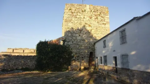
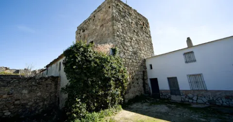
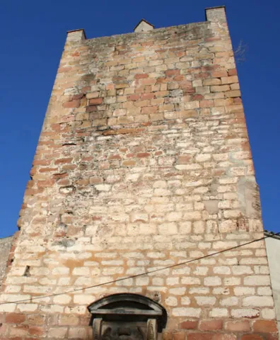
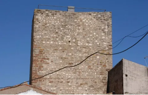
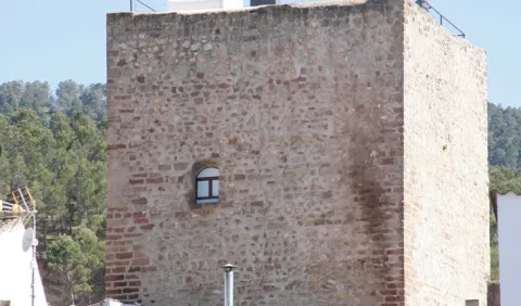
This tower, surrounded by buildings that cover its bottom, is built in irregular masonry.

It has a square floor of 10.50 m on its side, and in its interior two overlapping rooms are kept covered with half-canyon vaults. To access each of them, as well as the roof, there is a staircase embedded in the thickness of the walls covered with the same type of vault.

The access is now made through a building that houses the Adult Center of the town and which was previously the seat of the City Council.

The tower was declared in 1985 Good of Cultural Interest.

Breve descripción

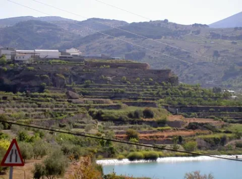
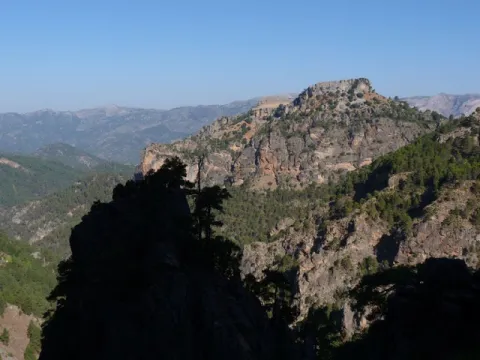
Génave is located on a hillside, near the wide valley in which the foothills of Sierra Morena and Sierra de Segura converge, on the road to Levante, a natural step that goes back to the Guadalimar River, connecting the Guadalquivir with the Peninsular Levant.

The only rest of the missing Génave castle is the so-called Torreon de la Tercia built by Christians at the end of the 13th century. It has an impressive cubic structure and is located in the center of the population.
Ubicación
Latitud
38.430300
Longitud
-2.733180
Dirección
C/ Tercia, 17
Distrito
Municipio
Ubicación en el mapa
POINT (-2.73318 38.4303)
Tipos de punto de interés
Imágenes carrusel
imagen
Imagen
11.jpg
Imagen principal
Desactivado
Imágenes cabecera
imagen
Imagen
12.jpg
Imagen principal
Activado
Loading map
Preparing points of interest and routes...

Tower of the Muña

Submitted by brandcode_deweloper on
Id
4873576
Descripción
Breve descripción

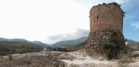
Located at the top of a small ameseado, it is defined as a fortification under medieval (XIV-XV century), several wall canvases and a magnificent square-floor tower, built in masonry and structured in two rooms covered with pointed vaults.

Telecomunicaciones
Sitio web
www.torredelcampo.es/index.php?option=com_content&task=view&id=134&Itemid=135
Teléfono de contacto
953 568 649
Ubicación
Nombre
Cortijo de la Muña
Código Postal
23640
Latitud
37.831870
Longitud
-3.942100
Distrito
Municipio
Ubicación en el mapa
POINT (-3.9421 37.83187)
Tipos de punto de interés
Imágenes carrusel
imagen
Imagen
t.%20de%20la%20mu%C3%B1a%202.jpg
Imagen principal
Desactivado
Imágenes cabecera
imagen
Imagen
unnamed.jpg
Imagen principal
Activado
Microsite al que pertenece
Loading map
Preparing points of interest and routes...

Tower of the Fuente Sorda

Submitted by brandcode_deweloper on
Id
6232212
Descripción
Breve descripción

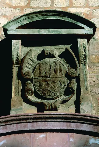
Old deaf, tower of the Almohad wall, which in the 15th century was lined with silery. The shield of the city that decorates the central front is from the 16th century. It is made of stone, on cut and timbrated hides. Above it is a curved fronton held by two mencapsules as a baking. The source below must be of later chronology.

Telecomunicaciones
Sitio web
www.turismodeandujar.com
Teléfono de contacto
953 504 959 / 953 508 200
Correo electrónico
turismodeandujar@andujar.es
Ubicación
Código Postal
23740
Latitud
38.036330
Longitud
-4.057340
Dirección
C/ Alcázar, 5D
Distrito
Municipio
Ubicación en el mapa
POINT (-4.05734 38.03633)
Tipos de punto de interés
Imágenes carrusel
imagen
Imagen
Mon488.jpg
Imagen principal
Desactivado
imagen
Imagen
Mon491.jpg
Imagen principal
Desactivado
Imágenes cabecera
imagen
Imagen
10325717824_6a02e248a0_z.jpg
Imagen principal
Activado
Horario
24 h.
Microsite al que pertenece
Loading map
Preparing points of interest and routes...

Tower of the Cabeza

Submitted by brandcode_deweloper on
Id
4658496
Descripción
Breve descripción

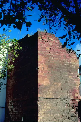
It is a cylindrical masonry turret with a monitoring and communication function. It was built in its current state by the Constable Miguel Lucas de Iranzo between 1462 and 1470, although it is likely to rise on the ruins of another previous one. In fact, this tower is part of a set of them that crossed the province in the North-South direction. At this one, there were two more towers today in meltdown.

Telecomunicaciones
Sitio web
www.ayto-pegalajar.org
Teléfono de contacto
953 360 003
Correo electrónico
pegalajar@promojaen.es
Ubicación
Código Postal
23110
Latitud
37.712700
Longitud
-3.641780
Distrito
Municipio
Ubicación en el mapa
POINT (-3.64178 37.7127)
Tipos de punto de interés
Imágenes carrusel
imagen
Imagen
torre-de-la-cabeza-2.jpg
Imagen principal
Desactivado
Imágenes cabecera
imagen
Imagen
torre-de-la-cabeza.jpg
Imagen principal
Activado
Microsite al que pertenece
Loading map
Preparing points of interest and routes...

Tower of Calígula

Submitted by brandcode_deweloper on
Id
4444587
Descripción
Descripción larga

This castle reached the second-rank level at the time of the Constable Iranzo, played an important role in taking sides, like Andújar, on the realistic side when in 1465 the king's enemies placed Jaén, and became famous when, six years later, the warden Diego Frías stopped and ordered a rival of the Constable, Don Fernando de Acuña, son of the Count of Buendía and no less than nephew of the Archbishop of Toledo, to be locked in his tower.
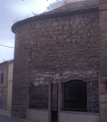
In fact, the castle, of small dimensions, was formed by a cylindrical tower with an almond parapet, as Martin drew it from Ximena Jurado. A stone from the upper tower seems to have an inscription, probably Arabic. There is no trace of this tower in the village. However, the head of the church presents a lock that could correspond to the remains of the castle. This solid semicircular wall of masonry could be reused from a large round tower, sister of those of the Rus and El Marmol castles, in the lands of Baeza.
This turret was declared Good of Cultural Interest in 1985.

Breve descripción

The so-called Torre de Caligula, a semicircular turret of the old castle, is preserved in the parish church.

Telecomunicaciones
Sitio web
www.cazalilla.es
Teléfono de contacto
953 537 131
Correo electrónico
castalla@cazalilla.es
Ubicación
Nombre
Torre de Calígula
Código Postal
23628
Latitud
37.984160
Longitud
-3.881890
Distrito
Municipio
Ubicación en el mapa
POINT (-3.88189 37.98416)
Tipos de punto de interés
Imágenes carrusel
imagen
Imagen
torre%20caligula.jpg
Imagen principal
Desactivado
Microsite al que pertenece
Loading map
Preparing points of interest and routes...

Natural Rock Screws of Gualay

Submitted by brandcode_deweloper on
Id
4486441
Descripción
Descripción larga

Location: To the south of the town, in the natural park of Cazorla, Segura and Las Villas.

Distance: 42 km

Medium: By vehicle, by bike and on foot.

Access route:: On the road A-319 towards La Iruela; at this point, after going 13 km, we will take the Chorro road, then turn away by the horseshoe road leading to Puerto Llano.

Breve descripción

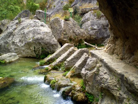
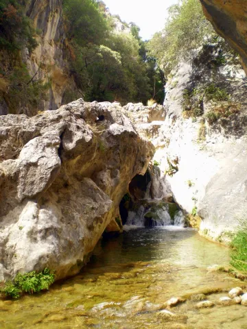
This is a beautiful place where we can enjoy watching the coastal vegetation surrounding the Arroyo de los Tornillos de Gualay; it is the ideal place to start visiting different enclaves of interest within the Natural Park.

Ubicación
Código Postal
23470
Latitud
37.913497
Longitud
-3.125280
Municipio
Ubicación en el mapa
POINT (-3.12528 37.913497)
Tipos de punto de interés
Imágenes carrusel
imagen
Imagen
gualay2.jpg
Imagen principal
Desactivado
Imágenes cabecera
imagen
Imagen
tornillogualay.jpg
Imagen principal
Activado
Loading map
Preparing points of interest and routes...

Cliffs of the Canjorro

Submitted by brandcode_deweloper on
Id
1909505
Descripción
Breve descripción

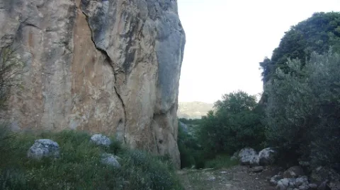
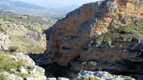
A very suitable place for the scale. Good rock (limestone) with a variety of styles and tracks, some very technical. You could say it's one of Jaén's best schools. Very recommended in winter. The average height is 20 meters, although maximum heights of 55 meters are reached. Verticality and sports climbing define this school. Insurance equipment is reliable.

Ubicación
Código Postal
23001
Latitud
37.745442
Longitud
-3.791119
Distrito
Municipio
Ubicación en el mapa
POINT (-3.791119 37.745442)
Imágenes carrusel
imagen
Imagen
unnamed.jpg
Imagen principal
Desactivado
imagen
Imagen
unnamed%20%281%29.jpg
Imagen principal
Desactivado
Imágenes cabecera
imagen
Imagen
IMG_4505.JPG
Imagen principal
Activado
Loading map
Preparing points of interest and routes...

Pond and Orchard Irrigation Systems de Pegalajar

Submitted by brandcode_deweloper on
Id
5848991
Descripción
Breve descripción

Set qualified by the Council of Culture of the Junta de Andalucía as a Place of Ethnological Interest, and included in the General Catalogue of Historical Heritage of the Junta de Andalucía. System of Muslim-medieval origin, for the storage of water, irrigation and exploitation of a system of traditional gardens in banks built in masonry. It is currently in serious danger of deterioration and change of use, despite its protection.

Ubicación
Latitud
37.740730
Longitud
-3.645870
Distrito
Municipio
Ubicación en el mapa
POINT (-3.64587 37.74073)
Tipos de punto de interés
Imágenes carrusel
imagen
Imagen
huerta3%20%282%29.jpg
Imagen principal
Desactivado
Imágenes cabecera
imagen
Imagen
huerta-banc%20%282%29.jpg
Imagen principal
Activado
Microsite al que pertenece
Loading map
Preparing points of interest and routes...

Syncline of the Poyos de la Mesa

Submitted by brandcode_deweloper on
Id
877705
Descripción
Descripción larga

The hill of the Poyos de la Mesa is an inverted relief in which the dolomies of the Upper Cretaceous and the limestones of the discordant Miocene on them are affected by a sincerity perfectly visible from the north.

The fold is more tight in the older materials (Cretaceous dolomies), and is more open in the discordants (myocene limestones). Both litological sets flare at the top, very steep, of the relief. Between them there is a well-developed canchal, which marks approximately the axial plane of the fold.

Source: Inventory of Georresources of Andalusia. Environmental Council. Junta de Andalusia.

Breve descripción

Stilting of the Poyos of the Table

Ubicación
Latitud
37.912893
Longitud
-3.003887
Municipio
Ubicación en el mapa
POINT (-3.003887 37.912893)
Tipos de punto de interés
Imágenes carrusel
imagen
Imagen
564_img.png
Imagen principal
Desactivado
imagen
Imagen
2%20%281%29.jpg
Imagen principal
Desactivado
imagen
Imagen
3%20%281%29.jpg
Imagen principal
Desactivado
Imágenes cabecera
imagen
Imagen
1.jpg
Imagen principal
Activado
Loading map
Preparing points of interest and routes...

Chasm / Sinkhole of Pinar Negro

Submitted by brandcode_deweloper on
Id
877405
Descripción
Descripción larga

The total power of the section is over 150 m. On a few sucrose dolomies attributed to the lower and medium Jurassic we find materials from the upper Kimmeridgian; they are limeals with large gastropods and corals that end up on an erosive surface with a crusts of iron oxides.

The following are limestones, locally sandy and margas, with various levels of interspersed calcrets; these materials are being decrified and dolomitised, giving way to stoned dolomies with abundant carbonous remains; this whole set of materials is of the age Hauteriviense- Barremiense. The lower Aptiense is characterized by the presence of sands, calcareous sandstone and sandy limestone with laminations and cross stratifications as well as orbitolins at various levels. The materials of the upper Aptiense have abundant rudists and orbitolins. The Albibe is represented by dolomies with black songs and ghosts of rudists.

Source: Inventory of Georresources of Andalusia. Environmental Council. Junta de Andalusia.

Breve descripción

Black Pinar Sima

Ubicación
Latitud
38.298857
Longitud
-2.651877
Distrito
Ubicación en el mapa
POINT (-2.651877 38.298857)
Tipos de punto de interés
Imágenes carrusel
imagen
Imagen
P1050513.JPG
Imagen principal
Desactivado
imagen
Imagen
V04.jpeg
Imagen principal
Desactivado
Imágenes cabecera
imagen
Imagen
pinar-negro.jpg
Imagen principal
Activado
Loading map
Preparing points of interest and routes...