Saltar al contenido principal
icon-intereses-aventura

Palacio Diputación Provincial de Jaén

Submitted by brandcode_deweloper on
Id
PUN-0003
Perfil de redes sociales
Descripción
Descripción larga
Before finding the right building for the government and provincial administration, the Diputación was located in different buildings in the old town of the capital. Finally, in 1891 the provincial government will move to the Plaza de San Francisco from where still today the Provincial Palace continues to preside over the passage of Bernabé Soriano Street, from the vicinity of the Cathedral. The Provincial Palace is the main work of the civil architecture of the city of Jaén. It was not the first time the Diputación had occupied this site. In fact, the first building that houses the Institution was the Convent of San Francisco, built in 1246 by Fernando III the Holy as a palace with chapel and donated in 1354 by King Pedro el Cruel to the Franciscan friars. With the deamortization, like the rest of the city's convents, it will pass to public hands by hosting our Diputación. It was the poor state of the building that led the Provincial Council to travel through other enclaves of the capital, although the desire to return to that Plaza remained latent. In the middle of 1867, threatening ruin, the convent was demolished to raise in the same place, after almost thirty years of construction, the current Provincial Palace. Jorge Porrua and Moreno were the architect of the project that guides the construction: a traditional building with two floors and basement that revolve around an interior courtyard. In front of the façade, thought of as neoclassical but removed with the neobaroque taste of the architect Justino Flores de Llamas; on the opposite face, the north, a semicircular form that resembles a hemicycle, symbolic space of local democracy. When entering the building the first stop is for the courtyard. It condemns the light and the transfer through the vain galleries, filling the dependencies with life. Coronado with balustrated columns and carpeted by the gardens, round around a fountain from which the image of the virgin emerges. A sculptural set from the Convent of Dominics of the Guard and donated by its owners, to occupy in principle the courtyard of the Provincial Museum. On the first floor, the office of the Presidency is located among others. Already on the second floor is the Hall of Illustrated Characters on whose walls and as witnesses of time are the portraits of jiennenses highlighted throughout history. The balcony of this room serves as a privileged lookout from which to contemplate the Cathedral. Also on this floor is the Salon de Plenos, the heart of local democracy in the province. The Full Hall or Sessions Hall owes its harmonious decoration to the project of the architect Justino Flórez Llamas. Its style recovers the historical mannerist tendencies. The entrance view to the stay draws three parts, the largest central. Most of the decoration is concentrated on the top of the walls in which striated columns give rise to interdices in which large medallions are placed with glass windows supported by children. Most of the windows have civil symbolology related to the province, mainly shields of various municipalities. Close the decoration the roof divided into fifteen milled quadrants in which the three spider lamps that set the living room in a place. The wealth and grandiosity of the stay seems to try to rise to the function assigned to it. The Chamber provides for the full meetings of the Members, at the head of them the President and the other Members in the form of an Chamber. The banks for the attendees are available in front. The plenary sessions of the Council are open to all citizens.
Breve descripción
The Provincial Palace of Jaén is the main work of the civil architecture of the city of Jaén and houses the headquarters of the Provincial Diputación.
Telecomunicaciones
Sitio web
https://www.dipujaen.es/conoce-diputacion/sedes-y-directorios/palacio-provincial/
Teléfono de contacto
953 303 573
Correo electrónico
secretariaturismo@dipujaen.es
Ubicación
Código Postal
23006
Dirección
Plaza San Francisco. S/N
Distrito
Municipio
Tipos de punto de interés
Horario
Monday to Friday: 09: 00-15: 00 / Weekends and holidays: 10: 00-14: 00

Forestrand Track Peña del Olivar - Puentehonda

Submitted by brandcode_deweloper on
Id
931026
Descripción larga

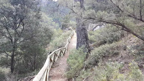
The track runs on the northwest face of Mount Bucentaina. When we have been walking for about 20 minutes we will reach the source of the Noguerón, from which there is plenty of water. In this place, the path PR-A 175 is separated by a path to the left. We're still on the main road.

At first we will see the mountains and olive groves around Siles, and then enter the forest. It is one of the best pineapples of carrasco pine the Natural Park. Just as the village of Puentehonda appears before us, we see on the left, on the same road, two gigantic and venerable specimens of carrasco pine, which are included in the Inventory of Singular Trees of Andalusia with the names of Pino de los Barrilos de Puentehonda and Pino del Cerro Bucentaina and respectively. The latter is 32 m high and 4.5 m in diameter at its base.

We will also find in our way an indication to go up a narrow and steep path to the remains of the castle of Puentehonda, whose ruins, corresponding to two towers, are half hidden in the thickness of the forest.

The village of Puentehonda, at the foot of the Peñalta, has a small recreational area with a fountain in which it is worth resting. The way back and forth, doing so quietly, will take about four hours.

Breve descripción

This route, of just under 5 km, runs along a narrow forest track that we recommend to walk. Its main attraction is the carrasco pine forest that crosses, under which grows a closed forest of oak, madroños and doves. The first kilometer is quite steep, but the rest is barely at a level. To reach the village of Puentehonda it is enough to follow the track, without taking any detour, until it ends up in another of greater width. The other side of the village is the village.

Latitud
38.1402
Longitud
-2.5704
Distrito
Ubicación en el mapa
POINT (-2.5704 38.1402)
imagen
Image
unnamed%20%2812%29.jpg
Imagen principal
Activado
imagen
Image
1%20%282%29.png
Imagen principal
Desactivado
imagen
Image
20.jpg
Imagen principal
Desactivado

Nature

icon-intereses-naturaleza

Friends

icon-intereses-amigos

Adventure

icon-intereses-aventura

Culture

icon-intereses-cultura

Sport

icon-intereses-deporte

Eco-friendly

icon-intereses-eco-friendly

For couples

icon-intereses-en-pareja

Family

icon-intereses-familia

Gastronomy

icon-intereses-gastronomia

Municipality

icon-intereses-municipio

Low-cost tourism

icon-intereses-turismo-low-cost

Solo travel

icon-intereses-viajar-solo
Pista Forestal Peña del Olivar - Puentehonda
Desactivado

Cerrada del Utrero and Cascada de Linarejos

Submitted by brandcode_deweloper on
Id
930180
Descripción larga

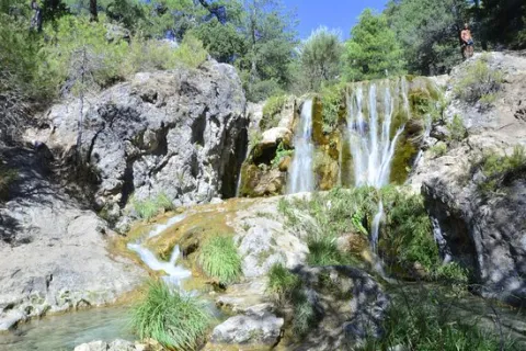
The Guadalquivir made this canyon narrow and deep, leaving some streams - like that of Linarej- hanging on the heights. When this stream is at the throat it forms the spectacular Cascade of Linarejos, which after standing in some pozas joins the Guadalquivir to descend to the valley.

The path is 1.6 km and on its circular route it surrounds the "Peñón del Lanchón" to return to the road in a pleasant walk of about 45 minutes.

In the final part of the road - just before returning to the asphalt - you reach a pine-resinero or black forest (Pinus pinaster) that was used to obtain the resin with which the water used to be made. In these trees you will see the furrows that the resineros opened to allow the exit of this sap.

We suggest:

  • Observe the numerous rupicular birds that nest on the rocky wall in front of our path, as we pass the waterfall of Linarejos. You will see small species, such as the victor, the lone rocher or the white lavender, sharing space with much larger ones like the leonate vulture.
  • Get to know the small town of Vadillo-Castril, where the old Rife sawmill was and today it is the home of two agencies of great importance for the Natural Park: the School of Forest Capataces and the Forest Defense Center.
Breve descripción

The site known as Cerrada del Utroo-Linarejos is an amazing natural work sculpted by the Guadalquivir in the limestone that surrounds it. The path is on foot, and it will allow you to appreciate the sharp rocks and objades created by water over hundreds of thousands of years. It is a charming walk where the labiérnago, the cornicabra, and the willow accompany you to one of the most photographed places in the Park: the "horse tail" or Cascada de Linarejos.

Latitud
37.9054
Longitud
-2.9553
Municipio
Ubicación en el mapa
POINT (-2.9553 37.9054)
imagen
Image
cascada_de_linarejos_g.jpg
Imagen principal
Activado
imagen
Image
arroyo-de-linarejos-jpg
Imagen principal
Desactivado

Family

icon-intereses-familia

Friends

icon-intereses-amigos

Nature

icon-intereses-naturaleza

Adventure

icon-intereses-aventura

Solo travel

icon-intereses-viajar-solo

Culture

icon-intereses-cultura

Gastronomy

icon-intereses-gastronomia

Sport

icon-intereses-deporte

Municipality

icon-intereses-municipio

Low-cost tourism

icon-intereses-turismo-low-cost

Eco-friendly

icon-intereses-eco-friendly

For couples

icon-intereses-en-pareja
Cerrada del Utrero y Cascada de Linarejos
Desactivado

El Aguardentero

Submitted by brandcode_deweloper on
Id
929850
Descripción larga

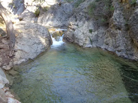
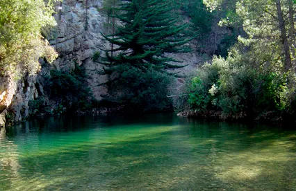
We deviate from the road, in order to see, upstream, a spectacular leap of water, with a large poza in its base, whose waters look an emerald green by the reflection of the lush vegetation surrounding it. Let us take our way back, to reach a small hill, with a very particular silhouette. It is the Paso del Aguartedo, place of impressive views towards the countryside.

The path is conditioned and low, with a serpentating route, on a steep and rocky slope. On our left we found a striking oquity - an ashtray - where the shepherds used to keep their cattle. Below we reach a small lookout, where the path is fork. We follow the one on the right, until we get back to the channel to contemplate the majestic cascade of the Osera, perhaps one of the highest and beautiful waterfalls of Andalusia.

We continue along the path marked, by the narrow and steep ravine, enjoying the multiple pozas of the channel, to a walkway that crosses the river and back the path to the Odera lookout. If at this point we continue along the road that goes parallel to the channel, we will reach the explanade of La Osera, place where the vehicles are left when it is accessed from Mogón.

For these wonderful places it is very easy to observe the flight of the leonate vulture. The real eagle is also present and, if we look well, we can even see the little perdicular eagle.

We suggest:

  • In a place like this, where water is the protagonist, spring is, of course, the most splendid season.
  • The path can also be done in the ascending sense, starting from Mogon.

The most recommended option is to make the path down. From the reservoir of Aguascebas, the walk is 4.5 km, from the km 18.8 of the road JH-7155 (Transversal de las Villas). At this point, to our left are the houses of the reservoir and, right behind it, we can observe an old quarry, where the path starts.

Breve descripción

This path will allow you to discover one of the most charming environments in the Las Villas mountains. It runs along the natural channel of the river Aguascebas Chico, where we will discover unusual and unexpected corners. Following him, on our right, we found fenced land of ancient crops and a small cortijo half-melting. This place is known as "Las Ramblillas." In the deep valley you can see the river Aguascebas Chico.

Latitud
38.1901
Longitud
-2.6903
Municipio
Ubicación en el mapa
POINT (-2.6903 38.1901)
imagen
Image
aguardentero.jpg
Imagen principal
Activado
imagen
Image
El%20Aguardentero.png
Imagen principal
Desactivado
imagen
Image
15483593Master.jpg
Imagen principal
Desactivado

Nature

icon-intereses-naturaleza

Friends

icon-intereses-amigos

Adventure

icon-intereses-aventura

Culture

icon-intereses-cultura

Sport

icon-intereses-deporte

Eco-friendly

icon-intereses-eco-friendly

For couples

icon-intereses-en-pareja

Family

icon-intereses-familia

Gastronomy

icon-intereses-gastronomia

Municipality

icon-intereses-municipio

Low-cost tourism

icon-intereses-turismo-low-cost

Solo travel

icon-intereses-viajar-solo
Baja
El Aguardentero
Desactivado
Tramo de asfalto o cemento
 
Tramo de pista o camino forestal
 
Tramo de vía pecuaria
 
Tramo de senda
 

Río Guazalamanco

Submitted by brandcode_deweloper on
Id
913911
Descripción larga

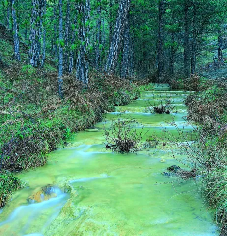
Once the asphalt ramp is over, the most painful stretch of the road, we reach an excellent lookout that allows us to enjoy a good view of the reservoir and the Valentine Barrio. A little later the track runs parallel to the river. When it wanders the way, without crossing, we follow the shore to the corners full of charm that we will meet. Later we will be forced to leave the shore to access a lane. We continue upstream, until we reach the Dike Cascade, very easy to distinguish because in its crown it has stone walls. A little lower, hidden in the bush, a beautiful leap of water is hidden that we must not miss.

Overcoming the Cascade of the Dique, part of a path that, at first, crosses the channel twice and takes us to the head of the river. Leaving the bottom of the ravine for a long time, and then returning to it, when the road ends on a forest track, we reach the bottom of the Cerrada de Navas, where the Guazalanco offers one of its most beautiful pictures.

However, to get to this point from above and to make the way down the stream, you can make an interesting route from the Nature Hall and Botanical Garden of El Hornico: Route of Guazalamanco on the Prays of Arredondo. This circular itinerary is signposted and has 13.2 (circular) length. If two vehicles are available and leaving one on the Cuesta del Cement, we reduce the route to 8.8 km and, in addition, we avoid the most flat and monotonous part of the route, the Dehesa del Rincón.

The most direct access to the Guazalamanco River is by the Dehesa del Rincón. From Pozo Alcón you have to take the A-326, up the Avenida de la Bolera, direction to Castril. By passing the campsite de la Bolera and the Km. 7, we take a detour that comes to our left and that borders the Forest House of la Bolera (it indicates to the Hornico). On an unasphalted road, always following the main road, 6,7 km from its start a fork to the left, in a slope, is left, which is asphalted (Cuesta del Cement). Although with an apron we can reach the Pasada de Guazalamanco, by a forest track parallel to the channel, the most recommended option is to leave the vehicle at the foot of the hill and take a small walk to the Cascade del Dique (round and round 2.5 km), and enjoy the many corners that this beautiful and wild mountain stream offers us.

Breve descripción

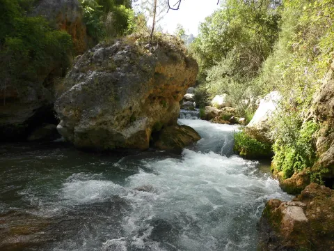
Guazalamanco is a mountain channel of permanent and turbulent waters, loaded with oxygen and gelid glass. Each of its corners invites us to recreate our senses, to remain still, in silence, as if we wanted to merge with nature and return to our origins. If you forget the camera in the car, when you discover the stream you will return to your steps to restart the road, now with the machine ready.

Latitud
38.1704
Longitud
-2.7002
Municipio
Ubicación en el mapa
POINT (-2.7002 38.1704)
imagen
Image
cascada-del-guazalamanco.jpg
Imagen principal
Activado
imagen
Image
guazalmanco.jpg
Imagen principal
Desactivado

Nature

icon-intereses-naturaleza

Friends

icon-intereses-amigos

Adventure

icon-intereses-aventura

Culture

icon-intereses-cultura

Culture of the Bull

icon-intereses-cultura-del-toro

Sport

icon-intereses-deporte

Eco-friendly

icon-intereses-eco-friendly

For couples

icon-intereses-en-pareja

Family

icon-intereses-familia

Gastronomy

icon-intereses-gastronomia

Municipality

icon-intereses-municipio

Low-cost tourism

icon-intereses-turismo-low-cost

Solo travel

icon-intereses-viajar-solo
Baja
Río Guazalamanco
Activado

Pine Tree Galapán

Submitted by brandcode_deweloper on
Id
913492
Descripción larga

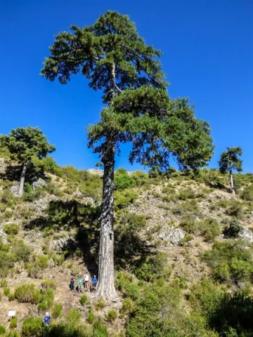
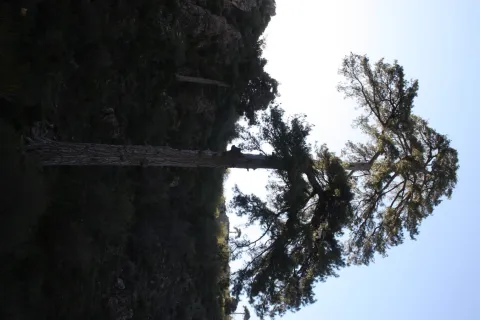
Because until you're with him you're not aware of his proportions. Embrace and surround it is impossible if 4 or 5 people do not join, as its perimeter reaches 5.40 meters. For its dimensions it is part of the Project "Trees: Legends vivables," a beautiful work of cataloging unique trees of the Iberian Peninsula.

This wonderful pine tree has survived the intense forest activity that developed on these lands for several centuries. Many of his companions, who are no longer present, were part of the ships that were built for the Spanish Navy between the 16th and 18th centuries. It was the time when the Serra de Segura saw was the Maritime Province. But the Galapan is still with us to show you its splendor.

We suggest...

  • Enjoy a good time sitting next to the Pino Galapán, under his cup, watching the water spread through the stream of the Juan Fría and appreciating this natural monument, which for centuries has been the inspiration of legends, stories, writings and traditions.
  • Since you have come to that you can continue on the forest track until you look at the fields of Hernán Perea, another of the natural treasures of the Park. You won't regret it.

From Santiago de la Espada you have to follow the road A-317 towards La Matea, and through this town continue to the village of Don Domingo. Once there you have to take a forest track in perfect condition, marked for hiking as GR 144. This track is directed towards Rambla Seca and the fields of Hernán Perea. As you pass a bridge you will find a first crossing where, on the right, the route to the Pino Galapán is indicated. 2.6 km from this crossing you will find it in the right margin of the road.

Breve descripción

You have before you a magnificent example of larix pine, which here is called the Salgareño pine (Pinus nigra salzmanii), a living treasure of this territory that with its more than 400 years of age and 39 m of height is listed as one of the giants of the Spanish forests. It is the most emblematic tree in the Segura saw, and although it does not seem much to you from the forest track, you have to go down the path and get to its base to understand what is special.

Latitud
38.111768
Longitud
-2.551516
Ubicación en el mapa
POINT (-2.551516 38.111768)
imagen
Image
Pinogalapan450-x-600.jpg
Imagen principal
Activado
imagen
Image
Pino%20Galap%C3%A1n.jpg
Imagen principal
Desactivado

Friends

icon-intereses-amigos

Adventure

icon-intereses-aventura

Culture

icon-intereses-cultura

Culture of the Bull

icon-intereses-cultura-del-toro

Sport

icon-intereses-deporte

Eco-friendly

icon-intereses-eco-friendly

For couples

icon-intereses-en-pareja

Family

icon-intereses-familia

Gastronomy

icon-intereses-gastronomia

Municipality

icon-intereses-municipio

Nature

icon-intereses-naturaleza

Low-cost tourism

icon-intereses-turismo-low-cost

Solo travel

icon-intereses-viajar-solo
Pino Galapán
Desactivado
Coordenadas / Huso 30S
30S x = 539316 and = 4218311
Tramo de asfalto o cemento
 
Tramo de pista o camino forestal
 
Tramo de vía pecuaria
 
Tramo de senda
 

Embalse Úbeda la Vieja

Submitted by brandcode_deweloper on
Id
912924
Descripción larga

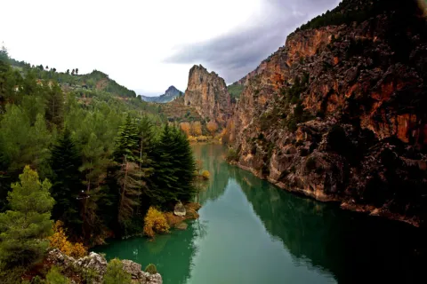
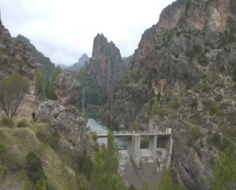
From the road you will find a road that goes down to the reservoir dam, where the vision is even more spectacular, with the impressive Pico Morrión standing out at the bottom.

This area of the Park represents better than any of the world of mountain villages: landscape, culture, gastronomy, odors, colors, life forms that when we come from the city we find unreal; as if it were not possible to live integrated into nature, living from the resources it provides but without damaging it.

Around the reservoir there are villages held in the time that each of them offers you different delicacies: the bread and the cakes of Tobos made in a historic wood oven, or the magnificent Vites spirit with which to make delicious artisanal liquors such as the pachan or the mistela.

We suggest...

  • Eating in the surroundings of the reservoir: Segureño lamb, slaughter viandas or any serrano dish will be safe of your liking.
  • Visit some of the villages near the reservoir, such as Marchena, La Muela or Miller.

This reservoir is located halfway between the town of Santiago de la Espada and the village of the Miller Boards, on the local road JF-7038, at the height of the village of Morrión.

Breve descripción

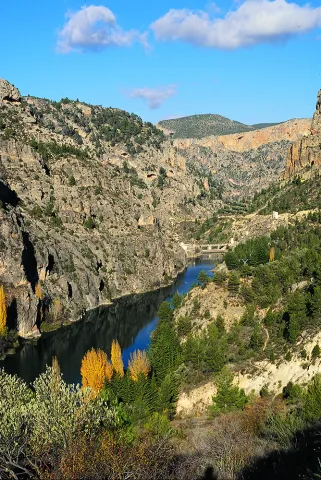
The vegetation-covered slopes and stone walls are reflected in the blue green waters of this tiny reservoir, which looks more like a natural lake of high mountain than a human construction. In it the Zumeta River retains its waters for an instant creating a peaceful and serene place, ideal for a moment of tranquility.

Latitud
38.0131
Longitud
-3.3706
Ubicación en el mapa
POINT (-3.3706 38.0131)
imagen
Image
embalse_lavieja%20%281%29.jpg
Imagen principal
Activado
imagen
Image
embalsedeLaVieja01.jpg
Imagen principal
Desactivado

Friends

icon-intereses-amigos

Adventure

icon-intereses-aventura

Culture

icon-intereses-cultura

Sport

icon-intereses-deporte

Eco-friendly

icon-intereses-eco-friendly

For couples

icon-intereses-en-pareja

Family

icon-intereses-familia

Gastronomy

icon-intereses-gastronomia

Municipality

icon-intereses-municipio

Nature

icon-intereses-naturaleza

Low-cost tourism

icon-intereses-turismo-low-cost

Solo travel

icon-intereses-viajar-solo
Embalse Úbeda la Vieja
Desactivado

Segura de la Sierra - Río Madera

Submitted by brandcode_deweloper on
Id
859335
Descripción larga

Its main attractions are the large forests of pine laricio, the head of the valley of the river Madera and some small villages.

Below we tell you how to make the route and suggest some possibilities:

Km 2.8.To the right part of the road to the small and hidden village of Moralejos, which is reached in a few minutes. We advise you to visit her, because she has a very harmonious environment and is well preserved.

Km 6.The Royos. From this tiny village you can see beautiful views of the header of the Trujala valley. Km 8.3. Important cross with many indications. We turn right, towards Rio Madera, on the JF-7016 road. To the left we would go to Las Azebeas and Siles. Here is a significant change in the plant environment, as we have entered the area of the pine pine larice.

Km 8.7.On the left, a forest track opens that gives access to Navalespino, the Collado de Góntar and the abandoned village of Prado de Juan Ruiz, among other areas of high quality landscape.

Km 9.5.Fountain and forest house of Navalhora. The pinar acquires all its splendor. Three hundred meters further, take the long forest track from Navalhora to El Robledo to the right, for which we recommend walking.

Km 10.1.At this crossing, our route follows to the left, towards Rio Madera, on the JF-7038 road. From here we go down and we'll see large copies of complaints and some twins. Km 12.3. Start a forest track to the left, to the counter. It gives access, without taking any detour, to the far-off villages of La Tobilla and Prado Espinosillo.

Km 13.5.Los Negros' controlled camp area. It has a fountain and tables, and is accessible for people with reduced mobility. An excellent place to rest under large larity pines. From here, during the 4.3 km that separate us from the village of Arroyo Canales, we recommend to walk quietly next to gardens and small cortijos, always close to the river Madera and in the middle of one of the best pine lario forests in Spain.

Km 17.8.The village of Arroyo Canales, sometimes given the name of the village of Rio Madera, is a strategic point throughout the area. At this very marked crossing, we turn right on the JF-7039 road. From here on the route rises and the forest is less lush, but you gain splendid views. We will find several forest tracks signposted to El Jaral, La Huelga de la Vigas and the Collado de Los Asperones. All of them are interned in magnificent places.

Km 22.4.Very marked cross where we turn right, on the JF-7016 road. Two hundred meters later, we ignored the left crossing towards the Hornos de Segura and followed the front. From here on the plain route and the environment becomes more lush.

Km 23.7.We arrived at the location of El Campillo, where there is an old forest house. To the left, the asphalted forest track goes up to El Yelmo. Both on the road and at the summit, the views are extraordinary.

Km 32.5.We found again the crossing through which we went down to Rio Madera. From here on, we return to Segura de la Sierra on the same route we brought.

PRACTICAL PARTICULARS

The route is 42 km, and it starts and ends in Segura de la Sierra. The beginning from which we count the kilometers is at the exit of Segura de la Sierra on the road JV-7032, exactly at the point where the road to the castle comes right.

Breve descripción

This route, which is part of the small and beautiful village of Segura de la Sierra, leads along small mountain roads to the valley of Rio Madera, ascends to the vicinity of the Yelmo and returns to the starting point.

Latitud
38.3547
Longitud
-2.6487
Distrito
Ubicación en el mapa
POINT (-2.6487 38.3547)
imagen
Image
Natu048.jpg
Imagen principal
Activado
imagen
Image
1%20%285%29.jpg
Imagen principal
Desactivado
imagen
Image
2%20%284%29.jpg
Imagen principal
Desactivado
imagen
Image
3%20%284%29.jpg
Imagen principal
Desactivado

Nature

icon-intereses-naturaleza

Friends

icon-intereses-amigos

Adventure

icon-intereses-aventura

Culture

icon-intereses-cultura

Sport

icon-intereses-deporte

Eco-friendly

icon-intereses-eco-friendly

For couples

icon-intereses-en-pareja

Family

icon-intereses-familia

Gastronomy

icon-intereses-gastronomia

Municipality

icon-intereses-municipio

Low-cost tourism

icon-intereses-turismo-low-cost

Solo travel

icon-intereses-viajar-solo
Segura de la Sierra - Río Madera
Activado
Tramo de asfalto o cemento
 
Tramo de pista o camino forestal
 
Tramo de vía pecuaria
 
Tramo de senda
 

Santiago de La Espada - Juntas de Miller

Submitted by brandcode_deweloper on
Id
859170
Descripción larga

The morphology of the land also tells us of the thousands of years in which water has been the artisan hand that has built the landscape. As we go down this road, the oak and pine trees make way for lush riverside forests.

Among the options we propose to you:

Km 0.Santiago de la Sword. Located at 1350 m of altitude, its main economic activity is extensive livestock. It has the parish church of Santiago Apostle (16th century), built on an earlier hermitage dedicated to the same saint and which has a beautiful major altarpiece of Baroque style. In the square of the City Hall we find an old 16th century inn with a vistose wooden balconade.

Km 10.Mirador del Salto de la Nova or del Zumeta; 10 km from Santiago we find on the right hand side this mirador from which we see the limit of the Park and the province of Jaén. Watch out for hats, they can fly a long way.

Km 12.Tobos village. Compulsory stop to buy good bread and delicious cakes. Next to the road there is a simple laundry room that circulates the Tobos stream, with fresh and clean waters.

Km 13.Vites village. To get to the village of Vites you have to turn left and drive 2 km. In this village are raised magnificent white grapes, large and sweet, from which a powerful spirit is distilled. Ask the local neighbors.

Prado Moro.At the end of the village of Vites a left road ascends to Prado Moro. Here a centenary oak resists at the time that gives us a vision of the vegetation that in the past existed in the area.

Km 16.Embalse de la Vieja. A prominent peak called the Morrison announces the beginning of the Old Age reservoir. After the village of Morrión, a lane - not marked - goes down on the left to the reservoir.

Km 18.The Vadico. Two km from the reservoir there are houses on the right side of the road with a wall in front. Right across the street we found a way up to the Vadico. It's a nice walk, by a real vergel, which deserves to be made on foot. On the way there are sources to be able to refresh and collect water.

Km 18.5.Entrance to the villages of La Muela, Marchena and Marchenica. The Muela is 5.4 km from this point. In its vicinity is Hoya Somera, an important archaeological site of the bronze age. Later on there are Marchena and Marchenica. In its surroundings, there were Roman remains and an Arab necropolis.

Km 22.Miller's together. At this point the Zumeta River has come with us all the way and the Segura. A natural stone tunnel announces the arrival at this meeting place.

Miller village.From Las Juntas there is another road that reaches this historic village with more than 20 water births. It is a starting point for several routes that will make us known beautiful areas of the Sierra de Segura. When you pass the stone tunnel you have to follow the indication "Central and Miller."

PRACTICAL PARTICULARS

Distance:From Santiago to the Miller Boards there are 22 km away, by a mountain road. The route is extended if we enter the villages and recommended points.

Home:Santiago de la Sword village to which you can reach the A-317. The route is developed by the JF-7038 road

Breve descripción

The Zumeta Valley, through which this route runs, is a true journey in time. By the river there have been settlements from the Neolithic to today. We will find archaeological sites, rock paintings, small castles and villages that are authentic ethnological museums in the open air. In them it is still easy to see their inhabitants doing work of other times.

Latitud
38.0764
Longitud
-2.5222
Distrito
Ubicación en el mapa
POINT (-2.5222 38.0764)
imagen
Image
santiago-espada.png
Imagen principal
Activado
imagen
Image
Natu187.jpg
Imagen principal
Desactivado

Nature

icon-intereses-naturaleza

Friends

icon-intereses-amigos

Adventure

icon-intereses-aventura

Culture

icon-intereses-cultura

Sport

icon-intereses-deporte

Eco-friendly

icon-intereses-eco-friendly

For couples

icon-intereses-en-pareja

Family

icon-intereses-familia

Gastronomy

icon-intereses-gastronomia

Municipality

icon-intereses-municipio

Low-cost tourism

icon-intereses-turismo-low-cost

Solo travel

icon-intereses-viajar-solo
Baja
Santiago de La Espada - Juntas de Miller
Activado

Piscifactoría del Borosa

Submitted by brandcode_deweloper on
Id
859115
Descripción larga

The route is 45 km. It begins in the farm of the Borosa and ends in the Hornos de Segura. It is recommended at least one full day. There are many tourist accommodation on the route.

Km 0 - Piscifactory and River Borosa River Interpreting Center. In this Centre we will know the importance of water and river ecosystems in the Natural Park, in which emblematic species such as the common trout and the otter stand out.

Km 1,7 - Vinagre Tower. This area is one of the most crowded in the Park and is located in a geographically privileged area for its centrality. Here it is essential to know the Park Visitors Center, which has been recently modernized and has various interactive resources. It has a Natural Park Store, toilets, cafe, rest room and children's play area on the outside. Very close to this center is the Botanical Garden, a pleasant place with a wide and careful selection of natural park plants, from small herbaceas to large trees. It is a perfect place to observe and learn to distinguish them or simply to take a pleasant walk between lush vegetation.

Km 6.5 - Coto Ríos. This village, on the banks of the Guadalquivir, was built in the 1960s of last century to house families living in scattered villages and cortijos and whose houses were expropriated to create the National Cazorla-Segura Hunting Coto (now the Andaluza de Caza Reserve). It has medical assistance, shops and other services, in addition to several campsites.

Km 13.3 - Wild Fauna Park Collado del Almond. In their enclosure they pasture in semi-freedom deer, mountain goats, wos and muflons. You can see them and photograph them by walking a pleasant itinerary with fountains, banks and several viewpoints with splendid views of the Tranco reservoir and the ruins of the castle of Bujaraiza.

Km 14 - FRF look. It is one of the milestones of the Route of the same name, dedicated to the mythical naturalist Felix Rodríguez de la Fuente, who from this point of view filmed the famous scenes of the berrea of the deer in the 1970s. In front of it is Mount Bujaraiza, which sometimes, when the reservoir is very full, becomes an island, and is crowned by the ruins of an Arab turret.

Km 17.6 - Old-garden controlled area. This place is very nice to eat and rest, except on the dates you are occupied by some camp.

Km 19.2 - House of Crafts Los Casares. It is an old Forest House converted into a shop of crafts and products from the Park.

Km 26 - Old Control Recreative Area. It is a large and recently built area with magnificent views over the northern part of the Tranco reservoir. It has banks, tables to eat and fountain.

Km 28.4 Tranco Dam - This impressive dam, whose height on the Guadalquivir channel is 82 meters, is one of the largest in Spain. In its surroundings there are several restaurants, terraces and water sports facilities, as well as the village that was raised for the workers who built the dam.

Km 31.5 - The Parral Recreative Area. It is in the middle of the carrasco pine pinar and has a look-out with good views over the waters of the Tranco reservoir.

Km 35.7 - Cñada Morales. When it reaches this village the landscape is opened and no longer exclusively forest, to give way to large humanized areas with olive groves, orchards and scattered cortijos.

Km 44.6 - Safe Furnaces. This small town, built on the top of a peñasco, is in the center of the Natural Park. Its monuments, views and irregular alleys of the Arab past, served him the declaration of Artistic Historical Set.

Breve descripción

This route is one of the most classic and frequented of the Natural Park, as it brings together a very attractive landscape dominated by the water of the Tranco reservoir with the possibility of visiting a number of facilities, in which we will enjoy knowing and observing the natural wealth of this protected space. It is mostly due to the winding road A-319, for which it is appropriate to drive with caution, especially on the dates of the greatest tourist influx. You will find various viewpoints and recreational areas in which we recommend stopping you, but below we recommend a series of stops and almost mandatory visits. You will find expanded information from most of these places on this same website.

Latitud
38.01536
Longitud
-2.863737
Distrito
Municipio
Ubicación en el mapa
POINT (-2.863737 38.01536)
imagen
Image
shutterstock_742514128.jpg
Imagen principal
Activado
imagen
Image
Natu050.jpg
Imagen principal
Desactivado
imagen
Image
imgOptim2%20%282%29.jpeg
Imagen principal
Desactivado
imagen
Image
Natu126%20%281%29.jpg
Imagen principal
Desactivado
imagen
Image
Natu290.jpg
Imagen principal
Desactivado

Nature

icon-intereses-naturaleza

Friends

icon-intereses-amigos

Adventure

icon-intereses-aventura

Culture

icon-intereses-cultura

Sport

icon-intereses-deporte

Eco-friendly

icon-intereses-eco-friendly

For couples

icon-intereses-en-pareja

Family

icon-intereses-familia

Gastronomy

icon-intereses-gastronomia

Municipality

icon-intereses-municipio

Low-cost tourism

icon-intereses-turismo-low-cost

Solo travel

icon-intereses-viajar-solo
Piscifactoría del Borosa
Desactivado
Coordenadas / Huso 30S
30S x = 511961 and = 4207528
Tramo de asfalto o cemento
 
Tramo de pista o camino forestal
 
Tramo de vía pecuaria
 
Tramo de senda