Saltar al contenido principal

Mingo

Submitted by brandcode_deweloper on
Id
1909247
Descripción larga

How to get there. -7 km from Jaén capital. Access is a little complicated. Take the road that leads to Puente de la Sierra; after passing a small urbanization of shawls, 50 meters from the kilometric milestone take the asphalt deviation that comes to the right. Continue without diverting to a point where it is fork in two, then take the right track and reach a chain that prevents us from passing. From here we have to continue to an old cortijo where the road is over. Taking as reference the walls of the Mingo (another area) in front of us, continue to the right on a low marked road that leads us to the Canjorro.

Right at the entrance of this popular school, it comes down first by the olive grove and then through a vaguada, until it comes, about 10 minutes later, following a little marked path, to the river, right in front of one of the most spectacular walls. We cross the river and to the left we take a smooth upward path that leads five minutes to the Inkilino sector. To reach other sectors you have to continue along this path to a wire, and to the right, in the direction of the larger sectors.

Breve descripción

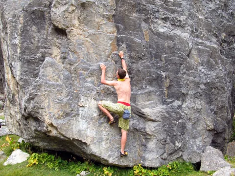
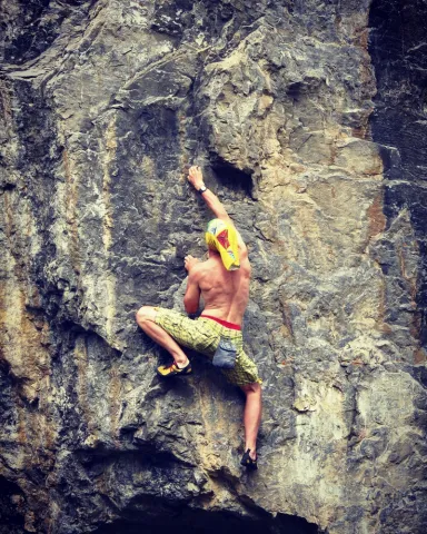
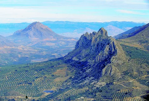
The area is of high quality landscape. It is a classic wall par excellence in which the sports sector known as the Inkilino has recently been equipped. It has a long approach, good possibilities and for the moment few routes. In this area there are alternating paths of sports climbing and classical climbing. Some routes require an explosive escalation, especially in the extrusions. The anchorages we found are reliable. The average height is 15 meters. The maximum height is 25 meters.

Latitud
37.764682
Longitud
-3.790903
Distrito
Municipio
Ubicación en el mapa
POINT (-3.790903 37.764682)
imagen
Image
shutterstock_1054327565%20%281%29.jpg
Imagen principal
Activado
imagen
Image
shutterstock_1512767882.jpg
Imagen principal
Desactivado
imagen
Image
shutterstock_1494195701.jpg
Imagen principal
Desactivado

Friends

icon-intereses-amigos

Nature

icon-intereses-naturaleza

Adventure

icon-intereses-aventura

Solo travel

icon-intereses-viajar-solo

Gastronomy

icon-intereses-gastronomia

Sport

icon-intereses-deporte

Municipality

icon-intereses-municipio

For couples

icon-intereses-en-pareja
Mingo
Desactivado

Number of routes:4

You're up to V:0%

Votes from V + to 6c +:0%

Vies from 7a to 7c +:90%

Eight-way:0%

Best time:From spring to autumn

Where to drink. -There's no water in the vicinity.

Coordenadas / Huso 30S
30S x = 430339 and = 4180001
Tramo de asfalto o cemento
 
Tramo de pista o camino forestal
 
Tramo de vía pecuaria
 
Tramo de senda
 

Las Cimbras

Submitted by brandcode_deweloper on
Id
1909009
Descripción larga

Where to sleep. -There are not many places nearby to camp. We must seek life in the nearby villages or live.

Where to drink. -There are three sources of drinking water.

Notes and warnings. -In summer you can climb from dawn to 12.30 p.m.; in the afternoon from 18 a.m.; and in winter during the hours of the sun.

How to get there. -The school is located a few kilometers from Jaén, leaving in the direction of Mancha Real. Once there you have to go to Torres by the JV-3242. No parking problem. The area is in the same village, by the road.

Breve descripción

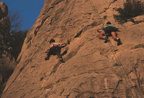
It is a small area integrated into the urban centre. It is located in front of the municipal pool. Comfortable and undergraduate. The average height is 8 meters. The maximum height is 12 meters. It is equipped and very good for initiation.

Latitud
37.785244
Longitud
-3.509375
Distrito
Municipio
Ubicación en el mapa
POINT (-3.509375 37.785244)
imagen
Image
shutterstock_1048500664.jpg
Imagen principal
Activado
imagen
Image
shutterstock_279617825.jpg
Imagen principal
Desactivado

Friends

icon-intereses-amigos

Nature

icon-intereses-naturaleza

Adventure

icon-intereses-aventura

Solo travel

icon-intereses-viajar-solo

Gastronomy

icon-intereses-gastronomia

Sport

icon-intereses-deporte

Municipality

icon-intereses-municipio

For couples

icon-intereses-en-pareja
Las Cimbras
Desactivado
Coordenadas / Huso 30S
30S x = 455148 and = 4182110

La Cueva

Submitted by brandcode_deweloper on
Id
1908346
Descripción larga

Where to sleep. -There is a camping area (meringeros) a few kilometers later, in the Cañada de las Azadillas. We have to ask the day care center for permits. The proximity of the city of Jaén offers accommodation and restaurants of all categories.

Where to drink. -In the cave itself or in the meringers.

Information and books. -www.usuarios.lycos.es / atope / otinar.htm

Notes and warnings. -As a livestock area, under no reason should one climb when he has won in the cave. High difficulty area. Recommended for climbers that reach sufficient level.

How to get there. -From Jaén capital you take the road to Puente la Sierra, to continue to the Pantano de Quiebrajano. Before you get to the recreational area, a lane goes right. We have to park at the bottom without obstructing the track. In this area interesting climbing areas are concentrated.

Breve descripción

Probably one of the most interesting climbing schools in Andalusia. Their interest is increased by being placed in a area of high landscape value. It is a cave with high difficulty itineraries on ball formations, stalactites and giant jets. A complete collection of karmic formations (shaped in limestone) This school is a paradise of continuity. The tracks have reliable anchorages for sports climbing. The average height is: 25 meters. The maximum is 30 meters.

Latitud
37.674288
Longitud
-3.749732
Distrito
Municipio
Ubicación en el mapa
POINT (-3.749732 37.674288)
imagen
Image
shutterstock_1386587255%20%281%29.jpg
Imagen principal
Activado
imagen
Image
shutterstock_532809607.jpg
Imagen principal
Desactivado
imagen
Image
shutterstock_527300206.jpg
Imagen principal
Desactivado

Friends

icon-intereses-amigos

Nature

icon-intereses-naturaleza

Adventure

icon-intereses-aventura

Solo travel

icon-intereses-viajar-solo

Gastronomy

icon-intereses-gastronomia

Sport

icon-intereses-deporte

Municipality

icon-intereses-municipio

For couples

icon-intereses-en-pareja
Alta
La Cueva
Desactivado

Number of routes:50

You're up to V:0%

V + to 6c + routes: 0%

Vies from 7a to 7c +:30%

Eight-way:70%

Best time:From spring to autumn

Coordenadas / Huso 30S
30S x = 433885 and = 4169942
Tramo de asfalto o cemento
 
Tramo de pista o camino forestal
 
Tramo de vía pecuaria
 
Tramo de senda
 

La Cantera

Submitted by brandcode_deweloper on
Id
1908295
Descripción larga

For water, food and accommodationYou can take advantage of the city of Jaén, next to which is this climbing area.

Notes and warnings.- The estate is an olive grove, so it is not appropriate to get close to the walls. We must also park in places that do not stop the passage.

How to get there.- From Jaén capital you take the road of Los Villares (C-3221). At kilometer two, a small lane that takes directly to the area is on the right. In Jaén this area is known as the Fuente de la Peña, an old laundry area on the outskirts of the city. The scarves go from there to the quarry.

Breve descripción

They are not too many tracks and some of the older ones have a veiled equipment, but the slightly collapsed and good quality orange wall offers itineraries with many holes and rigs. This is a sports climbing school, where most of the fixations are reliable. The characteristics of these walls make the tracks explosive. The rock is limestone. The maximum height of the walls is 15 meters. It is a good area of boulder, sometimes very powerful.

Latitud
37.751413
Longitud
-3.804531
Distrito
Municipio
Ubicación en el mapa
POINT (-3.804531 37.751413)
imagen
Image
rendered%20%281%29.jpg
Imagen principal
Activado
imagen
Image
shutterstock_105196313.jpg
Imagen principal
Desactivado
imagen
Image
shutterstock_528238198.jpg
Imagen principal
Desactivado

Friends

icon-intereses-amigos

Nature

icon-intereses-naturaleza

Adventure

icon-intereses-aventura

Solo travel

icon-intereses-viajar-solo

Gastronomy

icon-intereses-gastronomia

Sport

icon-intereses-deporte

Municipality

icon-intereses-municipio

For couples

icon-intereses-en-pareja
La Cantera
Desactivado

Number of routes:26

You're up to V:0%

Votes from V + to 6c +:70%

Vies from 7a to 7c +:30%

Eight-way:0%

Best time:From autumn to spring

Coordenadas / Huso 30S
30S x = 429126 and = 4178539

Cerro Golondrina

Submitted by brandcode_deweloper on
Id
1908278
Descripción larga

For water, food and accommodation.- Water should be brought, as the nearest water is in Bedmar or Jodar. The accommodation and restaurants of the immediate villages are ideal for finding supply.

How to get there.- The area is 60 kilometres from Jaén capital. From this city you have to go to Bedmar (C-328). After that municipality we turn right through the crossing with the C-325. We arrived shortly after the area. The walls have no loss. They get up in the middle of the hill. There's enough space to park on both sides of the road.

Breve descripción

It is a very bright wall, which is integrated into an interesting relief formation and surrounded by a landscape with magnificent views. It is located at the limits of the Natural Park of Sierra Magina. Although it is a school of local interest, it may be of interest for a short visit. His inclination is quite vertical. The insurance system allows sports climbing with a certain technical character. The limestone walls reach 25 meters of level, with an average height of 15 meters.

Latitud
37.813578
Longitud
-3.340539
Distrito
Municipio
Ubicación en el mapa
POINT (-3.340539 37.813578)
imagen
Image
Natu010.jpg
Imagen principal
Activado
imagen
Image
2.jpg
Imagen principal
Desactivado
imagen
Image
1.jpg
Imagen principal
Desactivado

Friends

icon-intereses-amigos

Nature

icon-intereses-naturaleza

Adventure

icon-intereses-aventura

Solo travel

icon-intereses-viajar-solo

Gastronomy

icon-intereses-gastronomia

Sport

icon-intereses-deporte

Municipality

icon-intereses-municipio

For couples

icon-intereses-en-pareja
Cerro Golondrina
Desactivado

Number of routes:16

You're up to V:60%

Votes from V + to 6c +:40%

Vies from 7a to 7c +:0%

Eight-way:0%

Best time:spring and autumn

Coordenadas / Huso 30S
30S x = 470026 and = 4185186
Tramo de asfalto o cemento
 
Tramo de pista o camino forestal
 
Tramo de vía pecuaria
 
Tramo de senda