Saltar al contenido principal
icon-intereses-gastronomia

Castle Hill

Submitted by brandcode_deweloper on
Id
8143181
Descripción
Descripción larga

Location: To the north of the city centre, very close to it, in the natural park of Cazorla, Segura and Las Villas.

Distance: 2 km. Medium: On foot.

Access route: Through a rural road leading to the dehesa del Castillo.

Breve descripción

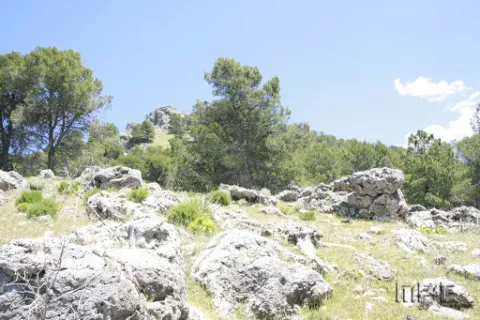
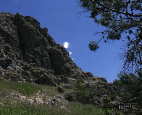
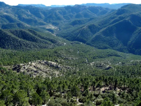
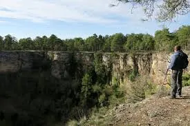
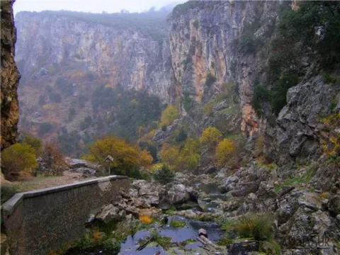
Natural enclave located at 1,145 m high, from which we can enjoy stunning views of the Natural Park and the urban core. In the dehesa of the Castle we can visit the Fountain of the Cerezo, a natural water spring located next to prehistoric caves.

Telecomunicaciones
Teléfono de contacto
953 494 005
Ubicación
Nombre
Torres de Albánchez
Código Postal
23391
Latitud
38.414570
Longitud
-2.677250
Distrito
Ubicación en el mapa
POINT (-2.67725 38.41457)
Tipos de punto de interés
Imágenes carrusel
imagen
Image
Cerro%20del%20Castillo2.jpg
Imagen principal
Desactivado
imagen
Image
Cerro%20del%20Castillo3.jpg
Imagen principal
Desactivado
Imágenes cabecera
imagen
Image
Cerro%20del%20Castillo.jpg
Imagen principal
Activado
Loading map
Preparing points of interest and routes...

Hill of San Miguel

Submitted by brandcode_deweloper on
Id
5631210
Descripción
Descripción larga

Benatae is the smallest municipality in the Sierra de Segura and is fully included in the Natural Park of the Sierras de Cazorla, Segura and Las Villas, so it is a perfect place for lovers of tranquility and nature.

The Cerro de San Miguel is located 1.5 kilometres east of the city centre of Benatae, in the direction of Puente Honda.

The Cerro de San Miguel is a recreational area with excellent views of the park. On one of its slopes, a source that gives origin to its name, one of the many water sources that spatter the municipality, stands out.

The recreational area has several tables and its corresponding banks, barbecues, the pillar and a large explanade.

In the recreational area you can see the vegetation and fauna typical of the Natural Park and from where you can observe excellent landscapes.

On the hill dominates the black pine pine pineapple, under which grows a stinking little forest with juniper, lentif, jars and crocodile. The fox, boar and squirrel are very abundant, and it is possible to contemplate mountain goats at the summit. Among the raptures are the pilgrim hawk, the seedling eagle and the leonate vulture.

From the Cerro de San Miguel you can take hiking routes, not so, in the recreational area we find the panel of beginning of the path (PR-A 179) to the summit of Peñalta (1,412 m.).

Breve descripción

It's a recreational area at 1.5 km. from the city centre, and from which we will get magnificent views of the Natural Park of the Sierra de Cazorla, Segura and Las Villas.

Telecomunicaciones
Sitio web
www.benatae.es
Teléfono de contacto
953 482 080
Ubicación
Código Postal
23390
Latitud
38.345040
Longitud
-2.643430
Distrito
Municipio
Ubicación en el mapa
POINT (-2.64343 38.34504)
Tipos de punto de interés
Imágenes carrusel
imagen
Image
Cerro%20de%20San%20Miguel.jpg
Imagen principal
Desactivado
Imágenes cabecera
imagen
Image
p1100918.jpg
Imagen principal
Activado
Loading map
Preparing points of interest and routes...

Hill of los Palancares

Submitted by brandcode_deweloper on
Id
8096219
Descripción
Descripción larga

To the north of the term, there is a mountain, the fourth of Ardal, in which the oaks predominate, along with the retama, the albar thorn, wild rosals, juniper, ivy and madreselva. An ideal ground for the cicnetic species of major hunting (boar, deer, corzo...), and also of pastures, especially for the cattle of ligia.

Breve descripción

Located north of the Sierra de Segura region, at an altitude of 835 m., most of the territory of Génave is included in the Natural Park of the Sierras de Cazorla, Segura and Las Villas.

Telecomunicaciones
Correo electrónico
ayuntamiento@genave.es
Ubicación
Código Postal
23392
Latitud
38.429960
Longitud
-2.733040
Distrito
Municipio
Ubicación en el mapa
POINT (-2.73304 38.42996)
Tipos de punto de interés
Imágenes carrusel
imagen
Image
Cerro%20de%20los%20Palancares%2C2%20%281%29.jpg
Imagen principal
Desactivado
Imágenes cabecera
imagen
Image
Cerro%20de%20los%20Palancares%2C%20%281%29.jpg
Imagen principal
Activado
Loading map
Preparing points of interest and routes...

La Herradura Gorge and Mesto Glen

Submitted by brandcode_deweloper on
Id
912316
Descripción
Descripción larga

This bridge was built when, in the sixty of the last century, the repressive waters buried the Molinillo Bridge, which passed through the Guadalanimin a little below, and which allowed, from time immemorial, the access of reels to a road that unites the inhabitants of the scattered cores in the upper part of the Sierra (Nava de San Pedro, Puntal de Ana María, la Loma de la Sarga, Vadillo de Castril, etc.) with El Almicarán and Pozo Alcón. Much of the wheat that was sown in that mountainous area became a flour mill that was at the confluence of the Guazalamanco River with the Guadalanimin, very close to the said bridge, and that gave name to the site.

This historic road, which progress was responsible for truncating more than forty years ago, is already collected in the medieval chronicles. It was also the way to the Mesta, where the cattle of Pozo Alcón and Castril were led to the winter of Sierra Morena, with a softer and more prone climate for sheep and cows. The journey that communicates the reservoir with the Vado de las Carretas, near the Nava de San Pedro is via pecuaria and, officially, receives the illustrative name "Cordel de Visas Pintoresca." The first stretch of this journey, which passes through the cortijo de los Tontos, forest house of the Puntal de Ana María and cortijo del Raso del Peral (the highest point of the road at about 1,320 m of altitude) is known as Cañada del Mesto, and is a pleasant walk (about 8 km away and back from where we have left the vehicle) that will surprise us by the natural viewpoints we find on the route (Cortijo de los Tontos, Puntal de Ana María and the Poyo del Raso) and the views that give us. If we continue about 5 K. further forward we find the Vado de las Carretas and the Cerradas del Guadalentín and Canaliega.

We suggest...

  • That before we take the road on foot that leads us to the Cerrada de la Herradura, in the vicinity of the Molinillo Forest House, we lie, with the maximum of precautions, to the edges of the cut that give view to the reservoir and to the final stretch of the Guazalamanco River, before we connect with the Guadalmin. If the level of the reservoir is low we can see the old Molinillo bridge and what's left of the small old flour factory. In that case, a recommended option is that, through a sidewalk that leaves east of the forest house, just in front of the large bridge, we go down to the river bank and approach the mill. There are still remains of the old systems used for the milling of wheat.

The Cerrada de la Herradura is located in the tail of the Bolera reservoir and is accessed by the Dehesa del Rincón, a large entrelano located on the right bank of that reservoir. From Pozo Alcón you have to take the A-326, up the Avenida de la Bolera, direction to Castril. By passing the campsite de la Bolera and the km 7, we take a detour that comes to our left and that borders the Forest House of la Bolera (it indicates to the Hornico). On an unasphalted road, always following the main road, you reach the Molinillo Forest House, now apricot of cattle, 7.7 Km. later. There we left the vehicle and followed the path of the route that indicates the Road Vado. About 800 meters later a narrow bridge crosses a riverbed. We meet at the Herradura Clock. If we continue the road, until it begins to descend again, 3.5 Km. later, we will make the journey known as Cañada del Mesto.

Breve descripción

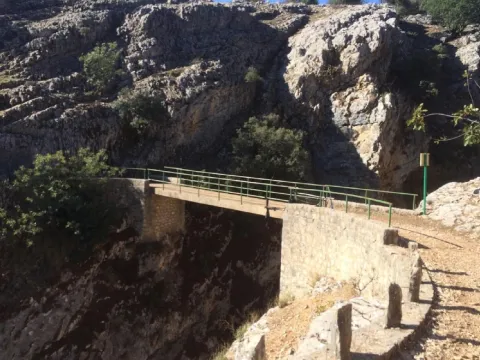
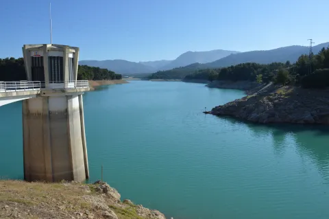
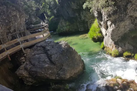
Depending on the level of the reservoir, the cannon is more or less deep. The best point to have a view of it is the same bridge that crosses it. With the safety that gives us its metal railing we can look and see polish trout and barbs in the crystal waters that the Guadalanimín River carries at its entrance to La Bolera.

Ubicación
Latitud
37.702695
Longitud
-2.935057
Municipio
Ubicación en el mapa
POINT (-2.935057 37.702695)
Tipos de punto de interés
Imágenes carrusel
imagen
Image
unnamed.png
Imagen principal
Desactivado
Imágenes cabecera
imagen
Image
herradura.jpg
Imagen principal
Activado
Loading map
Preparing points of interest and routes...

La Bolera Gorge

Submitted by brandcode_deweloper on
Id
912227
Descripción
Descripción larga

When that happens, the old Ituri Canal, already without use, loads its bed of crystalline liquid and discharges it to the riverbed, forming several waterfalls and chorreaderos of fine rain. At that time, neither the gallid waters, nor the technical difficulties that the current may pose, prevent the visitor from enjoying a unique show. Not in vain, this is one of the canyons preferred by the fans of this adventure sport of our country.

We suggest...

  • To practice barranquism within the Natural Park it is necessary to have permission from the Environmental Council.
  • It is possible that the vents of the reservoir will relieve water. To be sure we are not surprised by an avenue inside the canyon, it is recommended to request information on this matter from the administration of the reservoir (Tfno. 953 738 251)
  • Under normal conditions, there is no need for large physical powers or advanced knowledge to carry out the activity with a specialized guide. Several multiadventure companies offer this service in the area.

To go to the Bolera Clock there would be two options. The first is to go to the Bolera reservoir, as the dam is raised on the beginning of the canyon. A highly recommended option to observe the parade is the visit of the Peña de la Alcantarilla. To get to this place, in Pozo Alcón we take the road A-326 towards Castril. Just as we enter the Natural Park (there is a large panel indicating it as we pass a bridge after a long straight, past the km 6), we leave the main road turning left, passing through one of the entrances of Campsite La Bolera, we follow a narrow road to a parking lot located 30 meters from where the asphalt ends, 1 km later.

Breve descripción

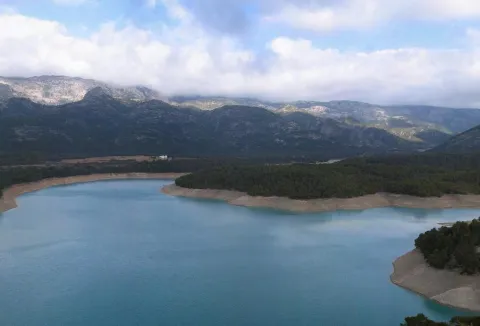
The Cerrada de la Bolera is one of the most spectacular and beautiful cannons in the Natural Park. From above, from the dam of the reservoir of the same name, from the bridge on which the road A-326 saves the parade or from the view of the Peña de la Alcantarilla, the view impresses. However, the most beautiful surprises are kept in their insides, in a territory reserved exclusively for barranquists. The shedding does not always carry water, as the leaks cause, in the driest times, the flow flow in a lower section, sometimes leaving the canyon dry. And yet, it is worth going through, because the forms that have modeled the river are very attractive. If on the contrary the level of the reservoir is high, those same leaks turn the journey into a dream.

Ubicación
Latitud
37.702695
Longitud
-2.935057
Municipio
Ubicación en el mapa
POINT (-2.935057 37.702695)
Tipos de punto de interés
Imágenes carrusel
imagen
Image
Pantano_de_la_Bolera_%28Pozo_Alc%C3%B3n%29.jpg
Imagen principal
Desactivado
Imágenes cabecera
imagen
Image
JDCANO_PANTANO_BOLERA.jpg
Imagen principal
Activado
Loading map
Preparing points of interest and routes...

Utrero Gorge

Submitted by brandcode_deweloper on
Id
2980150
Descripción
Descripción larga

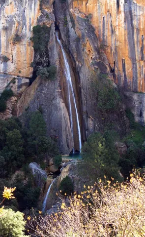
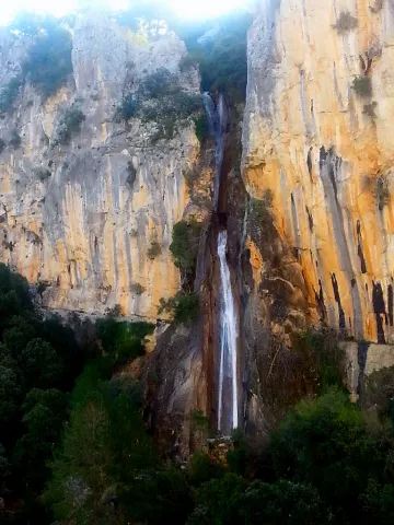
The site known as Cerrada del Utroo-Linarejos is an amazing natural work sculpted by the Guadalquivir River in the limestone that surrounds it. The path is walked on foot, allowing us to appreciate the sharp rocks and overlooks created by water over hundreds of thousands of years. It is a charming walk where the labiérnago, the cornicabra and the willow will accompany us to one of the most photographed places of the Natural Park Sierras de Cazorla, Segura and Las Villas: the "horse tail" or Cascada de Linarejos. The path, of 1.6 km, has a circular route to return to the road on a pleasant itinerary of about 45 minutes. It may be of interest to get to know the small town of Vadillo-Castril, where the former RIFE sawmill was and which today is the home of two agencies of great importance for the natural park: the School of Forest Capataces and the Forest Defense Centre.

Breve descripción

From Cazorla, following the road of the A-319 saw to the crossing known as the valley junction. At this point we will turn right and continue on the JF-7092 road. Just before passing the bridge over the Guadalquivir River (about 4 km from the junction) the Cerrada del Utrero path begins.

Ubicación
Código Postal
23470
Latitud
37.924623
Longitud
-2.927399
Dirección
Carretera de Vadillo Castril a Buruchel
Municipio
Ubicación en el mapa
POINT (-2.927399 37.924623)
Tipos de punto de interés
Imágenes carrusel
imagen
Image
8.jpg
Imagen principal
Desactivado
imagen
Image
7.JPG
Imagen principal
Desactivado
imagen
Image
9.jpg
Imagen principal
Desactivado
imagen
Image
Natu289.jpg
Imagen principal
Desactivado
imagen
Image
Natu294.jpg
Imagen principal
Desactivado
Imágenes cabecera
imagen
Image
5.jpg
Imagen principal
Activado
Loading map
Preparing points of interest and routes...

Cerrada de Utrero - Linarejos Waterfall

Submitted by brandcode_deweloper on
Id
874733
Descripción
Descripción larga

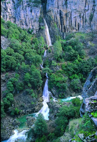
The sector of the Cerrada de Utroo-Lancar de Linarejos is located in materials of the Prebetic of the Betic Cordillera. In particular, in the Cerrada de Utrero, the Guadalquivir River fits into limestone of the Superior Jurassic often dolomitised that develop constructive and destructive karmic forms at different scales.

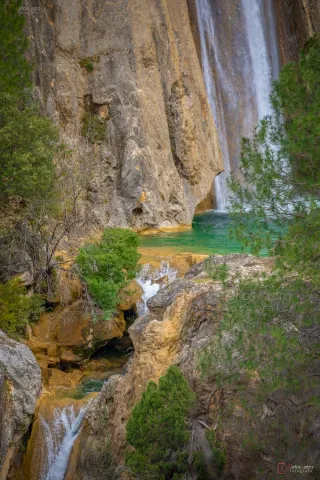
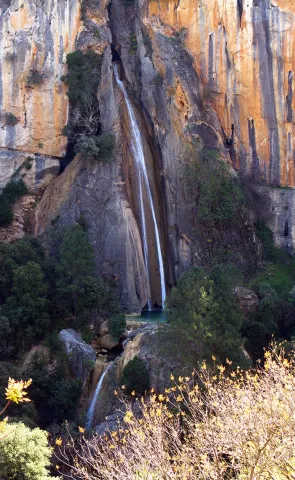
The narrow river-karctic valley was carved during the quaternary along the axis of a synchronous N40E direction. The karctic canyon of the closed is one km long and has a profile scaled by the development of travertines and pozas. The walls of the valley are pulled by minor karmic forms of great beauty and spectacular lapiaces The setting of the Guadalquivir River has left the stream of Linarejos hanging producing an impressive waterfall, known as the Cascade of Linarejos. This water jump of several tens of meters develops a travertine mass with "horse tail" morphology and cascade facies. The Lanchar de Linarejos is located on the SE flank of the synclinal and features a sequence of lapiaces and structural alleys controlled by conjugated diaclases.

Source: Inventory of Georresources of Andalusia. Environmental Council. Junta de Andalusia.

Breve descripción

Closed from Utrero, Linarejos

Ubicación
Latitud
37.920351
Longitud
-2.994140
Municipio
Ubicación en el mapa
POINT (-2.99414 37.920351)
Tipos de punto de interés
Imágenes carrusel
imagen
Image
Natu091.jpg
Imagen principal
Desactivado
imagen
Image
cascada-linarejos-cazorla.jpg
Imagen principal
Desactivado
Imágenes cabecera
imagen
Image
cascada_de_linarejos_g.jpg
Imagen principal
Activado
Loading map
Preparing points of interest and routes...

Elías Gorge

Submitted by brandcode_deweloper on
Id
874689
Descripción
Descripción larga

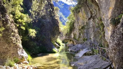
The river incision of the Borosa River in the Cretaceous limestone of Urgonian faces produces the strong fitting of the channel in this area, generating a narrow karmic valley with vertical walls more than 10 m in height and about 400 m in length.

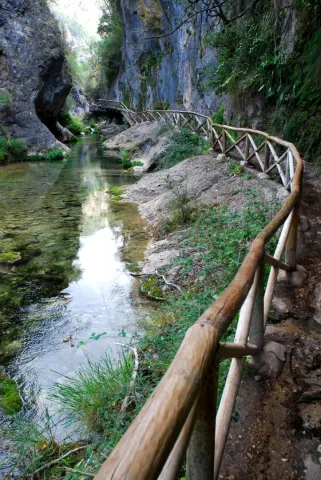
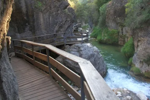
This spectacular throat known as the Cerrada de Elias can be crossed over a pendant walkway several meters above the river, which is suspended on the vertical walls of the Cerrada.

Source: Inventory of Georresources of Andalusia. Environmental Council. Junta de Andalusia.

Breve descripción

Closed of Elijah

Ubicación
Latitud
37.920351
Longitud
-2.994140
Municipio
Ubicación en el mapa
POINT (-2.99414 37.920351)
Tipos de punto de interés
Imágenes carrusel
imagen
Image
img_tayala_20201019-104833_imagenes_lv_terceros_cerrada_de_elias-198-kHfF-U484165980244z1B-992x558%40LaVanguardia-Web%20%281%29.jpg
Imagen principal
Desactivado
imagen
Image
687_ss_03-jpg
Imagen principal
Desactivado
imagen
Image
CR09-e1515518982814%20%281%29.jpg
Imagen principal
Desactivado
Imágenes cabecera
imagen
Image
687_ss_01-jpg
Imagen principal
Activado
Loading map
Preparing points of interest and routes...

Baeza Bullring Exhibition Center

Submitted by brandcode_deweloper on
Id
1571463
Descripción
Descripción larga

It also includes documentation and pieces such as the first entrances and posters, capotes, bullfighter suits and bull heads such as the "Vantanero" of the Saltillo livestock, dealt with by the sword Rafael Molina Lagartijo on the day of its inauguration or the bull Escobedo of the Livestock of Don Sancho Dávila, treated on the day of the centenary of the Baezan coso by the sword José Ortega Cano. The visit begins in the area of the vault; reception area and visitors that hosts the exhibition area linked to the history of the square. The itinerary includes the tour of the toriles, corrals, cavalries, chapel and nursing.

Breve descripción

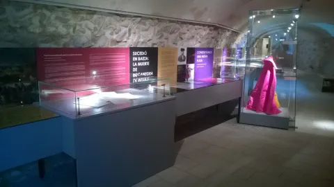
The exhibition centre is located in the Plaza de Toros de Baeza, opened on May 18, 1892. The sample is displayed in vitrines, panels with the text in several languages, interactive screens, audiovisual room and environmental sound in the torile area that collects the bulls' shearing work in the days of running.

Telecomunicaciones
Sitio web
www.baeza.net
Teléfono de contacto
953 740 150
Correo electrónico
turismo@baeza.net
Ubicación
Latitud
37.993920
Longitud
-3.460650
Dirección
C/ Sor Felisa Ancín, s/n
Municipio
Ubicación en el mapa
POINT (-3.46065 37.99392)
Imágenes carrusel
imagen
Image
09-Rehabilitacion-anillo-Plaza-de-Toros-plaza-general.jpeg
Imagen principal
Desactivado
imagen
Image
IMG_2733_960x640.JPG
Imagen principal
Desactivado
Imágenes cabecera
imagen
Image
Museo%20Taurino%20de%20Baeza.jpg
Imagen principal
Activado
Microsite al que pertenece
Loading map
Preparing points of interest and routes...

Cathedral of Nuestra Señora de la Asunción de la Virgen

Submitted by brandcode_deweloper on
Id
2293142
Descripción
Descripción larga

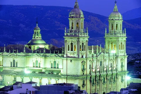
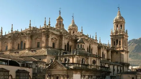
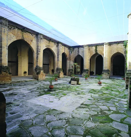
Declarada Bien de Interés Cultural el 3 de junio de 1931. Jaén se convirtió en nueva sede episcopal en 1248, a poco de su conquista por Fernando III. Siguiendo la tradición de ocupar el espacio de una mezquita, consagrándolo, la primitiva catedral mantuvo la estructura de aquélla durante más de un siglo hasta la segunda mitad del s. XIV en que el obispo don Nicolás de Biedma decide construir un nuevo edificio, ya gótico, de cinco naves y un claustro al lado norte, ya que por el sur corría la muralla. Cien años después flaqueaba esta construcción y se emprende una nueva fábrica, en torno a 1492, en el episcopado de don Luis Osorio, dentro de la corriente del gótico flamígero o último, se supone que con trazas de Enrique Egas, pero su verdadero artífice es Pedro López y Diego Martínez hasta que en 1525 se derrumbara el cimborrio sobre el crucero, que puso fin al proyecto medieval.

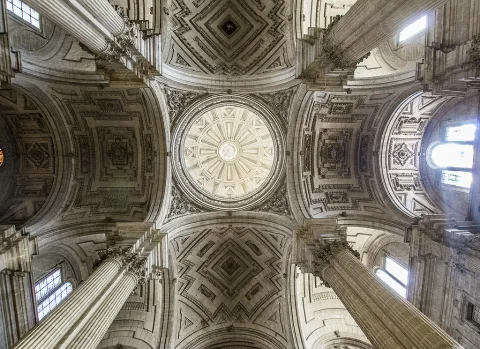
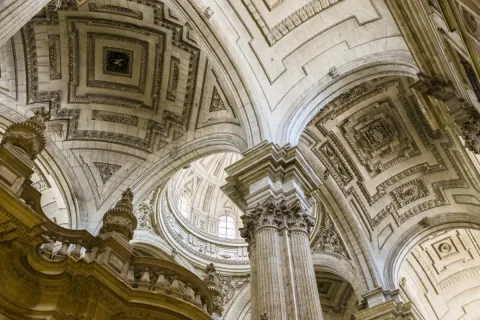
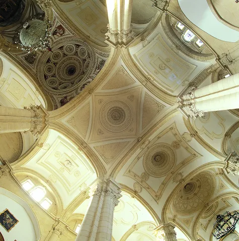
En 1548 se decide la reanudación de las obras, pero ahora bajo el nuevo estilo al “antiguo” o “romano” entonces imperante. A tal fin son consultados los arquitectos Jerónimo Quijano, Pedro Machuca y Andrés de Vandelvira, siendo este último el que se quedara como Maestro Mayor a partir de 1553 hasta su muerte en 1575. Durante este tiempo sólo se realizarían las dependencias auxiliares: Sala Capitular, Sacristía y Bóveda Panteón más el Archivo y Biblioteca en planta alta, que ocupan el bloque lateral de la cabecera en el ángulo suroriental. Aunque parezca poco, sin embargo es lo suficiente para condicionar el esquema del desarrollo del cuerpo basilical de la iglesia al dejar también planteado el alzado del muro de la nave sur. Dicho esquema consistía en una planta de tres naves, todas a igual altura, separadas por pilares cruciformes, según el modelo de la catedral de Granada, que conforman una estructura modular cubierta con bóvedas vaídas. Lo más original será el alzado del muro, donde cada uno de los módulos subdivide el gran arco que lo forma en otros dos a la altura de la planta principal, para dar origen a sendas capillas, y abriendo en la mitad superior ventanas correspondientes a estancias y galerías, que recorren todo el templo, más los grandes ventanales o claristorio en el tímpano del gran arco en forma de “serlianas”.

Este esquema, absolutamente vandelviriano, fue continuado por su aparejador y fiel colaborador, Alonso Barba, hasta finales del siglo, si bien con pareceres de otros arquitectos como Francisco del Castillo, Juan Bautista Villalpando y Lázaro de Velasco, que poco variaron. Después se interrumpen las obras por falta de medios hasta que en 1635 se emprenden de nuevo, bajo el impulso del obispo don Baltasar de Moscoso y la dirección del arquitecto Juan de Aranda Salazar. Esta fase comprende hasta 1660, fecha en que se consagra la nueva catedral, cuando se había realizado el tramo que va desde la cabecera hasta el crucero, cuya cúpula es traza de Aranda. Una tercera fase, emprendida en 1667 por los pies, será dirigida por el discípulo de Aranda, Eufrasio López de Rojas, quien diseña la fachada, luego concluida por su continuador al frente de las obras, Blas Antonio Delgado, quien remata las torres a principios del s. XVIII. La última fase se emprendería en 1736 bajo la dirección del salmantino, José Gallego y Oviedo del Portal, y afecta al tramo comprendido entre la fachada y el crucero, centrándose su intervención en la construcción del coro, acaso la parte más disonante con el proyecto renacentista. Por último, Ventura Rodríguez, ultimaría algunos detalles para su terminación y sobre todo diseñaría la magnífica Capilla del Sagrario, como templo anejo, en el lado noroccidental, en perfecto equilibrio con el opuesto de la Sacristía, en un estilo barroco clasicista romano, finalizado por su sobrino Manuel Rodríguez, justo en 1800.

De la catedral gótica quedan como testigos el friso con cardinas, motivos zoomorfos fantásticos que corre por el tercio inferior del muro exterior de la cabecera, dispuesto así por Juan de Aranda, y una escalera de caracol en la capilla del lado norte de la cabecera. El resto del alzado exterior de la catedral debe su mayor parte a los diseños de Juan de Aranda, a excepción de la fachada, en parte, y del bloque de la Sacristía y portada meridional del crucero, evidentemente vandelvirianas. Los muros de estas dependencias auxiliares son muy sobrios al igual que los vanos que se abren en ellos, siendo de destacar el tondo con el escudo episcopal de don Francisco Delgado sostenido por “putti” renacentista de excelente talla, en el muro de la sacristía y el escudo de la catedral, que da a la lonja. En este punto, la galería alta en esquina, a modo de mirador, con arcos de medio punto, aligera el compacto muro. Bajo ella se abre la portada meridional del crucero, dedicada a la Asunción, en orden dórico y jónico, típica composición de Vandelvira con columnas pareadas y cerrada por un frontón triangular. A destacar en este muro sur un gran reloj de sol del siglo XVII.

La portada norte del crucero, también muy clásica, pero con mayor relieve y ornamentación que la del lado opuesto, es obra de Juan de Aranda hecha en 1642.

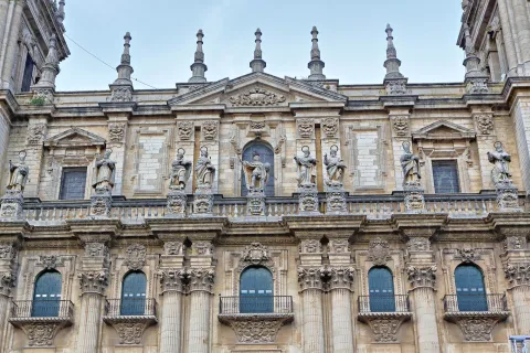
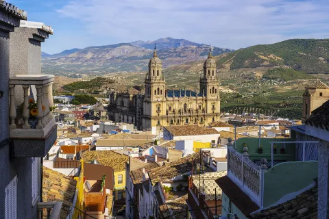
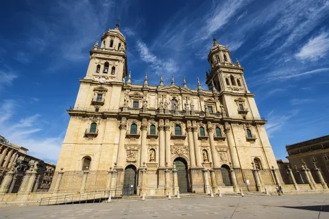
La fachada, considerada por la crítica como una de las primeras grandes fachadas barrocas de España, aunque de diseño definitivo de López de Rojas, de 1667, quedó en lo estructural planteada por Aranda; esto es, sus tres puertas con pares columnas entre ellas. El orden gigante, compuesto, y el retranqueo del cuerpo superior, que deja un paso a modo de balcón entre las torres, se inspira en la basílica de san Pedro de Roma y en la iglesia de El Escorial, respectivamente. En conjunto, se trata de un gran retablo en piedra, donde al tema de la Asunción, protagonista, sobre la puerta central, se unen las de los santos patronos de la ciudad: San Miguel y Santa Catalina, en las laterales; San Pedro y San Pablo, a izquierda y derecha, señalando los ejes del Evangelio y la Epístola, y coronando los ejes columnarios los cuatro Evangelistas y los cuatro Padres de la Iglesia (San Ambrosio, San Agustín, San Jerónimo y San Gregorio), auténticos “pilares” de la Iglesia, y en el centro el rey conquistador, Fernando III, todos en barroco y teatral movimiento, debidos a la mano de Pedro Roldán y su taller. Entre San Fernando y la Asunción, subrayando la importancia del eje central, se sitúa el relieve del Santo Rostro, imagen objeto de peregrinación, que se guarda en esta catedral, y que se mostraba en días señalados desde el balcón central sobre el que está.

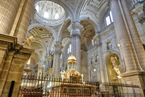
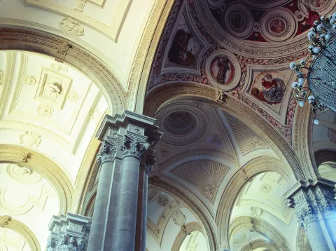
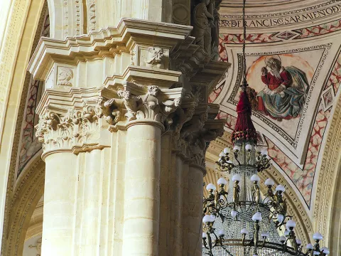
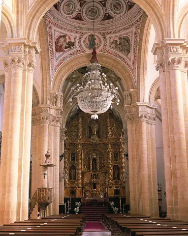
Interiormente, la catedral de Jaén destaca por la armonía entre todas sus partes, premisa fundamental de la belleza renacentista; un espacio calmo y luminoso tan sólo alterado por el excesivo tamaño del coro en proporción al resto y sus formas protuberantes; obra barroca, como se ha dicho, pero cuya sillería interior es en gran medida la primitiva de 1519-1526, tallada por el flamenco Gutierre Gierero y Jerónimo Quijano, entre otros maestros. El trascoro es de mármoles de colores embutidos, tan al gusto andaluz del siglo XVIII.

Por lo demás en las capillas y alzado en general no se advierte diferencia pese a las distintas fases de su construcción a lo largo de doscientos años. Las tres capillas más amplias, de un único hueco, corresponden a la cabecera, siendo la Mayor la del centro o del Santo Rostro, por guardarse allí la que se considera reliquia de la Faz, o “vero imago”, de Cristo, Además se adorna con cuadros, copias de la Colección Real, realizadas por Sebastián Martínez a mediados del siglo XVII. Las piezas auxiliares, son como se ha dicho, lo primero en realizarse de la nueva catedral. De ellas la primera en concluirse fue la Sala Capitular, paralela a la cabecera, con entrada desde la capilla de Santiago. Se terminó en 1556. La sala, de planta rectangular se cubre con bóveda de cañón y en su alzado, muy plano, se sucede en todo el derredor el motivo de arco triunfal romano de arco entre pares de pilastras, en orden jónico, ocupando el testero un original retablo de pintura, muy italianizante, obra de Pedro Machuca y su hijo Luis, cuyo tema iconográfico principal es la figura de San Pedro de Osma. Contigua a ella, pero perpendicular en eje, la Sacristía, tal vez sea con justicia la pieza estrella de la catedral y una de las obras maestras de Vandelvira, terminada poco después de su muerte. Aquí, a diferencia de la anterior sala, el alzado es todo protuberancia con pares de columnas dispuestas en fondo sobre las que cabalgan arcos de distinta luz en ritmo alternante. Se cubre también con cañón, pero con arcos en su base a modo de cerchas, que repiten en paralelo el ritmo de los inferiores. Tiene su entrada la sacristía desde un vestíbulo que comunica con el crucero de la iglesia y sirve de distribuidor, tanto para la acceder a la sacristía como para subir a los pisos altos y descender a la Cripta por sendas escaleras bajo la forma estructural de una gran “serliana”, en cuyo hueco central se exhibe una copia a escala de la célebre custodia de asiento renacentista, desaparecida, de Juan Ruiz “el Vandalino”.

La Cripta o Panteón de Canónigos, reproduce los tres espacios de la planta principal (Vestíbulo, Sacristía y Sala Capitular) en un alarde de técnica constructiva en piedra (estereotomía) sin apenas parangón en la arquitectura española. A la misma entrada sorprende la forma abarcante del gran arco que cobija a otros tres desiguales, como los de la Sacristía, enlazados por un óculo, todo transparente para llevar luz a un subterráneo. En la sala principal, que funciona como capilla, la bóveda “plana”, es otro prodigio estereotómico, con potentes nichos laterales que penetran en la bóveda, quedando bien iluminada por una luz de bodega procedente de unas ventanas a ras de suelo en la calle.

En cuanto al templo del Sagrario, proyecto de Ventura Rodríguez de 1764, que vino a sustituir a otro anterior de Juan de Aranda maltrecho tras el terremoto de Lisboa (1751), su planta oval con su gran cúpula de casetones octogonales, que tanto recuerda al San Andrés de Bernini en Roma, es otra soberbia respuesta de continuidad en el dominio del arte de la cantería de impecable ejecución, excepto en los ángeles de la base de la bóveda, obra del francés Verdiguier, de mediocre factura. Igualmente magnífica desde el punto de vista de su construcción en piedra es la amplia cripta, con entrada directa a la calle por la Plaza de San Francisco.

Breve descripción

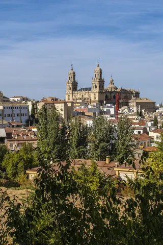
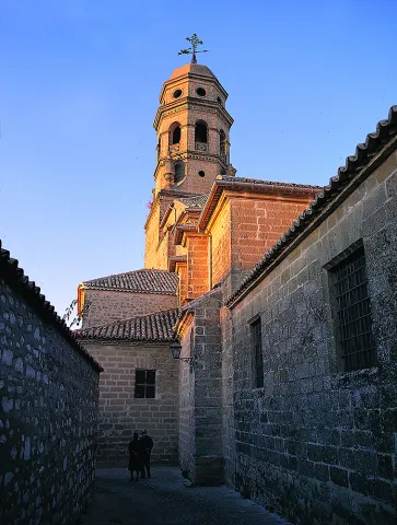
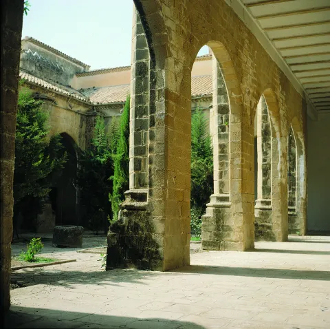
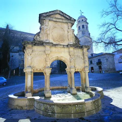
The cathedral of Jaén, a masterpiece by Andrés de Vandelvira and a source of inspiration for the construction of many cathedrals in Hispanoamerica, is considered one of the most notable works of the Renaissance in Andalusia, so that a few years ago the process of achieving its declaration as World Heritage by UNESCO began.
Telecomunicaciones
Sitio web
www.catedraldejaen.org
Teléfono de contacto
953 234 233 / 953 241 448
Correo electrónico
correo@catedraldejaen.es
Ubicación
Código Postal
23002
Latitud
37.765170
Longitud
-3.789830
Dirección
Plaza Santa María, s/n
Distrito
Municipio
Cómo llegar (URL de Google Maps)
https://www.google.es/maps/dir/Plaza+Santa+María,+23002+Jaén/23002+Jaén/@37.7591539,-3.7729584,15z/data=!4m14!4m13!1m0!1m5!1m1!1s0xd6dd773c2027d93:0x1f530131e8a4167!2m2!1d-3.7905829!2d37.7648412!1m5!1m1!1s0xd6dd8f2e07e6313:0x1c03d27be17d5650!2m2!1d-3.7739869!2d37.7379293?entry=ttu&g_ep=EgoyMDI2MDIxNi4wIKXMDSoASAFQAw%3D%3D
Ubicación en el mapa
POINT (-3.78983 37.76517)
Tipos de punto de interés
Imágenes carrusel
imagen
Image
Mon150.jpg
Imagen principal
Desactivado
imagen
Image
Catedral de Jaén
Imagen principal
Desactivado
imagen
Image
Catedral de Jaén interior
Imagen principal
Desactivado
imagen
Image
Catedral de Jaén
Imagen principal
Desactivado
imagen
Image
Catedral de Jaén
Imagen principal
Desactivado
imagen
Image
Catedral de Jaén
Imagen principal
Desactivado
imagen
Image
Catedral de Jaén
Imagen principal
Desactivado
imagen
Image
Catedral de Jaén
Imagen principal
Desactivado
imagen
Image
Catedral de Baeza
Imagen principal
Desactivado
imagen
Image
Catedral de Baeza
Imagen principal
Desactivado
imagen
Image
Catedral de Baeza
Imagen principal
Desactivado
imagen
Image
Catedral de Baeza
Imagen principal
Desactivado
imagen
Image
Catedral de Baeza
Imagen principal
Desactivado
imagen
Image
Catedral de Baeza
Imagen principal
Desactivado
imagen
Image
Catedral de Baeza
Imagen principal
Desactivado
imagen
Image
Catedral de Baeza
Imagen principal
Desactivado
Imágenes cabecera
imagen
Image
Jaen%20exteriores%20catedral%201.jpg
Imagen principal
Activado
Horario
Monday to Saturday: 10: 00 - 15: 00 and 17: 00 - 20: 30. Sundays: 10: 00 - 11: 30 and 16: 00 - 20: 30.
Microsite al que pertenece
Loading map
Preparing points of interest and routes...