Basilica and Royal Sanctuary of Nuestra Señora de la Cabeza
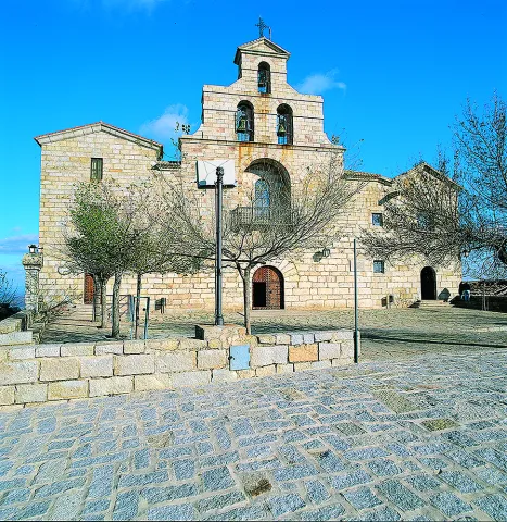
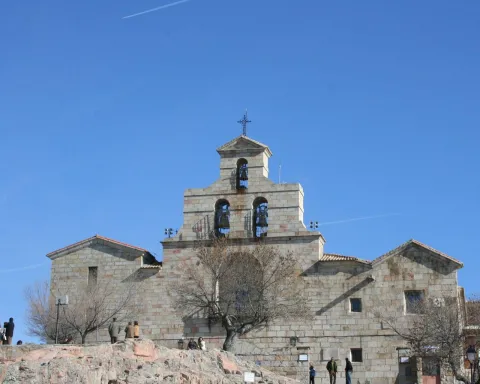
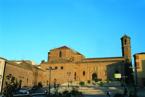
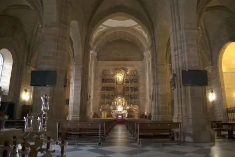
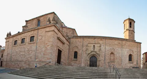
La vieja fábrica gótica de Santa María resultaba insuficiente para el culto, proyectándose un nuevo templo parroquial. Sin embargo, la falta de medios económicos determinó la paralización de las obras y tan solo se fabricó la Capilla Mayor, que quedó unida con el resto de la fábrica gótica en ochavo, y buena parte de la torre de campanas. Tal circunstancia ha generado un perfil del templo ciertamente singular al quedar unidas ambas arquitecturas tan dispares en altura, parcialmente contrarrestado gracias a la esbelta torre de campanas que se yergue a los pies. Documentalmente conocemos la intervención de varios maestros canteros, destacando entre ellos Andrés de Salamanca y Andrés de Vandelvira, director y tracista del nuevo templo renacentista.
El inicio del proceso constructivo de sustitución de la antigua iglesia gótica (siglos XIV-XV), tradicionalmente fijado en torno al año 1573, hay que retrotraerlo a los años 60 del mismo siglo. La primera noticia que conocemos sobre el desarrollo de las obras la aporta el padrón de vecinos de 1564, pues se cita entre los moradores de la calle del Pilar a un maestro de cantería llamado Andrés de Salamanca, del que se dice: en la actualidad trabaja en la obra de la iglesia mayor junto con sus oficiales, todos ellos solteros. Las primeras tareas se centraron en el derribo progresivo de la fábrica gótica, que comenzaron por la cabecera, según se desprende de la carta suscrita por Andrés de Salamanca el 27 de agosto de 1566 por la que se obligó a mudar el retablo viejo de la iglesia para que la obra siga adelante.
En 1568 se dio comienzo a la nueva Capilla Mayor, ya que en este año (16 de octubre) el cantero Fernán Cobo y su fiador Gabriel Jordán se obligan a sacar piedra para la obra de la iglesia mientras durase esta. De 1568 a 1571 las obras se desarrollaron a buen ritmo. El 24 de septiembre de 1571 se publican las condiciones para cubrir la Capilla Mayor, lo que evidencia que esta ya estaba construida; la obra, que consistía en enmaderar el conjunto de la Capilla, fue rematada en el carpintero Ginés de Zamora.
Tradicionalmente se ha especulado con una más que probable intervención en la obra del nuevo templo del arquitecto Andrés de Vandelvira. No ha de extrañarnos tal intervención, ya que por los años en que dio comienzo el arquitecto alcaraceño ya figuraba como maestro mayor de la Catedral de Jaén, cargo que conllevaba el de maestro de obras del Obispado. En buena lógica es fácilmente deducible que un proyecto de la envergadura de Santa María tendría que pasar por las manos de Vandelvira. Nuestras conjeturas pueden quedar avaladas, al margen del propio análisis de la pieza, a través de dos documentos. El primero, publicado por el cronista Sánchez Caballero, deja bien claro que Vandelvira viajó en 1573 a Linares para inspeccionar el nivel de la construcción, ver el modo de tirar pilares viejos y apuntar como ha de seguirse la obra nueva. Con arreglo a este planteamiento, el 2 de octubre de 1574 el cantero Andrés de Salamanca se obligó a llevar a cabo lo dictaminado y trazado por Vandelvira, es decir, a seguir con el derribo de elementos góticos para avanzar con el proyecto renacentista del crucero. En 1579 el visitador del Obispado, Francisco de Huete dispuso sin embargo, que “no pudiéndose continuar el proyecto que había sobre el resto de la iglesia, se liquidase dicha obra”. El proyecto vandelviriano, que entendemos contemplaba la sustitución completa de la estructura gótica, se interrumpió definitivamente. A finales del siglo XVI se remató la torre y en la centuria siguiente se labró la portada con arreglo al diseño del arquitecto catedralicio Juan de Aranda Salazar. La portada gótica, orientada al sur, procede
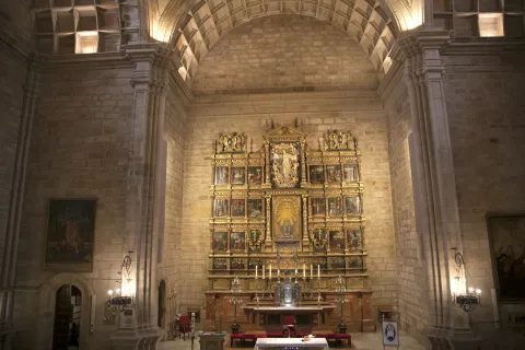
La Capilla Mayor de Santa María, se muestra al espectador como un organismo independiente, produciéndonos la sensación de un gran espacio centralizado, al estilo de S. Francisco de Baeza o de la iglesia de La Guardia, común según F. Marías a las capillas mayores renacentistas. En Linares este efecto se refuerza al quedar la cubierta gótica muy por debajo de la obra renacentista y además por la ausencia de la proyectada nave única de planta cruciforme con capillas-hornacinas que Vandelvira creemos planteó para esta nueva parroquia.
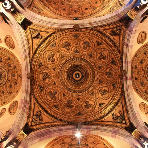
Como recuerdo del plan vandelviriano quedan los vestigios de las dos primeras capillas que debían abrirse a ambos lados de esta nave, cuyos arranques dan la idea que aquellas serían cubiertas con bóvedas de medio cañón por cruceros. Años atrás Vandelvira ya había ensayado el plan de la iglesia de Linares en la iglesia dominica de La Guardia, aunque en una escala menor. Este espacio centralizado de Santa María está conformado por cuatro arcos torales de medio punto que abren al presbiterio acasetonado, a dos capillas laterales igualmente acasetonadas y en el lado de las naves conecta con el “ochavo”; estos arcos apoyan en pilares de esquina de tradición siloesca con columnas adosadas y traspilastras en las que se alternan el orden dórico y corintio. El crucero se cubría con una bóveda vaída. El ochavo que enlaza el crucero con las naves góticas se materializó haciendo recaer el peso de los tres paños del mismo sobre el arco central apuntado del primer tramo gótico y sobre dos arcos escarzanos en diagonal sustentados entre los primeros pilares góticos y los semipilares de esquina. Las portadas, de haberse llevado a término el proyecto de Andrés de Vandelvira, tendríamos en Linares una importante muestra, ya casi final, de su trayectoria como arquitecto, pero en cualquier caso el conjunto gótico-renacentista es de gran interés.
OTRAS MANIFESTACIONES ARTÍSTICAS NO ARQUITECTÓNICAS
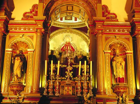
El patrimonio mueble conservado en esta parroquia es especialmente valioso. Sustituyendo al desaparecido retablo barroco de la capilla mayor, destruido en 1936, se alza en ella un hermoso retablo renacentista con pinturas sobre tabla, obra del Maestro de Ávila, en opinión de la profesora Luz de Ulierte. Procede este retablo del pueblo leonés de Villarrabines, y fue adquirido por D. José Yanguas Messía y su esposa Dª. Rosario Pérez de Herrasti. Antes de ser colocado fue recompuesto por el granadino José Navas Parejo e hijos. A este artista se deben otras piezas: tabernáculo y sagrario (labrados con plata procedente de las minas de Linares), mármoles de la capilla mayor y retablo de la capilla Yanguas, retablos en madera tallada y dorada dedicados a la Virgen del Carmen, San Isidro y la Inmaculada de la Medalla Milagrosa.
Sobresaliente es el conjunto de su imaginería, toda ella posterior a 1939. Destaca el impresionante conjunto de la Santa Cena, obra del escultor Víctor de los Ríos, a quien se deben también el Cristo de las Misericordias (venerado en la capilla enterramiento de Lolo, linarense en proceso de santificación) y un hermoso Ángel. La custodia de asiento del Corpus, aunque recompuesta, es una bella muestra del taller de los Morales (siglo XVI).
Monument declared 02 / 07 / 1974 Linares, a village belonging to the end of Baeza since the 13th century, experienced throughout the 16th century an extraordinary economic and demographic development that led to his emancipation under the reign of Philip II. The proceedings, initiated in 1564, bear fruit on 15 August of the following year, the Council and neighbours being forced to pay the Crown the undespicable sum of 20,000 ducats. The increase in the population of Linares, which rose from 657 neighbours in 1528 to 1,059 in 1586, led to an increase in the number of feligresses.
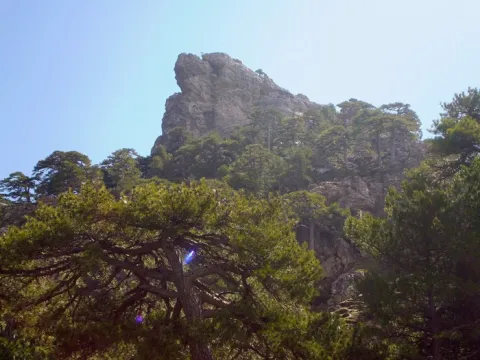
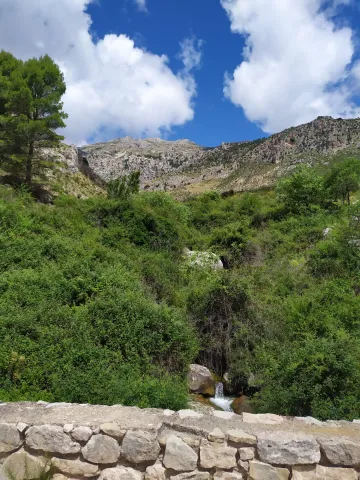
The name of the Forest Pass has a source that is worth knowing. The current wide road was formerly a cavalry path that communicated the Garbanzal forest house, with the area of Tícar and that more than thirty years ago became a forest track to allow access to vehicles in the event of emergencies, thanks to the theson and imagination of a forest guard, Alfonso Bosques. The track, in the first section, had to save the obstacle of a vertical wall (Picones de Fique), so the work was craved impossible for the superior of the agent, who denied the attempt.
Forests was in charge of a maintenance crew, to clean the gutters and fix the forest tracks. Taking advantage of the main guard's vacation, he got to work, almost without means. Based on masonry and hard work, in just twenty days he managed to widen the lane, allowing the movement of all-terrain vehicles, which facilitated rapid access to an area to which, in the event of a forest fire, he could only access on foot or give a rodeo of almost 40 km. Even to make a blow on the rock he used fair rockets, the only explosive he had within his reach. Since then, the locals have known the place with the last name of the guard.
We suggest...
By reference to the Port of Tícar, 500 metres from the highest point of the road, in the direction of Pozo Alcón, there is a forest track to our left, in a wide entrance where we can leave the vehicle. The firm is good, so we can drive in another 800 meters, up to a wide curve (with a pine in the interior vertex) with space to park. A few meters later (either on foot or on a bike) of the main lane part another track that ascends the slope, to enter between the rocks (there is a chain). Following that lead we reached the Picones de Fique and the Barrio del Garbanzal. If we continue later, already in the next ravine, we arrive at the birth of the Extreme Arroyo.
The road is simply spectacular. After passing through the Forest Pass, under the capricious pious forms of the Picones de Fique, along the two slopes of the Barranco del Garbanzal, we reached the ruins of the forest house, of which there is only a majane of stones. So far we'll have gone about 2 km from the chain. If we follow the forest track, we enter the next ravine, much wider and more open, than as the stream that runs through it, it bears the name of Extremera. Some 1,200 m later we reached the crystalline water channel, waded by the forest track. If we keep running up the vaguade we get to a spring, considered the birth of the stream.
Location: To the west of the city centre, in the natural park of Sierra Magina.
Distance: 7 km.
Medium: By vehicle tourism and on foot.
Access route: By a lane that leaves directly from the city centre, until you reach a mountain road that access the enclave.
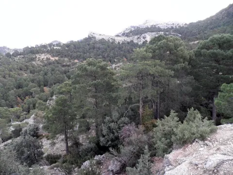
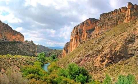
Interesting mountain side that stands out for the presence of white thorn or majolets and cornetals, among other plant formations. The rocky walls next to the Garganton serve as a refuge to a wide variety of birds, such as the royal victor, the black collar or the fences.
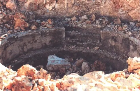
They are the archaeological remains of a few baths apparently from the Arab era, although some researchers say they can be Roman, in which we find a series of circular bathrooms with access staircase. These waters are medicinal.
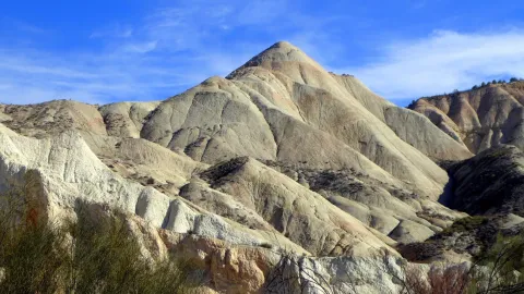
The area to the north of the Guadiana Menor, between Hinojares and Cabra del Santo Cristo, is part of one of the most desert areas of the province of Jaén, where they are added to the shortage of precipitation, a high litological erosionability and the accelerated process of natural erosion due to the phase of adaptation of the river channels to the change of the base level that occurred during the Quaternary in the Depression of Guadix- Baza.
All of these circumstances give rise to a highly degraded, carpeted landscape called bad@-@ land, of enormous beauty and geomorphological interest.
The area described corresponds to a large area of land in the south-eastern part of the province of Jaén, of which we will highlight the environment of the Cortijo Cherrín, in the vicinity of which there is also a magnificent example of deformation structures. These metric scale deformation structures are found in the upper Miocene (Tortonian) age turbite deposits, and are produced by the liquefaction of the sediment due to the abrupt sedimentation of turbidity currents. In particular, these are piled load structures with asymmetric morphology, whose vergence indicates the sense of movement of the turbidity current.
Source: Inventory of Georresources of Andalusia. Environmental Council. Junta de Andalusia.
Zone between Hinojares and Cabra of the Holy Christ
The hazelnut is presented in several places in the Park, usually in the area of Segura and in it we will see it. In the high valley of Segura, between Pontones and the Utrera Strike, one of the most extensive hazelnuts of the Park is spread, presenting a good state of conservation, as it has preserved it from the transformation of the area by the human being.
In the recommended area the hazelnut (Corylus avellana) is abundant, forming an extensive plant community, in which we find lanthanes (Viburnum lantana), worlds (Viburnum opulus), vidars (Clematis vitalba), liver, (Hepatia nobilis), parnasias (Parnassia palustres), wild strawberries (Fragaria vesca), orchids (Listera ovata, Dactyliorhiza elata), cardos (Cirsium pyrenaucas and several sagulis (S.), and Sallicola (S.). We also found repopulation choperas with the Populus x canadensis hybrid. This whole set forms a thick and wide forest in gallery, where hazelnut is the protagonist.
For our visit to the hazelnut we choose the head of the Segura River. We will go to Pontones and from there we will take the track that passes to the side of the Segura River, downstream, in the direction of the Masegoso cortijo. We can make it walk or by vehicle, but we will enjoy more of the walk, as it does not reach 5 km to the end.
When we have talked about the "North in the South" we invite to discover the hazelnuts in the area of Las Azebeas, but there are them in many other places, forming exceptional exceptional plant communities, authentic more northern plant shelters that live in the South.
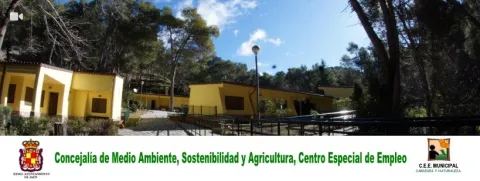
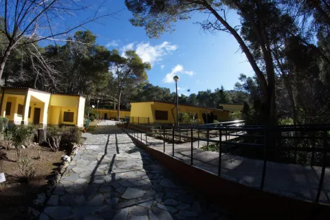
These municipal facilities are located in the Parque Periurbano Monte La Sierra, 23 km from Jaén, with an extension of 2,720 Hectareas, a mountainous terrain and an average altitude of 1000-1200 meters, make it a natural space of high botanical, faunistic and geological interest, which make it part of the Network of Protected Natural Spaces of Andalusia (RENPA). The Hall offers mainly environmental awareness activities, environmental programs, day, camps... not to mention the playful sports facet.
The Nature Hall of the "Cañada de las Hazadillas" is an Environmental Education Centre run by the Special Employment Centre since 1999.
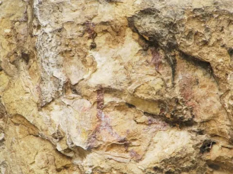
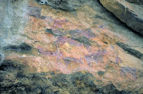
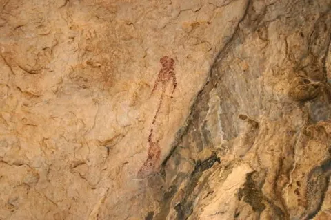
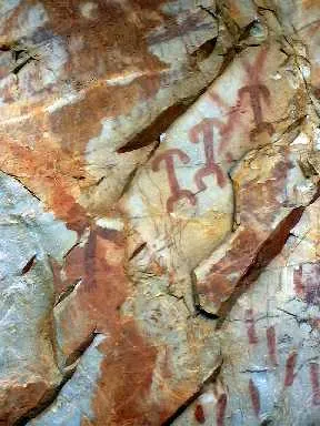
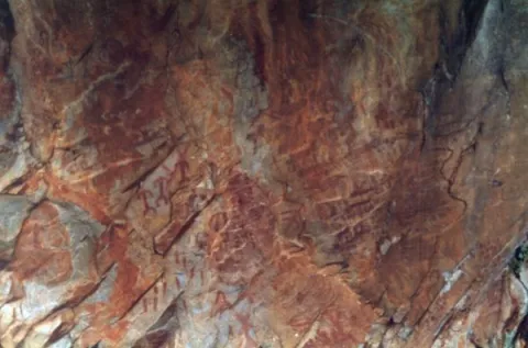
These more or less realistic but generally schematic manifestations reproduce human beings, animals and symbols, forming isolated scenes. It is a time of great changes in the way of life in which human beings move from being a predator to domesticating vegetables and animals to getting plenty of food and storing it to avoid moving continuously. The representations not only evoke and report part of daily life, but leave us witness to its complex and mysterious spirituality.
The Sierras de Segura and Cazorla are home to an interesting set of uplifting rock art; a lot of coats and caves where these first inhabitants left their art. In 1998 it became part of the UNESCO catalogue as World Heritage Site.
These sites can be considered as authentic outdoor museums of incalculable value, whose preservation concerns each and every fellow citizen. When visiting them, we must remember that we contemplate figures made by the primitive man, not least human and intelligent, more than 4,000 years ago. It's all by law, Cultural Interest Property.
Visiting these places can be difficult and frustrating, not only because of their access; it can be dangerous, but because sometimes their conservation status is the least poor; and it is recommended that they be visited with a specialist. For this purpose, before scheduling the visit, it is advisable to consult with someone familiar with the place (to advise and guide) or even to be accompanied by a responsible local guide (it is advisable to contact local authorities or associations).
In Santiagos- Pontones stands out the existence of the Abrigo de Río Frio, the Caves of Engarbo I and II and the Abrigo de Cañada de la Cruz. Just like the Cave of Birth, the only one that has been excavated.
The Rupestre Art, "art on rock," is composed of the pictorial manifestations that our remote ancestors left on the walls of numerous covacas and petreous coats of our saws, in prehistoric times (in our region, from the Neolithic, to the Bronze Age).
In Aldeaquemada, as a sample of its valuable cultural heritage, there are different groups of rock paintings, of a schematic and eulin style; distributed by fleshlands and rocky coats of the municipal term. So much so that UNESCO, meeting in Kyoto (Japan) in 1998, agreed to catalogue the Levine Rupestre Art of the Spanish Mediterranean Arc as a World Heritage Site. Meeting in assembly, he gave this important name and included in the list the 19 deposits of Rupéstre Levino and Eschematic Art discovered in this municipality, cataloguing that has come to recognize and highlight the great importance of the cultural manifestations of the former inhabitants of these lands.
These deposits, unique for their subject matter, are the most important in Andalusia and can be considered as authentic outdoor museums, of incalculable value and whose preservation concerns each and every one of us. When visiting them, we must remember with all due respect that we contemplate figures made by the primitive man; but not for that less human and intelligent, more than 4,000 years ago. They are all by law Cultural Interest Goods.
These groups of rock paintings, located on most occasions on rock coats, were studied at the beginning of the 20th century by the Abate Brehuil and M. Cabré, who catalogued the vast majority of existing groups in the area.
Subsequently, thanks to the new and relevant discoveries of the chronist Carlos Sanchez- Battle, it has been possible to have an extended relationship and a full awareness of the great heritage value that, for Aldeaquemada, represents the whole of its cave paintings.
Visiting these places is difficult and can be frustrating, not only because of their access; dangerous sometimes, but because of their poor conservation status; they make them difficult to see if they are not specialized. For this reason, before scheduling a visit, you should consult with a local connoisseur and let yourself be accompanied by a responsible local guide.
The most representative coats, on which signposted routes have been developed; not yet operational until the final protection of the paintings, but which has been announced (the Ayto. provide guides) can be visited, are those of the Poyos de La Cimbarra, Cimbarillo del Prado de Rechesa, Cave de la Mina, Garganta de la Hoz, Prado del Azogue and Cave de Los Arcos. Although there are another series of awakened groups.
The Rupestre Art, "art on rock," is composed of the pictorial manifestations that our remote ancestors left on the walls of numerous covacas and petreous coats of our saws, in prehistoric times (in our region, from the Neolithic, to the Bronze Age).