Saltar al contenido principal
icon-intereses-deporte

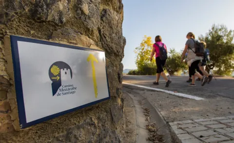
Camino Mozárabe de Santiago

Submitted by brandcode_deweloper on
Id
3919434
Descripción larga

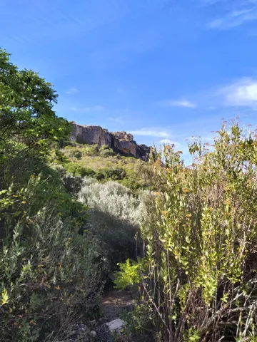
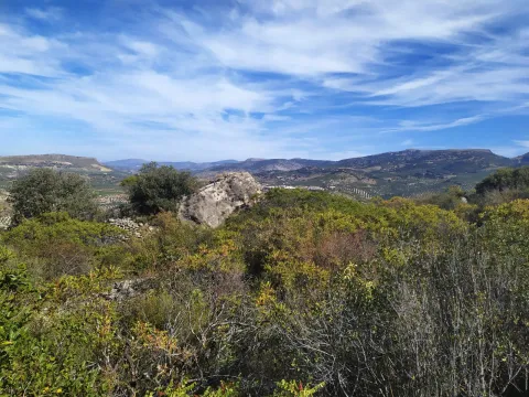
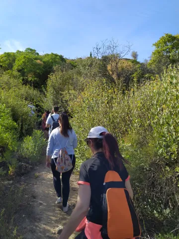
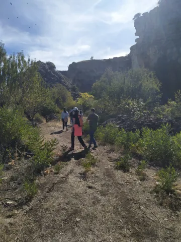
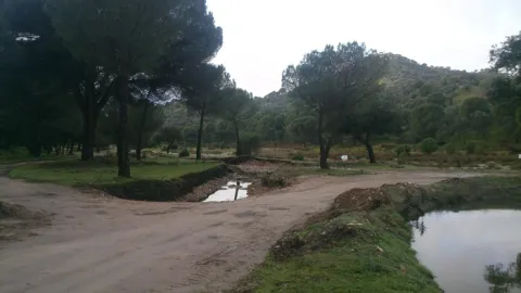
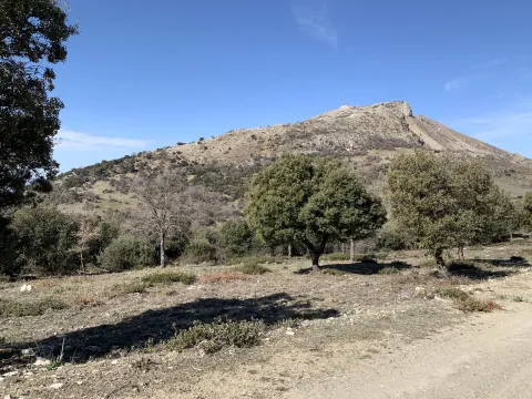
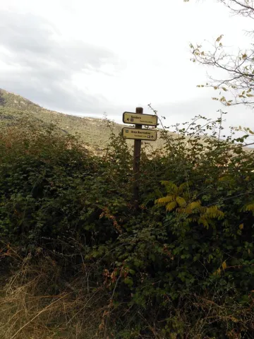
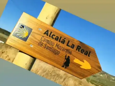
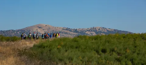
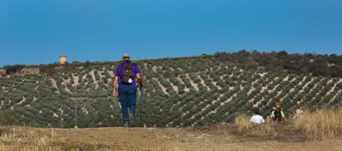
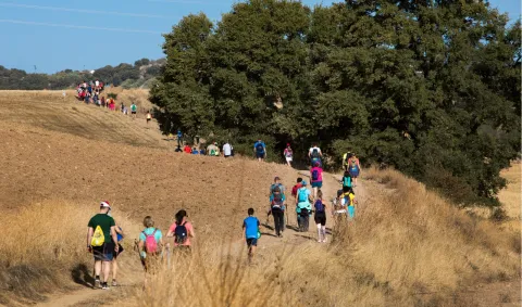
From Alcalá la Real you can enjoy two of the stages of this famous tour. First of all, the Moclin - Alcalá la Real (21.8 km) and Alcalá la Real - Alcaudete (23.7 km) stage.

Breve descripción

The well-known MozArab Way was used by Christians living in the Arab Kingdoms to link with the Via de la Plata to Santiago de Compostela, one of the oldest routes on the Santiago Way. Alcalá serves as a meeting point for pilgrims coming from Granada, acting as the end of the stage and beginning of the one that passes through the province of Jaén.

Latitud
37.461216
Longitud
-3.922399
Distrito
Municipio
Ubicación en el mapa
POINT (-3.922399 37.461216)
imagen
Image
6%20%281%29.jpeg
Imagen principal
Activado
imagen
Image
7%20%281%29.jpeg
Imagen principal
Desactivado
imagen
Image
5.jpeg
Imagen principal
Desactivado
imagen
Image
4.jpeg
Imagen principal
Desactivado
imagen
Image
1%20%281%29.jpeg
Imagen principal
Desactivado
imagen
Image
3%20%281%29.jpeg
Imagen principal
Desactivado
imagen
Image
8%20%281%29.jpeg
Imagen principal
Desactivado

Nature

icon-intereses-naturaleza

Friends

icon-intereses-amigos

Adventure

icon-intereses-aventura

Culture

icon-intereses-cultura

Sport

icon-intereses-deporte

Eco-friendly

icon-intereses-eco-friendly

For couples

icon-intereses-en-pareja

Family

icon-intereses-familia

Gastronomy

icon-intereses-gastronomia

Municipality

icon-intereses-municipio

Low-cost tourism

icon-intereses-turismo-low-cost

Solo travel

icon-intereses-viajar-solo
Camino Mozárabe de Santiago
Desactivado
Coordenadas / Huso 30S
30S x = 418426 and = 4146438
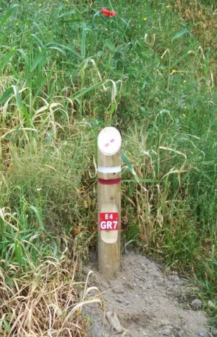
El Trail de Gran Recorrido GR 7, Trail Europeo E-4

Submitted by brandcode_deweloper on
Id
3919177
Breve descripción

It is the longest path in Europe. Alcalá la Real is part of this path and perhaps we stand before the stretch of the path, where we can see the historical presence more; the stretch that we are going to begin, it circulates between some of the villages of Alcalá la Real; we will pass by old stone crosses, watchmen, who were watching enemy incursions. We will run between ancient stone walls that protected the fields of cultivation, from the passage of the cattle, that passed through the crossroads of cascades and cords that are in the area of moor before reaching the population.

Latitud
37.4614
Longitud
-3.9222
Distrito
Municipio
Ubicación en el mapa
POINT (-3.9222 37.4614)
imagen
Image
2%20%281%29.jpeg
Imagen principal
Activado

Nature

icon-intereses-naturaleza

Friends

icon-intereses-amigos

Adventure

icon-intereses-aventura

Culture

icon-intereses-cultura

Sport

icon-intereses-deporte

Eco-friendly

icon-intereses-eco-friendly

For couples

icon-intereses-en-pareja

Family

icon-intereses-familia

Gastronomy

icon-intereses-gastronomia

Municipality

icon-intereses-municipio

Low-cost tourism

icon-intereses-turismo-low-cost

Solo travel

icon-intereses-viajar-solo
El Sendero de Gran Recorrido GR 7, Sendero Europeo E-4
On foot
All year round
Activado
Tramo de asfalto o cemento
 
Tramo de pista o camino forestal
 
Tramo de vía pecuaria
 
Tramo de senda
 

Route del Río Velillos

Submitted by brandcode_deweloper on
Id
3918981
Descripción larga

Path PR-A 414 River Velillos (10.4 km).

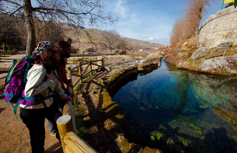
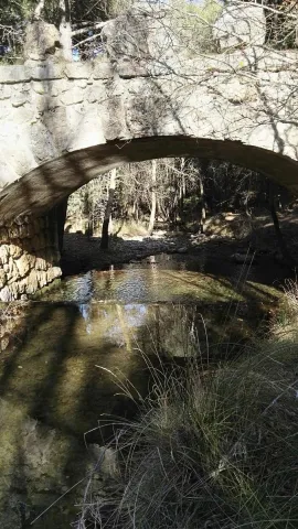
The uniqueness of this linear route is that through the river Alcalá la Real and Vega granadina communicated, making it a strategic area of the Sierra Sur de Jaén, throughout its history.

The path that begins in the village of Ribera Alta, for the most part on roads and paths, near or on the margins of the Salobral stream, the Palanantia stream and above all on the banks of the river Velillos, which we will be forced to cross on several occasions. The fountain of the Bath Cortijo will help us to refresh, before it takes some height to enjoy a great view of the river and up the Ribera Alta. Friars and the hill of the Martina at the bottom and looking down at the village of Ribera bajo.

On the bridge next to Tahona, we arrive to the Baja Bank, small pedanía of Alcalá la Real, where the landscape is made up of 800 and 900 meters covered with olive trees, and in the low parts cereal crops. It is here that the river crosses the town side by side, with a magnificent Vega and some choperas or small wires, which give it a picturesque image and a refreshing climate.

Breve descripción

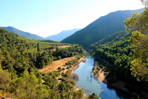
With this path approved by the National Mountain Federation, you will discover the natural heritage of the municipality. He walks by the river Velillos and discovers the importance of water in a land characterized by dry crops. It walks between olive trees, cereal, wire and choperas and is in a unique environment, discovering the pedanias of Ribera Alta and of Ribera Baja, in which the river has shaped the distribution of its population since Roman times.

Latitud
37.463702
Longitud
-3.925019
Distrito
Municipio
Ubicación en el mapa
POINT (-3.925019 37.463702)
imagen
Image
1.jpg
Imagen principal
Activado
imagen
Image
Ruta%20del%20rio%20velillos.jpg
Imagen principal
Desactivado

Nature

icon-intereses-naturaleza

Friends

icon-intereses-amigos

Adventure

icon-intereses-aventura

Culture

icon-intereses-cultura

Sport

icon-intereses-deporte

Eco-friendly

icon-intereses-eco-friendly

For couples

icon-intereses-en-pareja

Family

icon-intereses-familia

Gastronomy

icon-intereses-gastronomia

Municipality

icon-intereses-municipio

Low-cost tourism

icon-intereses-turismo-low-cost

Solo travel

icon-intereses-viajar-solo
Ruta del Río Velillos
All year round
Desactivado
Coordenadas / Huso 30S
30S x = 418197 and = 4146716

Route de Los Zumaques

Submitted by brandcode_deweloper on
Id
3917355
Descripción larga

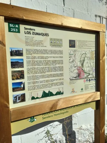
SLA-253 The Zumaques Path (9.4 km).

Breve descripción

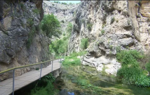
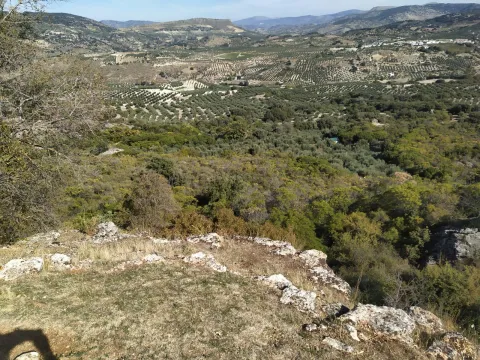
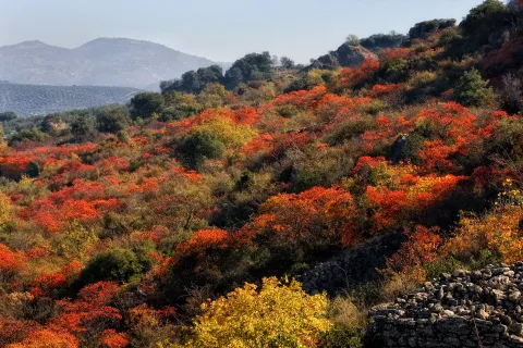
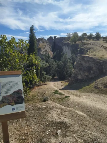
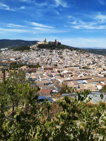
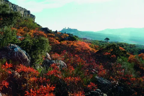
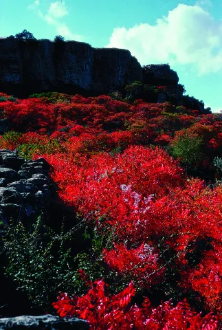
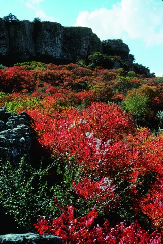
This path, approved by the National Mountain Federation, runs along the emblematic Zumaques route. Through canyons and trails you will enjoy "Los Tajos," impressive rocky cuts under which natural vegetation is preserved as a sample of what at one time were the Mediterranean forests of the southern Iberian Peninsula. This vegetation is an example of the zumala, this autumn plant, which takes a reddish tone that will fall in love with you. All this with wonderful views of the Fortress of the Mota. An impressive place to enjoy the sunset.

Latitud
37.463702
Longitud
-3.925019
Distrito
Municipio
Ubicación en el mapa
POINT (-3.925019 37.463702)
imagen
Image
9.jpeg
Imagen principal
Activado
imagen
Image
1.jpeg
Imagen principal
Desactivado
imagen
Image
2.jpeg
Imagen principal
Desactivado
imagen
Image
3.jpeg
Imagen principal
Desactivado
imagen
Image
5%20%281%29.jpeg
Imagen principal
Desactivado
imagen
Image
6.jpeg
Imagen principal
Desactivado
imagen
Image
7.jpeg
Imagen principal
Desactivado
imagen
Image
8.jpeg
Imagen principal
Desactivado
imagen
Image
10.jpg
Imagen principal
Desactivado
imagen
Image
11.jpeg
Imagen principal
Desactivado
imagen
Image
12.jpeg
Imagen principal
Desactivado
imagen
Image
Natu019.jpg
Imagen principal
Desactivado
imagen
Image
Natu024.jpg
Imagen principal
Desactivado
imagen
Image
Natu025.jpg
Imagen principal
Desactivado
imagen
Image
Natu397.jpg
Imagen principal
Desactivado

Nature

icon-intereses-naturaleza

Friends

icon-intereses-amigos

Adventure

icon-intereses-aventura

Culture

icon-intereses-cultura

Sport

icon-intereses-deporte

Eco-friendly

icon-intereses-eco-friendly

For couples

icon-intereses-en-pareja

Family

icon-intereses-familia

Gastronomy

icon-intereses-gastronomia

Municipality

icon-intereses-municipio

Low-cost tourism

icon-intereses-turismo-low-cost

Solo travel

icon-intereses-viajar-solo
Ruta de Los Zumaques
All year round
Desactivado
Coordenadas / Huso 30S
30S x = 418197 and = 4146716
Tramo de asfalto o cemento
 
Tramo de pista o camino forestal
 
Tramo de vía pecuaria
 
Tramo de senda
 

GR-247 "Bosques del Sur"

Submitted by brandcode_deweloper on
Id
2980378
Descripción larga

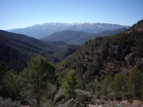
The largest hiking route in Spain's largest natural space. The Southern Forest trail offers 478 kilometres marked, along 21 main stages and 11 derivations. In addition, it has 3 variants, composed of two sections each, that help subdivide the layout, and make a version adapted to our interests and time available. Its journey leads to the births of the rivers Guadalquivir and Segura, entering us by the mosaic of landscapes of this mountain: high mountain peaks, castles, forests, rivers and waterfalls, traditional roads, altiplanicies, villages and villages still inhabited, historical sets, olive groves, gardens. A great way to discover the flight of the broken bones, the cleanest waters, the conversation with the transhuman pastors, the way to live in the mountain villages..., a collection of experiences and the authenticity of the most extensive saws of Andalusia. Most of the stages begin and end in places close to basic services: sources, villages or villages, campsites and other accommodation, camping areas or near roads. Other sections have only emergency shelters without services, built to provide these areas of the GR. Some stages go through very remote places, without telephone coverage, often subject to high mountain conditions that can leave us isolated (snow, wind, and low-zero temperatures in winter, or lack of water and permanent insolation in summer), so we should be informed about the conditions before we start the route; in addition to having enough to awaken. We will never leave the route, we will always follow the rules of use of the GR and the shelters, as well as the instructions of the natural park staff. It respects all the rules of protected space as you walk the path and use its equipment.

Breve descripción

The first stage of the path of a large route Southern Forests begins in the recreational area of Peña del Olivar, located in the Natural Park Sierras de Cazorla, Segura and Las Villas. This area is accessed through the town of Siles, taking the road A-310, in the direction of Las Acebeas; after going about two kilometres we will meet the Peña del Olivar. It is one of the best-equipped public-use equipment of the park with tables, fountain, children's games, bar, terrace, etc., and in summer even with an exceptional natural bathroom area.

Latitud
38.388517
Longitud
-2.581781
Distrito
Municipio
Ubicación en el mapa
POINT (-2.581781 38.388517)
imagen
Image
N_ID_34.jpg
Imagen principal
Activado
imagen
Image
GR247%20Bosques%20del%20Sur.jpg
Imagen principal
Desactivado

Nature

icon-intereses-naturaleza

Friends

icon-intereses-amigos

Adventure

icon-intereses-aventura

Culture

icon-intereses-cultura

Sport

icon-intereses-deporte

Eco-friendly

icon-intereses-eco-friendly

For couples

icon-intereses-en-pareja

Family

icon-intereses-familia

Gastronomy

icon-intereses-gastronomia

Municipality

icon-intereses-municipio

Low-cost tourism

icon-intereses-turismo-low-cost

Solo travel

icon-intereses-viajar-solo
GR-247 "Bosques del Sur"
Activado
Coordenadas / Huso 30S
30S x = 536524 and = 4249006

Route Antigua estación FFCC de Jódar

Submitted by brandcode_deweloper on
Id
2854331
Descripción larga

About 6 km away is Jódar, the largest town in Sierra Mágina. We'll be on the A-401 road. Jódar stands out for the offer of services, and for the castle that hosts one of the two Visitors' Centers of the natural park of Sierra Magina.

Our tour runs along the eastern side of Sierra Magina. Little by little and for 18 km the landscape of olive trees on a subdesert mountain.

To the right we will find the detour to Bélmez de la Moraleda. The waters of the Garganton River assigns to the green landscape and the presence of gardens. The main attraction of the town is the famous faces of Belgium, a curious phenomenon that attracts its own and strangers to this small town.

On the A-401, our walk will continue for 12 km towards Huelma. Almost at the end of the tour we find the pedany of Cabritas, a scattered rural habitat that hides dozens of ancient mills and gardens that for centuries, and from the Middle Ages made this place a vergel of fruit and vegetables.

Attention to the detour in the A-324, which in only three km leads us to the centre of Huelma, a town that offers us restoration services, and two jewels of the Andalusian Renaissance, the Church of the Immaculate Conception, the work of Andrés de Vandelvira, and the castle that watches the village from above.

Breve descripción

It is the route that links the Loma de Ubeda and the Guadalquivir River with the core of Sierra Magina.

The railway station of Jódar, is adjacent to the municipal term of Ubeda. In this station, in disuse, millions of tons of wood that came floating through the Guadalquivir from the Serras of Cazorla and Segura were embarked at another time. Similarly the spatter production of Jódar and Cabra of Saint Christ also used these railway docks to begin their long journey.

Latitud
37.913346
Longitud
-3.348917
Distrito
Municipio
Ubicación en el mapa
POINT (-3.348917 37.913346)
imagen
Image
9961866Master.jpg
Imagen principal
Activado
imagen
Image
PARQUE_NATURAL_CAZORLA%2C_SEGURA%2C_LAS_VILLAS._SIERRA_DE_SEGURA.jpg
Imagen principal
Desactivado
imagen
Image
R45.jpg
Imagen principal
Desactivado

Nature

icon-intereses-naturaleza

Friends

icon-intereses-amigos

Adventure

icon-intereses-aventura

Culture

icon-intereses-cultura

Sport

icon-intereses-deporte

Eco-friendly

icon-intereses-eco-friendly

For couples

icon-intereses-en-pareja

Family

icon-intereses-familia

Gastronomy

icon-intereses-gastronomia

Municipality

icon-intereses-municipio

Low-cost tourism

icon-intereses-turismo-low-cost

Solo travel

icon-intereses-viajar-solo
Ruta Antigua estación FFCC de Jódar
All year round
Desactivado

50 minutes (excluding stops).

Coordenadas / Huso 30S
30S x = 469330 and = 4196258
Tramo de asfalto o cemento
 
Tramo de pista o camino forestal
 
Tramo de vía pecuaria
 
Tramo de senda
 

Route: Pegalajar-Mancha Real-Torres-Albanchez de Mágina-Jimena-Garcíez-Bedmar

Submitted by brandcode_deweloper on
Id
2854246
Descripción larga

Just after leaving Pegalajar, you can reach a small mountain port, a portillo known as Seven Pillas, between the Serrezuela de Pegalajar and the massif of Sierra Magina. In this place, favored by winds is the paragliding area of the same name.

The few 7 km that link Paste with Manchar Real (Ctra. JA-3203) are those of a small road that hangs from the skirts of Sierra Magina, and are a magnificent lookout towards the countryside and the city of Jaén. Mancha Real runs through the center of its urban centre. This industrial and olive-growing town has a beautiful Renaissance church, the Church of the Holy Cross, which well deserves a stop.

The stretch between Mancha Real and Torres (Ctra. JA-3106) shows a good view of Sierra Magina. The arrival in Torres offers one of the best landscapes of the Natural Park. A high mountain horizon, which in its skirts collects the orchards and cherry plantations that reach the urban town of Torres hanging from Mount Aznaitín. The Marquis de Camarasa palace, the climbing in the Cimbras, some of its restaurants are sufficient reasons to devote a while to this town. It is highly recommended to walk to the clock that crowns the population and that in an unknown viewpoint teaches the best of these mountains.

But the best thing is to come. The mountain road between Torres and Albanchez de Mágina (JA-1107) is so small that these two villages separated by only 10 km do not enjoy a bus line... because there is no commercial-sized bus that can travel some points on this road. The main attraction is the landscape, which leads from the moist north side to the driest east, always accompanied by cherry and olive plantations.

Albanchez de Magina, has a rocky castle of must visit, as well as the need to try the almonds, cupcakes and bread, for many the best in the province of Jaén.

7 kilometers (Ctra. JA-3105) more and you will reach Jimena and the A-320 road. In Jimena you can ask about the wheat potage, and you have to visit the Cueva de la Graja, with interesting neolithic rock paintings (access is by a steep path that begins in the municipal pool). The city hall will provide you with the instructions and key to visit the cave. If your pass through Jimena is at the beginning of the summer, look for the best brews in Andalusia that are collected here by the local cooperative.

In the direction of Jaén@-@ Mancha Real, for the Ctra. A-320, just two kilometers away you will find the right turn that will take you to the village of Garciez, always on a road (A-6104) that immerses you in the olive grove for five km.

Garciez and his Renaissance palace of the Marquis de Viana are a surprise. The palace is not visitable, but only the outside walk gives an idea of importance of the place in the 16th century.

Seven more miles and you'll be in Bedmar. This town has restaurants and bars for food, as well as a ruined castle hanging over the village. In this town is the seat of the Regulatory Council of the Denomination of Origin of Extra Virgin Oil Sierra Magina, which orders the production of one of the best oils in Jaén.

Breve descripción

This route by car involves a visit to different areas of Sierra Magina. Although it is recommended for any time of year, autumn, but especially spring are the best time to make this visit.

The route begins in Pegalajar, town of the Guadalbullón River, with different points of interest, such as its traditional medieval garden system or rural accommodation in cave houses

Latitud
37.8244
Longitud
-3.3956
Distrito
Ubicación en el mapa
POINT (-3.3956 37.8244)

Nature

icon-intereses-naturaleza

Friends

icon-intereses-amigos

Adventure

icon-intereses-aventura

Culture

icon-intereses-cultura

Sport

icon-intereses-deporte

Eco-friendly

icon-intereses-eco-friendly

For couples

icon-intereses-en-pareja

Family

icon-intereses-familia

Gastronomy

icon-intereses-gastronomia

Municipality

icon-intereses-municipio

Low-cost tourism

icon-intereses-turismo-low-cost

Solo travel

icon-intereses-viajar-solo
Ruta: Pegalajar-Mancha Real-Torres-Albanchez de Mágina-Jimena-Garcíez-Bedmar
Spring and autumn
Desactivado

Distance: 55 km.
Time approx.: 1 and a half hours (not including stops).

Tramo de asfalto o cemento
 
Tramo de pista o camino forestal
 
Tramo de vía pecuaria
 
Tramo de senda
 

Route cicloturista de Andújar a Baños de la Encina

Submitted by brandcode_deweloper on
Id
2641192
Descripción larga

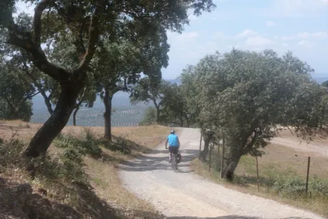
We left Andujar in the direction of the Peñallana vineyards through the Ctra. J-501. In the km. About 14,400, after passing the Los Pinos Restaurant, we take a road that comes out to the right; we go into it we will get to Los Escoriales, leave to our left a dish of bulls or tentadero and, at about 100 m., we will get a track to the right that we will take; here we can observe an interesting darkness occupied preferably by alcornocals, at some points as a mature or climate community on a sediment-type substrate. When we begin to descend, we will leave to our right the Cerro del Moro, an elevation that maintains a well-developed shroud, we will pass through the house of the Gorgojil and the Nava de Andújar, dehesa ganadera and place of transit that allows to observe the typical topographic relief of Sierra Morena and the crops of the geological domain of Guadalquivir, coming to the reservoir of the Rumblar, a sheet of water perfectly attached to the steep relief and, from here, to Baños de la Encina, one of the four municipalities that make up the Natural Park of Sierra de Andújar, the whole of the city of the town of the city of the city of the city of the city of the city of the city of the town of the city of the city of the city of the town of the city of the city of the town of the city of the city of the town of the city of the city of the city of the city of the town of the town of the town of the town of the town of the town of the town of the town of the town of the town of the town of the town of the town of the town of the town of

Breve descripción

Unbeatable views of the local castle. First Km by road and soft profile.

Stage without any complication.

Latitud
38.17381
Longitud
-3.844715
Distrito
Municipio
Ubicación en el mapa
POINT (-3.844715 38.17381)
imagen
Image
16811388.jpg
Imagen principal
Activado
imagen
Image
Ruta%20cicloturista%20de%20And%C3%BAjar%20a%20Ba%C3%B1os%20de%20la%20Encina.jpg
Imagen principal
Desactivado

Nature

icon-intereses-naturaleza

Friends

icon-intereses-amigos

Adventure

icon-intereses-aventura

Culture

icon-intereses-cultura

Sport

icon-intereses-deporte

Eco-friendly

icon-intereses-eco-friendly

For couples

icon-intereses-en-pareja

Family

icon-intereses-familia

Gastronomy

icon-intereses-gastronomia

Municipality

icon-intereses-municipio

Low-cost tourism

icon-intereses-turismo-low-cost

Solo travel

icon-intereses-viajar-solo
Ruta cicloturista de Andújar a Baños de la Encina
In Bicycle, Horse, on foot
All year round
Desactivado
Coordenadas / Huso 30S
30S x = 426011 and = 4225437
Tramo de asfalto o cemento
 
Tramo de pista o camino forestal
 
Tramo de vía pecuaria
 
Tramo de senda
 

Torres - Hondacabras - Fuenmaandor - Puerto de Torres - Castillejos - Mata Bejid - Centro de visitantes del Natural Park

Submitted by brandcode_deweloper on
Id
2639034
Descripción larga

From Torres, and through the Pila Pellenda parquet, a mountain road is started towards Albanchez de Magina. A few four kilometres away we find a right turn, which gives access to the youth camp area Hondacabras. These sites were cattle's rest on the freckles that passed through these mountains. In this place begins a forest track between pine trees that gradually ascends for 4 Km, something beyond the Nita Fountain. When we get to the crossing we will change direction to make the promotion to the Port of the Mata. The floor of the track is firm, but we will find some outstanding ramps that the less experienced can invite them to take off their bikes. In 3.5 km the port is reached, a step between mountains - some above 2,000 meters. The landscape is a gift for the view: all the southern side of the Natural Park, mountains more than 2,000 meters of altitude (Almadén, 2.036 m., Ponce, 2.006 m and Cerro Cárceles, 2.061 m.), and dehesas in height of complaints, flocks of sheep..., and on the horizon the province of Granada. The rest of the way is down. Five and a half kilometres from the port we arrived at the Castlejo de Mata Bejid, a beautiful place that housed a garrison, which watched this passage on the Middle Ages border, and that until the first half of the 20th century it housed several families of settlers who cultivated the dehesas along the way. This castle was donated to the city of Jaén by the Catholic Kings in 1494, in reward for the services provided in the conquest of Cambil and Alhabar. Two kilometers of olive trees take us to the Cambil-Huelma road. At this point it is worth looking at the corrijada of Mata Bejid, where the spirit of the belle époque with rural dyes is still revived. It is a private property that has an interesting chapel, gardens, house of the gentlemen and even a garage of regionalist style. From here we can choose to go down to the town of Cambil, by the course of the Oviedo River (5 Km.), or better to get close to the new Visitors Center of the Natural Park just three km away. In addition to information from all over the Park, the centre has a shop, meringers, children's games, fountain, services and a walk area for people with reduced mobility.

Breve descripción

This route crosses the Sierra Magina massif by immediate areas to the high mountain. The tour begins and ends at the limits of the Natural Park, from south to north, through it completely.

Latitud
37.7917
Longitud
-3.5447
Distrito
Municipio
Ubicación en el mapa
POINT (-3.5447 37.7917)
imagen
Image
22394163Master.jpg
Imagen principal
Activado
imagen
Image
camping0.jpg
Imagen principal
Desactivado
imagen
Image
13277673.jpg
Imagen principal
Desactivado
imagen
Image
parque-natutal.jpeg
Imagen principal
Desactivado

Nature

icon-intereses-naturaleza

Friends

icon-intereses-amigos

Adventure

icon-intereses-aventura

Culture

icon-intereses-cultura

Sport

icon-intereses-deporte

Eco-friendly

icon-intereses-eco-friendly

For couples

icon-intereses-en-pareja

Family

icon-intereses-familia

Gastronomy

icon-intereses-gastronomia

Municipality

icon-intereses-municipio

Low-cost tourism

icon-intereses-turismo-low-cost

Solo travel

icon-intereses-viajar-solo
Torres - Hondacabras - Fuenmayor - Puerto de Torres - Castillejos - Mata Bejid - Centro de visitantes del Parque Natural
Desactivado

Mancha Real - Summit of Almadén - Torres

Submitted by brandcode_deweloper on
Id
2638904
Descripción larga

The tour begins in Mancha Real and ends in the neighboring town of Torres; therefore a route that makes it easier to leave a car in each village to organize the return after the route. If you are going to complete the tour you will need water, some food to replenish strength and a coat for the high mountain area. In Mancha Real you will only have to ask about the rise to the Almadén peak or the TV repeater - the summit is located a set of telephone and telecommunications antennas. Any neighbor will know you have to go south of the village, next to the Pila Fountain and the municipal pool. There, and on permanent rise by repopulation pineers, the lane rises from the repeater by which you will pedal for 10 km of climb next to the Sierra de la Peña del Eagle. The ascent will take you from the 850 m from Mancha Real to the plains of Bercho and Peña Blanca at 1,400 m. on the Jiennense countryside, where the landscape of mountain plains is appreciated, an area that was described in the Middle Ages, in the Chronicle of the Constable and the Book of the Alphony X Mountain, as... "an important place of major hunting, rich in boars, wolves, deer, bears and a closed vegetation." Two kilometers of plain and we are on the detour for the big climb, the step towards the high mountain: the Almadén summit pedaling by track. It's six and a half miles of ramps and sweat, but the effort is worth it. The summit, if the day is clear, is a privileged viewpoint in Andalusia. To the north is the entire great depression of Guadalquivir, closed by the horizon of Sierra Morena. The east shows you the other peaks of more than 2,000 meters from the Sierra Magina massif. To the south you will see the Sierra Nevada Natural Park horizon in Granada. The drop of the same 6.5 Km. (watch out for curves and speed!) leads us back to the previous crossing. From here a new stretch of 4 Km. by cherry plantations accompanies us to Navaparís, one of the most cuddly sources in the area. 2.5 kilometers more and you are on the local road - asphalt - that will take you in permanent descent (another 2.5 km more) between orchards, cherry fields and small cords to the Torres River, and the town of the same name.

Breve descripción

For mountain bike lovers in pure state. Large levels, long ascends, roads of changing floors, with several hours of pedal and with little water. The first ten kilometres are outside the Sierra Magina Natural Park. The rest of the journey goes through the protected natural space.

Latitud
37.7856
Longitud
-3.6156
Distrito
Municipio
Ubicación en el mapa
POINT (-3.6156 37.7856)
imagen
Image
cycling-1527260_1280.jpg
Imagen principal
Activado
imagen
Image
8613_0py6f5ox1mdut7an.jpg
Imagen principal
Desactivado
imagen
Image
40143113.jpg
Imagen principal
Desactivado
imagen
Image
Campos_de_cerezos_y_Torres_al_fondo.jpg
Imagen principal
Desactivado

Nature

icon-intereses-naturaleza

Friends

icon-intereses-amigos

Adventure

icon-intereses-aventura

Culture

icon-intereses-cultura

Sport

icon-intereses-deporte

Eco-friendly

icon-intereses-eco-friendly

For couples

icon-intereses-en-pareja

Family

icon-intereses-familia

Gastronomy

icon-intereses-gastronomia

Municipality

icon-intereses-municipio

Low-cost tourism

icon-intereses-turismo-low-cost

Solo travel

icon-intereses-viajar-solo
Mancha Real - Cumbre de Almadén - Torres
Desactivado

34 km of lanes and mountain slopes, in addition to the end by a local road paved with occasional traffic.

Tramo de asfalto o cemento
 
Tramo de pista o camino forestal
 
Tramo de vía pecuaria
 
Tramo de senda