Saltar al contenido principal
icon-intereses-deporte

Route Cabra del Santo Cristo

Submitted by brandcode_deweloper on
Id
2638783
Descripción larga

If you prefer to save your promotion to Cabra, you can start your pedal in this town, but the beginning and end of the route will be very disconnected.

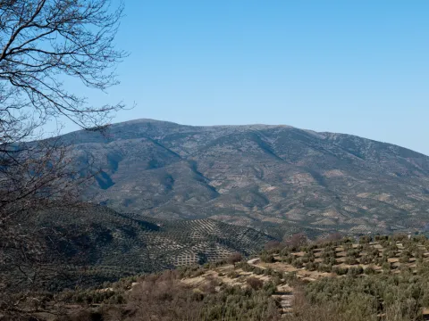
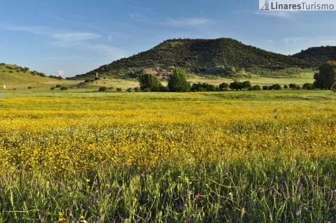
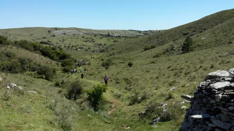
From here there are almost 20 km of solitary plains (including the detour and the visit to the Cabra Station), along the secondary road of the altiplano. The tour is very quiet because of the few slopes - except some ramps - and because of the near absence of road traffic. The road has a sufficiently cyclable floor, passing through repopulation pines, olive groves and high cerealist fields. The area consists of a succession of rural areas, with large panoramic to the south, with the permanent image of the summits of the Sierra Nevada Natural Park (province of Granada). To the north the summits of the Natural Park of Sierra Magina rise.

The last stretch is a continuous descent from the pedanean town of Solera to the valley of the Jandulilla River. Solera is a small town with a tiny old town set up around the ruins of a rocky castle that was watching the medieval border. This 15 km stretch ends in Huelma, where you can eat in one of its restaurants, and visit the Vandelvirian Church and its castle, both monuments of the Andalusian Renaissance.

Breve descripción

Unpublished route, near the Natural Park of Sierra Magina. The tour is divided into three sections: The first kilometers - just over 10 - represent a rise from the valley of the Jandulilla River to the high plane of Cabra of Holy Christ. This stretch stands out for the subdesert landscapes, a little known beauty of unique shapes and colors. From here there are still 7 Km. without slope to the town of Cabra of Holy Christ. In this town, one of the historic places of the espartera industry in southern Spain, you must visit its interesting church or eat at Casa Herminia restaurant.
Latitud
37.727883
Longitud
-3.377833
Distrito
Ubicación en el mapa
POINT (-3.377833 37.727883)
imagen
Image
31692175.jpg
Imagen principal
Activado
imagen
Image
Ruta%20Cabra%20del%20Santo%20Cristo.JPG
Imagen principal
Desactivado

Nature

icon-intereses-naturaleza

Friends

icon-intereses-amigos

Adventure

icon-intereses-aventura

Culture

icon-intereses-cultura

Sport

icon-intereses-deporte

Eco-friendly

icon-intereses-eco-friendly

For couples

icon-intereses-en-pareja

Family

icon-intereses-familia

Gastronomy

icon-intereses-gastronomia

Municipality

icon-intereses-municipio

Low-cost tourism

icon-intereses-turismo-low-cost

Solo travel

icon-intereses-viajar-solo
Ruta Cabra del Santo Cristo
All year round
Desactivado

53 km of asphalt roads with occasional traffic.
Coordenadas / Huso 30S
30S x = 466705 and = 4175691

Peñas de Castro and Monte del Canjorro

Submitted by brandcode_deweloper on
Id
2619220
Descripción larga

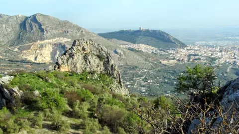
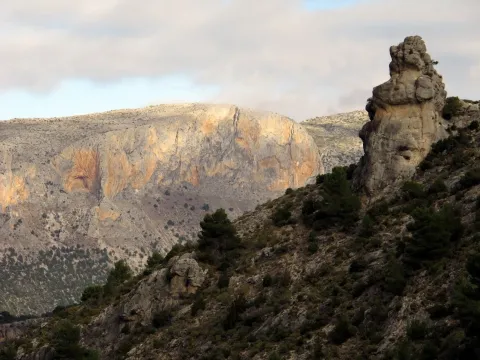
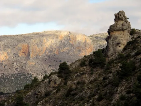
A hundred meters past the restaurant we take a lane to the left that after passing by a house leads us to the lordory Casería del Portichuelo, located just at the foot of the hill that make up the two rocks that form the picturesque rocky set. We go up through the olive grove to the hill (840 meters) from which we see the other side of the rocks towards the payment of Pedro Coes and the valley that forms the Jaén River.

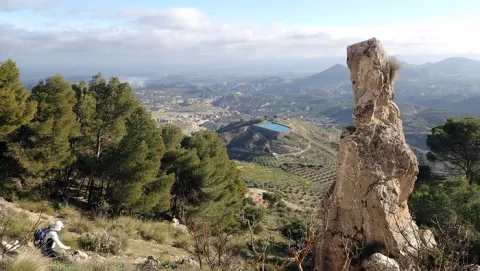
If we want to try to ascend to the pointed major summit of the Peñas, we will look on the hill for a sidewalk that we will take to the left towards the north rock. The sidewalk passes over the pine tree that falls between the two rocks and borders the rocky wall. In this area there are a lot of climbing pathways and in a fracture on the wall a cave (Secret Cave) in which there are anthropomorphic rock paintings (some up to 65 cm). After crossing an area of mountain and crossing a wire of cattle, it flows into a small, straight meadow surrounded by pine and olive trees. To the right of that meadow, semi-hidden between the weeds, it begins to climb towards the ridge. From here the ascension begins that becomes quite difficult, as the line of crest is very pending and we will find ourselves with complicated swamps. We will have to be careful with the rocky abyss that are forming on our right: in about twenty minutes we will be at the top of this unique mountain. There are remains of an Arab turret in it. Here we will enjoy one of the best panoramic views of the region of Jaén, as we are right in the geographical center of it, in a pettic atalaya 945 meters high and without any obstacle to the view.

From the hill we have another less risky option: to go down to the other side by reference to the ruins of a medieval turret, a little further down to the cortijo of Pedro el Cruel. After a mile we will be in the cortijo, behind which a path that leads us in twenty minutes to Mount Canjorro, the final foothold of the Peñas de Castro. It is an interesting climbing area, with abundant caves, from which you can see the setting of the river from above and the valley of Los Villares.

Breve descripción

The approach will always be by vehicle, from the city of Jaén. There are two options. For its eastern part, taking the road to the Sierra Bridge, in the Km 2.5 three hundred meters after the restaurant Casería de Cristóbal, take a particular road (Pedro Coes lane) with strong slope to the right that borders the Peñas, taking a track to the right paved cement that reaches its base. On the western side, from the Villares road to the Portichuelo (Km 4). This latter possibility will allow us a more comfortable ascent to the rocks, as we must overcome less height. We can leave the vehicle next to the El Mirador Restaurant, shortly before arriving at the port.

Latitud
37.9143
Longitud
-3.0072
Distrito
Municipio
Ubicación en el mapa
POINT (-3.0072 37.9143)
imagen
Image
3914419.jpg
Imagen principal
Activado
imagen
Image
Pe%C3%B1as%20de%20Castro%20y%20Monte%20del%20Canjorro.jpg
Imagen principal
Desactivado

Nature

icon-intereses-naturaleza

Friends

icon-intereses-amigos

Adventure

icon-intereses-aventura

Culture

icon-intereses-cultura

Sport

icon-intereses-deporte

Eco-friendly

icon-intereses-eco-friendly

For couples

icon-intereses-en-pareja

Family

icon-intereses-familia

Gastronomy

icon-intereses-gastronomia

Municipality

icon-intereses-municipio

Low-cost tourism

icon-intereses-turismo-low-cost

Solo travel

icon-intereses-viajar-solo
Peñas de Castro y Monte del Canjorro
Desactivado

Approximate distance: 8 Km (one-way only)
Difficulty: Low. High on the ascent to the Peña.

Tramo de asfalto o cemento
 
Tramo de pista o camino forestal
 
Tramo de vía pecuaria
 
Tramo de senda
 

Monte Jabalcuz

Submitted by brandcode_deweloper on
Id
2619117
Descripción larga

After crossing this new neighborhood, before reaching the Arroyo Riocococrotico, a kilometer beyond the urbanization (by the old road, in what was the direction towards Jaén) a track (very steep in its first meters) appears to the left of the road that we will have to take to start the ascent to Mount Jabalcuz. A little more than a mile from its beginning we will find a barrier that prevents the passage of motor vehicles. From there the road ascends with a soft slope on the north side of the mountain between small trees of young pine trees. At half a mountain slope the track is headed towards its western end, towards the Air Port (1331 m) between Jabalcuz and the Devil's Crest, a sharp limestone that contrasts with the rounding of the mountain we are going to climb. The track up to the port continues to the opposite side towards Torredelfield. We will take the left turn to the summit.

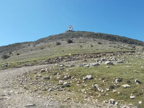
From the Port of Air the pines are finished, a bioclimatic floor with high mountain plant cover is reached. We will continue our march towards the top, from which we are still separated three and a half kilometres. The road ends 100 meters from the summit (1614 m) where there is a fire guard house. From this privileged viewpoint, the village of Los Villares, the Betic Cordilleras with Sierra Nevada are seen to the south and to the North Jaén and the Guadalquivir Valley, full of villages, as a backdrop of Sierra Morena. The descent we will do on the same path we have brought. Arriving at the Air Port, you could choose to descend to the Torredelfield side, to a track of similar characteristics, also with restricted motor traffic. This option is more long, unless a vehicle was previously approached to the access barrier. In the event of choosing this route, the connection with the Green Way of Oil is recommended, either by all-terrain bike or on foot.

Breve descripción

The approach can be done by vehicle from Jaén. We take to the south of the city the road of Los Villares and just leave the town centre we find a detour of access to the Fuente de la Peña. It is a spring that supplies some castors and former public lavatories. Two or three kilometers further we find a detour to the right that leads us to an urbanization built around the old Jabalcuz Spa, very busy during the first quarter of the last century, but currently in a state of ruin and waiting for a next rehabilitation. Within the spa there is a source of calcium sulfated water that arises at about 30 degrees of temperature.

Latitud
37.6804
Longitud
-3.7802
Distrito
Municipio
Ubicación en el mapa
POINT (-3.7802 37.6804)
imagen
Image
Jabalcuz_-_anpalacios.jpg
Imagen principal
Activado
imagen
Image
Monte%20Jabalcuz1.jpg
Imagen principal
Desactivado

Nature

icon-intereses-naturaleza

Friends

icon-intereses-amigos

Adventure

icon-intereses-aventura

Culture

icon-intereses-cultura

Sport

icon-intereses-deporte

Eco-friendly

icon-intereses-eco-friendly

For couples

icon-intereses-en-pareja

Family

icon-intereses-familia

Gastronomy

icon-intereses-gastronomia

Municipality

icon-intereses-municipio

Low-cost tourism

icon-intereses-turismo-low-cost

Solo travel

icon-intereses-viajar-solo
Monte Jabalcuz
Desactivado

Approximate distance: 10 km (one-way).
Difficulty: Low.

Montaña del Castillo and Pinares del Nevaral

Submitted by brandcode_deweloper on
Id
2615395
Descripción larga

One of these routes starts right above the Almond Quarter, at the junction of the Circumvalation Road with the rise to the Castillo-Parador de Turismo. Towards the south side of the hill of the Castle of Santa Catalina, next to the road of ascending to the Castilla-Hospital El Neveral, a narrow path rises between almonds under the vertical walls that serve as foundations to the walls of the castle. The itinerary presented here has the possibility of being extended with other surrounding areas.

We will pass to a water tank and then we will enter the pine until we leave to a crossing of the road right next to the Caño Quebrado fountain. From the back of the forest house in this Source continues a path parallel to the road. We followed her until we crossed the track next to the El Neveral Recreative Zone. We continue on the path that goes up between the pine and the olive grove, overlooking the Hospital of El Neveral, and pass by another water tank, until we reach a clear area of trees from where we will see a closed curve a crossing and continue to glide and leave the crossing to the right and another to the left. We will connect with a track that, after, a small climb that places us at more than 1000 meters of height, just below the Cerro de los Morteros, descends to the previous recreational area, culminating the circular stretch of this path and then continuing on the road already travelled to the fountain of Caño Quebrado, at the crossing with access to the Castle.

Right next to this crossing, in front of the Fountain is taken a descending lane to the north side and to the city of Jaén, which immediately becomes a path from which we will enjoy beautiful views of the city through the pines. We had a small olive tree and crossed the wall of Almohad origin (11th century). In this area, in the direction of the decks of the Cross of the Castle, through the wall through the door there, there are some scarves that have traditionally been the school of the Jiennese climbers. By a final stretch of the downhill track we will go to the Circumvalation Road, already in the Magdalena district, again in the city of Jaén.

Breve descripción

Recently, hiking routes (PR-A 126 and 127) have been identified in the immediate mountains to the city of Jaén, in particular in the Periurban Park of the Neveral and Castle of Santa Catalina, which is mostly made up of a magnificent forest of Pinus halepensis and rocky areas. This tour is sometimes used by athletes from the capital, for hiking, all-terrain bike, trial bike, mountain race and climbing. This is an area of environmental value that offers resources for the practice of different activities.

Latitud
37.6002
Longitud
-3.8401
Distrito
Municipio
Ubicación en el mapa
POINT (-3.8401 37.6002)
imagen
Image
2498238.jpg
Imagen principal
Activado
imagen
Image
Monta%C3%B1a%20del%20Castillo%20y%20Pinares%20del%20Nevaral.jpeg
Imagen principal
Desactivado

Nature

icon-intereses-naturaleza

Friends

icon-intereses-amigos

Adventure

icon-intereses-aventura

Culture

icon-intereses-cultura

Sport

icon-intereses-deporte

Eco-friendly

icon-intereses-eco-friendly

For couples

icon-intereses-en-pareja

Family

icon-intereses-familia

Gastronomy

icon-intereses-gastronomia

Municipality

icon-intereses-municipio

Low-cost tourism

icon-intereses-turismo-low-cost

Solo travel

icon-intereses-viajar-solo
Montaña del Castillo y Pinares del Nevaral
Activado

Circular.
Length: 6 Km.
Difficulty: Low / medium.

Tramo de asfalto o cemento
 
Tramo de pista o camino forestal
 
Tramo de vía pecuaria
 
Tramo de senda
 

Cresta de Matamulos - Cañada de las Hazadillas

Submitted by brandcode_deweloper on
Id
2615240
Descripción larga

We take the track that leaves next to the Hall of Nature in the direction of Llanos de Palomares; about 1 Km we will find a crossing where an indicator tablet points a 4x4 route to the village of Cárchel (same beginning as on the route of the Cross of the Chimba). We take the right track, cut with a chain, and after walking about 500 meters in a closed curve, a path that is introduced into a pipe and ends in the Pocicco hill is left. We leave the track and take that path. We'll soon find a fork and take the left path. The road passes between a dense pine and after overcoming a slightly steep slope stretch, it leaves the forest area. A few meters away you will find the Matamulos Crest and the point of the same name (1256 m). From there the mountain is almost minced to the Quiebrajano River. We have magnificent views of the reservoir and all the saws of the area. If we grow to our right we will reach the Cueva del Montañés, at the same summit of the Matamulos. The views of the valley and the Garganta de los Thieves are impressive.

From there we will return in the opposite direction to the Llanos de Palomares until we take the track that will bring us back to the Cañada de las Hazadillas by the head of the valley. In case of doubt it is recommended to return for the same one-way route.

Breve descripción

Vehicle approach from the Quebrajano Road to the Hazadillas Canyon. One of the paths to know in depth the Parque Periurbano Monte de la Sierra.

Latitud
37.6211
Longitud
-3.8303
Distrito
Municipio
Ubicación en el mapa
POINT (-3.8303 37.6211)
imagen
Image
100_4865.jpg
Imagen principal
Activado

Nature

icon-intereses-naturaleza

Friends

icon-intereses-amigos

Adventure

icon-intereses-aventura

Culture

icon-intereses-cultura

Sport

icon-intereses-deporte

Eco-friendly

icon-intereses-eco-friendly

For couples

icon-intereses-en-pareja

Family

icon-intereses-familia

Gastronomy

icon-intereses-gastronomia

Municipality

icon-intereses-municipio

Low-cost tourism

icon-intereses-turismo-low-cost

Solo travel

icon-intereses-viajar-solo
Cresta de Matamulos - Cañada de las Hazadillas
Desactivado

Circular.
Approximate distance: 8.5 Km.
Difficulty: Low. Average on the ridge.

Cañada de las Hazadillas-Cruz de la Chimba

Submitted by brandcode_deweloper on
Id
2615165
Descripción larga

We take the track that leaves next to the Hall of Nature in the direction of Llanos de Palomares; about 1 Km we will find a crossing where an indicator tablet points a 4x4 route to the village of Cárchel. We take the right track cut by a chain, ignoring a right turn, also cut. We follow it for 1.5 Km until we reach the plateau where the port of the Cross of Chimba is located, through the Llanos de Navalopos, some curious depressions possibly of glacial origin. Just as the track becomes a street, we abandon it and turn to our left we seek a shelter that is located at the end of the plateau at 1154 m next to the steep slope that falls to the Quebrajano Valley.

A great deal of caution if you take this walk with children, since the landings in the shelter are gigantic. From there we have magnificent panoramic views of the Pandera and the whole valley with the city of Jaén in the background. We return to the sidewalk and after passing by the portillo of the Madroñales it descends to the fountain of the Cañada de las Hazadillas.

Breve descripción

Vehicle approach from Jaén: by the Quebrajano road to the Hazadillas Canyon. One of the paths to know in depth the Parque Periurbano Monte de la Sierra.

Latitud
37.6204
Longitud
-3.8202
Distrito
Municipio
Ubicación en el mapa
POINT (-3.8202 37.6204)
imagen
Image
4605310Master.jpg
Imagen principal
Activado
imagen
Image
Ca%C3%B1ada%20de%20las%20Hazadillas-Cruz%20de%20la%20Chimba.jpg
Imagen principal
Desactivado

Nature

icon-intereses-naturaleza

Friends

icon-intereses-amigos

Adventure

icon-intereses-aventura

Culture

icon-intereses-cultura

Sport

icon-intereses-deporte

Eco-friendly

icon-intereses-eco-friendly

For couples

icon-intereses-en-pareja

Family

icon-intereses-familia

Gastronomy

icon-intereses-gastronomia

Municipality

icon-intereses-municipio

Low-cost tourism

icon-intereses-turismo-low-cost

Solo travel

icon-intereses-viajar-solo
Cañada de las Hazadillas-Cruz de la Chimba
Desactivado
Tramo de asfalto o cemento
 
Tramo de pista o camino forestal
 
Tramo de vía pecuaria
 
Tramo de senda
 

Ravine of la Hoanda-La Pandera

Submitted by brandcode_deweloper on
Id
2611254
Descripción larga

We take a track that goes up the ravine of Estoril and after leaving to our left a huge rocky coat, in which there are curious prehistoric engravings with geometric shapes, we go out to a valley dominated by the castle of Otiñar. There comes a sidewalk that, after entering a narrow throat, rises with a strong slope all over the ravine of the Hoya del Caño. We ignore all the detours to the left and right and pass by the Bishop's source. After a very hard rise in some sections the sidewalk, which passes almost all the time on the right side of the ravine in the sense of ascension, we are located in the Llanos de las Navas, beautiful enclave more than 1500 m high where the forest of lush pine trees with fresh meadows is altered. In winter it is not uncommon to find them snowy. To get here, we'll need about three hours and a lot of physical effort.

The plains are taking a slope to the side of the Pandera, which we have in front of us. In the upper area, on its eastern side, there is a cave disguised by a huge rock that is in front of its entrance. Right on the top of this cave, which serves as a shelter for pastors and mountaineers, a path begins that, through a rocky high mountain terrain will lead us in an hour and a half more to the summits of the Pandera. The sidewalk, which must be located by reference to the cave, is clearly marked at first, as it takes place by opening way between low mountain, but we will have to pay attention to not lose it as we gain height. In days of low visibility or bad weather it is risky to venture to the summit. We will unwind in a vaguada that forms between the Peña del Altar (1809 m) on our left, and the Alta de La Pandera (1870 m) on our right. In addition to this last summit, there are old military facilities. In the Peña del Altar we will see two small constructions: a fire guard house and a small open shelter that is used by the mountaineers for overnight stay. The views from Peña del Altar are spectacular. Its rocky cliffs fall to the Quebrajano. We are at the highest point in the entire South Sierra de Jaén. Much of the province of Jaén and Granada is seen from here. The countryside and the Guadalquivir Valley after the Sierra de Jabalcuz to the north, the peaks of Sierra Magina and the Sierras de Cazorla, Segura and the Villas to the east and to the south and west all the bethic mountain system, with the backdrop of the Sierra Nevada mountain range.

The descent will have to be realized by returning to our steps. In winter time, we will have to be careful of the slippery ice-cream snowers that we can find in this area of darkness. There is an alternative that the end of the tour will be made to the road from Los Villares to Valdepeñas, in the area known as Arroyo Frio, which will require coordination with a second vehicle that would be left in this area previously. In any case it is a route that requires practice in the orientation, as to this point would still have to go several kilometres of paths, with the use of cartography, and even the current guidance systems with browser and / or GPS, being recommended. This stretch, in the reverse sense, is explained in more detail in the section of the Sierra Sur, clicking on the path Puerto de la Hoya.

Breve descripción

The beginning is at the Km 14 of Jaén to the Embalse del Quiebrajano, next to the so-called Casa del Pintor (house with green graffiti on the walls), in the vicinity of the road crossing between the Cañada de las Azadillas and the Embalse del Quiebrajano.

Latitud
37.6201
Longitud
-3.7603
Distrito
Municipio
Ubicación en el mapa
POINT (-3.7603 37.6201)
imagen
Image
9939744Master.jpg
Imagen principal
Activado
imagen
Image
Barranco%20de%20la%20Hoya-La%20Pandera.jpg
Imagen principal
Desactivado

Nature

icon-intereses-naturaleza

Friends

icon-intereses-amigos

Adventure

icon-intereses-aventura

Culture

icon-intereses-cultura

Sport

icon-intereses-deporte

Eco-friendly

icon-intereses-eco-friendly

For couples

icon-intereses-en-pareja

Family

icon-intereses-familia

Gastronomy

icon-intereses-gastronomia

Municipality

icon-intereses-municipio

Low-cost tourism

icon-intereses-turismo-low-cost

Solo travel

icon-intereses-viajar-solo
Barranco de la Hoya-La Pandera
Desactivado

Ascensiones a la Peña de Jaén and Tajos de la Mella

Submitted by brandcode_deweloper on
Id
2611103
Descripción larga

If we decide to ascend to the Peña de Jaén, to our left, we will take a path of goats that leads us to the ridge on the southern slope and that is quickly lost between the steep and sharp limestone skulls that make up the entire high area of this mountain. We will have to continue through this rocky terrain, trying to get close to the crest line and looking for the most appropriate steps, so the ascension is quite difficult. After 30 minutes we will be in one of the "peinets," as the mountaineers call these summits, on impressive cuts that fall lead to the North. Few cities count in their surroundings
immediate with a look as majestic as the one that offers us this emblematic rock.

The descent we can do on the opposite side by letting us fall down to the hill that forms the two combs and catch a sidewalk that descends at first with quite a slope between the slices, on a seemingly inaccessible terrain, and then turns left, bordering the mountain below the cliffs. It will lead us to the roof of the abrevadero.

If we decide to ascend to the Tajos de la Mella and "crest them" we will have to take from the same hill a sidewalk that goes up to the right and that, through a small climb, allows us to place ourselves in the ridge line. The path is broken down and will have to continue, as in the case of the Peña de Jaén, very carefully, above the rocks, trying not to distance us from the ridge, but paying attention to the cliff, as we walk above slices of up to 70 and 80 meters. It is worth it, however, for the views that we will enjoy all the way. We will continue to the highest part (1245 m) and once the mountain has finished to come down on the West side to find an accessible step. We will go out near a stone shelter and from there we will take the road that descends us to the city.

From the roof we can also go through the lower sides, following some of the animal paths that go up parallel to them. This option presents less difficulty and may be interesting for those who go for climbing routes. Throughout more than 1 km of rock walls we will find a lot of them. It is a true paradise for climbers just a few minutes from the city.

Breve descripción

To ascend to the Peña de Jaén, without a doubt the most spectacular peak of these saws, it is best to do so on the northern side.

Latitud
37.7796
Longitud
-3.7849
Distrito
Municipio
Ubicación en el mapa
POINT (-3.7849 37.7796)
imagen
Image
9281686.jpg
Imagen principal
Activado
imagen
Image
Ascensiones%20a%20la%20Pe%C3%B1a%20de%20Ja%C3%A9n%20y%20Tajos%20de%20la%20Mella.jpg
Imagen principal
Desactivado

Nature

icon-intereses-naturaleza

Friends

icon-intereses-amigos

Adventure

icon-intereses-aventura

Culture

icon-intereses-cultura

Sport

icon-intereses-deporte

Eco-friendly

icon-intereses-eco-friendly

For couples

icon-intereses-en-pareja

Family

icon-intereses-familia

Gastronomy

icon-intereses-gastronomia

Municipality

icon-intereses-municipio

Low-cost tourism

icon-intereses-turismo-low-cost

Solo travel

icon-intereses-viajar-solo
Ascensiones a la Peña de Jaén y Tajos de la Mella
Desactivado

Approximate distance: 5.5 Km
Difficulty: Low to the hill and medium-high along the ridge.
Estimated time: 2 hours

Tramo de asfalto o cemento
 
Tramo de pista o camino forestal
 
Tramo de vía pecuaria
 
Tramo de senda
 

Trail de La Garza

Submitted by brandcode_deweloper on
Id
2603115
Descripción larga

Back to the main path we are heading towards the hill that form El Cerro de las Manciebas and el Cerro Paño Pico for a cross-sectional tour that offers a magnificent panorama of this place surrounded by mining remains where its slender chimneys stand out. At the crossing of the hill we connect with the trail Cerro de las Manciebas, PR-A 261, which ascend to the left together, so that we can enjoy the views and the aroma of the valley and breathe the history by passing by the Pozo Zulueta, Pozo San Ignacio and the Abradero de Mineral de Arrayanes, end of the common stretch. To the Lavadero is reached by descending to the left, at a crossing, by an eroded road, from where an old line dismantled from the mining railway connects it with the Cuesta del Mimbre, turned into a wide track very crossed by the trucks of the quarry. This place in turn converges in a short section common to the PR-A 263 that links Linares, from the Hermitage of Linarejos, with the Mina del Mimbre.

Flying down the track to the same valley the path returns without difficulty to the "La Garza" Sports Complex.

Breve descripción

Starting from the "La Garza" Sports Complex located north of the municipality of Linares, following the lane in the direction of Guarroman, we are entering the fertile valley of the Lagunas, where every passing day more greenhouses appear. Before the first houses we will have the option to take a derivation to visit the Mina de San Andrés (3.2 Km away and back) towards the Embalse La Fernandina, an area with abundant vegetation.

Latitud
37.6104
Longitud
-3.8102
Distrito
Municipio
Ubicación en el mapa
POINT (-3.8102 37.6104)
imagen
Image
20110501-101%20%281%29.jpg
Imagen principal
Activado
imagen
Image
P1180095.jpg
Imagen principal
Desactivado
imagen
Image
image_173103.jpeg
Imagen principal
Desactivado

Nature

icon-intereses-naturaleza

Friends

icon-intereses-amigos

Adventure

icon-intereses-aventura

Culture

icon-intereses-cultura

Sport

icon-intereses-deporte

Eco-friendly

icon-intereses-eco-friendly

For couples

icon-intereses-en-pareja

Family

icon-intereses-familia

Gastronomy

icon-intereses-gastronomia

Municipality

icon-intereses-municipio

Low-cost tourism

icon-intereses-turismo-low-cost

Solo travel

icon-intereses-viajar-solo
Baja
Sendero de La Garza
On foot
All year round
Activado

Cerro Media Luna

Submitted by brandcode_deweloper on
Id
2599231
Descripción larga

The first steps pass through the rail of Fries, but must be left immediately, at the first crossing: on the left hand side another lane goes back the lone ravine of the Arroyo del Vadillo. The rise, though long, 1 hour 25 minutes of march, does not offer difficulties for the walkers. The proud rocky scarves of the Solana del Morón will accompany during the first repulses.

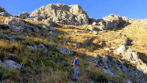
A number of curves reach a farmer's cortijo. The road passes immediately to the right bank of the ravine, usually without water. The landscape changes. On the slopes, now of less sharp profile, small-sized chaperones grow and some I complain looking for the freshness of the umbria. After another tight zigzag, this longer time, the Navalayegua Collado is crowned at 1,500 meters high. At this point you have to leave the main lane, and go through an ancient era to take the road around the hill and die a little later.

A narrow path that goes up parallel to the wire is born next to the barren. This is the most uncomfortable part of the excursion, as thorny bushes sometimes make progress difficult. As you gain height, the tree vegetation disappears. On the top of the hill, the route is turning to the right, with the naked summit of the Cerro de la Media Luna, which is crowned in about 20 minutes. The return takes place on the same path as the one-way.

Breve descripción

The starting point of the excursion is in the upper part of Valdepeñas, near the football field. At the explanade next to the fountain, you can leave the car. The tour will take almost three hours

Latitud
37.6003
Longitud
-3.8301
Distrito
Ubicación en el mapa
POINT (-3.8301 37.6003)
imagen
Image
Vista_del_valle_del_Hilo_de_la_Vida.jpg
Imagen principal
Activado
imagen
Image
turismoActivo3.jpg
Imagen principal
Desactivado

Nature

icon-intereses-naturaleza

Friends

icon-intereses-amigos

Adventure

icon-intereses-aventura

Culture

icon-intereses-cultura

Sport

icon-intereses-deporte

Eco-friendly

icon-intereses-eco-friendly

For couples

icon-intereses-en-pareja

Family

icon-intereses-familia

Gastronomy

icon-intereses-gastronomia

Municipality

icon-intereses-municipio

Low-cost tourism

icon-intereses-turismo-low-cost

Solo travel

icon-intereses-viajar-solo
Cerro Media Luna
Desactivado
Tramo de asfalto o cemento
 
Tramo de pista o camino forestal
 
Tramo de vía pecuaria
 
Tramo de senda