Saltar al contenido principal

Bélmez de la Moraleda – Cabra de Santo Cristo -Solera (C6)

Submitted by brandcode_deweloper on
Id
RUT-0008
Descripción larga
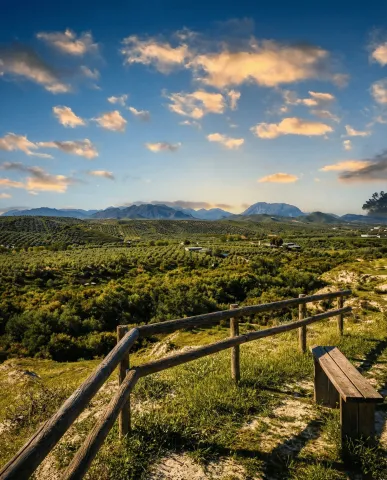
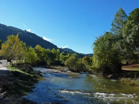
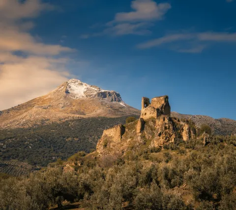
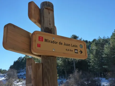
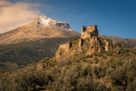
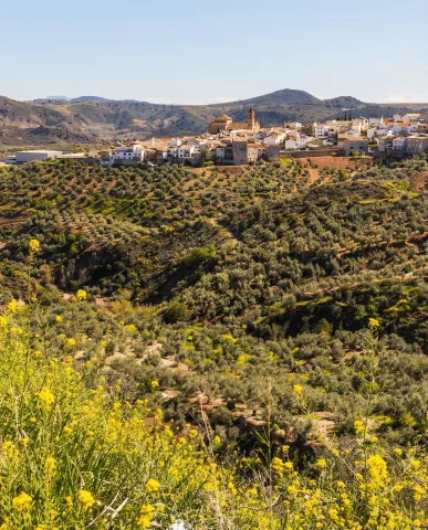
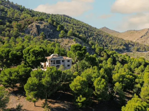
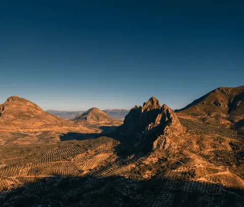
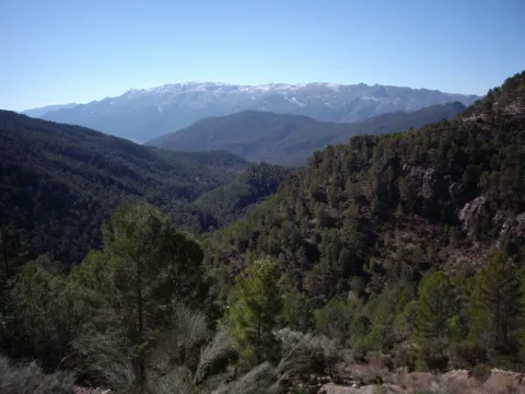
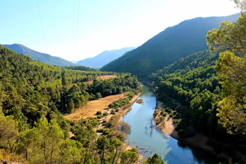
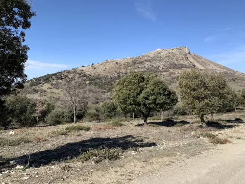
Circular route of about 50 km that runs through the Jandulilla valley from Bélmez de la Moraleda to Cabra del Santo Cristo and Solera, alternating olive slopes, pine trees and limestone reliefs. It is an accessible route, with moderate slopes and comfortable descents, with a firm majority asphalt. It stands out for its clear reading of the territory: valley water, panoramic balconies and a very visible heritage (hermitage, lookout and castle), with the option of looking at the ibera footprint of the Cortijo del Pajarillo. The route begins in Bélmez de la Moraleda, leaving on local roads between olive groves and small loins that soon open their eyes to the saws that close the Jandulilla corridor. In the first kilometers there is the possibility of a (non-compulsory) detour to the castle of Bélmez and the caves of Baltibañas, before continuing to the valley. The itinerary gains character by joining the corridor of the Jandulilla River, where the landscape becomes more serrano: the olive tree is mixed with pinars and limestone florings. After crossing the river, the route begins a progressive rise to Cabra del Santo Cristo, with a change of tone that announces the transition to drier landscapes. In this section stands the Hermitage of the Holy Christ of Burgos, a good point for a short stop, and later the Mirador de Cabra, from which is recognized the southern façade of Sierra Magina and the saws that open to the east. The arrival in Cabra del Santo Cristo allows to regroup and avituallar in an urban environment with services. On the way out, the tour continues on local roads between olive lomas and small hills, with comfortable pedal and good views. On the way there is a detour to the Casa de la Pradera, a useful point for cyclists for their equipment linked to the maintenance and cleaning of bicycles. The stretch towards Solera returns the protagonism to the relief: the pedany is located at the foot of Mount Morron, with the Castle of Solera dominating the landscape as a visual milestone. Very close, a lookout allows to expand the panorama over the valley and the alignment of Magina. From here, the route returns to the Jandulilla corridor and links back to the road back to Belgium. In this sector, the Iberian Sanctuary of the Cortijo del Pajarillo is close, a reminder of the historical depth of the territory (visitable according to access and conditions of the moment). The circuit is closed again in Bélmez de la Moraleda, with a comfortable ending that invites you to finish the day by walking through the city centre. General recommendations A path suitable for mixed audiences with minimal experience in medium exits. See weather and wind, especially in open and looking areas. Attention to links and main road crossings; always in line and with visible elements. It has enough water and takes advantage of stops in Cabra del Santo Cristo and Solera to rest. In sensitive enclaves (caves / archeology), it respects signs and prevents access to unconditioned areas.
Breve descripción
From Bélmez de la Moraleda, this route proposes a route of about 50 km to Cabra del Santo Cristo and Solera, crossing the valley of the Jandulilla between hillsides of olive and pine. The Hermitage of the Holy Christ of Burgos, the Mirador de Cabra, the cyclist support point of the Casa de la Pradera and the castle of Solera on Mount Morron are highlighted. Very close, the Iberian sanctuary of the Cortijo del Pajarillo recalls the strong Iberian tradition of the territory.
Latitud
37.6701
Longitud
-3.3903
Distrito
Ubicación en el mapa
POINT (-3.3903 37.6701)
imagen
Image
1.jpg
Imagen principal
Activado
imagen
Image
c6.jpg
Imagen principal
Desactivado
imagen
Image
c6-1.jpg
Imagen principal
Desactivado
imagen
Image
c6-2.jpg
Imagen principal
Desactivado
imagen
Image
c6-3.jpg
Imagen principal
Desactivado

Sport

icon-intereses-deporte
Baja - Media
Bélmez de la Moraleda – Cabra de Santo Cristo -Solera (C6)
49 km
1153m
Activado
Bedmar – Jódar – Paraje Natural Alto Guadalquivir - Úbeda – Baeza (C8)

Submitted by brandcode_deweloper on
Id
RUT-0007
Descripción larga
A circuit of about 80 km that connects Bedmar with Jódar, Alto Guadalquivir and the Renaissance cities of Ubeda and Baeza, before returning to the starting point. The itinerary combines local roads, agricultural roads and bici lanes, with moderate ascends, a firm majority asphalt and a clear reading of the territory: river valley, olive countryside and historical heritage. It is a varied and very complete proposal, ideal for road cycling and light gravel. The route begins in Bedmar, heading north on the JV-3032 between olive groves, with early views of the Serrezuela de Bedmar and the Sierra Magina summits. The passage through the Lavadero de Bedmar recalls the historic relationship of the municipality with the water before leaving the asphalt to take compact tracks towards Salmerón and the Lavaderos de la Fuente Garciez, a good place to make a first stop. The entrance to Jódar marks the transit to the Guadalquivir valley. After crossing the urban centre, the route is heading east, alternating agricultural roads and road sections to reach the vicinity of the river. The crossing of the Puente de Ubeda la Vieja is one of the main points of the tour: here the Guadalquivir appears as the central axis of the landscape, accompanied by the view of Iltiraka and the ruins of Ubeda la Vieja, which provide a historical dimension to the itinerary. Very close, the detour to the Laguna de la Herradura allows you to discover a small wet area of great environmental value. From the valley, the tour gradually gains height in the direction of Ubeda, crossing the La Loma countryside, an infinite sea of olive groves on soft wavy hills. The arrival in this city, declared World Heritage, invites a longer stop to discover its historic centre and to regain strength. The route continues to Baeza by a bike lane parallel to the A-316, a comfortable and secure stretch that connects two of the most important Renaissance assemblies of Andalusia. After leaving Baeza behind, the tour is back towards the south, crossing the Guadalquivir along the Mazuecos bridge, a masterpiece of Renaissance engineering, and returning to the Bedmar Valley. The final part is between olive groves and small runoff barrels, with the possibility of a brief detour to the Cerro de Fique to enjoy a wider view of the Serrezuela and the mountain alignations of Sierra Magina. The return to Bedmar ends a long but balanced route, in which river landscape, countryside and urban heritage occur in a harmonious way. General recommendations Road and gravel bike-suitable route, with considerable mileage that requires good schedule planning and avitualations (Jódar, Ubeda and Baeza are key points for this). In summer it is recommended to avoid the central hours of the day due to the shortage of shade in the countryside. Pay attention to the crossings with communal roads and always respect the signposted route, especially in the river and agricultural areas.
Breve descripción
The Itinerary of almost 80 km that links the Guadalquivir valley with the plains of La Loma, connecting Jódar, Ubeda and Baeza on local roads and bike lanes. The tour crosses the Puente de Ubeda la Vieja, looks at the Mirador de Itiraka, offers the detour to the Laguna de la Herradura and ascends to the Renaissance cities of Ubeda and Baeza before returning to the Puente de Mazuecos and the Cerro de Fique.
Latitud
37.8244
Longitud
-3.3956
Distrito
Municipio
Ubicación en el mapa
POINT (-3.3956 37.8244)
imagen
Image
1.jpg
Imagen principal
Activado
imagen
Image
c8.jpg
Imagen principal
Desactivado
imagen
Image
c8-1.jpg
Imagen principal
Desactivado
imagen
Image
c8-2.jpg
Imagen principal
Desactivado
imagen
Image
c8-3.jpg
Imagen principal
Desactivado
imagen
Image
c8-4.jpg
Imagen principal
Desactivado
imagen
Image
c8-5.jpg
Imagen principal
Desactivado

Sport

icon-intereses-deporte
Baja - Media
Bedmar – Jódar – Paraje Natural Alto Guadalquivir - Úbeda – Baeza (C8)
86,7 km
1363m
Activado
Tramo de asfalto o cemento
 
Tramo de pista o camino forestal
 
Tramo de vía pecuaria
 
Tramo de senda
 

Ravine ofl Gargantón

Submitted by brandcode_deweloper on
Id
RUT-0006
Descripción larga
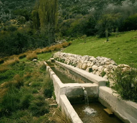
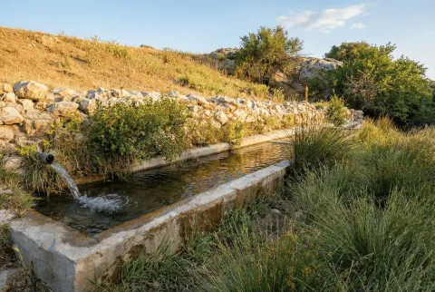
Short and very nice route that follows the course of the Garganton River between pinars and limestone slopes, with return by a traditional acequia still in use. A fresh and serene tour, where the water marks the pace and alternates riverside sections with views towards the valley and the summits of Sierra Magina. The itinerary begins next to the Garganton bridge, on the local road, and begins with a short climb per track that allows you to gain perspective over the valley. The lane is soon abandoned to take a halfway path, from which views are opened towards the Gate of Magina and the high summits, with Miramundos as a reference. The path descends to reach the way of the Garganton River, which from here guides the march. The route goes upstream between pinars and clear slopes, crossing the stream through small wooden walkways that facilitate the passage and provide a friendly character to the tour. The valley fits, the environment becomes damp and the rumor of water accompanies every step. The central point of the itinerary is the Birth of the Garganton River, where the water flows directly from the limestone, forms a short poza and is channelled down valley. This spring feeds the traditional acequia that irrigates the gardens of Bélmez de la Moraleda, a hydraulic system of historical origin that remains active and constitutes a cultural and landscape heritage of great value. From birth, the route returns along the path of the waterfall, always in gentle descent. The route runs along the left side of the valley, between orchards and olive groves, offering a clear reading of the traditional agricultural landscape and the sustainable use of water. Finally, the itinerary links with the main path of the Garganton and returns to the starting point, closing a balanced journey between water, riverside and panoramic of Magina. General recommendations Route suitable for all people used to walking. See the weather, especially after rain, when the flow can increase. Use shoes with good grip in wet sections and respect the waterfalls and walkways, avoiding stepping on the margins so as not to damage this fragile hydraulic heritage.
Breve descripción
Short and very nice route that runs through the Garganton ravine following the course of the river and its traditional waterfalls. From the parking lot next to the bridge, the track is transformed into a riverside path that crosses several times the channel between chopos and gardens until it reaches the birth of the river. The return takes place on the way of service of the acequia, overlooking the slopes of Magina and the gardens of Bélmez de la Moraleda.
Latitud
37.6803
Longitud
-3.7801
Distrito
Ubicación en el mapa
POINT (-3.7801 37.6803)
imagen
Image
1.jpg
Imagen principal
Activado
imagen
Image
R7-SIERRA MAGINA.jpg
Imagen principal
Desactivado
imagen
Image
R7-1.png
Imagen principal
Desactivado
imagen
Image
R7-2.png
Imagen principal
Desactivado
imagen
Image
R7-3.png
Imagen principal
Desactivado

Sport

icon-intereses-deporte
Medium
Barranco del Gargantón
2,9 km
197m
Desactivado

Recreational Area Río Cuadros – Caño del Aguadero

Submitted by brandcode_deweloper on
Id
RUT-0005
Descripción larga
A serene and balanced route that runs through one of the most unique river landscapes of Sierra Mágina, from the south of the Cuadros River to the Caño del Aguadero, then to Búlmez de la Moraleda. A itinerary where water, geology and rural memory are combined in a comfortable layout, designed to enjoy without haste. The tour begins in the Recreative Area of the River Cuadros, in the surroundings of Bedmar, entrance door to an exceptional thinning, one of the best preserved and most extensive of the southern peninsular. From the first steps, the path runs next to the channel, between walkways, limestone slopes and riverside shade, with the constant rumor of water marking the rhythm. The route gently ascends through the valley following the main route, shared in the start with the C5 cycloturist route, while the river accompanies between galleries of adelfas, willows and fig trees. The landscape reveals its fluviokarctic character: limestone walls, rocky highlights and small throats modeled by the discharge of the Cárceles-Carluca aquifer, which feeds the springs of the area. The central point of the itinerary is the Caño del Aguadero, a cold and constant spring that sprouts at the foot of the limestone and gives life to the valley even in the driest months. It is an ideal place to stop, read the landscape and recognize the peaks of Magina that are cut on the horizon. From here, the route changes from the side to the Garganton Valley, starting a progressive descent with open views of olive groves and pine trees. Before reaching Bélmez, a short detour allows you to look at the hill of the Torre del Lucero, an ancient medieval atalaya that watched the steps of the Jandulilla and maintained visual contact with the castle of Bélmez de la Moraleda. The final section descends through clear paths between burning and open lomas until entering the urban centre, where the route ends. It is a tour that invites you to understand how the water structure the territory, from the saw to the gardens, and to walk calmly through a living and worked landscape for centuries. General recommendations Route suitable for walking trails. See the weather, especially after rain, when springs can increase their flow. Use shoes with good grip in wet sections and respect the riverside environment and springs, avoiding getting out of the trail. It has enough water, although you will find seasonal sources on the tour.
Breve descripción
A journey that links the Recreative Area of the Cuadros River with Bélmez de la Moraleda, ascending between pinars and thunderheads until the Caño del Aguadero and the high slopes of Magina. The tour combines forest slopes and half-mountain trails, with wide views over the valley of the Cuadros River and the Garganton Barrio, to end up coming down between olive groves and gardens towards the urban town of Bélmez.
Latitud
37.7702
Longitud
-3.4704
Distrito
Municipio
Ubicación en el mapa
POINT (-3.4704 37.7702)
imagen
Image
R8.png
Imagen principal
Desactivado
imagen
Image
R8-1.png
Imagen principal
Desactivado
imagen
Image
R8-2.png
Imagen principal
Desactivado
imagen
Image
R8-3.jpeg
Imagen principal
Desactivado

Sport

icon-intereses-deporte
Alta
Área Recreativa Río Cuadros – Caño del Aguadero
21,1 km
1317m
Desactivado
Tramo de asfalto o cemento
 
Tramo de pista o camino forestal
 
Tramo de vía pecuaria
 
Tramo de senda
 

Recreational Area Fuenmaandor – Albanchez de Mágina

Submitted by brandcode_deweloper on
Id
RUT-0004
Descripción larga
A linear and varied route linking water, forest and height from the recreational area of Fuenmayor to Albanchez de Magina. A very grateful tour, with pinars, rails and open views, which changes considerably according to the season and encourages it to be repeated at different times of the year. The itinerary begins in the recreational area of Fuenmayor, a fresh and dark environment marked by the constant presence of water. From the parking lot and the fountain is taken a compact ground track that gently ascends between pine trees, with progressive views over Torres and a rosary of Sierra Magina summits, including the Aznaitín and the Almadén. Soon after, the tour approaches the Zurreon Cascade, an intermittent jump where the water covers the rock with delicate travertine. Although the spring is permanent, the waterfall appears after abundant rains and, in cold winters, can become cold, offering a unique picture. The road continues along the path of the GR-7, sharing a corridor with old fallow tracks that have historically articulated the transit along these slopes. The ascent continues to reach the Nita Fountain, a spring attached to the foot of the hillside, a good point for a pause and to read the landscape: the Torres Valley, the Lomas of La Loma, the traces of loose stone of the Almadén and the summits that close the horizon. From here, the route leaves the main track to enter the Barrio de la Víbora, where a narrow and stony path goes back between pine and clear limestone. The rise culminates in the Collado de la Vibora, turning point of the journey. From here on, the itinerary begins a descent by a cattle foyer - the tranche of the pecuary track of the Cordel de la Sierra to the Abradero del Espino - which leads to the area of Las Hoyas. The limestone is in open steps and loins, with a prominent presence of cornicabra, which in the autumn is dyed with red shades. There are also remains of ancient huts, a testimony of the traditional use of this high. The final section runs between olive groves, alternating paths and barbed tracks that are right across the local road before gently descending to the vicinity of Albanchez de Magina, where the route ends. General recommendations Check the meteorology before starting the route, especially in the collate and stony down sections. Wear mountain shoes with good grip; the sticks are appreciated on the down from the Collado de la Viper. It takes enough water and extreme caution when crossing local roads.
Breve descripción
This route from Fuenmayor offers a short but complete route, where water, forest and height mark the way. Part in the shadow of Fuenmajor, with the water marking the compass of the march. Soon the rock is dressed in lime in the Zurreon and the air is fresh; it is the prelude of a sidewalk that goes back among pine trees until the Víbora hill, where the limestone opens and the cornicabra ignites the red umbria when autumn comes. From there, we let the loin release us to Las Hoyas, more kind, and let the cattle feral take us between olive groves, without haste, to Albanchez de Magina. It is a short and complete tour (water, forest and height) that invites you to repeat it at another station, when the mountain changes skin and each step counts something different.
Latitud
37.8004
Longitud
-3.4757
Distrito
Ubicación en el mapa
POINT (-3.4757 37.8004)
imagen
Image
1.jpg
Imagen principal
Activado
imagen
Image
r4_1.png
Imagen principal
Desactivado
imagen
Image
r4_2.png
Imagen principal
Desactivado
imagen
Image
r4_3.png
Imagen principal
Desactivado
imagen
Image
r4_4.png
Imagen principal
Desactivado
imagen
Image
r4_5.png
Imagen principal
Desactivado
imagen
Image
r4_6.png
Imagen principal
Desactivado
Sport

icon-intereses-deporte
Medium
Área Recreativa Fuenmayor – Albanchez de Mágina
10,7 km
953m
Desactivado
Recreational Area El Peralejo – Recreational Area Fuenmaandor

Submitted by brandcode_deweloper on
Id
RUT-0002
Descripción larga
A linear and very complete route in the heart of Sierra Magina that links livestock memory, height dehesa and water. A serene tour, with progressive rise to the Puerto de la Mata and a fresh descent through umbria and springs, ideal for enjoying the landscape without haste. The itinerary begins in the surroundings of Mata Bejid, next to the Recreative Area of El Peralejo, in a landscape of oaks, complaints and young pine. From the beginning there are the traces of the traditional use of the mountain: bozos of pastors, ancient horseshoe roads and small mallads that accompany the smooth rise on half the hill. The sidewalk unabruptly ascends at the foot of the limestone walls where today a ferrata track has been equipped, and it is exposed to the Cave of the Solana, small karmic coat excavated in the limestone, surrounded by lapiaces and dissolving fissures characteristic of the Magina relief. The road then links with a forest track leading to the Castlejo de Mata Bejid, remains of a medieval fortification that watched the passage between the countryside and the high umbria of the saw. This stretch crosses a dehesa of rare height, with oaks and complaints scattered over mountain pastures, a unique landscape at these levels. From here, the route continues to Los Prados, where a rezume feeds the Fountain of Los Prados, before facing the final ascent to the Port of the Mata, which marks the change of aspect. After the port, the route goes down the northern, cooler and more dark side. The pinar is closed, seasonal eruptions such as Hoya Lino appear and the environment becomes clearly wet. In the final section, the road approaches again the Zur-reon, whose jump can be shown after abundant rains, and the constant rumor of the spring accompanies the last steps to the Recreative Area of Fuenmayor, where the route ends. It is an itinerary that combines history, forest landscape and water, very grateful to travel it calmly and discover how the saw changes to every kilometer. General recommendations See the weather, especially in the surroundings of the Puerto de la Mata. Use mountain shoes with good grip; the sticks can be useful in the descent. It carries sufficient water and extreme caution in sections of track with loose stone and in humid areas close to springs.
Breve descripción
Linear route connecting two classic Sierra Magina enclaves: the El Peralejo Recreative Area and the Fuenmayor Recreative Area. The itinerary ascends between oak and pine trees towards the upper side of Magina, passing next to the Cortijo del Peralejo and the Cueva de la Solana, and offering views over Mata Bejid and the limestone walls of the saw. After coronating the upper area, the road descends to the valley of the Zurreon and ends in the spring and the shadows of Fuenmayor.
Latitud
37.8101
Longitud
-3.4504
Distrito
Municipio
Ubicación en el mapa
POINT (-3.4504 37.8101)
imagen
Image
mapas-las-villas-4-1-png
Imagen principal
Activado
imagen
Image
r5_1.png
Imagen principal
Desactivado
imagen
Image
r5_2.png
Imagen principal
Desactivado
imagen
Image
r5_3.png
Imagen principal
Desactivado
imagen
Image
r5_4.png
Imagen principal
Desactivado
imagen
Image
r5_5.png
Imagen principal
Desactivado
imagen
Image
r5_6.png
Imagen principal
Desactivado

Sport

icon-intereses-deporte
Alta
Área Recreativa El Peralejo – Área Recreativa Fuenmayor
4,8 km
875m
Desactivado

Albanchez de Mágina – Cima del Aznaitín

Submitted by brandcode_deweloper on
Id
RUT-0001
Descripción larga
Direct climb from Albanchez de Magina to one of the most emblematic summits of Sierra Magina. A short but demanding rise, by mixed firm, that combines traces of the serrana life and a wide panoramic end. The route proposes a direct rise from Albanchez de Magina to the top of the Aznaitín (1,745 m), on a path of rise by initial asphalt, forest track and stony path. The itinerary starts next to the City Hall and gains height on the street of Ohorno between houses set to the exit of the village and facing the north-east side of the saw. As it rises, the landscape becomes more austere and clearly mountainous. The slope is constant and the gap is concentrated within a few kilometres, so it is appropriate to maintain a regular pace. In the middle section are the first testimonies of traditional life in height: the remains of a snow well, used for the collection and transport of ice between the 18th and 19th centuries, and the ruins of a shack of pastors, simple dry stone constructions linked to the grazing and the development of the saw. The final stretch leaves the track to take a clear path that gains height with decision between stone and limestone, until reaching the summit of the Aznaitín, a true natural balcony. From here, the views open in all directions: the heart of Sierra Magina, the region of La Loma and the Guadalquivir valley, the dark line of Sierra Morena, the saws of Cazorla and Las Villas and the summits of the Sierra Sur. A complete lookout that rewards the effort of promotion. The route ends at the top, returning on the same itinerary. General recommendations Recommended route for well-formed trails. Check the weather before the exit, use mountain shoes with good grip and the use of sticks in the strands of strong slope and pedestal is recommended. It has enough water and prevents ascension in extreme heat or strong wind.
Breve descripción
A round-trip Itinerary that ascends from the urban centre of Albanchez de Magina to the top of the Aznaitín (1,745 m). The tour combines a forest track and an increasingly stony mountain path, with continuous slopes that require good physical form and regular passage. The remains of an old snow well and of shepherds' huts are visited along the climb, before reaching a panoramic summit over the Natural Park of Sierra Magina and the olive sea of La Loma.
Latitud
37.8003
Longitud
-3.4756
Distrito
Ubicación en el mapa
POINT (-3.4756 37.8003)
imagen
Image
mapas-cazorla-3-2-png
Imagen principal
Activado
imagen
Image
r2_1.png
Imagen principal
Desactivado
imagen
Image
r2_2.png
Imagen principal
Desactivado
imagen
Image
r2_3.png
Imagen principal
Desactivado

Sport

icon-intereses-deporte
Alta
Albanchez de Mágina – Cima del Aznaitín
9,8 km
1030m
Desactivado
Tramo de asfalto o cemento
 
Tramo de pista o camino forestal
 
Tramo de vía pecuaria
 
Tramo de senda
 

Route Antigua estación FFCC de Jódar

Submitted by brandcode_deweloper on
Id
2854331
Descripción larga

About 6 km away is Jódar, the largest town in Sierra Mágina. We'll be on the A-401 road. Jódar stands out for the offer of services, and for the castle that hosts one of the two Visitors' Centers of the natural park of Sierra Magina.

Our tour runs along the eastern side of Sierra Magina. Little by little and for 18 km the landscape of olive trees on a subdesert mountain.

To the right we will find the detour to Bélmez de la Moraleda. The waters of the Garganton River assigns to the green landscape and the presence of gardens. The main attraction of the town is the famous faces of Belgium, a curious phenomenon that attracts its own and strangers to this small town.

On the A-401, our walk will continue for 12 km towards Huelma. Almost at the end of the tour we find the pedany of Cabritas, a scattered rural habitat that hides dozens of ancient mills and gardens that for centuries, and from the Middle Ages made this place a vergel of fruit and vegetables.

Attention to the detour in the A-324, which in only three km leads us to the centre of Huelma, a town that offers us restoration services, and two jewels of the Andalusian Renaissance, the Church of the Immaculate Conception, the work of Andrés de Vandelvira, and the castle that watches the village from above.

Breve descripción

It is the route that links the Loma de Ubeda and the Guadalquivir River with the core of Sierra Magina.

The railway station of Jódar, is adjacent to the municipal term of Ubeda. In this station, in disuse, millions of tons of wood that came floating through the Guadalquivir from the Serras of Cazorla and Segura were embarked at another time. Similarly the spatter production of Jódar and Cabra of Saint Christ also used these railway docks to begin their long journey.

Latitud
37.913346
Longitud
-3.348917
Distrito
Municipio
Ubicación en el mapa
POINT (-3.348917 37.913346)
imagen
Image
9961866Master.jpg
Imagen principal
Activado
imagen
Image
PARQUE_NATURAL_CAZORLA%2C_SEGURA%2C_LAS_VILLAS._SIERRA_DE_SEGURA.jpg
Imagen principal
Desactivado
imagen
Image
R45.jpg
Imagen principal
Desactivado

Nature

icon-intereses-naturaleza

Friends

icon-intereses-amigos

Adventure

icon-intereses-aventura

Culture

icon-intereses-cultura

Sport

icon-intereses-deporte

Eco-friendly

icon-intereses-eco-friendly

For couples

icon-intereses-en-pareja

Family

icon-intereses-familia

Gastronomy

icon-intereses-gastronomia

Municipality

icon-intereses-municipio

Low-cost tourism

icon-intereses-turismo-low-cost

Solo travel

icon-intereses-viajar-solo
Ruta Antigua estación FFCC de Jódar
All year round
Desactivado

50 minutes (excluding stops).

Coordenadas / Huso 30S
30S x = 469330 and = 4196258
Tramo de asfalto o cemento
 
Tramo de pista o camino forestal
 
Tramo de vía pecuaria
 
Tramo de senda
 

Route: Pegalajar-Mancha Real-Torres-Albanchez de Mágina-Jimena-Garcíez-Bedmar

Submitted by brandcode_deweloper on
Id
2854246
Descripción larga

Just after leaving Pegalajar, you can reach a small mountain port, a portillo known as Seven Pillas, between the Serrezuela de Pegalajar and the massif of Sierra Magina. In this place, favored by winds is the paragliding area of the same name.

The few 7 km that link Paste with Manchar Real (Ctra. JA-3203) are those of a small road that hangs from the skirts of Sierra Magina, and are a magnificent lookout towards the countryside and the city of Jaén. Mancha Real runs through the center of its urban centre. This industrial and olive-growing town has a beautiful Renaissance church, the Church of the Holy Cross, which well deserves a stop.

The stretch between Mancha Real and Torres (Ctra. JA-3106) shows a good view of Sierra Magina. The arrival in Torres offers one of the best landscapes of the Natural Park. A high mountain horizon, which in its skirts collects the orchards and cherry plantations that reach the urban town of Torres hanging from Mount Aznaitín. The Marquis de Camarasa palace, the climbing in the Cimbras, some of its restaurants are sufficient reasons to devote a while to this town. It is highly recommended to walk to the clock that crowns the population and that in an unknown viewpoint teaches the best of these mountains.

But the best thing is to come. The mountain road between Torres and Albanchez de Mágina (JA-1107) is so small that these two villages separated by only 10 km do not enjoy a bus line... because there is no commercial-sized bus that can travel some points on this road. The main attraction is the landscape, which leads from the moist north side to the driest east, always accompanied by cherry and olive plantations.

Albanchez de Magina, has a rocky castle of must visit, as well as the need to try the almonds, cupcakes and bread, for many the best in the province of Jaén.

7 kilometers (Ctra. JA-3105) more and you will reach Jimena and the A-320 road. In Jimena you can ask about the wheat potage, and you have to visit the Cueva de la Graja, with interesting neolithic rock paintings (access is by a steep path that begins in the municipal pool). The city hall will provide you with the instructions and key to visit the cave. If your pass through Jimena is at the beginning of the summer, look for the best brews in Andalusia that are collected here by the local cooperative.

In the direction of Jaén@-@ Mancha Real, for the Ctra. A-320, just two kilometers away you will find the right turn that will take you to the village of Garciez, always on a road (A-6104) that immerses you in the olive grove for five km.

Garciez and his Renaissance palace of the Marquis de Viana are a surprise. The palace is not visitable, but only the outside walk gives an idea of importance of the place in the 16th century.

Seven more miles and you'll be in Bedmar. This town has restaurants and bars for food, as well as a ruined castle hanging over the village. In this town is the seat of the Regulatory Council of the Denomination of Origin of Extra Virgin Oil Sierra Magina, which orders the production of one of the best oils in Jaén.

Breve descripción

This route by car involves a visit to different areas of Sierra Magina. Although it is recommended for any time of year, autumn, but especially spring are the best time to make this visit.

The route begins in Pegalajar, town of the Guadalbullón River, with different points of interest, such as its traditional medieval garden system or rural accommodation in cave houses

Latitud
37.8244
Longitud
-3.3956
Distrito
Ubicación en el mapa
POINT (-3.3956 37.8244)

Nature

icon-intereses-naturaleza

Friends

icon-intereses-amigos

Adventure

icon-intereses-aventura

Culture

icon-intereses-cultura

Sport

icon-intereses-deporte

Eco-friendly

icon-intereses-eco-friendly

For couples

icon-intereses-en-pareja

Family

icon-intereses-familia

Gastronomy

icon-intereses-gastronomia

Municipality

icon-intereses-municipio

Low-cost tourism

icon-intereses-turismo-low-cost

Solo travel

icon-intereses-viajar-solo
Ruta: Pegalajar-Mancha Real-Torres-Albanchez de Mágina-Jimena-Garcíez-Bedmar
Spring and autumn
Desactivado

Distance: 55 km.
Time approx.: 1 and a half hours (not including stops).

Tramo de asfalto o cemento
 
Tramo de pista o camino forestal
 
Tramo de vía pecuaria
 
Tramo de senda
 

Torres - Hondacabras - Fuenmaandor - Puerto de Torres - Castillejos - Mata Bejid - Centro de visitantes del Natural Park

Submitted by brandcode_deweloper on
Id
2639034
Descripción larga

From Torres, and through the Pila Pellenda parquet, a mountain road is started towards Albanchez de Magina. A few four kilometres away we find a right turn, which gives access to the youth camp area Hondacabras. These sites were cattle's rest on the freckles that passed through these mountains. In this place begins a forest track between pine trees that gradually ascends for 4 Km, something beyond the Nita Fountain. When we get to the crossing we will change direction to make the promotion to the Port of the Mata. The floor of the track is firm, but we will find some outstanding ramps that the less experienced can invite them to take off their bikes. In 3.5 km the port is reached, a step between mountains - some above 2,000 meters. The landscape is a gift for the view: all the southern side of the Natural Park, mountains more than 2,000 meters of altitude (Almadén, 2.036 m., Ponce, 2.006 m and Cerro Cárceles, 2.061 m.), and dehesas in height of complaints, flocks of sheep..., and on the horizon the province of Granada. The rest of the way is down. Five and a half kilometres from the port we arrived at the Castlejo de Mata Bejid, a beautiful place that housed a garrison, which watched this passage on the Middle Ages border, and that until the first half of the 20th century it housed several families of settlers who cultivated the dehesas along the way. This castle was donated to the city of Jaén by the Catholic Kings in 1494, in reward for the services provided in the conquest of Cambil and Alhabar. Two kilometers of olive trees take us to the Cambil-Huelma road. At this point it is worth looking at the corrijada of Mata Bejid, where the spirit of the belle époque with rural dyes is still revived. It is a private property that has an interesting chapel, gardens, house of the gentlemen and even a garage of regionalist style. From here we can choose to go down to the town of Cambil, by the course of the Oviedo River (5 Km.), or better to get close to the new Visitors Center of the Natural Park just three km away. In addition to information from all over the Park, the centre has a shop, meringers, children's games, fountain, services and a walk area for people with reduced mobility.

Breve descripción

This route crosses the Sierra Magina massif by immediate areas to the high mountain. The tour begins and ends at the limits of the Natural Park, from south to north, through it completely.

Latitud
37.7917
Longitud
-3.5447
Distrito
Municipio
Ubicación en el mapa
POINT (-3.5447 37.7917)
imagen
Image
22394163Master.jpg
Imagen principal
Activado
imagen
Image
camping0.jpg
Imagen principal
Desactivado
imagen
Image
13277673.jpg
Imagen principal
Desactivado
imagen
Image
parque-natutal.jpeg
Imagen principal
Desactivado

Nature

icon-intereses-naturaleza

Friends

icon-intereses-amigos

Adventure

icon-intereses-aventura

Culture

icon-intereses-cultura

Sport

icon-intereses-deporte

Eco-friendly

icon-intereses-eco-friendly

For couples

icon-intereses-en-pareja

Family

icon-intereses-familia

Gastronomy

icon-intereses-gastronomia

Municipality

icon-intereses-municipio

Low-cost tourism

icon-intereses-turismo-low-cost

Solo travel

icon-intereses-viajar-solo
Torres - Hondacabras - Fuenmayor - Puerto de Torres - Castillejos - Mata Bejid - Centro de visitantes del Parque Natural
Desactivado