Saltar al contenido principal
icon-intereses-en-pareja

Cave of los Muñecos

Submitted by brandcode_deweloper on
Id
5867250
Descripción
Descripción larga

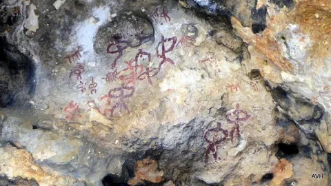
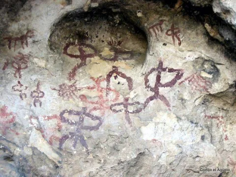
This Sanctuary of the Ibera era, along with another located also in Jaén, in the town of Castellar are very important and have provided the largest number of bronze exvotes, important pieces not only to know the work of this metal in the Iberian world, but to solve many other problems related to the faithful who approached the divinity in these places of worship, such as the type of religiosity, the forms of clothing, the jewels, weapons, the type of hair, etc.

From Collado de los Jardines more than 2,500 exvotes have come out, and from Castellar more than 2,000. The almost all of these objects are kept in the National Archaeological Museum of Madrid.

The exvotes (dolls) of this Shrine of the Collado de los Jardines are of the most varied, in them are represented faithful of all kinds: women, men, warriors, etc.
The latest research was based on the documentation of a historical population in the "Cerro del Castillo" located above the Sanctuary, with the consequent recording of materials and the documentation of 'work units' such as a Roman track, a wall and the environment of the solar that occupied the Iberian necropolis.

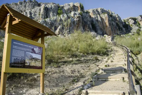
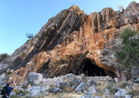
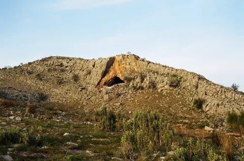
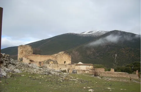
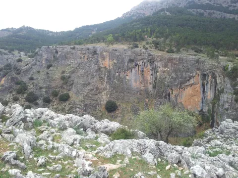
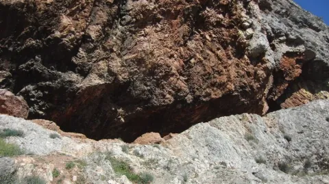
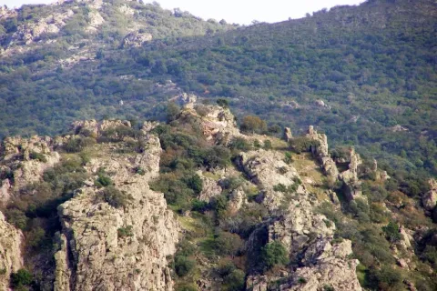
The Cueva de los Muñecos is located inside the Natural Park Despeñacolos, the municipal term of Santa Elena, within a ravine, built between colossal stone blocks, in which there are excavated several caves, the largest of which, about 50 meters deep, was probably the limit of the sacred enclosure. Within this cave today there is a water spring that probably should have existed already in ancient times. In the area there is today a Centre for the Interpretation of the Historical and Cultural Heritage of the Natural Park of Despeñacolos, as well as a path for public use that leads to the Sanctuary and a lookout in the so-called Cerro del Castillo.

Breve descripción

There is a place in St. Helena (Jaén) for all the neighbors known as La Cueva de los Muñecos, called for the number of votes (bronze figures) found in the area. It is the Iberian Sanctuary located on the Collado de los Jardines located on the A-6200 road that leaves from the A4 motorway in Despeñacolos to the town of Aldeaquemada.
Ubicación
Código Postal
23213
Latitud
38.388230
Longitud
-3.498410
Distrito
Municipio
Ubicación en el mapa
POINT (-3.49841 38.38823)
Tipos de punto de interés
Imágenes carrusel
imagen
Image
Cueva-de-los-Munecos-jaen-escondido-e1557137991914.jpeg
Imagen principal
Desactivado
Imágenes cabecera
imagen
Image
Cueva%20de%20los%20Mu%C3%B1ecos_SantaElena.jpg
Imagen principal
Activado
Loading map
Preparing points of interest and routes...

Graja Cave

Submitted by brandcode_deweloper on
Id
5692889
Descripción
Descripción larga

The great presence of limestone and the karmic effects make our province abundant the caves and coats that served as a home for those who lived these lands thousands of years ago. The Cueva de la Graja is an example of this; this rocky coat located at the north end of the Aznaitín at 750 meters high houses rock art manifestations with an age of 2000 to 5000 years before our age. The cave can be visited by requesting it previously in the City of Jimena.

Breve descripción

At the north end of the Aznaitin massif, in the area known as "the Cimbra," is the Cueva de la Graja. It is really a 6-meter-deep coat by 6-wide, which in its highest part reaches 5 meters. In addition to offering wonderful views from its 750 meters of altitude, this coat houses rock art manifestations that were made between 2000 and 5000 years before our era. Made with pigments obtained through the mixture of iron oxide, clays and animal fats; the paintings represent rites and grazing work. Declared an Artistic Historical Monument in 1924, the cave can be visited on request in the City of Jimena.

Telecomunicaciones
Sitio web
www.lugaresmiticosdejaen.com/es/articulos/lugares/cueva-de-la-graja
Correo electrónico
ayuntamientodejimena@gmail.com
Ubicación
Código Postal
23530
Latitud
37.833960
Longitud
-3.473090
Distrito
Municipio
Ubicación en el mapa
POINT (-3.47309 37.83396)
Tipos de punto de interés
Imágenes carrusel
imagen
Image
12.jpg
Imagen principal
Desactivado
imagen
Image
13.jpg
Imagen principal
Desactivado
Imágenes cabecera
imagen
Image
11.jpg
Imagen principal
Activado
Microsite al que pertenece
Loading map
Preparing points of interest and routes...

Cabrera Cave

Submitted by brandcode_deweloper on
Id
4281397
Descripción
Descripción larga

The site of the first archaeological remains dated from the Neolithic (4000 BC) in the town of La Guardia de Jaén. It was later used by the local inhabitants as a guard and poultry for the cattle from which it comes its current name: Cueva Cabrera.

On a blackened wall there is a red stain that can be a rock painting (cave paintings of the Cabrera Cave).

Breve descripción

It is located on the current road to the Allanada del Santo Recreative Zone.

Ubicación
Latitud
37.742568
Longitud
-3.693708
Distrito
Ubicación en el mapa
POINT (-3.693708 37.742568)
Tipos de punto de interés
Imágenes carrusel
imagen
Image
cuevacabrera.jpg
Imagen principal
Desactivado
Imágenes cabecera
imagen
Image
35.jpg
Imagen principal
Activado
Microsite al que pertenece
Loading map
Preparing points of interest and routes...

Peñolite Stream Basin

Submitted by brandcode_deweloper on
Id
4707471
Descripción
Breve descripción

The Peñolite stream has a basin limited by peaks from which the beautiful panoramic surroundings of the Cazorla Natural Park, Segura and Las Villas and the nearby Calar Alto Park in Albacete stand out, as well as magnificent sunsets to the west, with the Jiennese countryside in the background. In its center is the village of Peñolite. La Corda de Lucas is located to the east of the village of Peñolite and separates the municipalities of Puente de Génave and La Puerta de Segura. It is accessed by the forest track that links Peñolite with Cañada Catena. At its highest peak this rope reaches 1,143 m. This water division continues to be limited to the municipalities of Beas de Segura and Arroyo del Ojanco. Among its summits are the Cerro de Las Banderillas, of 1,160 m, the peak Catena, with 1,233 m and the Cerro Estero, of 1,103 m, the Cerro de La Lagunilla and the Cerro del Espartal, of 1,050 m.

Ubicación
Código Postal
23350
Latitud
38.355595
Longitud
-2.802850
Distrito
Municipio
Ubicación en el mapa
POINT (-2.80285 38.355595)
Imágenes carrusel
imagen
Image
poV6a-xw%20%281%29.jpeg
Imagen principal
Desactivado
Imágenes cabecera
imagen
Image
que-ver-y-hacer-en-puente-de-genave-jaen-2339-2.jpeg
Imagen principal
Activado
Loading map
Preparing points of interest and routes...

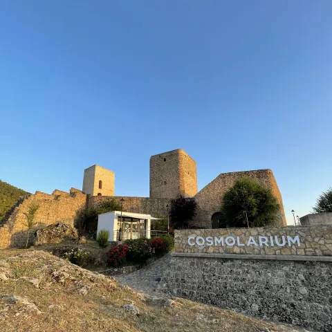
Cosmolarium Castle of Hornos. Interpretation Centre of Astronomía y Planetario

Submitted by brandcode_deweloper on
Id
2343310
Descripción
Descripción larga

While other castles can focus mainly on their medieval history, Cosmolarium offers a completely different experience for two reasons:

  1. It offers an experience focused on astronomy and the universe
  2. It values the incredible sky of the Sierra de Segura, Cazorla and the Villas, non-light pollution.

In short, its universe museum, planetary sessions, guided tours and night sky observation activities make it unique in the region.

Breve descripción

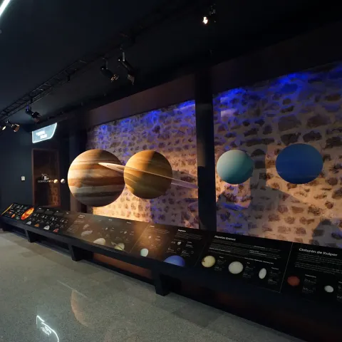
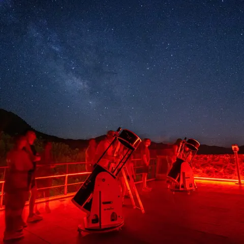
It is a centre for the interpretation of astronomy that consists of a digital planetarium, with a dome of 8 meters in diameter that shows enveloping audiovisual productions, complete exhibition rooms on the Universe, spaces for workshops and educational games, as well as a terrace for astronomical observations.

Telecomunicaciones
Sitio web
https://www.cosmolariumdehornos.com
Teléfono de contacto
664 175 596
Correo electrónico
info@cosmolariumdehornos.com
Ubicación
Nombre
Castillo de Hornos
Código Postal
23292
Latitud
38.216480
Longitud
-2.718430
Distrito
Municipio
Ubicación en el mapa
POINT (-2.71843 38.21648)
Tipos de punto de interés
Imágenes carrusel
imagen
Image
cosmolarium-interior-jpg
Imagen principal
Desactivado
imagen
Image
observacion-nocturna-jpg
Imagen principal
Desactivado
Imágenes cabecera
imagen
Image
cosmolarium-exterior-jpg
Imagen principal
Activado
Horario
Wednesday to Sunday: 10: 30 - 14: 00. Late by season (see web).
Loading map
Preparing points of interest and routes...

El Moralejo Farmhouse

Submitted by brandcode_deweloper on
Id
2853367
Descripción
Descripción larga

To arrive there is only to follow the signs to the Natural Monument of the Quejigo del Master from Valdepeñas de Jaén, just 1 '5 km from a lane that descends to the right, continuing just over 2 km we arrive to an old ruined cortijo in the middle of a wide explanade.

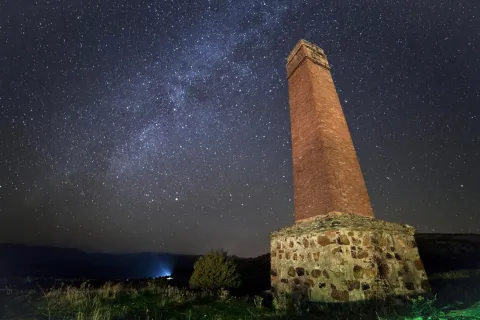
The horizon is wide, although it is true that the mountains cut the celestial vault a little. We are facing a top-class place for those most demanding fans.
This observation point is located more than 1,100 meters in height and in the bottom of the valley with outstanding conditions of seeing and darkness.

Breve descripción

We are at one of the best points in the entire Starlight Reserve in the South Sierra de Jaén. Note: the use of 4x4 vehicle is necessary to access this point, however it is worth it because it is reached at the bottom of a large valley surrounded by lomas and mountains that hide the few remains of light pollution. From this point on the darkness and purity of heaven is exquisite.

Telecomunicaciones
Sitio web
www.andalucia.org/es/valdepenas-de-jaen-turismo-cultural-cortijo-del-moralejo
Ubicación
Latitud
37.591089
Longitud
-3.808862
Distrito
Ubicación en el mapa
POINT (-3.808862 37.591089)
Tipos de punto de interés
Imágenes carrusel
imagen
Image
shutterstock_313430609.jpg
Imagen principal
Desactivado
Imágenes cabecera
imagen
Image
image_197209.jpeg
Imagen principal
Activado
Loading map
Preparing points of interest and routes...

María Luisa Farmhouse

Submitted by brandcode_deweloper on
Id
2853502
Descripción
Descripción larga

The point we propose in the old rear explanade of the old cortijo of Maria Luisa, right on the border between the provinces of Córdoba and Jaén, in the municipal term of Martos. It is easily accessed from the marteña pedanía of Monte Lopez-Alvarez in the direction of Albendín, a few meters from the province limit a detour to the left in the direction of Alcaudete. At this point is already visible the large line of cereal with the old cortijo preceded by a row of trees that is just the way of access.

In the back we find a large place to leave the vehicles and set up to enjoy the night show.

Breve descripción

A nearby place for the inhabitants of the surrounding populations, easily accessible and wide to go on summer nights to enjoy the rain of stars. It is a place of wide horizon, very dark in the cenit and free of light pollution in much of the horizon. Only the light of Martos pollutes the horizons E and NE.

Telecomunicaciones
Sitio web
www.martos.es
Teléfono de contacto
953 210 000
Ubicación
Código Postal
23600
Latitud
37.723220
Longitud
-3.970320
Distrito
Municipio
Ubicación en el mapa
POINT (-3.97032 37.72322)
Tipos de punto de interés
Imágenes carrusel
imagen
Image
JJG_4951.jpg
Imagen principal
Desactivado
Imágenes cabecera
imagen
Image
Imagen principal
Activado
Loading map
Preparing points of interest and routes...

Mata Bejid Farmhouse

Submitted by brandcode_deweloper on
Id
5857145
Descripción
Breve descripción

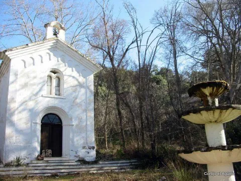
In this private estate the spirit of the belle époque with rural dyes is still revived. It is a private property with an interesting chapel, gardens, house of the gentlemen and even a regional style garage.

Ubicación
Latitud
37.676846
Longitud
-3.564921
Distrito
Municipio
Ubicación en el mapa
POINT (-3.564921 37.676846)
Tipos de punto de interés
Imágenes carrusel
imagen
Image
Ermita_Begid.jpg
Imagen principal
Desactivado
Imágenes cabecera
imagen
Image
Cortijada%20Mata%20Bejid.png
Imagen principal
Activado
Microsite al que pertenece
Loading map
Preparing points of interest and routes...

El Chorro Cliffs

Submitted by brandcode_deweloper on
Id
912498
Descripción
Descripción larga

Two are the points from which you get a good view of the Chorro:

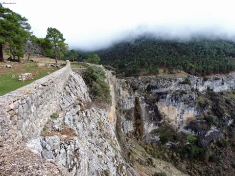
  • In front of the forest house comes a path that takes you to a lookout with a stone wall from which to serene observe the show that opens before your eyes. The white spots that are seen on the walls of this mole accuse the presence of vultures' nests, for they are only the stained of their excrements by being dragged through the waters.
  • Following the track that has brought us to the Chorro and a few meters away you have to go down a path that comes to the right to the very abyss through a cast of sharp stones. You're on top of an impressive rosejo of vertical walls. With great caution you can look and get over the heights, views and flight of the many birds that live or go by in their constant search for food.

We suggest...

  • Take binoculars to see the caves where the birds nest.
  • Make use of the wooden observatory from where you will pass unnoticed for the birds that will fly and pose around you without complexes. At the entrance there is an information panel with the most common birds in the area. A good time to learn to identify them.

In the Iruela, from the City Hall square, the road rises towards the Riogazas hotel. It is known as the Chorro road. 12 km from the Iruela is the Chorro forest house on the left bank of the forest track.

Breve descripción

This abrupt glow, located just a few meters from the road, is an ideal place to observe carrion birds such as the leonate vulture or the aloche. The impressive cut of limestone forms deep cracks used by numerous birds to nesting. The royal vicar, the common cernicalo and even the pilgrim hawk are constantly flying over the ravine of the Chorro stream, which is strolling in a 70-meter waterfall and which welcomes the melting waters of the Giillo.

Ubicación
Latitud
37.920351
Longitud
-2.994140
Municipio
Ubicación en el mapa
POINT (-2.99414 37.920351)
Tipos de punto de interés
Imágenes carrusel
imagen
Image
cortados.jpg
Imagen principal
Desactivado
imagen
Image
576_img.png
Imagen principal
Desactivado
Imágenes cabecera
imagen
Image
El%20Chorro%20078.JPG
Imagen principal
Activado
Loading map
Preparing points of interest and routes...

Cornicabrales

Submitted by brandcode_deweloper on
Id
920498
Descripción
Descripción larga

Once we get to Central, we're already in the middle of the cornicabral. A mile earlier, from the Nidillo Strike, we will be accompanied by the cornicabra to our right on a very stony and pending slope. At the end of the route, in front of the bridge that crosses the Borosa River to access the central one, on the hillside that extends to our left after crossing the bridge, we will observe large trees, which look like oak trees, but if you look at us it will surprise us that they are large cornicabra. In the fall we are presented with a multitude of warm colors ranging from orange to dark red.

The cornicabral that we see is associated with little vegetation in its lowland, this is because the presence of cattle (wild or domestic ungulates) benefits the cornicabra, its outbreaks and spills of seed are very toxic and not appetizing to the cattle, so it is not easy to see other species accompanying the cornicabral, and more in areas frequented by the cattle. However, they are usually seen in oak (Quercus ilex ballota), arces de Montpelier (Acer mosnpessulanum), agracejos (Phillyrea latifolia), sabinas (Juniperus phoenicea), lentisco (Pistacia lenticus), rosemos (Rosmarinus officinalis), torvizcos (Daphne gnidium), esamujos (Rosa ssp.) and among herbaceas we highlight the peony or rose of mountain (Paeonia broteroi), as well as in the gradivos (Rachos), as in the gradivázos, as in the gradivánas in the gracos (Rachos, as in the gradius, as in the gradivás, as in the gradivázos, as in the gracos (Rachos), as in the gradius, as in the gradivávás, as in the gradius in the gracas in the gracos, as in the (Poa bulbosa, Agrostis ssp., Cynosurus echinatus, Aegilops geniculata, Arrhenatherum elatinus, etc.).

The name of the cornicabra is due to the protuberances in the form of goat horn so characteristic in leaves and stems, which are gills produced by the bite of an insect, which uses them as food for its larvae.

We suggest:

  • The cornicabral are present in others in many mountains and more or less stony slopes of the Park, as in this type of environment it is where the cornicabra (Pistacia terebinthus) finds its habitat. Extensive cornicabral can be seen on the slopes of the Zumeta River, near the Ticiano Sale, in the gutters of Peña Corba (Las Villas), on the slopes of the Yelmo Chico, in the Cerrada del Utrero, etc.

Route of the Borosa, from the place known as La Central. To reach the cornicabral we must remount the Borosa River along the track that passes to its vera, and that ends up in a hydroelectric power plant. We take it on the farm of Borosa, a well-known place. We have 8 km ahead of us, but they don't have much slope and can be done easily, and we go all the way through the Borosa River, which is one of the most spectacular and popular routes of the Park.

Breve descripción

Pilate boat, Borosa River

This cornicabral is extended by the Pilate Boat, at the head of the Borosa River, where there are the largest copies of those in the Park.

When enjoying plant formations, preference is often given to those that are starring in trees, but in these saws many are dominated by shrubs. This is the case with the cornicabral, of great ecological and landscape importance, especially in the autumn, when they become almost red.

Ubicación
Latitud
38.252679
Longitud
-2.890872
Distrito
Municipio
Ubicación en el mapa
POINT (-2.890872 38.252679)
Imágenes carrusel
imagen
Image
Natu154.jpg
Imagen principal
Desactivado
Loading map
Preparing points of interest and routes...