Saltar al contenido principal

Iberian Sanctuary el Pajarillo

Submitted by brandcode_deweloper on
Id
4652660
Descripción
Breve descripción

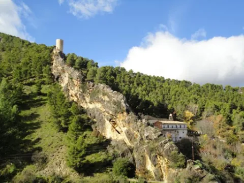
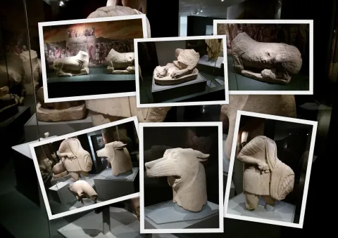
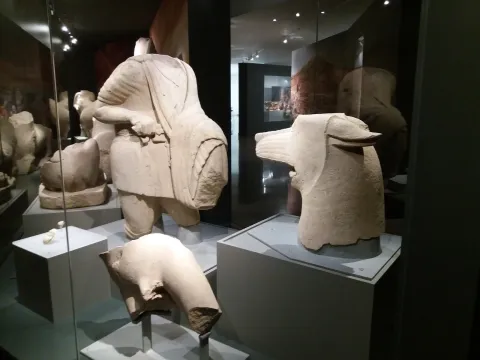
TheSanctuaryHeroic of ElDuck, inHuelma, is the place where the well-known sculptural ensemble in which a wolf and a hero are faced, surrounded by other animals such as lions and taps and placed on a stone tower, in sum in a monumental context of great importance.

Telecomunicaciones
Sitio web
www.redjaen.es
Ubicación
Código Postal
23560
Latitud
37.647300
Longitud
-3.455180
Distrito
Municipio
Ubicación en el mapa
POINT (-3.45518 37.6473)
Tipos de punto de interés
Imágenes carrusel
imagen
Image
el%20santuariodel%20pajarillo.jpg
Imagen principal
Desactivado
Imágenes cabecera
imagen
Image
santuario.jpg
Imagen principal
Activado
Microsite al que pertenece
Loading map
Preparing points of interest and routes...
Iberian Sanctuary of the Collado de los Jardines

Submitted by brandcode_deweloper on
Id
4554285
Descripción
Descripción larga

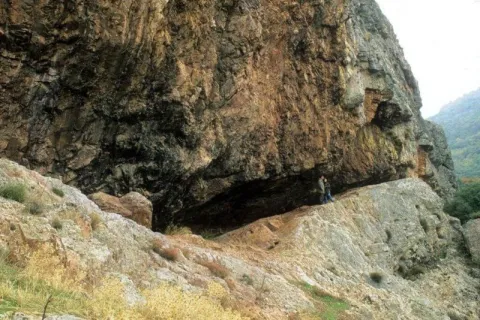
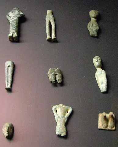
The original place of worship would be made up of a grotto in the rocky massif and a source; in front of that it is possible to emerge at different times, successive buildings of worship; for the oldest one it is kept news of its rectangular plant, and it is suspected a chronology of the centuries V- IV BC; for the most recent the dating managed would place it in the first century or perhaps before; the Shrine would already work from before the construction of the first building and would continue to do so, at least until the fourth century, after the destruction of the second building towards the third century AD. It seems that the exvotes, in the vast majority or in their entirety bronze figures, "Fury primitivement dépossées dans la caverne, et jetées de temps a autre sur la pente, mais jamais aucune fosse ne fut creusée pour les recevoir," which prevents the existence of a reliable strategy, which is aggravated by the precarious conditions of the excavation, at the beginning of the century, of the site. It is not unlikely, as one of the excavators suggested, that the religious whole should also be completed with a sacred forest, from whose branches the devotees would hang part of the offerings.

Breve descripción

Located in the area that could have been by way (although not surely of the most important before the 18th century) between Alta Andalucía and the Plateau, is this Sanctuary of which almost all that is known are its bronze exvotes (about 2,200 from the official excavations) that the Oretan peoples offered to the gods.

Telecomunicaciones
Sitio web
www.santaelena.es
Teléfono de contacto
953 664 010
Ubicación
Nombre
Cueva de los Muñecos
Código Postal
23213
Latitud
38.388204
Longitud
-3.498567
Distrito
Municipio
Ubicación en el mapa
POINT (-3.498567 38.388204)
Tipos de punto de interés
Imágenes carrusel
imagen
Image
Santuario%20Collado%20de%20los%20Jardines3.jpg
Imagen principal
Desactivado
imagen
Image
Santuario%20Collado%20de%20los%20Jardines2.jpg
Imagen principal
Desactivado
Imágenes cabecera
imagen
Image
dsc03816.jpg
Imagen principal
Activado
Loading map
Preparing points of interest and routes...

Sanctuary of the Virgen de la Fuensanta

Submitted by brandcode_deweloper on
Id
12131034
Descripción
Descripción larga

Today we see olive trees around the sanctuary but we must think of forest areas with some clear for cultivation, highlighting on the high Iznatoraf as the most important villa of the advance to the north of the Guadalquivir.

Little by little this situation of danger is disappearing, new inhabitants arrive and places are beginning to live outside the walls of the villa until it is necessary to disconnect them from the municipality. The inhabitants of the Moraleja in 1396 knew the autonomy with respect to Iznatoraf, going on to be called since then Villanueva del Archbishop.

It tells an ancient legend that in Muslim times there was a group of MozArabs in Iznatoraf with a great devotion to the virgin Mary. The king's wife showed some interest in the Christian religion by helping them in all that she could. When her husband, known as Alimenon, found out, he ordered that they take his wife into the forest and cut off her hands and take her eyes out to die in the most absolute solitude. The woman called on the virgin Mary, who presented herself and made a fountain sprout to wash her wounds. Miraculously he healed and the virgin ordered him to go up to her husband so that, being aware of the miracle, they would be baptized in the fountain and set up a temple in his honor.

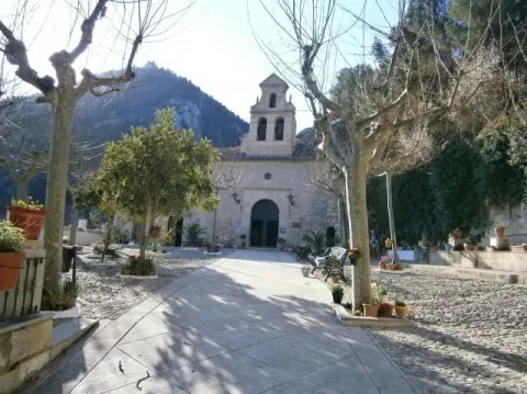
The Sanctuary and the virgin of the Fuensana is one of the oldest in Spain and it is known that it existed in 1291 already as an important pilgrimage center on the border lands. The building is of three Gothic-style ships, although there are still some Romanesque reminiscent, such as a beautiful medieval mudejar tile. The virgin of the Fuensana is sold in a baroque shrimp of the 17th century.

Breve descripción

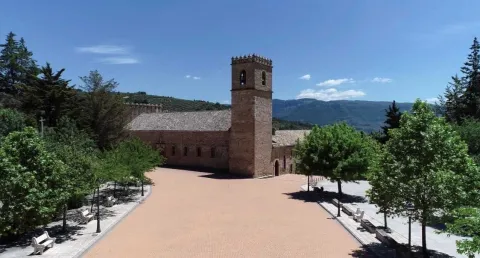
Contemplating the sanctuary building comes to mind memories of border life. The almenada tower and the robustness of the walls refer to other times when the danger of war was present in the daily lives of the people who lived in the village of the Moraleja. Without ever losing sight of Iznatoraf as a villa from which the different places that have ended up giving rise to the Sierra de las Cuatro Villas were torn.

Telecomunicaciones
Sitio web
https://villanuevadelarzobispo.es/turismo/
Teléfono de contacto
607 184 628
Correo electrónico
turismovillanuevadelarzobispo@gmail.com
Ubicación
Código Postal
23330
Latitud
38.163020
Longitud
-2.994220
Ubicación en el mapa
POINT (-2.99422 38.16302)
Tipos de punto de interés
Imágenes cabecera
imagen
Image
1604769448440107388872821794175587.jpg
Imagen principal
Activado
Horario
May - ago: Wednesday to Saturday 09: 00 - 14: 00 and 18: 00 - 21: 00, Sunday 10: 00 - 13: 00. Sept - abr: Wednesday to Saturday 10: 00 - 14: 00 and 16: 00 - 20: 00, Sunday 10: 00 - 13: 00.
Otros servicios
Guided tours under reservation in Tourist Office
Loading map
Preparing points of interest and routes...

Sanctuary of Cuadros

Submitted by brandcode_deweloper on
Id
7974744
Descripción
Descripción larga

u external appearance is low stylized but viscous by its volumetric contrasts. Made of masonry, the cover framed by molded cornice opens with a half-point arch on imposts with smooth transdotes. On its axis is raised a high swordsman of two bodies, the lower one with two arches also of half point and the upper one with one, triangular front and vases. It keeps a cover in a carved stone that belonged to the Marquis de la Cueva palace.

Its plant is rectangular and consists of a single ship covered with false plaster canyon vault, with false fajon arches that are based on arquitrabed pilasters. Both the ship and the presbyterium - which is accessed by a reduced spinal arch and covered with a half-orange vault on the breast - are decorated with geometric and plant thematic motifs. The choir stands at the feet and is supported by two columns with shoes. The shrimp has a polygonal plant, was built in the early 18th century and has undergone various reforms and modifications.

It is possible that the devotion to the Virgin of Cuadros may be extended to the Middle Ages as it corresponds to a very active region militarily in the Christian conquest and with a primarily agricultural activity. The relaunch of his worship was based on the model of popular religiosity promoted by the Council of Trent and on the ecclesiastical policy carried out in the province by Bishop Dávila. The importance of both the process and the claim of the pilgrimage of rosemary of the Sanctuary of the Virgin of Cuadros exceeds its artistic and monumental value.

Breve descripción

In the relations of Philip II, 1575, the great devotion felt in the region by the Virgin of Cuadros, whose sanctuary, five kilometres from Bedmar, was raised in 1615, forming together with a medieval turret and mill.

Telecomunicaciones
Sitio web
www.bedmargarciez.es/el-municipio/patrimonio-historico.html
Ubicación
Código Postal
23537
Latitud
37.790090
Longitud
-3.408750
Dirección
JV-3222
Distrito
Municipio
Ubicación en el mapa
POINT (-3.40875 37.79009)
Tipos de punto de interés
Imágenes carrusel
imagen
Image
santuario%20de%20cuadros%20bedmar2.jpg
Imagen principal
Desactivado
Imágenes cabecera
imagen
Image
santuario%20de%20cuadros%20bedmar.jpg
Imagen principal
Activado
Microsite al que pertenece
Loading map
Preparing points of interest and routes...
Juniper and Savin Forests rastreros

Submitted by brandcode_deweloper on
Id
923306
Descripción
Descripción larga

When we enter the fields of Hernán Pelea we are open to the landscape, and we will discover true vegetable monuments that charge a large extent of soil.

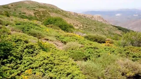
The rake savannas colonize the rocky soils, so we find them in the scarves and cresteries, as well as in the highest of the summits. On the contrary, rake juniors prefer more developed soils, although it is not difficult to see them together. They are very long-lived species, being able to reach 1000 years of age. They do not raise much from the ground, rarely more than a meter high, but a single example can extend more than 20 m ².

They are almost mono-specific plant formations, that is, of a single dominant species, to which only some salgarean pine (Pinus nigra salzmannii), thorns (Berberis vulgaris australis) and on the slopes some maple (Acer granatense) or mustard (Sobus aria) are accompanied. But in the summit areas, the rareras are the queens of the landscape, competing with piornal and lastonar.

These two species came to our saws with the glaciations of the Quaternary. Today, with a more arid climate, they only survive in the highest and coldest of the mountains. Their regeneration is difficult and scarce, and they are also used as food by herbivores, so their future is not the most flattering.

LOCATION

Following the track that goes into the fields of Hernán Perea from Don Domingo, we take the one that goes through the rample of Juan Fría, in which is the Galapan pine, we overcome it and as we pass through the cortijo of the Pinadilla, we are opened a splendid sabinar rastrero.

Breve descripción

Campos de Hernán Pelea

We cannot speak of the high mountains, their summits, their stony slopes and cresteries, without mention of one of their most emblematic inhabitants, the hillbillies or chaspines (Juniperus sabina) and the hillbillies (Juniperus comunnis hemisphaerica), true vegetable monuments of our mountains, to which can be given the qualification of The Elders of the Summits. They are plants that cover our summits in dark green and give shelter to a number of animals.

Ubicación
Latitud
37.772886
Longitud
-3.788329
Ubicación en el mapa
POINT (-3.788329 37.772886)
Imágenes carrusel
imagen
Image
4.png
Imagen principal
Desactivado
Imágenes cabecera
imagen
Image
86746483001_5836777155001_5826845296001-vs.jpg
Imagen principal
Activado
Loading map
Preparing points of interest and routes...

Ruins of the Castle of Castro Ferral

Submitted by brandcode_deweloper on
Id
5868858
Descripción
Descripción larga

In 1169 the Castle of Castro Ferral was conquered by Calatravos, commanded by Fernando de Icaza, the second Master of the Order. However, before the battle of the Navas de Tolosa, the fortress was again under Muslim control. Ferral would lead several acts of weapons during the military campaign that would end with the Christian triumph of the Navy (1212). The strategic importance of this castle, by controlling one of the traditional steps of Sierra Morena, made it an essential objective for any army that would want to cross the area.

The transfer of the border to the Betic Cordilleras marked the decline of Castro Ferral, who lost his role as a watchman for access to the Guadalquivir Valley. The foundation of St. Helena (Ermita de los Palacios), which has made it less important as a reference centre for the small population of those contours, was joined. In an undetermined time, they beat it to prevent it from becoming a jumpers' den.

The castle of Ferral was made up of three defensive enclosures. The first, currently the worst preserved, was a broad emulated in the slope of land that closed the top of the fence describing an almost perfect circle. This defensive line is more solid and pronounced at the North and North-East ends, where the land gap is greater.

In its interior is developed a second enclosure, possibly built in ground tapial on the base of masonry, from which are preserved various remains and two bastions that could protect the entrance to the castle.

The central core of the castle is made up of a rectangular enclosure of argamase tapial, in which the underground remains, possibly aljibes, are visible.

Breve descripción

There are only remains of this castle of a bulldozer built by Muslims before the Battle of the Saves of Tolosa. It is located inside the Natural Park, on the heights of the port of Muradal, to keep the Paso de la Losa, route between Andalusia and the Plateau. It is accessed exclusively by forest track.

Telecomunicaciones
Sitio web
www.castillosybatallas.com/es/castillo-de-castro-ferral/
Teléfono de contacto
953 368 839
Ubicación
Código Postal
23213
Latitud
38.392870
Longitud
-3.545360
Distrito
Municipio
Ubicación en el mapa
POINT (-3.54536 38.39287)
Tipos de punto de interés
Imágenes carrusel
imagen
Image
Castillo%20de%20Castro%20Ferral%2C.jpg
Imagen principal
Desactivado
Imágenes cabecera
imagen
Image
Castillo%20de%20Castro%20Ferral%2C%202.jpg
Imagen principal
Activado
Horario
24 h.
Loading map
Preparing points of interest and routes...

Jandulilla River

Submitted by brandcode_deweloper on
Id
8114425
Descripción
Descripción larga

Former Xandulilla. Influent on the left bank of the Guadalquivir River. Collect the waters from the northeastern face of the Sierra Magina massif. The associated valley is given the same name. Unwind in the Guadalquivir River, in the area of Ubeda the old one. The Arab geographer Al-Zuhrí, mentions him by the name of Wadi-l-Ard, or Rio de la Tierra.

He named the former population of Xandulilla, of which there are many archaeological remains of great importance spread throughout the area. In the 17th century it was known as "Villa de Felix" with its own jurisdiction. It is a river with a normally low and variable flow rate and without regulatory structures. It is born under the Port of the Gallardos, also known in its first stretch as Rio Huelma, its main tributaries, both on the left are the Gualijar River and the Garganton River that are born in the main massif of Magina and after a very short journey they result in the Jandulilla, apart from numerous intermittent rags and ramps.

Breve descripción

The Jandulilla River is a short river in the south of Spain, tributary to the left bank of the Guadalquivir River that runs through the province of Jaén and collects the waters of the northeastern face of the Sierra Magina massif. The associated valley is given the same name. Unwind in the Guadalquivir River, in the area of Ubeda la Vieja.

Telecomunicaciones
Teléfono de contacto
953 390 210
Ubicación
Código Postal
23560
Latitud
37.650300
Longitud
-3.459550
Distrito
Municipio
Ubicación en el mapa
POINT (-3.45955 37.6503)
Imágenes carrusel
imagen
Image
r%C3%ADo%20Jandulilla%202%20%281%29.jpg
Imagen principal
Desactivado
Imágenes cabecera
imagen
Image
r%C3%ADo%20Jandulilla.jpg
Imagen principal
Activado
Microsite al que pertenece
Loading map
Preparing points of interest and routes...
Gall Oak Forest of the Collado de los Jardines

Submitted by brandcode_deweloper on
Id
4554494
Descripción
Descripción larga

With regard to the faunistic species that inhabit the environment, mention the wolf, the lince, the otter, the imperial eagle, the royal eagle or the azor.

Location: To the north-east of the town, in the heart of the Natural Park of Despeñacolos.

Distance: 16 km.

Medium: Tourism vehicle.

Access route: Departing from the village by the highway of Andalusia in the sense of Madrid and taking, to the right and after going about 6 km, the road J-6.110 towards Aldeaquemada.

Breve descripción

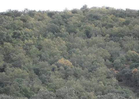
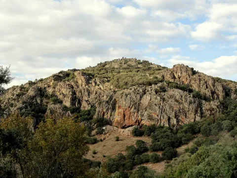
This enclave, which belongs to the Natural Park of Despeñacolos, stands out for its biodiversity; thus, among the plant species present, there are complaints, alcornoques, maples and other typical of the humid Mediterranean forest.

Ubicación
Código Postal
23213
Latitud
38.390302
Longitud
-3.494124
Dirección
Carretera Aldeaquemada, km. 6,6
Distrito
Municipio
Ubicación en el mapa
POINT (-3.494124 38.390302)
Tipos de punto de interés
Imágenes carrusel
imagen
Image
quejical.png
Imagen principal
Desactivado
Loading map
Preparing points of interest and routes...

Dam of Mengíbar

Submitted by brandcode_deweloper on
Id
4619362
Descripción
Descripción larga

The Mengibar Dam was an important civil work in its time, as it was among the first hydraulic power plants to be built in Spain with mobile doors. Until then, the dams were fixed and, if they exceeded their capacity, overflowed. However, in the case of Mengibar, in anticipation of possible floods, Mengemor engineers designed to install mobile doors that allow the water to be depacked in a controlled way to the river. Built from load walls, with natural stone masonry, lacquered and assembled by concrete mortar. The holes form a half-point arc with material of similar characteristics. Covered with flat ceramic tile, mounted on metal fences. It is in good conservation and is currently used to generate electrical power and inject it into the network.

Breve descripción

Located on the Guadalquivir River and inaugurated on 30 November 1916 by King Don Alfonso XIII, the project was the work of architect Antonio Palacios Ramilo and built by the company Mengemor.

Telecomunicaciones
Sitio web
www.mengibarturismo.com
Teléfono de contacto
677 222 285
Correo electrónico
turismo@aytomengibar.com
Ubicación
Código Postal
23620
Latitud
37.987049
Longitud
-3.792523
Dirección
Carretera de la Presa
Distrito
Municipio
Ubicación en el mapa
POINT (-3.792523 37.987049)
Imágenes cabecera
imagen
Image
main_image_97200.jpeg
Imagen principal
Activado
Microsite al que pertenece
Loading map
Preparing points of interest and routes...
Jabalquinto Park

Submitted by brandcode_deweloper on
Id
8122790
Descripción
Descripción larga

The park is located in a public square in the centre of the city centre, with urban facilities and furniture dating back to the 1980s and which were old and in disuse. "It is a comprehensive project that will remodel this Freedom Park, which is almost 40 years old and has an image of deterioration," he adds. In this first phase, the entire infrastructure of supply, sanitation and public lighting is being changed. This performance will continue in a second phase in which all the urban furniture will be completed, consisting of banks running around the alcorques and the children's playground, as well as the covering of the fountain and the decorative lighting of the whole.

Breve descripción

New park on Avenida de Andalucía. It was designed to build a biosaludable park for outdoor sport with swing area for children.

Telecomunicaciones
Teléfono de contacto
953 617 056
Correo electrónico
jabalquinto@jabalquinto.es
Ubicación
Código Postal
23712
Latitud
38.019340
Longitud
-3.726970
Distrito
Municipio
Ubicación en el mapa
POINT (-3.72697 38.01934)
Tipos de punto de interés
Imágenes carrusel
imagen
Image
parque%20Jabalquinto%20%281%29.jpg
Imagen principal
Desactivado
Imágenes cabecera
imagen
Image
parque%20Jabalquinto2%20%281%29.jpg
Imagen principal
Activado
Loading map
Preparing points of interest and routes...