Saltar al contenido principal

Palace of the Marqueses de Viana de Garcíez

Submitted by brandcode_deweloper on
Id
5857980
Descripción
Descripción larga

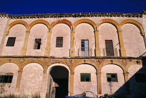
The building has been of great importance for the Garcíez community, both at the economic and social level, which transcends the history of the lordship itself and its successive owners, as well as in the urban configuration of the town.

Despite the numerous remodeling it has suffered over time, the building maintains the original structure of an Italian Renaissance palace. From the artistic point of view, it is a unique building in the panorama of the 16th century architecture in the province. The six covers, part of the porticated galleries of the two courtyards, decorated with Renaissance, medallion and heraldic motifs, as well as the magnificent staircase. The palace is located in the central area of the historic town of Garciez. Its main facade of marked horizonality and powerful volume stands out among the different surrounding constructions.

Breve descripción

It is one of the large civil buildings of Renaissance style built in the province of Jaén. It was raised by the heirs of the former Garciez County Lordship, whose origin dates back to the Christian Conquest and remained as heritage inherited until the 20th century by the Marquis of Viana Castromonte.

Ubicación
Latitud
37.832416
Longitud
-3.423530
Dirección
Plaza del Rey Juan Carlos I, 1
Distrito
Municipio
Ubicación en el mapa
POINT (-3.42353 37.832416)
Tipos de punto de interés
Imágenes carrusel
imagen
Image
unnamed.jpg
Imagen principal
Desactivado
Imágenes cabecera
imagen
Image
Mon231%20%281%29.jpg
Imagen principal
Activado
Microsite al que pertenece
Loading map
Preparing points of interest and routes...

Palace of the marqueses de Camarasa

Submitted by brandcode_deweloper on
Id
5858362
Descripción
Descripción larga

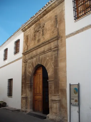
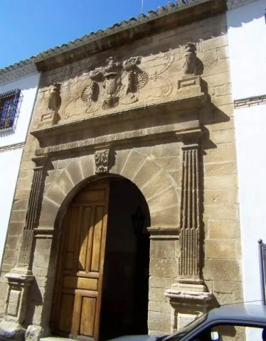
This house is the most outstanding civilian building as an architecture of the people and must be judged, at the same time, as a sign of their power through this special ornamental treatment of classical cover and the symmetrical composition of the facade that confers on it that seal of the palace as a dwelling, centre of dominion and administrative control of a territory.

The cover It is divided into two bodies by an injunction.At the bottom is a half-point arc with acanto highlighted key and framed by acanto pilasters. The upper body is crowned laterally by two vases on pedestal and in the center a shield with a dome and cross of Santiago between columns decorated with reliefs.

On the other hand, distribution of the inner space It does not correspond strictly to that of rooms and housing, but to that of the depositary of the goods in kind that, as income due to the lord, had to be collected there. This aspect is above that of housing in the general consideration of the property. This deposit primacy is well justified by the agreement of the Marquis, whose residence since the end of the 16th century was not even in the land of Jaén, but in Valladolid. This primary function is demonstrated by the two large ships that run on the second floor along the entire body of the house and on whose access bank there is still an allusion to the date of construction of the barn.

In 1997 it was included in the catalogueGeneral of the Historical Heritage of Andalusia.

Breve descripción

As it appears in the inscription of the friso of the cover, in 1565 the house was finished - the palace of the Marquis of Camarasa, also known as house-palace of the Cobos. Renaissance style,remember the splendor that the people livedfrom the moment Carlos I sells it to his secretary D. Francisco de los Cobos.

Ubicación
Latitud
37.783665
Longitud
-3.508898
Dirección
C/ Prior Higueras, 2
Distrito
Municipio
Ubicación en el mapa
POINT (-3.508898 37.783665)
Tipos de punto de interés
Imágenes carrusel
imagen
Image
DSCF5542.JPG
Imagen principal
Desactivado
Imágenes cabecera
imagen
Image
Palacio_Marqueses_de_Camarasa.jpg
Imagen principal
Activado
Microsite al que pertenece
Loading map
Preparing points of interest and routes...

Navalta y Navalconejo

Submitted by brandcode_deweloper on
Id
8094809
Descripción
Descripción larga


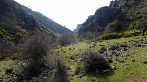
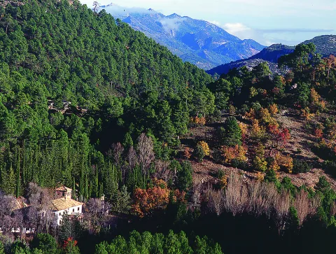
Location:To the west of the town, in the foothills of the mountain set of the South Sierra.
Distance:7 km.

Medium:Tourism vehicle.

Access route:Taking the road leading to the Hoya del Salobral.

Breve descripción

These are fenced valleys surrounded by burning and painting, which are located next to the road leading to Navalcán. They are very visited in the fall by cardo mushroom seekers. The livestock holding (sheep and goats) is very present in this area, with several cortijos in the surroundings dedicated to this work.

Telecomunicaciones
Sitio web
www.noalejo.es/el-municipio/patrimonio-natural.html
Teléfono de contacto
953 306 134
Ubicación
Código Postal
23140
Latitud
37.528500
Longitud
-3.660950
Distrito
Municipio
Ubicación en el mapa
POINT (-3.66095 37.5285)
Tipos de punto de interés
Imágenes cabecera
imagen
Image
Navalta%20y%20Navalconejo..jpg
Imagen principal
Activado
Microsite al que pertenece
Loading map
Preparing points of interest and routes...

Source of the River Arbuniel

Submitted by brandcode_deweloper on
Id
8091520
Descripción
Descripción larga

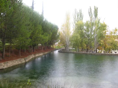
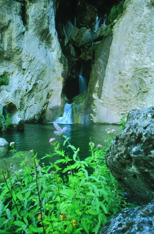
It is one of the most cuddly and important springs in Sierra Magina, being the pride of the shrubs. Although water sprouts through limestone rocks and liasic dolomies of an aquifer, it has a marked saline character because it arises in the breast of margas with triasic plaster.

The waters of the birth are collected in an artificial construction raft that stores them and leads by a system of waterfalls that runs throughout the village.

Next to the birth is one of the four power plants that used the waters of the river for the production of electricity.
This beautiful area is conditioned with a meringero area that allows visitors to enjoy a picnic in a unique natural environment.

The river course is channeled in a multitude of waterfalls that give wealth to the land of the municipality and irrigate many hectares of land. Previously it gave impetus to flour and oil mills, while it is currently used for the irrigation of the olive tree, true economic engine of the area.

The space has a magnificent road with barbecues, banks, tables, stationery, a small bar and children's playground, where you can spend a pleasant day surrounded by nature and where you can take advantage of the freshness of the place and the shadows of the trees.

In the birth of the Arbuniel you can see ducks and river crabs, which inhabit in its channel thanks to the great amount of lime of its waters, and abundant trout.

Breve descripción

The Birth of the Arbuniel River, also known as The Birth of Water, is located on the slopes of Mount Torre de Gallarín, in the vicinity of the urban town of Arbuniel (Cambil), within the region of Sierra Magina.

Telecomunicaciones
Sitio web
www.cambil-arbuniel.es/municipio/patrimonio-natural/nacimiento-de-arbuniel/
Ubicación
Código Postal
23193
Latitud
37.624420
Longitud
-3.540790
Dirección
Camino del Álamo, 3. Arbuniel
Distrito
Municipio
Ubicación en el mapa
POINT (-3.54079 37.62442)
Imágenes carrusel
imagen
Image
Nacimiento%20del%20r%C3%ADo%20Arbuniel2.JPG
Imagen principal
Desactivado
imagen
Image
Nacimiento%20de%20Arbuniel.jpg
Imagen principal
Desactivado
Imágenes cabecera
imagen
Image
Nacimiento%20del%20r%C3%ADo%20Arbuniel3.jpg
Imagen principal
Activado
Microsite al que pertenece
Loading map
Preparing points of interest and routes...

Virgen de la Cabeza Marian Museum

Submitted by brandcode_deweloper on
Id
5871152
Descripción
Descripción larga

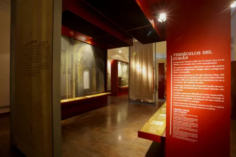
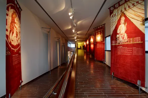
The museum is divided into three rooms, highlighting in the first one the mantos of the greatest historical significance, as well as a picture of the 17th century Romeria and the custody donated by Mussolini; in the second, we can see the mantos donated by the kings of Spain and other personalities, several reproductions of the image of the Virgin of the Head, its processional cage and several vitrines with objects of high significance; in the third room we can find a model of the sanctuary on a scale of 1 / 50, work by Manuel Molina and the pinacoteca of the painter Arsenia on the Menerora.

Breve descripción

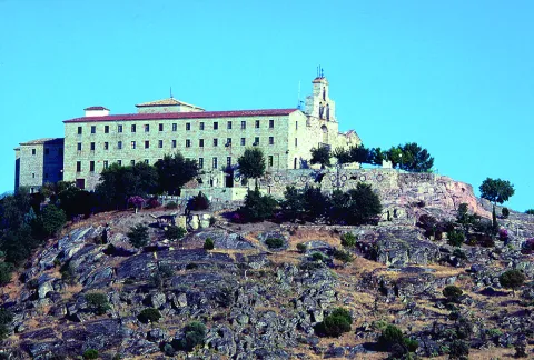
The Marian museum "Virgen de la Cabeza" is located in the very premises of the sanctuary (32 km from Andújar). Promised by the Trinity Fathers community, it contains an important artistic, documentary and anthropological exhibition of the historical legacy towards devotion to the Virgin of the Head.

Telecomunicaciones
Sitio web
www.santuariovirgencabeza.org
Teléfono de contacto
953 509 015
Correo electrónico
secretaria@santuariovirgencabeza.org
Ubicación
Nombre
Santuario de la Virgen de la Cabeza
Código Postal
23740
Latitud
38.039236
Longitud
-4.050560
Distrito
Municipio
Ubicación en el mapa
POINT (-4.05056 38.039236)
Tipos de punto de interés
Imágenes carrusel
imagen
Image
6.jpg
Imagen principal
Desactivado
imagen
Image
DSC00639-1.jpg
Imagen principal
Desactivado
imagen
Image
5.jpg
Imagen principal
Desactivado
imagen
Image
Anotaci%C3%B3n%202020-04-16%20082158.jpg
Imagen principal
Desactivado
imagen
Image
Mon503.jpg
Imagen principal
Desactivado
Imágenes cabecera
imagen
Image
Anotaci%C3%B3n%202020-04-16%20082134.jpg
Imagen principal
Activado
Horario
Winter: Saturday 11: 00 - 13: 00 and 16: 00 - 20: 00. Groups can make an appointment. Summer: Saturday 11: 00 - 13: 00 and 16: 00 - 20: 00. Groups can make an appointment.
Microsite al que pertenece
Loading map
Preparing points of interest and routes...

Museum of the Batalla de las Navas de Tolosa

Submitted by brandcode_deweloper on
Id
319212
Descripción
Descripción larga

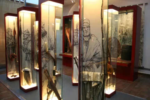
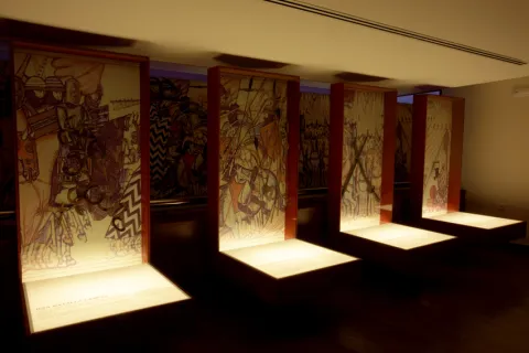
The seizure of the fortress of Salvatierra, the province of Ciudad Real, by the Almohades in September 1211, prompted Alfonso VIII of Castilla to organize a campaign for the summer of 1212 with which to destroy the Almohade military capacity, inciting Innocent III to enact a bull that turned the campaign into a crusade. This is a decisive act, as it brings them together with the company across Europe and gentlemen of the different military orders.

On June 20, 1212, three troops left Toledo: Aragonese and Catalan under the command of Peter II of Aragon; Castilians with his king Alfonso VIII; and Ultramontans; Leonese and Portuguese under the orders of Don Diego López de Haro, lord of Vizcaya. The troops of López de Haro, in their advance, take the castles of Malagon (24 June) and Calatrava (1 July), the latter by capitulation. The lack of booty and the course of events began to create unrest among foreign combatants, most of whom decided to return to their places of origin.

The Almohad Caliph Muhammad al-Nasir in whose army were integrated fighters from the Maghreb, from sub-Saharan territories and from Turkish troops, set in motion his men who leave Jaén with the aim of blocking Christian troops in Sierra Morena.

Between 4 and 6 July Alfonso VIII continued his progress by taking several fortifications, including that of Alarcos. With the arrival of Sancho VII of Navarra the total of Christian armies is gathered at the foot of the castle of Salvatierra, from where they continued in search of the Almohade army.

On July 12 advanced from Don Diego López de Haro took the Puerto del Muradal, with the fortification of Castro Ferral. Two days later, after being blocked in the passage of the Slayer, they camp in the place known as the King's Table, from where they go to the battle that took place on July 16, defeating the Alphade army that will withdraw from the fortresses that defended the entrance to the Guadalquivir Valley. On July 19 they occupied Baeza and a day later they besieged Ubeda, who would eventually capitulate.

After the campaign was completed and access to the Guadalquivir Valley was assured, Christians withdrew to their kingdoms in the north.

Archaeological investigations seem to confirm some of the sites where the written sources placed the contenders' camps. The results obtained by archaeological prospecting in Mesa del Rey corroborate the presence of a camp occupied not only by the troops, but also by higher-ranking characters of the Christian army, having identified areas within the internal organization of the camp, such as that intended to change the horseshoes of the beasts. It can be proposed that the King's Bureau be the place that occupied the troops of King Alfonso VIII of Castile, but not all of the Christian armies.

Similarly, in the surroundings of the castle of Castro Ferral, the great concentration of weapons material can be interpreted as the vestiges of the assault by Alfonso VIII's troops to the fortress. Parts related to daily life have also been documented in El Ferral and its military function (horsemen, furniture elements, garrison of clothing, tools, nails and passers).

The set of recovered pieces points to the existence of a large concentration of materials related to the battle, despite the intense expolity suffered throughout the area for more than a century.

LEYENDAS

The pastor of the Navas de Tolosa. In July 1212 the Christian hosts, on their way to the heart of al- Andalus, were to cross Sierra Morena through the natural passage of La Losa, a narrow throat in the port of Muradal, defended by the fortress of Castro Ferral. Alfonso VIII sent Don Diego López de Haro to take the castle, but despite his conquest, the road remained strongly defended.

At the Christian camp came a man from the place, a connoisseur of those border lands, who showed them an alternative path between the mountains, leading Don Diego López de Haro and his troops to a high-level, ever since known as the King's Table. In it, the Christian camp was set up to launch its offensive against the Almohad army, on July 16, 1212, a confrontation that would open the door of al-Andalus to the Christian armies. The man who showed them the way was called Martin Halaja, a shepherd for some, a hunter for others and for the most pious of the same Saint Isidro.

Breve descripción

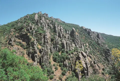
The Battle of the Saves of Tolosa of July 16, 1212 was one of the most prominent milestones in the medieval history of Peninsular, for its significance in the advance of the Christian kingdoms over al- Ándalus. Conceived as a crusade, which was preached by Pope Innocent III, he faced an army of men coming not only from the Peninsular realms, but from the other side of the Pyrenees, commanded by the Christian kings, Alfonso VIII of Castile, Peter II of Aragon and Sancho VII of Navarra, against the Almohad Caliph of Muhammad al-Nasir, in whose army were integrated fighters from the Maghreb, from sub-Saharan territories and from Turkish contingents. The Almohad defeat meant the beginning of the definitive conquest of al- Ándalus by the peninsular Christian kingdoms.
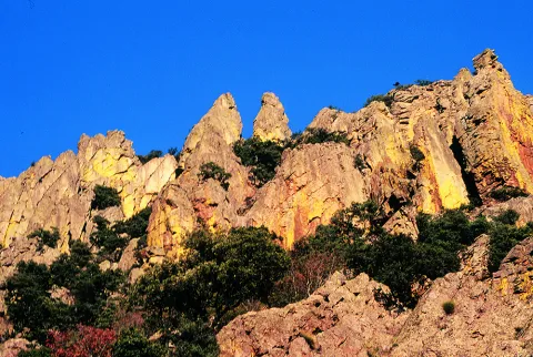
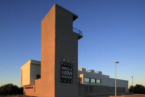
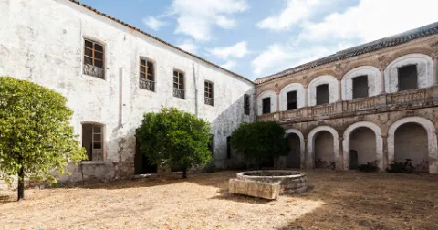
In the Park of Despeñacolos, within walking distance of the place of battle, is the Museum of the Battle of the Navas de Tolosa, in the town of Santa Elena. A centre in which visitors are guided by the history of the contest, from the prolegomens to the war, through audiovisual and scenography, teaching workshops or visits to the battlefield and the Natural Park of Despeñacolos. It is also a starting point and information of the Route of the Castles and Battle of the Kingdom of Jaén.

Telecomunicaciones
Teléfono de contacto
953 459 693
Correo electrónico
museoyturismosantaelena@gmail.com
Ubicación
Código Postal
23213
Latitud
38.342790
Longitud
-3.548910
Dirección
Carretera de Miranda del Rey, s/n
Distrito
Municipio
Ubicación en el mapa
POINT (-3.54891 38.34279)
Tipos de punto de interés
Imágenes carrusel
imagen
Image
Santa%20Elana%20-%20Museo%20Batalla%20Navas%20%281%29.jpg
Imagen principal
Desactivado
imagen
Image
PICT8132.JPG
Imagen principal
Desactivado
imagen
Image
batalla-navas-tolosa.jpg
Imagen principal
Desactivado
imagen
Image
Stoa-M%2CN%2CT020.jpg
Imagen principal
Desactivado
imagen
Image
Museo%20Navas%20039%20%282%29.jpg
Imagen principal
Desactivado
imagen
Image
Stoa-M%2CN%2CT059%20%281%29.jpg
Imagen principal
Desactivado
imagen
Image
Stoa-M%2CN%2CT024%20%281%29.jpg
Imagen principal
Desactivado
Imágenes cabecera
imagen
Image
_MG_6954%20%281%29.jpg
Imagen principal
Activado
Horario
Oct - may: Tuesday to Saturday 10: 00 - 14: 00 and 16: 00 - 19: 00, Sunday 10: 00 - 14: 00 and 15: 30 - 18: 30, Monday closed (except holidays and eve). Jun - Sept: Tuesday to Saturday 10: 00 - 14: 00 and 17: 00 - 20: 00.
Otros servicios
  • Guided tours.
  • Audio-guides.
  • Shop.
  • Coffee shop.
  • Conference and multiple-use rooms.
  • Beer area and games.
  • Parking.
  • Storage and delivery.
  • Tourist information of the province.
  • Hiking on the battlefield.
  • Routes through the Natural Park of Despeñacolos.
  • Educational workshops for schoolchildren
Loading map
Preparing points of interest and routes...
Interés

Museum of Artes Plásticas "Antonio González Orea"

Submitted by brandcode_deweloper on
Id
5871105
Descripción
Breve descripción

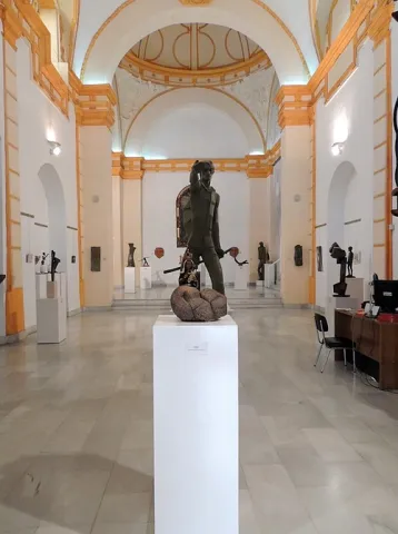
The Museum is located in the Old Convent of Capuchino Mothers. The building is of a conventional type, it responds to a single ship, covered by a canyon vault with lunetes in all its sections, with the exception of that of the major chapel, in which a semi-spherical vault appears on the breast.

Telecomunicaciones
Teléfono de contacto
953 505 903
Correo electrónico
museorea@gmail.com
Ubicación
Código Postal
23740
Latitud
38.041210
Longitud
-4.056820
Dirección
C/ Calancha, 19
Distrito
Municipio
Ubicación en el mapa
POINT (-4.05682 38.04121)
Tipos de punto de interés
Imágenes carrusel
imagen
Image
Museo%20G%C3%B3mez%20Orea%20%281%29%20%281%29.jpg
Imagen principal
Desactivado
imagen
Image
Museo%20G%C3%B3mez%20Orea%20%282%29.jpg
Imagen principal
Desactivado
Imágenes cabecera
imagen
Image
Museo%20G%C3%B3mez%20Orea%20%283%29.jpg
Imagen principal
Activado
Horario
Thursday to Saturday: 10: 00 - 14: 00 and 17: 00 - 20: 00.
Microsite al que pertenece
Loading map
Preparing points of interest and routes...

City Walls

Submitted by brandcode_deweloper on
Id
1909116
Descripción
Descripción larga

After the Christian conquest, some of his canvases (those who would have suffered the greatest destruction in the assault on the village or were in a worse state of conservation) are reinforced through coatings made with walls of irregular rippled masonry, which in most cases are mounted on the tapiales, reaching the defenses higher height. For the defense of the paraments, new-floor towers are built and the tapial towers are reinforced.

The urban core was accessed through several doors, of which we have located two: La Villa and Santa Ana. They were protected or flanked by towers, or located in a wall break, which facilitated their defense and control of visitors.

Breve descripción

The urban fence or walls that surrounded and protected the core of the population were built in Islamic times, with a tapial of land on a small base of masonry. The canvases were defended by square-floor towers, built with the same material, not knowing if, at the adarve level, they would have any room or level, where the sentries were covered, or were crowned by levels of terraces.

Ubicación
Latitud
37.588140
Longitud
-4.081294
Distrito
Municipio
Ubicación en el mapa
POINT (-4.081294 37.58814)
Tipos de punto de interés
Imágenes carrusel
imagen
Image
murallas%20urbanas.png
Imagen principal
Desactivado
Imágenes cabecera
imagen
Image
main_image_79940.jpeg
Imagen principal
Activado
Loading map
Preparing points of interest and routes...

Natural Monument Quejigo del Amo o del Carbón

Submitted by brandcode_deweloper on
Id
2193220
Descripción
Descripción larga

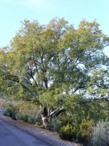
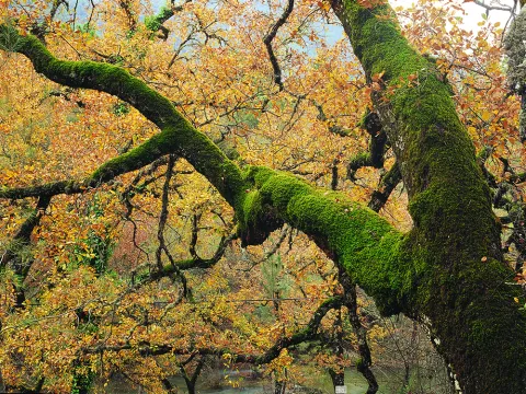
The complaint is one of the most representative trees of Mediterranean vegetation, especially of those territories with a subhumid climate. A few kilometers from the municipality ofValdepeñas de Jaénis found a centenary of this species, the Natural MonumentCoal Complaints.

Breve descripción

Located in the municipality of Valdepeñas de Jaén, this example of Quercus faginea Lam., representative of the native Mediterranean vegetation, is considered one of the largest dimensions of the Andalusian territory.

Ubicación
Latitud
37.594050
Longitud
-3.727670
Distrito
Ubicación en el mapa
POINT (-3.72767 37.59405)
Tipos de punto de interés
Imágenes carrusel
imagen
Image
PB120096.JPG
Imagen principal
Desactivado
imagen
Image
Quercus_faginea-400x533.jpg
Imagen principal
Desactivado
imagen
Image
Natu347.jpg
Imagen principal
Desactivado
Imágenes cabecera
imagen
Image
Natu014.jpg
Imagen principal
Activado
Microsite al que pertenece
Loading map
Preparing points of interest and routes...

Natural Monument Los Órganos de Despeñaperros

Submitted by brandcode_deweloper on
Id
5867289
Descripción
Descripción larga

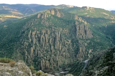
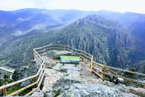
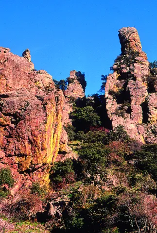
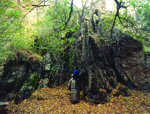
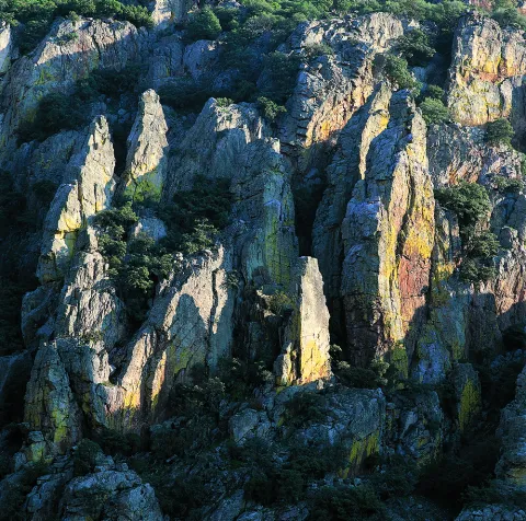
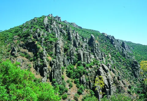
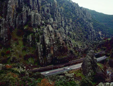
From the nearby viewpoint you can see this monument, whose origin is surprising. 500 million years ago the whole area was covered by the sea, though with little depth, so it was filled with sands and clays brought by the rivers that were flowing there from the Iberian plateau. It was 300 million years ago that the forces of the land made these lands emerge and since then, the erosion of the river, the rains and the wind have been sculpting the relief, creating beautiful forms like these organs. On these rocks, oaks, alcornoques and shrubs have found their substrate, forming a Mediterranean forest in which they inhabit ginets, chickpeas and numerous rapaces.

Breve descripción

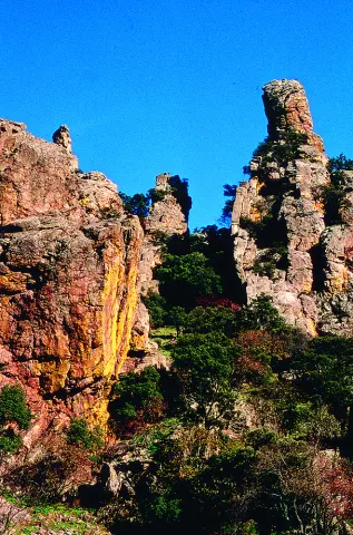
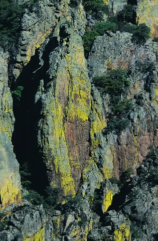
Declared Natural Monument of Andalusia. This Natural Monument is one of the most prominent places in the Despeñacolos Parade, where a set of huge rock columns are raised that resemble the tubes of an organ of a large cathedral. The beauty of this site increases the chromatic contrast of the rock grey with the intense yellow and orange of the different species of lichens that survive here.

Ubicación
Código Postal
23213
Latitud
38.411329
Longitud
-3.559652
Distrito
Municipio
Ubicación en el mapa
POINT (-3.559652 38.411329)
Tipos de punto de interés
Imágenes carrusel
imagen
Image
DESPENAPERROS%20%281%29.jpg
Imagen principal
Desactivado
imagen
Image
1615_MI_01.jpg
Imagen principal
Desactivado
imagen
Image
Natu020.jpg
Imagen principal
Desactivado
imagen
Image
Natu009.jpg
Imagen principal
Desactivado
imagen
Image
Natu066.jpg
Imagen principal
Desactivado
imagen
Image
Natu099.jpg
Imagen principal
Desactivado
imagen
Image
Natu392.jpg
Imagen principal
Desactivado
imagen
Image
Natu368.jpg
Imagen principal
Desactivado
imagen
Image
Natu331.jpg
Imagen principal
Desactivado
imagen
Image
Natu220.jpg
Imagen principal
Desactivado
imagen
Image
Natu160.jpg
Imagen principal
Desactivado
imagen
Image
Natu239.jpg
Imagen principal
Desactivado
Imágenes cabecera
imagen
Image
Parque_Natural_Despexaperros_3%20%281%29.jpg
Imagen principal
Activado
Loading map
Preparing points of interest and routes...