Saltar al contenido principal

Las Cimbras

Submitted by brandcode_deweloper on
Id
5846924
Descripción
Breve descripción

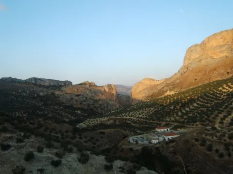
Great beauty rocky scarves that are attached in the urban case of Torres, next to the municipal pool. For its accessibility, climbing routes have been installed, for which it is necessary to be a federated sportsman or to hire the services of an authorized service company.

Ubicación
Latitud
37.689185
Longitud
-3.821449
Distrito
Municipio
Ubicación en el mapa
POINT (-3.821449 37.689185)
Tipos de punto de interés
Imágenes carrusel
imagen
Image
4781171%20%282%29.jpg
Imagen principal
Desactivado
Imágenes cabecera
imagen
Image
1934914Master%20%282%29.jpg
Imagen principal
Activado
Microsite al que pertenece
Loading map
Preparing points of interest and routes...

Las Cabritas

Submitted by brandcode_deweloper on
Id
5845992
Descripción
Breve descripción

Area of old gardens and mills belonging to the municipality of Huelma. Until well into the 20th century it was one of the most fruitful gardens in the province of Jaén. It cultivated multiple varieties of fruit and vegetables. Some of these varieties were inherited from ancient crops of the Middle Ages.

Ubicación
Latitud
37.695120
Longitud
-3.432440
Distrito
Municipio
Ubicación en el mapa
POINT (-3.43244 37.69512)
Tipos de punto de interés
Imágenes carrusel
imagen
Image
Las_Cabritas_%28Huelma%29.jpg
Imagen principal
Desactivado
Imágenes cabecera
imagen
Image
Las_Cabritas.jpg
Imagen principal
Activado
Microsite al que pertenece
Loading map
Preparing points of interest and routes...

Lagoon Honda

Submitted by brandcode_deweloper on
Id
7009935
Descripción
Descripción larga

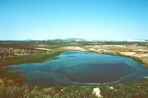
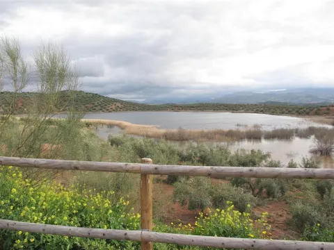
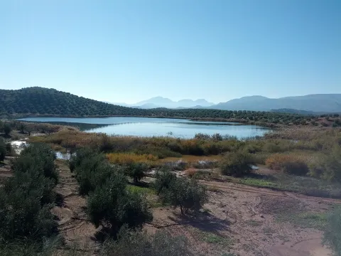
It has an area of 65 hectares, as well as an additional protection area around it of 220 hectares.

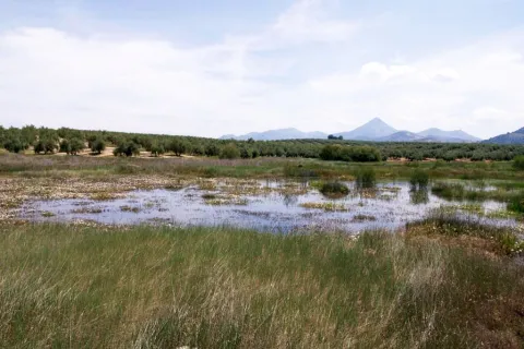
Laguna Honda is a humid, endemic area that is flooded with the first rains of autumn and remains as such until spring, with a small river mass, making it a seasonal lagoon although a small stream, which comes from the Sierra de Orbes, provides water flow.

This lagoon has a high saline content, caused by the materials of the substrate as well as the washing of adjacent land.

Vegetation

The area is surrounded by agricultural land of rainforest olive trees, highlighting its perilagunar palustre vegetation of eneas (typha dominguensis), carrizos (phragmites australis) and juncos. One of the primitive and still preserved plant varieties in this reserve is tarage.

Fauna

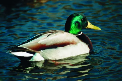
The main species that are located in Laguna Honda are vertebrates, always with a temporary or seasonal character, highlighting the aquatics, such as the hens (gallinula chloropus), easily recognizable because it emits a strong graznada, the common focal (fulica atra), which has the white peak and black plumage or the real anade (anas platyrhnchos), which has a yellow peak and is known as a common duck.

Breve descripción

This Nature Reserve is located to the south-west of the province of Jaén, in the area of Tumbalagraja, very close to the Casariche cortijo, passing very close to the line of the old railway Linares- Puente Genil, today Via Verde del Eil, between the Sierra Orbes, the Cambrón and the Desgarradero, and limiting with the province of Córdoba.

Ubicación
Latitud
37.600710
Longitud
-4.143600
Distrito
Municipio
Ubicación en el mapa
POINT (-4.1436 37.60071)
Tipos de punto de interés
Imágenes carrusel
imagen
Image
lagunaonda%20%281%29.jpg
Imagen principal
Desactivado
imagen
Image
ondalaguna.jpeg
Imagen principal
Desactivado
Imágenes cabecera
imagen
Image
1.jpg
Imagen principal
Activado
Loading map
Preparing points of interest and routes...

Lagoon of the Chinche

Submitted by brandcode_deweloper on
Id
2190731
Descripción
Descripción larga

Its importance is increased, as in the case of Laguna Honda, due to the shortage of wet areas in the province. Natural vegetation has been transformed and only remains of perilagunar vegetation remain. The most common species are carrizo, swordsman and tarage. The fauna of this nature reserve of 6.5 hectares of extension, as such, and 39 hectares of protection area, is related to that of the neighbouring Laguna del Conde or Salobral in the province of Córdoba.

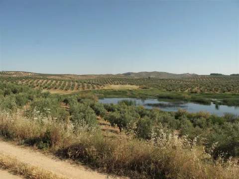
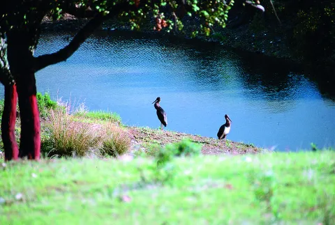
Surrounded by olive groves, it has a small natural vegetation of spadaws, reeds and carrizos. Among the aquatic birds, the occasional presence of pink flamingos, storks, royal anades and whistles and red ducks and spoon stands out. As for the terrestrial fauna, the rabbit and the red partridge abound in the area.

Breve descripción

On a relief of soft profiles is raised this lagoon of endorreic nature fed by the surface runoff. The wetland, located in the south-west Jiennense, is surrounded by agricultural land and olive groves.

Ubicación
Latitud
37.614040
Longitud
-4.152960
Distrito
Municipio
Ubicación en el mapa
POINT (-4.15296 37.61404)
Tipos de punto de interés
Imágenes carrusel
imagen
Image
20_RN_01%20%282%29.jpg
Imagen principal
Desactivado
imagen
Image
laguna-chinche%20%282%29.jpeg
Imagen principal
Desactivado
imagen
Image
Natu045.jpg
Imagen principal
Desactivado
Imágenes cabecera
imagen
Image
Natu043.jpg
Imagen principal
Activado
Microsite al que pertenece
Loading map
Preparing points of interest and routes...

Lagoon of las Casillas y laguna de las Navas

Submitted by brandcode_deweloper on
Id
4885202
Descripción
Breve descripción

They are seasonal lagoons located in the western part of the municipality. Since 2007 they have been registered in the inventory of wetlands in Andalusia. These two lagoons are ideal for the observation of aquatic and amphibian birds at some times of the year.

Ubicación
Código Postal
23650
Latitud
37.761010
Longitud
-3.951102
Distrito
Municipio
Ubicación en el mapa
POINT (-3.951102 37.76101)
Imágenes carrusel
imagen
Image
lagunanavas.png
Imagen principal
Desactivado
Imágenes cabecera
imagen
Image
4%20%283%29.jpg
Imagen principal
Activado
Microsite al que pertenece
Loading map
Preparing points of interest and routes...

La Puente

Submitted by brandcode_deweloper on
Id
912688
Descripción
Descripción larga

Cobos not only had territorial jurisdiction over these populations, but also exercised strong control over all of them of their Councils and their inhabitants.

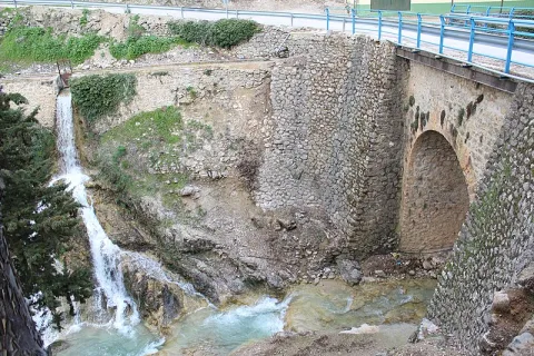
In Torres, apart from certain actions to preserve the medieval castle, the Council planned various works throughout the 16th century, such as the capitular houses, the posite, the reform of the parish temple and a bridge, absolutely necessary to unite the town with the site of the Fuenmayor, where the mills of the secretary Cobos were located, by which the neighbors were required to pass. In the population, the only one who had a privilege to build mills was Cobos and his wife, Maria de Mendoza. Their control assured them of a safe income, so it was absolutely necessary to keep the bridge in good condition.

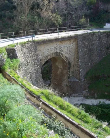
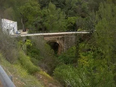
Dead Cobos, Mrs. Maria de Mendoza, through his butler Bartolomé Ximénez, ordered the Council to make a new bridge, as the old man was destroyed by a heavy storm. The project was carried out by Andrés de Vandelvira, an architect at the service of the family of Cobos. According to María José Sánchez Lozano the works began in 1561, and the following year the Council agreed that all that was left to rise from it should be done according to the trace of Andrés de Vandelvira: "(...) I saw what is left to be made of the work of the bridge that is to be done in the river of the said villa for the passage of the mills of the bread of his lordship (...) command that everything that is left to be made of the bridge be done by the trace that has given Andrés de Vandelvira (...). The bridge, which is currently preserved, although removed, is made of stone and has a single half-point eye rather high, as the ravine on which it rises is very deep in this area.

Vandelvira draws a bridge without great pretensions, without decorative attachments, in which security and permanence in time must take precedence over other aspects. Vandelvira will be an experienced bridge builder, sometimes simple as this one of Torres, others of great architectural and engineering monumental, such as those raised on the channels of the Guadalmena, Guadalimar (Ariza) and Guadalquivir (Mazuecos) rivers.

Breve descripción

In 1539 the Secretary of Charles V, the ubetense Don Francisco de los Cobos, acquired the villas of Canena and Torres, which were alienated by the Crown to the Military Orders of Santiago and Calatrava. With this double purchase he rounded Cobos his heritage; years earlier, in 1537 he also made it with the villa of Sabiote, head of his large lordship, completed with the acquisition of Jimena and Recena by his wife Maria de Mendoza.

Telecomunicaciones
Sitio web
www.torresturismo.es
Teléfono de contacto
953 363 011
Correo electrónico
info@torresturismo.es
Ubicación
Código Postal
23540
Latitud
37.786140
Longitud
-3.509730
Distrito
Municipio
Ubicación en el mapa
POINT (-3.50973 37.78614)
Tipos de punto de interés
Imágenes carrusel
imagen
Image
La%20Puente%202.jpg
Imagen principal
Desactivado
imagen
Image
La%20Puente.jpg
Imagen principal
Desactivado
Imágenes cabecera
imagen
Image
800px-La_Puente%2C_Torres_24J_02.jpg
Imagen principal
Activado
Microsite al que pertenece
Loading map
Preparing points of interest and routes...

La Laguna

Submitted by brandcode_deweloper on
Id
5928867
Descripción
Breve descripción

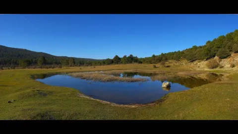
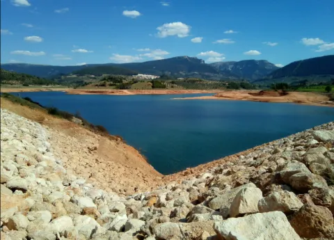
The Laguna de Siles is approximately 150 m in diameter and 3 m in maximum depth depending on the station. To access La Laguna, from the municipality of Siles, an indicative lane is taken in the direction of El Puntal. At one of the crosses to the left, a lane goes straight to the place, and is very well identified with signs.

Ubicación
Latitud
38.377901
Longitud
-2.537913
Distrito
Municipio
Ubicación en el mapa
POINT (-2.537913 38.377901)
Imágenes carrusel
imagen
Image
4.jpg
Imagen principal
Desactivado
Imágenes cabecera
imagen
Image
pantanosiles.png
Imagen principal
Activado
Loading map
Preparing points of interest and routes...

The Pond

Submitted by brandcode_deweloper on
Id
4658699
Descripción
Descripción larga

This spring has never been enough to fertilize all the lands that extend on a decreasing level towards the Guadalbullion River. On the other hand, the years of drought have always been very numerous, in which the volume of this source was significantly reduced, because the piezometric surface of the aquifer located to the north of the population, which gives rise to the Charca spring, is linked to driving through galleries with siphoning phenomena.

Breve descripción

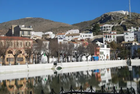
La Charca is a reservoir that collects the waters of the birth of the Fuente de la Reja from medieval times. In the beginning it was a simple dam with a containment stone wall and gates that regulated the water output through an intricate network of miles of waterfalls. These irrigated the orchard and olive lands located to the south of the urban core, distributed in banks. The higher caces served as a southern limit to the population, thus delimiting the urban growth of Pegalajar.

Ubicación
Código Postal
23110
Latitud
37.739660
Longitud
-3.644450
Distrito
Municipio
Ubicación en el mapa
POINT (-3.64445 37.73966)
Imágenes carrusel
imagen
Image
lacharca.jpg
Imagen principal
Desactivado
Imágenes cabecera
imagen
Image
charca-kM3F-U501644234364StF-624x385%40Ideal.jpg
Imagen principal
Activado
Microsite al que pertenece
Loading map
Preparing points of interest and routes...

The Priest's House

Submitted by brandcode_deweloper on
Id
6547993
Descripción
Breve descripción

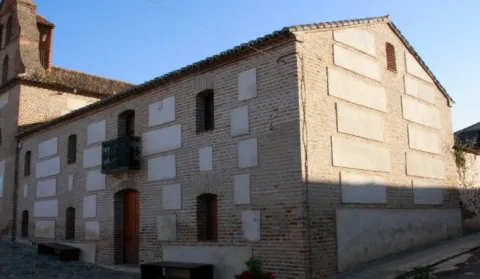
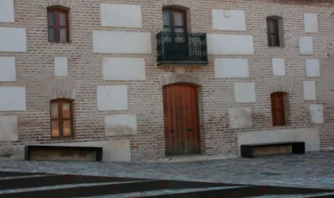
Located on the side of the church, the house of the priest is currently in the process of restoration after a time of abandonment.

Telecomunicaciones
Sitio web
www.aldeaquemada.com
Teléfono de contacto
680 104 199
Correo electrónico
turismo.aldeaquemada@gmail.com
Ubicación
Código Postal
23215
Latitud
38.412170
Longitud
-3.371710
Dirección
C/ Miguel Hernández, 4
Distrito
Municipio
Ubicación en el mapa
POINT (-3.37171 38.41217)
Tipos de punto de interés
Imágenes carrusel
imagen
Image
1.jpg
Imagen principal
Desactivado
Imágenes cabecera
imagen
Image
3.jpg
Imagen principal
Activado
Loading map
Preparing points of interest and routes...

The Civil Commander's House

Submitted by brandcode_deweloper on
Id
6549854
Descripción
Breve descripción

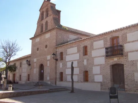
In the church, this house has had several functions, some of which are the City Council and currently the home of the retired. For many years it was used as a poultry of braves during the holidays.

Telecomunicaciones
Sitio web
www.aldeaquemada.com
Teléfono de contacto
680 104 199
Correo electrónico
turismo.aldeaquemada@gmail.com
Ubicación
Código Postal
23215
Latitud
38.411930
Longitud
-3.371660
Dirección
C/ Miguel Hernández, 4
Distrito
Municipio
Ubicación en el mapa
POINT (-3.37166 38.41193)
Tipos de punto de interés
Imágenes carrusel
imagen
Image
1001176.jpg
Imagen principal
Desactivado
Imágenes cabecera
imagen
Image
Aldeaquemada%20-%20Iglesia%20%281%29.jpg
Imagen principal
Activado
Loading map
Preparing points of interest and routes...