Saltar al contenido principal

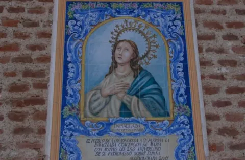
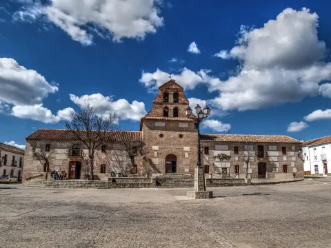
Church of the Purísima Concepción

Submitted by brandcode_deweloper on
Id
6549415
Descripción
Descripción larga

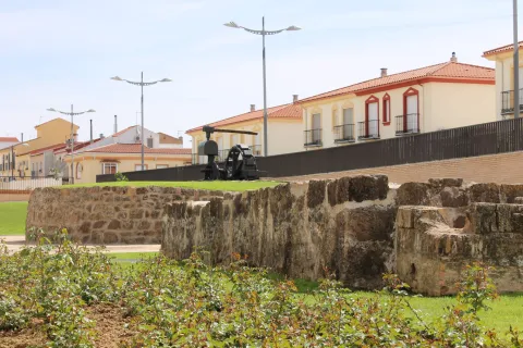
There are two houses on both sides of the church, corresponding to the old house of the priest and the post commander.

Breve descripción

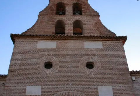
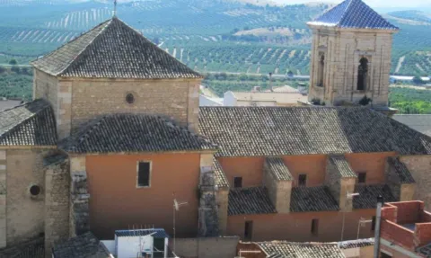
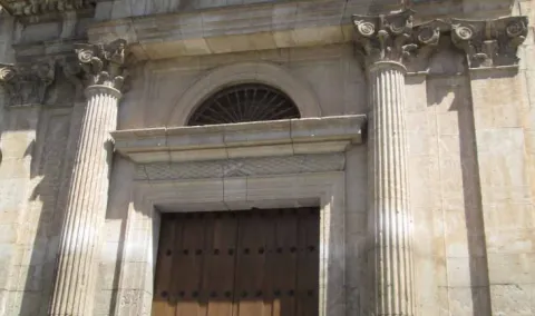
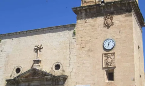
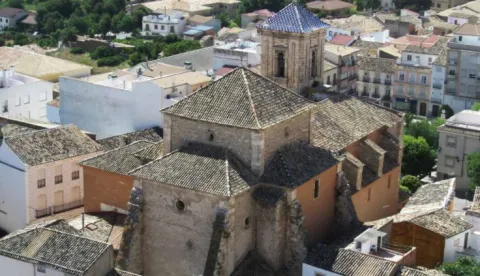
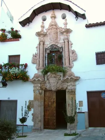
One-ship colonial-type church of the 18th century. Its facade is made of brick and is articulated in two bodies, in the first, in a rectangular way, the only differentiated elements are a narrow cover with a half-point arch and above, two lunetes that keep the line of horizonality; in the second body, a swordsman body with a bell tower that culminates in a small front.

Telecomunicaciones
Sitio web
http://www.aldeaquemada.com/historia/arquitectura/index.html
Teléfono de contacto
680 104 199
Correo electrónico
turismo.aldeaquemada@gmail.com
Ubicación
Código Postal
23215
Latitud
38.412050
Longitud
-3.371720
Dirección
C/ Miguel Hernández, 4
Distrito
Municipio
Ubicación en el mapa
POINT (-3.37172 38.41205)
Tipos de punto de interés
Imágenes carrusel
imagen
Image
aldeaquemada_3.jpg
Imagen principal
Desactivado
imagen
Image
2%20%281%29.jpg
Imagen principal
Desactivado
Imágenes cabecera
imagen
Image
3.jpg
Imagen principal
Activado
Loading map
Preparing points of interest and routes...

Church of the Inmaculada Concepción de Huelma

Submitted by brandcode_deweloper on
Id
5857399
Descripción
Descripción larga

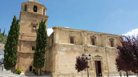
In front of the works in this constructive phase were Francisco del Castillo "El Viejo" and Domingo de Tolosa. In 1547 Andrés de Vandelvira and Juan de Maeda assessed the works carried out by Castillo and Domingo de Tolosa, focusing primarily on the lifting of the major chapel and the first section of the temple. It is the first documented news about the intervention of Andrés de Vandelvira in this church, whose initial approach will be changed by this teacher by 1559. The changes introduced by Vandelvira affected the remaining sections: the ships are equal in width and height, among the counterstrong are chapels, the initial nervations of the vaults are changed by bays, the pillars, with semi-columns and Corinthian backpilars, are now cruciforms and with a more classical modulation, similar to those employed in the cathedrals of Baeza and Jaén.

The work on foot was, among other teachers, under the direction of Castillo "El Viejo," but in 1564 the contract that this master had signed with the church was transferred to his son Francisco del Castillo "el Joven," related since 1555 to the construction. "El Joven" Castle followed the guidelines marked by Vandelvira, which visited Huelma in 1569 and 1570 to assess the works. In 1575, the year of the death of Andrés de Vandelvira, the factory was quite advanced, but some vaults and exteriors were to be finished with the covers, the sacristy and the bell tower. He now appears as a master of the Francisco del Castillo "El Joven" factory, which will be in charge of it until his death in 1586. The central vault, with a sculptural program completed by Marcos Hernández in 1584, and five other decorated with geometric motifs of the mannerism, were worked under its supervision, highlighting the third decorated with the weapons of the Giennese prelate Francisco Sarmiento de Mendoza (1580-1595).

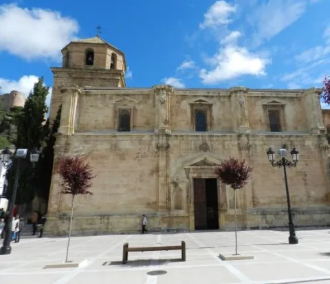
The last three vaults are no longer of stone, but of brick, and were removed after the death of Castillo along with the sacristy, whose disposition in "L" reminds us of the solution proposed by Vandelvira in the dependencies of the Jaén Cathedral. The exteriors, a work of Castillo "el Joven," present one of the most elegant heights built in the 16th century within the Andalusian religious architecture. Castillo "El Joven" introduces in these exterior models of civil architecture taken from the architectural treaties of Sebastián Serlio. The rhythm of this plateau is marked by the Corinthian pilasters placed on the two floors, by the windows adintered with triangular frontons and by the cover, highlighting that of the south, equally adintered and crowned by large triangular fronton and flanked with hornadoes. Heraldic, mascara, garlands, masked cornels and other elements of the mannerist repertoire complete the beauty of the whole, finally finished already within the 17th century with a large tower of bells, in whose second body the shield of Bishop Moscoso and Sandoval (1619- 1646) appears. The temple of Huelma - as Rafael López Guzmana points out - "perfectly shows the aesthetic evolution that occurs in the Kingdom of Jaén during the 16th century; in addition to having, in its realization, the most outstanding teachers of the moment."

OTHER ARTISTICAL MANIFESTIONS

Of the important set of movable goods that this magnificent temple was acquiring over the centuries, there is nothing left, as they were completely destroyed in the last Civil War (1936-1939). We know that in the major chapel there was a good altarpiece drawn at the end of the 16th century by Sebastián de Solís, which was supported by the sculptor Cristóbal Téllez and the assembler Blas Briñón. Today, the chapel is painted by Juan Almagro (Pegalajar, 1886-1965), and a size of a Risen one is worth it. Of some value is a canvas of granadine school of the Immaculate Conception, anonymous work of the last third of the 17th century.

Breve descripción

Declared a Monument on June 5, 1981, this 16th century temple in the province of Jaén is one of the most notable examples of the religious architecture of the time. Under the direction of Diego de Siloe, the master master of the cathedral of Granada, an initial floor was built with a rectangular major chapel, three ships with Gothic vaults and square pillars on basements crowned with entrenches. Featured artists such as Francisco del Castillo el Viejo, Andrés de Vandelvira and Francisco del Castillo, the Mozo, also participated in his execution. In the middle of the century, classical elements of the Renaissance were incorporated, and the southern and northern facades follow a similar scheme, with a four-body tower attached to the western facade. This temple has been declared Good of Cultural Interest.

Ubicación
Latitud
37.650440
Longitud
-3.460970
Dirección
C/ Ancha, 6
Distrito
Municipio
Ubicación en el mapa
POINT (-3.46097 37.65044)
Tipos de punto de interés
Imágenes carrusel
imagen
Image
2340286_orig.jpg
Imagen principal
Desactivado
Imágenes cabecera
imagen
Image
igleisa-huelma.jpg
Imagen principal
Activado
Loading map
Preparing points of interest and routes...

Church of the Asunción

Submitted by brandcode_deweloper on
Id
5712493
Descripción
Descripción larga

The beautiful tower is the work of John de Aranda (1640) decorated with episcopal shields. The cover is neoclassical from the end of the 18th work of Manuel Caballero, one of the best in the province due to its airful proportions. Located on the wall, there is the valuable 'Ibero-Latin inscription of Galdur' old cradle city of Jódar, of the 1st century. C. This practice served to enaltecer the classical antiquity, where this architectural style found its roots.

History

It was built on the primitive Mosque, documented by the Arab geographer Al-Himyari, which mentions that it was "three ships supported by marble columns."

His primitive advocation was that of Santa Maria, not knowing what the primitive building was, only that the Altar Mayor was oriented to the west and its main door to the north, next to the so-called "Source of the Place." The first documentary data on the works of the present temple dates back to 1547, bringing the stone from the quarry of Bedmar. In 1569 the Sunday Master of Uriarte worked on it. From 1582 to 1589 the work was carried out by Juan Vizcaino. In 1591, the Gaspar and Francisco de Aranda brothers were mentioned as builders and singers, building the central ship with their six side chapels with cassette vaults, so to the use of Vandelvira, who was the supervisor of the works of the temples of the Diocese. The whole set is of Renaissance-purist style.

In 1613 the construction of the Tower began, according to the trace of Juan de Aranda Salazar in a baroque style. Three shields belonging to the Bishops are carved in stone: Sancho Dávila, Cardinal Moscoso and Fernando Andrade, in the work of the Masters Francisco de Zamora, Alonso Galan, Andrés and Diego Guerrero, being completed in 1661 by Euphrassio López de Rojas, a shield of Sancho Dávila is found inside. One of its four bells is 1794.

In 1729 he repaired the header or Major Chapel by Juan de Consuegra. From 1771 to 1780 is built the current cruise, Capilla Mayor and dome of the Evangelists in neoclassical style with details of the rocky in the dome that was built by Pedro Fernández, Manuel and Juan Armenteros. In 1799, the pulpits and graderies were placed and the construction of the Main Fachada in neoclassical style was started by Manuel Caballero, who finished it, along with the choir in 1801. According to some historians, the façade is one of the best in the province because of its irous proportions. In 1864 the Capels of Expiration and Baptism were built. In 1877 the construction work of the Chapel of San José, directed by the architect Pedro Pascual Samaniego, with elegant orange half, was completed and decorated with interesting frescoes from 1915. From 1989 to 1992 the temple suffered a profound restoration by adding elements that further enhance its interior as several altarpieces in Macael marble and stone, the magnificent Reja and silery of the Chapel of San José, lighting, etc.

Breve descripción

With a classical Renaissance façade, the main temple of the town dates from mid-XVI, at which time it was built on the site of an ancient church of Santa Maria which in turn was located on the major mosque. It is a Latin cross plant with side chapels like Andrés de Vandelvira. Covered with canyon vault and dome on breast on the cruise. The cruise, the presbytery and the major chapel are 1775.

Telecomunicaciones
Sitio web
www.iasuncion.es
Teléfono de contacto
953 327 100 / 953 785 157
Ubicación
Código Postal
23500
Latitud
37.844840
Longitud
-3.352880
Dirección
C/ Juan Martín, 1
Distrito
Municipio
Ubicación en el mapa
POINT (-3.35288 37.84484)
Tipos de punto de interés
Imágenes carrusel
imagen
Image
Igleisa-de-asuncion.jpg
Imagen principal
Desactivado
imagen
Image
2.jpg
Imagen principal
Desactivado
imagen
Image
4.jpg
Imagen principal
Desactivado
Imágenes cabecera
imagen
Image
3.jpg
Imagen principal
Activado
Microsite al que pertenece
Loading map
Preparing points of interest and routes...

Hútar

Submitted by brandcode_deweloper on
Id
5848201
Descripción
Breve descripción

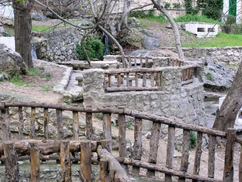
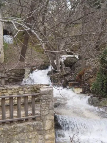
Water spring located in the municipal term of Albanchez de Magina, just where the Hútar stream is born. It is a traditional area of meringeros, with barbecues, swimming pool and games for children among other facilities..

Ubicación
Latitud
37.792170
Longitud
-3.466120
Distrito
Ubicación en el mapa
POINT (-3.46612 37.79217)
Tipos de punto de interés
Imágenes carrusel
imagen
Image
hutar.jpeg
Imagen principal
Desactivado
Imágenes cabecera
imagen
Image
Hutar.jpg
Imagen principal
Activado
Microsite al que pertenece
Loading map
Preparing points of interest and routes...

Cora Botanical Garden

Submitted by brandcode_deweloper on
Id
5713992
Descripción
Descripción larga

Since 2013 the Association of the Cultural Garden of the Cora, has had the institutional recognition and the transfer of the land by unanimous agreement of all the political groups of the City of Jódar.

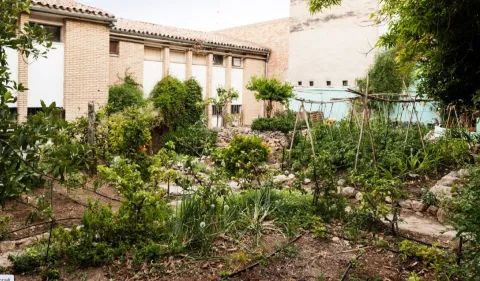
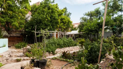
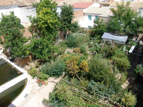
Everything in the Garden of Cora has a why, a story that goes unnoticed in the eyes of the visitor. It is necessary to decipher the meaning of each component or inhabitant of this space in order to understand the true value of what the walls of this old school, which despite not being occupied by children's laughter and games, remain synonymous with life and the future.

Thanks to the work of the members of the Echo Cultural Association of the Garden of Cora, here is a real laboratory activity; the recovery and conservation of local seeds - or other sources - at risk of extinction as well as the cultivation of specimens from other areas of the planet that are considered especially interesting based on the climatic conditions of the area.

Breve descripción

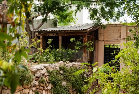
Located in the municipality of Jódar, in an old school that was occupied in the early 1990s, the Garden of Cora is a reality built thanks to the solidarity and selfless work of the people who are members of the association that manages it.
In its banks it houses a complex amalgam of promising species and plant varieties of high agroecological value, extremely unique and many of them almost unknown or at risk of disappearance, a fact that has attracted visits by experts and scholars from countless points on the planet. To date, the garden maintains a quota of about 400 different varieties - either in direct cultivation through its seed bank.

Telecomunicaciones
Sitio web
https://huertodelacora.es.tl/
Teléfono de contacto
622 345 626
Ubicación
Código Postal
23500
Latitud
37.838500
Longitud
-3.354360
Dirección
C/ Sevilla, 29
Distrito
Municipio
Ubicación en el mapa
POINT (-3.35436 37.8385)
Tipos de punto de interés
Imágenes carrusel
imagen
Image
7.jpg
Imagen principal
Desactivado
imagen
Image
6.jpg
Imagen principal
Desactivado
imagen
Image
5.jpg
Imagen principal
Desactivado
Imágenes cabecera
imagen
Image
8.jpg
Imagen principal
Activado
Microsite al que pertenece
Loading map
Preparing points of interest and routes...

Huerta Vieja (Camping Area ontrolada)

Submitted by brandcode_deweloper on
Id
880967
Descripción
Descripción larga

Tranco road A-319, in the surroundings of the Tranco reservoir.

Breve descripción

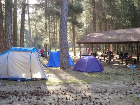
Large area surrounded by lush vegetation, with fountain and wooden dining area, crossed by a stream. When you are not occupied by a camp, it is an excellent place to eat and rest. Very close is also the delicious place where the village of Bujaraiza was, abandoned since the construction of the Tranco reservoir.

Ubicación
Latitud
38.117830
Longitud
-2.806540
Dirección
Carretera del Tranco A-319
Distrito
Municipio
Ubicación en el mapa
POINT (-2.80654 38.11783)
Imágenes carrusel
imagen
Image
Huerta%20Vieja%202.jpg
Imagen principal
Desactivado
imagen
Image
Huerta%20Vieja%201.jpg
Imagen principal
Desactivado
Imágenes cabecera
imagen
Image
huerta-vieja.jpg
Imagen principal
Activado
Loading map
Preparing points of interest and routes...

Orchard of the Sordo o Huerta de San Lázaro

Submitted by brandcode_deweloper on
Id
6616170
Descripción
Descripción larga

That historic day will play an important role, as the heat attached to the scarcity of the liquid element for the French troops would be a key factor in defeating the Galo army, which in the last moments of the struggle would despair to reach the desired place where to satisfy the unbearable thirst. The popular tradition tells us that many of these soldiers will be thrown into the river of the San Lazaro Garden, the only place near with water, with the following phrase "To die here and resurrect in Paris."

Breve descripción

The Orerta de San Lazaro, or commonly known as the Orerta del Sordo, is a prominent symbol of the battle of 1808, where both armies converge during the Battle of Bailen of 1808. Declared as Good of Cultural Interest with a category of "Historic Site," it retains within it the old line that acted as a dividing line between the French and Spanish army during the battle.

Ubicación
Latitud
38.092970
Longitud
-3.786950
Distrito
Municipio
Ubicación en el mapa
POINT (-3.78695 38.09297)
Tipos de punto de interés
Imágenes carrusel
imagen
Image
unnamed%20%281%29.jpg
Imagen principal
Desactivado
Imágenes cabecera
imagen
Image
huerta-san-lazaro-scaled-jpg
Imagen principal
Activado
Microsite al que pertenece
Loading map
Preparing points of interest and routes...

Hospital of Cambil

Submitted by brandcode_deweloper on
Id
5856970
Descripción
Breve descripción

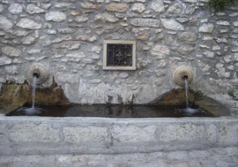
An interesting example of Baroque architecture in the rural environment, this building retains the façade of the second half of the 18th century.
Ubicación
Latitud
37.675940
Longitud
-3.566600
Dirección
C/ Hospital, 3
Distrito
Municipio
Ubicación en el mapa
POINT (-3.5666 37.67594)
Tipos de punto de interés
Imágenes carrusel
imagen
Image
hospital%20cambil.jpg
Imagen principal
Desactivado
imagen
Image
hospital%20cambil%202.jpg
Imagen principal
Desactivado
Imágenes cabecera
imagen
Image
Hospital_Cambil.jpg
Imagen principal
Activado
Microsite al que pertenece
Loading map
Preparing points of interest and routes...

Fountain of the Gargantón

Submitted by brandcode_deweloper on
Id
5845859
Descripción
Breve descripción

Caudalosa fountain fed by the Garganton River, one of the most important watercourses on the southern side of the Sierra Magina mountains. In summer the park and the bar next to the fountain are places to stop.

Ubicación
Latitud
37.723720
Longitud
-3.382640
Distrito
Ubicación en el mapa
POINT (-3.38264 37.72372)
Tipos de punto de interés
Imágenes carrusel
imagen
Image
1465030943_456942_1465032471_album_normal%20%281%29.jpg
Imagen principal
Desactivado
imagen
Image
fuente%20%282%29.jpg
Imagen principal
Desactivado
Imágenes cabecera
imagen
Image
13641265.jpg
Imagen principal
Activado
Microsite al que pertenece
Loading map
Preparing points of interest and routes...

Fountain of the Seda

Submitted by brandcode_deweloper on
Id
1735506
Descripción
Breve descripción

Source and public laundry that gives name to the area where the bushes were grown. The production and trade of silk, introduced by Muslims, was one of the economic bases of Albanchez until the 18th century.

Ubicación
Código Postal
23538
Latitud
37.794312
Longitud
-3.464879
Dirección
Camino de Bedmar, s/n
Distrito
Ubicación en el mapa
POINT (-3.464879 37.794312)
Tipos de punto de interés
Imágenes carrusel
imagen
Image
fuente%20de%20la%20seda.jpg
Imagen principal
Desactivado
Imágenes cabecera
imagen
Image
unnamed.jpg
Imagen principal
Activado
Horario
24 h.
Microsite al que pertenece
Loading map
Preparing points of interest and routes...
Interés