Saltar al contenido principal

Iznatoraf

Submitted by brandcode_deweloper on
Id
735238
Perfil de redes sociales
Facebook
https://www.facebook.com/Ayuntamiento-Iznatoraf-519195424913359/
Youtube
https://www.youtube.com/channel/UCT7zde11OeQ44D2itW1x3mw
Descripción
Breve descripción

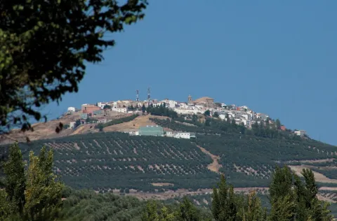
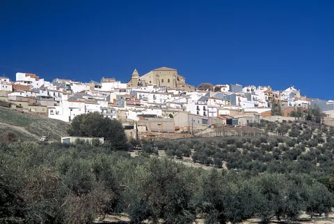
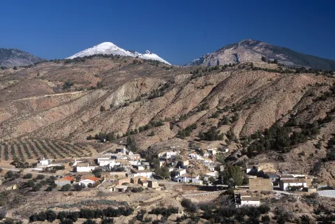
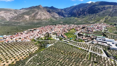
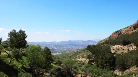
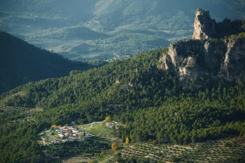
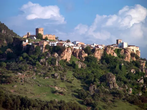
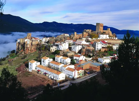
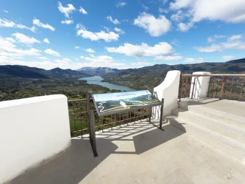
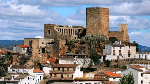
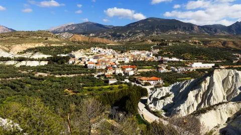
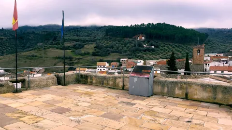
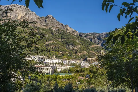
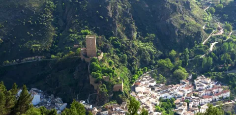
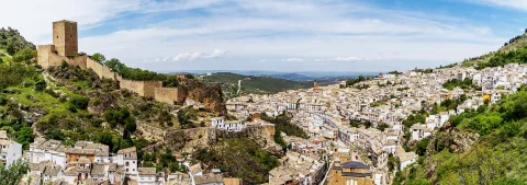
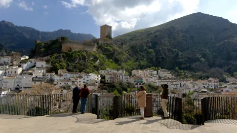
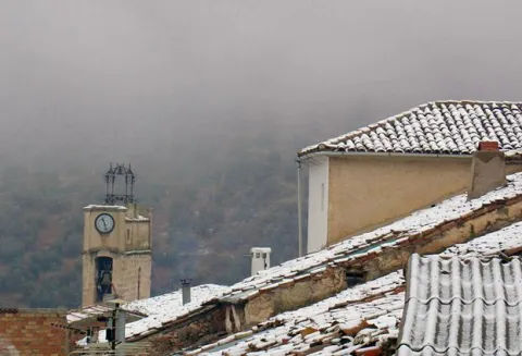
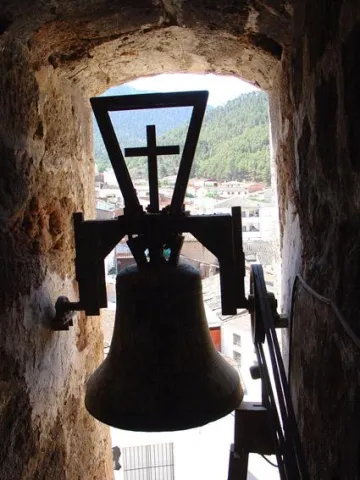
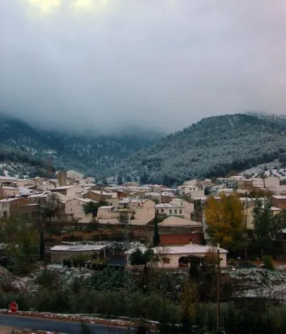
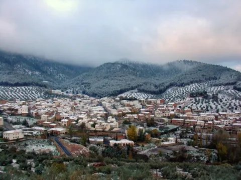
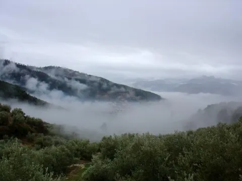
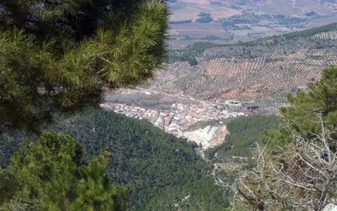
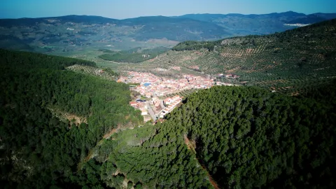
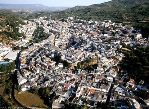
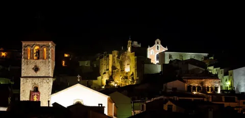
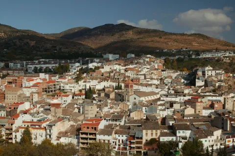
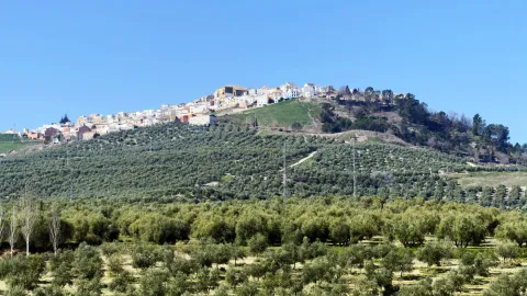
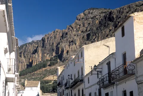
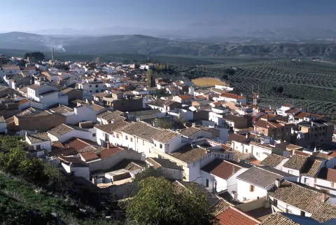
Iznatoraf (also known as Torafe) is one of the most beautiful places in Jaén, one of the highest in Andalusia and one of the most surprising to the traveller. It is located to the north-east of the region of Las Villas and is located on a hill of 1,036 m, as a lookout post over tens of kilometres of olive trees in all directions. The view of the Sierra de Las Villas is spectacular.

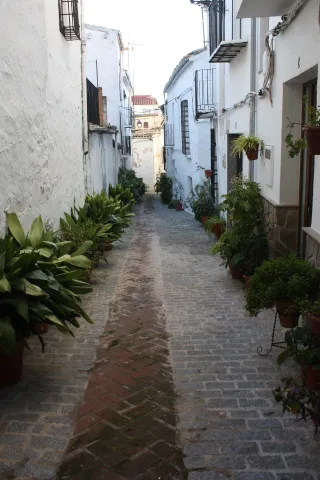
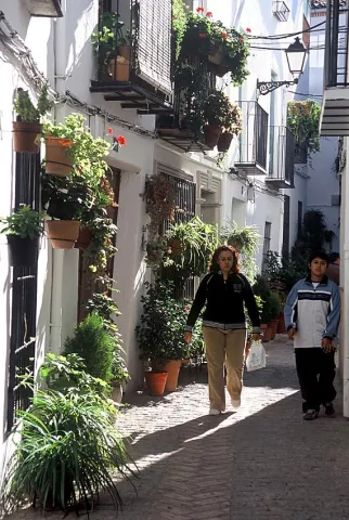
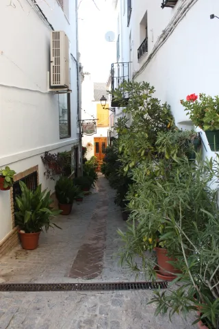
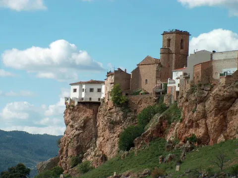
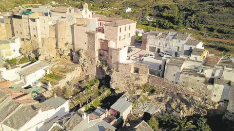
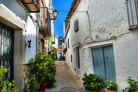
It is an almost unique viewpoint to see much of the province and a crucible of cultures (Arab, Jewish and Christian) that have left a rich artistic legacy. It retains its urban layout of narrow, slimmed and winding streets within an Arab-based walled enclosure.

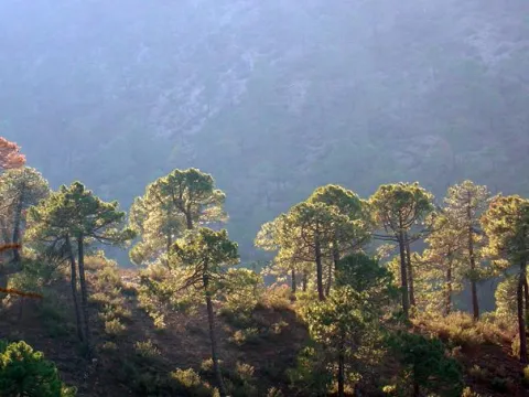
Its term is divided into two separate enclaves: one to the west, where the urban core is located and above all the olive tree; and the other to the east, essentially forest and within the limits of the Natural Park of the Sierras de Cazorla, Segura and Las Villas.

Several are the houses inhabited by the municipal term, such as Batanejo, 15 km away and others like Santa Marina or Sillero, in the Sierra de Las Villas.

Economic activity is the olive tree and the oil industry. Tourism in this region has virtually not developed.

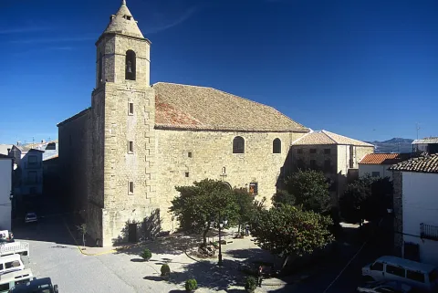
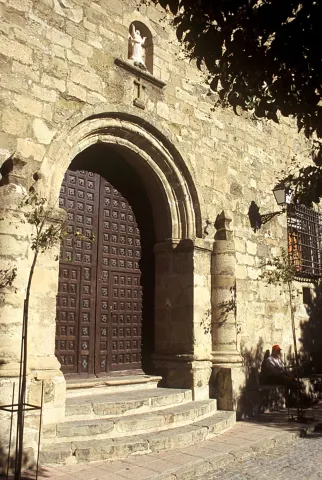
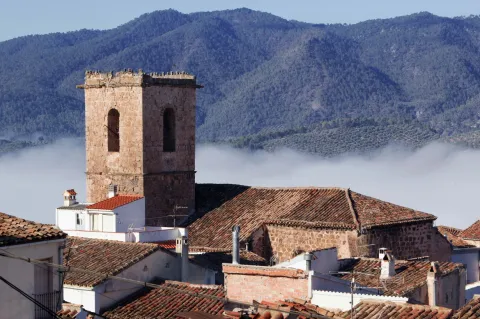
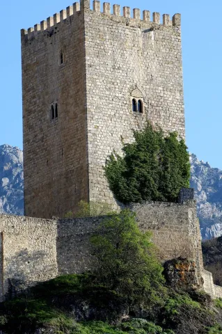
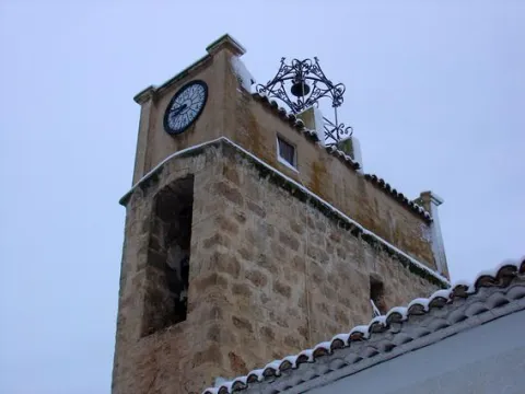
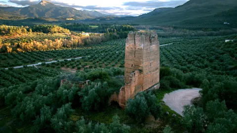
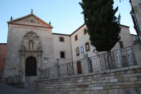
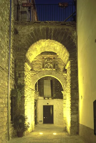
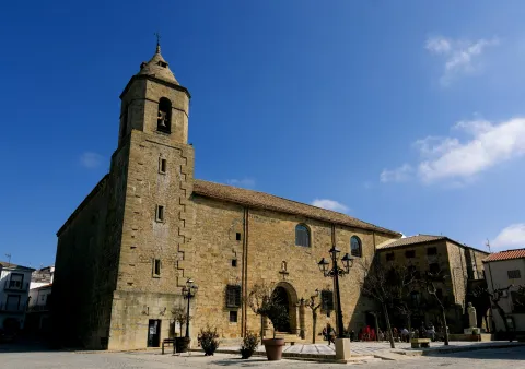
Among its historical heritage are the Church of the Assumption, the remains of the medieval wall with its access doors and the Hermitage of the Christ of the Veracruz, among others.
The old town of Iznatoraf was declared an Artistic Historical Set on May 15, 2012.

Since 2020, Iznatoraf has had the distinction of Flor de Andalucía, with the category of four flowers, given by the Multisectoral Association of the Andalusian Gardening, being the only municipality in Gienese that obtained this qualification. It also belongs to the network of Magical Peoples of Spain, the only people in the province, which unites peoples with charm from various European and Ibero-American countries.
Telecomunicaciones
Teléfono
953 451 507
Sitio web
www.iznatoraf.es
Fax
953 452 492
Ubicación
Nombre
Iznatoraf
Latitud
38.157030
Longitud
-3.032730
Municipio
Ubicación en el mapa
POINT (-3.03273 38.15703)
Imágenes
imagen
Image
e44ccc0f-c0c8-5efb-6379-aaeaec9b5995?t=1595512030295
Imagen principal
Desactivado
imagen
Image
36109a4f-dd90-ee2e-1589-5eec29c2fa9d?t=1618496951759
Imagen principal
Desactivado
imagen
Image
img_9498-jpg
Imagen principal
Desactivado
imagen
Image
1b5bb631-9d13-f9d1-5545-ed0298066094?t=1595512273130
Imagen principal
Desactivado
imagen
Image
97ae8a28-43f2-a8ca-bdf2-26f5097dd6f6?t=1618497158369
Imagen principal
Desactivado
imagen
Image
28e4e19c-3103-3488-ac95-935e087e61b5?t=1618497158473
Imagen principal
Desactivado
imagen
Image
bbd2ff61-a4c0-4bcd-d582-78965f65205e?t=1618497158542
Imagen principal
Desactivado
imagen
Image
6a0fd625-07c8-a8bd-b6a8-e16db69ebff4?t=1618497158595
Imagen principal
Desactivado
imagen
Image
img_9499-jpg
Imagen principal
Desactivado
Información adicional
Curiosidades

Zona turística: Sierras de Cazorla, Segura y las Villas
Distancia a la capital (km): 102,9
Altitud sobre el nivel del mar (m): 1036
Extensión (Km²): 86,47
N° de Habitantes: 960
Gentilicio: Torafejos o torafeños
Código postal: 23338
Imágenes cabecera
imagen
Image
Iznatoraf
Imagen principal
Desactivado
Videos
Video file
Cultura

From its monumental heritage we detail:

  • Parish Church of the Assumption. Data from the late 16th century and early XVII years. In it are mixed the baroque and mannerist styles. Its interior is Vandelvirian, of almost square floor, four large pillars divide it into three ships; the decks are vaulted vaults and of the edge, highlighting in all of them a delicate mannerist decoration that augurs the end of the Renaissance, no doubt traces from the followers of the Master, perhaps Alonso Barba. At the foot of the temple is the choir with baroque silery of great beauty and quality. The sacristy with the shield of Bishop Andrade and Castro is baroque. On the side of the main façade is a body for parish dependencies and its small tower compared to the rest of the building. The church keeps a dazzling wealth. Cartons, rolls and heraldic motifs, but the the greatest treasure is the sacristy and the set of ornaments and liturgical pieces it hosts. It has a table of black marble and abalastro of the 18th century with huge walnut drawers with excellent stems with magnificent Renaissance reliefs, dated in the early years of the 16th century, as well as an important goldsmiths: crosses, custodians, chalices... and liturgical dresses.
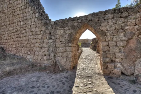
  • Walls and Arches. The wall of Iznatoraf was an imposing fortification built in masonry of Arab origin, consisting of eleven fortines and nine doors arches to facilitate the entry and exit of the enclosure, made in irregular masonry and argamase. They are covered with arches of half-point imperfect trace and vertebra the inner space. Some 500 metres of the wall of the ancient Arab fortress, as well as several of the access arches and ten of the eleven towers that were at that time, are preserved. In the popularly known as Castle or house of Ali Menon, We can admire an authentic Arab bass made up of ceramic conductions and, within it, an aljibe. The remains of the The Gate of Arms and the Gate of the Virgin of the Postigo, composed of half-point arches with wooden beams and double brick arches inside, they are among the few such samples that are preserved. The Gate of the Virgin of the Postigo was declared Historical Monument in 1985. From the end of the 16th century, the exits and entrances were carried out through the various doors of access to the intramuro core: Puerta del Campo, del Arrabal..., the latter, also called the Royal Gate, is of Renaissance style, raised in line with the wall, with a half-point arch of quarry on imposts on its outer side and irregular silery as a whole. Inside it, it has a half-canyon vault with a hornacino that welcomes a relief of the Virgin, classicist, framed by small pilasters and cornices, also of irregular silery as a whole. The urban wall of Iznatoraf has been declared in 1985 Good for Cultural Interest.
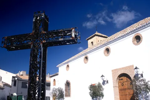
  • Hermitage of the Christ of the Vera Cross. The hermitage is a religious building built between the 17th and 18th centuries. It was rebuilt in the 19th. Its plant is of Latin cross covered by half-canyon vault, on the cruise it is oval and on the half-orange shrimp with the four evangelists in high relief in the pechines and decorated with baroque-style vegetable motifs. On the outside, swordsmanship and on its cover scarlet arch and smooth jambas.
Naturaleza

Iznatoraf is one of the four villas which, along with Villacarillo, Villanueva del Archbishop and Sorihuela del Guadalimarthey make up the region called Las Villas.

A town where there are many sites of extraordinary environmental and landscape value that are the gateway to the fascinating Sierra de las Cuatro Villas.

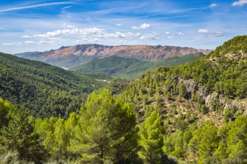
By its municipal term the rivers run Guadalquivir and Guadalimar, that add beauty to the landscape wealth to both vegetation and fauna. Surrounded by a sea of olive trees and cereal fields, part of its territory is included in the Natural Park of the Serras de Cazorla, Segura and Las Villas.

It is one of the localities where the vegetation has a greater variety, with the species of the High mountain, such as the larix pine or the acebo, they live with other species that develop to lower height, such as black pine, tile or boj and with those that develop in the lowest area: melojo oak, the oak oak, coscoja, olive trees, and other endemic and aromatic plants.
To this vegetation we will add the one that develops in the river banks: Chopos, willows, mumberas, tarais...

The faunain line with the plant variety and the numerous habitats in the term, abundant and diverse.

A raptures and mountain scavengers, eagles, broken bones, lethargy vultures, the cynetic speciesboth major hunting, deer, muflon, boar, like the minor hunting, rabbit, hare, partridges, gines, badgers, quail...

Without forgetting the typical olive birdswho either live in it, or feed on migration movements: curuca, verderon, zorzal, petirred... The fauna of the rivers of crystal clear water in its high courses: trout, barbo, otters, salamanders... Just like reptiles and amphibians.

A privileged world where Nature is the main attraction of these lands. Nothing better than to discover it in one of the many places in municipal terms, we will point out three recreational areas and have good accessibility:

  • Cueva del Peinero. It is one of the most abrupt and steep places in the park. Its natural exit is the impressive throat where the river runs Huascebas Grande, whose crystal waters descend into successive waterfalls. There is a road with areas of shade, barbecues and drinking water, as well as a forest shelter, which is an ideal starting point for excursions inside the Natural Park. In the recreational area, the river is sorely and quiet between the thick vegetation of willows, chopos and nozzles. The huge lanterns that close the site rise more than 600 meters, forming scalated poyos covered with fully virgin vegetation by the difficult access. It tells the tradition that this cave was inhabited in the summer by a craftsman who was dedicated to making boj wood utensils, very abundant material in the area, and among other objects, made hair combs.
  • Landscape of La Parra. It is a road with shadow areas from where you can enjoy beautiful landscapes; there is a forest house, being an ideal starting point for excursions inside the Natural Park.
  • The place of Jesus of the Mount. The Cañada de la Madera has access to this natural setting, with good views of the park and a well-equipped road with drinking water and a hermitage. In this same place stands the Fuente del Avellano.
Fiestas y Eventos

Among the holidays of Iznatoraf we will highlight the Festivals of San Isidro and the Corpus and those with the most popular roots:

  • Holy Week. Very interesting are the celebrations that take place on Thursday and Good Friday, with representations of passages of the Passion. They have always been characterized by their great simplicity and austerity, being followed with deep recollection.
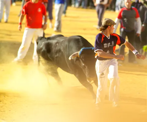
  • Patrons in honor of the Virgin of the Fuensana and the Christ of the Veracruz. Iznatoraf celebrates its patron parties in honor of the Holy Christ of the Vera Cruz during the first week of September, being the afternoon of day 3 when the Holy One is honored with the image procession.The day 7 is celebrated the rosemary in honor of the patron, in the splanade of the Sanctuary of the Fuensanta. The next day has place la procession of the image of Our Lady of the Fuensana, Patrona de las Cuatro Villas y Señora del Olivar. Many cultural, sports and playful activities are planned. Among them, the most successful are the nocturnal cores of raves, who go through the streets of the population. These bulls are the only ones in the province who have the privilege of being nocturnal, this is due to their great tradition, for after the conquest of the king, Fernando III, he authorizes his parties with the cumshot of braves.

Gastronomía

It shares its traditional cuisine with which it is unique to the region of the Four Villas to which it belongs, but it stands out the products that are obtained from the traditional slaughter of the pig, being the "chickenpox" The most characteristic.

  • "Kale-hole.". It is made of fried onion, cooked rice, abundant garlic, spices, undisturbed pork butter and the blood of the pig. It takes hot with tender bread.
  • "Pipirrana". Made of cooked potatoes, dried peppers and fried fried, oil, garlic and salt.
  • "Chickpeas with muffins". They are chickpeas with meatballs made of bread, garlic and chopped parsley. It's like Holy Week.
  • "Tarrafeña". It's a way to prepare the rabbit in sauce. The name can be a phonetic deformation of the word "Torafeña" or "Torafeño," which is what is known as those born in the municipality.

In pastry shops:

  • "Wind coffins.", of hollow interior, which demonstrate the Arab presence in the origins of its kitchen.

Historia

Although discontinuous in time, the settlement is very early in this area. The first evidence of occupation in Iznatoraf dates from the Bronze Age (II millennium BC). It's supposed to have, like, to control the road to the mines of Sierra Morena.

The human presence continues to the Iberians since the 6th century BC, perhaps with a small atalaya. The plateau would then function as an oppidum in the Iberorroman period and it is also known of the visionary military population thanks to the archaeological finding of pieces of this period.

In Muslim times, the Torafeño enclave expands south, covering the rest of the plateau. Possibly in the 11th century and above structures an important defensive square was erected with its walls and alcázar, as a system of protection of the inhabitants of the environment, thus increasing the strategic value of the enclave.

The name of Iznatoraf is of Arab origin and refers to its wall ("Castle of the Way" or of the Street). As in other cases, it was not conquered by weapons but by negotiation.
Its narrow streets and its solid fortification, speak of the military importance it had to have.

In 1235 Fernando III obtained possession of the villa, granted to Iznatoraf, once repopulated, of Cuenca and their lands are declared realingoIn other words, it is not given to any master or military order or to the Church. From this moment on, the walls are reinforced and the castle is erected, the residence of the authority and now disappeared.

But this lasted for a short time, because Alfonso X, in 1252, gave the place to the Archbishop of Toledo, thus becoming part of the Cazorla's advance.

With the advance of the Reconquista, it loses military importance, but it becomes a strong economic center, to such a extent that the population overflows its walls and is established outside them, leading to the growth of the populations around it. Thus, La Moraleja becomes a village and is renamed Villanueva del Archbishop in 1396, and in 1450, Archbishop Alfonso Carrillo independence the Tower of Mingo Priego which will take the name Villacarillo.

In 16th century the municipality is head of the arzimortamiento and the construction of the church of Our Lady of the Assumption begins.

For a long time the history of Iznatoraf is that of an agricultural villa that knows a certain prosperity by highlighting its oil production.
Loading map
Preparing points of interest and routes...
Imagen principal
imagen
Image
Iznatoraf
Imagen principal
Activado

Huesa

Submitted by brandcode_deweloper on
Id
733126
Perfil de redes sociales
Facebook
https://www.facebook.com/ayuntamientodehuesa/
Twitter
https://twitter.com/search?q=ayuntamiento%20de%20Huesa&src=typed_query
Instagram
https://www.instagram.com/aytohuelma/
Descripción
Breve descripción

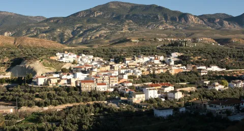
Bone belongs to the region of the Sierra de Cazorla. Located south-west of Jaén, on the border with the province of Granada. The north and north-east of mountain orography in which, between pine trees, olive plots are intercaled in the lower parts. This part of the territory is within the Natural Park of the Serras de Cazorla, Segura and Las Villas. TheThe rest of the territory is of softer orography and inclined towards the Minor Guadiana, with land occupied by pastures, bushes, tumble and split.

The municipality is made up of the following population centres: Huesa, Cerillo, Ceal and Cortijo Nuevo. Theolivar has increased significantly in recent years, making the economy mainly based on olive cultivation and to a lesser extent on livestock and forestry. It hasnumerous natural sites of interest like the Sierra del Caballo next to the urban core.

Among its historical heritage are the Parish Church of Our Lady of the Head, the remains of the Bronze Age of Cerro Negro, the remains of a Roman colonial house and a 20th-century flour mill.

Telecomunicaciones
Teléfono
953 715 009
Sitio web
www.huesa.es
Fax
953 715 672
Ubicación
Nombre
Huesa
Latitud
37.764260
Longitud
-3.077320
Municipio
Ubicación en el mapa
POINT (-3.07732 37.76426)
Imágenes
imagen
Image
df08a6d3-0339-d164-1c06-d6e147f0e1af?t=1617881797755
Imagen principal
Desactivado
imagen
Image
263b29c3-8155-9685-7028-75bb7c6fa529?t=1617881797835
Imagen principal
Desactivado
imagen
Image
45938878-9596-8655-9c4e-683b8a94db1e?t=1617881797914
Imagen principal
Desactivado
imagen
Image
a49ff829-6f33-04d3-0b1e-662697cf62e7?t=1617881798013
Imagen principal
Desactivado
imagen
Image
9abd6172-054e-8917-4044-caaf7aef7146?t=1617881798103
Imagen principal
Desactivado
imagen
Image
3effb89b-f0aa-3f55-c99c-a95930fd48e6?t=1594912011290
Imagen principal
Desactivado
Información adicional
Curiosidades

Plaza Constitución, 13

Imágenes cabecera
imagen
Image
Huesa
Imagen principal
Desactivado
Datos de interés

Tourist area: Serras de Cazorla, Segura and the Villas

Distance to the capital (km): 82

Altitude over sea level (m): 653

Extension (km ²): 138

Number of inhabitants: 2,489

Gentilicon: Osences or Bones

Postal code: 23487

Videos
Video file
Cultura
  • Parish Church of Our Lady of the Head. The church dedicated to the patron is certainly the most important of the heritage of the municipality. Built in the 18th century, in the same place where it is believed that there was a Gothic chapel of the 15th century. Although it has been restored on several occasions, it continues to preserve the profile of the religious architecture of that century. In one of the modifications was built an annexed chapel, the chapel of the Sagrarian, of the same length as the central ship and with its own access. The most characteristic element is the square-based tower with four bell bodies covering half-point arches and covered with four-water tiles. There are no data on its antiquity, some sources place it in the mid-16th century.
  • Black Cerro. It is a town in the late Bronze Age. The surface of this hill is made up of four paved terraces in which you can see remains of stone constructions forming a low-height reticular surface, which defines rectangular spaces that are adapted to the topography of the ground.
  • El Gato flour mill. It dates from the 1950s of the last century. This is a well-preserved electric flour mill.
Naturaleza

The municipal term of Huesa is located delimited to the United Nations Guadiana Minor and the Guadahortuna rivers, respectively. The latter, at the turn of the minor Guadiana, draw the southeast of the term of Huesa. The route of these rivers, with their short but fertile vegas, go to set up a natural corridor that communicates the granadine lands with the area of Alto Guadalquivir. A corridor that would be very passed through the civilizations that have preceded us, Carthaginese, Iberian, Roman and Muslim.

The term Bone is an area of abrupt relief and with deep-attached canyons, the gift of the maximum height is in the Pico del Caballo with 1464 m altitude, along with others distributed by the term: El Tomilar (1004 m.), el Peñón de Padilla or el Tabernillas.

Next to these steep mountains, predominant in the north, territory included in the Natural Park of the Sierras de Cazorla, Segura and Las Villas, there are areas of pastures, olive groves, land dedicated to the cultivation of cereals and orchard areas next to the river line.

So much. flora as fauna of the territory is abundant and very diverse. In the vegetation We find pineapples, preferably in the higher and more steep areas, a mixture of different indigenous coniferous and bushes, areas of pasture and the coastal forests along the river line, with birches, chopos, alamos, mitreras...

The groups of animals that make up the fauna of this territory are as follows: Avian (coal, chochyn, montesino, codorniz...); Dam birds (close it, pilgrim hawk, black milano); mammals (hares, rabbits, foxes, gines, boar and badger); reptiles (rib, lizard, Salamanca) and fish (barbs, tents, trout and gobs)

Fiestas y Eventos

The following parties are held in Huesa:

  • San Silvestre, 31 December. It's the parties in honor of their pattern. They start the night before in the church square where the calls are burned "Castles of the Holy," raised with pine wood. Around the fires you sing, dance, and there are even those who dare to jump the flames and rescolds.

The tradition has been preserved since time immemorial of "to serve the saint," either by fulfilling a promise or by a penitential vote.

A draw will award the calls "charges" of Captain., Abandoned and Guinche, who will be forced to organize a party in their respective homes, and to wear the striking suits that are their own, inspired by the army's gala uniforms in the 18th century. In this way, they will accompany the Holy in the procession of a drum. After completing the religious function the Abandado shows its ability to malabar the flag and invites other people to do the same.

It's also tradition to offer San Silvestre some huge "white swimwear" sweet of Moorish reminiscent, which are given by the "charges" and neighbors who have promise to do so. The next day they are auctioned and the collection is dedicated to the needs of the parish.

  • San MarcosApril 25. The main events are the Mass, followed by the surrender to the attendees of the calls "cakes of the saint" which by tradition are developed by those who have married the previous year. It ends the feast with the procession of the image of the saint to "El Cerro," from where the fields are blessed.
  • Our Lady of the Headon April 26. Celebrations in honor of his Patronwith a rosemary to the hermitage of the Virgin, where religious acts are held. The rosemary lunches in the surroundings.

At night they make fires in the square of the Church and they taste the "crow"(drink made from wine, sugar, water and fruit) that the City Council offers to the attendees.

The first Sunday of June is also held a pilgrimage in honor of the Virgin of Tiscar, in the vicinity of Caniles.

Gastronomía

The gastronomy of Huesa has viandas of festive rituals, such as "the white-bath rosches" offered to San Silvestre, and the "cakes of the saint" with which the attendees of the Mass are given in honor of San Marcos.

The slaughter of the pig is carried out when the first cold arrive, and it is now frequent to celebrate with relatives and neighbors. Products the killing are:

  • The black bitesmade of onion, grated bread, minced almonds and pig blood. The chorizos are usually fried in olive oil and are kept in orzas to go eating them during the year.
  • Cakes, made with the butter that is left in the slaughter accompanied by porcine chicharons.

Other typical dishes of the Bone cuisine are:

  • Pickles, which are made of flour, dry red peppers, roasted peppers and spicy.
  • Andrajos, which are known here as "talarines." It is a stew of flour cakes with a tomato saffrito, onion, red peppers and minor game meat, hare or field rabbit.
  • Migas of bread and flourThey carry torrezos, chorizo, rabanillos, olives and melon.
  • "Maimons," It is a flour mashed with a dyes that covers the products of the slaughter.

Other than those indicated "bath thighs" and "cakes of the saint," We can quote calves and skillet rosses.

Historia

The municipality of Huesa is located south of the Pico del Caballo, mostly occupied by the depression of the minor Guadiana.

From Bronze age the area was populated by communities that took advantage of the fertility of the Vega. In Black Cerro There are remains of a settlement. In the Iberian period played a very important role, this territory served as a passage of goods, Greek ceramic, between the granadine altiplanices and the high Guadalquivir.

The oppidium of Castellones of Ceallocated at the limit of the term Bone and Hinojares, it shows us. With the arrival of the Romans, there was a change in the landscape due to the proliferation of agricultural crops, one of these the olive tree in Strong Arm.

During Islamic period, according to an Arab historian, Huesa, Tícar and Belerda were destroyed in the ninth century by Muslim troops, and then repopulated and centuries later become the last enclaves in Muslim hands of the saw. Being border of Castilla with the kingdom of Granada It was the scene of many struggles between Moors and Christians. It will not be until the 15th century when Don Iñigo de Mendoza, Marquis de Santillana, conquers this area, which would again fall into Muslim hands, to be finally released in the year 1455, the date on which King Henry IV grants him the title of County.

After the conquest of Granada, the core of Huesa begins its consolidation and repopulation, moves to its current location and passes to be part of the municipal term of Quesada until 1847.The 16th century was a time of economic prosperity, but this situation changed in the following century by the crises of lack of care and epidemics. The period of population recovery began in the 18th century.

Loading map
Preparing points of interest and routes...
Imagen principal
imagen
Image
Huesa
Imagen principal
Activado

Hornos de Segura

Submitted by brandcode_deweloper on
Id
731780
Perfil de redes sociales
Facebook
https://www.facebook.com/profile.php?id=100093559135446
Descripción
Breve descripción

Nice town located in the Sierra de Segura, fully included within the Parque Natural de las Sierras de Cazorla, Segura and Las Villas. Next to the reservoir of the Tranco de Beas and the valley of the Guadalquivir River at its beginning.

The municipality of Hornos belongs to several villages spread throughout the municipality: Cañada Morales, La Capellanía, El Carrascal, Fuente de la Higuera, Guadabraz, Hornos El Viejo, El Majal, La Plantera, El Tovar, El Tranco and La Venta. Some of them are located in places of great beauty, such as La Plantera or La Capellanía, and others are more active thanks to their situation, such as Cañada Morales or El Tranco. The rest with a marked agricultural character, where peace and tranquility are assured, are currently developing interesting quality tourist infrastructure such as rural houses.

Furnaces are essentially forest, the pinars occupy about 80% of their municipal term.

The urban core is surprised to be located on a large peñasco. Its medieval character gives it a special charm. It has been declared an Artistic Historical Set in 1985.
Its economy is based on tourism, forest use and olive cultivation. Without forgetting the very important activities and fishing.

It has a rich heritage: the Castle, the Church of Our Lady of the Assumption, the Castle of Bujaraiza, the Puerta de la Villa, the Mirador del Aguilón and the Tower of Bujarcaiz.

Telecomunicaciones
Teléfono
953 495 002
Sitio web
www.hornos.es
Fax
953 495 031
Correo electrónico
secretaria@hornos.es
Ubicación
Nombre
Hornos de Segura
Latitud
38.216730
Longitud
-2.719170
Distrito
Municipio
Ubicación en el mapa
POINT (-2.71917 38.21673)
Imágenes
imagen
Image
d562cab0-e866-6fc2-5039-73ea3dbf7a78?t=1617879834093
Imagen principal
Desactivado
imagen
Image
4684996b-b0d2-b0c9-6c52-78a920a820ba?t=1617879834360
Imagen principal
Desactivado
imagen
Image
3cec6640-bac7-3c8e-ffdb-f6c872b5e0cb?t=1617879834408
Imagen principal
Desactivado
imagen
Image
d4899350-18e9-f1b0-db9d-0b24730b8c30?t=1595609312667
Imagen principal
Desactivado
imagen
Image
barco-solar-jpg
Imagen principal
Desactivado
imagen
Image
f206640e-6f53-e174-aeb5-00637460fe64?t=1617879834950
Imagen principal
Desactivado
imagen
Image
1466792f-a098-2464-a39e-1dcc797b36fa?t=1595609312725
Imagen principal
Desactivado
imagen
Image
e4ae55d5-e1fc-f627-48a6-8b65c462cff8?t=1602772415163
Imagen principal
Desactivado
imagen
Image
830bbe2f-9ca3-3494-3786-ada91c4ef032?t=1617879835016
Imagen principal
Desactivado
Información adicional
Imágenes cabecera
imagen
Image
Hornos de Segura
Imagen principal
Desactivado
Datos de interés

Tourist area: Serras de Cazorla, Segura and the Villas
Distance to the capital (km): 103
Altitude over sea level (m): 865
Extension (km ²): 117
Number of inhabitants: 679
Gentillo: Horneros or Hornenses
Postal code: 23292

Videos
Video file
Cultura

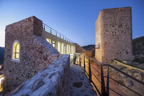
Castle. Hornos was granted by Fernando III the Holy, after his conquest in 1239 to the Order of Santiago. The time at which the castle would be built, probably on an earlier Muslim fortress from which the aljibe is preserved.

Of a purely defensive nature, the trapezoidal shape set is built with small masonry. It is made up of a magnificent Tribute Tower, three slender torreons square floor and the outer wall of a room that closed the courtyard of arms.

The Tower of Tribute in square shape and rounded corners, something common in the constructions of the Order of Santiago, has only one entrance at half height.

In its interior two overlapping rooms supported by vaults and communicated by a staircase carved in thick wall.

By the end of the 20th century, the rehabilitation of the castle that was very damaged began. After many attempts, in 2011 the works of their total restoration were completed. It has been declared Good of Cultural Interest in 1985.

Located inside the castle you can visit one of the most important tourist resources of the area as is the Cosmolarium.It is a centre for the dissemination of astronomy that consists of a digital planetarium, with a dome of 8 meters in diameter that shows enveloping audiovisual productions, complete exhibition rooms on the Universe, spaces for workshops and educational games, as well as a terrace for astronomical observations.

Parish Church of the Assumption. Data from the first half of the 16th century. Its construction follows the style of the Order of Santiago. Of a square floor, with one ship and side chapels, it is divided into three square sections separated by fajon arches.

The decks are gothic, the 16-century renaissance-style altarpiece as it is recorded. The cover is one of the first plateresque in the province of Jaén, although it is currently damaged by time.

The tower stands out for the gargobles of the cornice and the Gothic crest of the mast. We can say it's a magnificent example between Gothic and Renaissance.

In it was found the ornamental vessel in the form of a Nazi-style amphora, with motifs glazed in blue and gold on white enamelled background that is preserved in the National Archaeological Museum.

The Villa Gate. It's a door on the wall dating back to the 11th century. It is built in elbow to make access to the enemy difficult, which makes you think of a mothade origin. Made of masonry and red brick in the vaults, as well as a small window of the facade. Declared Good of Cultural Interest in 1985.

Bujaraiza Castle. It rises on a the island in the waters of the Tranco reservoir. It is a small fortress formed by a walled polygonal enclosure and a tower of tribute. It is built with small-size masonry yarn, with lime mortar. Declared Good of Cultural Interest in 1985.

Tower of Bujarcaiz. It is currently submerged under the waters of the Tranco reservoir. It was part of the surveillance system of the Hornos castle. It is a square floor construction and a troncoconic form.

Aguilon Viewer. Located next to the City Hall shows one of the best views of the Natural Park and an impressive view of the waters of the Tranco reservoir.

Naturaleza

The municipal term of Hornos is located in the heart of the Sierra de Segura, and by it they run the waters of the high courses of the Segura and Guadalquivir rivers, it takes its waters to the Tranco reservoir.

The water is present in much of its term and makes that nature is overflowingboth in the arid High summits villages of larive pine trees and high-rise tiles, as in the lower areas where the black pines grow, whose wood is very resistant to rot, oaks, oaks, moans and chopos.

Here we find more than thirty endemic species that cover the steep surfaces of the rocks, such as aromatic plants or the curious trapping.

The variety of ecosystems also makes the number of animal species living in these areas very diverse. In the higher and more steep areas live the large-game, muflon, deer, go and boar species; Rapes and scavengers like, eagles, broken bones and lethargy vultures. And in the less high areas, the cynetic species of minor hunting: badgers, foxes, hares, rabbits or gines. Without forgetting the fauna that lives in the crystalline waters of these rivers: trout, barbs, otters, salamanders. No the birds who either live in olive trees, or feed on their fruits in their migratory movements: carboneros, abbullas, jilgueros, petriroreds, ratoneros...

The municipal term of Hornos will present us with thousands of routes to discover and that it will surely leave a deep footprint on us when you go through them.

We point out three places that we should not miss:

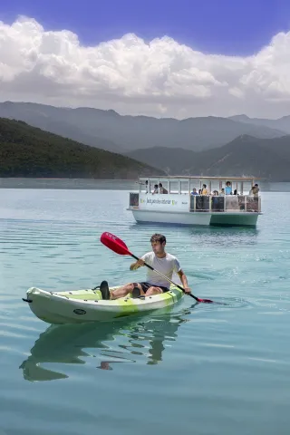
  • The Tranco Pantano. It is an inner sea between pine trees, given the abundant vegetation surrounding it and the olive sea that goes down to the banks of the reservoir. The main and regulator of the Guadalquivir River. The village of Tranco had chapel, schools, event hall, sound cinema, post office and civil guard headquarters. Dolorosa was the disappearance under the waters of the Lordship of San Miguel de Bujaraiza, loaded with history and whose castle still stands out challenging above the waters, when the swamp is at its highest level. From time to time, in El Tranco water sports have proliferated. This activity is designed to be enhanced by public institutions as an alternative to tourism in one of the essential visiting places for all nature lovers.
  • Cynegetic park. An interesting nature reserve where animals live together in semi-freedom, highlighting especially deer and go. It is visited following a perfectly marked itinerary that has sources and viewpoints. It is near the Tranco swamp.
  • The Celadillas. A promenade area with a view towards the village and the Tranco swamp. The views are unbeatable.
Fiestas y Eventos

These are the parties that are held in Hornos:

  • Patron parties. In honor of Our Lady of the Assumption and Saint Roque and are held in mid-August. For a week there are dances, Turkish bowling championships, summer cinema and the most important things: "The Vickles". On the new door, you can release the poplars that are run through the streets of the village. This taurina tradition has a deeply popular character.
  • Saint Anton. The 17 January And it's the pattern of the animals. The day before, fires are lit, around which they dance, sing and eat and drink. As long as the light lasts, chorizos, morcillas and other viandas of the pig are prepared, such as the carette accompanied by traditional drinks such as the crow and the mistelle.
  • Romeria under the title of the Virgin of Fatima, is held since the mid-last century. A teacher from the school of La Capellanía donated an image of the Virgin of Fatima to the parish of Hornos and asked the parish priest to perform a mass so that the children of the village and the surrounding cortijos could make the first communion. Today is celebrated in the beautiful The Control site.
  • Holy Week. Emotional procession that takes place on the Sunday of Resurrection in which the encounter of Mary and her Risen son. The hornilleros celebrate this day by shooting their shotguns in the air, for the time the process course lasts.

They are also held Other parties as: San José, in Cañada Morales and the Virgin of Carmen in the Tranco.

Gastronomía

Among the most typical dishes of Furnaces are:

  • Pig derivatives. The products derived from the pig have an important place. Chorizos, loins, ribs, solomiles, stored in the oil of the traditional orza. The morcillas, longanizas and faces that are left to be consumed on the day of Saint Anton around the bonfires.
  • Garlic. It is made with the liver of the fried pig that is added to a saffrito of green peppers, tomato, garlic and pepper, to end up adding mist of bread, water and spices. It is also known as Killing garlic.
  • Garlic of flour. With potatoes and vegetables, but with the unmistakable taste of nisthem from the saws.
  • Bread crumbs. They have the particularity that they are cooked in a meat broth with crushed peeled tomato.

To highlight the drinks which are usually taken on festive occasions. This is about "the crow," a mixture of wine and water with a lot of sugar and pieces of fruit; "Mistel." made up of spirits, coffee and spices.

To accompany these drinks you will take some traditional sweets, including the panets and Fried roses.

Historia

The site currently occupied by Hornos He was busy. for the period Copper age and remained busy during the Bronze age. This place was subsequently abandoned.

From the Roman times There are many remains of tombstones, coins and ceramic pieces in the La Laguna field.

It's in the Middle age when this population reaches its greatest splendor, mainly due to its strategic and defensive situation. The Arabs know her as Fornus and was a small village inaccessible for its situation.

The Islamic Age in the area of Hornos, and in the mountains in general, she was convulsed by the struggles between the leaders who wanted to impose her authority. The population for the most part was Muladi. During the X and XI centuries, is a zone of great splendor, Since along with the surrounding populations are the border between Christians and Muslims, they will be the starting point of war expeditions against Christians.

The Christian conquest was carried out by the knights of the Order of Santiago in 1239, in particular by Pedro Pelayo Correa, master of the Order and was attached to the commission of Segura de la Sierra, dependent on the spiritual of the diocese of Cartagena. Fernando III will grant you the Villa title.

Hornos was one of the places, along with Segura de la Sierra, from which members of the Manrique family actively participated in the Spanish politics of the 15th century. This family was generally confronted with the kings of Castilla Juan II and Henry IV, as they always controlled a large part of the forces and resources of the Order of Santiago, of which Don Rodrigo Manrique, the commander of Segura, came to proclaim himself Grand Master, resisting and defeating in Hornos the troops sent against him by John II and his valid Don Álvaro de Luna.

In 1833 the demarcation of the municipality within the province of Jaén, after a stage of secondment and belonging to the province of Murcia.

The period of the largest expansion of this population was between the mid-19th and mid-20th centuries. From this date its population has declined to reach the just over 700 inhabitants at present.

Otra información

A characteristic sport in Furnaces are the serrano bowling, which consists of throwing a ball without passing a line and giving the "mingo" of wood to send it as far away as possible. They are made championships and come neighbors of the rest of the villages that make up the municipality.

Loading map
Preparing points of interest and routes...
Imagen principal
imagen
Image
Hornos de Segura
Imagen principal
Activado

Hinojares

Submitted by brandcode_deweloper on
Id
731413
Perfil de redes sociales
Facebook
https://www.facebook.com/Ayuntamiento-Hinojares-1575704262491049/
Descripción
Breve descripción

Hinojares is a small town located to the south-east of the province of Jaén, extends its landscape in the region of Alto Guadalquivir, south of the Natural Park of the Sierras de Cazorla, Segura and Las Villas, and much of its municipal term belongs to the Park. It is limited to the terms of Quesada, Pozo Alcón and Bone.

Hinojares is accessed by the autonomous road A-315 Torreperogil-Baza, diverting on the stretch between Huesa and Pozo Alcón, on the road JA-8200.

The municipality has the pastry of Cuenca, where the river Turrilla is born.

It is now one of the least populated Jienian municipalities, only four hundred, of which one quarter are foreigners who have bought the damaged houses, reformed them and established their residence in the municipality.

Telecomunicaciones
Teléfono
953 738 111
Sitio web
www.hinojares.es
Fax
953 738 260
Correo electrónico
hinojares@dipujaen.es
Ubicación
Nombre
Hinojares
Latitud
37.715400
Longitud
-2.999230
Municipio
Ubicación en el mapa
POINT (-2.99923 37.7154)
Imágenes
imagen
Image
3620de2a-7871-c5ce-06c2-315740196b13?t=1595007399397
Imagen principal
Desactivado
imagen
Image
e6511218-ab8e-17d4-15ac-77f36d161aeb?t=1595007479169
Imagen principal
Desactivado
imagen
Image
cf56932d-c7c9-dc10-08d6-0aaa08ece42e?t=1595007406260
Imagen principal
Desactivado
Información adicional
Imágenes cabecera
imagen
Image
Hinojares
Imagen principal
Desactivado
Datos de interés

Tourist area: Serras de Cazorla, Segura and the Villas
Distance to the capital (km): 94.2
Altitude over sea level (m): 659
Extension (Km2): 40
Number of inhabitants: 401
Gentillo: Hinojareños e Hinojarienses
Postal code: 23486

Videos
Video file
Cultura

In his artistic heritage we highlight:

  • Church of San Marcos Evangelista. Built in the late 17th century, it is the most remarkable building in Hinojares. It is an austere construction that stands out by the rotunity of its volume, marked by the white of its walls, with few and reduced voids, whether circular or rectangular and a side access door with no ornamentation. It completes a bell tower, simulating a swordsman, placed on the wall that links the header with the rest of the temple body, closing the strip that borders the only ship. Inside it is adapted to the shape of a Latin cross and has a Renaissance altarpiece and a baptismal pile of white marble to which the parishioners have in great esteem.
  • City Council. It is the same line of architectural austerity, and without concessions to decoration and aesthetics. It has three heights and intoned holes, the most outstanding is that of the balcony on the first floor, in vertical line with the access door and crowned by a small attic with a watch that imitates that of the municipalities colonized in the 18th century, although it is not located in the center, but on one of the sides of the building and on which a small bell is installed.
  • Urban helmet. Urbanistically this municipality has not been configured with prior planning. It is a set of traditional houses whitened and covered in two waters with Arab tiles, with small verticalized holes to avoid the rigors of winter and adapted to the simple habits of the inhabitants dedicated to the tasks of hunting, pastures and agricultural, and in more peripheral positions, houses with floor structures, with a maximum of four heights and roofed to four waters. Of great ethnic value are the "casas- caves"which have become a defining element par excellence in the people of Hinojares. Built without having to take the hands of architects, the forms and volumes depend to a large extent on the characteristics of the rock in which they have been excavated and on the originality and needs of the building. The caves, located on the slopes of the hills, in the canyons and in the rails, with an anarchic distribution, with their curved lines, lime, vaulted ceilings and chimneys, make up an interesting set of uniqueness. Its architectural originality, its temperature (18 ° C to 20 ° C, so no bedding is necessary) and its welcoming, intimate and rustic environment have made them a very appreciated habitat.

Naturaleza

Hinojares is the gateway to a world full of contrasts and beauty, diverse and rich, an example of human and natural coexistence for millennia.

The Guadiana Minor and Turrillas rivers, with its short but fruitful vegas and the sharp and cut orography, cause a natural corridor which links the Alto del Guadalquivir with the Mediterranean coast, and are essential elements that explain the location, situation and morphology of the population nuclei of the Nagorno-Chinese territory, as well as the way of life of its neighbours.

The municipal term of Hinojares is an authentic maze of valleys, calares, slices, mountains and streams that convert water in the real protagonist of these places.

To better understand the physiognomy of this territory, nothing better than to approach one of the following places to admire nature and let us captive:

  • The birth of the river Turrillas. It is the natural element that is most conclusive in the vertebration of the term of Hinojares. To this end we move to the village of Basin, a very preserved and peculiar small village, belonging to Hinojares and within the Natural Park of the Sierras de Cazorla, Segura and Las Villas. Here we will find a spring of fresh and crystalline water, called Seven Sources, which begins to give life to the valley and is the place of official birth of the river. However, its first waters come from a few kilometres above, with the Arroyo de las Doves, your true precursor. Its usual flow rate is filtered in the middle of the route, but in times of abundant rains, the spring is cleared by an impressive cut of more than 100 meters in height, resulting in the spectacular Cascade of the Vinatera of an extraordinary beauty. The neighbors consider this waterfall a talisman of good crops. In front, the Clock Stone, with the game of shadows that form its three vertical steps, informs the locals of the time of day in which they are found.
  • Salinas de Chillar. They are located near the village of Cuenca, and date from the XX-XX century. They are spring salins, i.e. salted water from the subsoil and that emerges to the surface naturally. The process for the exploitation of salt is simple: during the months of autumn, winter and spring, the water from the spring is collected and concentrated in heaters (pools), where at the end of spring, when the water is evaporated, the salt is left, which when it reaches a thickness of 5 cm. is collected, treated and packaged for sale.

There is a possibility of many activities in nature: ravine, multiadventure circuit, all-terrain bicycles, kayac and pyragüismo, paintball, horse routes, trekking and hiking.

Places and routes of interest near Hinojares:

  • Route to the Pico Cabañas
  • Passerella on the Castril River
  • Water Cave
  • Fishing point Peralta
  • Several viewpoints: the Lirio, Peña de Quesada, La Alcantarilla
  • Arroyo Guazalamanco
  • Bread Packaging

So much. fauna as flora of the territory It is abundant and very diverse.

In the vegetation We find pineapples, preferably in the higher and more steep areas, a mixture of different indigenous coniferous and bushes, areas of pasture and the coastal forests along the river line, with birches, chopos, alamos, mitreras...

The groups of animals that make up the fauna of this territory are as follows: Avian (coal, chochyn, montesino, codorniz...); Dam birds (close it, pilgrim hawk, black milano); mammals (hares, rabbits, foxes, gines, boar and badger); reptiles (rib, lizard, Salamanca) and fish (barbs, tents, trout and gobbles).

Fiestas y Eventos

In the municipality of Hinojares, the following parties are held:

  • San Marcos. It's the Hinojar Patron. It is held on April 25. On that day the evangelist is processed with a cake on his left arm. A symbol that at the end of religious trades they will be shared between their own and visitors.
  • Holy Christ of forgiveness. It was held at the end of September, when the summer agricultural work had been completed. But because many Hinojareños this month came to the harvest of other places, he moved to August 21, 22 and 23.
  • Saint Anton. The 17 January with traditional fire-ignition, asking for the health of the animals that help them in the agricultural tasks. He sings and dances, eats and drinks. A party that puts final brooch to Christmas parties is what the saying says:"Even San Antón, Pascuas are."
  • The Candelaria. February 2nd. Where at the touch of souls the fires are rekindled with the purifying sense of the commemoration of Mary's Purification and the Presentation of Jesus in the Temple.
  • The "bordes"It is a curious carnival tradition, in which the young men use the "bordos," the fruit of the anea, with which once they were clenched the asses of the chairs, and whose long strips rubbed until they released a white and sticky hair that was attached to the hair or to the clothes of the young woman to which they wanted to demonstrate their love, being a reason for pride for the mothers of the props to see that their daughters returned with many "bordos," an unequivocal sign that they had many suitors.
  • Lent and Holy Week. On Ash Wednesday, or some Lent Fridays, it is tradition to sing the old "Cops of the Way of the Cross," quartets whose origin is lost in the popular poetry of the Golden Century. On Easter, the so-called "Courts," a popular piece of the sacred theatre, carried out by the neighbors of the village, are represented in Hinojares Square.
Gastronomía

The gastronomy of Hinojares is immersed in what is typical of the region to which it belongs. We highlight the following dishes:

  • Ajo hasherowhich was prepared by the pine cutters with some guizcanos (niscalos) from the saw.
  • Ahomaran, With this dish the days of the morning rite were over. With pork they made a good relationship of home sausages, which will be the ones that give body from the traditional cooked and pudding of the rest of the year to the loin of orza, chorizo with pimenton and morcilla.
  • Gachamasthat they must be included in the artisan-made viandas.
  • Andrajos, cooked in the broth of boiling minor game pieces with peppermint and a saffrito of vegetables and strips of flour made of jirones that take the name of "talarines."
  • MaimonsThey're bread soups.
  • The crumbs of bread with torreznos.

In the gastronomy of Hinojares, the sweets: for Christmas, fried rosses for Easter and cupcakes home for family celebrations of other times.

Without forgetting the "San Marcos cake.", distributed after the procession. They are round pieces with ribetated edges of a size and weight of "five a kilo.", which are decorated with flowers and various decorative motifs that are made with wooden mold.

Historia

In order to know the Prehistory and Ancient History of Hinojares, we must refer to the Castles of Ceal, one of the most important Iberian settlements in the province of Jaén.

The origin of this settlement is in the control of the commercial route who from Levante introduced Greek manufactured products into the Guadalquivir Valley. It is located in a spur, with a circular plateau, where the remains of walls and housing buildings are abundant.

The study of the Iberian phase of necropolis with rich joules in which Greek weapons and ceramics appear, points to the presence in the village of powerful aristocratic characters.

The first phase of the occupation of this settlement went to the end of the 7th and 6th century BC; later abandoned until it was built the Iberian village in the 4th century BC and that lasted until the Roman Republican stage.

The origin of the present Hinojares is uncertain, as it is not cited in the medieval documents of the conquest of the Sierra Quesada- Cazorla. However, in its term there are villages and cortijos whose names do appear in the chronicles of the Spanish conquest. In this period there was a transfer of the population from the mountain to the valley. One of these examples is Cuenca, which was converted into the village of Quesada in 1257.

Hinojares must have been a plateau or a new foundation in the valley after the Spanish conquest of these lands. Until 1648 it depended on Quesada. And from this date it will become a village of Well, Alcon.

In the year 1690 got the title of villa and thus the independence of well of Alcon.

This title was similar to his concession in Temporary Lordship Mr Íñigo Rodulfo Fernández Angulo Sandoval, from the habit of Santiago, who asks the monarch to be given the name of Hinojares.

This Lord later passed to the nobility house of the Count of Arenal. At the end of the 18th century the Marquis de Guadalcázar will be honorary lord of the Villa of Hinojares.

Loading map
Preparing points of interest and routes...
Imagen principal
imagen
Image
Hinojares
Imagen principal
Activado

Génave

Submitted by brandcode_deweloper on
Id
728475
Perfil de redes sociales
Facebook
https://www.facebook.com/ayuntamientodegenave
Instagram
https://www.instagram.com/ayuntamientogenave/
Descripción
Breve descripción

Génave is a municipality located to the north of the Sierra de Segura, in the first foothills of Sierra Morena. Most of its municipal term is included in the Natural Park of the Serras de Cazorla, Segura and Las Villas. Two thirds of its territory is occupied by a mountain, where forest and livestock are dominated. The rest are cultivated land, which is distributed by the olive tree, mostly from the dry and the arable crops.

It was a strategic enclave that served as a passage between Andalusia and La Mancha. And it is also border land and fortresses that define its urban physionomy in the midst of a rural landscape of extraordinary beauty.

With regard to the architectural heritage, the parish Church of the Immaculate Conception, completed to build in the late 15th century the purest Renaissance style, except some primitive parts that are of Gothic style (13th century), stands out. It also stands out the Torre de la Tercia, located in the centre of the town, which is the tower of tribute of an old medieval castle.

The villages of La Almohadilla, Las Parrillas, Las Atalayas and the Castle of the Laguna or Zarrocotin are also located in the border of Génave.

Its economy is based on the production of organic oil, under the designation of origin Sierra de Segura and the brand Oro de Génave. It is important to highlight the commitment to organic farming, an idea that started from a few neighbours back in 1989 and that has continued to add new partners and many hectares dedicated to this cultivation.

Telecomunicaciones
Teléfono
953 493 081
Sitio web
www.genave.es
Fax
953 493 124
Correo electrónico
ayuntamiento@genave.es
Ubicación
Nombre
Génave
Latitud
38.429950
Longitud
-2.733020
Distrito
Municipio
Ubicación en el mapa
POINT (-2.73302 38.42995)
Imágenes
imagen
Image
764f2a42-bd9d-dc0b-62de-b9e9a61cd490?t=1617797669275
Imagen principal
Desactivado
imagen
Image
3addd545-7c30-6196-d8b0-f4d0fe5fb5bf?t=1594992454266
Imagen principal
Desactivado
imagen
Image
c70a6ff8-c2fd-f34c-4a21-2ce5bc873930?t=1617797669532
Imagen principal
Desactivado
imagen
Image
24880c6a-1015-a668-1dae-b4fde6c2848c?t=1611059856965
Imagen principal
Desactivado
imagen
Image
a5ec63c7-4f22-6257-4c6a-e54dc995c062?t=1617797669641
Imagen principal
Desactivado
Información adicional
Imágenes cabecera
imagen
Image
Génave
Imagen principal
Desactivado
Datos de interés

Tourist area: Serras de Cazorla, Segura and the Villas
Distance to the capital (km): 152
Altitude over sea level (m): 823
Extension (km ²): 54
Number of inhabitants: 629
Genuine: Genaero
Postal code: 23392

Videos
Video file
Cultura

We highlight its architectural heritage:

  • The Parish Church of the Immaculate Conception, which shows several architectural styles, due to the time from the beginning to the completion of the construction. It begins its construction in the 13th century, with Gothic characteristics, and most of it is finished in the late 15th century in the purest Renaissance style, finishing its works in the 18th century in Baroque style. Of rectangular ship, vertebrated in five sections with arches on semi-pillars. On the sides are open chapels covered with half a cannon. The presbyterium has flat tester, covered with a half-barrel with lunetes and is accessed through a half-point arch on pillars with entrenches. At the foot of the temple is the tower, which is Renaissance, built in shillery. Square base and hollow for bells. Also highlight its two Renaissance covers.
  • Tower of the Tercia. It is an impressive cubic structure located in the centre of the village, which could be identified as the tower of the Tribute of a castle built by Christians in the 13th and 15th centuries. This castle was able to replace an ancient Islamic fortress. It has a square floor and in its interior two rooms are kept covered with half-barrel vaults pointed. It has been declared Good of Cultural Interest in 1985.
  • Castle of the Laguna or Zarracotín. Located in the north and about three kilometres from Génave, in the direction of Sierra Morena. It was raised by Muslims between the 11th and 13th centuries, being for them a fundamental enclave in the Christian conquest. The remains of a tower built in a rectangular-floor argamase tapial are now left. Its structure and technique is similar to other strengths of the Sierra de Segura. Internally, it must have had at least two overlapping rooms. It was declared Good of Cultural Interest in 1985.

Naturaleza

Located to the north of the Sierra de Segura region, at an altitude of 835 m., most of the territory of Gemave is included in the Natural Park of the Serras de Cazorla, Segura and Las Villas.

Because of its situation it was a strategic enclave that served as a passage between Andalusia and La Mancha. A border land with a rural landscape of extraordinary beauty. Its landscape is shaped by a wide valley of asymmetric slopes and alominated reliefs crowned by the Picarzo 1296 m high.

North of the term, there is a mountain, the Ardal Room, in which the oaks, together with the retama, predominate, the albar thorn, wild rosals, juniper, ivy and madreselva. An ideal ground for the cicnetic species of major hunting (boar, deer, corzo...), and also of pastures, especially for the cattle of ligia.

SouthWe met with him. Cerro de los Palananas, with abundant olive plantations in addition to other arable crops such as cereals. To stress that the town of Génave is a pioneer in the production of organic oil. No insecticides are used to combat pests. The dominant variety in 97% of the area's olive groves is the picual, a variety resistant to cryptogamic diseases and low temperatures. Other plant species that we will also find to the south will be the complaints, oaks, pine and rosemary.

As regards fauna, they predominate the birds; the most common is the common coal; birds stands out the common cernicalo and the common mouse. And in meadows and bushes is common the totovia and the common clogged.

Fiestas y Eventos

In addition to Christmas parties, Carnavales and San Isidro, these festivities are also held in the town:

  • Saint Anton, held on 17 January. The night before, at night, they turn on "the luminaires" (bonfires) and around them they eat, drink, dance and have fun the neighbors. A very deep-rooted festive in the agricultural-festive culture of the serrans.
  • San Marcoson April 25. This day the genavers go to the field following the old rite of "Tie the devil.", which consists of tying knots with matas of mine or with retamas. In this way they leave, symbolically, tied to the evil and the people and fields of Génave are free from their evil actions.
  • Romeria de la Virgen del Campo. It is a holiday of recent creation that takes place on the last Saturday of May in honor of the Virgin of the Field. That day the genavers walk behind the image to the hermitage located in the Pizarro Rodeo. There is a Mass in his honor and a meal. In the afternoon they return with their Patron, accompanied by the music band.
  • Cultural Week, takes place the third week of August. The neighbors schedule multiple activities for these days: exhibitions, dance competitions, theatre, typical food tasting...
  • Celebrations in honor of her Patron, the Virgin of the Field, take place from September 23 to 27. During those days the celebrations revolve around the bulls of brave bulls. One of them will be sacrificed and his stewed meat will be distributed to the neighbors and visitors.

Among the rich ethnic heritage of this municipality is the so-called Jota de Génave, which belongs to the large group of serrana jotes of the region of Segura, although in this town there is a certain manchego air in its music and in the interpretation of its dance. It was performed at the parties in the village square, in the rosetry of the Virgin of the Field and in the dances that were organized in the cortijos of the area. It is made up of a walk, a chisel and a cup full of ingenuity and picaresque. His music is mainly produced with guitar, accompanying the dishes the rhythm of the dance.

Gastronomía

Génave's gastronomy remains the traditional one, highlighting the dishes made with products from its massacres.

In times of slaughter, the "jopringa" or "Ahomaran". It is prepared with the liver of the cooked, ground and seasoned pig with abundant olive oil and other products. This dish and the "pot" or "cooked with thistles"they are the ones that have traditionally been used to invite the attendees to the slaughter.

The whiteIt is not made of pig blood, but of lean meat, chicken or turkey meat, bread miga, beaten eggs and spices, although it is called morcilla. The "gachamita"They're the traditional cake-shaped crumbs.

This municipality has its own dishes for some parties, so for San Antón, it is traditional the "crow lethulls", wine, sugar, water and fruit, drink that is accompanied by roasted potatoes.
For San Marcos is prepared "lamb chard." And for the patronal parties it is customary to kill a bull, and once its meat, fried or cooked in a chilli, is distributed between neighbors and visitors.

At the Feast of All Saints, the "sweet peas with toast".
Other dishes are also made that are typical of the Sierra de Segura: Migas de pan, Ajopringue, or Pipirrana, among others.

In pastries are prepared baked, fried rosses, chickpeas cakes, Easter panets and drunks.

Historia

For the remains found, we can consider that the first human settlements are of the Iberian periodbut no more specific data are available.

Given its location has been a natural step between the high Andalusia and the Peninsular Levant, a stretch of the Roman road of the 1st and 2nd centuries is preserved, with a length of about 100 meters and a width of 3 meters.

The strategic position of the municipality determined that between the 11th and 12th centuries, in the face of the advance of Christian troops, Muslims built fortresses in many places to control the movements of the enemy army. This is probably the case with the Tower of La Laguna. Génave does not appear in the relationship of places conquered by Fernando III The Holy One, at that time, would be a small rural settlement, but is considered to have passed into Christian hands around 1235. After the conquest he was handed over to the Order of Santiago, integrating himself into the possessions of the Sensue. This membership of the Security Council was extended until Philip II granted the villa title in 1551.

The urban physionomy of the mid-16th century remained unchanged for a long time. Its inhabitants were engaged in agriculture, growing cereals, chickpeas, vineyards, olive trees... It was also important for pasture and mountain surfaces. With the agrarian crisis of the late 19th century, the replacement of cereal crops begins and as the 20th century progresses, the olive tree is more prominent, occupying most of the cultivated land.

Loading map
Preparing points of interest and routes...
Imagen principal
imagen
Image
Génave
Imagen principal
Activado

Chilluévar

Submitted by brandcode_deweloper on
Id
727759
Perfil de redes sociales
Facebook
https://es-es.facebook.com/pages/category/Sports-Event/Concejalia-de-Deportes-del-Ayuntamiento-Chillu%C3%A9var-1512821252344121/
Descripción
Breve descripción

Chilluévar is located to the east of the Province of Jaén, in the Cuenca Alta del Guadalquivir, in the transition area between the Sierra de Las Villas and the Jienese olive countryside.

The city centre of Chilluévar is typical for its narrow and steep streets. Under his feet, the horizon of soft hills and olive groves that populate the depression of the Guadalquivir River is majestic. Its broken streets lead to roads and paths that reveal the peculiar nature of its municipal term.

The territory is essentially agricultural and dependent on the olive tree. A crop that occupies land on the slope and that goes from the north and east to the rivers of La Vega and Cañamares, to the south and south-east. On the other hand, the proximity of working land to the mountains is an ideal habitat for small hunting species and small insect birds.

Its municipal term, integrated into the Sierra de Cazorla region and the Sierra de Cazorla Natural Park, Segura and the Villas, has four attached population centres: Los Romos, Las Almansas, Chilluévar la Vieja and the Noguero.

Among its historical heritage are the church of Our Lady of Peace, the Duende Tower and an ancient oil mill.

Telecomunicaciones
Teléfono
953 717 300
Sitio web
www.chilluevar.es
Fax
953 717 225
Correo electrónico
chilluevar@dipujaen.es / secretaria@ayuntamientochilluevar.es
Ubicación
Nombre
Chilluévar
Latitud
38.001000
Longitud
-3.031700
Municipio
Ubicación en el mapa
POINT (-3.0317 38.001)
Imágenes
imagen
Image
af24e07a-39f2-a70d-526c-84d1bcf4358c?t=1585601131641
Imagen principal
Desactivado
imagen
Image
1a27565d-7d93-b261-10db-14772fc74383?t=1585666545230
Imagen principal
Desactivado
imagen
Image
e4b00673-c7f3-b1f2-f458-19a1803bba6f?t=1585666544297
Imagen principal
Desactivado
imagen
Image
6fbfc974-f9a0-a5f4-7f33-a50546bf6ca8?t=1617643302036
Imagen principal
Desactivado
imagen
Image
8d9046f7-54ca-c2cc-b3b3-c509468668fc?t=1585666545577
Imagen principal
Desactivado
imagen
Image
54d38618-3d9a-dfda-55c7-6d4f0f2f446b?t=1585666546978
Imagen principal
Desactivado
imagen
Image
5d92f0de-548a-583f-1cda-cebfd22d7b23?t=1617643302086
Imagen principal
Desactivado
imagen
Image
99d3c538-e917-4c95-10d4-b8b0c36efa30?t=1585666546306
Imagen principal
Desactivado
imagen
Image
f598289a-7d9d-f7c2-4e91-f11e10826988?t=1585666542508
Imagen principal
Desactivado
imagen
Image
f36a44a2-1178-a309-3c99-c154f7d5e43e?t=1617643302274
Imagen principal
Desactivado
imagen
Image
adcfa5ae-6c76-b70c-8c2d-5c000ee42bff?t=1617643302464
Imagen principal
Desactivado
Información adicional
Imágenes cabecera
imagen
Image
chilluevar
Imagen principal
Desactivado
Datos de interés

Tourist area: Serras de Cazorla, Segura and the Villas
Distance to the capital (km): 94
Altitude over sea level (m): 738
Extension (km ²): 38
Number of inhabitants: 1434
Gentilicon: Chilluevenses
Postal code: 23477

Videos
Video file
Cultura

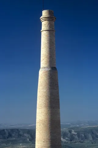
The skyline of Chilluévar stands out by the tower of the parish church Our Lady of Peace and the brick fireplace, known by the Goblin, the rest of an old factory linked to oil.

  • The parish church Our Lady of Peace is the work of the architect Gómez Luengo and was completed in 1949. Inside it preserves an 18th-century baptismal pile.
  • Tower the Goblin. The slender brick fireplace that seems to challenge the softness of the hills belonged to an old oil mill.

The different cultures have been leaving their tracks in the municipal term Chilluévar. A good example of this is the remains found in the village of Las Almansas, from the second and third centuries, in the Roman era. These remains are guarded at the Jaén Provincial Museum.

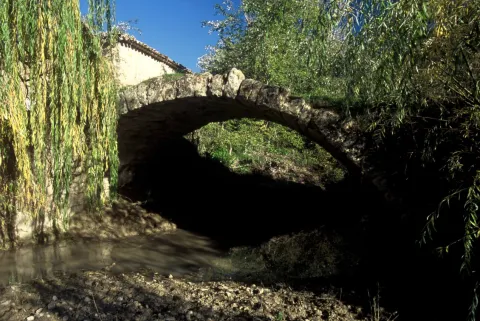
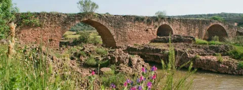
2.5 km. of the city centre, the Roman bridge on the river Cañamares, with a single eye through a half-point arch and vertical parameters, is one of the best preserved cultural legacies in the municipality.

Other remains that reveal the presence of past cultures, is the Nubla turretlocated on the left bank of the Cañamares River at its mouth on the Cerezuelo River.

Naturaleza

Located in Chilluévar, it is like looking at a balconada, in which we have protected our back with the Sierra de Las Villas, and from where we can see Sierra Magina, Sierra Nevada, the Sierra de Cazorla, as well as a large part of the jienese countryside. It is this location that defines its strategic position as part of the Cazorla Advance.

Its municipal term is a slope by which rivers, streams and springs run along the hillside to the south and south-east with the rivers of La Vega and Cañamares.

To walk through any of the signposted paths is to have the opportunity to meet with abrupt spaces, throats, limestone slices, cave formation, banks, ravines, karmic formations or large cut. In addition to the mountain pastures, we find larix pines, black pines, carrasco pines, as well as endemic species of the area.

In the vicinity of the rivers are observed riverside forests: Mimberas, willows, tarais, white chopos or black alamos.

The proximity of the saw to the lands of work, located to the south and south-east, meets the ideal conditions for the life of the Small-game cynetic fauna: rabbits, hares, foxes, partridges, quail... As well as the characteristic avifauna next to rivers, reservoirs and dams.

Without a doubt the best option to know these lands and discover life in nature, is to travel one of the close ones signposted trails of the Natural Park: Cañamares River Path, Aguascebas- Gil Cobo, Cueva del Peinero Path, Aguascebas Embalse or the Odera and Navazalto Path.

Fiestas y Eventos

In Chilluévar, in addition to the Carnival and Christmas parties, the following are also held:

  • Patron party in honor of Our Lady of Peace. Along with other peoples such as Bélmez de la Moraleda or Beas de Segura, Chilluévar has the Virgin of Peace as her patron. In his honor on January 24 his feast is celebrated with a mass and the procession of his image. The most characteristic of the celebration is the colossal luminaries that rise throughout the municipality the night before, created by the neighbors with the remains of the prunes of the olive tree.
  • Festivity of San Isidro. Together with Our Lady of Peace, they are the bosses of Chilluévar. On May 15, the Brotherhood of Labradores organized the celebration of this holiday in the area of the saw known as "Los Vilchetes."
  • Corpus Christi. On this day the neighbors are glaring the main streets of the town with carpets and altars of flowers. The procession will go through the streets accompanied by the children who made the first communion that year.
  • Fair and parties in honor of Ntra. Madam. Peace. They take place between the 3rd and 7th of September, the 4th being the day of the Virgin. In addition to religious acts, they highlight the holding of taurine acts with loops of pods that walk through the streets besieged by wooden barriers.
  • Cultural Week. In the week before the September holidays the Cultural Week takes place in which the different local associations participate and they program: dances, exhibitions, plays, bowling, riding...

Gastronomía

The varied serrana cuisine is able to adapt to the wide spectrum of seasonal products, from simple mushrooms to elaborate crumbs with their cohort of companions.

Without forgetting that the town has a area of Vega and variety of vegetables obtained in the gardens put a color note in the hot summers.

The hunting meat and other viandas are processed by their meat industry to be converted into sausages.

Among the most traditional dishes are:

  • Gachamas, which carry torreznos and dried peppers.
  • Tallarines, mass cakes with mushrooms and hare or partridge.
  • Serrana tortilla, an omelet made with a lot of chorizo.
  • Trout.
  • Lamb to the rosemary.
  • Garlic.
  • Ajoharina.
  • Crow tortilla.
  • Tissue. (chorizo, black and white morcilla, splatter)

In the pastry shop:

  • Rice with milk.
  • Sweet peas.
  • Paparajotes.
  • Skillet roses.
  • Wine nuts.
  • Butter cake.
  • Lis flower.
Historia

Chilluévar seems to have its origin in a population scattered around Las Almansas, traditionally occupied since ancient times by the Romans. Known by the Arabs, since ancient times, like Al-Corai or Alcorache (El-Balcony) makes reference to its name because of the wonderful views it enjoys.

Two circumstances contributed to the flourishing of this village: on the one hand, the works promoted by the Cardinal of Toledo, Don Rodrigo Ximénez de Rada, in his desire to spread the new Christian faith on the lands conquered to the Muslims and on the other, the transfer of cattle farmers through this place, as Chilluévar became a forced step of the Mesta on the road that unites Andalusia and Levante.

In "Chilluévar la Vieja," as today is known to the primitive site, a hermitage, a hostel, a cemetery and a pool were built. Livestock, pilgrims and traders visited the hermitage, found rest in shelter and pensions, and made the cattle abound. The disappearance of the Mesta and Trashumancia meant the progressive decline and marginalization of this primitive core, but not that of the town that at the end of the 18th consecrated a new parish church in the place called "Chilluévar Nuevo," to a quarter of leagues of the ancient hermitage. In 1787 the village received the title "Villa" at the request of Cardinal Lorenzana, a title which, although it did not mean any kind of independence, supported its recognition as a core population.
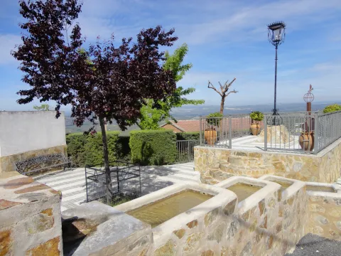
From its balconate mountain, protected on the back by the Sierra de Las Villas, you can see; the Sierra de Magina, Sierra Nevada, the Sierra de Cazorla, as well as much of the countryside, which defines its strategic position as part of the "Cazorla advance." Chilluévar belonged to the municipality of La Iruela until December 14, 1926 when he became independent.

Loading map
Preparing points of interest and routes...
Imagen principal
imagen
Image
chilluevar
Imagen principal
Activado

Cazorla

Submitted by brandcode_deweloper on
Id
727503
Perfil de redes sociales
Facebook
https://www.facebook.com/ayuntamientode.cazorla
Twitter
https://twitter.com/AytodeCazorla
Descripción
Breve descripción

Cazorla is a municipality located to the east of the province of Jaén, declared a historical-artistic complex and within the Natural Park of the Sierras de Cazorla, Segura and Las Villas, the largest protected space in Spain, the second in Europe and declared a Biosphere Reserve by Unesco since 1983.

It is the main urban enclave in these serranies. Its urban centre is located in the shadow of the Hawks' rock, with the saw behind its back and an immense sea of olive trees towards the sunset.
On the whole, the majestic castle of the Yedra stands out, from which you can see fantastic panoramic views of the urban warp of white houses, narrow and steep streets, with traditional houses and master houses, and a large number of monuments of outstanding artistic interest.

The waters of its slopes are collected by the River Cerezuelo, tributary of the Guadalquivir. A place where nature is expressed in its greatest splendor.

Telecomunicaciones
Teléfono
953 710 102
Sitio web
www.cazorla.es
Correo electrónico
hola@cazorla.es
Ubicación
Nombre
Cazorla
Latitud
37.913000
Longitud
-3.002700
Municipio
Ubicación en el mapa
POINT (-3.0027 37.913)
Imágenes
imagen
Image
85b80621-7b8b-3b9c-8a00-a8148aeeb028?t=1603980245902
Imagen principal
Desactivado
imagen
Image
b594df67-f959-109e-c0ba-7e18a6472567?t=1604611878998
Imagen principal
Desactivado
imagen
Image
c1c05e33-7065-7f4b-98d0-102559d70087?t=1617642311354
Imagen principal
Desactivado
imagen
Image
ddf4ab98-9081-e8a6-be4e-1de1e18fa35f?t=1585601103888
Imagen principal
Desactivado
imagen
Image
cascada-de-la-malena-jpg
Imagen principal
Desactivado
imagen
Image
5a4be7ef-845e-1311-4465-5d93ee402b65?t=1585662613147
Imagen principal
Desactivado
imagen
Image
6b0f484b-a6df-5339-56ce-d36c1b3447bf?t=1585662608904
Imagen principal
Desactivado
imagen
Image
98013154-7e60-0798-f8a2-8276d4558831?t=1585662610794
Imagen principal
Desactivado
imagen
Image
8e6fbd9b-cd54-a1bb-152d-26517851640a?t=1585662606458
Imagen principal
Desactivado
imagen
Image
53c2b0f0-ae8b-4c68-be4a-65a62d56213a?t=1585662608209
Imagen principal
Desactivado
imagen
Image
6dfc9684-2c39-5bcb-6034-5f683a2d4fe7?t=1585662610402
Imagen principal
Desactivado
imagen
Image
d05370ad-6492-179e-94f9-f68a1f31a13e?t=1617642404091
Imagen principal
Desactivado
imagen
Image
984decb5-d613-1794-5c3d-c6906af63538?t=1617642404161
Imagen principal
Desactivado
imagen
Image
19447111-87cb-503d-367d-48d3479d9dff?t=1617642477177
Imagen principal
Desactivado
imagen
Image
843cba48-ecf2-71bb-65c4-4c96633d6c17?t=1617642477250
Imagen principal
Desactivado
imagen
Image
b3601395-6287-90b8-0503-7c31c7d3cbb8?t=1617642477422
Imagen principal
Desactivado
imagen
Image
cazorla-1-jpg
Imagen principal
Desactivado
Información adicional
Curiosidades

https://cazorla.es/turismo/
turismo@cazorla.es

Imágenes cabecera
imagen
Image
castillo-de-la-yedra-6-jpg
Imagen principal
Desactivado
Datos de interés

Tourist area: Serras de Cazorla, Segura and the Villas
Distance to the capital (km): 105
Altitude over sea level (m): 836
Extension (km ²): 305
Number of inhabitants: 8527
Gentilicon: Cazorleños
Postal code: 23470

Videos
Video file
Cultura

Cazorla, at the gates of the Natural Park of the Sierras de Cazorla, Segura and Las Villas, is a lesson of how man and nature have forged an alliance that comes to this day. Its rich cultural heritage includes places that cannot be lost.

The castle of the Yedra, whose origins could be Muslims, perhaps from the Almohad era (12th century), although throughout the 13th, 14th and 15th centuries Christians finished giving it their definitive configuration, which explains that in many of their inner stays the Gothic style predominate. The tower of tribute houses the Museum of People's Arts and Costumbres of Alto Guadalquivir. It is a place where you can learn more about how the ancestors lived on these lands.

From its enclave, 831 meters above sea level, it is seen the town of Cazorla and its surroundings.

The ruins of the church of Santa Mariaa sample of the Andalusian Renaissance. It is very likely that its author was Andrés de Vandelvira, as many of its elements can be recognized in the temples of its author located in Ubeda.

It is built on the Cerezuelo River, which was forced to channel previously, and which enters a large visitable vault under the main altar, across the whole church, to follow its course under the square of Santa Maria. It is very likely that the church was never fully completed and that the serious damage caused by the terrible storm and flood of 1694 would further make it difficult to complete it. It is the only church built on the bed of a river.

The City of Cazorla currently houses the Municipal Office of Information and Tourism and the Multipurpose Spacewhere concerts and shows are held.

Naturaleza

The location of Cazorla in the middle of the saw, whose historic town seems to be spilled on the rock of the Hawks, certainly makes it one of the most beautiful Jienian peoples. And the best way to discover the wonders of nature in this area is to realize one of the paths that, duly signified, exist in the environment. These include the following:

  • The Castle of the Five Skins Path.
  • Circular path of the Cerezuelo River.
  • Path of the Stairway.
  • The birth of the Guadalquivir River.

Walking these paths will be the ideal way to contemplate the maze of valleys, calares, slices, mountains and river basins, as well as the large number of rivers and streams that go along the slopes. In these walks, we will also discover the variety of Mediterranean botany of this place: pine, juniper, oak and other endemic species. Among the fauna are rapacious birds and mammals such as the rabbit, hare, deer, foxes and boars. A unique opportunity to discover the many ecosystems that exist in this environment.

Fiestas y Eventos

The Holy Week is of unique importance in this town of Cazorla. During the days of this week they process several steps in each of the days and have been carved by well-known imagers.

The Romeria de la Virgen de la Cabeza, which takes place on the last Sunday of April, has a deep-rooted devotion among the neighbors. In preparation for the rosemary, on the Sunday of April before the rosemary, a parade of lambs decorated with colored ties is held to be offered to the Virgin and will be auctioned in the following days.

From the City Hall, numerous cultural and sports events are organized and promoted, including the following: Blues Cazorla Festival, International Theatre Festival, Festivals of the advance of Cazorla, Nocino de la Tragantía (a local theatrical association), Marathon BTT Sierra de Cazorla.

Gastronomía

The gastronomy of the 26 municipalities that form this Natural Park of the Sierras de Cazorla, Segura and Las Villas is influenced by both Andalusian and Castile La Mancha cuisine.

The raw materials they use are game meat, river fishing, vegetables and vegetables from their own harvest. That's right, all of it properly decorated with the oil of their olive groves.

Among the most typical dishes, we will mention the following:

  • The gachfriend, crumbs of flour, water, oil, dried and fried peppers, chorizo and, depending on the time of year, melon, cherries, grapes...
  • Ajoflour: flour, garlic, peppers, potatoes, tomatoes, pepper, water and salt.
  • Thalarines or rhinestones: fine flour mass cakes with hare or rabbit.
  • The rhin-ran.: a good entrance at any table. The traditional serrano bread is attached in a purée of pyrrrrrama or gypsy salad: made of onion, pepper, tomato, garlic, cumins, extra virgin oil, vinegar and salt.
  • The serrana trout, trout in almond sauce or trout with truffle.
  • Grape bread: an outstanding dessert made with dried figs and mixed with nuts, minced almonds and a chorrit of anis.
Historia

Around 2000 BC, on the ancient terraces of the Cerezuelo River, the first inhabitants are established.

During the romanization, the Romans settle in this region and exploit the wealth of silver and salt that existed in the area. It will be during the Muslim occupation that Cazorla, like its neighbouring localities, will be fortified by the construction of castles.

In this way the Lord of Cazorla in the Middle Ages will become a major border enclave. This shows the number of castles and fortresses that delineate the advance, created in 1231.

The Christian conquest of these territories was carried out by Mr Rodrigo Ximénez de Rada, Archbishop of Toledo, in 1235. It will be King Ferdinand III who gives in feud to the archbishopric of Toledo these territories under the name of the advance of Cazorla.

The lordship will continue until the abolition of the Lordships in the early 19th century, although in this time space there are jurisdictional conflicts between the inhabitants and the diocese of Toledo.

The Cortes de Cadiz gave him the title of City in 1813 for his participation in the War of Independence.

Loading map
Preparing points of interest and routes...
Imagen principal
imagen
Image
cazorla
Imagen principal
Activado

Benatae

Submitted by brandcode_deweloper on
Id
1551128
Perfil de redes sociales
Facebook
https://www.facebook.com/Ayuntamiento-de-Benatae-1664722857091061/
Twitter
https://twitter.com/aytobenatae?lang=es
Instagram
https://www.instagram.com/aytobenatae/?hl=es
Descripción
Breve descripción

Benatae is a municipality in the province of Jaén that is located in the centre of the Sierra de Segura. With 44.4 km2and 574 inhabitants, the smallest of the municipalities of this saw.

Its urban core is located at the foot of the mountain Peñalta. And everything its term is included in the Natural Park of the Sierra de Cazorla, Segura and Las Villas.

Economic activity depends on the olive tree Although most of its term is forestry. Tourism has not arrived to this area, so it draws attention to the tranquility and silence of its streets and permanent contact with nature. This is a real luxury that contrasts with the pollution, noise and haste of the large urban cores.

Its municipal term is divided into two enclaves: the mainwhich concentrates most of the area of the term and where the municipal capital is located; and Toril- Hornico Canyon Room, to the southeast of the previous and already at the limit of the term of Siles.

The municipality of Benatae has four urban centres: Benatae (with 522 inhabitants), The Sources (41 inhabitants), Honda Bridge (11 inhabitants) and La Sierra (0 inhabitants).

Of historical interest is the parish church of Our Lady of the Assumptionbuilt between the 15th and 18th centuries, under the Gothic, Renaissance and Baroque styles. The Cardete castle, of Islamic origin.

Telecomunicaciones
Teléfono
953 482 080 / 646 538 193
Sitio web
www.benatae.es
Fax
953 48 03 78
Correo electrónico
ayuntamiento@benatae.es
Ubicación
Nombre
Benatae
Latitud
38.352800
Longitud
-2.651720
Distrito
Municipio
Ubicación en el mapa
POINT (-2.65172 38.3528)
Imágenes
imagen
Image
503381a0-a037-4194-ff60-5d0bde7bd8eb?t=1586173665113
Imagen principal
Desactivado
imagen
Image
a8f2e998-bdeb-46df-7db5-53a201b069a5?t=1586260713984
Imagen principal
Desactivado
imagen
Image
0b040457-3cd7-a698-46cc-e44610d76b68?t=1586260715045
Imagen principal
Desactivado
imagen
Image
dfcb0a73-e543-fbd6-0029-ff19866b10b0?t=1586260714932
Imagen principal
Desactivado
imagen
Image
254e1600-7171-d7b0-b2e0-07895307f642?t=1586260714731
Imagen principal
Desactivado
imagen
Image
0c1cbd11-c624-b079-2569-5a28b68c84b3?t=1586260714632
Imagen principal
Desactivado
imagen
Image
a30e8140-f057-e226-6c36-a1aa40da29ba?t=1586260714550
Imagen principal
Desactivado
imagen
Image
99bed497-698b-3a53-3064-0c490799b8ee?t=1586260714426
Imagen principal
Desactivado
imagen
Image
47d35d7b-6844-f724-ebe6-24419b8f82e6?t=1586260714265
Imagen principal
Desactivado
imagen
Image
ba5bb27c-ae97-a532-b5ff-11bd95214a12?t=1586260714150
Imagen principal
Desactivado
Imágenes cabecera
imagen
Image
benatae
Imagen principal
Desactivado
Datos de interés

Tourist area: Serras de Cazorla, Segura and the Villas
Distance to the capital (km): 156
Altitude over sea level (m): 842
Extension (Km2): 45
Number of inhabitants: 545
Gentilicon: Babies
Postal code: 23390

Videos
Video file
Cultura

Its historical and monumental heritage highlights:

  • Church of Our Lady of the Assumption: It's the most important of Benatae's buildings. The temple responds to the sacred Levine architecture, which could be due to the fact that, during the period of configuration of its factory, it belonged to the kingdom of Murcia, a situation that lasted until the suppression of the Military Order of Santiago. Construction started in the 15th century and ends in the XVII, which causes architectural elements of the Gothic, Renaissance and Baroque styles to exist. The cover, next to the epistle, is of sillery, with a half-point arc with convexa molding through the intrados. It is framed in a potter that rests on Gothic moldings. The tower of irregular silery has a characteristic form: it is quadrangular and three times longer than widewith holes at the ends for the bells. The plant is of a central ship in the form of a rectangle divided into three sections. The presbyterium appears behind a pointed chest arc. The altarpieceIn the wood, it is organized in three streets and in the central one is found the image of the Immaculate in a furnace.
  • Cardete Castle: In the Islamic era, Benatae would have as a refuge the nearby fortress of Cardete. The enclosure is an irregular trapezoidal construction, with a troncopyramidal tower on the lower side reaching 14 m high. It was declared Good of Cultural Interest in 1985.

Other monuments:Semicircular bullring square, where in addition to the cobblestones and taurina parties are held competitions of the characteristic game of the Sierra de Segura, the serrano bowling, a hermitage consecrated to San Ginés and in its municipal term the Castle of the Fuentes, declared Good of Cultural Interest.

Naturaleza

The strategic geographical position of Begíjar, in an environment of great agricultural wealth, made its population possible from the most remote antiquity. The oldest remains are linked to the Final Neolithic and Copper Age (3rd millennium BC) in the settlement of Las Majadillas, and in the settlement a little later, of the Bronze Age, of Terrera del Goterón.

Fiestas y Eventos

The turnips look forward to the arrival of the following parties:

  • San Ginés de la Jara: The feast of the patron, San Ginés de la Jara, the major feast of Benatae, and is celebrated of the day 22-25 August. The pattern is held as the protective saint who cured the herniates. Traditional are the cows' coins, which are run through the streets of the village. The cocks were brought from Orcera to the missing San Ginés hermitage, located at the entrance of the village. It was preceded by the banner of the brotherhood that ran in front of them.
  • San Marcos: the 25 April, local town party. This day we consume the traditional hornazos and we usually go to the field to "scare the devil." The turnips spend the day in the area called "Fuentemarcos" (The fountain of San Marcos).
  • San Isidro: on May 15, the farmers' guild celebrates their patron by taking the "crow," a traditional drink consisting of wine with water, sugar and fruit. They are usually done. "luminaires," bonfires with branches of rosemary, on the eve of some celebrations like San Antón, la Candelaria and San Blas.

Gastronomía

The gastronomy of Benatae has a common dish that accompanies many of its dishes, is the call "brave broth." The basic preparation of this dish consists of cooking a few spicy dry peppers and then soaking the spoon of the food to be accompanied by this broth.

It is a special accompaniment for flour or corn crumbs, serrano galians, gachas crumbs, or bread crumbs that are usually accompanied by fried chorizo, orza loin, torreznos and fried dry peppers.

A dish of the town are the "scallops"in which the very fine strips of flour are cooked in a stew of potatoes, tomato, pepper, onion, garlic and sweet pepper, with a touch of peppermint. The rags can carry hare or cod if they are made for Lent time.

On Easter, the "panets" accompany the cod vigil potage. The "panets" are made of bread miga, very chopped parsley, saffron in strands, garlic, pepper, salt and beaten egg. With all this, a mass is made which, being thrown into very hot oil, will go golden and form the "panets."

The turnips have not lost the custom, with all the pitancers, of the killing of the pigAnd there are many families that make their own chacinas that will be giving good account for the rest of the year.

Historia

It is not known when the first occupation occurred in the territory of Benatae, although it must not be ruled out that in very old phases of the Stone Age There would have been some population. In the Eagle cavein the cortijo of Los Lagartos, located almost a thousand meters above sea level, as from there come some microlytes, small pieces of silex.
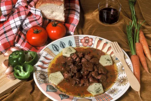
They've been found. ceramic remains at the end of the Iberian stage in the Cerro del Castillo of the Cortijo de las Fuentes. Surely, as in other areas of the Guadalimar Valley, the calls were extended to one and the other side of the river. "Roman villae"whose inhabitants lived from the cultivation of the land.

In the Islamic era it must have been a village and its name seems to be of Arab or Berber origin. Like the village of Benatae, there would be others who had as refuge the castle of Cardete, constituting a district, an organizational structure that was widespread in Al-Andalus.

Although Benatae does not appear cited in the populations conquered by Fernando IIIIt must have been busy. between 1,226 and 1,242, at the same time as most of the Sierra de Segura. It would later be ceded by the king to the Military Order of Santiago.

From this date on the population continued to grow, and 1.415, King John II gives him the title of villa.

In the following five centuries, the history of Benatae has been linked to the kingdom of Murcia, the Order of Santiago, the General Assembly of Castile and the bishopric of Cartagena. The population of the town will increase to 1,538 in the year 1,950.

From this date, the Economic hardship who suffered the region for much of the Franco, and migrationThey're in the causes of the beginning of depopulation that starts to notice.

The current economy is based on agricultural orientation, on the cultivation of cereals, corn, hemp, wine and oil. In addition to this, the breeding of the cattle, the hunting and the logging of wood on the mountain, become its productive reference points.

Loading map
Preparing points of interest and routes...
Imagen principal
imagen
Image
benatae
Imagen principal
Activado

Beas de Segura

Submitted by brandcode_deweloper on
Id
725377
Perfil de redes sociales
Facebook
https://es-la.facebook.com/pages/AYUNTAMIENTO-DE-BEAS-DE- SEGURA/125298257498380
Twitter
https://twitter.com/aytobeassegura
Descripción
Breve descripción

A town located to the north-east of the province, between Sierra Morena and the Sierra de Segura, with a landscape of large olive groves and mountain areas. Part of its term is included in the Natural Park of the Sierras de Cazorla, Segura and Las Villas, the largest protected space in Spain: the orographic labyrinth of valleys, calares, tachos, mountains and altiplanos of great hydrological importance (because of the large amount of rivers and streams that they handle); botany (lario pine, carrasco pine, black pine and many endemic species); faunistico-cynetic and landscape.

From all of which it follows that it is one of the most visited and frequented natural spaces in the country. In its term is the Embalse del Tranco de Beas, one of the most beautiful places in the entire Park. The urban core has a quiet, white and harmonious aspect, in which elements such as the Convent of the Carmelites, the Mocchio Bridge, the Parish of Our Lady of the Assumption and the Palace of the Sandovales stand out.

Telecomunicaciones
Teléfono
953 424 000
Sitio web
www.beasdesegura.es
Correo electrónico
turismo@beasdesegura.es
Ubicación
Nombre
Beas de Segura
Latitud
38.252530
Longitud
-2.889850
Distrito
Municipio
Ubicación en el mapa
POINT (-2.88985 38.25253)
Imágenes
imagen
Image
79945e94-3092-d99e-1404-1cf7692a4381?t=1585574461382
Imagen principal
Desactivado
imagen
Image
b8a94a81-da6c-d0c4-8cab-5f4f5136a71c?t=1616675872913
Imagen principal
Desactivado
imagen
Image
cff0ec28-2934-b2e1-ce19-53f1746163fd?t=1585574461798
Imagen principal
Desactivado
imagen
Image
31d69475-fd88-41ac-3e7b-bcaece457149?t=1616675873252
Imagen principal
Desactivado
imagen
Image
88bcf4cd-a186-1f8f-8170-cac04aa6998f?t=1585574456638
Imagen principal
Desactivado
imagen
Image
f05e0b2a-2d48-4d1f-ead4-d31316d00b49?t=1585574456825
Imagen principal
Desactivado
imagen
Image
0c9bc10a-ced0-46be-a896-2fa43b1c0cf6?t=1585574457518
Imagen principal
Desactivado
imagen
Image
a35ec1fb-ac27-b460-6d48-f560c3021388?t=1585574461578
Imagen principal
Desactivado
imagen
Image
151ff99d-bb15-0c69-fc80-350b68f240f9?t=1585087029731
Imagen principal
Desactivado
Información adicional
Curiosidades
  • http://www.turismobeasdesegura.es/
  • turismobeas@gmail.com
Imágenes cabecera
imagen
Image
4366d0ec-d1b6-4363-8869-a2a89e5b76f4?t=1611067513835
Imagen principal
Desactivado
Datos de interés

Tourist area: Serras de Cazorla, Segura and the Villas
Distance to the capital (km): 121
Altitude over sea level (m): 600
Extension (Km2): 155
Number of inhabitants: 5591
Gentilicon: Beassians
Postal code: 23280

Videos
Video file
Cultura

Few villas may presume to have been a source of poetic inspiration from some of the most universal literates. St. Teresa of Jesus, St. John of the Cross or Francis of Quevedo were captivated by the places they found in Beas de Segura, the main population core of the Sierra de Segura, with a strategic location and a legacy full of history.

The municipality also belongs to the pedanias of Cañada Catena, Cuevas de Ambrosio, Cazona, Los Santiagos, Cortijo de las Piedras and Prados de Armijo among others. Arroyo del Ojanco also belonged to Beas de Segura, until its segregation in 2001.

It is the most inhabited municipality of the Sierra de Segura region, also one of the entrance doors to the Natural Park on the road A-314 (Segura-Cortijos Nuevos), once the National 322 (Crta. Cordoba-Valencia) has been abandoned.

Beas is a bridge that links the Campo de Montiel with the Alto Guadalquivir and forced passage from Baja Andalucía to Levante. Its name comes from the Latin term Veha which means way or way, because it is located at the crossing of three Roman tracks that are headed for the Sierra, the Levante and the County. It's across the Beas River.

It has 35 archaeological sites in its term that give proof of its history. In the urban centre we will find medieval architecture, historical of the late 19th, etc. Beas de Segura also has villages that are a delight for the visitor.

We highlight the following points of interest:

  • The Carmelite Convent.Here was the first foundation of St. Teresa of Jesus in Andalusia in 1575. Three years later, San Juan de la Cruz arrived. A Renaissance style in his church stands out as a major altarpiece.
  • Mocchio Bridge.Located on the Guadalimar River, this bridge that belonged to the new Via Augusta, is made of limestone masonry. Paleolithic materials have been found nearby. Divide Beas from the neighbor Chiclana de Segura.
  • Church of the Assumption.It is of medieval origin, but was rebuilt in 1825 after the burning it suffered years earlier. In the 14th century the chapel was built where the gentlemen who made the incursion into the Nazarite territory of Granada were buried.
  • Uceda Street.The historical architecture representative of the 19th century is altered in this way with neo-Arab elements with classical and Renaissance lexicographs. To highlight another house with califal references with horseshoe arches and scones.


Naturaleza

In its municipal term the traveller is surprised with a landscape of valleys and mountains surrounded by a true sea of olive trees. The orography of the term is very rugged by the countless valleys and mountains that settle. Mountains such as Pico Corencia, Eagle Stone, Cerro de la Hoyera or Las Zanjas, with heights above 1,000 meters, and places such as the Water Cave (very close to the village and divided into two orchards communicated by a small but deep lake).

The areas of the Soto, Palananas, Buenamar, Aceres, Buzo de la Nieve or Fuente Pinilla are also important and deserve the attention of nature lovers and hiking. No less suggestive is the Mirador de las Maravillas, in the direction of the village of Cañada Catena, a limestone escarpe over the valley of the Beas River that gives name to the cortijo, used as rural accommodation.
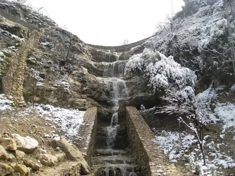
Another of the attractions of the municipality is the aerodrome of El Cornicabral, located in the N-322, about five kilometres from the city centre of Beas. It has two cross-tracks of 1,500 and 700 metres long, two hangars for 800 and 600 square metres aircraft and free camping area with service building.


Fiestas y Eventos

On January 23, the eve of the day of Our Lady of Peace where the lumbres burn in all the corners of the town while tasting typical products. After Holy Week The big local party is taking place. From 22 to 25 April the parties of San Marcos that bring together thousands of people from the most diverse backgrounds around the running of bravas, soaked in the streets of the town.
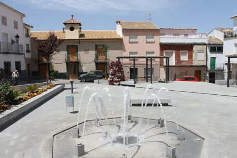
Although the first skirmishes, for the younger ones, begin on the afternoon of the 23rd, the adrenaline is fired when, one after another, the reses are jumping into the sand. Bulls and cows, between clouds of dust and screams of the spectators to see almost the hundred that, during the afternoon of the 24 and all the day 25, will walk the streets led by squadrons to care for and guide them with a rope of between 10 and 25 meters. After the summer period with the festivities of its different villages already held, ends the festive cycle with the fair and parties from 17 to 20 September in honor of the Our Lady of Peace.
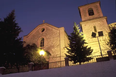
 

Gastronomía

Beas was always a land of passage for the transhuman pastors who crossed the manchegan lands looking for the pastures of the south for their cattle.

The fruit of this pastoral heritage, in Beas, the pastoralist cakes, made of flour, water and salt and amassed in a curted sheep or goat skin that the pastor carried on his journey, have been preserved. These cakes are the basis of other masses that are incorporated into the peas, such as the andrajos or galians, where the mass is cooked next to the hunting meat and sometimes with pieces of cod.

To highlight also the Easter bannazos, with several eggs cooked.
 

Historia

Beas de Segura is a villa full of history. Their occupation is documented from the Lower Paleolithic. It was in Roman times that Beas was consolidated as an urban core. From that time there are many tracks, such as villas, streets or the emblematic Mocho Bridge.

During the Islamic period, the stage of the highest splendor of Beas was reached in the time of Abdeleran III where it was part of the great district of the Alpujarra and Elvira. From that time it was its fortified enclosure, now already missing. Fernando III conquered Beas between 1224 and 1227 by joining her in the Crown of Castile, giving as an award to his Chancellor Don Juan, Bishop of Osma, the castle and the Villa of Beas, and this in turn the exchange with the Master of Santiago in exchange for inheritance. The title of Villa and other privileges received it in 1239, and in the 16th century, according to the Topographic Relations of Philip II, Beas appears as a flourishing economic center in the area of Segura, with a strong agricultural activity.

After the Reconquista was first included in the territorial demarcation of Toledo and within the Order of Santiago's Order, then passed to the Dependence of the Governor of Segura. Thus he was part of the Segura Common and all his territory was governed by the Ordinances. It was a crossroads of roads, hence its primitive name of Veha (way or way). Here are the three Roman tracks that were heading for the mountains, the Levante and El Condado.

At present, Beas is one of the main economic centres of the Sierra de Segura, whose region presupposes pride despite the fact that in the past it did not belong to the Segura Encomandación. Through the Beas River, the town is on horseback between the Sierra de Segura and the lands of El Condado and Sierra Morena. Beas de Segura offers the traveller a legacy impregnated in history, as demonstrated by the 35 archaeological sites located in its term.

The oldest pieces, including those of the Mocchio Bridge, are preserved in the archaeological section of the Provincial Museum. Beas is one of the doors of the Natural Park of the Sierras de Cazorla, Segura and Las Villas and an excellent starting point for entering the interior of these majestic lands.

Before, the traveller can walk his urban town, between narrow and tortuous streets that bear witness to a rich medieval and historical architecture of the late 19th century, such as Ángel Uceda Street and the building of the Old Carniceria. However, his main monumental claim is the Convent of the Descalzas Carmelites, which Saint Teresa of Jesus founded in houses owned by Catherine Maria de Sandoval and Godínez.

In a Renaissance style, the convent has a baroque cover and is structured with the classic half-point arch on imposts, with mensula in the key and rosettes. On the friso with triglyphs there is a split fronton and shields that frame the pilasters and bake with San José and El Niño. On the niche, the shield of the Order. A large triangular front and pinnacles kill the facade.

Loading map
Preparing points of interest and routes...
Imagen principal
imagen
Image
d383e669-73f6-0a29-76df-3aa2da3d3377?t=1603979643246
Imagen principal
Activado
Literatura

An appeal that captivated the greatest mystic poets: Santa Teresa, for whom this land was "most delightful and of a fine climate," and San Juan de la Cruz, who was constantly travelling to and from Beas from the various places his duties took him. 

The presence in the town of illustrious figures such as Santa Teresa de Jesús, San Juan de la Cruz and Ana de Jesús reinforces Beas's importance in the reform of the Carmelite Order.

Archaeological Site Terrazas del Guadalimar

Submitted by brandcode_deweloper on
Id
7971552
Descripción
Descripción larga

The human occupation of the environment of what is today Beas de Segura is very old. The first human testimonies of the Sierra de Segura appear in this site, in the area of Puente Moccho, a name that is designated to an extensive outdoor habitat next to the terraces of the Guadalimar River. There are materials from the Lower and Middle Paleolithic of the dawn of the last glaciation (between 100,000-10,000 BC).

This place was the passage of important mammals, it had abundant fishing resources and abundant raw material for the manufacture of carved stone tools, highlighting rolling edges and pebbles worked in quartdate.

The remains of the Lachelian political industry of this place were discovered in 1913 by Cabré and the Abad Breuil and part of them are found in the Provincial Museum of Jaén, in the Archaeology Section, room 1: Prehistory.

Breve descripción

It is the oldest archaeological site in the province of Jaén, so the oldest pieces that are preserved in the provincial archaeological museum are those from this site.

Telecomunicaciones
Sitio web
www.beasdesegura.es
Correo electrónico
aytobeas@yahoo.es
Ubicación
Código Postal
23280
Latitud
38.253863
Longitud
-2.889467
Dirección
Paseo de la Constitución, 1
Distrito
Municipio
Ubicación en el mapa
POINT (-2.889467 38.253863)
Tipos de punto de interés
Imágenes carrusel
imagen
Image
Yacimiento%20Arqueol%C3%B3gico%20Terrazas%20del%20Guadalimar2.jpg
Imagen principal
Desactivado
Imágenes cabecera
imagen
Image
YACIMIENTO%20ARQUEOL%C3%93GICO%20TERRAZAS%20DEL%20GUADALIMAR%20PUENTE%20MOCHO.jpg
Imagen principal
Activado
Loading map
Preparing points of interest and routes...