Saltar al contenido principal

Siles

Submitted by brandcode_deweloper on
Id
751177
Perfil de redes sociales
Facebook
https://www.facebook.com/ayuntamiento.siles/
Descripción
Breve descripción

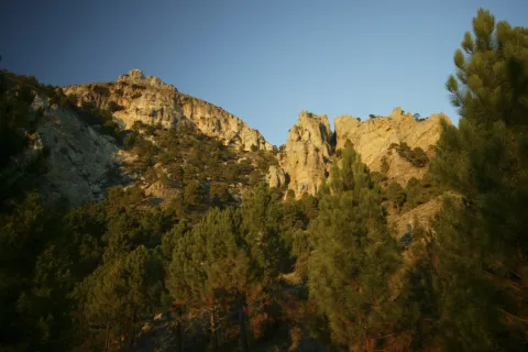
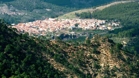
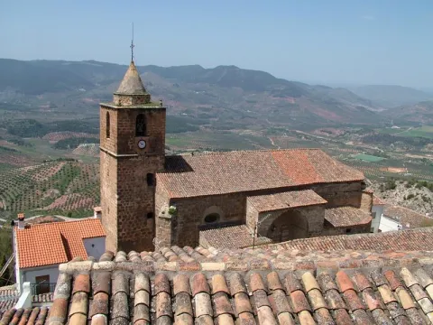
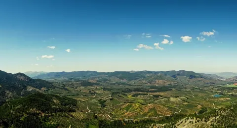
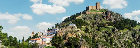
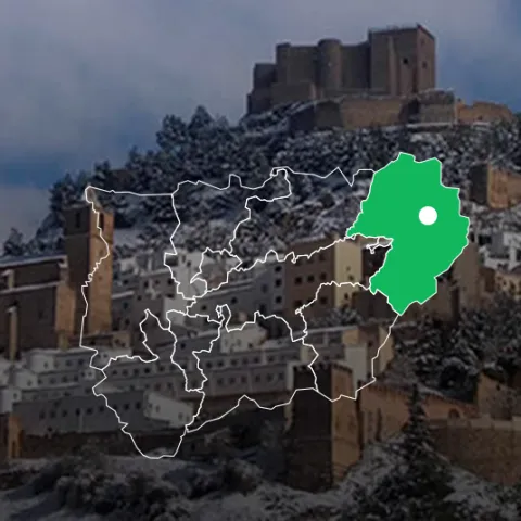
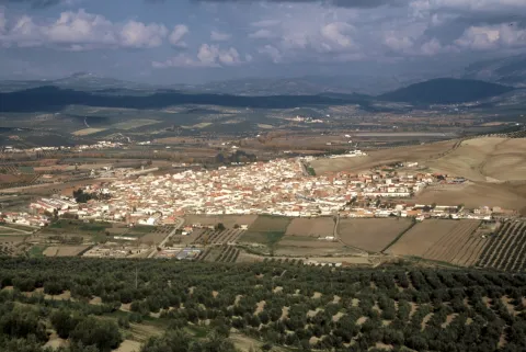
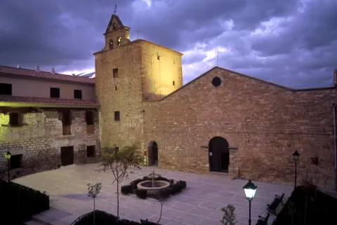
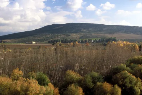
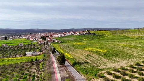
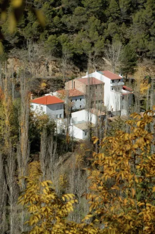
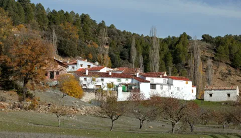
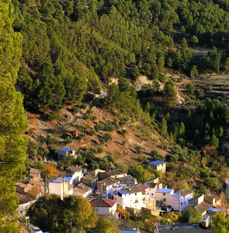
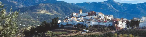
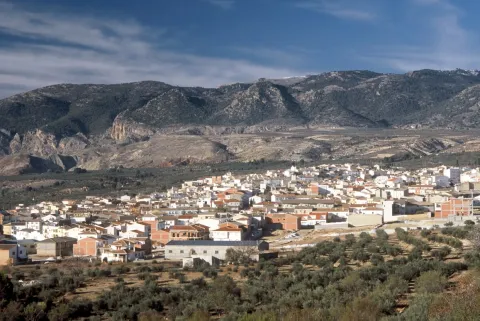
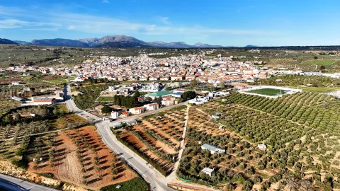
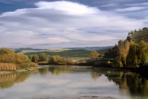
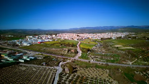
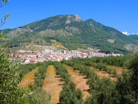
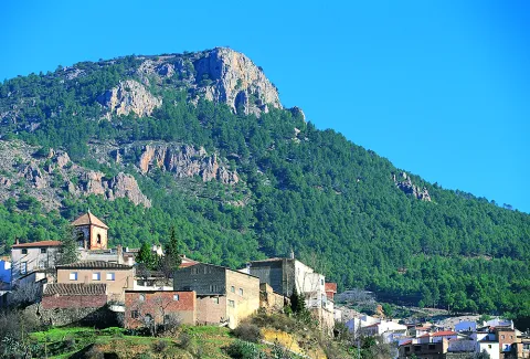
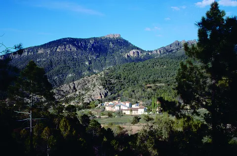
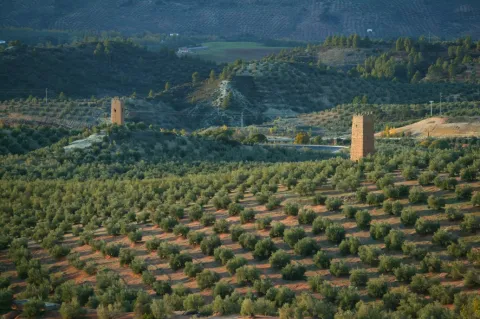
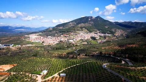
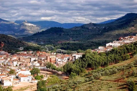
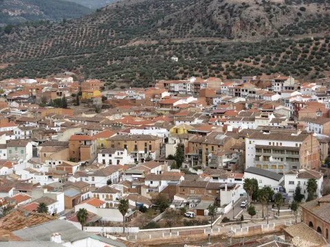
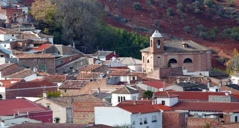
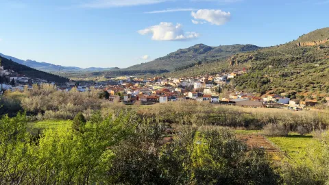
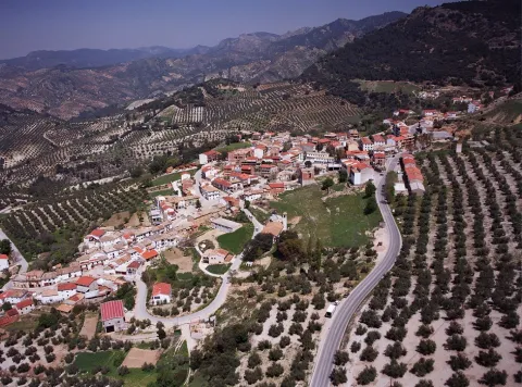
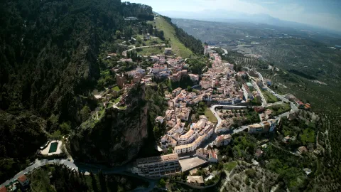
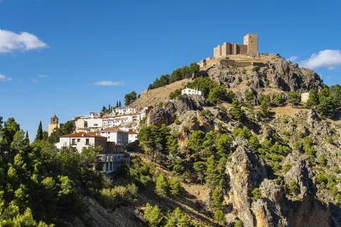
Siles, a municipality belonging to the region of La Sierra de Segura, located in the north-east of the province of Jaén bordering that of Albacete. Much of its municipal term is found within the Sierra de Cazorla Natural Park, Segura and Las Villas. It is a largely forestry municipality where the agricultural land is occupied by the olive tree.

The economic activity is based on olive cultivation and tourismand also contributing to the Forest and sheep farming.

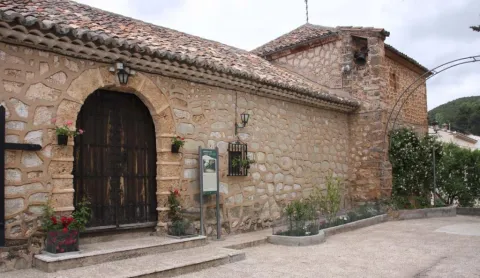
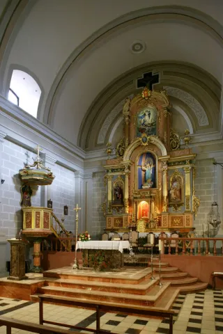
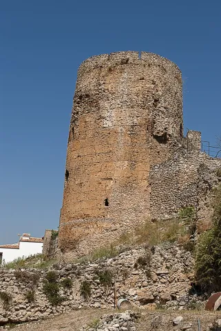
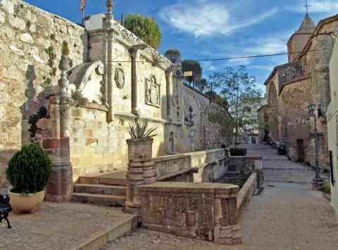
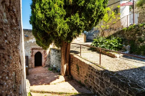
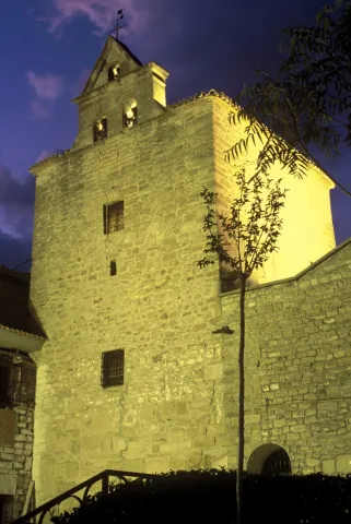
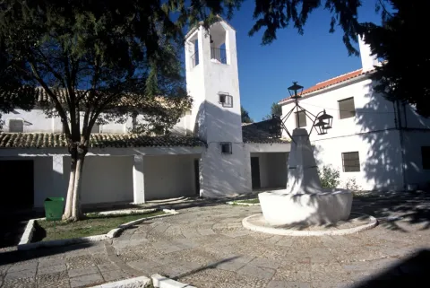
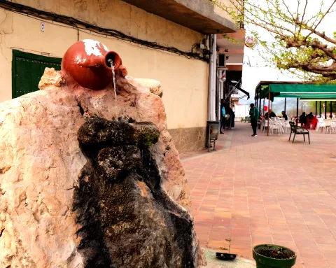
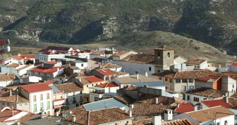
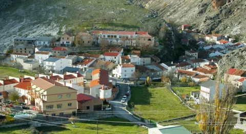
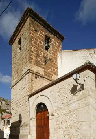
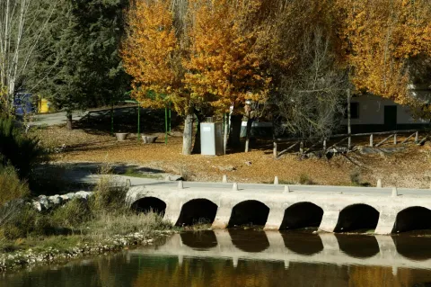
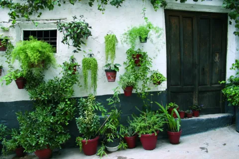
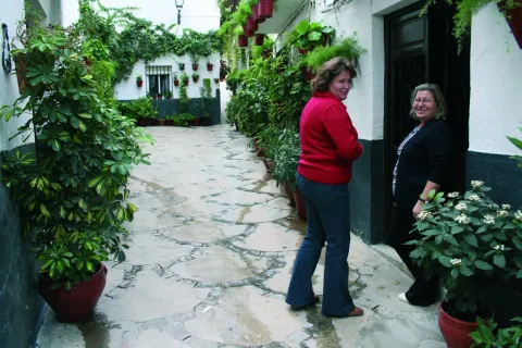
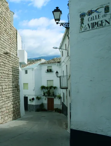
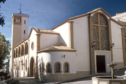
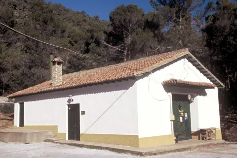
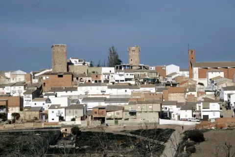
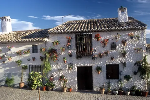
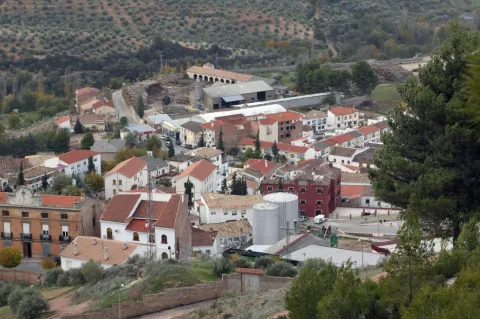
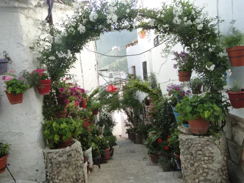
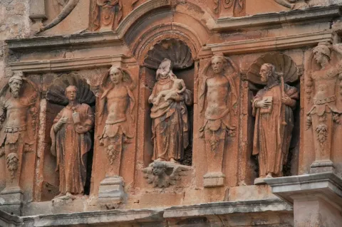
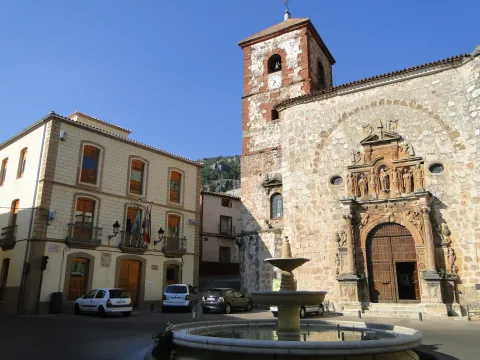
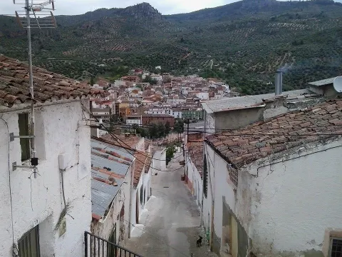
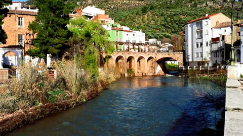
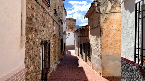
Siles is a peculiar town of paved streets, located on a valley surrounded by raging hills and lush vegetation. Among its historical heritage we highlight: The Cube, the Parish Church of Our Lady of the Assumption, the Casa Tercia and the Hermitage of San Roque

The urban centres of Cañada del Señor, Don Marcos and Vega de Castrobayona are part of this municipality.

In its surroundings is the Peña del Olivar, the Fresnedilla and the Acebas.
Telecomunicaciones
Teléfono
953 490 011
Sitio web
www.siles.es
Fax
953 490 134
Correo electrónico
siles@dipujaen.es
Ubicación
Nombre
Siles
Latitud
38.387860
Longitud
-2.582630
Distrito
Municipio
Ubicación en el mapa
POINT (-2.58263 38.38786)
Imágenes
imagen
Image
76a95edf-8d78-b395-9f6d-b4a6b8bdda0b?t=1595425987772
Imagen principal
Desactivado
imagen
Image
94370971-1dc8-2799-0129-eca53780063d?t=1595425987994
Imagen principal
Desactivado
imagen
Image
98659dbc-bf62-4c41-697a-1d7c25ededcd?t=1621466619603
Imagen principal
Desactivado
imagen
Image
89e38897-1d73-3719-11f7-569687f1ec85?t=1595425988395
Imagen principal
Desactivado
imagen
Image
30c2aa9f-934a-d68a-6550-ef7098aee8b7?t=1621466707413
Imagen principal
Desactivado
imagen
Image
972b6bcb-8161-571b-15b9-f84461a75c71?t=1598449651752
Imagen principal
Desactivado
imagen
Image
c52e7eb7-3a4b-972c-b3de-63e5e010a5ae?t=1621466707445
Imagen principal
Desactivado
imagen
Image
1a36dd25-c65a-39ed-adb6-a746dc8c5317?t=1621466707475
Imagen principal
Desactivado
imagen
Image
84e4e8d7-ec58-9d4b-8a66-8bc7b40e79e8?t=1621466707618
Imagen principal
Desactivado
imagen
Image
2a247660-1e9b-78f3-1f93-ac7a1c2a05dd?t=1621466707739
Imagen principal
Desactivado
Información adicional
Curiosidades

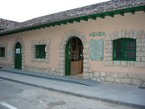
Punto de Información Turística (Siles)

TURISMO ACTIVO

  • Ctra. Hellín, 21
  • 23380 Siles Jaén (España)
  • Tfno.: 953 491 143
Imágenes cabecera
imagen
Image
Siles
Imagen principal
Desactivado
Datos de interés

Tourist area: Serras de Cazorla, Segura and the Villas

Distance to the capital (km): 160

Altitude over sea level (m): 828

Extension (km ²): 178

Number of inhabitants: 2,241

Gentillo: Sileños

Postal code: 23380

Videos
Video file
Cultura
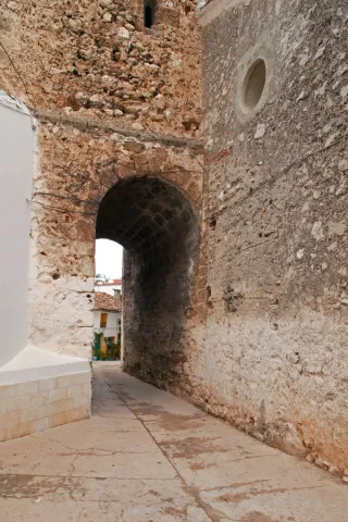
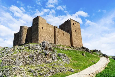
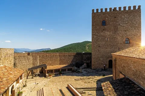
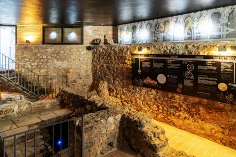
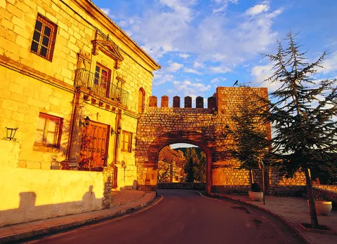
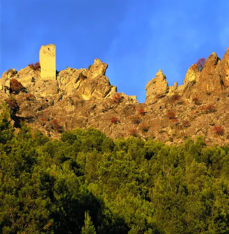
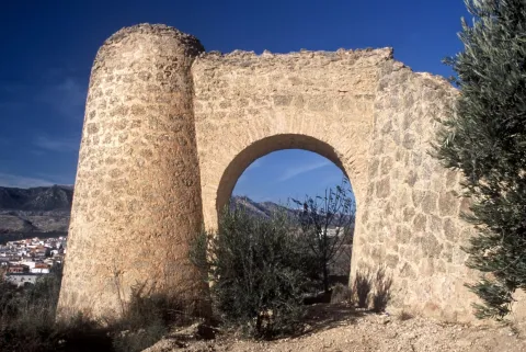
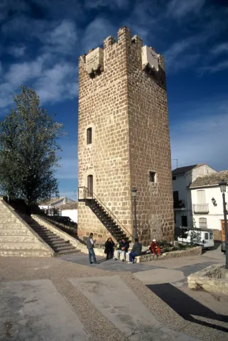
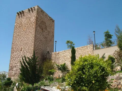
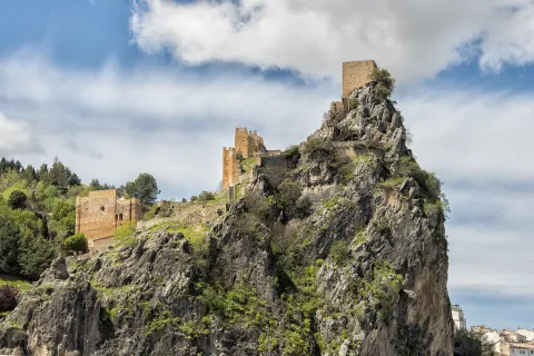
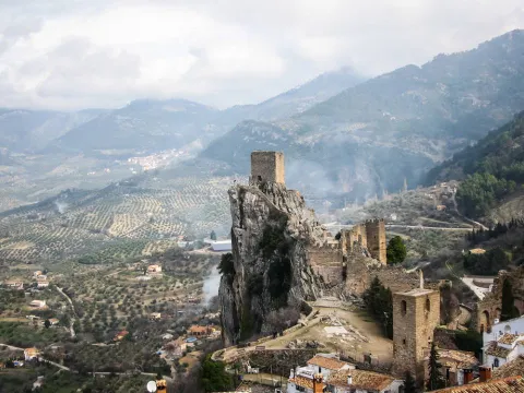
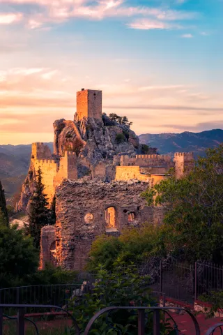
  • The Cube: The cylindrical tower of The Cube is the main emblem of Siles. It's a 21.5 m height. It is made of masonry with lime mortar. On the lower level we find a room of considerable height, topped with a half orange vault. On the first floor, it has another circular room of smaller size, because it has the staircase of access to the roof, and covered with gothic vault with nerves. By the type of construction, its origin can be Muslim and restructured by the Order of Santiago. Within the enclosure of what was the fortress, they remain, remains of wall, other turret, this one with a half-point arch and corners reinforced with soga and sawn pieces, and the Arco de la Magdalena which dates from the XIII-XIV and is one of the arches of the old wall that surrounded the village, made in masonry and which has a small tower.It's declared Good of Cultural Interest in 1985.
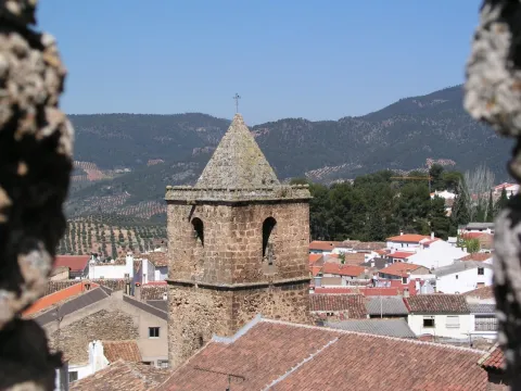
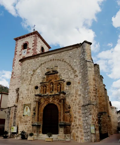
  • Church of Our Lady of the Assumption: Built between the 14th and 15th centuries and reformed in XVIII. It consists of a single central body and several side chapels. Two factories are distinguished: the 18th century section that is covered with a half-canyon vault, with fajon arches supported by a classic molding on crate pilasters. The entrance to the second factory is made through a pointed diaphragm arc. It has a Renaissance altarpiece presided over by the Virgin of the Assumption. The two covers are protected with wooden ranger between counterstrengths. They're Renaissance. At the foot is the 16th century tower, which has three bodies, the last one with bell holes and a pyramidal chapel finish.
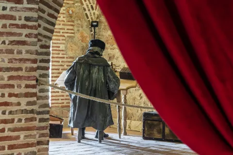
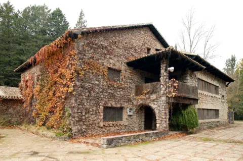
  • Casa Tercia: Built in the 15th century between the two towers with which the fortress had. It was the house where the tithe collectors settled. Here lived the master of Santiago, Don Rodrigo Manrique, father of Jorge Manrique, whom the poet cried to in "Cops to the death of my father."
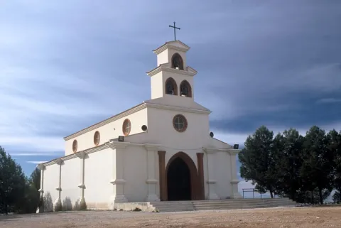
  • Hermitage of San Roque: Take the picture of the pattern, San Roque. It has only one ship. On its outside stands the body of the header covered in four waters and in one of its sides, a counter-fort that houses a bell. Store the boilers used to cook the meat of the cows that are slaughtered at the foot of the pattern and then distributed in the village.
Naturaleza

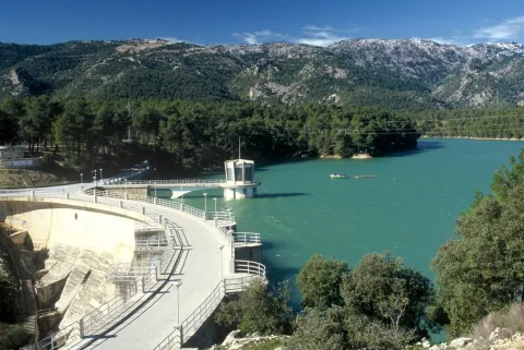
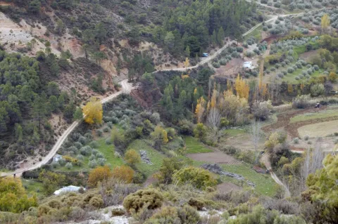
The entrance door of the Sierra de Cazorla Natural Park, Segura and Las Villas from Levante. This municipality is a forest-growing mountain territory, with a minimum part of its area dedicated to cultivation, the olive tree being the predominant crop.

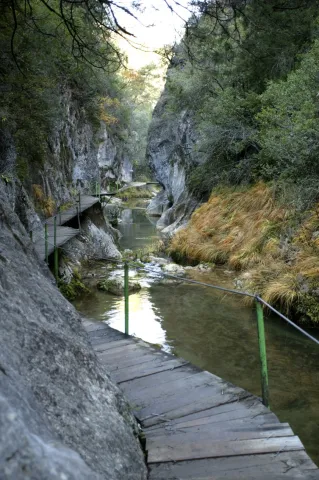
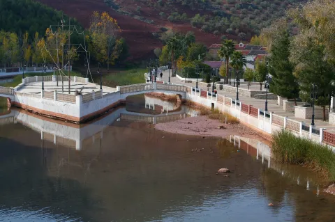
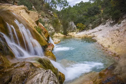
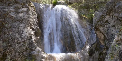
Here we find natural places like the ravine of the Tejosor Laguna from Siles.

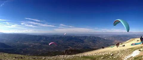
They are many their viewpoints natural above 1,500 m of altitude. Among the activities that can be practiced in the term of Siles is spelology, climbing, hiking or free flight.

It also offers us recreational areas, highlighting La Peña del Olivarwhere we can visit the botanical garden to contemplate some of the most outstanding species in the Sierra de Segura.

The area of high mountain is populated by salgarean or larice pine, sabinas, maples, acebos and thorns; the valley areas, welcomes the engraving in addition to the black pine and in the intermediate area The dense pine trees and pastures abound. Next to the rivers and banks of the swamps develop the gallery forests: chopos, birches, willows... that put a color note in the landscape with the passage of the seasons, especially during the fall.

The fauna It is also very varied, in forests are often observed large mammals like the boar, the muflon, the deer, the gamo and the goat, small mammals like the liron, the otter, the jineta and the common squirrel. Among the reptiles is the Valverde lizard, exclusive of the area, and among the fish is the common trout.

Special mention deserves some natural sites such as:

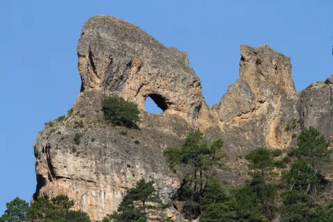
  • Reservation area Las Abeas - Navas del Espino.His special characteristics have earned his recognition as Area of Maximum Reserve within the Natural Park of the Sierra de Cazorla, Segura and Las Villas, being included in the Reserve Area of Las Acebe- Espino Navy. It is the maximum level of protection. To the north of Mount Acebas rises the Bucentaina, 1,395 m., separated from it by the Stone of the Hole, which, although not included in the Reserve Area, is a magnificent natural lookout. On Mount Azebeas reaches its highest peak on the Navalperal at 1,620 m., a calcareous altiplanicie, type mountain calar. Here we find various plant species, complaints, majajelos, oaks and some hazelnuts, pine forests, olives and maples.
  • Laguna de Siles. The natural continental wetlands are few in the Sierra, but the Siles lagoon, a small karmic lagoon, a high mountain calar. It is surrounded by pine trees and oaks which, although water remains all year round, reach its splendor in spring. They play a role like unique biotopeswhere many species of flora are found: algae, macrophytes, palustre vegetation on the banks, etc., and the presence of faunistic groups of the humid areas is noticed.
  • Tu River. Born in Siles, at the foot of the Las Acebeas- Nava del Espino Reserve Area. With an unparalleled environment, with a forest of black pines and larices where there are abundant deciduous species, maples, complaints, majuelos and thorns. Of these calcareous plains are born infinity of streams: Arroyo de la Fuente, Arroyo de Navalasna, Arroyo de la Cañada del Avellano...
Fiestas y Eventos
  • San Roque.Between August 10 and 16, the major parties of Siles are held in honor of their patron. The feast begins on the 10th, when the image of the Patron is brought in procession from his hermitage to the parish Church, where religious cults will be held every day in his honor. The saint returns to his hermitage on the 16th. The most important of this week of festivities is the bulls that are repeated every day, but the one of the most interest is the one that is celebrated on the eve of San Roque, in which the last re that has run that day, "The cow of the water of San Roque" will not be pointed at the end of the festivities, but it is carried to the hermitage to be sacrificed.
  • San Marcos April 25. Feel the great devotion to this Holy One, who, together with San Roque, are protectors against plague epidemics and are very linked to the celebrations of ritual immolation of bulls and cows. On that day, the Sileans pass it in the field and it is traditional to take the "Hornazo de San Marcos."
  • San Miguel Fair 27-29 September. In these parties with a very playful character, there is no lack of the traditional evening bulls and verbenas. A fair was previously held where the serrans of the region made deals to buy and sell the cattle.
  • San Antón 17 January and Candelaria February 2. To celebrate these parties, the ancient serrana tradition of igniting fires is maintained.
Gastronomía

In Siles we find a very varied gastronomy and related to that of the region to which it belongs. Let's quote some of your dishes.

  • Ajoatao: For your preparation we need potatoes, garlic, oil, salt eggs and lemon.
  • Ajopringue: to do so we use oil, pig fat, pig liver, bread crumbs, garlic, pepper, cinnamon, pepper and salt.
  • Lome of Orza: prepared with pork loin and spices such as oregano, black pepper, sweet pepper, ground nail, cinnamon in branch, laurel, dry choriceros peppers, garlic, cumin, Jerez and olive oil.
  • Fritao: oil, garlic, flour, water, bacon, salt and pepper.
  • Gachamita: are made with bacon, oil, flour, water, garlic and salt.
  • Andrajos: We need rabbit meat, mint, parsley, mass cakes, potatoes and oil.

Warehouse:

Drinks, fried rosses, panets, pestiños, flowers....

Drinks.:

  • The Crow: red or white wine, sugar water, peaches, apples, prunes and lemon scraping.
Historia

Because of its geographical location, Siles has been the place of establishment of various populations, from the prehistoric time when caves were used, to Iberian and Roman, but the true origin of the history of Siles is in the Middle Ages.

In the time of Al Andalus, it was a prosperous population, named in the chronicles as Silis. It had a castle - fortress that was one of the most important defensive bulwarks in the control of the lifting roads. It had in its term other fortresses, Peñafleita, Tasca and the fortified population of La Peña Horadada, necessary for its strategic position. It has been the scene of multiple struggles, when Abderran III began the pacification of Eastern Andalusia.

Siles was conquered to the Muslims around 1230, by Christian militias and Fernando III donates this territory to the knights of the Order of Santiago becoming part of the extensive rule of it, based in Sierra insurance and that it was its mission to defend the border between the Kingdom of Granada and that of Murcia.

In 1397 he was granted the Title of Villa because he had expanded his defensive fence with the construction of walls and three torreons. It also had a main fortress, which in turn had two other towers and among them was the housewhere the sanctiaguists collected the tithes of bread and where Don Rodrigo Manrique lived for a long time until his death.

In the mid-19th century, the fortress was still standing. Siles was divided into two, the old part called the Villa, within the walls, which kept their almenas and three doors and the urban town outside, which was called New Population.

In the last 30 years, the population of this municipality has experienced a significant decline, leaving in some villages and only some families, when they are not uninhabited or dedicated to tourist or agricultural purposes.
Loading map
Preparing points of interest and routes...
Imagen principal
imagen
Image
Siles
Imagen principal
Activado

Segura de la Sierra

Submitted by brandcode_deweloper on
Id
751057
Perfil de redes sociales
Facebook
https://www.facebook.com/ayuntamiento.segura/
Youtube
https://www.youtube.com/channel/UC0tAxfUQ5z6fv74Z3R6BrGg
Instagram
https://www.instagram.com/seguradelasierra_/
Descripción
Breve descripción

Segura de la Sierra is a beautiful villa located in the heart of the Sierra de Segura, located in the northeast of Andalusia. It is certainly one of the most beautiful peoples in Andalusia and, as such, is part of the most beautiful Peoples Network in Spain.

Segura gives name to a river, to a region and is synonymous with history. Visiting this town we can pack history and heritage in its urban centre or taste nature in its maximum expression in the many villages of its large municipal territory.

From its castle, of Muslim origin, you can see impressive panoramic views of the whole area, which is distinguished by its wide serrania, with an enormous natural and forest wealth. It is part of the Natural Park of the Sierras de Cazorla, Segura and Las Villas, the largest protected area in Spain.
This wonderful environment, its streets and historical corners make Segura de la Sierra has been declared a Historical-Artistic Set and Pintoresque Park.

Segura de la Sierra and its high peaks served to illuminate the best literature of the Renaissance, by the hand of Jorge Manrique, author of the "Cops to the death of my father."

Telecomunicaciones
Teléfono
953 480 280
Sitio web
www.seguradelasierra.es
Fax
953 481 012
Correo electrónico
administracion@seguradelasierra.es
Ubicación
Nombre
Segura de la Sierra
Latitud
38.298850
Longitud
-2.651870
Distrito
Ubicación en el mapa
POINT (-2.65187 38.29885)
Imágenes
imagen
Image
18670190-05e7-df1b-a17a-e92e0d671cef?t=1603979935869
Imagen principal
Desactivado
imagen
Image
despegue-el-yelmo-jpg
Imagen principal
Desactivado
imagen
Image
84676aeb-bfa8-a851-5550-3b4d15c74706?t=1621445408264
Imagen principal
Desactivado
imagen
Image
6fde7b00-3201-46c4-e6c3-528a9d11093d?t=1595353573804
Imagen principal
Desactivado
imagen
Image
a66e4f4c-435d-565a-2c1d-47799e04c4ce?t=1595353573833
Imagen principal
Desactivado
imagen
Image
4e21d820-8e51-89a4-0274-af8aeb2894f0?t=1621445408309
Imagen principal
Desactivado
imagen
Image
8668c55e-f4f0-0979-0f1b-fbd53f037c7e?t=1621445408354
Imagen principal
Desactivado
imagen
Image
78496ace-41be-4e6a-cd26-a6097356a63d?t=1621445408397
Imagen principal
Desactivado
imagen
Image
d1c73291-0577-d6d3-7c68-b4cea6f8ac35?t=1595353574079
Imagen principal
Desactivado
imagen
Image
5a350abd-951a-6543-e791-3a83e2a39938?t=1621445408446
Imagen principal
Desactivado
imagen
Image
307ca2fa-ccf4-8ce0-302a-896577682bb1?t=1595353574160
Imagen principal
Desactivado
imagen
Image
4d621b1f-d10e-8b22-6bc0-9c2c2c218615?t=1621445408494
Imagen principal
Desactivado
imagen
Image
b5bce32c-dbd5-c32b-b191-af98ea79ea34?t=1621445408543
Imagen principal
Desactivado
imagen
Image
aeb6f7e7-dfc2-de87-6f7f-daaaadba363b?t=1621445408593
Imagen principal
Desactivado
imagen
Image
49a44de3-3e7c-ef37-cfb0-56a999ea436d?t=1602789076574
Imagen principal
Desactivado
Información adicional
Imágenes cabecera
imagen
Image
segura-de-la-sierra1-jpg
Imagen principal
Desactivado
Datos de interés

Tourist area: Serras de Cazorla, Segura and the Villas
Distance to the capital (km): 160
Altitude over sea level (m): 1145
Extension (Km2): 224
Number of inhabitants: 1986
Gentillo: Segureños
Postal code: 23379

Videos
Video file
Cultura

The villa offers the physiognomy of past times, preserving its steep and silent streets. From its rich and varied heritage, we highlight:

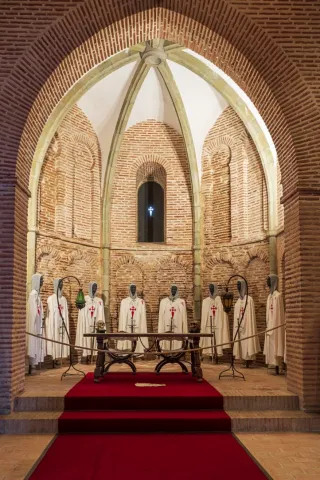
  • Castle.Of Mudejar origin, eternal vigil located in the highest of the village and surrounded by an old wall that still retains some turreons. The tower of tribute, which reaches 18.50 m in height and from which you can see impressive panoramic views of the Segura saw. Inside the castle we find: chapel, adarves, covered with wood and roofed in two waters, aljibe and Arab baths.
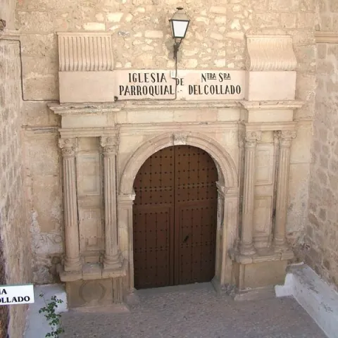
  • Parish Church of Saint Mary of the Collado. It was built in the 16th century on the site of the old Romanesque temple. The Napoleonic troops set it on fire and would be restored between 1814 and 1817. Its only ship is rectangular and of vaulted roof. On the outside, his tower built with masonry. With a quadrangular plant, it has its first body with a flask and a second body covered with an octagonal pyramid on which a forged iron cross goes. He has accumulated a rich religious iconography during his history.
  • City Hall. Other Renaissance paradigm, old house of the Society of Jesus. It opens with an arched arch of highlighted keys, to which they flank crate pilastras and dotal column. The second body is embellished by a curved balcony, a triangular fronton decorated with tacos and noble oval shields with plucked helmets.
  • Imperial source. A monument that reflects the transition between the Gothic and the Renaissance. It is built in front of the church and dates from the year 1517. Presents a large fronton divided into three streets separated by Ionian columns. A large shield with the weapons of Carlos V. is displayed on the central street
  • Casa de Jorge Manrique. The façade has a half-point arch decorated with vegetable motifs, flanked by crate pilasters and complemented by small Ionian columns. The nobility shield of arms of the Figueroa, the mother family of Jorge Manrique, was carved in stone.
  • Church of the Jesuit. It is built in the last quarter of the 16th century. It has Renaissance decoration, with a half-point arch with reliefs of the apostles. This building has now been remodeled and turned into an event and exhibition room.
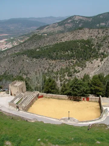
  • Bull's Square. It is located on the outskirts of the village in the old courtyard of weapons and chivalry. It's one of the oldest and most curious, being quadrangular.
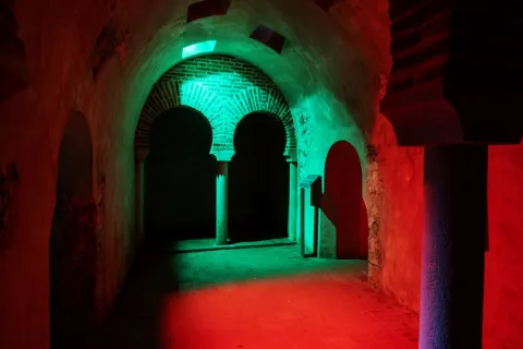
  • Arab baths (hammam). Used not only for hygiene and toilet, but also as social assembly centres. They were used by both men and women, but at different times. They consist of three longitudinal ships, corresponding to thecold room, the most external,tempered and hot, the innermost. They were tied with double horseshoe arch and canyon vault with skylights. It is estimated to be built between the 11th and 12th centuries.
  • Wraith and defense. Many sections of the local walls can still be observed. One of the best preserved is the water tower, It is called that because its mission was to protect a water spring that supplied the plateau. Other still preserved are: The Era tower, the School tower and the Snow well. The latter space was used to store water and snow during the winter period and then to use them through drains that existed at the bottom.
  • Access doors. The way to access the Segura de la Sierra fortification was 4 doors: The New, the Gontar, the Catena and the Orcera.


Naturaleza

Segura de la Sierra is located in the center of the mountains to which it gives name, the entire municipal term is part of the PN Sierras de Cazorla, Segura and the Villas.

The flora, when there is such a great difference in height in the municipal term, it is different: high mountainLet's find the pino laricio, flexible and resin-rich wood, and lacquer; half mountain live the black pine, whose wood is very resistant to rot and can reach 45 m in height and tejoof slow growth, but of a longevity that can reach the age of 5,000; low mountainthe Pine carrasco, complaining, melojo oak, the oak, the oak, the coscoja, olive and other endemic and aromatic plants.

The fauna is also, like the flora, very diverse. So, we'll meet. Rapist birds and scavengers(eagles, lethand vultures, alimoche vultures...), animals of major game(deer, muflon, gamo, boar...) and minor hunting (perdiz, rabbit, hares, crow, crows, tortoises, doves and foxes).

They also live in various species of fish, like trout, barbo, boga, etc., andmammals,Like bat, mountain cat, chickenpox, badger, otter, fox and gin.

An area with enormous natural and forest wealth, place to feel that nature is alive.
 

Fiestas y Eventos

The Segureños celebrate the following parties:

  • Patrons of the Virgin of the Rosary. They have a place of 4-8 Octoberand are celebrated in honor of the patron. On the 8th the most emotional act takes place: the procession of the Virgin on the shoulders of the women of Segura. During these days there are taurine celebrations, which are held in the peculiar square of quadrangular bulls, and serrano bolus competitions.
  • Saint Vincent. It is the patron saint of the town and is celebrated the January 22. In his honor fire is on in the extramides of the villa. It is a custom that is very rooted in the saw that the winter festivities turn on "Luminaires"(bonfires). This is the day of" La Pura "(8 December), in Saint Lucia (13 December), Christmas Eve, New Year's Eve, San Antón (17 January), in San Vicente (22 January) and ending at the Candelaria (2 February).
  • Romeria de San Isidro. It is the pattern of the New cuts, the most important pedany of the many that Segura has. It is held in the area of the Lomilla, by the village The Ojuelo.
Gastronomía

The gastronomy of Segura de la Sierra is rich and full of tradition, has been able to combine the agricultural customs with those of the pastors or those dedicated to the works of the wood, carried out by the cut of pine trees in this saw.

The diversity of the dishes that we find in the town is characterized by the use of the products we find in the area: olive oil, mountain meat in hunting season (boar, perdiz, rabbit, soybean sheep) and, in concrete seasons, mushrooms and niscalos (guízcanos) or asparagus that are so well given in the saw.

  • Galians, bread cakes, rabbit and spices.
  • Andrajoswith flour, meat and spices.
  • The Migasof bread, to which is added chorizo, torrezos...
  • The Gachamita, flour and potato that is accompanied by all kinds of dressing, both sweet and salty.
  • Lamb to the young shepherd, pastoralist chard, lamb in cabañil garlicIn all these dishes, the base is the same: the following sheep's meat.
  • Pisto gandul, made of goat, lamb or rabbit and is to then consume in fairs or evenings. Hence the name of the gangul.
  • Cecinaof sheep's or goat's meat that has been cured.
  • Ajopringueis consumed in the massacres and is made with the pig liver It's a bit.

In pastry, the bake, a dessert of oil cake that carries a hard egg in the middle.

Historia

The history of the term Segura de la Sierra dates back to the 4th millennium BC, according to the many archaeological sites that testify to the human presence in those times.

Very close to the city centre is the settlement called The Old Onea few kilometres from the village of Moralejos and that it has always been attributed to peoples as Iberians and Phoenicians, being later the scene of wars between Romans and Carthaginians.

But it is, no doubt, with the Islamic people (781) when the population they call Saqura lived the golden era as a strong square in the area. In the 9th and 10th centuriesAfter the collapse of the Cordoba caliphate, Segura de la Sierra has several periods of independence that make it important.

It will be conquered by the Christian troops, becoming dependent on the Order of Santiago by the donation of Alfonso VIII. In 1243, with King Fernando III, he passed to the crown of Castile and within the kingdom of Murcia until 1833, the year in which the current province of Jaén was created.

In 1517, after the visit by Carlos I to the square, the fountain is built in his honor. A Renaissance source, though clearly of transition. In 16th century had a a time of great splendor, provided by the large amount of wood produced in its territory and which, transported by the Guadalquivir River, supplied all of Andalusia.

In 18th century, the State has converted the saw, under the name of saw of Segura, Maritime Province, No doubt you need wood for the construction of your ships. The Napoleonic invasion (1810) turned the population into a huge stake, destroying the files and taking part of its history.

illustrious characters:

  • Jorge Manrique (1440-1479), a Spanish poet and author of "Cops for my father's death," considered one of the capital works of Spanish literature. The origin of his birth is discussed with Paredes de Nava (Palencia)
Otra información

We want to place on record two traditions that are very deep-rooted in Segura de la Sierra:

  • The serrana jack. Of the popular dances of Segura de la Sierra, no doubt, the serrana jota is the one with the greatest personality. It is interpreted alone or with whole or half-ways, usually, in popular parties.
  • Via living crucis. It is interpreted by the neighbors of the village and is developed in different places of the town, with excellent views of the Segura saw.
     
Loading map
Preparing points of interest and routes...
Imagen principal
imagen
Image
53a920a5-6491-8831-30ac-3d989e48192e?t=1603979644641
Imagen principal
Activado
Literatura

This town may have been the birthplace of the warrior-poet, since his father was Commander of Segura de la Sierra, the most important commandery of the Order of Santiago. In fact, the Manrique family home is still preserved today.

Segura de la Sierra pays tribute to the poet not only by marking the Manrique family home, but also by building part of its tourism offer around Jorge Manrique, dedicating several rooms of the castle to interpretation spaces devoted both to the poet and to the Order of Santiago.Segura de la Sierra also pays tribute to the illustrious writer with a statue-monument and with a magnificent viewpoint offering sweeping views of the Natural Park from the village itself.

The tribute to Jorge Manrique culminates with the biennial Jornadas Manriqueñas, an event combining academic and leisure activities as a way of honouring this illustrious figure.

Santo Tomé

Submitted by brandcode_deweloper on
Id
750937
Perfil de redes sociales
Facebook
https://www.facebook.com/Ayuntamiento-Santo-Tom%C3%A9-Ja%C3%A9n-1973833199595652/
Descripción
Breve descripción

Sao Tomé is located in the heart of the Sierras de Cazorla and Las Villas, in the northern part of the region of Alto Guadalquivir, to which it belongs, extending from the east to the west of the region, along a narrow and extensive municipal term that reaches from the fertile vegas of the Guadalquivir to the core of the Sierra de Cazorla. This territory has historically endowed Sao Tomé with pastures and forest resources that completed the rural local economy, with the cultivation of Vega and olive trees.

The eastern half is mountain, it belongs to the Natural Park of the Sierra de Cazorla, Segura and Las Villas, reaching the first stretch of the Guadalquivir River after its birth.

The western is a land of cultivation, in which the olive tree dominates. In the vegas of the Guadalquivir, the herbaceous crops of the dry and the gardens predominate.

The Borosa River marks the eastern limits of the term, in the heart of Natural Park. Next to the river is a river interpretation centre and a farm.

The city centre is concentrated around the old castle turret that gave rise to the population. Sao Tomé occupies the top of a hill that dominates the Guadalquivir valley.

There are three villages dependent on Sao Tomé: São Tomé, Arroyos Plaza and Las Erica, the last two in the saw area. The village of the Ericas and the Borosa River are some of the places of extraordinary beauty located in the municipal term.

The economic activity of the municipality is linked to agriculture and tourism.

As a sample of its architectural heritage, the tower of the bell tower of the church of St. Thomas the Apostle of the 14th century stands out, since it was originally an Arab defensive turret.

Telecomunicaciones
Teléfono
953 736 200
Sitio web
www.santotome.es
Fax
953 736 593
Correo electrónico
aytostotome@gmail.com
Ubicación
Nombre
Santo Tomé
Latitud
38.027370
Longitud
-3.099930
Municipio
Ubicación en el mapa
POINT (-3.09993 38.02737)
Imágenes
imagen
Image
48d6d5e3-b3de-3064-a192-5ad457f1dcfc?t=1621444907719
Imagen principal
Desactivado
imagen
Image
5419a7b5-1e13-a4ac-6f5a-09102a63b550?t=1621444907783
Imagen principal
Desactivado
imagen
Image
eaaff2f4-86a3-f819-49fe-81a5cd5ce707?t=1621444907834
Imagen principal
Desactivado
imagen
Image
22e64865-f553-5abf-0250-1c83541ee3f8?t=1621444907883
Imagen principal
Desactivado
imagen
Image
7f34e075-aa45-a88e-400f-e903a5d991af?t=1621444907930
Imagen principal
Desactivado
imagen
Image
8ff96080-3471-58e9-2d5f-432c840a8021?t=1621444907977
Imagen principal
Desactivado
Información adicional
Imágenes cabecera
imagen
Image
Santo Tomé
Imagen principal
Desactivado
Datos de interés

Tourist area: Serras de Cazorla, Segura and the Villas

Distance to the capital (km): 96

Altitude over sea level (m): 458

Extension (km ²): 73

Number of inhabitants: 2,462

Gentillo: Tomeseños

Postal code: 23311

Videos
Video file
Cultura
  • Castle.During the Middle Ages, Sao Tomé was linked to the archbishop of Toledo, and was part of the territory of the Cazorla advance. To meet the defensive objectives, in the 14th century a castle rose of which only thea tower of homage, of a rectangular base, almost square, which was preserved as a bell tower on the left side of the church. The tower that retains its Gothic features is of masonry and regular yarn on its ground floor, of armchair in the upper area and is covered with roof. As the original military function was changed to the religious one, he was added a singing swordsman with two holes for the bells, cornices and triangular front that hosts another bell. It was declared Good of Cultural Interest in 1985.
  • Big House. It is located in the church square and belongs to the first half of the 18th century. It consists of two bodies. On the lower floor it has a decentralized and intellized cover, with spillage dovens, silvery jambas and wooden doors with swollen nails. On the cover is shown a nobiliary shield of the people, the Sanchez of Quesada.
  • Church of St. Thomas the Apostle. Restored in the year 1,966. The façade is located at the foot of the temple, finished in a hastial with small circular window entangled, and retains a simple cover with a half-point arch on a chair jambas. The bell tower It corresponds to the tower of homage of the old castle.
Naturaleza

Sao Tomé belongs to the region of Sierra de Cazorla, it is 548 m above sea level, occupying the northern part of the region.

The municipal term is a strip of land, much longer than wide, which extends east to west.

The Eastern half It is mountainous, made up of coniferous mountains and belongs to the Natural Park of Cazorla, Segura and Las Villas, reaching the first stretch of the Guadalquivir after its birth.

The Western half is land of the countrysidein which the olive grove dominates until it reaches the banks of the Guadalquivir. In the lower area, the herbaceous crops of dry and irrigation are developed in the Vega of the river.

If something characterizes the region is the variety in landscapes and ecosystems, with altitudes ranging from 2,100 m. in the Sierra de la Cabrillaup to the 360 m. near the Bridge of the Cerrada. The high peaks are mixed with deep ravines, soft reliefs and wide valleys, forests, olive groves, high mountain pastures and gardens, humid, dry and semi-desert areas.

The altitude progresses from west to east, but not continuously, but forming saw teeth. The natural characteristics of the territory have conditioned the use and traditional use of it: livestock, forestry, olive cultivation, cereal, orchards, hunting, fishing, collection of mushrooms and wild fruits, as well as a variety of popular crafts, spartum and wicker mainly.

These traditional uses have given way to new economic activities, mainly service companies, especially tourism in the area of the Natural Park.

At present the olive tree has been displacing the other crops, In the driest areas the almonds spatter in white spring.

By the term of Sao Tomé, among many other species are moved as emblematic as the grubb, cappuccino herrererillo, royal anade (azulon), ashtray, common badger, fox, European otter, boar, gill, gill, deer, mountain goat, guadiana's wedding, Andalusian barb, trout and staircase.

Among the enclaves with special interest, we mention:

  • Borosa River Visitors Center. It focuses on the theme of the river ecosystem of the Borosa River, the most important tributary of the Guadalquivir in its first section of the route. The importance of water is shown in this news centre, with a model of the river and a series of panels that explain the water cycle. We will also be able to visit the farm of the Borosa River and practice fishing in the time of closure.
  • The Erica. In this pedany we can enjoy contemplating a beautiful waterfall and typical coastal vegetation that surrounds a nearby stream. It is located to the east of the village of The Ericain the natural park of Cazorla, Segura and Las Villas.
Fiestas y Eventos

Sao Tomé has been an eminently agricultural population, so its festivities are very close to the agricultural tasks. These include:

  • Saint Anton, January 17. This holiday is held with a bonfire made with the ramon from the pruning of the olive trees. Cosmeum of other times was "the marrillo of Saint Anton," who was taken care of by all the people and this day was auctioned or rifed among the neighbors.
  • La CandelariaFebruary 2. Party where the "lumbres" and commemorating the Presentation of Jesus in the temple and the Purification of Mary.
  • San Isidro Labrador, May 15. It is held in a place near the coast of Guadalquivir. It has the peculiarity that in the years of drought the saint was condemned to be bathed in the river, although it is true that some years were pardoned of such a peculiar practice. After sharing a monumental paella, in memory of the sisterhood food of other times, in which the less fortunate laborers were given.
  • Immigrant party. It is celebrated in the first days of August in honor of all the Temeseños who in their day had to emigrate outside the municipality in search of better living conditions. This day there are many playful and sports activities, competitions and, of course, greens threatened by fantastic orchestras.
  • Feast of St. Thomas and Our Lady of Remedies. It has a place of 25-27 September. It was a very old habit to run the bulls called "bagged," to which a wooden ball was placed on the horns, a serrana custom already lost.

Sao Tomé, like the whole Sierra de Cazorla, the traditional Fandango serrano. This standing rhythm fandango is danced on certain dates. At the pace of guitars and banners, a few coplas are sung that are improvised, and a true "pica" is raised among the attendees.

Gastronomía

With the arrival of the cold they also arrived the expected massacres who were taking up the loins and the prayers for the rest of the year. The killing also had the mission of establishing family and neighbourhood ties, and it had the connotations of a real party.

Among the most famous products is the "white bite," which does not carry pig blood.

These are typical dishes of Sao Tomé, among others:

  • Tararinswhich in other places are called "rags." They carry as ingredients water, flour and salt for wafers. In the frying pan a saffrito of tomato, garlic, onion, green pepper, a little spicy and rabbit, hare or partridge. When cooked the meat is added the wafers and let be boiled. They're served in the same pan.
  • "You fuck the poor." They're chips with pepper and eggs. A special dish if fried with olive oil from the area.
  • "Fowl with rice and meat." A dish to which the less fortunate farmers were invited on San Isidro day. Today it has been replaced by a paella. This Romeria of San Isidro, is a good sample of the Roman viandas: "minced meat," "fried meat" and "peppers."
  • Gachamita. It is a stew of flour, potatoes, olive oil, ingredients that are allowed to cook together, which require an expert hand to turn them into the pan so they can cook better.
  • Rin-ran. Stew made from cooked potatoes and choriceros peppers accompanied by olive oil, cod strips, hard eggs and onions.
Historia

The oldest human remains found in the municipal term that reveal the human presence go back to Neolithic: Arrow tips, sickle teeth and machineries.

In the Copper age there was a site near the São Tomé Group, known by Montiel.

In the lands of Sao Tomé the call would take place Battle Baecula, won by the Roman general Scipion against the Carthaginese Asdrúbal Barca. A defeat that would be end of the Carthaginese domain in the Iberian Peninsula (Cerro de las Albashas)

During Roman times had an intense occupation through rustic villas, such as the The Graves. They have found tombstones and a peso, which are found in the Provincial Museum.

From its visionary past, a stone was found, which is also exposed in the Provincial Museum.

In the Muslim period would be one of the lockers that populated this land and that had a tower for your protection, which would later become the bell tower of the local church.

In 1,231, Sao Tomé, along with other peoples of the region, became part of the advance of Cazorla, heritage of the archbishopric of Toledo. It will be in 1,438 when the archbishopric authorizes D. Pedro Díaz de Toledo the the foundation of this population, where there was only one corijo and an old tower.

The Vizcounty of Sao Tomé was created in 1627 by Felipe IVin favor of Hernando de Quesada Mendoza and Toledo.

Otra información

2 km. of the urban town is found Group of Sao Tomé, also known as Montiel. It is one of the nuclei of the New Populations as a result of the agricultural Colonization in Andalusia in the 1950s of the 20th century.

Loading map
Preparing points of interest and routes...
Imagen principal
imagen
Image
Santo Tomé
Imagen principal
Activado

Santiago Pontones

Submitted by brandcode_deweloper on
Id
750575
Perfil de redes sociales
Facebook
https://es-es.facebook.com/aytosantiagopontones/
Descripción
Breve descripción

Municipality formed by the localities of Santiago de la Espada and Pontones, based in Santiago de la Espada which is where the institutions are located. Until 1975 they were independent municipalities. In addition to these localities, there are 27 other population centres. Located north-east of the province of Jaén, it belongs to the region of Sierra de Segura. By extension is the largest municipality of the Natural Park of the Sierras de Cazorla, Segura and Las Villas and the second of the province. It symbolizes the deep saw, with spectacular ravines, beautiful valleys and arrogant summits, which offer idyllic landscapes. The Segura River is born in the area of Fuente Segura.

For the climate and the orography only 3% is cultivated land, dedicated to the cultivation of herbaceans. Its climatology is the coldest in the province. The economic activities are the livestock, mainly the cattle (it has several cattle cattle), the forestry, the inland tourism, hunting and fishing.

From the Architectural Heritage we highlight the Church of Santiago Apostol, the urban helmets of Santiago, Pontón Alto and Pontón Bajo and other monuments located in some of the population centres that are part of the City Council.

Telecomunicaciones
Teléfono
953 438 002 / 953 438 003
Sitio web
www.santiagopontones.es
Fax
953 438 009
Correo electrónico
ayuntamiento@santiagopontones.es
Ubicación
Nombre
Santiago Pontones
Latitud
38.118330
Longitud
-2.670260
Distrito
Municipio
Ubicación en el mapa
POINT (-2.67026 38.11833)
Imágenes
imagen
Image
dce75f72-d400-a9e8-f11a-b25ce9edbe11?t=1621443948721
Imagen principal
Desactivado
imagen
Image
ddbd58bb-7d83-95a4-8853-e41b290e6efd?t=1621443948783
Imagen principal
Desactivado
imagen
Image
4c5ef463-4e6e-a954-74aa-d355b98b6a93?t=1621443948834
Imagen principal
Desactivado
imagen
Image
faca425a-e62b-46a2-ed26-d017c6fd5c84?t=1621443948890
Imagen principal
Desactivado
imagen
Image
c9e175cd-4b5f-c8e3-050f-51a57a8ce18a?t=1621443948945
Imagen principal
Desactivado
imagen
Image
de18043b-f741-c890-7b35-dc081accb77d?t=1621443948992
Imagen principal
Desactivado
imagen
Image
78ddc946-a1c4-cf99-b9ae-1c680b4772c8?t=1621443949154
Imagen principal
Desactivado
imagen
Image
7f97a099-c6bb-bc6e-8d93-1c5c5d48b088?t=1621443949283
Imagen principal
Desactivado
imagen
Image
5aae6190-0f83-fd6a-5298-77b81bb658cf?t=1621443949420
Imagen principal
Desactivado
imagen
Image
33ab0f60-a38d-154a-2fba-409e20fe1188?t=1621443949679
Imagen principal
Desactivado
imagen
Image
cazorla-cabras-jpg
Imagen principal
Desactivado
Información adicional
Curiosidades

https://mosaicoinfinito.es/
Oficina de Información Turística: Avda. de Andalucía s/n –Santiago de la Espada
Oficina de Información Turística: Las Juntas, s/n  -Las Juntas de Miller
CENTROS DE INTERPRETACIÓN Centro de Visitantes Torre del Vinagre 
Ctra. del Tranco A-319 km 48

Imágenes cabecera
imagen
Image
Santiago Pontones
Imagen principal
Desactivado
Datos de interés

Tourist area: Serras de Cazorla, Segura and the Villas
Distance to the capital (km): 218
Altitude over sea level (m): 1340
Extension (km ²): 683
Number of inhabitants: 2,956
Gentillo: Santiagueños or Pontoneros
Postal code: 23290

Videos
Video file
Cultura
  • Church of James the Apostle: Built on an ancient hermitage in the 16th century with influences of the last Levine Gothic. It is a single ship divided by four arches, covered by a pair of armor in a row of Mudejar tradition, sustained by a half-point diaphragm arches. It reproduces the scheme of the early churches of the final Gothic, with Baroque altards and a wide wooden choir with curious craftsmen and a banner. The major Retail is from the 18th century and is the most valuable artistic element of the temple. On the outside stands the square-floor tower, which in 1763 was necessary to rebuild.
  • Urban helmets of Santiago, Pontón Alto and Pontón Bajo. The urban helmets of these nuclei are made up of streets that remember the morphology of medieval urbanism, in which regular and geometric planning is not followed, but is built according to needs. This gives rise to narrow and irregular streets with typical serrana houses: stone facades, farmed and encased, with small gaps, outstanding tiles to fire water and snow and thin chimneys.
  • Church of Our Lady of the Rosary. Located in Pontones, it has been built in the late 19th century. It is small, with a single rectangular ship and a simple facade with a stone cover, in harmony with the type of architecture surrounding it.
  • The Brush: Old inn of the 16th century. You can see a wooden balconade, a sample of the vernacular architecture, whose zapatas and balastres are well protected by the wide aldero of the roof.
  • Miller's Fort House, topped with thin aspilleras from the 13th to the 16th centuries, which could be a defensive bastion in front of the Alphavars and which was rehabilitated in the 19th century, during the Carlist wars.

It also has five declared property of Cultural Interest: The Castles of Matea and Gorgollitas, the coats ofCold River, No. Cañada de la Cruz y del Engarbothe latter, in addition World Heritage.

Naturaleza

Innailed in the Sierra de Segura, the municipality of Santiagos- Pontones, has an average altitude of 1,340 m., with a surface of 684 km ² that makes it the second municipality in extension of the province after Andújar.

Su orography which prevents its usefulness as a land of cultivation, differs with the rest of the municipalities of the province, occupying the olive tree an almost nil extension.

By the altitude it has a mountain climate, being much colder than the rest of the municipalities at all times of the year and one of the few where snow is not an extraordinary event.

Santiagos- Pontoons, fully included in the Natural Park of Cazorla, Segura and Las Villas, one of the most valuable forest areas in Spain, both for its density and variety of species.

The area of high mountain is populated by salgarean or larice pine, sabinas, maples, acebos and thorns; in the valley of Guadalquivir welcomes the engraving in addition to the black pine and in the intermediate area The dense pine trees and pastures abound. Next to the rivers and banks of the swamps develop the gallery forests: chopos, birches, willows... that put a color note in the landscape with the passage of the seasons, especially during the fall.

The fauna It is also very varied, in forests are often observed large mammals like the boar, and the muflon, and the deer, and the shrimp, and the goat, small mammals like the liron, the otter, the jineta and the common squirrel. Among the reptiles is the Valverde lizard, endemic to the area, and among the fish is the common trout.

However, the birds are the majority, for which the municipality was declared a Special Protection of Birds Zone (ZEPA). Here we can see large-scale raptures: leonate vulture, rattlers, pilgrim hawk, eagles of different species, and even broken bones.

It is also easy to see another type of smaller birds like the blue climber, common gateer, carbonero tick, piquituerto, verderon, pinzón, zorzal, picapinos..., and close to the rivers and reservoirs, the aquatic myrtle, the watershed or the bastard nightingale.

The numerous natural enclaves that are scattered by the municipal term are the best spaces that offer us the best information to appreciate the landscape, the morphology of the land, as well as the fauna and flora of this municipality. These include:

  • Pico Banderillas. A summit of almost 2,000 m (1,993 m.) altitude from which we can see beautiful panoramic views of the Natural Park of Cazorla, Segura and Las Villas.
  • The birth of the Segura. Inside the peculiar calcareous crest of Sierra de Segura, at 1,410 m of altitude, a crystalline water spring known as the Birth of the Segura River. Along its northwestern route it goes to the Mediterranean and collects the waters of the Wood, Zumeta and Tu rivers.In its surroundings there is a recreational area surrounded by a gallery forest. It's 22 km away. to the west of Santiago de la Sword.
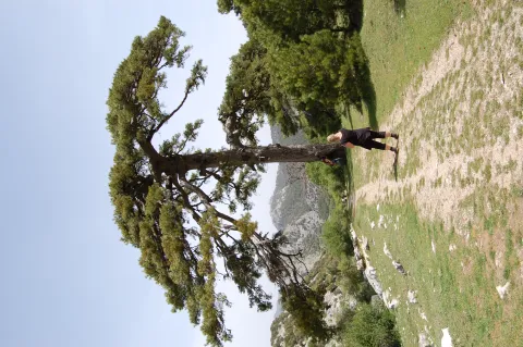
  • Pino Galapan. It is an impressive natural monument, a 40 m tall larix pine and over four centuries old and four adults are needed to be able to surround its trunk with extended arms.
  • I jump from the organs. Next to the birth of the Borosa River, the Los Organos power plant presents a beautiful landscape that contains all the typical elements of the Natural Park. It highlights the geological environment, made up of calcareous formations of unusual forms that cause grotto and caves of great beauty.

Fiestas y Eventos

The traditional parties are very numerous in this municipality, because most of the population centers celebrate their own popular parties.

During these many and varied activities are carried out, such as the Romeria in honor of the pattern of each of the localities, the champions of the serrano bowling, popular verbenas, horse racing, children's games.... In Santiago de la Espada, Pontones and La Matea, there are also the popular bulls of braves, which are brought from the field to the square and which are tasted in the afternoon.

22 May Santiago de la Espada the Romeria of Santa Quiteria. The tradition of eating "hornazo" on that day has continued since the 16th century.

In mid-June, parties are held in the village of The Cerezo in honour of the Sacred Heart and during the last days of the month, festivals of the Virgin Miracle in La Matea

In July many villages celebrate their holidays: in Miller Santa Isabel, in the Atascaderos the Virgin of Carmen, on the 25th Santiago in Coto Ríos.

It is the month of August when more parties are held: Carrasco houses in honor of San Antonio, in Pontones the Virgin of the Rosary, in Pontón Alto meeting in which the neighbors prepare crumbs. In honor of the Immaculate Conception, parties are held in La Toba, Los Teatinos and Santiago de la Sword.

During the month of September the feast in honor of the Immaculate Conception takes place in Marchena. Maybe it's the party where the most traditions are preserved. Between 15 and 17, the Santiago de la Sword Livestock Fair And we finished with the Ponton Livestock Fair on October 12.

Gastronomía

It is to the transhumanous pastors to whom the municipal term of Santiago - Pontones owes the particularity of the serrana food, made with great patience as the saying indicates: "the crumbs of the gañan at both turns are, and the crumbs of the pastor the more the better."

  • The following lamb, star product of the local gastronomy.
  • Segureño lamb dish: lamb, red pepper, onion, garlic, pepper, laurel, water, white wine olive oil, flour, black pepper, vinegar and salt.
  • The sausages: from the massacres of the past.
  • Guisote: made of pork, potatoes, onion, pepper, peppers, tomatoes, spices and very fine minced almonds.
  • Gachamita: Made of flour, potatoes, oil or a "garlic."
  • The Pontoon's "spoon": Meat with garlic, olive oil, parsley, spices, aromatic herbs and pepper. It is left to rest and made in the oven in a casserole.
  • The "dyed rabbit 'means: dish that the shepherds prepare. The skin is removed and joined with butter, wine, aromatic herbs and spices and the skin is replaced.
  • Let us quote also, The Migas, El ajoatao, El ajo pringue, Las andrajos...

Warehouse: The fried donuts, the flowers, the chandelier of egg-plated mass...

The Carrascana catfish It is made in the villages of Vites, Tobos, La Marchenica, La Muela and Miller.

Historia

The municipality of Santiago Pontones was born from the merger carried out by decree in 1975 between the municipalities of Santiago de la Espada and Pontones.

In the Cave of Birth in Fuente Segura (Pontones), the oldest human occupation of the province has been documented with absolute dates. A community of kinship who lived from the hunt. To this first phase of occupation is added another in the Neolithic and to a later one belongs the coat of Rio Frio, where a collective tomb has been found.

The cave paintings of the Caves of Engarbo I and II, the Abrigo de Río Frio and the coat of the Cañada de la Cruz must be highlighted. All of them are included together with all of those who make up the Rupestre Art of the Spanish Mediterranean Arc on the list of World Heritage made by UNESCO in 1998.

+ INFO

In the forty years of the last century, a great treasure of goldsmiths was found, which is supposed to be of the first century BC. It is composed of more than a hundred objects, highlights a set of gold earrings in the form of a grape cluster, of Iberian manufacture, which inserts a figure of winged woman. It should be noted that these pieces are included among the key works of Iberian art. It is preserved at the Instituto Valencia de Don Juan in Madrid.

During Muslim period the municipal term of Santiago - Pontones was populated by numerous fortifications and alqueras or small populations. In the municipal term there are traces of fortified enclosures among them the Castle of Miller, or the castle of the Gorgolillas. This area was conquered to Muslims around 1247, by the Order of Santiago becoming part of its domains.

James of the Sword was founded in 1525, with its origin being a group of pastors who came with their cattle to this place, whom they called "The Bake.". For the Endowment of Santiago was "Puebla de Santiago" which in 1570 was declared a village by King Philip II, although under the jurisdiction of Segura de la Sierra. It was later declared "Villa de Santiago" and around 1770 would be given the current name: "Santiago de la Sword".

Pontones, in the time of Philip II was a village of Segura de la Sierra called "El Pontón," reached its independence in 1837 with a municipal term of about 200 km ²., being called "Pontones de Segura." Its work, legal and economic activities were regulated by the ordinances of the Segura Common from 1580 and was later part of the Maritime province.

The entire municipal territory is included in declarations of protection and conservation of the Sierra de Segura:

  • National Court on 21 July 1960
  • Declaration by UNESCO as a Biosphere Reserve on 30 June 1983
  • Natural Park on 5 February 1986
  • Special protection of birds by the EEC in 1988
Otra información

It has more than ten peaks with an altitude of more than 1.800m. With an extension of more than 700 km2 the distance between some points of the municipality exceeds 100 km.

Loading map
Preparing points of interest and routes...
Imagen principal
imagen
Image
Santiago Pontones
Imagen principal
Activado

Quesada

Submitted by brandcode_deweloper on
Id
750095
Perfil de redes sociales
Facebook
https://www.facebook.com/ayuntamientoquesada
Youtube
https://www.youtube.com/user/AyuntamientoQuesada
Instagram
https://www.instagram.com/ayuntamiento_de_quesada/
Descripción
Breve descripción

Quesada is a municipality in the Sierra de Cazorla region, south-east of the province of Jaén. The east and south of its territory are part of the Natural Park of the Sierra de Cazorla, Segura and Las Villas.

This municipality is made up of Quesada and the villages of Belerda, Don Pedro, Collejares, Los Rosales and Tícar, as well as El Cortijuelo.

This is one of the most beautiful and historic villages in the park. Built around a hill, the streets and squares present the curved and heterogeneous physionomy of the medieval route.

In its municipal term is the birth of the Guadalquivir River, in La Cañada de las Fuentes.

In agriculture the olive grove dominates. It has an olive cooperative that is part of the designation of origin "Sierra de Cazorla." It is also very important to have sheep. The cultivation of the cereal is residual and has been replaced by the olive tree.

Its surroundings are splashed with places of environmental and heritage interest, such as the Roman villa of Bruñuel and the venerated shrine of the Virgin of Tícar.

Among its heritage is the Parish Church of San Pedro and San Pablo, the Atalaya del Infante Don Enrique, the Arc of the Saints and the rock paintings of the style of the Levine, declared World Heritage and located in the Cave of the Encashier; and finally the Museum of Rafael Zabaleta, a native painter of Quesada, and that of Miguel Hernández, whose wife was born in this town.

Telecomunicaciones
Teléfono
953 733 025
Sitio web
www.quesada.es
Fax
953 733 707
Ubicación
Nombre
Quesada
Latitud
37.842980
Longitud
-3.066920
Municipio
Ubicación en el mapa
POINT (-3.06692 37.84298)
Imágenes
imagen
Image
8bd2037d-3371-a447-c462-f23bb08238ba?t=1621356088703
Imagen principal
Desactivado
imagen
Image
b19dc278-a564-d320-1b28-83f48077c0be?t=1621356088757
Imagen principal
Desactivado
imagen
Image
915ef1cf-917d-c03a-a168-b51a2e548138?t=1621356088805
Imagen principal
Desactivado
imagen
Image
3bfc6c96-084a-ed27-97c6-8687538dd6dc?t=1621356088943
Imagen principal
Desactivado
imagen
Image
9ee5d02b-d843-108d-1f27-14997322ea39?t=1603724928275
Imagen principal
Desactivado
imagen
Image
1556b6e2-6b04-b9cc-c61b-9487ac687d36?t=1603747428216
Imagen principal
Desactivado
imagen
Image
ec921ab0-540a-0430-4cb0-0cf4c14bdd15?t=1621356089164
Imagen principal
Desactivado
imagen
Image
9b35f320-001f-6702-e3e2-b9000cbeea31?t=1621356089364
Imagen principal
Desactivado
imagen
Image
7f7a9beb-08e0-9187-90f8-061c87d37ef0?t=1621356089555
Imagen principal
Desactivado
imagen
Image
cazorla-pinar-jpg
Imagen principal
Desactivado
imagen
Image
nacimiento-del-gadalquivir-jpg
Imagen principal
Desactivado
Información adicional
Curiosidades

Oficina de Turismo de Quesada
Plaza de la coronación, 5
https://admin.dipujaen.es/municipios/Quesada/turismo.html

Imágenes cabecera
imagen
Image
431db42c-0322-5342-0307-bd339c5a9014?t=1606405219719
Imagen principal
Desactivado
Datos de interés

Tourist area: Serras de Cazorla, Segura and the Villas
Distance to the capital (km): 99
Altitude over sea level (m): 676
Extension (Km2): 328
Number of inhabitants: 5,944
Gentillo: Quesadeños
Postal code: 23480

Videos
Video file
Cultura

From the abundant and rich historical-artistic heritage, we highlight:

  • Tiscar Castle. It was raised in the Arab era and located in a rocky area of easy defense. The first news of the castle dates back to 876. It is a small complex with a small tower of tribute. Built in apial cane, with parts of bulkhead and the wall cloth attached to the rock. In the center there is a great rosehold called "Black Peña." In 1949 it was declared Good of Cultural Interest.
  • Sanctuary of the Virgin of Tícar. It is certainly the center of Marian devotion of the region, both for its tradition and for its location, under the "Black Peña Castle."The present construction of the Sanctuary of the Virgin of Tiscar dates back to the mid-20th century, although it retains architectural remains of previous times, such as the great entrance door with pointed bow and decorated jambas, remains of the plywood of the Granadine in the sacristy of the 14th century and others that can place us at the end of the Gothic of the 16th century. The exterior of the Sanctuary maintains the original trail and on the facade the two-high swordsman. Above the main door is an image of the Virgin between two trees sculpted in relief. During the Civil War he suffered great damage, which is why the Sanctuary has been reformed.
  • Parish Church of St. Peter and Paul. It dates from the 18th century, in a neoclassical style and built on the site that had previously occupied another Gothic church of which a chapel is preserved. It has a cross floor with three ships covered with half-canyon vaults with lunetes. The entrance door with 18th-century bronze carnation and the bell tower built on an ancient medieval tower are outside.
  • Atalaya del Infante Don Enrique. The spectacular cylindrical tower of More than 10 m. of height is in the Tiscar port. Its role was to monitoring the movement of troops of the Nazari kingdom of Granada. It was built in the late 13th century by order of the Infante Don Enrique, son of Fernando III. After its restoration, a metal staircase allows us to access its interior by the original door, located about three meters in height. From its privileged situation, we can see a very important extension of the territory.
  • The Arc of Saints. Gothic door that gave entrance to the walled enclosure, built in the 14th century. The exterior shows an arch pointed with a quarry, with two novels whose right hamba is a Roman funeral stele of the third century. At the bottom is a half point brick arch with a half-barrel vault. The double arcade that it presents today could be due to the fact that the arch of half-point interior was the original of the Andalusian enclosure, remade in Christian times.
  • Roman Villa of Bruñel. This villa is a magnificent testimony of Roman domestic architecture linked to agricultural exploitation. The exceptional wealth and magnitude of Bruñel makes it a scarce model among the rural houses of this time. Originally there must have been a rather modest construction that was reformed during the second century after Christ to build an extensive complex of great decorative wealth. An urban building was designed around a large central courtyard around which the rooms are distributed, mostly with splendid mosaics and covered walls. In the fourth century, part of the house was destroyed to overcome it another with a porticated central courtyard, with a large double room to the north and another wing with a central courtyard to the east. In this last phase, although a great decorative wealth is still maintained, there is already a great ruralization of life in the villa. Their abandonment and ruin had to take place gradually during the VI and VII centuries. This villa was declared Good of Cultural Interest in 2005.

Other monuments are: The Church of Purification, known as the Chica Church, built in the 17th century with Baroque-style features and the Hermitage of San Sebastián.

Naturaleza

It is surrounded by mountains of considerable height, such as the Gilillo peak (1899 m.), Rayal (1884 m.), or Magdalena (1219 m.), which is located in the surroundings of the Guadiana Menor River, with streams that serate along its slopes, it is an invitation to travel one of the many paths to let us be surprised by the botanical and faunistic wealth of its territory.

Part of its municipal term is included in the Natural Park of the Serras de Cazorla, Segura and Las Villas, the largest protected space in Spain. An orographic labyrinth of valleys, calares, slices, mountains, high-rise hydrological importancebecause of the large number of rivers and streams that run by their end; botany (larix pine, carrasco pine, tejos and a wide variety of endemic species; pheasant-cynetic and landscape.

In the mountains of Quesada there are numerous coats with rock paintings including the Cave of the Encarejo, the coat of the Cerro Vitar, the cave of the ivy and the Cave Cabrera, in which in addition to the rock paintings were found ceramics and lytics that have allowed to give the first human occupation of these lands in the third millennium BC

The variety of ecosystems also makes the number of animal species living in these areas very diverse. In the higher and more steep areas the major hunting speciesand muflons, and deer, and we, and boars, Rapes and scavengers like, eagles, broken bones and lethargy vultures. And in the areas of lower height, the cynetic species of minor hunting: badges, foxes, hares, rabbits or gines. Without forgetting fauna living in crystalline waters of these rivers: Trout, barbos, otters, salamanders. No the birds who either live in olive trees, or feed on their fruits in their migratory movements: carboneros, abbullas, jilgueros, petriroreds, ratoneros...

One of the places we can't stop visiting is the Water Cave. It is one of the first natural clusters of limestone formations discovered in Spain, in which the water of the Tícar River and the Roca del Monte de Caballo are combined.

He is also known by the names of the Cave of Wonders, for the spectacular waterfalls in the melting season and their stalactic formations, and Cave of the Virgin of Tícar, because according to the tradition there the Virgin appeared in 1391 to the king of Tiscar, Mohamad Abdon. Near the cave is the Sanctuary of the Virgin of Tícar.

Access to the cave is made through a tunnel about 10 meters long and 1 meter high. Inside, concerts are organized for the fantastic acoustics it has. This cave is 13 kilometres from Quesada.

In addition, Quesada has the following areas of environmental interest:

The Chorro.They highlight their impressive rocky cuts, places where it is very easy to observe how large carrion birds like the leonate vultures or the aloches fly over us.

  • Location: To the west of the town, in the natural park of Cazorla, Segura and Las Villas.
  • Distance: 11 km.
  • Medium: Tourism vehicle.
  • Access route: By the A-315 in the direction of Peal de Becerro; after a few km, we will turn right by the A-322 in the direction of Cazorla; after 1.5 km, we will take the JV-7.107 in the direction of the birth.

The birth of Guadalquivir.Impressive landscape, belonging to the Natural Park of Cazorla, Segura and Las Villas, characterized by the abundance of large formations of larice pine trees associated with rake juniper.

  • Location: To the west of the town, next to the Cañada de Las Fuentes, in the natural park of Cazorla, Segura and Las Villas.
  • Distance: 27 km.
  • Medium: Tourism vehicle.
  • Access route: By the A-315 in the direction of Peal de Becerro; after a few km, we will turn right by the A-322 in the direction of Cazorla; after 1.5 km, we will take the JV-7.107 in the direction of the birth.

Valley of the Tejos.It is a unique forest of tejos, among which one millenarian, with over 3,000 years of age, stands out.

  • Location: To the west of the town, in the natural park of Cazorla, Segura and Las Villas.
  • Distance: 27 km.
  • Medium: Tourism vehicle.
  • Access route: On the A-315 towards Peal de Becerro; a few km, we will turn right through the A-322 in the direction of Cazorla; after 1.5 km, we will take the JV-7.107 towards the birth of the Guadalquivir.
Fiestas y Eventos

The following parties are held in Quesada:

  • San Sebastián. Between 19 and 21 January, the parties are held in honor of San Sebastián, patron of Quesada. On the 19th, the saint is brought from his hermitage to the people, so that the next day the three banners and the drummer, bound in ancient suits, will make five feuds of flag during the procession of the image that takes place in the afternoon. The day ends with the luminaire raised in front of the City Hall door, where the products of slaughter and wine are tasted. The parties end on the 21st, which only differs from the previous one because the flags are danced three times.
  • Saint Anton. The 17 January, pattern and protector of animals. On the eve the lounges are lit in some streets and squares are made crumbs, morcilla, chorizos, bacon... Always accompanied by dances and singers of the participants and by the "crow."
  • Celebrations in honor of Patrona La Virgen de Tícar. The summer are held between the 23 and 29 August. During these days activities of all kinds are alternating until the moment when the Patron leaves the church of St. Peter and St. Paul to return to the Tiscar Sanctuarywhere you will stay until the first Saturday of May of the following year in which you will recelebrate the rosemary to take you back to Quesada.
  • Fiesta de los Cargos or Fiesta del Dios Chico. They are celebrated in the pedany of Belerda and is a tradition that dates back to the 16th century. The party begins on December 25. The five "Charges," First and second captain, the flag, guinche and the small charge, accompanied by the drummer and a very fervent comitiva leave on the 26th until the Sanctuary of Tiscar where they prosecute the Virgin. The return is made from corriada to corrijada, testing the products of the slaughter and the good wine with which they are made. The party ends with the renewal of the, "Charges."
Gastronomía

Quesada's kitchen is serrana, and therefore it is strong. Among the dishes we highlight:

  • Talarines. It is the most unique, similar to the manchego gazpacho and the andrajos. It consists of a stew of meat (rabbit, hare, pig) with vegetables and mushrooms in which wafers of mass are cooked that are made of strips, that look like rags of fabric. Hence his name.
  • Pipirrana. It is salad whose basic ingredients are onion, tomato, green pepper and cucumber.
  • Migas with chorizo, peppers, pancake and grapes.
  • Garlic flour. It consists of red peppers, niscalos, natural pancette, potatoes, garlic, pepper and flour. Cod is also sometimes used.
  • Gachurrene. Potatoes, oil, flour, salt and water for the mass, which is added to the fries

The pastry shop is also important and prepare: Sweet fig bread, papajotes, florites, drunks, bathrobes.

Historia

In the quesada saw there are caves with rock paintings, ceramic and lytic remains that allow us to give the first human occupation of the area in the third millennium BC

During Bronze age, With the arrival of the first argaric populations these same caves and others, such as the village and necropolis of the "Corral de Quiñones," were again occupied.

Of his Roman past, Villa de Bruñel It's a clear example. It is made up of a Roman necropolis from the 1st to the 4th century, a third century villa, with patios, peristilos, impluvium and an interesting collection of mosaics. From the 4th century the remains of a Paleocrist basilica. In addition to this villa, others have been located, such as Voladero, Aguas Calientes, Allozar and the Rosales.

The current location of the city centre is attributed to the Visigoths, according to the many remains that appear in the town, such as the capitals that pull access to the garden.

It was in the cunado Arab era it acquired entity as a population core becoming within the ten most important populations of Jaén. In its texts it appears as Madinat, a fortress at the foot of a mountain with markets, bathrooms, inns and arrabal village. At this time, its industry of dishes and wooden vessels were sold throughout Al-Andalus and the Maghreb.

Since the first Christian conquest in 1157, by King Alfonso VI, he has changed several times from Christian to Arab and vice versa. In 1310 it was finally recovered by Fernando IV, and in 1331 it became part of the advance of Cazorla, and was later given to Ubeda by King Alfonso XI.

In the 19th century, Queen Elizabeth II granted him the title of city.

In the early years of the 20th century they visited the city, Antonio Machado and Manuel Cigues Aparicio, which based some of their works in Quesada. The painter Rafael Zabaleta was born in 1916 and Josefina Manresa, wife of Miguel Hernández, was born.


Otra información

The Zabaleta Museum

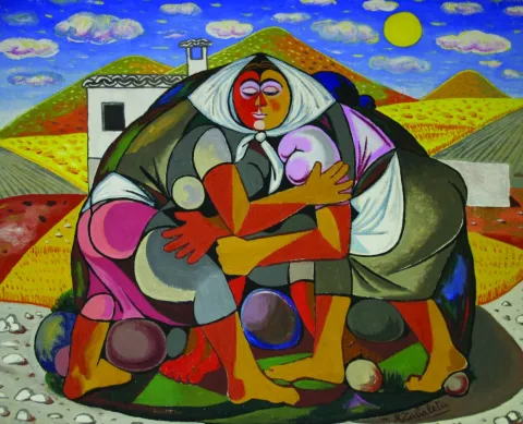
Rafael Zabaleta was born in Quesada in 1907. After studying at the Madrid School of Fine Arts he travels to Paris, where he studies the teachers of contemporary painting, such as Picasso. In 1942 he made his first individual exhibition and since then there will be many successes. He won the UNESCO Prize for the Third Latin American Biennial in 1956. In their painting, light, color, family objects, the fields of Quesada will be immortalized and hang in many museums around the world. He died in Quesada in 1960.
The Zabaleta Museum was created in 1963 with the important legacy donated by the heirs of the painter. All the works exposed are of great interest and constitute their most complete exhibition.

Museum of Miguel Hernández and Josefina Manresa

Located on the ground floor of the Zabaleta Museum, it contains much of Miguel Hernández's legacy. It offers a tour of the work and life of the poet and his wife, the quesadeña Josefina Manresa, a story of love full of passions and emotions.

Quesada Archaeological Heritage Interpretation Center, CIPAQ

The Center for the Interpretation of the Archaeological Heritage of Quesada, CIPAQ, opens its doors in September 2015 to join the extensive cultural offer of this picturesque jiennense villa, cradle of the Guadalquivir. The aim is to show the extraordinary legacy, prehistoric and Roman, which treasures Quesada. Thus, the first floor is dedicated to one of the most important sets of rock, eulin and schematic art in the province of Jaén, declared World Heritage by UNESCO in 1998. On the ground floor the theme revolves around the Roman villa of Bruñel, with an amazing group of mosaics in excellent conservation. The tour is set with the exhibition of interesting objects, recreations, audiovisual, interactive and a teaching classroom for small visitors to learn by playing. "

Loading map
Preparing points of interest and routes...
Imagen principal
imagen
Image
08dafa1a-7a1f-a656-cb9f-1064faa23eca?t=1603979598255
Imagen principal
Activado
Literatura

An excellent way to get to know one of the most beautiful and historic villages in this Natural Park is to follow in the footsteps of two illustrious poets: Antonio Machado and Miguel Hernández.

Quesada's connection with Antonio Machado stems from the fact that it is one of the places the poet visited during some of his frequent excursions to the source of the Guadalquivir river. You can follow in Machado's footsteps in a park where you'll find ceramic tiles bearing a fragment of one of his poems, and the same is true at the Sanctuary of the Virgen de Tíscar. Once there, be sure to visit the incomparable Cueva del Agua.

Quesada's link with Miguel Hernández, on the other hand, comes from the fact that his wife was born in the town. You can see how the people of Quesada cherish the poet's legacy through the Miguel Hernández-Josefina Manresa Museum and pay tribute to him through various corners linked to his memory.

Pozo Alcón

Submitted by brandcode_deweloper on
Id
749855
Perfil de redes sociales
Facebook
https://www.facebook.com/ayuntamiento.depozoalcon/
Twitter
https://twitter.com/PozoTurismo
Instagram
https://www.instagram.com/turismoenpozo/
Descripción
Breve descripción

Well Alcón is found to the south of the Natural Park of the Sierras de Cazorla, Segura and Las Villas, between two landscapes that combine the verdor of the mountains with the dryness of the lowlands that border Granada.

The agriculture is the main activity, highlighting the olive cultivation, herbaceous plants and almonds. The livestock It is also an important activity, dominated by sheep (Segureño lamb) and poultry. Bad communications with Jaén, makes this town is more linked to Baza (Granada)to other locations in the province.

The villa, that up to the 18th century belonged to Quesada, owns a valuable and dedicated popular architecture. It's the only of the peoples of the Natural Park which has not lost population census since the creation of the Park. The municipality has been able to preserve old monuments such as the church of Our Lady of the Incarnation and the City Hall Square. His home shows deep respect for traditional architecture, especially in the high neighborhoods surrounding the church of Our Lady of the Incarnation.

Tourism is consolidating as a future activity in the so-called environment "Sierra del Pozo," where there are numerous sites of great environmental value and exceptional landscapes. Near the village is the beautiful area of the Bread reservoir.

All this allows the enjoyment of numerous and varied activities ranging from extreme sports, hiking through sports fishing, observation of fauna and flora and astronomical observation.

Telecomunicaciones
Teléfono
953 738 041
Sitio web
www.pozoalcon.es
Fax
953 950 898
Correo electrónico
ayuntamiento@pozoalcon.es
Ubicación
Nombre
Pozo Alcón
Latitud
37.702010
Longitud
-2.932740
Municipio
Ubicación en el mapa
POINT (-2.93274 37.70201)
Imágenes
imagen
Image
4a1af24f-5e10-d7f4-b310-6d488956b6eb?t=1621355480052
Imagen principal
Desactivado
imagen
Image
1ca7f7e4-fdb2-99a3-6f26-6fd5015bda9d?t=1610988789849
Imagen principal
Desactivado
imagen
Image
df2400b1-a485-33ed-1b04-2bc6df5d6e8c?t=1621355480139
Imagen principal
Desactivado
imagen
Image
f975805d-814e-29f8-b061-57375da6c448?t=1621355480184
Imagen principal
Desactivado
imagen
Image
0d168a3f-fcab-3f86-8f23-6b1e514cb97e?t=1621355480242
Imagen principal
Desactivado
imagen
Image
dee179f4-893f-23e0-07fb-5433c3a50289?t=1621355480290
Imagen principal
Desactivado
imagen
Image
46d10711-3054-c7d7-c605-a95a68bac832?t=1621355480476
Imagen principal
Desactivado
Información adicional
Imágenes cabecera
imagen
Image
Pozo Alcón
Imagen principal
Desactivado
Datos de interés

Tourist area: Serras de Cazorla, Segura and the Villas

Distance to the capital (km): 134

Altitude over sea level (m): 854

Extension (Km2): 139

Number of inhabitants: 5,464

Cattle

Postal code: 23485

Videos
Video file
Cultura
  • Church of Our Lady of the Incarnation. Up in the middle of the the 1960s of the 20th centuryon another previous temple with the same advocation, whose origin was back to the 13th century. Its cover presents a vain of intellized access, Latin cross and hastial. The tower stands out for its volume, it is square-based and decorated with geometric elements.
Naturaleza

Pozo Alcón is a municipality del Alto Guadalquivir located on the border with the province of Granada. The North half of the term included in the Natural Park of the Sierras de Cazorla, Segura and Las Villas. Changing the natural environment to the south and south-east, on the hillside to the river Guadiana Menor and Guadalentín, changing the landscape abruptly with large half-life areas, very eroded, of splits and tumours.

Well Alcón is a natural paradise for sports lovers and activities in contact with nature. In a radius of a few kilometers we have three reservoirs near: El portillo swampat the end of Castril; The Negratin, in the region of the mountain plane; and La Bolera reservoir at the end of Well of Alcon. The water of these reservoirs, in addition to their use for irrigation and human consumption of the populations, can be practiced different sports.

The term municipal has many ecosystems in which infinity of species that make up rich and varied fauna:: from the rapacious birds, the carrionies, the cynetic species, both of major and minor hunting, the fish, amphibians, reptiles, as well as the characteristic fauna of the riverside vegetation that exists next to the stream and river.

No doubt, a true paradise where nature seems to be recreating. It is almost compulsory to make direct contact with one of the wonderful places that this territory hides, where in addition to observing "in situ" both vegetation and fauna, we can enjoy a fabulous panoramic view of the mountains and the jienese countryside.

Among the different sites, we mention:

  • Cold rice. This tributary of the Guadalanimín River, with crystal clear waters, is a beautiful enclave that invites you to travel through any of its margins. We can see his lush coastal vegetation: chopos, alamos, willows, mimberas... It's 17 km away. of the city and belongs to the Natural Park of the Sierra de Cazorla.
  • The Hornic. Here is most of the vegetation of Natural Park and is the starting point for start routes for the Sierra del Pozo. 10 km. of the city centre and is in full Natural Park.
  • Peña de Quesada look. This impressive massif that reaches 1329 m of altitude is a natural lookout for the stunning panoramic views of the boulder and the Sierra del Pozo. It's 10 km from the town.
  • Mirador de Guazalamanco, You can reach by enjoying a pleasant hiking route and watching from there magnificent views of the swamp and Sierra del Pozo.
  • Pico Cabañas. It reaches a height of 2038 m and is the emblematic place to contemplate the beautiful formations of larix pine. The rise to the peak will show you beautiful pictures. It's 25 km from the population.
Fiestas y Eventos

The people are looking forward to the arrival of the following local parties:

  • Feria y Fiestas de Santa Ana Patrona de Pozo Alcón. Since 3013, these parties are held during the days 25-30 Julyafter having been approved by a vote of the neighbors to recelebrate the parties on these dates, which had previously been modified by the risk of fires that may be caused by the rockets of the parties when coinciding with the period of collection of the mieses.
  • San Sebastiánon May 9. This day is celebrated a curious pilgrimage in honor of St. Gregory, which is taken in procession to an image of the Child Jesus which is popularly known among the poor as the "Boy of the Ball," and also with a cross to the place called "the Cross of St. Gregory," distant 1.5 km. on the road leading to the swamp of The Bolera.
  • Celebration of "El Paso" on Good Friday. At the dawn of this day an image of Our Father Jesus Nazarene, popularly known as "The Pass," comes out in procession. At a time of the journey the image of Nazarene, the Virgin of the Dolores and San Juan shall be composed "The Pass" to the full.
  • Festivity of the Immaculate Conception, on December 8. The day before the holiday the call was held "Viva's party", in memory of a friar who went through the streets of the village giving live and praises to the Immaculate Conception. Hence the popular name of the party, praises that were answered and chorted by the entourage of children who accompanied him during the tour, while filling a sack that he carried on his shoulder with sweets and nuts with which the neighbors gave him.
  • Living Bethlehem of Fontanar (nearest Saturday to December 25).
Gastronomía

The kitchen of Pozo de Alcón sinks its roots in the old fires that for generations have seen the preparation of daily sustenance. Among those dishes we remember:

  • "Hachapecho," also called a pharinera, with which the gluers were fed (workers who had as their trade the extraction of fish by combustion of pine wood). It consists of this dish in a "labrao garlic" made from olive oil and salt, to which some strips of cod were added.
  • "Rice with beans," Pintas beans that eat next to the caldy rice and that are usually accompanied by rabbit meat, symbol in the times behind the pocense Christmas.
  • "Bread crumbs." For the Romeria de San Gregorio, the Pocenses prepare the traditional "crumbs" accompanied by torreznos, chorizo, olives and some fruit.
  • "Arroches with meat," which are made in the Romeria of San Gregorio, next to the swamp of La Bolera.
  • "meat fries," also on the day of the rosemary in the fantastic surroundings of the La Bolera swamp. All this accompanied by the good wine of the earth.
  • Chickpeas with acelgas, is a dish that along with that of "fried cod ', are used preferably in Easter, it is a very deep-rooted custom in these southern lands.
  • "Spicy gazhas," made of fried or scabbering bakers, or the cakes with which the Carnival was celebrated and entered in time of abstinence.

In pastry shops:

  • Fruits of frying pan, typical of Easter, among which we can count the "fried rosses" and "Pens."
Historia

The first written reference of this locality dates from 1331, in which reference is made a "Pozuelo," between the limits of the term Cazorla, but without any population. After the completion of the Reconquest, a colonization of the area known as "El Pozo de Campo Cuenca."

In 1529, it was rotated by its inhabitants, who will begin to make their ground, which meant that the population was increasing, and in 1618 it already had the Hermitage of Santa Ana and the Church of the Incarnation.

The day 12 July 1648The king. Felipe IV separated the place of the well from the village of Quesada, passing to be a real and independent villaTo get it, several neighbors had to pay 5,000 ducats.

In achieving independence the municipality experienced a progressive increase in population, and already the mid-18th century had 2,227 inhabitants, a parish, two hermitage, a posite and a hospital.

In the town, wheat, barley, rye, oil, wine, cumin and anis are produced.

The main occupations of the neighbours included the "rivals," which consisted of going from village to village, with the goods on donkeys, to sell what they could.

Loading map
Preparing points of interest and routes...
Imagen principal
imagen
Image
Pozo Alcón
Imagen principal
Activado

Peal de Becerro

Submitted by brandcode_deweloper on
Id
749482
Perfil de redes sociales
Facebook
https://www.facebook.com/ayuntamiento.pealdebecerro/
Twitter
https://twitter.com/pealdebecerro
Youtube
https://www.youtube.com/channel/UCRo597Z-lgcrLF1Xzvee0Mg/videos
Instagram
https://www.instagram.com/ayto_pealdebecerro/
Descripción
Breve descripción

Municipality located to the east of the provincein the Sierra de Cazorla region.

It has an enclave in the middle of the mountain area. The main territory of the municipal term is to the west of the region on land of olive countryside. The original administrative division thus allowed this municipality to have forest resources, pastures in communal mountain areas.

It is part of the Guadalquivir watershed, a river that crosses the municipal territory, as well as its tributary Guadiana Minor, Guadaltiín and Toya.

In its landscape, the large olive groves and cereal fields. In addition of the main population centre, Peal de Becerro, the villages of Toya, Peal Furnaces and the enclave of The Almicaran, integrated within the mountain area of the Sierra de Cazorla.

In Toya exists a burial chamber of Iberian origin, declared a National Historical Monument in 1918. Inside it was found "La Bicha de Toya" which is a sculpture and is currently in the National Archaeological Museum of Madrid.

The local economy is based on olive cultivation, processed metal, construction, olive industry and meat products.

Within Historical Heritage We highlight: Toya Chamber, the Clock Tower, the Mocha Tower, the Toya Castle and the Peal Furnace Aqueduct.

Telecomunicaciones
Teléfono
953 730 075
Sitio web
www.pealdebecerro.es
Fax
953 730 901
Correo electrónico
ayuntamiento@pealdebecerro.es
Ubicación
Nombre
Peal de Becerro
Latitud
37.912130
Longitud
-3.124050
Municipio
Ubicación en el mapa
POINT (-3.12405 37.91213)
Imágenes
imagen
Image
36ed687c-6781-2c15-a6ca-96c10df24791?t=1621272389278
Imagen principal
Desactivado
imagen
Image
a1255b7a-25c1-49d8-c70f-54d9311fb045?t=1621272389327
Imagen principal
Desactivado
imagen
Image
0c495f3f-a175-bd80-6af1-b5a640307452?t=1595435156186
Imagen principal
Desactivado
imagen
Image
f46b1747-cb7f-6d40-a908-654d4eeffccd?t=1621272389373
Imagen principal
Desactivado
imagen
Image
687d48bc-006b-017f-12ea-4600ed60245b?t=1621272389419
Imagen principal
Desactivado
imagen
Image
a4e805f6-b189-49a7-3cfd-d274f4eef1ca?t=1621272389595
Imagen principal
Desactivado
imagen
Image
e876c399-4357-b1e3-3d9d-421dba5e1d2d?t=1595435254911
Imagen principal
Desactivado
Imágenes cabecera
imagen
Image
peal de becerro
Imagen principal
Desactivado
Datos de interés

Tourist area: Serras de Cazorla, Segura and the Villas
Distance to the capital (km): 87
Altitude over sea level (m): 550
Extension (km ²): 147
Number of inhabitants: 5,277
Gentillo: Pealeños
Postal code: 23460

Videos
Video file
Cultura
  • The Toya House. Discovered in the early 20th century, it is one of the most important funeral monuments of Iberian culture on the Peninsula, not only because of its conservation status, but also because of the monument itself. Some consider it the first great architectural work of the Iberian Peninsula. This is a underground burial chamber built with large "in situ" carved stones, placed one on the other without any type of argamase. The interior impacts, because it is a three-ship enclosure, the sides in turn, divided into two, made of carved chairs to fit perfectly on each other. Banks, bakers and a table appear. The roof is also closed with stone slabs. The construction work of the camera is very interesting for its high level of execution. The "Toya's jousting." It is characteristic of an Iberian prince and his family, of it we highlight: the wheels of a warrior car, dishes, vessels, remains of a sword, an iron helmet, beads of silver necklace, glass of marine blue and yellow....Declared Historical Artistic Monument in 1918.
  • The Clock Tower:In the heart of the urban core are two towers that formed part of an ancient medieval fortress, One of them, The Clock Tower raised at the end of the 14th century, sits on a stone socket, is quadrangular, of silery not always regular. It is internally distributed on four levels, maintains the almenate and also on two sides of its matacan-function balconies, in the third, matacan menulas, and in the latter a watch that gives it name has been placed.Declared Good of Cultural Interest in 1985.
  • The Mocha Tower: It is about the second tower of the fortress Medieval, it is of masonry concerted in some of its parts has corners reinforced to rope and sawn and topped with skimmed canes. It must have been built between the 13th and 14th centuries, it was restored at the end of the last century.It has been declared Good. of Cultural Interest in 1985. Among the towers is a wide space, in which an Auditorium has been established, for the celebration of cultural and playful activities in the open air.
  • The Castle of Toya: In Toya, near the Iberian tomb, an impressive tower of the Toya castle is maintained. It has a square floor, it is demochada and in its interior are preserved half-barrel vaults that covered the rooms and on its outside the arrangement of the masonry goes to soga and tizon, also showing structure of calicanto. It has been declared Good of Cultural Interest since 1949.
  • Aqueduct of Peal Furnaces: In this pedany, there is an old and damaged aqueduct, considered as of Roman construction. It defies the passage of time and erosion caused by the river that crosses it below.

Naturaleza

Peal de Becerro with a surface of 147 km2, belongs to the region of Sierra de Cazorla. Posee two pedanities, Toya and Peal Furnacesand an enclave, The Almicaran, integrated in the Sierra de Cazorla, 55 km. of the municipality.

It is part of the Guadalquivir watershed, river that crosses the municipality, as well as its tributary the Guadiana Menor, the Guadaltiín and other minor water streams.

The land of olive countryside and in a more secondary way, east of the region, a mountain areaincluded in the Natural Park of the Sierras de Cazorla, Segura and Las Villas.

The agricultural land are divided between arable crops (wheat, barley) and olive in similar extensions.

The enclave of The Almicaran, part limit with the province of Granada. In these saws there is a large variety of tree species. Up to 900 m of altitude are the pine forests carrasco, accompanied by Madroños and lentils. Up in altitude, we found oats, complaints and Pine rodenum.

In more humid areas we can find millennia tejos and copies of steels, both very few in Andalusia. On the margins of the rivers appear strawberries, willows, choposas well as and eneas where water birds and small mammals are covered.

The Natural Park has one of the richest flowers in the entire Mediterranean basin.

With the declaration of the National Cazorla and Segura Coto in 1960, some new species were introduced, such as: the muflon, boar or gamo. There are currently 51 species of mammals in the Park. The remaining include: Monkey goat, deer, gamo, fox, garduña and badger. In the fish fauna, the common trout, rainbow trout and barb. Several types of reptiles and amphibians.

Among the most interesting areas of the municipality we will mention:

  • Loma de los Castellones. From this abrupt enclave we can see the impressive rocky cliffs and stone blocks that rise in their surroundings. It is located south of the town in the natural park of the Sierras de Cazorla, Segura and Las Villas, 19 km. of the municipality.
  • Pico Crico. Impressive peak of 1,847 m., from which we can enjoy spectacular views of the Natural Park.
  • Gualay screws. It is a beautiful place where you can see the coastal vegetation surrounding the Arroyo Tornillos de Gualay.

Fiestas y Eventos
  • Saint Anton, 17 January: in honor of the holy protector of the animals. The tradition of burning fires is preserved, the night before.
  • La Candelaria February 2: The current custom is to bring the children who were born and baptized the year before the Church for presentation. The Pealeans carry offerings that are the typical roses and the popcorn of bread that are blessed and accompanied by the Virgin of the Incarnation. In the procession the image and the throne instead of being adorned with flowers and cirios are adorned with the rosches of the candlestick.
  • Celebrations of Our Lady of the Incarnation: the parties in honor of their patron are celebrated twice in the year. In the days close to March 25 and between August 17 and 21, dates on which the Peal de Becerro fair is held with a multitude of both playful and festive events, among which the loft of loops stands out.
  • Romeria dedicated to San Marcos in Toya: the last Sunday of April is celebrated in honor of San Marcos. In its course the image is moved to the river Toya, where it is wet as a symbol of purification of the fields and livestock, so that the year is fruitful.

Gastronomía
  • Gachamas: Cook flour and potatoes together, then turn a lot in the pan to get a golden cake, eat with chorizo, pancake, fried peppers and even some pieces of melon.
  • Talarines. Tomato, garlic, onion, a dry red pepper and minor game meat, rabbit or hare.
  • Beet: Made with olive oil, flour, potatoes, green pepper, tomato, crushed garlic and sweet pepper.
  • Rin-Ran:Mashed potatoes with choriceros peppers, sanded with olive oil, vinegar, salt, garlic and cumin. This dish is decorated with hard egg, cod strips and onion or onions.

In the pastry shop:

  • Cattle cake: The size of a cookie and made with a flour and water paste that is amassed with oil and canals that once fermented is cooked in the oven.
  • The "twists," punched for Christmas, white bath rosches for important parties, oil rosches for the Candelaria....

Historia

From Bronze Age settlements have been documented in the municipality of Peal de Becerro, with an intense population in the Toya and Guadiana Minor Rivers courses.

The connection of the province of Jaén with Iberian archaeology is important, but the municipality of Peal de Becerro is certainly an exceptional place. Since the 5th century of C., Tugia was a important centre in route control that through the Guadiana Menor put the Alta Andalucía in contact with the coast of the Levina. Between the 5th and 2nd century of C.the city was linked to development of the Iberian aristocracy as shown by many other remains found in the area, the location of an incineration necropolis presided by an extraordinary burial chamber, the most monumental and best preserved that has provided the Iberian Archaeology, the House of Toya.

From the Roman and Visigoda stage have been found various elementslike a funerary stele with a touch relief, a gravel stele, a quail, a visigode column and in the Cerro de la Horca a visigode necropolis with eight tombs.

In medieval times Peal is not mentioned so in that period it must have been a small population dependent on the fortified centre of Toya. Your castle, according to the chronicles by Fernando III. A few years later the king bestows on the archbishop of Toledo, Quesada and Toya, who incorporated the advance of Cazorla, passing by in 1,310 the jurisdiction of the Ubeda.

After the Spanish conquest Peal de Becerro became an independent population. The Spanish strengthened their defenses and They raised the towers. which we now know as the Clock and Mocha. It has belonged to the advance of Cazorla until its dissolution by the Cortes de Cadiz in 1812.

Then by Royal Order of King Fernando VII was declared villa in 1822.

Loading map
Preparing points of interest and routes...
Imagen principal
imagen
Image
peal de becerro
Imagen principal
Activado

Orcera

Submitted by brandcode_deweloper on
Id
749362
Perfil de redes sociales
Facebook
https://www.facebook.com/ayuntamiento.orcera/
Descripción
Breve descripción

Municipality belonging to the region Sierra de Segura, within the Natural Park of the Serras de Cazorla, Segura and Las Villas. Eminently forest and full of landscape attractions.

This municipality has the particularity of to be divided into two enclaves: one south-eastern, in which is the town of Orcera, and one in the north-western area of the region, bordering the province of Ciudad Real.

The cultivated land are in the west of the municipal term. The town is hidden in the skirts of Mount Peñalta, with an urban interiors and an excellent medieval town.

Economic activity It depends on the olive grove, the oil industry, the hunting, the forest and the tourism, as it is the gateway to the Natural Park of the Sierras de Cazorla, Segura and Las Villas.

Among its historical heritage we highlight: the Parroquial Church of the Assumption, the Towers of Santa Catalina, The fountain of the Chorros and its Old Town, among others.

Telecomunicaciones
Teléfono
953 480 154
Sitio web
www.orcera.es
Fax
953 480 155
Correo electrónico
ayuntamiento@orcera.es
Ubicación
Nombre
Orcera
Latitud
38.318020
Longitud
-2.661050
Distrito
Municipio
Ubicación en el mapa
POINT (-2.66105 38.31802)
Imágenes
imagen
Image
4d801f2d-0fbe-80cd-e9b3-da943df1b529?t=1621271852271
Imagen principal
Desactivado
imagen
Image
7564df32-691f-5fe6-5772-200271f90ab8?t=1596037186672
Imagen principal
Desactivado
imagen
Image
a3ef91bb-6788-aeb3-3ce1-52c63c6a049b?t=1596037276689
Imagen principal
Desactivado
imagen
Image
93ea953b-b7fb-00f7-6751-442e27f9d852?t=1621271784259
Imagen principal
Desactivado
imagen
Image
4b2b369e-2226-4eec-d0a4-6c1aa7068997?t=1596037329344
Imagen principal
Desactivado
imagen
Image
adf5b266-0623-263e-e83e-858b83feb20b?t=1603729407461
Imagen principal
Desactivado
imagen
Image
67588f5f-1456-f1f3-2a99-9ff944435ff8?t=1603729570170
Imagen principal
Desactivado
imagen
Image
6b96b240-e7be-da17-68df-cbe38bd19e5b?t=1621271852323
Imagen principal
Desactivado
imagen
Image
49fdaa46-c7f3-a242-9a12-4c6be0414434?t=1621271852458
Imagen principal
Desactivado
Información adicional
Curiosidades

C/ Joaquín Payá, s/n

Imágenes cabecera
imagen
Image
Orcera
Imagen principal
Desactivado
Datos de interés

Tourist area: Serras de Cazorla, Segura and the Villas

Distance to the capital (km): 151

Altitude over sea level (m): 797

Extension (Km2): 126

Number of inhabitants: 1,894

Gentillo: Orcerners

Postal code: 23370

Videos
Video file
Cultura
  • Church of Our Lady of the Assumption. It began to be built in 1530, finishing the works in 1570. The building is of a single ship divided into three sections that separate semi-columns with half-point arches covered with Gothic-style starvaults.
  • The major chapel also covered with a starry cross vault is accessed to it through a half-point backbone. It has side chapels.. The most important thing who owns is his magnificent mannerist coverfrom the ancient monastery of Santa María de la Peña. Data from last third of the 16th century and it is divided into two bodies: in the first one the arch door of half point is opened framed by Corinthian columns, with allegorical figures in the shrouds; in the upper body, a triple hornaine and the whole is removed by a triangular fronton divided with pinnacle. The tower is settled on a torreon of the primitive castle Medieval, it is quadrangular and consists of two bodies and bell tower, with soga and tendon reinforcements at the highest corners. On one side it has a magnificent window with a half-point arch on jambas caried between menillas, crowned by a triangular fronton. The other window displays in its half-point arch a whole decorative program: highlighted plates, cherubim in the key or semidesnude figures. This element is completed by lateral clumps. It was declared Good of Cultural Interest in 1985.
  • Fuente de los Chorros. Monumental source made of stone and brick, perhaps at the end of the 18th century. It is made up of a somewhat irregular silical frontis, in the central part of which two half-point arches and a triangular fronton that in its center carries a shield. They remove the fronton three pineapples, one at the vertex and the other at the ends.
  • Torres de Santa Catalina. Situations across the river OrceraWe see three Muslim towers dating back to the 12th century, when the advance of Christian troops required a strengthening of defensive structures. These atalayas and the one that rises in the church square, and that makes as the bell tower of the temple, will constitute the defensive line of the house. They have been declared Good of Cultural Interest.
  • Old helmet. Posee Orcera a medieval neighborhood who resist the vicissitudes of times. The old town of the population is perfectly adapted to the medium, with narrow alleys, intricate and unmistakable Islamic regent. The houses are built with slimmed masonry walls, and complicated asymmetric volumes, low height, original chimneys and Arab roofs.
Naturaleza

The municipal term of Orcera has 126 km2 and has the particularity that it is found divided into two enclaves:

  • The South-East enclavewhere the main population of the Orcera and is located within the Natural Park of the Sierras de Cazorla, Segura and Las Villas.
  • The second sector is in the North-West of the region, bordering the province of Ciudad Real in the foothills of Sierra Morena.

Orceradue to its location in the largest Natural Park in Spain has many picturesque areas and interesting placesincluding Armujus, with a huge river pool, The Straits, Cascade of the Hueta, Orcera Lagoon and Wood River.

The population centre is 795 m above sea level, on the hill of the Villares.

  • Key area:Its eastern part is very accidental from the orographic point of view, concentrating here the highest heights of the municipality: Peña Blonde (1625 m.), Engarbo (1595 m.), Navalhora (1419 m.), Los Villares (1209 m.) With a surface of 70 km2 is made up of forest mass (pineapples) and crossed by a warlike Wood River. The western part is the area of the valley, vertebrated by Orcera and Trujala rivers. Being the first tributary of the second, and this in turn, of the Guadalimar River. It is the most populated area of the municipality where the town's town centre and its villages are located. Here they concentrate. agricultural land, highlighting the olive tree, followed by cereal and orchards.
  • Northwest enclave:It is located to the northwest of the region, in the left bank of the Guadalmena River, which makes the border during a good stretch of the province of Jaén and Ciudad Real. It has a extension of 50 km2.The landscape is different from that of the other enclave, formed by shrubs, pastures, burning and scattered pine. It's a lower one on the mountain. The Marañosa (846 m.) maximum height.

Population is concentrated in the main core or municipal capital, the rest does in small villages or villages: La Hueta, La Marañosa, Linarejos, Los Arroyos and Valdemarin. Some of them, like Linarejos, are completely abandoned.

A space with many ecosystems in which infinity of species that make up rich and varied fauna:: from the rapacious birds, the carrionies, the cynetic species, both of major and minor hunting, the fish, amphibians, reptiles, as well as the characteristic fauna of the riverside vegetation that exists next to the stream and river.

No doubt, a true paradise where nature seems to be recreating. It is almost compulsory to make direct contact with one of the wonderful places that this territory hides, where in addition to observing "in situ" both vegetation and fauna, we can enjoy a fabulous panoramic view of the mountains and the jienese countryside.

Fiestas y Eventos
  • La Candelaria, February 2. This holiday has always been commemorated in Orcera. The celebration consists of a day of coexistence in the area known as The Convent. The typical snack of that day is "the Candelaria or Hornazo Rosca," that carries a hard egg in the center painted in colors. They also sing and dance a series of popular songs.
  • Holy Week. It's curious the custom that takes place on Good Friday in the procession of the Meeting, with the steps of Jesus of Nazareth. The Roman squadron that escorts Jesus of Nazareth prevents the procession of the Virgin of Soledad from approaching. At that time, an angel-dressed child will recite verses requiring soldiers to depose their attitude.
  • San Isidroon May 15. It has been held since the middle of the last century. A Mass is held in honor of the Holy and once finished, the gilded carrots for the occasion begin the way to the place known as Armujoaccompanied by all the orchards who wish to. It is tradition to distribute and consume a "crow."
  • Patrons in honor of Our Lady of the Assumption. These parties take place in honor of your patron from 10 to 15 August. They have a wide range of activities, including religious acts, pregon, verbenas, concerts, championships and traditional "cobblestones." One of the championships is of the Turkish bowling, the indigenous game of the Sierra de Segura that was almost lost and Orcera has been the pioneer of the resurgir of it, organizing in 1969 the "First Comarcal Championship."
Gastronomía

Orcera participates in the culinary wisdom of the serrana region to which it belongs. The wheat culture is manifested in many of its dishes.

  • Garlic of flour with walnuts: potato, flour, nests, garlic, green pepper, tomatoes, pepper, olive oil, salt and pepper.
  • Ajo-atao: potatoes, salt, garlic, olive oil, egg and vinegar.
  • Andrajos: saffrito of tomato, garlic, hare or mountain rabbit, mint and "the rags," homemade pasta made with water and flour.
  • Ajopringue: a dish of medieval origin, the main ingredient of which is the liver of the cooked, ground and seasoned pig with olive oil, red pepper, garlic, chopped parsley, tomato and miga of bread and all this seasoned with pimenton and saffron.

We must also mention the "roulette crumbs," made from corn flour. Among the products of the pig, in addition to the sausages, we must name the "fried," which is a long and slow frying of swine meat, tomato sauce, roasted peppers and other vegetables such as beans.

In his pastry shop, "The Traps," frying flour and eggs are then cooked in a roasted sugar syrup with orange, matalahuva and saffron peel.

The crow. is a drink made of wine, water, sugar and fruit. It is distributed in most acts as a symbol of brotherhood and hospitality.

Historia

It has been found that during the Neolithic valleys of the rivers as the Guadalimar were very populated, with centers of height like the Cerro de la Atalaya and Peñón Utrero, with abundant fortified remains and lower position sites, such as Cerro de la Coja. The first news we have about Orcera goes back to previous dates the Bronze age. In the Iberian period there is again news of a small occupation, which will increase during the stay of the Romans. Iberian and Roman remains have been found.

In the Islamic period, Orcera It was a small house located by the Orcera River. From the 11th century, and in the face of the danger of the Spanish armies of the 12th and 13th centuries, Orcera and the rest of the houses They raised defensive enclosures.. The three towers of Santa Catalina are preserved in the municipality. It was conquered in 1230 by the alfoz de Alcaraz of the current province of Albacete and belonged until 1258 to this jurisdiction of Alcaraz, going on this date to be part of the Segura Common and their land for a privilege of the king Sancho IV, which is preserved in the National Historical Archive. It will be donated as an Arrabal of Segura to the Order of Cavalry of Santiago, then owner of Segura.

In the area known as the "Convent" there was the Franciscan monastery of Our Lady of the Peña, in which in 1580 the procurators of the villas of the common to draw up "Orders of the Common of the village of Segura and its land," which was intended to save, preserve and manage the mountains of Segura.

These ordinances were confirmed by Philip II and were in force until 1744date on which the Segura Maritime Provincewhose seat and minister were located in Orcera, which was still in the area of Segura de la Sierra. In 1836 this maritime province was abolished, and the following year, 1837, Orcera became independent de Segura de la Sierra becoming an independent villa.

Loading map
Preparing points of interest and routes...
Imagen principal
imagen
Image
Orcera
Imagen principal
Activado

La Puerta de Segura

Submitted by brandcode_deweloper on
Id
739673
Perfil de redes sociales
Facebook
https://www.facebook.com/Ayuntamiento-La-Puerta-de-Segura-1196731970534179/
Descripción
Breve descripción

La Puerta de Segura is a municipality located in the north-east of the province of Jaén, in the Sierra de Segura region. It owes its name to its privileged position, as a natural entrance to the Sierra de Segura and one of the main accesses to the Natural Park of the Sierras de Cazorla, Segura and the Villas, within which is found much of its municipal term. It offers a mountain landscape full of nuances and variety that goes from olive fields to saw areas.

The villages of Los Pascual, Las Graceas, Bonache, Los Llanos and Los Yegüerizos are also part of this City Hall.

Its main economic activity is agriculture, the olive tree being the predominant crop. Tourism and hotel activity have some importance in the income of the municipality. Minor hunting, major hunting and fishing are also practised.

The urban core of La Puerta de Segura is divided into two parts by the Guadalimar River.

From its historical heritage, we highlight: Church of San Mateo, the Theatre, the Bridge on the Guadalimar River, the Castle of Bujalamé, the Casa Tercia.

Telecomunicaciones
Teléfono
953 486 002
Sitio web
www.lapuertadesegura.es
Fax
953 486 659
Correo electrónico
alcadia@lapuertadesegura.es
Ubicación
Nombre
La Puerta de Segura
Latitud
38.349680
Longitud
-2.736610
Distrito
Ubicación en el mapa
POINT (-2.73661 38.34968)
Imágenes
imagen
Image
8bc3e428-c20a-30be-004b-7c6d65b0b2eb?t=1595347564411
Imagen principal
Desactivado
imagen
Image
dc8e41c2-7974-0553-fd55-693b2e8694d2?t=1595347579489
Imagen principal
Desactivado
imagen
Image
la-puerta-jpg
Imagen principal
Desactivado
imagen
Image
ayuntamiento-2-jpg
Imagen principal
Desactivado
imagen
Image
373f3443-24d1-3952-9160-ed22d9795d42?t=1595347702076
Imagen principal
Desactivado
imagen
Image
fuente-alegorica-jpg
Imagen principal
Desactivado
imagen
Image
arquitectura-colorista-jpg
Imagen principal
Desactivado
imagen
Image
teatro-1-jpg
Imagen principal
Desactivado
imagen
Image
iglesia-de-san-mateo-jpg
Imagen principal
Desactivado
imagen
Image
rio-guadalimar-2-jpg
Imagen principal
Desactivado
Información adicional
Curiosidades

Oficina de Información Turística 
Ctra. de Siles s/n
Tfno.: 953 48 70 06
http://www.lapuertadesegura.es/turismo.html

Imágenes cabecera
imagen
Image
la puerta del segura
Imagen principal
Desactivado
Datos de interés

Tourist area: Serras de Cazorla, Segura and the Villas
Distance to the capital (km): 145.5
Altitude over sea level (m): 585
Extension (km ²): 98
Number of inhabitants: 2,646
Gentillo: Porceños
Postal code: 23360

Videos
Video file
Cultura
  • San Mateo Parish Church: It was erected in 1821 in the same place as the old medieval temple, which was burned by French troops in 1811. Despite its valuable dimensions, it was organized from a single ship, divided into two sections, with canyon vault cover that unloads on fajon arches. The inner walls are totally flimsy. The header covered by semi-spherical vault defines the circular arrangement of the main altar. A neoclassical air is observed externally. The main cover, of a quarry, consists of an intellized door of remarkable proportions, on it a large circular window and two smaller ones on both sides. The rest of the facade is made of embossed brick. The tower, of low height and lacquered appearance was later added and has a body of bells and a watch. In the sacristy is a processed cross of silver from the 16th century, which reflects in a very clear way the characteristics of the Renaissance goldsmith.
  • The Castle of Bujalamé. The strategic location of La Puerta de Segura resulted in the lifting of defensive constructions since the Islamic era, there is a record of two strengths in the place where the urban core is located. One of them popularly known as "The Castle" it has been deteriorating, its stones were used for other constructions. At present from the medieval fortress, only the remains of an old turret of the outer defensive belt, belonging to the Almohad period of the late 11th and first half of the 12th century, are preserved. In 1985 declared Good for Cultural Interest.
  • Theatre: The La Puerta de Segura Theatre was built in 1928. It is representative of the current trends and the most characteristic is its circular plant. The façade is versed on two floors: at the bottom the arched half-point door with trapezoidal key resting on pilasters and windows on both sides. On the upper floor, the central balcony with the ancestor of balaustre and double columns stands out. Two pilasters frame the height of the building to which a ceramic panel is crowned with the date of its construction. It's been rehabilitated recently.
  • Bridge: Built in the Muslim era, at the foot of an old fortress, it was made with calicanto masonry and with one eye. Dam service in case of danger. At present, the calicanto and the large and irregular medieval bulkheads are kept semi-hidden. Another bridge has been built in the same place, which is wider
  • Casa Tercia: Building on whose door the cross of the Order of Santiago appears, under whose domain the Sierra de Segura was found.

Naturaleza

The name of The Safe Gate comes from being the natural entrance to the Sierra de Segura along the Guadalimar River. This river that divides the village into two, on its shores is a nice walk with recreational areas and children's park.

On the Guadalimar River there was a bridge built in the Muslim era, however, the small eye of its only eye caused numerous floods, which led to its flight at the beginning of the 20th century, with a larger one currently appearing.

Across the river is a new ship-shaped bridge, built to facilitate people's passage from one shore to another.

In recent years, the town, like many of the surrounding municipalities, is orienting its future towards tourism to make known the rich natural heritage they have. Other initiatives include:

The Natural Way of Segura. Through this "Natural Way" programme, the Ministry of Agriculture, Food and the Environment, since 1993, has been building roads and infrastructure with the aim of creating marked routes that contribute to the development of rural areas and to meeting the demand of the urban population for the use of non-motorized routes that allow them access to nature and rural areas.

The Natural Way of Segura, with 27 km. in the municipal terms of Arroyo de Ojanco, Segura de la Sierra, Puente de Géave, La Puerta de Segura, Géave and Villarrodrigo.

A tour from which we can see the wild fauna of these sites. In addition to the large herbivores (deer, muflons, gooseberries, boars...) and the rapacious birds of impressive bearing, the term is full of many other animals whose observation can be enjoyed; the case of the small birds (coal, horseradish, pinkles, oroping, myrtle, reyezuelos...

The flora is made up of: oaks, cornoques, moans, oaks, moorish, Mediterranean nobleman forest, mother-of-pearl, brezo, lentils, cornicabra, coscoja and repopulation pines, as well as the gallery forests in the water courses. This riverside vegetation brings a color brush over the landscape with the change of the seasons, especially in the autumn season.

There are numerous enclaves that exist in the term to get fantastic panoramic from the region:

  • The Vulture: Located to the south-west of the town, at 1,245 m of altitude, it is an ideal place to view beautiful landscape views. Just 5 km away. We can move on foot or by vehicle.
  • Sierra de Oruña: This massif to the north-east of the town, with a maximum height of 1,153 m, is on the edge of the Natural Park and 7 km. of the city centre. It is an excellent place to contemplate the typical mountain vegetation.
  • Monte Salfaraf. The elevation of Salfaraf is a residual relief of the tectonic unit of the tabular shed of the plateau which, as a witness hill, is independent from the surrounding area, causing a landscape milestone, with a large visual basin. The topographic contrast with the surrounding terrain and the altitude of more than 1,000m make it easily identifiable. From its peak there are interesting views of other milestones such as the Guadalmena reservoir, the Yelmo or Segura de la Sierra.
  • Río Guadalimar The Gate of Segura is surrounded by the river Guada- limar from west to east, giving away a landscape of riverside to its channel, with a still preserved vegetation that contrasts with the olive plants that develop in its surroundings. The natural entrance to the Sierra de Segura that forms its valley, where the river has caused a narrow passage between the Alto de La Buitrera and the Pico Oruña, is remarkable.

Fiestas y Eventos

All the villages of La Puerta de Segura celebrate their patron parties. The Llanos, Last weekend of July. The Yegüerizos, July 26, Santa Ana. The Pascals andMay 3rd, Cross Day. Bonache August 15, Virgin of the Assumption.

The Safe Gate:

  • San Blas: February 3rd. The habit of lighting luminaires on the eve remains. On that day, the traditional donuts of the saint are distributed, which according to the popular sense will free all those who ingest them from the evils of the throat during the year.
  • Virgen del Carmen: Between the 15th and the 18th of July, festivals in Honor de la Virgen del Carmen. On the 16th day of the Virgin, a solemn Mass is held in the morning and in the afternoon the procession that will go through the streets of the people. Various activities are planned, playful, sports, cultural and every night popular greens.
  • Feast of St. Matthew: A cattle fair is held in La Puerta de Segura between 20 and 23 September, in honor of Saint Matthewit has now become a festive and outstanding fair of that part of the serrana region.

In addition to the traditional Multisectoral Agricol- Livestock Fair, a wide range of activities are planned, including bulls, bullfighting, the release of braves in the bullfighting square, plays, children's games and every night popular verbenas.

Gastronomía

In La Puerta de Segura they make good serrano dishes such as:

  • Andrajos: Serrano stew in which a thin mass made of water and wheat flour is cooked, in the sauce of a tomato saffrito and pepper with hare meat flavoured with herb.
  • Gahamas: It is based on flour, potatoes and olive oil. It can be accompanied with chorizo, torrezos...
  • Galians: Stew made with a cake of unleavened bread (galianera) hare, tomato, green pepper, olive oil water and salt.
  • Beads: They are made with the corn panizo flour accompanied by cucumbers, chorizos and torreznos.
  • Ajopringue: Owner of the time of the massacres. It is made with the liver of the ground pig and a lot of olive oil, with which it is customary to give to all those who participate in the singular rite of making the marrano a soul of orza and garlands of chacinas, with which once hung the ceilings of the pantries are adorned.
  • Sweet peas: of the feast of all Saints. Made of roasted flour, milk, cinnamon, orange shell and picatostes.

In pastries: fried rosses, oil rosses, baking, pestidos, entangled in Easter, flowers.... And to accompany, the home-made mistel.

Historia

The Gate of Segura has been populated since prehistory, with settlements on the banks of the Guadalimar River.

The strategic nature of the town is shown in the Iberian period in Bujalamé, whose remains reveal an agricultural, livestock and commercial activity.

The strategic position of this population led to the lifting of defensive constructions since the Islamic era. There are two strongholds, the one that was in the place that today occupies the urban town and the one of Bujalamé from which a stylized tower is preserved.

In 1235 it was conquered by the Knights of Santiago and became part of the extensive command of the Order, based in Segura de la Sierra.

During the reign of Philip II he was included in the territorial demarcation of Toledo, within the Order of Santiago's Order, later passing to the Dependence of the Segura Government.

For its geographical location, it was with Segura de la Sierra mojón of the kingdoms of Toledo, Granada and Murcia. In 1833 he passed with the entire region to depend on the province of Jaén. That same year he received the title of the villa and in 1917 he was added "de Segura."

In 1933 he was segregated Génave Bridge and Peñolite This represents a significant demographic and economic decline for the municipality, which lasted until the 1960s.

La Puerta de Segura currently records one of the minor depopulations of the region for its natural condition as the gateway to the Sierra de Segura.

Loading map
Preparing points of interest and routes...
Imagen principal
imagen
Image
la puerta del segura
Imagen principal
Activado

La Iruela

Submitted by brandcode_deweloper on
Id
739553
Perfil de redes sociales
Facebook
https://www.facebook.com/profile.php?id=100067577744297
Twitter
https://twitter.com/lairuela
Instagram
https://www.instagram.com/ayuntamientolairuela/
Descripción
Breve descripción

La Iruela, a small and beautiful town located in the north-east of the Sierra de Cazorla region. In its western part there are the cultivated lands, the rest of the municipal term is a mountain area reforested with pine trees. It belongs to the Natural Park of the Sierras de Cazorla and Las Villas, being its main entrance door.

The municipality of La Iruela, as if it were a puzzle, is composed of numerous cores, 17 pedanias are the ones that make it up. Burunchel, El Palomar, El Burrueco, Arroyo Frio, Fontanares, La Estrella, Mortalejos, Tramaya, El Pocico, San Martín, Pasada Barrero, Los Tísanas, Arroyos de Plaza, Juntas de Muriel, Nubla, Cortijo Enroque and Cañamares.

The economic activity of the municipality rests on two basic pillars: olive cultivation and nature tourism, also highlighting forest activity.
Among its historical heritage we quote the medieval castle, the ruins of the church of Saint Domingo de Silos and the conistory house.

The Iruela has been declared Artistic Historical Set in 1985.

Telecomunicaciones
Teléfono
953 720712
Sitio web
www.lairuela.es
Correo electrónico
info@ayuntamientolairuela.es
Ubicación
Nombre
La Iruela
Latitud
37.920350
Longitud
-2.994140
Municipio
Ubicación en el mapa
POINT (-2.99414 37.92035)
Imágenes
imagen
Image
00aa1637-c873-62dd-9f08-19a8dc93b82a?t=1594840447803
Imagen principal
Desactivado
imagen
Image
cascada-calavera-jpg
Imagen principal
Desactivado
imagen
Image
142fcccc-1b78-b00f-12b9-9861653aa985?t=1594840446686
Imagen principal
Desactivado
imagen
Image
984dda33-81c5-6dfc-f4c8-879496a017f7?t=1594840444901
Imagen principal
Desactivado
imagen
Image
cf00562e-66a8-42de-cafc-977dfa1c9576?t=1619544364548
Imagen principal
Desactivado
imagen
Image
0427da0e-3bb3-5495-44e8-9e5136623cc5?t=1611000362766
Imagen principal
Desactivado
imagen
Image
arroyo-de-las-truchas-la-iruela-2-jpg
Imagen principal
Desactivado
Información adicional
Imágenes cabecera
imagen
Image
La Iruela
Imagen principal
Desactivado
Datos de interés

Tourist area: Serras de Cazorla, Segura and the Villas
Distance to the capital (km): 106
Altitude over sea level (m): 954
Extension (km ²): 123
Number of inhabitants: 1,899
Gentilicon: Iruelenses or Firuqueños
Postal code: 23476

Videos
Video file
Cultura
  • La Iruela Castle. The imposing castle rises on an abrupt rock and at its feet a medieval district of unquestionable architectural value is spread. It is of mothade origin and is built on pre-Berber foundations. In the eighth century, La Iruela was occupied by Muslims, who in order to cultivate the land created alqueras, then walls to defend themselves from the enemies and, already in the twelfth century, the first fortress of the three that it currently presents. The second, also the work of the Almohades, was a courtyard of weapons surrounded by a series of defensive torreons united with each other by thick wall canvas. Inside the courtyard of arms are the remains of a large aljibe. When Fernando III conquers this area, Christians reform the castle and build the tower of tribute in the highest part of the rock. An auditorium with artistic and cultural activities has been created between the castle and the rock. It was declared a Historical Monument in 1985.
  • Ruins of the church of Saint Sunday. 16th century Renaissance Church, raised inside the walled castle enclosure. The church was composed of three ships, the largest central and where the presbytery was to be found, the sides had chapels. A building attached to the church would be the old tower-door of Muslim origin that would give entrance to the interior of the Almohad fortress and that Christians reused as a bell tower. During the French invasion, La Iruela suffered attacks and fires, in one of them (1810) the building was severely damaged. Some of its noble areas are still standing today.
  • Consistory house. It is a Mudejar-style monument that in its day was posited and grain storage. It dates back to the late 15th century. He was looted and burned in the War of Independence. In the mid-19th century it was set up as the municipality of La Iruela. A remodeling made at the end of the last century gave him the present look.

Naturaleza

The Iruela is in the skirts of the saw of Cazorla, crowning the Guadalquivir valley. It is located 932 m above sea level, which means it is the highest municipality in the entire region, and the one that has the most portion of the Natural Park of the Sierras de Cazorla, Segura and Las Villas.

If something characterizes the area is the variety in the landscapes and ecosystems, with altitudes ranging from 2,100 m in the Cabilla saw to 360 m in the vicinity of the Cerrada bridge.

The region is characterized by landscapes where the high peaks are mixed with deep ravines, soft reliefs and large valleys, forests, olive groves and high mountain pastures, orchards, humid, dry and arid areas. The altitude rises from the west to the east, but not continuously, but forming saw teeth, whose rising and incoming with progressively more pronounced, alternating river courses and summit lines.

The traditional useof these lands has been of pastures for livestock, forestry, small areas of traditional crops (olive, cereal, orchard), hunting, fishing, collection of mushrooms, wild fruits of the forest and spartum and wicker for the varied popular crafts, mainly.

These traditional uses have given way to new economic activities, mainly service companies, especially tourism, in the area of the Natural Park. Today La Iruela has a large tourist infrastructure that, together with those of the cities of Ubeda and Baeza, are the most important in the province of Jaén.

At present the olive tree has been displacing the other crops, the loins are occupied by a sea of olive trees interrupted, sometimes, by orchards, all framed in the surrounding saws. In the drier and driest areas the almonds spatter in white spring.

A space with many ecosystems in which infinity of species that make up rich and varied fauna:: from the rapacious birds, the carrionies, the cynetic species, both of major and minor hunting, the fish, amphibians, reptiles, as well as the characteristic fauna of the riverside vegetation that exists next to the stream and river.

Without a doubt, a true natural paradise to recreate. It is almost compulsory to make direct contact with one of the wonderful places that this territory hides, where in addition to observing "in situ" both vegetation and fauna, we can enjoy a fabulous panoramic view of the mountains and the jienese countryside.
Most of the land in La Iruela belongs to Mount Público Guadahornillos, with just over 6,740 hectares.

In the municipality of La Iruela, the following public equipment is highlighted:

  • Nature Hall "El Cantalar."
  • Recreative area "Tejina"
  • "Air Pass" lookout
  • Path Rio Borosa (partial)
  • Path Cold Arroyo to Cerrada de Utrero (partial)
  • Mirador "Ribera del Guadalquivir", located on the path Arroyo Frio to Cerrada de Utrero.
  • Several sections of GR-247 Southern Forests. Stage 10 "Refugio CF La Zarza - La Iruela" and derivation stage "Port of the Doves - Cold Arroyo".
  • Most of the GR-7 "Coto Rios a Vadillo Castril" and some trips of the Vadillo Castril - Quesada section.

Fiestas y Eventos

We began the festive cycle of La Iruela in January:

  • Saint Anton, January 17. It is tradition to light fires and bless animals so that Saint Anthony Abad will protect them throughout the year.
  • San Blason February 3. The traditional doughnuts are distributed and a joint raffle is made with the products that the neighbors have donated. A few days before the celebration of the party, the image is brought from its Nubla hermitage. During the procession, the saint is the reason for many offerings in thanks to the favors received.
  • Celebrations in honor of the Virgin of the Unprotected and Holy Silos Sunday. They are held in the last days of August. There are many and varied activities that are carried out: fireworks, barter championships, serrano bolus, domino tournaments, local garden and gastronomy products competition, children's theatre, pasacalles, recitals and verbenas. The Virgin is brought from her hermitage to the parish, where she will remain until the fall, when she will return to her.
  • Saint Martin and the Virgin of the Rosary. Romeria that is celebrated the first weekend of October since time immemorial. In the pedania of San Martín
  • Party in honor of the Assumption of the Virgin Mary. It is celebrated between the 13th and the 15th of August and takes place in the pedanias of Arroyo Frio and El Palmar.
  • Celebrations in honor of the Immaculate Conception and Saint Julian. From 22 to 25 August, it is held in the pedanía of Burunchel. The saint is transferred from the hermitage of Saint Julian to Burunchel, where it is processed.
Gastronomía

It shares its gastronomy with the region where it is located. In general, peas are made from land products. Among the most characteristic are the following:

  • Gachamita, which is made from olive oil, flour, water and potatoes. You can eat with chorizos, torreznos...
  • Farmed flour, which are made with hard pasta.
  • Tallarines. It consists of a stew of meat, vegetables and mushrooms in which wafers of mass are cooked that are broken.
  • Rin-Ran. It has red pepper, onion, potatoes, cod, black olives and olive oil.
  • Serrano eggs. They are usually served in saucepan with pork products, such as chorizo, scratched bacon and meat from game animals.
  • Other: In Easter the dishes made with cod and Fried artichokes.

Warehouse:

  • Lis flowers. They are made of a very liquid mass of flour and passed through the frying pan in hot iron mold.
  • Fried milk and sugar roses.
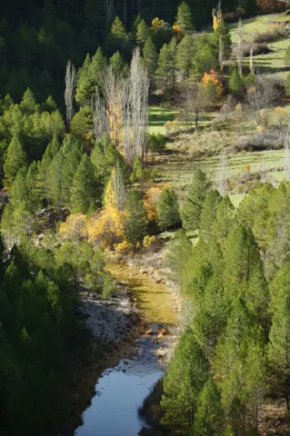
Historia

The first signs of human presence in the Iruela environment date from the Copper Age, with great occupation until the Bronze Age. Then there was a depopulation of the area for which the researchers have no explanation, since after time we attended a proliferation of settlements. One of them is that of Nubla, with remains of fortification and that was active from the Iberians to the medieval era, the same happening in the times of the Romans, the bridge of the Mill that crosses the Cañamares River is attributed to this period.
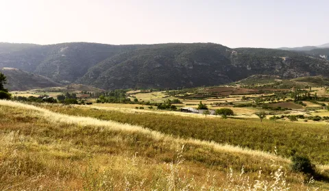
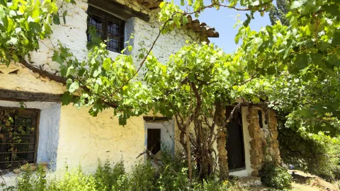
It has been said that the Carthaginians founded the city, that it was popular in Roman times, and that the Arabs destroyed it and then populated and rebuilt it.
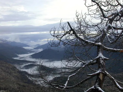
During the Islamic period it must have been one of the villages that populated the region. Around the 11th century this population was walled and the top of the promontory served as a refuge.

In the time of King Fernando III and thanks to the troops of the Archbishop of Toledo, conquer the castle and the rest of the municipality. In thanks the king gives him the jurisdiction of these lands within the advance of Cazorla. By the end of the 13th century, in order to strengthen the Alfoz of Cazorla, they donate to him La Iruela as a village, but La Iruela did not want to accept this privilege given to Cazorla.

He sometimes got the privilege of a villa, but for very short spaces of time.
Francisco de los Cobos, Secretary of Charles I, got the monarch to give him the villa to the detriment of the archbishop of Toledo, who pleaded until in 1606 he recovered it again. In this short period of time, the Cobos, large mecenas on the lands of their lordship, ordered to build the church of Saint Sunday of Silos in the interior of the castle.

The archbishops of Toledo always maintained the possession of this villa until 1811, when the Cortes of Cadiz abolished the territorial jurisdiction of the archbishop of Toledo. The spiritual jurisdiction over these lands reaches 1958, when it passed to Jaén.

Loading map
Preparing points of interest and routes...
Imagen principal
imagen
Image
Castillo La Iruela
Imagen principal
Activado