Saltar al contenido principal

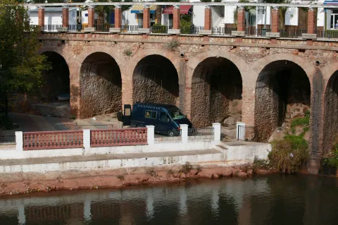
Bridge Musulmán

Submitted by brandcode_deweloper on
Id
5709600
Descripción
Breve descripción

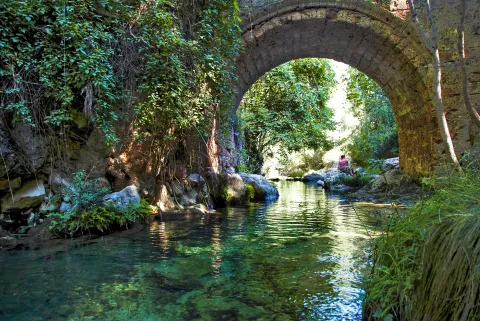
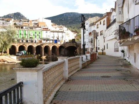
Built in Muslim times, it served as a prey in the event of danger, as it was covered with a door, the waters would remain and rise from level by flooding everything and leaving the bridge impracticable. Some medieval elements still remain semi-hidden, but most of the present part of it is modern: it is a long-term escarzan arch in a half-barrel vault that forms its only eye.

Telecomunicaciones
Sitio web
www.lapuertadesegura.es/el-municipio/patrimonio-historico.html
Correo electrónico
lapuerta@promojaen.es
Ubicación
Código Postal
23360
Latitud
38.349640
Longitud
-2.736660
Dirección
C/ de Pablo Iglesias, 37
Distrito
Ubicación en el mapa
POINT (-2.73666 38.34964)
Tipos de punto de interés
Imágenes carrusel
imagen
Image
tierras-de-jaen-042-2-jpg
Imagen principal
Desactivado
Imágenes cabecera
imagen
Image
puerta-de-segura-sobre-el-guadalimar-1-jpg
Imagen principal
Activado
Loading map
Preparing points of interest and routes...
Mocho Bridge

Submitted by brandcode_deweloper on
Id
919194
Descripción
Descripción larga
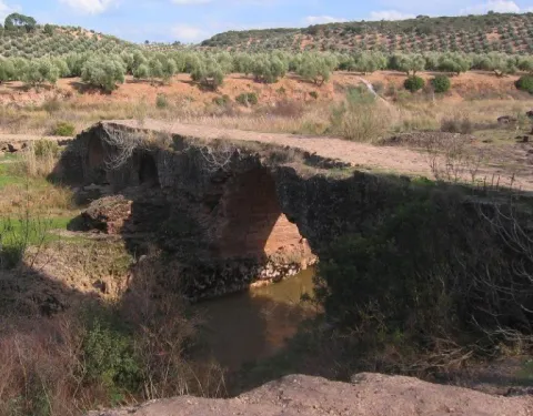
Puente Mocho constitutes an example of Roman architecture. The Romans carried out large civil constructions to guarantee communications within the different provinces that made up their domains and the mobility of the troops stationed in the different territories. In fact, in many cases it was the legionaries themselves who built some of the constructions that are preserved today, especially in the period known as the Pax Romana, in which there were no succession problems between the emperors and there was effective border control.
Breve descripción
Puente Mocho constitutes an example of Roman architecture. The Romans carried out large civil constructions to guarantee communications within the different provinces that made up their domains and the mobility of the troops stationed in the different territories. In fact, in many cases it was the legionaries themselves who built some of the constructions that are preserved today, especially in the period known as the Pax Romana, in which there were no succession problems between the emperors and there was effective border control.
Ubicación
Latitud
38.252679
Longitud
-2.890872
Distrito
Municipio
Ubicación en el mapa
POINT (-2.890872 38.252679)
Tipos de punto de interés
Imágenes carrusel
imagen
Image
Puente-Mocho-768x600.jpg
Imagen principal
Desactivado
imagen
Image
638_img.png
Imagen principal
Desactivado
Imágenes cabecera
imagen
Image
02-grand-01.jpg
Imagen principal
Activado
Loading map
Preparing points of interest and routes...
Bridge honda

Submitted by brandcode_deweloper on
Id
5631322
Descripción
Descripción larga

Location: east of the city centre, in the pedanía of Puente Honda.

Distance: 4 km.

Medium: by vehicle tourism.

Access: local road to Puente Honda.

Breve descripción

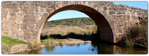
It is a recreational area in thepedanía de Puente Honda. 4 km. from the town of Benatae, and it is worth observing from this atalayo the Natural Park of the Sierra de Cazorla, Segura and Las Villas.

Telecomunicaciones
Sitio web
www.benatae@promojaen.es
Teléfono de contacto
953 480 378
Ubicación
Código Postal
23390
Latitud
38.352720
Longitud
-2.652320
Distrito
Municipio
Ubicación en el mapa
POINT (-2.65232 38.35272)
Imágenes carrusel
imagen
Image
benatae%20%281%29.jpg
Imagen principal
Desactivado
Imágenes cabecera
imagen
Image
c4d3ccf2_y.jpg
Imagen principal
Activado
Loading map
Preparing points of interest and routes...
Bridge of the Ojos

Submitted by brandcode_deweloper on
Id
8109973
Descripción
Descripción larga

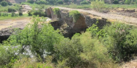
We arrive at the aqueduct by the Service Way that links Pozo Alcón with Cuevas del Campo, once we have overcome the Aqueducts of War and Caramaco we see at a distance the elongated silhouette of it. Its conservation status is quite good.

It is composed of 78 half-point arches of a plant, of masonry built with stone of the area - turroner - and argamase. It is about 400 m long and its arches are higher than those of the nearby aqueducts of War and Caramaco. Several of its arches have a height supplement to correct land irregularities.

Breve descripción

It is an aqueduct dating from the early 20th century, following the typology of Roman construction, built in stone and argamase.

Telecomunicaciones
Teléfono de contacto
953 738 041
Correo electrónico
ayuntamiento@pozoalcon.es
Ubicación
Código Postal
23485
Latitud
37.705420
Longitud
-2.968810
Dirección
Carretera Fontanar
Municipio
Ubicación en el mapa
POINT (-2.96881 37.70542)
Tipos de punto de interés
Imágenes carrusel
imagen
Image
Puente%20de%20los%20ojos2%20%281%29.jpg
Imagen principal
Desactivado
Imágenes cabecera
imagen
Image
Puente%20de%20los%20ojos%20%281%29.jpg
Imagen principal
Activado
Loading map
Preparing points of interest and routes...
Bridge of las Herrerías

Submitted by brandcode_deweloper on
Id
881939
Descripción
Descripción larga

They have in the area that in the 15th century, when Isabel La Católica was traveling to the conquest of Granada from Córdoba, it reached this point where Guadalquivir was so grown that it did not allow its passage. In one night, according to the book, his gentlemen raised this robust bridge that allowed him to reach Baza and Guadix.

The place is beautiful by itself: the bridge is surrounded by fig trees and wild rosals. And in the paths around it you can observe boj, strawberries and hazelnuts.

On the right side is joined the Maillar stream - with another beautiful stone bridge - which makes in rainy years the place an authentic vergel and a very busy bathing area.

We suggest:

  • Make walking some (or all) part of the road that leads to the birth of the Guadalquivir. They are about 11 km across the Navahondona- Guadahornillos Reserve Area, the most protected area of the Natural Park.

In Cazorla take the Sierra road (A-319) until the crossing known as the Empalme del Valle, 17 km. Turn right on the JF-7092 road and after passing the bridge over the Guadalquivir River (4 km from the Empalme) follow the right track (JF-7091) that after two kilometres reaches the Bridge.

Breve descripción

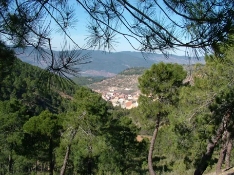
The Herrera Bridge and its surroundings are one of the best known places in the Alto Guadalquivir. It is a great place to start some of the most interesting routes of the Sierra de Cazorla, and the enranche that involves its recreational area will allow you to rest, refresh and enjoy a Guadalquivir river, which at this point already contains a considerable flow. The bridge, built on porous limestone armchairs - here called toba - is perfectly integrated into the landscape.

Ubicación
Latitud
37.900980
Longitud
-2.938540
Dirección
JF-7092
Distrito
Ubicación en el mapa
POINT (-2.93854 37.90098)
Tipos de punto de interés
Imágenes carrusel
imagen
Image
Puente%20de%20las%20Herrer%C3%ADas%202.jpg
Imagen principal
Desactivado
imagen
Image
Puente%20de%20las%20Herrer%C3%ADas.jpg
Imagen principal
Desactivado
imagen
Image
Puente%20de%20las%20Herrer%C3%ADas%20merendero.jpg
Imagen principal
Desactivado
Imágenes cabecera
imagen
Image
puente-herreras.jpg
Imagen principal
Activado
Loading map
Preparing points of interest and routes...
Poyos de La Mesa

Submitted by brandcode_deweloper on
Id
913611
Descripción
Descripción larga

Although it is possible to reach the Poyos de la Mesa from different places, we propose to do it from the track it leads to the Nava del Espino. From this point comes a path marked as PR-A 315 that in an hour and a half leads you to the top of this mountain.

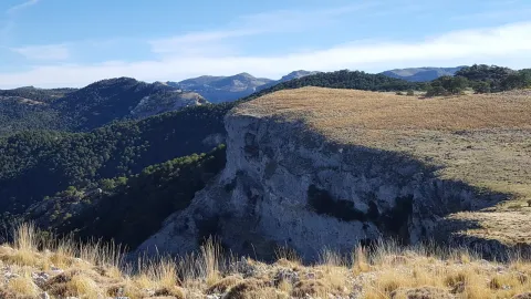
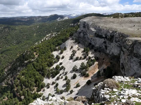
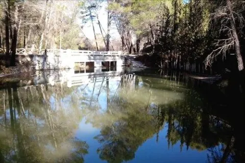
Once at the summit you will discover a wavy landscape of limestone eroded by the passage of time and covered with green meadows and larive pines. It is a formidable place to see the great herbivores of the Park that pasture to pleasure the juicy grass of these heights. It was also one of Felix Rodríguez de la Fuente's favorite places to shoot some of his famous wild scenes.

Now you have to enjoy the landscape around you and identify the many peaks you can see: The Banderillas, the Cabañas, the Empanadas rope, or the Pico Giillo are some of the most emblematic mountains of the Natural Park.

In these saws, it is known as "poyos" to the high plateaus surrounded by cliffs cut to peak, like huge teeth. The Poyos de la Mesa is one of the most spectacular. From its edges you can see a good panorama of the head of the Guadalquivir and if you look at the slices or poyos that name this mountain.

We suggest:

  • Once located in the Poyos you should not leave the opportunity to approach the area of the Marchante Prairie, by the bank of the Gualay Tornillo stream.

In Cazorla take the Sierra road (A-319) until the crossing known as the Empalme del Valle. Turn right on the JF-7092 road and after passing the bridge over the Guadalquivir River (4 km from the Empalme) follow the left track (JF-7091). Continue this track to the Nava del Espino in km 21 of the road signs, where you will find a milestone that points to the rise to the Poyos.

Breve descripción

Going up the way of the Navas demands our attention in a powerful way a huge mountain surrounded by cliffs that fall on the pine forests surrounding it. They're the Poyos of the Bureau. Something mysterious makes us stop our way to observe it. It is distinguished from the other hills by their peculiar forms that invite you to meet her...

Ubicación
Latitud
37.772886
Longitud
-3.788329
Ubicación en el mapa
POINT (-3.788329 37.772886)
Tipos de punto de interés
Imágenes carrusel
imagen
Image
poyos.jpg
Imagen principal
Desactivado
Imágenes cabecera
imagen
Image
poyos-mesa.png
Imagen principal
Activado
Loading map
Preparing points of interest and routes...
Granary (actual ayuntamiento)

Submitted by brandcode_deweloper on
Id
913332
Descripción
Descripción larga

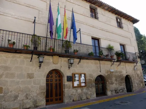
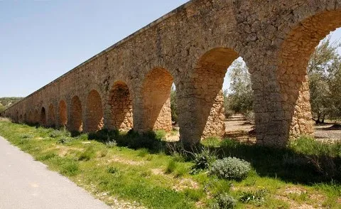
In 1572, the cantero Pedro Venetian and the mason Luís de Vilches committed themselves to building the posio, in accordance with the conditions and traces dictated by Andrés de Vandelvira. The building, of a rectangular floor, defines the confluence of the streets Corredera and San Antón with the square of the Constitution. It rises in the planned enranche in the 16th century, outside the medieval compound, essentially formed by the castle and the Renaissance church raised at the foot of it, in which, although perhaps not directly, Andrés de Vandelvira was able to intervene.

The ground floor, with a stone factory seen, is most likely the best preserved part, as the high ones (originally compartmentalized in trickery and built in brick and masonry) were later adapted for other local administrative functions. The singularity of this building is in the division drawn by Vandelvira on the ground floor, made up of five small rectangular ships covered with parallel half-barrel vaults, popularly called the "positillos," built in silery, which communicate directly with the outside based on half-point voids, being the largest central than the other ones.

Typically Vandelvira acuña a model, developed in such a way in the Pósito de Baeza, in which the knowledge of the stereotomy or cutting of the stone requires a great perfection due to the need for the isolation of wetlands to preserve the genre stored in the best conditions. Several heraldic shields are preserved in the building and, as a reminder of the recovery of the advance of Cazorla (in which the villa of La Iruela was included) by the Archbishopric of Toledo, in the early 17th century was placed by the command of Archbishop Don Bernardo de Rojas and Sandoval in the capitular room an allusive inscription to perpetuate this important event. A lot of effort and money cost Toledo's mitre to be made again with her old territory, which was taken from her in 1545 by Don Francisco de los Cobos, Secretary of the Emperor Charles V.

Breve descripción

Monument of the Historical-Artistic Set. Incoation 01 / 04 / 85. The professional activity of Andrés de Vandelvira revolved not only around religious or private architecture, but was also hired by the Councils to intervene in various municipal works: sources, bridges, foundings or grain stores, municipalities, etc. In the villa of La Iruela, the Pósito, the current headquarters of the City Council, has arrived today, from which the contract has been retained, published by V. M. Ruiz Fuentes.

Ubicación
Código Postal
23476
Latitud
37.920510
Longitud
-2.993990
Dirección
Plaza del Ayuntamiento
Municipio
Ubicación en el mapa
POINT (-2.99399 37.92051)
Tipos de punto de interés
Imágenes cabecera
imagen
Image
p%C3%B3sito%20-%20ayuntamiento.jpg
Imagen principal
Activado
Loading map
Preparing points of interest and routes...
River Folds of Borosa

Submitted by brandcode_deweloper on
Id
877125
Descripción
Descripción larga

The route of the Borosa River, between the Piscifactory and the Cerrada de Elias, allows to observe a varied set of folds. The structure of the Sierra del Pozo, in which the Borosa River is located, is characterized by the presence of folds and NNE-SSW direction failures. The general geological structure of this Sierra is controlled by two large synchlinals: the birth of the Guadalquivir River and the Cabañas River.

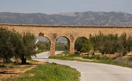
In the four initial kilometers of the itinerary that part of the Piscifactory, folds associated with those of a regional character are observed, the size of which ranges from 1 meter to several tens of meters. These are developed in Cretaceous materials of Urgonian facies and their orientation determines the course of neighboring streams, with the concordant relief of the Arroyo de las Trout valley controlled by a spectacular sinchinal. As an example of anti-linear, the best fold is found in the Los Caracolillo Bridge.

Source: Inventory of Georresources of Andalusia. Environmental Council. Junta de Andalusia.

Breve descripción

Plizas del Río Borosa

Ubicación
Latitud
38.298857
Longitud
-2.651877
Distrito
Ubicación en el mapa
POINT (-2.651877 38.298857)
Tipos de punto de interés
Imágenes carrusel
imagen
Image
1%20%285%29.jpg
Imagen principal
Desactivado
imagen
Image
2%20%284%29.jpg
Imagen principal
Desactivado
imagen
Image
Natu249.jpg
Imagen principal
Desactivado
Imágenes cabecera
imagen
Image
558_img.png
Imagen principal
Activado
Loading map
Preparing points of interest and routes...

Bullring of Villanueva del Arzobispo

Submitted by brandcode_deweloper on
Id
1563946
Descripción
Descripción larga

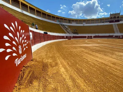
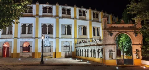
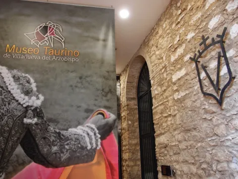
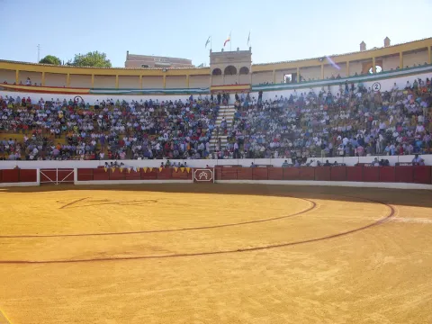
It was designed by the architect Mr Angel Arbex, Commander of Engineers. It was opened on 10 September 1928 by the rejonador Antonio Cañero and the matadores Manuel Jiménez Chicuelo, "El Algabeño" and Vicente Barrera before eight bulls of the cattle-making of Veragua.

This monument marks the architectural explosion of the 1920s in Villanueva del Archbishop, since to it would be added the House of the Arches, the Old Casino of the Commercial Circle, etc.

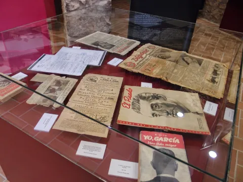
The 3rd Category Square has a capacity for 6,000 spectators. It is one of the most important Taurino things in the province of Jaén and through which the first figures of the Toreo have passed, from Manolete to the brothers Rivera Ordóñez, the Cordobés, Fandi... witnessing great taurine evenings and other cultural events of the villa.

Breve descripción

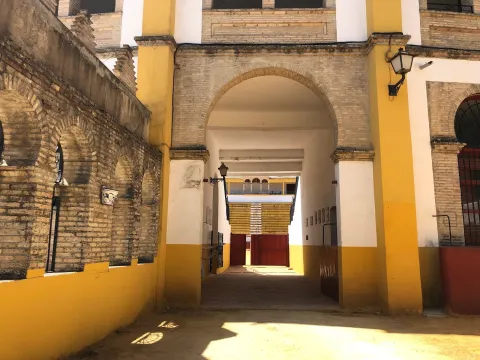
The Archbishop's Plaza de Toros de Villanueva is Neomudéjar style, with use of brick and horseshoe arches.

Telecomunicaciones
Sitio web
www.villanuevadelarzobispo.es/museo-taurino/
Teléfono de contacto
639 955 416
Correo electrónico
lamoralejaserviciosturisticos@gmail.com / turismo@villanuevadelarzobispo.es
Ubicación
Código Postal
23330
Latitud
38.162722
Longitud
-3.007320
Dirección
C/ Fuensanta, s/n
Ubicación en el mapa
POINT (-3.00732 38.162722)
Tipos de punto de interés
Imágenes carrusel
imagen
Image
16047678658039ca5c677-a731-4e34-ad3c-7fd9740e17b42254242240483307573.jpg
Imagen principal
Desactivado
imagen
Image
1604767365180126482876139755464677.jpeg
Imagen principal
Desactivado
imagen
Image
1604767869996A0436615-D3EB-4647-9691-2C55843102FB6154242950581307528.jpeg
Imagen principal
Desactivado
imagen
Image
160476787171270170C86-6429-4532-9AFE-4C6AAC4E610F7267178523688453260.jpeg
Imagen principal
Desactivado
imagen
Image
1604767359041112508596545032774690.jpeg
Imagen principal
Desactivado
Imágenes cabecera
imagen
Image
PlazaVillanueva.jpg
Imagen principal
Activado
Loading map
Preparing points of interest and routes...

Square de Santa María

Submitted by brandcode_deweloper on
Id
918485
Descripción
Descripción larga

The Church of Santa Maria was the most important monument of the advance of Cazorla. As a Renaissance, his inspiration is attributed to Andrew of Vandelvira or one of his disciples. It is built on the Cerezuelo River, taking advantage of the vault that covers the river and crosses the entire Plaza.

It is not the only unique building we find there: the House of the Clérigos, the Thematic Center of Threatened Species, the old Conistorial Houses (in an alley above the square) or the Fountain of the Chain (built in 1605) are some of the many visits we can make here.

In the square we also find nice restaurants that offer a great sample of local cuisine. To enjoy these dishes in the quiet dusk is one more reason to often go to this suggestive square.

We suggest:

  • Visit the ruins of Santa Maria, know its history and its curious construction. You can order information from the tourist office (953 71 01 02).
  • Up by the river Cerezuelo, passing the ruins of Santa María in the direction of the castle of La Yedra, and walking along one of the small routes that begin in this area. An information panel will help you to better know this area of the city.

In Cazorla, we leave the Plaza de la Constitución, in the center of the village. From here follow Doctor Muñoz Street to La Corredera Square. At the end of this, we turn right and immediately left, following the signs to the Castle of La Yedra. After passing by the balcony of Zabaleta and crossing the street José Salcedo Cano - a narrow and steep street with numerous pots in its balconies - we reached the Plaza de Santa María.

Breve descripción

Reaching the Old Square or Santa Maria Square through the old town of Cazorla is a surprise for the walker. The open space with the high slopes of the Peña de los Halcones, the Gilillo peak or the castle of La Yedra make it difficult for you to see what you have at your height. But at your height there is a beautiful square full of history and charm, where the ruins of the Church of Santa Maria demand the attention of the many travelers who come to this place.

Ubicación
Latitud
37.912893
Longitud
-3.003887
Municipio
Ubicación en el mapa
POINT (-3.003887 37.912893)
Tipos de punto de interés
Imágenes carrusel
imagen
Image
6%20%282%29.jpg
Imagen principal
Desactivado
Imágenes cabecera
imagen
Image
7%20%281%29%20%281%29.jpg
Imagen principal
Activado
Loading map
Preparing points of interest and routes...
Marcas de calidad