Saltar al contenido principal

Sanctuary of the Virgen de la Fuensanta

Submitted by brandcode_deweloper on
Id
12131034
Descripción
Descripción larga

Today we see olive trees around the sanctuary but we must think of forest areas with some clear for cultivation, highlighting on the high Iznatoraf as the most important villa of the advance to the north of the Guadalquivir.

Little by little this situation of danger is disappearing, new inhabitants arrive and places are beginning to live outside the walls of the villa until it is necessary to disconnect them from the municipality. The inhabitants of the Moraleja in 1396 knew the autonomy with respect to Iznatoraf, going on to be called since then Villanueva del Archbishop.

It tells an ancient legend that in Muslim times there was a group of MozArabs in Iznatoraf with a great devotion to the virgin Mary. The king's wife showed some interest in the Christian religion by helping them in all that she could. When her husband, known as Alimenon, found out, he ordered that they take his wife into the forest and cut off her hands and take her eyes out to die in the most absolute solitude. The woman called on the virgin Mary, who presented herself and made a fountain sprout to wash her wounds. Miraculously he healed and the virgin ordered him to go up to her husband so that, being aware of the miracle, they would be baptized in the fountain and set up a temple in his honor.

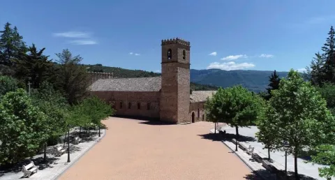
The Sanctuary and the virgin of the Fuensana is one of the oldest in Spain and it is known that it existed in 1291 already as an important pilgrimage center on the border lands. The building is of three Gothic-style ships, although there are still some Romanesque reminiscent, such as a beautiful medieval mudejar tile. The virgin of the Fuensana is sold in a baroque shrimp of the 17th century.

Breve descripción

Contemplating the sanctuary building comes to mind memories of border life. The almenada tower and the robustness of the walls refer to other times when the danger of war was present in the daily lives of the people who lived in the village of the Moraleja. Without ever losing sight of Iznatoraf as a villa from which the different places that have ended up giving rise to the Sierra de las Cuatro Villas were torn.

Telecomunicaciones
Sitio web
https://villanuevadelarzobispo.es/turismo/
Teléfono de contacto
607 184 628
Correo electrónico
turismovillanuevadelarzobispo@gmail.com
Ubicación
Código Postal
23330
Latitud
38.163020
Longitud
-2.994220
Ubicación en el mapa
POINT (-2.99422 38.16302)
Tipos de punto de interés
Imágenes cabecera
imagen
Image
1604769448440107388872821794175587.jpg
Imagen principal
Activado
Horario
May - ago: Wednesday to Saturday 09: 00 - 14: 00 and 18: 00 - 21: 00, Sunday 10: 00 - 13: 00. Sept - abr: Wednesday to Saturday 10: 00 - 14: 00 and 16: 00 - 20: 00, Sunday 10: 00 - 13: 00.
Otros servicios
Guided tours under reservation in Tourist Office
Loading map
Preparing points of interest and routes...

Juniper and Savin Forests rastreros

Submitted by brandcode_deweloper on
Id
923306
Descripción
Descripción larga

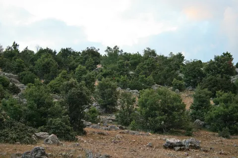
When we enter the fields of Hernán Pelea we are open to the landscape, and we will discover true vegetable monuments that charge a large extent of soil.

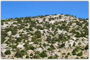
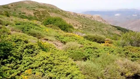
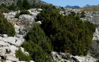
The rake savannas colonize the rocky soils, so we find them in the scarves and cresteries, as well as in the highest of the summits. On the contrary, rake juniors prefer more developed soils, although it is not difficult to see them together. They are very long-lived species, being able to reach 1000 years of age. They do not raise much from the ground, rarely more than a meter high, but a single example can extend more than 20 m ².

They are almost mono-specific plant formations, that is, of a single dominant species, to which only some salgarean pine (Pinus nigra salzmannii), thorns (Berberis vulgaris australis) and on the slopes some maple (Acer granatense) or mustard (Sobus aria) are accompanied. But in the summit areas, the rareras are the queens of the landscape, competing with piornal and lastonar.

These two species came to our saws with the glaciations of the Quaternary. Today, with a more arid climate, they only survive in the highest and coldest of the mountains. Their regeneration is difficult and scarce, and they are also used as food by herbivores, so their future is not the most flattering.

LOCATION

Following the track that goes into the fields of Hernán Perea from Don Domingo, we take the one that goes through the rample of Juan Fría, in which is the Galapan pine, we overcome it and as we pass through the cortijo of the Pinadilla, we are opened a splendid sabinar rastrero.

Breve descripción

Campos de Hernán Pelea

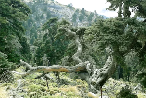
We cannot speak of the high mountains, their summits, their stony slopes and cresteries, without mention of one of their most emblematic inhabitants, the hillbillies or chaspines (Juniperus sabina) and the hillbillies (Juniperus comunnis hemisphaerica), true vegetable monuments of our mountains, to which can be given the qualification of The Elders of the Summits. They are plants that cover our summits in dark green and give shelter to a number of animals.

Ubicación
Latitud
37.772886
Longitud
-3.788329
Ubicación en el mapa
POINT (-3.788329 37.772886)
Imágenes carrusel
imagen
Image
4.png
Imagen principal
Desactivado
Imágenes cabecera
imagen
Image
86746483001_5836777155001_5826845296001-vs.jpg
Imagen principal
Activado
Loading map
Preparing points of interest and routes...

Juniper Forests of Sabina Mora

Submitted by brandcode_deweloper on
Id
881711
Descripción
Descripción larga

One of the most important plant formations of the park is the Sabinar of Sabina mora or simply of Sabina (Juniperus phoenicea). It is very important for its extension, for the habitat it occupies - rocks and dolomitic sandals - and for the large number of endemic species that it houses, including the most emblematic, the Cazorla violet (Viola cazorlensis) and the endemism of the Serra de Segura Jasione crispa seguridad. This training is therefore declared a Habitat of Community Interest in Natura 2000 Network.

It is presented to us in the form of clear sketches, where the black savina is the dominant plant element. We can find it in many areas of the Park, colonizing those places where other trees have not been able to develop, rocky, dry, wind-beat and with strong solar irradiation. You can say that sabina is the essence of hardness. We can also find it in isolation in almost all the forest formations of the Park, missing only in the high summits, so in many places we can see small sabinars more or less dense or scattered.

Inside Las Villas, on any side we will find sabinares. We've chosen the Wolf's boat. Once on the Sloth Hill, we will walk on the side of your left, according to the direction of the march. It is populated by savannas, juniperus oxicedrus, salgary and black pines (Pinus nigra salzmannii and Pinus pinaster), in a sparse and scattered manner, complaints and oinas (Quercus faginea and Quercus ilex ballota), thorns of dyes (Rhamnus saxatilis) and piorns (Erinacea anthyllis and Echinospartum boissierii). We are on this hill at the foot of the Blanquillo, the highest summit of the Las Villas saw.

Of the same characteristics as the one described - sabinar en rota - but with more cornicabra, are the sabinars of the Zumeta River, which extend throughout the left side in the sense of the waters. The sabinar is also seen from the other side, on the side of Albacete. We will see it from further, but in return we are compensated with the panoramic view of the Old Age reservoir.

LOCATION OF THE LOBO

We take the road that goes from the reservoir of Aguascebas to the Recreative Area of Gil Cobo. A little before we reach this area, we take a crossing that comes to our right, preferably on foot. We followed the track to a detour and took the one from the left, in gentle ascent, until we reached the Collado del Perenoso. To our left is the great lapiaz of the Lobo Boat.

ZUMETA LOCATION

In the village of Vites you have to head towards the Cortijo del Torcal.

Breve descripción

Lobo boat and Zumeta river

Ubicación
Latitud
37.912893
Longitud
-3.003887
Municipio
Ubicación en el mapa
POINT (-3.003887 37.912893)
Tipos de punto de interés
Imágenes carrusel
imagen
Image
622_img.png
Imagen principal
Desactivado
imagen
Image
unnamed.jpg
Imagen principal
Desactivado
Imágenes cabecera
imagen
Image
2%20%281%29.jpg
Imagen principal
Activado
Loading map
Preparing points of interest and routes...

Ruins of the Castle of Castro Ferral

Submitted by brandcode_deweloper on
Id
5868858
Descripción
Descripción larga

In 1169 the Castle of Castro Ferral was conquered by Calatravos, commanded by Fernando de Icaza, the second Master of the Order. However, before the battle of the Navas de Tolosa, the fortress was again under Muslim control. Ferral would lead several acts of weapons during the military campaign that would end with the Christian triumph of the Navy (1212). The strategic importance of this castle, by controlling one of the traditional steps of Sierra Morena, made it an essential objective for any army that would want to cross the area.

The transfer of the border to the Betic Cordilleras marked the decline of Castro Ferral, who lost his role as a watchman for access to the Guadalquivir Valley. The foundation of St. Helena (Ermita de los Palacios), which has made it less important as a reference centre for the small population of those contours, was joined. In an undetermined time, they beat it to prevent it from becoming a jumpers' den.

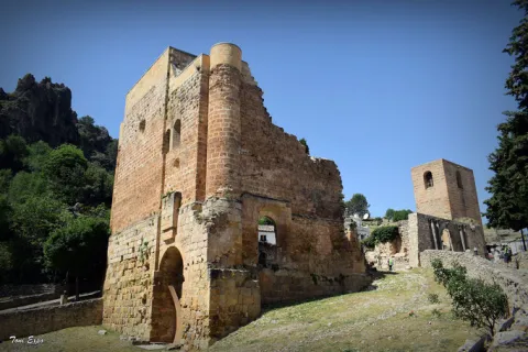
The castle of Ferral was made up of three defensive enclosures. The first, currently the worst preserved, was a broad emulated in the slope of land that closed the top of the fence describing an almost perfect circle. This defensive line is more solid and pronounced at the North and North-East ends, where the land gap is greater.

In its interior is developed a second enclosure, possibly built in ground tapial on the base of masonry, from which are preserved various remains and two bastions that could protect the entrance to the castle.

The central core of the castle is made up of a rectangular enclosure of argamase tapial, in which the underground remains, possibly aljibes, are visible.

Breve descripción

There are only remains of this castle of a bulldozer built by Muslims before the Battle of the Saves of Tolosa. It is located inside the Natural Park, on the heights of the port of Muradal, to keep the Paso de la Losa, route between Andalusia and the Plateau. It is accessed exclusively by forest track.

Telecomunicaciones
Sitio web
www.castillosybatallas.com/es/castillo-de-castro-ferral/
Teléfono de contacto
953 368 839
Ubicación
Código Postal
23213
Latitud
38.392870
Longitud
-3.545360
Distrito
Municipio
Ubicación en el mapa
POINT (-3.54536 38.39287)
Tipos de punto de interés
Imágenes carrusel
imagen
Image
Castillo%20de%20Castro%20Ferral%2C.jpg
Imagen principal
Desactivado
Imágenes cabecera
imagen
Image
Castillo%20de%20Castro%20Ferral%2C%202.jpg
Imagen principal
Activado
Horario
24 h.
Loading map
Preparing points of interest and routes...

Ruins of the Church of Santo Domingo de Silos

Submitted by brandcode_deweloper on
Id
913023
Descripción
Descripción larga

Se produce entonces el primer ensanche urbano de la población, que rompe longitudinalmente hacia el Suroeste con su antigua estructura amurallada. A lo largo de este eje se levantan el Pósito, sede del Ayuntamiento, y la iglesia de Ntra. Sra. de la Concepción, parroquia en pie hasta 1955, año en el que sobre ella se construyó la actual, perdiendo la población una de las dos parroquias históricas que tuvo en el pasado.

La otra parroquia se alza ruinosa dentro del recinto bajo de la fortaleza, configurando con ella y la espléndida naturaleza de la Sierra que la enmarca uno de los lugares más bellos de la provincia de Jaén. Este segundo templo, dedicado a Santo Domingo, es fruto del empeño de uno de los hombres más influyentes en la España de Carlos I, el famoso y prepotente secretario Francisco de los Cobos, que consiguió hacerse con el señorío del Adelantamiento en 1534, permaneciendo bajo la administración y control de sus descendientes, los Marqueses de Camarasa, hasta el año 1606, fecha en la que es recuperado por el Arzobispado de Toledo, propietario del amplio señorío desde el siglo XIII. Durante este período se construiría la que Rus Puerta califica como Iglesia Mayor.

Pero este monumental templo presentaba cierto abandono y ruina en el siglo XVIII. En el Catastro del Marqués de la Ensenada, de 1751, se relata así el estado en que se encontraba: “(...) lo que causa mayor dolor es ver la fábrica de la parroquial mayor de Santo Domingo de Silos por acabar, siendo esta bastante decente, y por los muchos hostigos y tejados con los que hoy se halla, por no estar perfeccionada padece el continuo detrimento de tan continuos gastos para poder conservarse (...)”.

La Guerra de la Independencia provocó su total ruina, pues fue incendiada, como Santa María, de Cazorla, el 4 de julio de 1810 por las tropas francesas. Posteriormente fue usado como Cementerio hasta mediados del siglo XX, quedando aún visibles los restos de esta ocupación. Paseando por las ruinas de Santo Domingo de Silos podemos acercarnos a uno de los episodios de la historia de estas sierras menos conocido. Poco sabemos sobre lo sucedido entre 1808 y 1812 en unas zonas muy alejadas de las ciudades ocupadas por los franceses. ¿Por qué incendiarían los franceses un edificio como la iglesia de Santo Domingo de Silos? Está claro que en una zona tan inaccesible, la presencia de los invasores franceses era bastante puntual.

Al mismo tiempo se ha constatado que aprovechando la geografía del terreno muchos guerrilleros se escondieron de los invasores en esta zona. Sabemos que ningún pueblo acogió de buena gana el gobierno de José I. Por el contrario, se organizaron juntas de defensas en las capitales de partido para hacer frente a los franceses.

En muchos pueblos se hicieron algunas obras de fortificación y quizá esta fue la última vez en la que se volvió a utilizar el castillo de Segura de la Sierra con fines militares. La respuesta francesa fue siempre la misma y consistió en el saqueo y destrucción de todos los elementos del poder en los pueblos. Normalmente se incendiaba el ayuntamiento con el objetivo de destruir toda la documentación del archivo y paralizar administrativamente el gobierno local. Otro objetivo eran las iglesias para destruir libros de bautismos y de defunciones, aunque la destrucción de las iglesias tenía también un componente psicológico pues se destruía un refugio para la población y al mismo tiempo el último recurso que los vecinos tenían en una situación de este tipo, el acudir a la iglesia a rezar para implorar la ayuda divina.

Por otra parte, según Vicente Salvatierra parece muy posible que la primitiva iglesia pudo estar en el mismo emplazamiento que la de Santo Domingo, al pie del castillo. En opinión de Luis Magaña, Rodrigo de Gibaja, maestro cantero ligado al Arzobispado de Toledo y responsable de las fábricas de la Colegial de Baeza y de la iglesia de Puebla de Don Fabrique, en tierras granadinas, tuvo a su cargo las obras de las iglesias de Santa María, en Quesada, y de Santo Domingo de La Iruela. También se ha documentado la participación del cantero cazorleño Gabriel de Tauste. No hay constancia documental de la intervención de Andrés de Vandelvira, pero es muy probable que diera las trazas a instancias de Francisco de los Cobos en torno al año 1534, encargándose de la ejecución Gibaja y Tauste, entre otros maestros canteros.

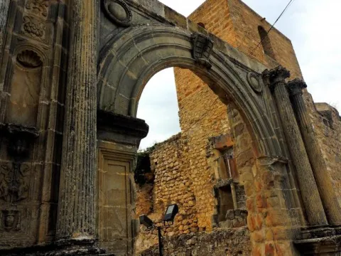
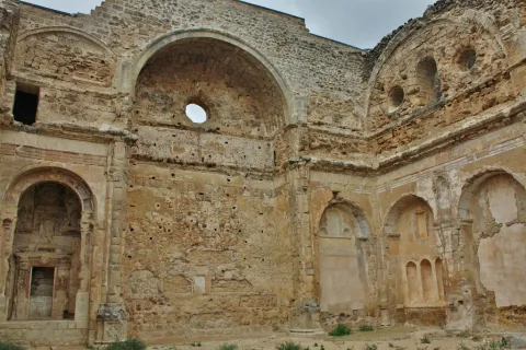
Chueca Goitia, comparando los restos de las iglesias de Santa María, de Cazorla, con la de La Iruela, estima que esta “Es de arte más pobre y tosco, como realizado por maestros locales siguiendo, seguramente, inspiraciones vandelvirescas”. En cualquier caso, ambas fábricas se están levantando paralelamente, dilatándose más en el tiempo la de Cazorla. De aquel monumental templo solo restan parte de los muros perimetrales, las portadas de acceso, la escalera de caracol para acceder a la torre de campanas, las capillas mayor y colaterales y una monumental portada en el lado del Evangelio con un relieve en el que se representa el milagro de la imposición de la casulla a San Ildefonso. La planta era de tres naves y la cabecera plana y destacada.

Determinados rasgos decorativos, la traza de las portadas de acceso y, sobre todo, la composición del alzado de los muros del crucero o primer gran tramo, articulado por un gran arco de medio punto en la parte alta y dos capillas en la baja separadas entre sí por una pilastra con una hornacina avenerada, son claramente vandelvirianos. En la catedral de Jaén o en San Isidoro de Úbeda, Andrés de Vandelvira incorporó monumentalmente esta composición, ejecutada con mayor sencillez en el caso de La Iruela.


Breve descripción

Monument included in the Historical-Artistic Set. Uncooked 01 / 04 / 85. The 16th century was a time of great economic development for the people of Alto Guadalquivir, which led to important urban and architectural interventions. In the villa of La Iruela, as in Cazorla, head of the advance, certain works were planned and carried out throughout that centuria that enhanced and modified its powerful medieval image, determined by its imposing strength.

Telecomunicaciones
Sitio web
www.lairuela.es/el-municipio/patrimonio-historico.html
Teléfono de contacto
953 720 712
Ubicación
Código Postal
23476
Latitud
37.920330
Longitud
-2.990450
Dirección
Cuesta Santo Domingo, s/n
Municipio
Ubicación en el mapa
POINT (-2.99045 37.92033)
Tipos de punto de interés
Imágenes carrusel
imagen
Image
Iglesia%20Santo%20Domingo%20de%20Silos%202%20%282%29.jpg
Imagen principal
Desactivado
imagen
Image
Iglesia Santo Domingo de Silos
Imagen principal
Desactivado
imagen
Image
Iglesia Santo Domingo de Silos
Imagen principal
Desactivado
imagen
Image
Iglesia Santo Domingo de Silos
Imagen principal
Desactivado
Imágenes cabecera
imagen
Image
Iglesia%20Santo%20Domingo%20de%20Silos-ok.jpg
Imagen principal
Activado
Modelo 3D
Loading map
Preparing points of interest and routes...

River Aguamulas

Submitted by brandcode_deweloper on
Id
913807
Descripción
Descripción larga

The forest track, 9 km long, is very pleasant to travel and has no loss, as it is only to follow right, and is also marked as GR-7. It always runs by the river, with very little level, except in a section where it is separated by forming several elevation curves.

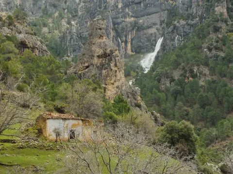
It is not necessary to travel throughout to enjoy these places, but if you arrive at the end you will find a lookout with unforgettable views of the Reco del Aguamulas. It is the rocky amphitheatre where this river is born, on whose base there are abandoned meadows and gardens.

You will also see the cords - already ruin - of La Fresneilla. In them lived the last inhabitant of these valleys, called Máximo Fernández Cruz, nicknamed "the Cojo de la Fresnedilla." This serrano character fought for thirty years not to leave the land he was born, from which were expelled the close to a hundred neighbors of the Aguamulas environment who suffered expropriation when the National Cote of Hunting was created in 1960. In 1982, Maximo paid for his resistance with the prison.

We suggest...

  • Be attentive to see some example of the dark green Valverde lizard, endemic to the Park and discovered in 1958 very close to here.
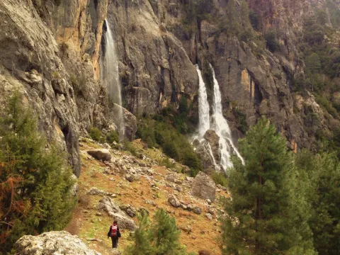
  • Continue beyond the lookout and take a walk in the La Fresnedilla area. If the water abounds, you will see the waterfalls of the birth of the Aguamulas.

In the campsite Llanos de Arance (road A-319) you have to take the forest track that crosses the Guadalquivir. At 3 km, after wading the Aguamulas, the crossing is taken to the right and followed 1 km to the barrier in the forest house of Los Bonal, where you can leave the car.

Breve descripción

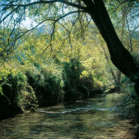
The Aguamulas is a small tributary of the Guadalquivir that runs one of the most beautiful valleys of the park, forming numerous rapids and pozas. It is enjoyed walking through a nice forest track between pine trees, in the shadow of which is developed a thick Mediterranean vegetation with oaks, madroños, lentils and cornicabra. At the bottom are the impressive walls of the Banderillas, whose summit is about 2,000 m high.

Ubicación
Nombre
Casa forestal Los Bonales
Latitud
38.044880
Longitud
-2.794950
Ubicación en el mapa
POINT (-2.79495 38.04488)
Tipos de punto de interés
Imágenes carrusel
imagen
Image
nacimiento-aguasmulas.jpg
Imagen principal
Desactivado
imagen
Image
aguasmulas.jpg
Imagen principal
Desactivado
Imágenes cabecera
imagen
Image
natu001%20%281%29.png
Imagen principal
Activado
Loading map
Preparing points of interest and routes...

Gall Oak and Oak Forests

Submitted by brandcode_deweloper on
Id
881625
Descripción
Descripción larga

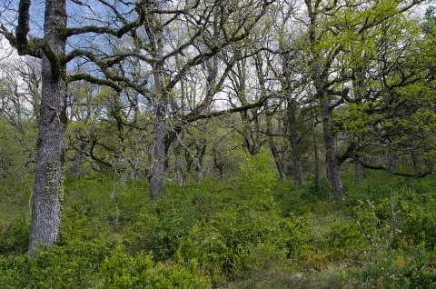
The Barrio del Guadalentín is one of the best complaints forests in the park. Among the complaints, on the other side of the ravine, the Poyos de la Carilong rise majestic. The whole set, whimsical, river and rocky fleshly make this walk a true enjoyment of our nature.

In other times, one of the most widespread forest formations in the mountains was the deniigal, embedded in deep soils, with abundant organic matter and quality. In this forest the dominant tree is the whine (Quercus faginea). In the colonization of the saw the human being occupied these rich and fertile soils for use, cutting the forest and taking advantage of its offal as fuel and material for construction. Later on it was the naval industry that was supplied with the wood of the Robledals or Robledals. In our days, the robledal, as it is named in the saw, survives in areas that are short-lived, in bright slopes and in the bottom of valleys like rodents or bosquets.

The complaints (Quercus faginea) are accompanied by some salgarean pine (Pinus nigra salzmannii) and some oaks (Quercus ilex ballota). In the forest, we find trees such as cereals (Prunus mahaleb) and pespejones (Sorbus torinlis), and shrubs such as majuelos (Crataegus monogina), skirmishes (Rosa spp.), laureolas (Daphne laureola), thorns (Berberis vulgaris australis). And by covering the ground, we find a herbaceous entourage among which we highlight grasses such as Brachypodium sylvaticum, Brachypodium phoenocoids, Festuca arundinacea, Dactylis glomerata, and Piptaterum meliaceum. Other species that we find in the complaint are the gold button (Geum sylvaticum), violets (Viola odorata), primaveras (Primula vulgaris), consueldas (Prunella grandiflora, P. laciniata, P. vulgaris), filippines (Filipendula vulgaris), eléboros (Helleborus foetidus), narcissos (Narcissus triandrus pallidulus) and wild jacintos (Scilla paui).

LOCATION

To access, we follow the road from Vadillo Castril to the San Pedro Navy. At the height of Los Collados it becomes a ground track, but with good firm. As we overcome the San Pedro Navy, we will be waiting for the second detour to our right. It is a closed track to the traffic of vehicles that is located a few meters from the old forest house of Fuente Steel, which is currently abandoned, but is kept standing and seen from the track. As we pass through it, about 200 meters away we find the detour, where we park and walk along the track. We will soon begin to enter a splendid forest of complaints.

Breve descripción

Environ del Barranco del Guadalentín

Ubicación
Latitud
37.702695
Longitud
-2.935057
Municipio
Ubicación en el mapa
POINT (-2.935057 37.702695)
Tipos de punto de interés
Imágenes carrusel
imagen
Image
837034Master%20%281%29.jpg
Imagen principal
Desactivado
imagen
Image
los-quejigales%20%281%29.png
Imagen principal
Desactivado
imagen
Image
Natu224.jpg
Imagen principal
Desactivado
Imágenes cabecera
imagen
Image
1200px-Robledal_de_Arabarko.jpg
Imagen principal
Activado
Loading map
Preparing points of interest and routes...

Pass of Tíscar

Submitted by brandcode_deweloper on
Id
913726
Descripción
Descripción larga

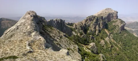
From the watchtower we will be able to contemplate a panoramic that will help us to know the environment better. Looking south a large ravine, which is named after the port, communicates the hill with the stepparian Valle del Guadiana Menor. The ravine is narrowed at the end in a rocky portico, which served for the Arabs to build the fortin of the Castle of Peña Negra. Once the Muslims were expelled, the new occupants raised the Tícar Sanctuary over the walls of the fortress. Looking to the west, the Peña de las Carboneras, one of the summits of the smallest and colecte orographic unit of the mountain massif, stands at the front: the Quesada saw, which houses numerous rock paintings of the Levine art, considered by UNESCO as the World Heritage Site.

To the north our view is lost in the olive sea of the Jiennense countryside, which as waves in a time, is aggressive in the slopes of the Cazorla saw, whose alignment is clear to the right of the olive tree. As we look east, our view inevitably stops at the Rayal Picon (1,834 m of altitude), the first important elevation of the Sierra de Cazorla from the south and impressive limestone mole that has a vertical cut on its north face. The name Rayal was synonymous with the border in the Middle Ages and the torreon in which we are located reminds us that this space was a border with the Nazareth Kingdom of Granada for almost three centuries.

We suggest...

  • It is recommended to carry binoculars and to track with them the limestone crestons that are seen, above all, in the northern half of the area, because it is quite easy to observe the montane goat. It is also a good point to see rapacious birds in flight.
  • Right in the same port is the Fuente de las Carboneras, a good place to refresh us. If the pipe was dry, the usual circumstance in the summer, following the lane that leaves from the same source, we arrive at the Forest House of Las Carboneras and, after the building, we will find another spring.

The Port of Tiscar is the highest point on the road A-6206, the winding mountain road that unites Quesada with the two southernmost villages of the Natural Park: Pozo Alcón and Hinojares. To get to this beautiful hill, if we leave from Quesada, at the exit we will continue straight, avoiding to the right the detour to Huesa (there is an indicator to the Port of Tíscar), until the rise, about 8.5 km later, where we find a signal indicating the location and altitude. From Hinojares (18 km) and Pozo Alcón (23 km) you have to take the A-6206 inverse to the previous one, always direction to Quesada at all the crosses.

Breve descripción

The Port of Tíscar is not only the mountain barrier to be saved to go to the Sanctuary of Our Lady of Tíscar, the historical patron of the advance of Cazorla and now of Quesada, and one of the most emblematic religious symbols of these mountains. It is an agribusiness area, with spectacular views, where it is easy to see the mountain goat, a corner full of history and nature. Leaving the vehicle in the parking areas in the same port, taking a small walk we arrive to a medieval watchtower, the Atalaya del Infante Don Enrique (14th century), an excellent lookout, with views to which for nothing in the world we must give up if we are there.

Ubicación
Latitud
37.865164
Longitud
-3.068421
Municipio
Ubicación en el mapa
POINT (-3.068421 37.865164)
Tipos de punto de interés
Imágenes carrusel
imagen
Image
tiscar.jpg
Imagen principal
Desactivado
imagen
Image
CazPuertoDeTiscar1.jpg
Imagen principal
Desactivado
Imágenes cabecera
imagen
Image
22072009_006_stitch.jpg
Imagen principal
Activado
Loading map
Preparing points of interest and routes...

Bridge Viejo sobre el Cañamares

Submitted by brandcode_deweloper on
Id
8088389
Descripción
Descripción larga

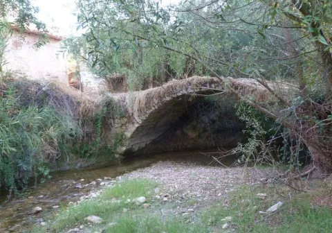
It is a one-eye bridge made up of a half-point arch, quite robust and with pillars and paraments that make a curve to the Cañamares River. The shillery is well worked and is quite regular in size.

Breve descripción

It has traditionally been given as a certain chronology for this construction the first centuries of the Christian era coinciding with the Roman presence on our lands, and the proximity of the Almansas, where there was an important settlement at the time.

Telecomunicaciones
Sitio web
http://www.chilluevar.es/
Teléfono de contacto
953 717 300 / 953 717 225
Ubicación
Código Postal
23477
Latitud
38.001450
Longitud
-3.030960
Dirección
Av. Andalucía, 6
Municipio
Ubicación en el mapa
POINT (-3.03096 38.00145)
Tipos de punto de interés
Imágenes cabecera
imagen
Image
Puente%20Viejo%20sobre%20el%20Ca%C3%B1amares2.jpg
Imagen principal
Activado
Loading map
Preparing points of interest and routes...

Bridge over El Guadalimar

Submitted by brandcode_deweloper on
Id
919236
Descripción
Descripción larga

The work of the pineers, called hooks in other areas, was hard and dangerous. We can imagine in the town square the group of piners with hooks and other equipment to start driving. The group would be very large, more than fifty people, and sometimes several hundred. There were some children to learn the trade, mules, dogs and the essential objects for a several-month journey.

When organizing the driving the responsible was the river master, the person who with his experience had acquired that condition and that allowed him to go next to the mayoral of the front to the front of the driving. Next to this mayoral there were two others in the center and in the back, and their mission was to direct the work of the pineers' bands.

The river master was the one who decided if it was necessary to do any channelling or other work made with the same wood to facilitate the driving and transport of the parts by the river.

We must think of harsh living conditions for people who spent much of the year outside their homes and that this activity was the only way to make a living. There is now an annual exhibition of wood driving in Yeste (Albacete) and another of following hasheros in Siles.

Breve descripción

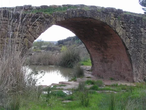
This was a point of passage of some of the many wood that over the centuries have led the wood of the forests of the Natural Park to Seville and other places, for the construction of ships and large civil and religious buildings, so many historical facts we know would not have been possible without the small history of the wood.

Ubicación
Latitud
38.087695
Longitud
-3.640179
Distrito
Municipio
Ubicación en el mapa
POINT (-3.640179 38.087695)
Tipos de punto de interés
Imágenes carrusel
imagen
Image
Uno_de_los_ojos_del_puente_Mocho.jpeg
Imagen principal
Desactivado
imagen
Image
rio-guadalimar-3-1-jpg
Imagen principal
Desactivado
Imágenes cabecera
imagen
Image
segura.jpg
Imagen principal
Activado
Loading map
Preparing points of interest and routes...
Interés