Saltar al contenido principal

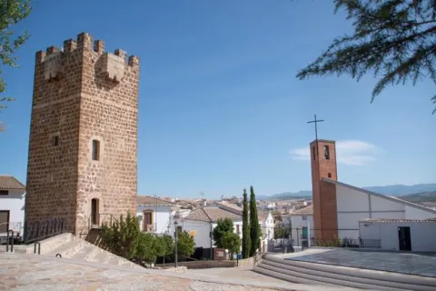
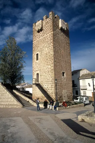
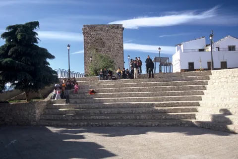
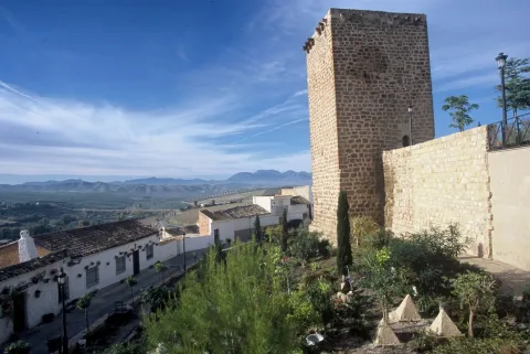
Mocha Tower

Submitted by brandcode_deweloper on
Id
4540320
Descripción
Descripción larga

Its construction was to be carried out between the 13th and 14th centuries and over time it was joined by houses of little entity that distorted its image. In 1987 the Cultural delegation of the Junta de Andalucía, in view of its state of advanced deterioration, carried out a restoration for the emergency procedure led by the architect Luis Carlos Gutiérrez Calatrava, which was modelic in terms of its rigor and treatment: consolidation of vaults and construction of roof for the evacuation of water, repair of external and interior locks, replacement of parts and outdoor carpentry and conditioning of the exterior and areas of access.

It was declared Good of Cultural Interest in 1985

Breve descripción

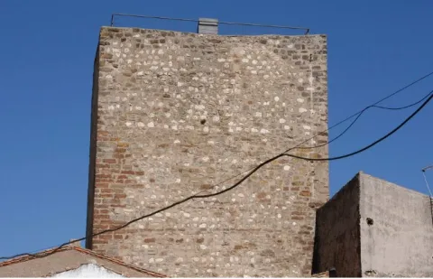
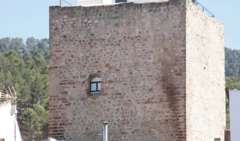
The Mocha tower, the other preserved in the medieval castle, is less elegant than the Clock. It is about seven meters from the side, it is made of masonry in one of its parts, it has its corners reinforced with rope and sawn, and it is topped with squiners - beams whose ends stand out to the outside.
Telecomunicaciones
Sitio web
www.pealdebecerro.es
Teléfono de contacto
953 730 075
Correo electrónico
ayuntamiento@pealdebecerro.es
Ubicación
Código Postal
23460
Latitud
37.911650
Longitud
-3.127570
Distrito
Municipio
Ubicación en el mapa
POINT (-3.12757 37.91165)
Tipos de punto de interés
Imágenes carrusel
imagen
Image
torre-mocha-peal-de-becerro-jpg
Imagen principal
Desactivado
Imágenes cabecera
imagen
Image
torre-mocha-y-paisaje-peal-de-becerro-jpg
Imagen principal
Activado
Loading map
Preparing points of interest and routes...

Clock Tower

Submitted by brandcode_deweloper on
Id
4540260
Descripción
Descripción larga

The Clock tower, built in the late 14th century, is about 12 meters high. It sits on a stone socket, it is quadrangular, its silvery is not entirely regular, it is distributed internally on four levels, it conserves the almenate and also, on two of its faces, balconies with the function of matacan; on another, matacan ménsulas; while on the north-west one has been placed a named watch, where the matacan and its ménilas were first located.

In 1985 it was declared Good of Cultural Interest.

Breve descripción

As we approach the mound on which the people are based, in the heart of the urban core, two towers that were part of a medieval fortress that was attached to Quesada and, past the equator of the 14th century, in 1361, was looted and burned in a raison of Arab troops from the kingdom of Granada.

Telecomunicaciones
Sitio web
www.pealdebecerro.es
Teléfono de contacto
953 730 075
Correo electrónico
ayuntamiento@pealdebecerro.es
Ubicación
Código Postal
23460
Latitud
37.912220
Longitud
-3.127110
Dirección
C/ de Josefa Sta. María, 2
Municipio
Ubicación en el mapa
POINT (-3.12711 37.91222)
Tipos de punto de interés
Imágenes carrusel
imagen
Image
torre%20del%20reloj%202.jpg
Imagen principal
Desactivado
Imágenes cabecera
imagen
Image
torre-del-reloj-peal-de-becerro-jpg
Imagen principal
Activado
Loading map
Preparing points of interest and routes...

Tower of the Tercia

Submitted by brandcode_deweloper on
Id
4539204
Descripción
Descripción larga

Historical data

The data relating to the medieval Génave are scarce, but it must have been one of the many foothills that populated the Sierra de Segura. A fortification or tower was probably built between the 11th and 13th centuries in the face of the advance of Christian armies.

After the Christian conquest, between 1235 and 1239, Géave and the whole Sierra de Segura were controlled by the Order of Santiago's Order and they had to endure the raison and attacks of intimidation of Saracena troops, so this and other torreons acted as a parapet in these war skirmishes and as a shelter for the population.

The chronicles written at the end of the Middle Ages, such as those of Don Francisco de León in 1468 or the Relations of Philip II of 1575, speak of the tower without any reference to a castle or enclosure of important dimensions, so it had to replace the ancient Islamic fortress.

Until 1551 Génave was the village of Segura de la Sierra, from that year on he received the privilege of Villa de orden de Felipe II.

In 1575 Génave is included in the Chancellery district of Granada, it depends on the archbishopric of Toledo and the Kingdom of Murcia before the Cortes, although it is directly under the governorate of Segura de la Sierra.

Description

This tower, surrounded by buildings that cover its bottom, is built in irregular masonry.

It has a square floor of 10.50 m on its side, and in its interior two overlapping rooms are kept covered with half-canyon vaults. To access each of them, as well as the roof, there is a staircase embedded in the thickness of the walls covered with the same type of vault.

The access is now made through a building that houses the Adult Center of the town and which was previously the seat of the City Council.

The tower was declared in 1985 Good of Cultural Interest.

Breve descripción

Génave is located on a hillside, near the wide valley in which the foothills of Sierra Morena and Sierra de Segura converge, on the road to Levante, a natural step that goes back to the Guadalimar River, connecting the Guadalquivir with the Peninsular Levant.

The only rest of the missing Génave castle is the so-called Torreon de la Tercia built by Christians at the end of the 13th century. It has an impressive cubic structure and is located in the center of the population.

Ubicación
Latitud
38.430300
Longitud
-2.733180
Dirección
C/ Tercia, 17
Distrito
Municipio
Ubicación en el mapa
POINT (-2.73318 38.4303)
Tipos de punto de interés
Imágenes carrusel
imagen
Image
11.jpg
Imagen principal
Desactivado
Imágenes cabecera
imagen
Image
12.jpg
Imagen principal
Activado
Loading map
Preparing points of interest and routes...

Natural Rock Screws of Gualay

Submitted by brandcode_deweloper on
Id
4486441
Descripción
Descripción larga

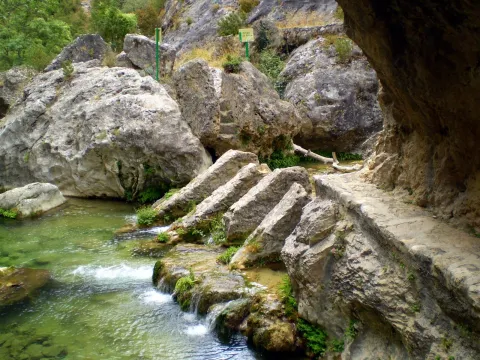
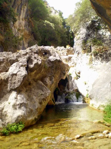
Location: To the south of the town, in the natural park of Cazorla, Segura and Las Villas.

Distance: 42 km

Medium: By vehicle, by bike and on foot.

Access route:: On the road A-319 towards La Iruela; at this point, after going 13 km, we will take the Chorro road, then turn away by the horseshoe road leading to Puerto Llano.

Breve descripción

This is a beautiful place where we can enjoy watching the coastal vegetation surrounding the Arroyo de los Tornillos de Gualay; it is the ideal place to start visiting different enclaves of interest within the Natural Park.

Ubicación
Código Postal
23470
Latitud
37.913497
Longitud
-3.125280
Municipio
Ubicación en el mapa
POINT (-3.12528 37.913497)
Tipos de punto de interés
Imágenes carrusel
imagen
Image
gualay2.jpg
Imagen principal
Desactivado
Imágenes cabecera
imagen
Image
tornillogualay.jpg
Imagen principal
Activado
Loading map
Preparing points of interest and routes...

Syncline of the Poyos de la Mesa

Submitted by brandcode_deweloper on
Id
877705
Descripción
Descripción larga

The hill of the Poyos de la Mesa is an inverted relief in which the dolomies of the Upper Cretaceous and the limestones of the discordant Miocene on them are affected by a sincerity perfectly visible from the north.

The fold is more tight in the older materials (Cretaceous dolomies), and is more open in the discordants (myocene limestones). Both litological sets flare at the top, very steep, of the relief. Between them there is a well-developed canchal, which marks approximately the axial plane of the fold.

Source: Inventory of Georresources of Andalusia. Environmental Council. Junta de Andalusia.

Breve descripción

Stilting of the Poyos of the Table

Ubicación
Latitud
37.912893
Longitud
-3.003887
Municipio
Ubicación en el mapa
POINT (-3.003887 37.912893)
Tipos de punto de interés
Imágenes carrusel
imagen
Image
564_img.png
Imagen principal
Desactivado
imagen
Image
2%20%281%29.jpg
Imagen principal
Desactivado
imagen
Image
3%20%281%29.jpg
Imagen principal
Desactivado
Imágenes cabecera
imagen
Image
1.jpg
Imagen principal
Activado
Loading map
Preparing points of interest and routes...

Chasm / Sinkhole of Pinar Negro

Submitted by brandcode_deweloper on
Id
877405
Descripción
Descripción larga

The total power of the section is over 150 m. On a few sucrose dolomies attributed to the lower and medium Jurassic we find materials from the upper Kimmeridgian; they are limeals with large gastropods and corals that end up on an erosive surface with a crusts of iron oxides.

The following are limestones, locally sandy and margas, with various levels of interspersed calcrets; these materials are being decrified and dolomitised, giving way to stoned dolomies with abundant carbonous remains; this whole set of materials is of the age Hauteriviense- Barremiense. The lower Aptiense is characterized by the presence of sands, calcareous sandstone and sandy limestone with laminations and cross stratifications as well as orbitolins at various levels. The materials of the upper Aptiense have abundant rudists and orbitolins. The Albibe is represented by dolomies with black songs and ghosts of rudists.

Source: Inventory of Georresources of Andalusia. Environmental Council. Junta de Andalusia.

Breve descripción

Black Pinar Sima

Ubicación
Latitud
38.298857
Longitud
-2.651877
Distrito
Ubicación en el mapa
POINT (-2.651877 38.298857)
Tipos de punto de interés
Imágenes carrusel
imagen
Image
P1050513.JPG
Imagen principal
Desactivado
imagen
Image
V04.jpeg
Imagen principal
Desactivado
Imágenes cabecera
imagen
Image
pinar-negro.jpg
Imagen principal
Activado
Loading map
Preparing points of interest and routes...

Jurassic-Lower Cretaceous Series of Navalperal

Submitted by brandcode_deweloper on
Id
877361
Descripción
Descripción larga

The total power of the section is over 150 m. On a few sucrose dolomies attributed to the lower and medium Jurassic we find materials from the upper Kimmeridgian; they are limeals with large gastropods and corals that end up on an erosive surface with a crusts of iron oxides.

The following are limestones, locally sandy and margas, with various levels of interspersed calcrets; these materials are being decrified and dolomitised, giving way to stoned dolomies with abundant carbonous remains; this whole set of materials is of the age Hauteriviense- Barremiense. The lower Aptiense is characterized by the presence of sands, calcareous sandstone and sandy limestone with laminations and cross stratifications as well as orbitolins at various levels. The materials of the upper Aptiense have abundant rudists and orbitolins. The Albibe is represented by dolomies with black songs and ghosts of rudists.

Source: Inventory of Georresources of Andalusia. Environmental Council. Junta de Andalusia.

Breve descripción

Navalperal

Ubicación
Latitud
38.298857
Longitud
-2.651877
Distrito
Ubicación en el mapa
POINT (-2.651877 38.298857)
Tipos de punto de interés
Imágenes carrusel
imagen
Image
1%20%285%29.jpg
Imagen principal
Desactivado
imagen
Image
561_img.png
Imagen principal
Desactivado
Imágenes cabecera
imagen
Image
561_img.png
Imagen principal
Activado
Loading map
Preparing points of interest and routes...

Jurassic-Cretaceous Series of El Yelmo

Submitted by brandcode_deweloper on
Id
877317
Descripción
Descripción larga

From the view of Segura de la Sierra you have a magnificent panoramic view of the relief of El Yelmo (its northern slope), one of the most emblematic of the Sierra de Segura. This relief has a synchronal structure, with a rich succession of marine and continental sedimentary rocks of Jurassic-Cretaceous age.

In addition to vertical succession, there are important side changes in the stratigraphic architecture, observable in the panorama, which consist of remarkable changes of powers, culminating in the coining of formations. These exceptional characteristics are due to the paleogeographical position on the margin of a marine basin (sudiberic paleomargen) during the Mesozoic. The observations on the northern side of the Yelmo are complemented, from the same viewpoint, by that of the "Segura de la Sierra Court," which shows a section covering the Jurassic and Cretaceous, and which is accessible by the asphalt forest track that leads inside the Segura Sierra from the Segura de la Sierra population.

Source: Inventory of Georresources of Andalusia. Environmental Council. Junta de Andalusia.

Breve descripción

Jurassic Series - El Yelmo Cretaceous

Ubicación
Latitud
38.298857
Longitud
-2.651877
Distrito
Ubicación en el mapa
POINT (-2.651877 38.298857)
Tipos de punto de interés
Imágenes carrusel
imagen
Image
1%20%285%29.jpg
Imagen principal
Desactivado
imagen
Image
2%20%284%29.jpg
Imagen principal
Desactivado
imagen
Image
Natu204.jpg
Imagen principal
Desactivado
Imágenes cabecera
imagen
Image
560_img%20%281%29.png
Imagen principal
Activado
Horario
Monday's closed. Tuesday to Friday: 10: 00 - 13: 00 and 18: 00 - 21: 00. Saturday: 10: 00 - 14: 00 and 18: 00 - 21: 00. Sunday and holidays: 10: 00 - 14: 00.
Loading map
Preparing points of interest and routes...

Cretaceous Series of the southern Yelmo

Submitted by brandcode_deweloper on
Id
877273
Descripción
Descripción larga

The stratigraphic section of the South Yelm is a magnificent example of the materials of the Aptiene-Ambient of the Prebetic. The Aptiense is essentially represented by limestone, of facies that vary between lacustre / palustres (carbonous) and of somere platform, both protected (lagoon), and open (coral reef).

The Albibe is made up of an alternation of carbonates (limestones and dolomies) and terrogenes (margas, clays and sands), from coastal to shallow marine environments. The faces represented are very rich and varied, at certain levels with a very well developed cyclicity. The content in fossils is extraordinarily rich, both in marine fauna and corals, lamelibranchios (rudists and ostreides), foraminiferous (e.g. orbitolinides), as well as fresh water (caraceous algae).

Source: Inventory of Georresources of Andalusia. Environmental Council. Junta de Andalusia.

Breve descripción

South Yelm Cretaceous Series

Ubicación
Latitud
38.298857
Longitud
-2.651877
Distrito
Ubicación en el mapa
POINT (-2.651877 38.298857)
Tipos de punto de interés
Imágenes carrusel
imagen
Image
2%20%284%29.jpg
Imagen principal
Desactivado
imagen
Image
1%20%285%29.jpg
Imagen principal
Desactivado
Imágenes cabecera
imagen
Image
sur-yelmo.png
Imagen principal
Activado
Loading map
Preparing points of interest and routes...

Segura de la Sierra

Submitted by brandcode_deweloper on
Id
919387
Descripción
Descripción larga

These lines correspond to the Treaty of the Mountain, studied by the Duke of Almazan, a document that some researchers attribute to Jorge Manrique. To talk about the 15th century in the Sierra de Segura is to talk about the Manrique family and the border period. A situation in which attacks and responses by Christians and Muslims were frequent. This danger and the border situation can only be seen by entering Segura de la Sierra: remains of walls, towers, entrance doors and on top of the hill, the watchful castle.

The Visits Books of the Order of Santiago described in the late 15th century the castle of Segura de la Sierra as a military compound with weapons to face a siege or, if necessary, to organize a village to attack the enemy. We cannot forget that in 1434 Rodrigo Manrique organized a village to conquer Huécar in the Altiplano granadino.

In Segura de la Sierra, taking advantage of this privileged position and under the security offered by its walls is where Jorge Manrique was raised under the care of his mother, Mrs. Mencía de Figueroa, in the house that still today is preserved five hundred years later.

Breve descripción

A candle on an oak table, a tintero with a pen and a half-write piece of paper. A figure draws attention to the rest of the room dedicated to the Manrique family on the second floor of the tower of tribute in the castle of Segura. Jorge Manrique is a character closely linked to Segura de la Sierra. If we were to imagine the poet in front of the paper, we might think that the text might start like this: "remind me to be very noble, Mr. Brother, having once said, in they are closer to mockery, you will see if you wanted me to write you something about the work of the Montaria."

Ubicación
Latitud
38.298857
Longitud
-2.651877
Distrito
Ubicación en el mapa
POINT (-2.651877 38.298857)
Tipos de punto de interés
Imágenes cabecera
imagen
Image
1517663098_978370_1517663226_noticia_normal.jpg
Imagen principal
Activado
Loading map
Preparing points of interest and routes...