Saltar al contenido principal

Rock Paintings in Santiago-Pontones

Submitted by brandcode_deweloper on
Id
650155
Descripción
Descripción larga

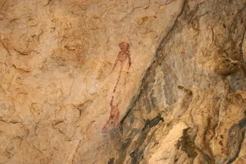
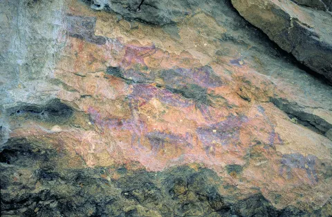
The simple fact of seeing a seed germinate and growing plants, or of observing animals and the birth of women, made these people wonder about the origin of life. These thoughts were those that moved to the walls of the caves as a representation of facts related to daily life and its world of beliefs. We can imagine one of the inhabitants of the Cave of Birth preparing the pigments, mixing them with animal fat, improvising a brush with animal hair and getting ready to paint a scene. I'd be thinking of painting a composition with a hunting scene, fight, dance trying to tell a moment, a scene of life.

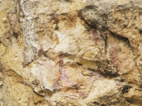
The rock paintings represent one of the most important cultural manifestations of prehistory, as they have helped to know some aspects of these societies to learn a little more about their life forms, fauna, flora and the world of their beliefs. What reasons could lead our ancestors to translate the manifestations of daily life and their beliefs into caves and coats? Maybe they were sanctuaries?

Breve descripción

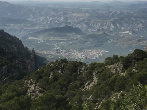
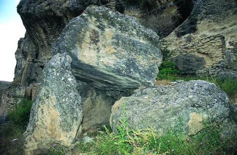
In the saws of Segura and Cazorla there are numerous coats and caves with rock paintings that are part of what is known as the Rupéstre Levino Art and which have been declared a World Heritage Site. We are talking about a very remote time, about 10,000 A.E. We must think of the inhabitants of the Caves of the Engarbo or the Cave of the Birth, for example, the latter being one of the few excavated and allowing to know the passage from Paleolithic to Neolithic. It is a time of great changes in the way of life in which human beings move from being a predator to domesticating vegetables and animals to getting plenty of food and storing it to avoid moving continuously.
Ubicación
Latitud
37.772886
Longitud
-3.788329
Ubicación en el mapa
POINT (-3.788329 37.772886)
Tipos de punto de interés
Imágenes carrusel
imagen
Image
Mon149.jpg
Imagen principal
Desactivado
imagen
Image
Natu149.jpg
Imagen principal
Desactivado
imagen
Image
pinturas_rupestres.jpg
Imagen principal
Desactivado
Imágenes cabecera
imagen
Image
IMG_4324-1.jpg
Imagen principal
Activado
Loading map
Preparing points of interest and routes...

Peaks of the Guadiana

Submitted by brandcode_deweloper on
Id
913424
Descripción
Descripción larga

The Guadiana Menor is a very young river from the geological point of view. Until about 10,000 years ago, its basin was a large salty lake, to which it provided its waters and sediments numerous streams from Sierra Nevada, Filabres and the Macizo de Cazorla and Segura. Its current course arose in an accidental and violent way, perhaps due to the breaking of one of the margins of the lake produced by an earthquake, excavating deep ravines, leaving out the yermas clays, loaded with plaster and salts, rolling edges and marine sands, a means that makes it difficult to survive the living beings that inhabit them.

The depression that bears its name from this river is the most arid area in the province and one of the driest in Europe, recording annual rainfall that very rarely exceeds 250 mm. The consequence is that of a semidesertic, rotational and beautiful landscape, populated by highly specialized Stepparian vegetables to the middle, most herbs and small matas. Its biological uniqueness is enormous, having an endemic character (very small geographical area) more than half of the species present in the area. This proportion is only comparable to the biological exclusivity of the high betic mountain, where we find most of the most well-known endemisms in the Natural Park.

We suggest...

  • Make the Desert Route, described in the Tourist Guide of Hinojares.
  • Visit the Mirador del Lirio, with stunning views of the valley and the desert of the Natural Park. It is accessed (it is signposted) from the village of Fontanar, which is located about 5 Km from Pozo Alcón.
  • Other unique points of this recommended visit are the necropolis ibera de los Castellones de Ceal, next to the village of Ceal, and the Salinilla de Chillar, located very close to Hinojares.

To visit the Picos del Guadiana and to visit the subdesert area of the Natural Park that corresponds to the Valle del Guadiana Menor, we will use the road section of the A-315 that links Bone with Pozo Alcón and Hinojares. The view of the Picos is at the beginning of these, in an enranche of the previous way, about 14 km from Hinojares and 19 km from Pozo Alcón.

Breve descripción

The geoforms of the valley of the Minor Guadiana, originating from the slow and inexorable erosive processes, are extremely striking. An enclave of great geomorphological interest, proposed as a natural monument: the Picos del Guadiana, stands out. It is a limestone crest where the petreous strata, arranged vertically, emerge from a cone of soft clays, forming a rocky alignment that resembles the teeth of a saw. The most imaginative say that it is the fossil of a colossal dinosaur that died by the river, without considering that there was no such channel in the Jurassic and that some of those prehistoric animals were huge, but not so much.

Ubicación
Latitud
37.702695
Longitud
-2.935057
Municipio
Ubicación en el mapa
POINT (-2.935057 37.702695)
Tipos de punto de interés
Imágenes carrusel
imagen
Image
picos.jpg
Imagen principal
Desactivado
Imágenes cabecera
imagen
Image
8040409Master.jpg
Imagen principal
Activado
Loading map
Preparing points of interest and routes...

Peaks of the Guadiana

Submitted by brandcode_deweloper on
Id
2980258
Descripción
Descripción larga

We are located in the subdesert area near the Natural Park Sierras de Cazorla, Segura and Las Villas. The geoforms of the valley of the Minor Guadiana, originating from the slow and inexorable erosive processes, are extremely striking. An enclave of great geomorphological interest, proposed as a natural monument: the Picos del Guadiana, stands out. It is a limestone crest where the petreous strata, arranged vertically, emerge from a cone of soft clays, forming a rocky alignment that resembles the teeth of a saw. The Guadiana Menor is a very young river from the geological point of view. The depression that bears its name is the driest area in the province and one of the driest in Europe, recording annual rainfall that very rarely exceeds 250 mm. Its biological uniqueness is enormous, having an endemic character (very small geographical area) more than half of the species present in the area.

Breve descripción

We can access this peculiar landscape through the A-315 road that links Bone with Pozo Alcón and Hinojares. The view of the Picos del Guadiana is located in a corner of the previous track, about 13 km. from Hinojares and 19 from Pozo Alcón.

Ubicación
Código Postal
23487
Latitud
37.747960
Longitud
-3.099540
Dirección
Carretera A-315
Municipio
Ubicación en el mapa
POINT (-3.09954 37.74796)
Tipos de punto de interés
Imágenes carrusel
imagen
Image
picos_guadiana.jpg
Imagen principal
Desactivado
Imágenes cabecera
imagen
Image
10463723Master.jpg
Imagen principal
Activado
Loading map
Preparing points of interest and routes...

Peak Gilillo

Submitted by brandcode_deweloper on
Id
4486161
Descripción
Descripción larga

Location: To the south of the town, in the natural park of Cazorla, Segura and Las Villas.

Distance: 16 km

Medium: In vehicle tourism and on foot.

Access route: By the A-319 in the direction of La Iruela; at this point, after 13 km, we will take the Chorro road, then diverting by a horseshoe road leading to the Port of Tejo.

When you reach the port of Giillo, you leave the path to turn right and climb to the rocky top of the same name, spectacular atalaya with beautiful views in all directions. The fall is made to the port of Giillo, and we will have to pass through an old, ruined shelter where a path of descent begins, this one passes through the Loma de Los Castellones, with beautiful views of the Calar de Juana and the Cabañas, as well as a spectacular sincerity that remains to our left, soon we arrive to the Laguna de Cazorla, a great dolina where we will take a beautiful horseshoe path that is headed towards the Port of Tejo. From here on, a beautiful fall begins on the path of masonry passing under the Banderín and the Cejo de la Mora, with beautiful views towards Los Castellones and Giillo, until reaching the ruins of the Forest House of Prado Redondo, beautiful corner with a fountain.

Breve descripción
Ubicación
Latitud
37.869750
Longitud
-2.993650
Municipio
Ubicación en el mapa
POINT (-2.99365 37.86975)
Tipos de punto de interés
Imágenes carrusel
imagen
Image
gilillo.jpg
Imagen principal
Desactivado
Imágenes cabecera
imagen
Image
NaturalPicoGilillo.jpg
Imagen principal
Activado
Loading map
Preparing points of interest and routes...

Cercado del Ciprés Forest Park

Submitted by brandcode_deweloper on
Id
2980366
Descripción
Descripción larga

This peri-urban environmental park occupies 11 hectares of land and has recreational areas, bike lane, trails, viewpoints, wooden buildings, classrooms, aviary, artificial lake and botanical garden. In the Cercado del Ciprés we will enjoy a beautiful courtyard of oranges, which presents a system of irrigation lacquers that reminiscent of the gardens of Muslim design. Here are the offices of the Sierras de Andújar Natural Park as well as a visitor information point. The environmental education activities they organize include the scientific nesting of birds and workshops on beekeeping, fishing and identification of animal prints.

Breve descripción

The Cercado del Ciprés forest park is located on the outskirts of the city of Andújar, next to the Alto Guadalquivir Regional Hospital, on the Rubiales Road and just 250 m from the Andalusian motorway.

Ubicación
Código Postal
23740
Latitud
38.042910
Longitud
-4.026890
Dirección
Camino de los Rubiales, s/n
Distrito
Municipio
Ubicación en el mapa
POINT (-4.02689 38.04291)
Imágenes carrusel
imagen
Image
parqueforestal.jpg
Imagen principal
Desactivado
imagen
Image
area%20recreativa%202.jpg
Imagen principal
Desactivado
Imágenes cabecera
imagen
Image
ZAC7.jpg
Imagen principal
Activado
Loading map
Preparing points of interest and routes...

Natural Area Alto Guadalquivir

Submitted by brandcode_deweloper on
Id
2190557
Descripción
Descripción larga

The whole area of this artificial wet area - with an increasingly important water vegetation belt - is surrounded by crops.

The palustre vegetation of these swamps is basically made up of eneas and canes, accompanied by beets and tarays and on their shores are mainly developed the alms.

While, as far as fauna is concerned, an abundant and varied community of aquatic birds is concentrated in these reservoirs of Alto Guadalquivir, highlighting the colony of squid (species catalogued as threatened at community level), royal ducks and spoons, as well as imperial porrones and garzas.

The total area of this natural area, whose reference locations are Ubeda and Jódar, is 663 hectares.

Breve descripción

To the south of the famous hills of Ubeda, the Guadalquivir River was repressed in the 1950s in a succession of three small reservoirs: Doña Aldonza (301 hectares), Pedro Marín (240 hectares) and Puente de la Cerrada (122 hectares).

Ubicación
Latitud
37.779600
Longitud
-3.784910
Municipio
Ubicación en el mapa
POINT (-3.78491 37.7796)
Tipos de punto de interés
Imágenes carrusel
imagen
Image
Natu178.jpg
Imagen principal
Desactivado
imagen
Image
Natu179.jpg
Imagen principal
Desactivado
imagen
Image
Natu237.jpg
Imagen principal
Desactivado
Imágenes cabecera
imagen
Image
Natu049%20%281%29.jpg
Imagen principal
Activado
Loading map
Preparing points of interest and routes...

Area of Jesús del Monte

Submitted by brandcode_deweloper on
Id
4585369
Descripción
Breve descripción

The Cañada de la Madera has access to this natural setting, with good views of the park and a well-equipped road with drinking water and a hermitage. In this same place stands the Fuente del Avellano.

Ubicación
Código Postal
23338
Latitud
38.157030
Longitud
-3.032730
Municipio
Ubicación en el mapa
POINT (-3.03273 38.15703)
Tipos de punto de interés
Imágenes carrusel
imagen
Image
iznatoraf_jesus.jpg
Imagen principal
Desactivado
Imágenes cabecera
imagen
Image
3609997Master.jpg
Imagen principal
Activado
Loading map
Preparing points of interest and routes...

Nava del Espino

Submitted by brandcode_deweloper on
Id
913357
Descripción
Descripción larga

From the Nava del Espino there are roads that lead you to the highest peaks of the Sierra de Cazorla, among which are the Poyos de la Mesa. It is a very recommended route by the views on the Guadalquivir that from this plancie you can reach.

If you stop your way in this place you can enjoy the landscape and if you are at the right time it will be easy to see some go feeding on their meadows.

About 2 km from the Navy following the track you brought, and on the left there is a recreational area next to the Fountain of the Garganta. An ideal place to rest and restore strength.

In Cazorla take the Sierra road (A-319) until the crossing known as the Empalme del Valle. Turn right on the JF-7092 road and after passing the bridge over the Guadalquivir River (4 km from the Empalme) follow the left track (JF-7091). In the km 21 of the road signs is the Nava del Espino.

Breve descripción

By going up the way of the Navas we come to this place which is surprising by its breadth. At 1430 m of altitude you will find high mountain grasslands, some pine-covered areas and an old abandoned forest house that indicate that we have reached the destination. Around you, high hills that seem like we can almost touch with our hands like the Tejo Head, from where it is possible to contemplate the Sierra Nevada summits.

Ubicación
Latitud
37.912893
Longitud
-3.003887
Municipio
Ubicación en el mapa
POINT (-3.003887 37.912893)
Tipos de punto de interés
Imágenes carrusel
imagen
Image
espino%20%281%29.jpg
Imagen principal
Desactivado
Imágenes cabecera
imagen
Image
6942435Master.jpg
Imagen principal
Activado
Loading map
Preparing points of interest and routes...

Source of the River Segura

Submitted by brandcode_deweloper on
Id
877023
Descripción
Descripción larga

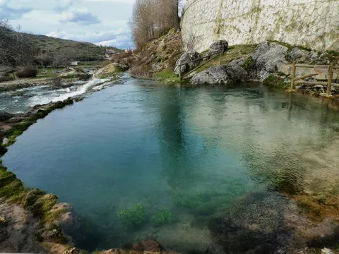
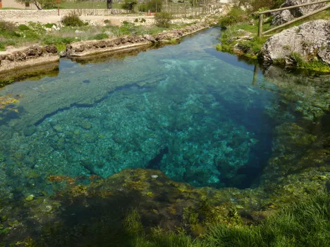
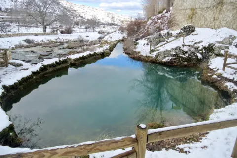
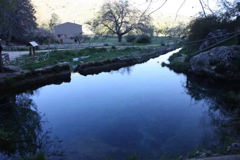
The birth of the Segura River is a penetrable siphon, with an explored length of 354 meters and a 17 meters gap. The exploration of this cavity was carried out by spelebuchers of the Madrid Standard Group during the 1979 and 1980 years, carrying out an important work of disobstruction within the siphon. (G.E. STANDARD, 1980) The emergence is located at the bottom of a blind valley in the foothills of the Sierra de Segura near the population of Pontones. It is a flooded gallery where three air bubbles are located at about 100, 160 and 255 m from the mouth.

Source: Inventory of Georresources of Andalusia. Environmental Council. Junta de Andalusia.

Breve descripción

This is a karmic surgence located at the entrance of a circular cavity of several meters in diameter. This is associated with the aquifer of higher Cretaceous dolomies and limestone. It is located in the vicinity of the inverse failure contact between the carbonates of the Upper Cretaceous and the waterproof margas of the Middle Myocene. It is a cavity that could in origin correspond to a small dolin, developed on subhorizontal layers.

Ubicación
Latitud
38.091458
Longitud
-2.701760
Ubicación en el mapa
POINT (-2.70176 38.091458)
Tipos de punto de interés
Imágenes carrusel
imagen
Image
nacimiento-del-segura.jpg
Imagen principal
Desactivado
imagen
Image
17201575670_6b5d38a518_b.jpg
Imagen principal
Desactivado
imagen
Image
7609945Master%20%281%29.jpg
Imagen principal
Desactivado
Imágenes cabecera
imagen
Image
Nacimiento%20del%20Segura.jpg
Imagen principal
Activado
Loading map
Preparing points of interest and routes...

Source of the Guadalquivir - Cañada de Las Fuentes

Submitted by brandcode_deweloper on
Id
913244
Descripción
Descripción larga

The "official" birth of the Guadalquivir River has been placed under a plaque that reproduces a poem by the brothers Alvarez Quintero. But, in the strict sense, the sources of Guadalquivir are found in the spacious honnada of the Cañada de las Fuentes. In this place there are several streams that come down from the nearby mountains: that of the Teatines, that of the Cold John or the stream of Light among others.

The place has overcome moments of intense tourist pressure and today, with a more appropriate public use order, we are presented with clean and sensitive, so our visit must be at all times silent and respectful.

From the Cañada de las Fuentes you are a step away from enjoying some of the most striking routes in the area.

We suggest...

  • Up to the peak of Cabañas, at whose foot is a forest track in acceptable condition, about 10 km. Following the track that goes to Pozo Alcón from the birth we arrive, after 2.5 km, to the pine of the three crosses. Here begins the track that goes up to this proud viewpoint of the Sierra del Pozo.
  • Walk by the Cañada de la Fuente. About a mile from the forest house of the same name, a road to the right begins surrounded by majuelos and maples, with some of the largest specimens of pine larice of the Park. On the way it is easy to observe we, even muflons in the lapiaz on the right, as well as millennia tejos
  • Continue two kilometers along the track that goes up to Pozo Alcón and, 300 meters before the pine of the three crosses, take the left road to the Prados de Navahondona.

From Cazorla you can reach the Sierra road, A319. In the Empalme del Valle we will see an indication of the birth to the right, and follow that direction for 4 km until you find a bridge over the Guadalquivir. As we pass the bridge we turn right to the Bridge of Herrerías. From here, without leaving the main road, there are 11 km to the Birth.

Breve descripción

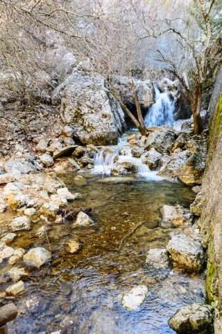
The birth of the most important river of Andalusia occurs in an area of great ecological value within Natural Park. It is a cool and pleasant place, where strawberries, maples and majuelos accompany the "Rio Grande," as the Arabs called it, in these first steps. Around it we find curious geological formations with dense pine pineapples and black. About a hundred meters above is the forest house of the Cañada de las Fuentes where there is a recreational area that often come to go and deer in small groups.

Ubicación
Latitud
37.702695
Longitud
-2.935057
Municipio
Ubicación en el mapa
POINT (-2.935057 37.702695)
Tipos de punto de interés
Imágenes carrusel
imagen
Image
17060619146_d431e5bd2f_b.jpg
Imagen principal
Desactivado
imagen
Image
Natu078.jpg
Imagen principal
Desactivado
imagen
Image
Natu183.jpg
Imagen principal
Desactivado
imagen
Image
Natu218.jpg
Imagen principal
Desactivado
imagen
Image
Natu217%20%281%29.jpg
Imagen principal
Desactivado
imagen
Image
Natu219.jpg
Imagen principal
Desactivado
imagen
Image
Natu237.jpg
Imagen principal
Desactivado
imagen
Image
Natu251.jpg
Imagen principal
Desactivado
Imágenes cabecera
imagen
Image
Natu015.jpg
Imagen principal
Activado
Loading map
Preparing points of interest and routes...