Saltar al contenido principal
icon-intereses-turismo-low-cost

Recreational Area of Linarejos

Submitted by brandcode_deweloper on
Id
881739
Descripción
Descripción larga

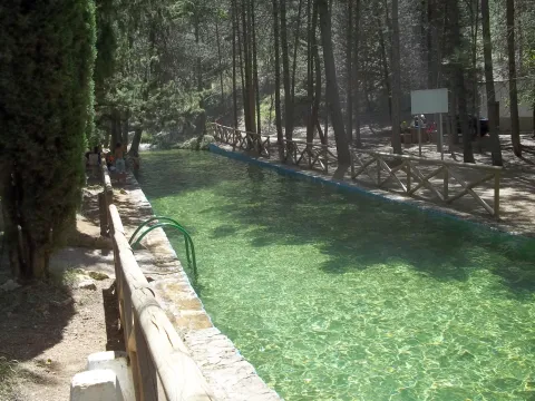
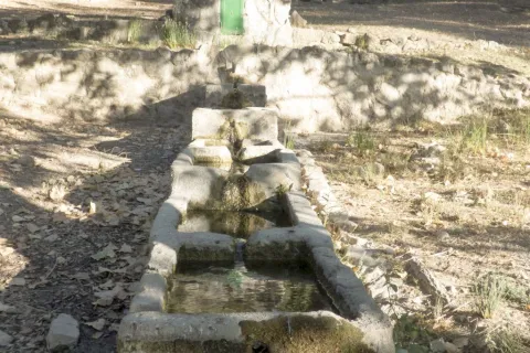
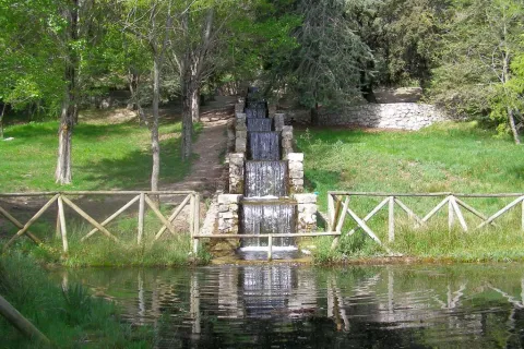
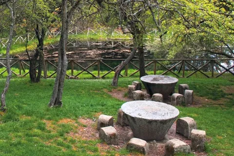
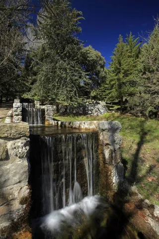
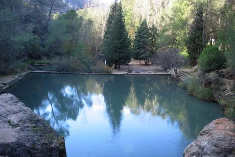
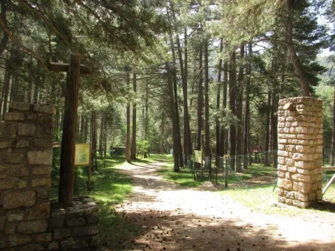
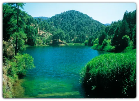
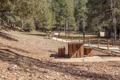
Here's what it takes to spend a quiet day in the middle of nature. You have a large parking area, meringeros with chairs and wooden tables, a fountain, a kiosk-bar (open only in summer) and a charming piscina-dam very busy in the months of hottest.

The presence of water attached to the lush and closed forest around this area allows, when there is little human activity, the mammals of the saw to move freely around. The bouquet, boar or even muflon have been seen a few meters from the recreation area.

But the minuscule life is the queen of the area: invertebrates like the dragonfly, and a very delicate crustacean like the native river crab are raised in the remnants of the stream of Linarejos. Your visit must, by obligation, be respectful of the inhabitants of the mountain, avoiding unnecessary noises and removing any waste from the place.

We suggest:

  • Take a walk to the canyon that the Guadalquivir River has tasted in the Cerrada del Utrero. It's about following the track that comes out next to the kiosk of the recreational area and turning left to go next to the stream. Do it with caution because in the end you arrive at the spectacular jump of Linarejos, where you don't have to look too much.

In Cazorla take the Sierra road (A-319) until the crossing known as the Empalme del Valle. Turn right on the JF-7092 road and after passing the bridge over the Guadalquivir River (4 km from the Empalme) follow the left track (JF-7091). 2 km from this bridge we turn left by a track that arrives, after a kilometre to the recreational area.

Breve descripción

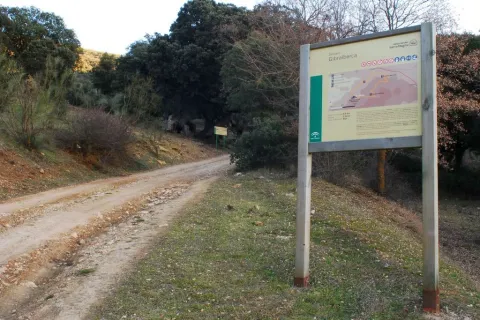
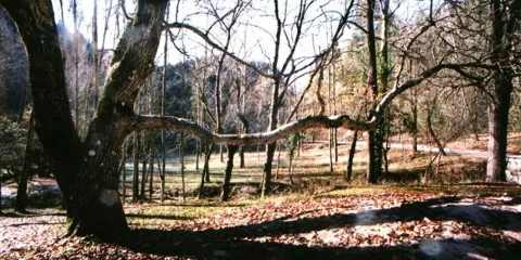
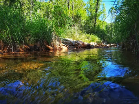
Through the Arroyo de Linarejos and wrapped in a lush vegetation, this recreational area is one of the most accessible and popular in the Sierra de Cazorla. The site is a sample of the most important that encloses the saw: crystal streams surrounded by a green mantle, lush riverside vegetation, freshness, pine and wild animals around. Here we can start and finish some simple routes that will allow us to know the surroundings.

Ubicación
Latitud
37.922990
Longitud
-2.911570
Dirección
Camino de la Huelga
Municipio
Ubicación en el mapa
POINT (-2.91157 37.92299)
Tipos de punto de interés
Imágenes carrusel
imagen
Imagen
Natu223.jpg
Imagen principal
Desactivado
imagen
Imagen
2.jpg
Imagen principal
Desactivado
Imágenes cabecera
imagen
Imagen
3%20%281%29.jpg
Imagen principal
Activado
Loading map
Preparing points of interest and routes...

Recreational Area of Gibralberca

Submitted by brandcode_deweloper on
Id
2981114
Descripción
Breve descripción

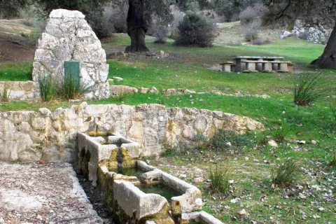
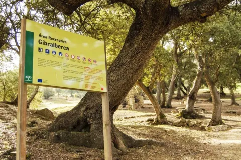
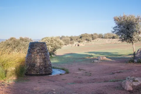
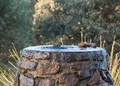
The recreational area of Gibralbca, at 1,200 metres of altitude, is a fuente- abrevadero whose waters come from the stream of the same name. Located between alamos, centenary oak and thorns, in the middle of a meadow, from this point we have impressive views of Mount Almadén (1,883 m), in the natural park of Sierra Magina. In addition, many forest birds, riverbanks and, above all, red squirrels can be observed in the moms that preside over it.

Telecomunicaciones
Sitio web
www.cambil-arbuniel.es
Teléfono de contacto
953 300 427
Ubicación
Código Postal
23560
Latitud
37.674840
Longitud
-3.498170
Dirección
Carretera A-324
Distrito
Municipio
Ubicación en el mapa
POINT (-3.49817 37.67484)
Tipos de punto de interés
Imágenes carrusel
imagen
Imagen
717_AR_02.jpg
Imagen principal
Desactivado
imagen
Imagen
717_AR_01.jpg
Imagen principal
Desactivado
imagen
Imagen
717_AR_04.jpg
Imagen principal
Desactivado
imagen
Imagen
722_SS_01.jpg
Imagen principal
Desactivado
Imágenes cabecera
imagen
Imagen
717_AR_03.jpg
Imagen principal
Activado
Microsite al que pertenece
Loading map
Preparing points of interest and routes...

Recreational Area of Fuenmayor

Submitted by brandcode_deweloper on
Id
2980282
Descripción
Descripción larga

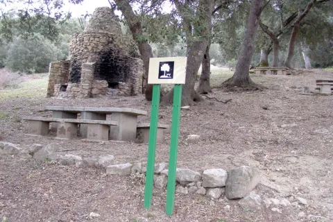
Fuenmayor in a camping area and a road, located in the middle of a large mass of trees, with plenty of water, as there is a spring there. The recreation area extends along the Fresnos de Fuenmayor stream, with a source of water jumps and a pond, as well as stationery, banks and picnic tables. The Fuenmayor is surrounded by long chopos between which you can see and hear some birds of forest and riverside like the listed reyezuelo, the common agateador or the cascade lavender.

Breve descripción

To the south of the town, in the Natural Park of Sierra Mágina, right on the slopes of the Almadén peak, about 7 km. Torres. The recreational area is accessed through an asphalt road that leaves the village and leads directly to Fuenmayor.

Telecomunicaciones
Sitio web
www.juntadeandalucia.es
Teléfono de contacto
954 544 438
Ubicación
Código Postal
23540
Latitud
37.750750
Longitud
-3.516820
Dirección
Carretera de Mancha Real
Distrito
Municipio
Ubicación en el mapa
POINT (-3.51682 37.75075)
Tipos de punto de interés
Imágenes carrusel
imagen
Imagen
ar%20Fuenmayor.jpg
Imagen principal
Desactivado
imagen
Imagen
ar%20Fuenmayor%202.jpg
Imagen principal
Desactivado
imagen
Imagen
ar%20Fuenmayor%203.jpg
Imagen principal
Desactivado
Imágenes cabecera
imagen
Imagen
18.jpg
Imagen principal
Activado
Microsite al que pertenece
Loading map
Preparing points of interest and routes...

Recreational Area Cave of the Peinero

Submitted by brandcode_deweloper on
Id
4585170
Descripción
Descripción larga

We suggest...

  • A walk up the road. Above the road that crosses it, a small dam is reached, hung by the scrapes of sediments, and at the back there is a pot of clean and transparent waters that invite an exciting bath when it is hot.
  • The short climb to the high mountain shelter of La Cueva del Peinero, through a short forest track that part of the Recreative Area. The almost circular panorama that you will have from this place will make you feel part of a wild and great scenario, overtaken by a lion vulture and other raptures.

LOCATION

JH-7155 (Transversal de las Villas) road, 34 km from Mogón. You can also access the opposite end of this road, in which case you have to travel 26 km from the detour on the road A-6202 (direction Charco del Oil).

Breve descripción

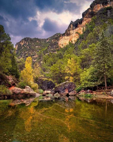
This area is in the midst of an impressive geological formation, which resembles a majestic circus, being one of the most abrupt and steep places in the park. Its natural exit is the impressive throat through which the river Aguascebas Grande flows, whose crystalline waters descend into successive waterfalls, between the large petreous blocks, hiding here and there, in an agitated turbulence of saltarine foams. On the contrary, in the Recreative Area the river runs in a quiet and quiet way, between the thick vegetation of willows, chopos, arraclanes and nozzles. The huge rocky lanterns that close the site rise more than 600 m, with poyos covered with fully virgin vegetation due to its difficult accessibility. All of this permeates the place of a great, hard to forget. The dusk and magical light of the sunset projects on the rocks a palette of suggestive colors, further accentuating the attractive forms of its relief. These are just some of the arguments that have motivated the site to be classified as a landscape interest. Next to the road, about 500 m down, there is a small grotto. But the name of the site does not come from this obscenity, but from a coat that is just below the shelter above the Recreative Area. According to tradition, the name comes from the fact that the coat was previously inhabited in summer by a craftsman who was dedicated to making utensils of boj wood, very abundant in the area, among which, due to its quality and fine processing, were the hair combs.

Telecomunicaciones
Teléfono de contacto
953 451 507
Ubicación
Código Postal
23338
Latitud
38.157670
Longitud
-3.032710
Dirección
C/ Carrera, 14
Distrito
Ubicación en el mapa
POINT (-3.03271 38.15767)
Tipos de punto de interés
Imágenes carrusel
imagen
Imagen
cueva-del-peinerojpg.jpg
Imagen principal
Desactivado
Imágenes cabecera
imagen
Imagen
PPCP6028.jpg
Imagen principal
Activado
Loading map
Preparing points of interest and routes...

Recreational Area Charco del Aceite

Submitted by brandcode_deweloper on
Id
895125
Descripción
Descripción larga

A large petreous blocks, which are in the middle of the channel, strongly call our attention and, at the top of one of them, a lookout gives us a magnificent view of this unique place, whose waters reflect the intense green of vegetation. At the foot of this little oasis, on our right, the rocky wall has a large cave to which the ceiling of the heirs climb.

According to tradition, the name of this place is due to the fact that a donkey, loaded with pear of oil, rushed down the narrow road, falling into this pond and impregnating the entire surface of liquid gold.

It is common to observe, on the edges of the imposing rocky walls, the silhouette of the montés goat and the slow and silent flight of the leonate vulture. In the same way of the river you can see the fishing martin biting like a small winged missile.

We suggest...

  • Visit about 200 m, on the left bank of the river, the opening of the drain tunnel of the Tranco reservoir, by which the water comes out turbulently.
  • The possibility to make several short routes, following the path that begins right next to the kiosk, and that runs parallel to the river line between the lush riverside vegetation, made up of alphas, mumberas, strawberries and doves.
  • Near this place, 300 m. below the Bridge of Los Agustines, one of the most unique and picturesque fishing grounds without death of common trout is started.

One of the main access to this area is from the N-322 road. At the height of Villanueva del Archbishop, we will take the road A-6202, which with its sinuous and quite characteristic layout, direction to the reservoir of the Tranco, to the crossing signposted to the Charco del Oil, in the km 18. We follow until the sale of the Agustines where the road is fork. Continuing from the front, during a small stretch that goes parallel to the route of Guadalquivir and you reach our destination. From the Sierra de Segura and the Valle alta del Guadalquivir you must reach the dam of the Tranco reservoir, to take the A-6202 direction to Villanueva del Archbishop and, later on, the detour to the Charco del Oil.

Breve descripción

This Recreative Area has a water remnant attached to the same route of the Guadalquivir River. It is a perfect place to take a good bath in summer, and a great place to enjoy a pleasant day at any time of the year. The area has stone tables, wooden seats and a kiosk-bar. The site is very lush and is framed by pine trees that descend from the steep rocky slopes surrounding it. In its fresh waters is the queen of the rivers of the Park, the bold common trout, as well as the indigenous barbs, the silver river bogas, and even the otter.

Ubicación
Latitud
38.241581
Longitud
-3.058056
Distrito
Ubicación en el mapa
POINT (-3.058056 38.241581)
Tipos de punto de interés
Imágenes carrusel
imagen
Imagen
1605177005097emilio_movil3498574119921452095-jpeg
Imagen principal
Desactivado
imagen
Imagen
16051767485808051568c-41fb-43ee-b9de-9c8e9bc64a663722139292531099924-jpg
Imagen principal
Desactivado
imagen
Imagen
1605176750156whatsapp_image_2020-11-07_at_14-48-39_17321797670982440696-jpeg
Imagen principal
Desactivado
Imágenes cabecera
imagen
Imagen
AR8.jpg
Imagen principal
Activado
Loading map
Preparing points of interest and routes...

Recreational Area Burguillos

Submitted by brandcode_deweloper on
Id
6615992
Descripción
Descripción larga

Mount Burguillos is one of the most significant elevations of the border area between Sierra Morena and the countryside.

The recreational area of Burguillos is equipped with tables, banks and barbecues, as well as sources, an artificial lagoon, parking area, a bar-restaurant and a Nature Hall.

The area is frequented by people who want to share a field meal with their friends or family, take a walk in the middle of nature or simply contemplate the rich biodiversity that Burguillos has.

The area of the Dehesa de Burguillos, also known as the Villa, is home to a Mediterranean forest of oak trees, alcornoques and complaints, a bucolic livestock area and a beautiful closed area through which the Rumblar River passes after leaving the dam. In addition, the land is splattered with spectacular rounded blocks of granite called "bowling" and of cavalry stones, as well as carrocal features of this area of Sierra Morena.

From the recreational area there are numerous hiking routes, all signposted and of medium-low difficulty, being able to intertwine with each other, highlighting one that goes into the mountain under adhesado to the Rumblar River and another that runs through the so-called Cerro de las Trinches, where trenches used in the Civil War are located.

Breve descripción

The Burguillos recreational area is located 5 kilometres north of the town of Bailén, within the area known as the Dehesa de Burguillos, a city-owned public mountain.

Ubicación
Latitud
38.138960
Longitud
-3.811280
Distrito
Municipio
Ubicación en el mapa
POINT (-3.81128 38.13896)
Tipos de punto de interés
Imágenes carrusel
imagen
Imagen
natural28_223.jpg
Imagen principal
Desactivado
imagen
Imagen
natural28.jpg
Imagen principal
Desactivado
imagen
Imagen
natural28_224.jpg
Imagen principal
Desactivado
Imágenes cabecera
imagen
Imagen
natural28_227.jpg
Imagen principal
Activado
Microsite al que pertenece
Loading map
Preparing points of interest and routes...

Los Negros Camping Area

Submitted by brandcode_deweloper on
Id
5928053
Descripción
Breve descripción

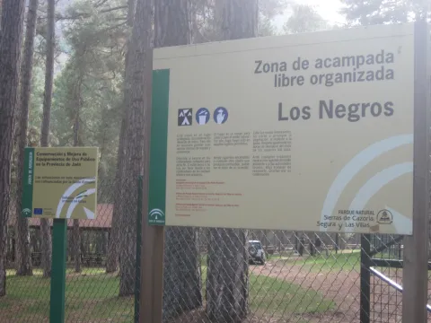
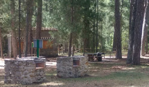
This ZALO is located in the valley of Rio Madera, a few kilometres after its birth, next to the road in the Canyon of Poyo Torres and very close to the river line. It is located in an area where the larix pine forest predominates, with a sotoforest of ferns, which denotes the moist nature of the environment.

Ubicación
Latitud
38.317340
Longitud
-2.575560
Distrito
Municipio
Ubicación en el mapa
POINT (-2.57556 38.31734)
Tipos de punto de interés
Imágenes carrusel
imagen
Imagen
Los%20Negros%203.jpg
Imagen principal
Desactivado
imagen
Imagen
Los%20Negros.jpg
Imagen principal
Desactivado
Imágenes cabecera
imagen
Imagen
3%20%281%29.jpg
Imagen principal
Activado
Loading map
Preparing points of interest and routes...

Aptiense de la Formación Arroyo de los Anchos

Submitted by brandcode_deweloper on
Id
661117
Descripción
Descripción larga

The first of the corals, located between meters 66 and 69 of the stratigraphic series, can be found at its base some levels with small requirements. On this level there are limestones with abundant orbitolins and milliolids; on the roof of some banks we can find drying cracks and rhizocretions. The second level of corals is between meters 109 and 116. On both levels they are massive corals, usually located in a position of life. On the second level of corals there are sand and sand that have above the first levels of rudists. The best florings of these organisms are from the 142 meter to the roof of the stratigraphic section.

Source: Inventory of Georresources of Andalusia. Environmental Council. Junta de Andalusia.

Breve descripción

The Aptiense de la Formación Arroyo de los Anchos is mainly made up of carbonates with an abundant fossiliferous content. There are also intercalations of margas, sandstone and sand. The total power is 93 m. Especially striking are the banks with corals and the levels of rudists.

Ubicación
Latitud
37.772886
Longitud
-3.788329
Ubicación en el mapa
POINT (-3.788329 37.772886)
Tipos de punto de interés
Imágenes carrusel
imagen
Imagen
Aptiense%20de%20la%20Formaci%C3%B3n%20Arroyo%20de%20los%20Anchos.png
Imagen principal
Desactivado
Imágenes cabecera
imagen
Imagen
146354-aldea-de-los-anchos.jpg
Imagen principal
Activado
Loading map
Preparing points of interest and routes...

Former Civil Guard Barracks

Submitted by brandcode_deweloper on
Id
8103250
Descripción
Descripción larga

Located in the northern part of the population, at the beginning of it.

Breve descripción

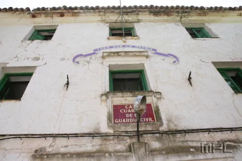
Today abandoned building, it retains on its facade the emblem of the civil guard. It highlights the greenish color of its main door and windows.

Telecomunicaciones
Correo electrónico
ayuntamiento@carboneros.es
Ubicación
Código Postal
23211
Latitud
38.232766
Longitud
-3.630393
Dirección
C/ Escolástica, 8
Distrito
Municipio
Ubicación en el mapa
POINT (-3.630393 38.232766)
Tipos de punto de interés
Imágenes carrusel
imagen
Imagen
Antiguo%20Cuartel%20de%20la%20Guardia%20Civil%202.jpg
Imagen principal
Desactivado
Imágenes cabecera
imagen
Imagen
Antiguo%20Cuartel%20de%20la%20Guardia%20Civil.jpg
Imagen principal
Activado
Loading map
Preparing points of interest and routes...

Former Town Hall of Larva

Submitted by brandcode_deweloper on
Id
8088700
Descripción
Descripción larga

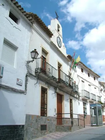
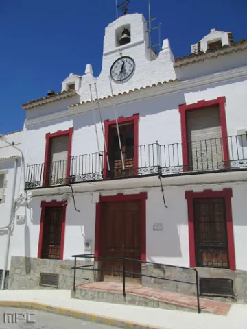
Among the Caserio de Larva is the old Town Hall, located in an altozano, with narrow walls, large symmetrical and verticalized voids, adapted to the slight level of heights of the street, and which is distinguished from the typology of the houses surrounding it by a prismatic, higher fronton, which hosts a watch and a small bell, following the model of the consistory houses of the illustrated colonization.

Breve descripción

The lands of Larva have been populated since the oldest prehistory, a town sponsored by its location near the Guadiana Menor, on the communication road that joined the Alto Guadalquivir with Levante. One kilometre from the city centre is the Iberian settlement of Cerro de Castellón, dated between the 2nd and 1st century BC. It is a fortified enclosure located at the top of a hill isolated in the middle of the plain, which remained occupied in Roman times.

Telecomunicaciones
Sitio web
www.larva.es/el-municipio/patrimonio-historico.html
Teléfono de contacto
953 781 500
Ubicación
Código Postal
23591
Latitud
37.759340
Longitud
-3.201280
Dirección
Paseo de Andalucía, s/n
Distrito
Municipio
Ubicación en el mapa
POINT (-3.20128 37.75934)
Tipos de punto de interés
Imágenes carrusel
imagen
Imagen
Antiguo%20Ayuntamiento%20larva2.jpg
Imagen principal
Desactivado
Imágenes cabecera
imagen
Imagen
Antiguo%20Ayuntamiento%20larva%20%281%29.jpg
Imagen principal
Activado
Microsite al que pertenece
Loading map
Preparing points of interest and routes...