Saltar al contenido principal
icon-intereses-turismo-low-cost

Guadiana Menor Badlands

Submitted by brandcode_deweloper on
Id
874475
Descripción
Descripción larga

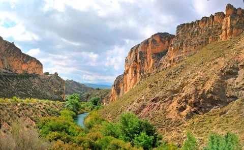
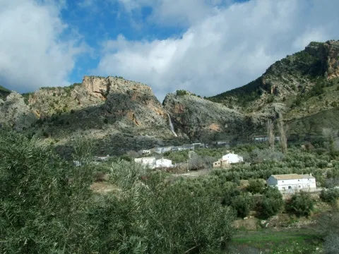
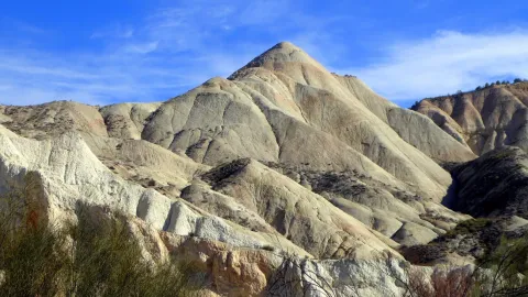
The area to the north of the Guadiana Menor, between Hinojares and Cabra del Santo Cristo, is part of one of the most desert areas of the province of Jaén, where they are added to the shortage of precipitation, a high litological erosionability and the accelerated process of natural erosion due to the phase of adaptation of the river channels to the change of the base level that occurred during the Quaternary in the Depression of Guadix- Baza.

All of these circumstances give rise to a highly degraded, carpeted landscape called bad@-@ land, of enormous beauty and geomorphological interest.

The area described corresponds to a large area of land in the south-eastern part of the province of Jaén, of which we will highlight the environment of the Cortijo Cherrín, in the vicinity of which there is also a magnificent example of deformation structures. These metric scale deformation structures are found in the upper Miocene (Tortonian) age turbite deposits, and are produced by the liquefaction of the sediment due to the abrupt sedimentation of turbidity currents. In particular, these are piled load structures with asymmetric morphology, whose vergence indicates the sense of movement of the turbidity current.

Source: Inventory of Georresources of Andalusia. Environmental Council. Junta de Andalusia.

Breve descripción

Zone between Hinojares and Cabra of the Holy Christ
Ubicación
Latitud
37.702695
Longitud
-2.935057
Municipio
Ubicación en el mapa
POINT (-2.935057 37.702695)
Tipos de punto de interés
Imágenes carrusel
imagen
Imagen
badland.jpg
Imagen principal
Desactivado
Imágenes cabecera
imagen
Imagen
guadianamenor-24.jpg
Imagen principal
Activado
Loading map
Preparing points of interest and routes...

Avellanares

Submitted by brandcode_deweloper on
Id
919885
Descripción
Descripción larga

The hazelnut is presented in several places in the Park, usually in the area of Segura and in it we will see it. In the high valley of Segura, between Pontones and the Utrera Strike, one of the most extensive hazelnuts of the Park is spread, presenting a good state of conservation, as it has preserved it from the transformation of the area by the human being.

In the recommended area the hazelnut (Corylus avellana) is abundant, forming an extensive plant community, in which we find lanthanes (Viburnum lantana), worlds (Viburnum opulus), vidars (Clematis vitalba), liver, (Hepatia nobilis), parnasias (Parnassia palustres), wild strawberries (Fragaria vesca), orchids (Listera ovata, Dactyliorhiza elata), cardos (Cirsium pyrenaucas and several sagulis (S.), and Sallicola (S.). We also found repopulation choperas with the Populus x canadensis hybrid. This whole set forms a thick and wide forest in gallery, where hazelnut is the protagonist.

For our visit to the hazelnut we choose the head of the Segura River. We will go to Pontones and from there we will take the track that passes to the side of the Segura River, downstream, in the direction of the Masegoso cortijo. We can make it walk or by vehicle, but we will enjoy more of the walk, as it does not reach 5 km to the end.

Breve descripción

When we have talked about the "North in the South" we invite to discover the hazelnuts in the area of Las Azebeas, but there are them in many other places, forming exceptional exceptional plant communities, authentic more northern plant shelters that live in the South.

Ubicación
Latitud
37.772886
Longitud
-3.788329
Ubicación en el mapa
POINT (-3.788329 37.772886)
Tipos de punto de interés
Imágenes carrusel
imagen
Imagen
ave%20%281%29.jpg
Imagen principal
Desactivado
imagen
Imagen
avellanares%20%282%29.jpg
Imagen principal
Desactivado
Imágenes cabecera
imagen
Imagen
1.JPG
Imagen principal
Activado
Loading map
Preparing points of interest and routes...

Cañada de las Hazadillas Nature Classroom

Submitted by brandcode_deweloper on
Id
5419829
Descripción
Descripción larga

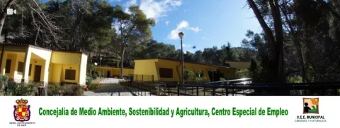
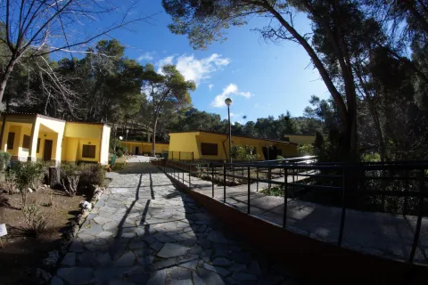
These municipal facilities are located in the Parque Periurbano Monte La Sierra, 23 km from Jaén, with an extension of 2,720 Hectareas, a mountainous terrain and an average altitude of 1000-1200 meters, make it a natural space of high botanical, faunistic and geological interest, which make it part of the Network of Protected Natural Spaces of Andalusia (RENPA). The Hall offers mainly environmental awareness activities, environmental programs, day, camps... not to mention the playful sports facet.

Breve descripción

The Nature Hall of the "Cañada de las Hazadillas" is an Environmental Education Centre run by the Special Employment Centre since 1999.

Telecomunicaciones
Sitio web
http://naturaleza.aytojaen.es/aula-naturaleza-canada-hazadillas
Teléfono de contacto
953 120 693
Ubicación
Código Postal
23002
Latitud
37.655040
Longitud
-3.714300
Dirección
Plaza Sta. María, 1
Distrito
Municipio
Ubicación en el mapa
POINT (-3.7143 37.65504)
Tipos de punto de interés
Imágenes carrusel
imagen
Imagen
83010111_1538218636328604_7188407138916499456_n.jpg
Imagen principal
Desactivado
imagen
Imagen
83291529_1543948079088993_4945864105035563008_n.jpg
Imagen principal
Desactivado
imagen
Imagen
27628827_974682099348930_6641180239363225364_o.jpg
Imagen principal
Desactivado
Imágenes cabecera
imagen
Imagen
aula_naturaleza.jpg
Imagen principal
Activado
Loading map
Preparing points of interest and routes...

Atochares

Submitted by brandcode_deweloper on
Id
919830
Descripción
Descripción larga

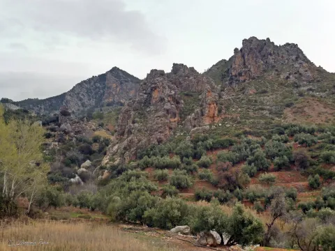
These semi-arid areas are the result of the gradual degradation of the ancient Mediterranean forest, which with an aridization of the climate has sculpted landscapes whose beauty is only overcome by their hostility and dryness, causing the plants to pass hard tests in order to live in these environments.

This vegetation is called xerophyll, because it lives in dry environments, with precipitation below 300 mm. annual. Among them are species such as albaida (Anthyllis cytisoides), sosas or salsoles (Salsola oppositifolia), salates (Suaeda spp., Hammada articulata), herb of the conjunctures (Ephedra fragilis), garbancers (Ononis fruticosa) and rabbit garbancillo (Ononis tridata). At times there are sabinas (Juniperus phoenicea), rosemary (Rosmarinus officinalis), male rosemary (Cistus clusii), rethemes (Retama sphaerocarpa), tomilos (Thymus zigis), some carrasco pine (Pinus halepensis) and some other lenticus (Pistacia lenticus), reminding us that this vegetation is the result of the destruction of an ancient Mediterranean forest.

But one of the most significant species of these areas is the caparra (Capparis spinosa), a culinary plant that its preparation in vinegar has been known from very old, and is now an essential element in the best European kitchens.

We suggest:

  • The best times for this visit are in autumn and early spring.

On this trip we will not spare the car. We will head to Huesa and from there we will take the road of Pozo Alcón and follow it to the crossing that leads us to the village of Ceal. From this village comes a narrow and tortuous road that goes to Hinojares, which passes through a semi-arid area, populated by scavenges (Stypa tenacissima), which in the area has the name of an atocha, so a nochar is a spartal.

Breve descripción

We will not know all the wealth of the vegetation of the Park without visiting the semi-arid areas of its southern end. They are hard, unwooded landscapes, with an extreme climate of very high temperatures, but that hardness is overcome by the beauty of its landscapes, its colors and its vegetation that is extraordinarily interesting by the number of unique species in the territory it houses.

Ubicación
Latitud
37.715542
Longitud
-2.998754
Municipio
Ubicación en el mapa
POINT (-2.998754 37.715542)
Tipos de punto de interés
Imágenes carrusel
imagen
Imagen
35b5650ec4c04bdc2304a80e5ac58abd.jpg
Imagen principal
Desactivado
imagen
Imagen
hinojares9.jpg
Imagen principal
Desactivado
Imágenes cabecera
imagen
Imagen
14761066Master.jpg
Imagen principal
Activado
Loading map
Preparing points of interest and routes...

Arte Rupestre

Submitted by brandcode_deweloper on
Id
1927651
Descripción
Descripción larga
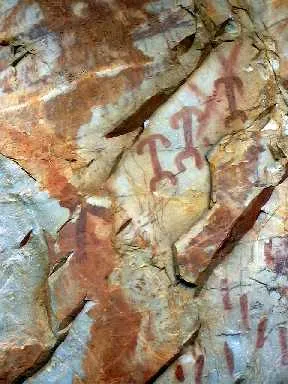
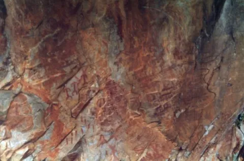
These more or less realistic but generally schematic manifestations reproduce human beings, animals and symbols, forming isolated scenes. The representations not only evoke and report part of daily life, but leave us witness to its complex v mysterious spirituality.

World Heritage Site

In Aldeaquemada, as a sample of its valuable cultural heritage, there are different groups of rock paintings, of a schematic and eulin style; distributed by fleshlands and rocky coats of the municipal term. So much so that UNESCO, meeting in Kyoto (Japan) in 1998, agreed to catalogue the Levine Rupestre Art of the Spanish Mediterranean Arc as a World Heritage Site. Meeting in assembly, he gave this important name and included in the list the 19 deposits of Rupéstre Levino and Eschematic Art discovered in this municipality, cataloguing that has come to recognize and highlight the great importance of the cultural manifestations of the former inhabitants of these lands.

Outdoor museums

These deposits, unique for their subject matter, are the most important in Andalusia and can be considered as authentic outdoor museums, of incalculable value and whose preservation concerns each and every one of us. When visiting them, we must remember with all due respect that we contemplate figures made by the primitive man; but not for that less human and intelligent, more than 4,000 years ago. They are all by law Cultural Interest Goods.
These groups of rock paintings, located on most occasions on rock coats, were studied at the beginning of the 20th century by the Abate Brehuil and M. Cabré, who catalogued the vast majority of existing groups in the area.
Subsequently, thanks to the new and relevant discoveries of the chronist Carlos Sanchez- Battle, it has been possible to have an extended relationship and a full awareness of the great heritage value that, for Aldeaquemada, represents the whole of its cave paintings.

Visit the paintings

Visiting these places is difficult and can be frustrating, not only because of their access; dangerous sometimes, but because of their poor conservation status; they make them difficult to see if they are not specialized. For this reason, before scheduling a visit, you should consult with a local connoisseur and let yourself be accompanied by a responsible local guide.
The most representative coats, on which signposted routes have been developed; not yet operational until the final protection of the paintings, but which has been announced (the Ayto. provide guides) can be visited, are those of the Poyos de La Cimbarra, Cimbarillo del Prado de Rechesa, Cave de la Mina, Garganta de la Hoz, Prado del Azogue and Cave de Los Arcos. Although there are another series of awakened groups.

Breve descripción

The Rupestre Art, "art on rock," is composed of the pictorial manifestations that our remote ancestors left on the walls of numerous covacas and petreous coats of our saws, in prehistoric times (in our region, from the Neolithic, to the Bronze Age).

Ubicación
Latitud
38.411070
Longitud
-3.374460
Distrito
Municipio
Ubicación en el mapa
POINT (-3.37446 38.41107)
Tipos de punto de interés
Imágenes carrusel
imagen
Imagen
pintlafelicita02%20%281%29.jpg
Imagen principal
Desactivado
imagen
Imagen
pintbarrancocueva%20%281%29.jpg
Imagen principal
Desactivado
imagen
Imagen
pintbarrancocueva01%20%281%29.jpg
Imagen principal
Desactivado
Imágenes cabecera
imagen
Imagen
pintpradoazogue%20%281%29.jpg
Imagen principal
Activado
Loading map
Preparing points of interest and routes...
Marcas de calidad

Recreational Area La Recta

Submitted by brandcode_deweloper on
Id
2980342
Descripción
Descripción larga

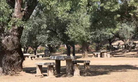
La Recta is a recreational area that has barbecues and tables and is accessed by a signposted path. Its characteristic vegetation is made up of the typical riverside forests of the Sierras de Andújar Natural Park: alarms, sargas, talles, strawberries, which serve as a refuge to faunistic species such as royal herons, zampullines, water cocks, otters. Very close is a watershed to give water to the abundant deer of this saw, next to the dam of the Encinarejo

Breve descripción

It is accessed by the road J-5010 of Andujar to the Sanctuary of the Virgin of the Head, turning left by a track leading to the New Place, very close to the Jandula River.

Telecomunicaciones
Sitio web
www.turismodeandujar.com/areas-recreativas
Teléfono de contacto
953 504 959
Correo electrónico
turismodeandujar@andujar.es
Ubicación
Código Postal
23740
Latitud
38.154730
Longitud
-4.021100
Dirección
Carretera A-6177
Distrito
Municipio
Ubicación en el mapa
POINT (-4.0211 38.15473)
Tipos de punto de interés
Imágenes carrusel
imagen
Imagen
%C3%81rea%20recreativa%20La%20Recta%202.jpg
Imagen principal
Desactivado
imagen
Imagen
%C3%81rea%20recreativa%20La%20Recta%203.jpg
Imagen principal
Desactivado
Imágenes cabecera
imagen
Imagen
%C3%81rea%20recreativa%20La%20Recta%20%281%29.jpg
Imagen principal
Activado
Microsite al que pertenece
Loading map
Preparing points of interest and routes...

Recreational Area La Aliseda

Submitted by brandcode_deweloper on
Id
5867211
Descripción
Descripción larga

It occupies a wonderful valley in the southern foothills of Sierra Morena, next to the Natural Park of Despeñacolos. Here they grow a great variety of aromatic plants and beautiful trees of different species, such as pine trees, oak trees, alcornoques, chestnuts, willows, abounding the plateau from which this place takes the name. There is also a small river of crystalline waters on a stony bed called "La Campana."

In the geological aspect, there are iron pyrite, which is why the waters of one of its many springs are ferruginous. This area where La Aliseda is located, was in its time part of a large mining center where the gallena filons abound with a lot of silver.

Breve descripción

La Aliseda is currently a recreational area of great landscape value, located in the municipal term of Santa Elena (Jaén) and five kilometres from the population centre. We can get to it on the JA-7100 district road that we will take from the motorway of Andalusia A4 at Exit 258 or 266.

Telecomunicaciones
Sitio web
www.espaciosnaturalesdejaen.com/espacios/9-area-recreativa-la-aliseda.html
Teléfono de contacto
953 401 240
Ubicación
Código Postal
23213
Latitud
38.330910
Longitud
-3.575760
Distrito
Municipio
Ubicación en el mapa
POINT (-3.57576 38.33091)
Imágenes carrusel
imagen
Imagen
13.jpg
Imagen principal
Desactivado
imagen
Imagen
11.jpg
Imagen principal
Desactivado
imagen
Imagen
10.jpg
Imagen principal
Desactivado
imagen
Imagen
natural9.jpg
Imagen principal
Desactivado
Imágenes cabecera
imagen
Imagen
14.jpg
Imagen principal
Activado
Loading map
Preparing points of interest and routes...

Recreational Area El Control Viejo

Submitted by brandcode_deweloper on
Id
880664
Descripción
Descripción larga

It is interesting to look at the species with which the recreational area and its surroundings have been repopulated. They are indigenous plants of great ecological value, such as maples, complaints and madroños. The whole area suffered a serious fire in the summer of 2005, as a result of a dry storm that unloaded hundreds of rays. In addition, a powerful natural regeneration of vegetation is taking place in the recreational area. The whole shows how right human action is when it supports nature's own regenerative capacity.

Tranco road A-319, in the surroundings of the Tranco reservoir.

Breve descripción

It is a large and recently built area with magnificent views over the northern part of the Tranco reservoir. It has banks, tables to eat and fountain.

Ubicación
Latitud
38.117026
Longitud
-2.800611
Dirección
Carretera del Tranco A-319
Ubicación en el mapa
POINT (-2.800611 38.117026)
Tipos de punto de interés
Imágenes carrusel
imagen
Imagen
Control%20Viejo%203.jpg
Imagen principal
Desactivado
imagen
Imagen
Control%20Viejo%202.jpg
Imagen principal
Desactivado
imagen
Imagen
Control%20Viejo.jpg
Imagen principal
Desactivado
Imágenes cabecera
imagen
Imagen
control-viejo.jpg
Imagen principal
Activado
Loading map
Preparing points of interest and routes...

Jabalí Recreational Area

Submitted by brandcode_deweloper on
Id
2981139
Descripción
Descripción larga

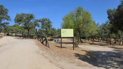
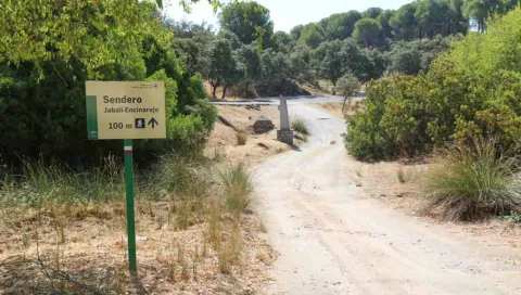
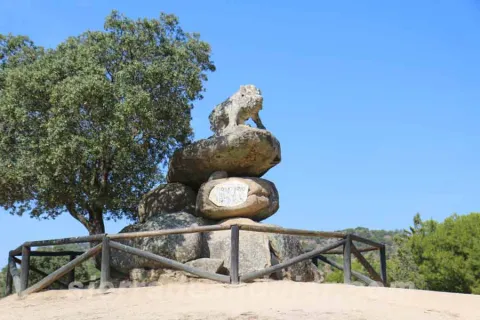
The recreational area of the Jabali is distinguished by the abundance of oak trees surrounded by pine trees, very characteristic of the Sierras de Andújar Natural Park, to which it belongs. It is perfectly equipped to celebrate a family picnic, with tables, banks, barbecues, containers, and even a fountain. His name is given by the remarkable stone sculpture of the lone boar who presides over the space, the work of local artist Luis Aldehuela. The enclave links with the path that connects El Jabali with the Encinarejo.

Breve descripción

It is accessed by the road J-5010, from Andújar to the Sanctuary Virgen de la Cabeza, diverting about 5 km. before reaching the Basilica, right on one of the road's margins. The vehicles can be parked in the same recreational area.

Telecomunicaciones
Sitio web
www.turismodeandujar.com
Teléfono de contacto
953 508 200
Correo electrónico
turismodeandujar@andujar.es
Ubicación
Código Postal
23740
Latitud
38.183160
Longitud
-4.015840
Dirección
Carretera A-6178
Distrito
Municipio
Ubicación en el mapa
POINT (-4.01584 38.18316)
Tipos de punto de interés
Imágenes carrusel
imagen
Imagen
sierra-de-andujar-42.jpg
Imagen principal
Desactivado
imagen
Imagen
sierra-de-andujar-38.jpg
Imagen principal
Desactivado
imagen
Imagen
sierra-de-andujar-40.jpg
Imagen principal
Desactivado
imagen
Imagen
sierra-de-andujar-39.jpg
Imagen principal
Desactivado
Imágenes cabecera
imagen
Imagen
sierra-de-andujar-43.jpg
Imagen principal
Activado
Microsite al que pertenece
Loading map
Preparing points of interest and routes...

Recreational Area Dehesa del Oso

Submitted by brandcode_deweloper on
Id
3964833
Descripción
Descripción larga

There are two ways to access the Bear Dehesa:

  • From the village of Onsares, you have to leave on the road to Villarrodrigo and, within 3 km, we take the forest track that leaves on our right. We follow her without taking any of the detours that go back to Onsares to the right. At 6, 5 km from the time we took this lead, we got to the recreational area.
  • From the A-310 road between Siles and La Puerta de Segura, at point 17, we take a forest track passing through the village of La Pendolera. After 14.8 km, without being separated by any detour, we reached the Dehesa del Oso. The initial section of this track passes through the area where the works of the Siles dam are currently being carried out.

If we access from Siles, it is appropriate to stop for a while in the small village of La Cañada the Lord.

The whole area is covered by an impressive black pine pineapple with oaks, complaints and dense Mediterranean bush.

From the Dehesa del Oso you can go by forest track to the village of El Bellotar, 5 km, already located in the province of Albacete. To do this, we have to follow the Cambrón route and, in which we will see at the end of 0.7 km (collado de Las Lagunillas), follow the front rather than turn right towards El Cambrón. From El Bellotar you can get off by asphalt road to the charming village of Villaverde del Guadalimar and close a circuit back to Siles.

Breve descripción

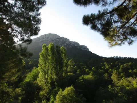
This small recreational area, next to an old forest house, is located at the foot of the Cambrón, a pétrea mole whose walls rise almost vertical on a pine sea, at the northern end of the Natural Park. The name of the place evokes the presence of the bear in these saws until the mid-18th century. There is a fountain with abundant flow, tables to eat, small meadows and beautiful walnuts. It is the starting point for climbing the Cambrón along the signposted route PR-A 173.

Telecomunicaciones
Sitio web
www.lasierradesegura.org/parajes-naturales/dehesa-del-oso/
Correo electrónico
villarrodrigo@promojaen.es
Ubicación
Código Postal
23393
Latitud
38.462640
Longitud
-2.580450
Distrito
Municipio
Ubicación en el mapa
POINT (-2.58045 38.46264)
Tipos de punto de interés
Imágenes carrusel
imagen
Imagen
2%20%281%29.jpg
Imagen principal
Desactivado
Imágenes cabecera
imagen
Imagen
image_175589.jpeg
Imagen principal
Activado
Horario
24 h.
Loading map
Preparing points of interest and routes...