Saltar al contenido principal
icon-intereses-turismo-low-cost

Route Natural del Puerto de Navatrillo

Submitted by brandcode_deweloper on
Id
2591156
Descripción larga

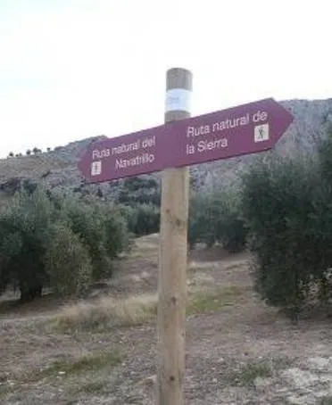
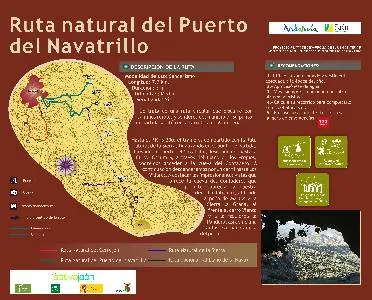
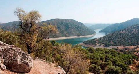
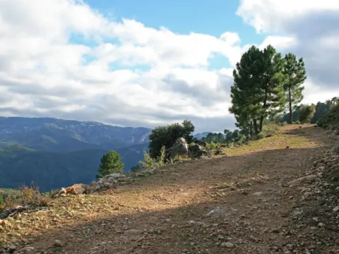
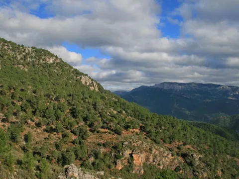
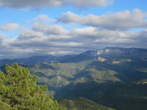
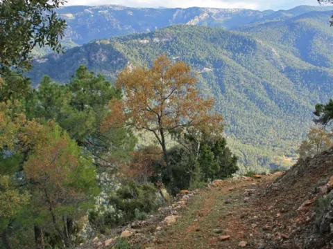
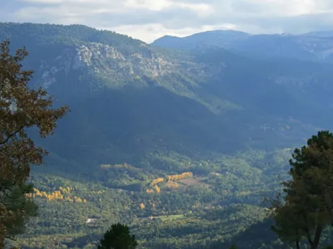
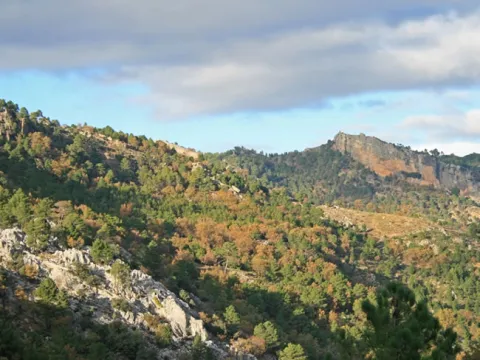
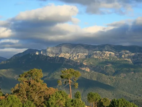
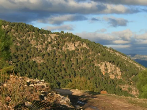
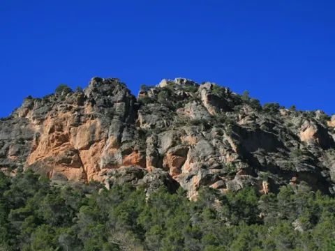
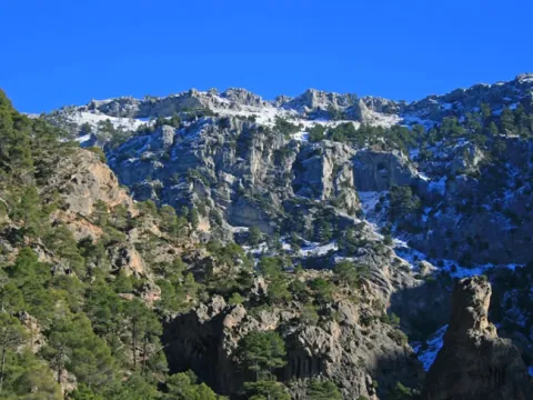
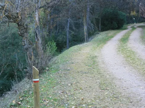
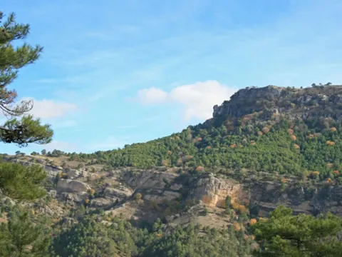
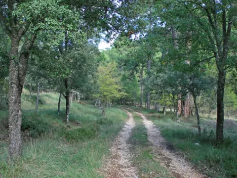
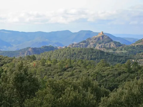
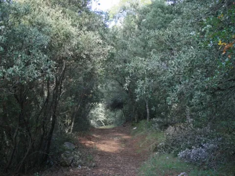
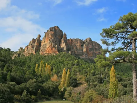
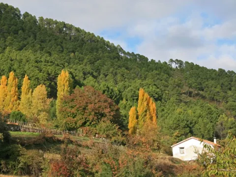
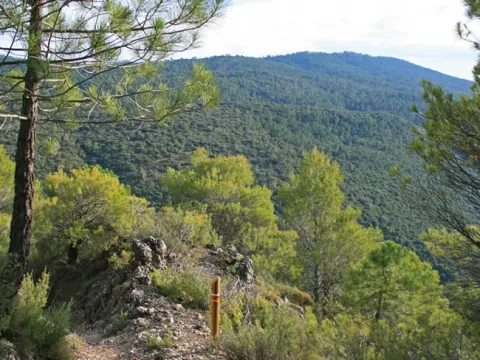
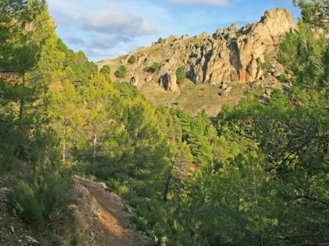
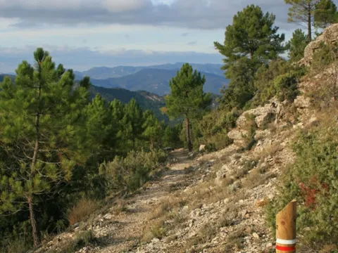
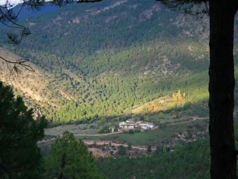
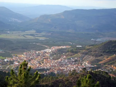
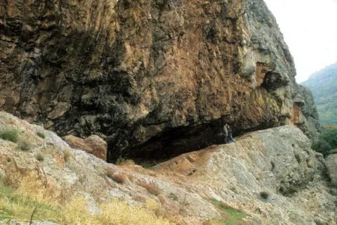
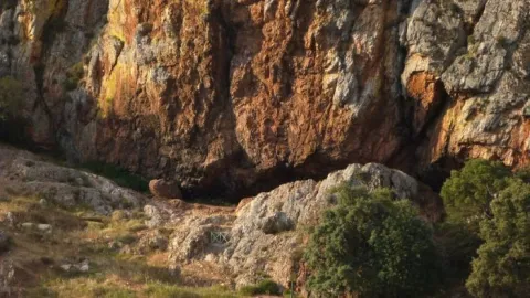
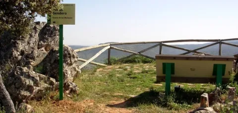
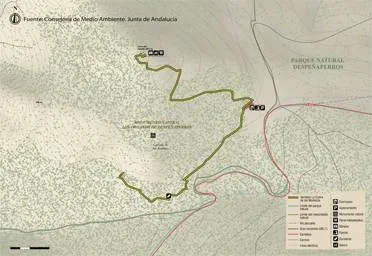
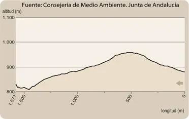
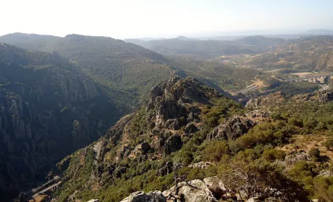
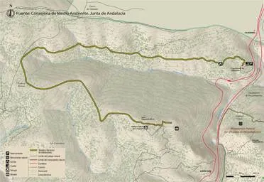
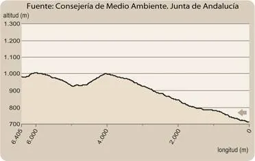
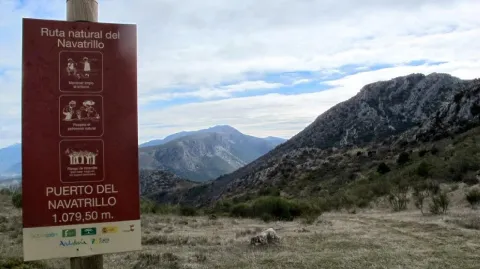
It is a circular route that runs along rural roads and trails of the municipality. Its starting point is on the Valdepeñas road, on the access lane to La Urbanización La Carrasquilla (Los Torcales lane). To the point of kilometric 3,300, the stretch is shared with the Natural Route of the Sierra, ending at the starting point. Arriving at the port of the Navatrillo, we go down to the Dark Cave and, through the Llano de los Propios, we can access the cave of the Contadero. Then we'll go down a lane to Los Villares. To highlight the impressive views of the Cave of the Contadero, which allow to appreciate to our right Jabalcuz, to the background the rock of Castro and the Sierra la Grana, to the front of the Mount Wind and to the left the Pandera, as well as a fantastic panoramic of the village.

Breve descripción

It is a circular route that runs along rural roads and trails of the municipality.

Latitud
37.7601
Longitud
-3.5003
Distrito
Municipio
Ubicación en el mapa
POINT (-3.5003 37.7601)
imagen
Image
3413300Master.jpg
Imagen principal
Activado
imagen
Image
Ruta%20Natural%20del%20Puerto%20de%20Navatrillo.jpg
Imagen principal
Desactivado
3 h

Nature

icon-intereses-naturaleza

Friends

icon-intereses-amigos

Adventure

icon-intereses-aventura

Culture

icon-intereses-cultura

Sport

icon-intereses-deporte

Eco-friendly

icon-intereses-eco-friendly

For couples

icon-intereses-en-pareja

Family

icon-intereses-familia

Gastronomy

icon-intereses-gastronomia

Municipality

icon-intereses-municipio

Low-cost tourism

icon-intereses-turismo-low-cost

Solo travel

icon-intereses-viajar-solo
Medium
Image
b212551f-6a80-444a-b4a8-aa9f9726c98e?t=1589203992521
Ruta Natural del Puerto de Navatrillo
7,7 km
All year round
Desactivado

- Use comfortable shoes and dress suitable for the time of year.
- Hold on to water.
- Always go with another or other hikers.
- Calculate your route to complete before sunset.
- In case of an accident, call the emergency number 112.

Valdepeñas road.

Tramo de asfalto o cemento
 
Tramo de pista o camino forestal
 
Tramo de vía pecuaria
 
Tramo de senda
 

Route Natural del Cerrejón

Submitted by brandcode_deweloper on
Id
2585128
Descripción larga

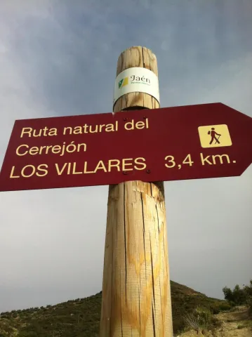
It is a circular route that runs in its entirety on rural roads and has as its starting point the path of access to the municipal building, in the city centre, ending in the Mirador del Molino del Rey, also in Los Villares. The first 500 m., looking behind our back, we can see a beautiful panorama of Los Villares, the Canjorro, as well as the Peña de Castro. Continuing the ascent, we will leave the municipal landfill and the Pedregoso River to our right. From the Casería de la Venta we descend, through a partially paved road, to the area of Los Molinos, by the river Frio. On the left bank of the river, we will pass through a fountain located just on foot, about 500 meters before the end of the itinerary. The route of the Cerrejon ends in the parking lot, which is located next to the Mill of the King.

Latitud
37.7902
Longitud
-3.4604
Distrito
Municipio
Ubicación en el mapa
POINT (-3.4604 37.7902)
imagen
Image
Ruta%20Natural%20del%20Cerrej%C3%B3n%20%281%29.jpg
Imagen principal
Activado
imagen
Image
turismoActivo1.jpg
Imagen principal
Desactivado
1 h 30 min

Nature

icon-intereses-naturaleza

Friends

icon-intereses-amigos

Adventure

icon-intereses-aventura

Culture

icon-intereses-cultura

Sport

icon-intereses-deporte

Eco-friendly

icon-intereses-eco-friendly

For couples

icon-intereses-en-pareja

Family

icon-intereses-familia

Gastronomy

icon-intereses-gastronomia

Municipality

icon-intereses-municipio

Low-cost tourism

icon-intereses-turismo-low-cost

Solo travel

icon-intereses-viajar-solo
Baja
Image
74e9f9e5-b35d-33eb-a75a-0bc9d83133f5?t=1589202824829
Ruta Natural del Cerrejón
3,7 km
All year round
Desactivado

- Use comfortable shoes and dress suitable for the time of year.
- Always go with another or other hikers.
- Calculate your route to complete before sunset.
- In case of an accident, call the emergency number 112.

Route Natural de La Sierra

Submitted by brandcode_deweloper on
Id
2579303
Descripción larga

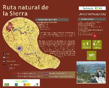
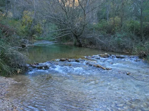
The Natural Route of the Sierra runs along rural roads and trails of the municipality. Its starting point is on the road of Valdepeñas A-6.060, on the road of access to La Urbanización La Carrasquilla (lane of Los Torcales), ending on the same road at the height of Rio Frio. After leaving the Port of Navatrillo, to the left, we will ascend to the Llano de Gamonaz, passing through the rock of Beltran, which is left to our left. When we reach the ravine called the Neveros, we will be diverted along the road that leads to the Port of Hoya from Otiñar. From the Port of the Hoya we begin the descent by a lane that connects with the exit of the Pancorbo retreat, in the vicinity of the Cold River.

Breve descripción

In much of its journey, the Natural Way of La Sierra runs along two rivers: the Guadalporcún and the Guadalete. Both in perfect conservation, have a common denominator with the rivers of the southern Iberian Peninsula: their name, which begins with guadal.

Latitud
37.7803
Longitud
-3.4801
Distrito
Municipio
Ubicación en el mapa
POINT (-3.4801 37.7803)
imagen
Image
rutas-sierra-andujar.jpg
Imagen principal
Activado
imagen
Image
Ruta%20Natural%20de%20La%20Sierra.jpg
Imagen principal
Desactivado
4 h

Nature

icon-intereses-naturaleza

Friends

icon-intereses-amigos

Adventure

icon-intereses-aventura

Culture

icon-intereses-cultura

Sport

icon-intereses-deporte

Eco-friendly

icon-intereses-eco-friendly

For couples

icon-intereses-en-pareja

Family

icon-intereses-familia

Gastronomy

icon-intereses-gastronomia

Municipality

icon-intereses-municipio

Low-cost tourism

icon-intereses-turismo-low-cost

Solo travel

icon-intereses-viajar-solo
Alta
Image
577003b6-0362-77b8-767f-b7df4c1d272d?t=1589201888703
Ruta Natural de La Sierra
9 km
420m
710m
1
1
1
4
All year round
Desactivado
29

- Use comfortable shoes and dress suitable for the time of year.
- Hold on to water.
- Always go with another or other hikers.
- Calculate your route to complete before sunset.
- In case of an accident, call the emergency number 112.

Tramo de asfalto o cemento
 
Tramo de pista o camino forestal
 
Tramo de vía pecuaria
 
Tramo de senda
 

ALTERNATIVE GR 247.2 STAGE 2: Coto Ríos - Forestrand House Refuge La Zarza

Submitted by brandcode_deweloper on
Id
2579107
Breve descripción

The Guadalquivir Valley, in its main section, is the protagonist of this stage, because we will tour it during the first section and see it from the heights during the second. The route leaves the town of Coto Ríos and very soon passes a few meters from the great river of Andalusia. Then we will reach the Borosa River, at the starting point of the spectacular road that goes back to it, without a doubt the most popular of the Natural Park.

In the surroundings of the Guadalquivir - Rio Grande, as the Muslims called it - there are a number of public equipment that are among the most attractive in the Park: the Torre del Vinagre Visitors Center, the Botanical Garden of the same name and the Rio Borosa Visitors Center. This area is the most crowded and visited area of the Park, and although it can be massified on high dates, it is worth taking advantage of the resources offered to us to inform us, understand the natural values of the territory we are going through or simply take a quiet walk between the lush vegetation of the Botanical Garden.

Later on the route leaves the bottom of the Valley and ascends along the slopes of its left side, entering in pinars with closed Mediterranean forest.

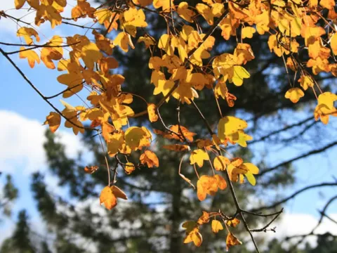
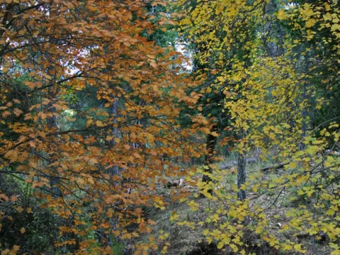
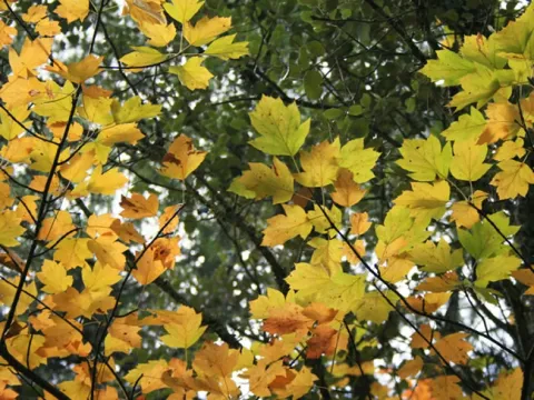
Several are the attractions of this second part of the route: the spectacular panorama on the Guadalquivir Valley that open as we go to gain height; the mixed forests that we cross in some sections, where the large larice pines and the oak trees are mixed with trees of a caduca leaf as oaks (complaints), maples and pears of mountain (Sorbus tormentinalis), which are dressed in yellow and orange in autumn; and the high possibility of watching most of the species of large wild ungulates that give fame to the Park, such as deer, boars, and goats.

The Stage ends in the Refuge enabled in the Forest House of La Zarza, a strategic place, not only by the beautiful panoramic ones that from its surroundings can be seen, but also because it is the starting point or the arrival of the South Forest Path's 9 and 10, the first to the Sierra de

The Villas and the second to the villages of La Iruela and Cazorla.

Latitud
37.9103
Longitud
-2.9497
Distrito
Municipio
Ubicación en el mapa
POINT (-2.9497 37.9103)
imagen
Image
1.jpg
Imagen principal
Activado
imagen
Image
2.jpg
Imagen principal
Desactivado
imagen
Image
3.jpg
Imagen principal
Desactivado
imagen
Image
4.jpg
Imagen principal
Desactivado
imagen
Image
5.jpg
Imagen principal
Desactivado
imagen
Image
6.jpg
Imagen principal
Desactivado
imagen
Image
7.jpg
Imagen principal
Desactivado
imagen
Image
8.jpg
Imagen principal
Desactivado
imagen
Image
9.jpg
Imagen principal
Desactivado
imagen
Image
10.jpg
Imagen principal
Desactivado
imagen
Image
11.jpg
Imagen principal
Desactivado
imagen
Image
12.jpg
Imagen principal
Desactivado
imagen
Image
13.jpg
Imagen principal
Desactivado
imagen
Image
14.jpg
Imagen principal
Desactivado
imagen
Image
15.jpg
Imagen principal
Desactivado
imagen
Image
16.jpg
Imagen principal
Desactivado
imagen
Image
17.jpg
Imagen principal
Desactivado
imagen
Image
18.jpg
Imagen principal
Desactivado
imagen
Image
19.jpg
Imagen principal
Desactivado
5 h 41 min

Nature

icon-intereses-naturaleza

Friends

icon-intereses-amigos

Adventure

icon-intereses-aventura

Culture

icon-intereses-cultura

Sport

icon-intereses-deporte

Eco-friendly

icon-intereses-eco-friendly

For couples

icon-intereses-en-pareja

Family

icon-intereses-familia

Gastronomy

icon-intereses-gastronomia

Municipality

icon-intereses-municipio

Low-cost tourism

icon-intereses-turismo-low-cost

Solo travel

icon-intereses-viajar-solo
Medium
Coto Ríos - Refugio Casa Forestal La Zarza
15,75 km
640m
701m
78m
2
1
2
3
On foot
All year round
Activado
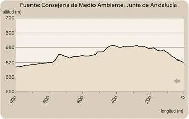
The path from the vicinity of Torre del Vinagre to La Zarza (kilometer 6.4) has about 400 meters with a strong slope.
Coto Ríos, Loma de María Angela, beginning of the route of the Borosa, fountain in front of the Visitors Center Rio Borosa, Visitors Center Rio Borosa, Visitors Center Torre del Vinagre, near the Refugio Casa Forestal de la Zarza.

On the path: Coto Ríos
Near the path: Cold Arroyo

In the beginning: there is no. In the end: Refugio Casa Forestal de la Zarza.

The carnivorous mammals of the Natural Park

It will be rare for the walker, if he is attentive, not to see any of the representatives of the famous group of the great herbivores of the Park on any route from GR 247. But you will have to be very lucky to see the members of the select group of carnivorous mammals: cunning, effective, very specialized, and extraordinarily discreet, almost nocturnal, beings found at the top of the complex and abigarated trophic pyramid of the Park.

It is likely that sooner or later the senderist will see some fox, even if it is right at the time he sets the land in between. It will be more difficult to see a gin, that big, long-tailed jumper and climber with black and white rings. Or a badger, with a gordinflon teddy look with a whitish mask.

Or a chickpea, or chickpea, as they call it around here, who never had much sympathy for these lands given their love for chickens and other poultry. It is very lucky to have to see a weasel, the smallest and most hyperactive of the four-legged hunters, and who can be considered to be touched by some divine design is the walker to whom a mountain cat appears before his eyes. A real mountain, with its voluminous head, its powerful fangs and its large anilated tail, well different from the frequent cats hybrided with domestic copies.

Agiles, cunning, silent and almost always "out of plan," these animals are the true champions of the fauna of the Park next to their winged pairs, the rapaces, you are yes, much more visible. The existence and abundance of each other is the most forceful demonstration that life flows through the Natural Park, as there are no hunters without prey, or prey without... etc.

Coto Ríos

La Zarza Forest House Refugio

Coordenadas / Huso 30S
According to Projection UTM Datum ETRS89
Tramo de asfalto o cemento
20.85%
Tramo de pista o camino forestal
67.55%
Tramo de vía pecuaria
0
Tramo de senda
11.6%

Route card

Km 0

Coto Ríos

Esta Etapa comienza en el poblado de Coto Ríos. Es muy sencillo encontrar el panel de inicio, ya que la aldea es pequeña y sus calles tienen trazado rectilíneo: si miramos la aldea desde la parte de abajo, es decir, desde el Guadalquivir, hay que ir por cualquier calle a la parte situada más arriba y más a la derecha.

Junto al panel veremos una puerta, que deberemos cerrar a nuestro paso, que da acceso a un ameno camino asfaltado. Este transita por una estrecha y fértil vega regada por el agua del Guadalquivir, entre huertos y frutales. A los 500 metros acaba el asfalto y a la derecha seguimos viendo algunos bancales sin labrar y olivos aislados, mientras a lo lejos se alzan las montañas de la Sierra de Las Villas. Por nuestra izquierda tenemos un bosque de pino carrasco con abundantes encinas.

En el kilómetro 1,1 hay que abrir y cerrar una nueva puerta y enseguida vemos, abajo a la derecha, el Río Guadalquivir, al que un poco más adelante podemos bajar sin ninguna dificultad. La arboleda es muy variada, pues a los pinos y encinas se suman quejigos (robles), chopos y grandes fresnos. Nos sorprenden, incluso, algunos acebos.

Hay también mucho lentisco y algunos arces de Montpellier (Acer monspessulanum). La heterogeneidad y variedad de esta hermosa arboleda se debe, por un lado, a la combinación de la baja altitud de la zona con la humedad que aporta la cercanía del río, y por otro, a la mezcla de especies de origen espontáneo con otras de origen antrópico, es decir, plantadas o favorecidas por el ser humano.

Los caminos por los que va esta primera parte de nuestra ruta tienen un aspecto diverso, tanto en anchura como en firme. El último tramo antes de llegar a la aldea de La Loma de María de María Ángela es más estrecho y tiene mayor pendiente. En el kilómetro 3,3 cruzamos un arroyo y 200 metros después hay que abrir y cerrar una última puerta. Enseguida, entre grandes encinas, llegamos al siguiente hito de la Etapa.

Km 3,6

Loma de María Ángela

La ruta pasa por medio de esta pequeña población, en un privilegiado enclave rodeado de montañas, y donde encontraremos a la izquierda la Fuente Puchardo. Salimos bajando por la pequeña carretera asfaltada que da acceso a la aldea entre huertos y pequeños olivares.

Km 4,6

Piscifactoría del Río Borosa

Llegamos al Río Borosa, uno de los más bellos y salvajes afluentes que vierten sus aguas al Guadalquivir en su tramo de cabecera. Es un cruce importante porque coincide con el inicio de la espectacular ruta del Borosa, la más popular del Parque Natural. Esta ruta se inicia en el aparcamiento que encontramos a la izquierda –donde hay una fuente- y está señalizada por la Consejería de Medio Ambiente de la Junta de Andalucía hasta su final en el Salto de Los Órganos.

Hay que reseñar que nuestra Etapa coincide desde Coto Ríos hasta la piscifactoría con el GR 7, que aquí se separa remontando por la ruta del Borosa y solapándose con ella hasta el Puente de los Caracolillos.

También es destacable que el primer tramo de esta ruta, concretamente hasta el Arroyo de Las Truchas, de poco más de 1 kilómetro, es apto para las personas de movilidad reducida, ya que apenas tiene desnivel y va por pista forestal con buen firme cerrada al tráfico de vehículos privados a motor. Por otra parte, es interesante saber que la citada ruta del Borosa está considerada de especial interés ornitológico, de lo cual nos informa un panel situado en su inicio.

Desde el cruce de la piscifactoría que hemos comentado nuestra Etapa gira a la derecha, siguiendo por camino asfaltado y cruzando el puente sobre las bravas aguas del Río Borosa. Dejamos a la derecha la piscifactoría y a la izquierda una fuente. A los 200 metros queda a la derecha el Centro de Visitantes Río Borosa, que dispone de un amplio aparcamiento.

En este Centro podremos conocer la importancia del agua y de los ecosistemas fluviales en el Parque Natural, en los que destacan especies emblemáticas como la trucha común y la nutria.

Nuestra ruta continúa en compañía de grandes quejigos y cruza el Guadalquivir, que aquí está bastante remansado y flanqueado por una bien conservada vegetación de ribera. Un poco más adelante llegamos al emblemático paraje de Torre del Vinagre.

Hay que remarcar que este tramo de 1,7 kilómetros entre la piscifactoría del Borosa y Torre del Vinagre no tiene marcas ni balizas, ya que la Consejería de Medio Ambiente tiene prevista la creación de un nuevo sendero de uso exclusivamente peatonal que uniría ambos puntos y por el que transitaría el Sendero Bosques del Sur.

De todas formas, la ruta que hemos descrito por el actual camino asfaltado no tiene pérdida, además de que es muy transitada.

La ruta del Borosa como variante para subir a Collado Bermejo en la Etapa 15

La popular Ruta del Borosa, y su continuación hacia las Lagunas de Valdeazores y Collado Bermejo, aunque no pertenece al GR 247, puede utilizarse como variante para subir hasta la Etapa 15. La ruta está señalizada por la Consejería de Medio Ambiente hasta La Central Eléctrica. Pero la ruta puede continuarse hacia arriba, sin pérdida posible, por el túnel de la central hidroeléctrica de Los Órganos y las famosas Lagunas de Valdeazores, y después hasta Collado Bermejo por senda que no tiene pérdida y es bastante transitada.

Es preciso estar atentos a posibles desprendimientos en el tramo anterior a los túneles. Una vez en el Collado ya hemos enlazado con la Etapa 15 del Sendero Bosques del Sur, a 3,4 kilómetros del Refugio Casa Forestal Fuente Acero. Desde la piscifactoría del Borosa hasta Collado Bermejo hay en total 16,5 kilómetros de distancia y un desnivel total de 880 metros. Esta ruta, de extraordinaria belleza, puede utilizarse, por tanto, como una cuarta variante transversal del Sendero Bosques del Sur.

Km 6,3

Centro de Visitantes de Torre del Vinagre

El camino asfaltado desemboca en la carretera A-319, que recorre el Valle del Guadalquivir y el Embalse del Tranco, siendo el eje de comunicación más visitado del Parque Natural. A la derecha del cruce tenemos dos lugares de imprescindible visita y entrada gratuita.

El primero es el Centro de Visitantes Torre del Vinagre, el más importante y mejor dotado del Parque, que ofrece información y cuenta con variados recursos interactivos, muy atractivos para orientar comprender los principales valores del espacio protegido que estamos recorriendo. Tiene una tienda del Parque Natural, aseos, cafetería, sala de proyección de audiovisuales y zona de juego infantil en el exterior.

El segundo lugar está situado unos metros más allá y es el Jardín Botánico de Torre del Vinagre. Este cuidado vergel cuenta con una amplia selección de plantas del Parque Natural, desde pequeñas herbáceas hasta grandes árboles. Es un lugar perfecto para observarlas y aprender a distinguirlas o, simplemente, para darse un placentero paseo entre exuberante vegetación. Su visita ayuda a entender por qué la extraordinaria riqueza botánica de estas sierras es uno de los principales motivos por las que están declaradas como espacio natural protegido.

Si no nos desviamos hacia estos lugares, nuestra ruta continúa girando a la izquierda en la carretera A-319, que abandonamos 100 metros más adelante por una senda bien señalizada que sale a la derecha, ascendiendo a contramano. A partir de aquí el ambiente cambia por completo. Dejamos las zonas humanizadas –incluso, en ocasiones, masificadas, como ocurre entre el Borosa y Torre del Vinagre- para internarnos en el bosque ganando altitud sobre el Valle del Guadalquivir.

La senda se retuerce con bastante pendiente por un pinar, bajo el que crece un denso sotobosque mediterráneo, con mucho lentisco, y en el que hay magníficos quejigos (robles) dispersos. Conviene, durante los primeros 500 metros de este tramo, ir pendientes de las numerosas balizas que lo jalonan. En el kilómetro 6,8 la senda se convierte en un camino más ancho, girando a la izquierda, que pronto llanea.

A esta altura habremos ganado ya unas magníficas vistas sobre las montañas del lado de enfrente del Valle del Guadalquivir, es decir, de su vertiente derecha, y de las grandes elevaciones de la Sierra de Cazorla que lo cierran al frente. Todo el monte que vamos a recorrer hasta el final de la Etapa es muy rico en fauna, por lo que es frecuente ver ciervos, cabras monteses, jabalíes, etc. El camino se transforma poco más adelante en pista forestal.

Km 7,9

Pista forestal a La Zarza

La pista por la que caminamos sale en este punto a otra más ancha que tomamos hacia el frente, encontrando al poco una valla que impide el paso a los vehículos. Seguimos estando en medio de un pinar de pino carrasco con abundantes encinas y quejigos, y a la izquierda dejamos el Barranco del Arroyo de la Torre del Vinagre y el cortijo del mismo nombre.

A partir del kilómetro 10 comenzamos de nuevo a disfrutar de vistas espectaculares, ya que, en adelante, la pista se convierte de manera intermitente en un maravilloso balcón sobre el Valle del Guadalquivir. Las vistas dejan de obtenerse en los tramos en los que la ruta se interna en los pliegues y barrancos de la ladera, pero a cambio, en estas zonas, disfrutamos de un ambiente boscoso especialmente frondoso y acogedor. En el kilómetro 9,7 ignoramos una pista que sale a la derecha.

Km 10,2

Collado de los Corzos

La ruta, que durante el último tramo ha venido girando hacia el norte para rodear Los Torcalillos, alcanza el Collado de los Corzos, donde gira bruscamente al oeste para recuperar su dirección paralela al Valle del Guadalquivir. Merece la pena parar para contemplar unas panorámicas memorables. El nombre del lugar, además, nos recuerda a una de las especies más importantes de la fauna de estas sierras que se extinguió a mediados del siglo XX.

En el año 1952 se hizo un intento de repoblación con la suelta de diez ejemplares, pero la experiencia fracasó. La reintroducción de este animal fue uno de los objetivos del Parque Natural desde su creación en 1986, pero, a pesar de la realización de varios estudios técnicos, hasta el momento no ha sido abordada.

Continuamos la ruta descartando en el kilómetro 10,5 una nueva pista que llega a la nuestra por la derecha, a contramano. Los pinos carrascos y negrales van siendo sustituidos por los esbeltos pinos laricios según ganamos altitud, y en los tramos más abrigados de la ladera la ruta discurre inmersa en un rico bosque mixto, de gran relevancia ecológica y belleza paisajística, en el que los pinos y encinas están mezclados con árboles de hoja caduca como quejigos (Quercus faginea), perales de monte (Sorbus torminalis), arces granadinos (Acer granatense) y arces de Montpellier (Acer monspessulanum), que adquieren en otoño su máximo esplendor cromático.

A partir del kilómetro 13,5 disfrutamos de nuevo de sensacionales vistas, presididas hacia el este por la impresionante mole rocosa de Las Banderillas, y hacia el sur por las Sierras de Cazorla y del Pozo, cuyas altas cumbres ciñen el fondo de una profunda perspectiva cuyo eje es siempre el Valle del Guadalquivir.

Unos 250 metros antes de llegar al final de nuestra Etapa está la fuente de la que se servía la antigua Casa Forestal de La Zarza. No se ve desde el camino, pero el lugar es fácil de identificar porque veremos a nuestra izquierda un amplio claro, bastante llano y con restos de pequeños aterrazamientos de piedra seca, hechos en su momento para allanar el terreno y facilitar su labranza. Atravesamos el claro hasta un pequeño abarrancamiento y allí mismo encontraremos un tornajo de madera y otro abrevadero de obra con la fuente.

Siguiendo nuestra ruta, un poco más adelante veremos a la derecha, a contramano, el cruce con el camino por el que discurre la Etapa 9 del Sendero Bosques del Sur, que viene del Refugio de Majalserbal en la Sierra de Las Villas.

Km 15,7

Refugio Casa Forestal de La Zarza

Alcanzamos el final de la Etapa, que coincide con el de la citada Etapa 9 y el comienzo de la 10 hacia La Iruela. La Casa Forestal está situada en un lugar privilegiado por sus vistas hacia la Cordillera del Banderillas y el Valle del Guadalquivir, flanqueado por espectaculares montañas.

Desde la Casa Forestal parte un sendero señalizado que no forma parte del GR 247, pero cuyo recorrido es muy recomendable, sobre todo en su tramo inicial, que es muy panorámico.

Se trata de un viejo camino de herradura de 3 kilómetros que baja con bastante pendiente hasta el fondo del Valle del Guadalquivir, pasando por el Barranco de la Tuerta, el Arroyo del Saúco y Los Huertezuelos. El sendero finaliza en la carretera A-319 a la altura del kilómetro 43, es decir, a unos cinco kilómetros de Torre del Vinagre.

ALTERNATIVE GR 247.2 STAGE 1: Refuge Campo del Espino - Coto Ríos

Submitted by brandcode_deweloper on
Id
2577928
Breve descripción

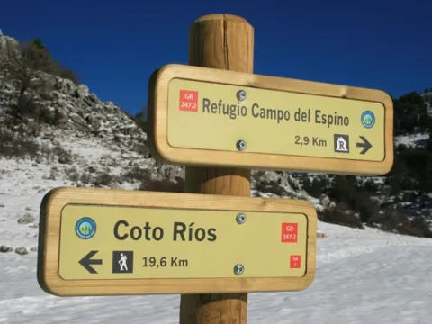
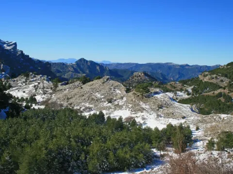
This long stage of the GR 247 is very special because it runs across the very heart of the Natural Park, down from the severe and imposing altiplanicie of Los Campos de Hernán Perea, to 1700 meters of altitude, to the Valle del Guadalquivir, to 1000 meters less altitude. This allows you to enjoy strong landscape contrasts that are a good exponent of the diversity of environments of these saws.

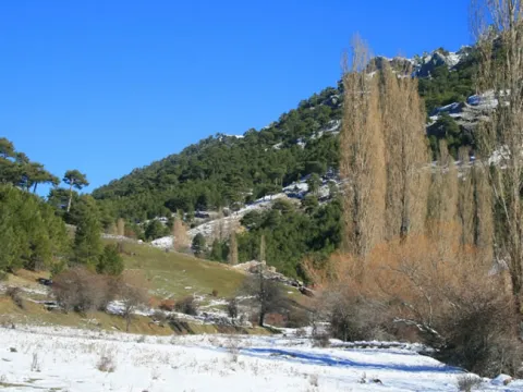
We will begin the route in the high-rise grasslands of Los Campos, with wide panoramic and clear skies. We will go down from there to the village of La Hoya de La Albardia, unpopulated, in a collection and beautiful Vega surrounded by mountains.

Then we will take a path that goes down a deep ravine covered with pine trees to another emblematic place of the Natural Park, the corrijada of La Fresnedilla, at the foot of the impressive farallions of the Banderillas, and that was the stage of the resistance of the last inhabitant of these places, Máximo Fernández Cruz, nicknamed "El Cojo de la Fresnedilla," against the forced expulsion of the people who lived in these valleys until the 1960s of the 20th century.

Later the route runs next to the Aguamulas River, one of the first tributaries of the Guadalquivir mountain, of clean and wild waters, where it champions the common trout and jumps the aquatic myrtle from rock to rock. Always immersed in the forest, we will accompany this river to its mouth in the Guadalquivir. Then we will walk in a small way near the latter, the great river of Andalusia, which here is still very young, but with wider channels and more quiet waters than its tributary the Aguamulas.

La Etapa ends in the village of Coto Ríos, a pleasant and quiet place on the banks of the Guadalquivir, located in a very strategic place from the tourist point of view and place of start of the second stage of this Variant, which will take us to the opposite side of the Guadalquivir Valley.

By going through some of the less inhabited and more abrupt places in the Natural Park, our route is an excellent scenario - if luck is with us - to see closely we, deer, muflons, boars and mountain goats, as well as vultures and various rapacious birds, not forgetting that we can have the fortune to see some of the broken bones that have been reintroduced into the Park.

Latitud
38.0601
Longitud
-2.6302
Distrito
Municipio
Ubicación en el mapa
POINT (-2.6302 38.0601)
imagen
Image
refugio-campo-del-espino-jpg
Imagen principal
Activado
imagen
Image
2.jpg
Imagen principal
Desactivado
imagen
Image
3.jpg
Imagen principal
Desactivado
imagen
Image
4.jpg
Imagen principal
Desactivado
imagen
Image
5.jpg
Imagen principal
Desactivado
imagen
Image
6.jpg
Imagen principal
Desactivado
imagen
Image
8.jpg
Imagen principal
Desactivado
imagen
Image
10.jpg
Imagen principal
Desactivado
imagen
Image
11.jpg
Imagen principal
Desactivado
imagen
Image
12.jpg
Imagen principal
Desactivado
imagen
Image
14.jpg
Imagen principal
Desactivado
imagen
Image
17.jpg
Imagen principal
Desactivado
imagen
Image
18.jpg
Imagen principal
Desactivado
imagen
Image
20.jpg
Imagen principal
Desactivado
imagen
Image
21.jpg
Imagen principal
Desactivado
imagen
Image
22.jpg
Imagen principal
Desactivado
imagen
Image
24.jpg
Imagen principal
Desactivado
imagen
Image
25.jpg
Imagen principal
Desactivado
5 h 55 min

Family

icon-intereses-familia

Friends

icon-intereses-amigos

Nature

icon-intereses-naturaleza

Adventure

icon-intereses-aventura

Solo travel

icon-intereses-viajar-solo

Culture

icon-intereses-cultura

Gastronomy

icon-intereses-gastronomia

Sport

icon-intereses-deporte

Municipality

icon-intereses-municipio

Low-cost tourism

icon-intereses-turismo-low-cost

Eco-friendly

icon-intereses-eco-friendly

For couples

icon-intereses-en-pareja
Medium
Refugio Campo del Espino - Coto Ríos
22,5 km
1085m
154m
1182m
2
1
2
3
On foot
All year round
Activado
The Stage runs on a path between the km 2.9 and 8.4, where some sections with a strong slope will be found, especially in the last 700 meters.
Refugio Campo del Espino (aljibe), Casa Forestal de Los Bonal, Coto Ríos

On the path: Coto Ríos
Near the path: No

At the beginning: Campo del Espino Refuge. In the end: there is no.

The tornajos: an ethnographic heritage and a habitat for the fauna that is lost

In this and other stages of GR 247 the senderist will see old tornajos made in pine that are very characteristic of these mountain landscapes, especially in the high areas where the sheep abound.
The tornajos are veneers that were made by smoking a pine, which was placed next to a fountain or spring in the middle of the mountain to retain the circulating water and facilitate its availability for the livestock. The pine used was salgareño, which is what is called the laricio pine (Pinus nigra sp. nigra). The set of several tornajos, arranged for some to pour on others, is called tornajera.

The usual thing in other parts of Spain is that these barnacles were built with stone, but here the pine was always more successful, both for its availability and for its resistance, as long as the tornachus has water, its cracks are closed by the dilation of the wood and it lasts decades.

Little by little, the traditional Turnips of the Sierras are disappearing. This means that culture, landscape and biodiversity are lost. Many of them have been replaced, first, by cement pits, and then, by metal, with a chirping aesthetic.

With every tornachus lost, a portion of the livestock culture and its artisan crafts is gone. There goes an element that gives character and personality to the mountain landscape.

The print and memory of the people who have modeled that landscape is gone. It even leaves a little bit of our natural heritage, because each tornachus is a small ecosystem that makes its best use of that magical and always scarce element that is water: these small wooden balsas are a paradise for the amphibians, including the small Iberian midwifery (Alytes dickhillini), an exclusive species of the Iberian southeastern saws whose trellas thrive happily in the tornachs, but they are cooked in the metal aberrates.

In short, tornajos are a small, but significant exponent of all the good that happens when there is tune between man, nature and culture, at the bottom, three ways to say the same.

Resugio Campo del Espino

Coto Ríos

Coordenadas / Huso 30S
According to Projection UTM Datum ETRS89
Tramo de asfalto o cemento
0.44%
Tramo de pista o camino forestal
75.11%
Tramo de vía pecuaria
0
Tramo de senda
24.45%

Route card

Km 0

Refugio de Campo del Espino

La Etapa comienza en el refugio de pastores de Campo del Espino, a 1700 metros de altitud, en medio de la imponente altiplanicie de Los Campos de Hernán Perea, el reino de la oveja de raza segureña, un vasto territorio con una elevada altitud y casi desarbolado. Iniciamos la Etapa siguiendo el camino señalizado en dirección noroeste, teniendo a nuestra derecha la cuerda montañosa de Pinar del Risco, de laderas escarpadas cubiertas por pinos laricios, y al que nos vamos aproximando de manera oblicua.

Al cabo de 1,2 kilómetros pasamos una barrera que impide el paso a vehículos. Las vistas son amplísimas.A partir del kilómetro 2,2 caminamos por una cañada, siendo el camino menos panorámico que antes, y apareciendo pinos dispersos y enebros rastreros.

Km 2,9

Hoya del Ortigal

Llegamos a este pequeño llano rodeado de cerros donde hay un importante cruce señalizado de caminos. Hacia el norte, siguiendo el GR 7, iríamos hacia el Nacimiento del Río Segura y Pontones. Una parte de ese camino, desde el fantástico Mirador de Juan León hasta cerca del Nacimiento, está incluido en el GR 247 como Derivación 6. Nuestra ruta, sin embargo, continúa hacia el oeste, coincidiendo con el GR 7 hasta Coto Ríos.

Al atravesar la hoya pasamos otra barrera y el paisaje cambia radicalmente. Comenzamos a internarnos en el bosque, abandonando la severa sobriedad de Los Campos para iniciar un largo descenso que acabará en el Valle del Guadalquivir, a unos 1000 metros menos de altitud. Comenzamos el descenso por una estrecha cañada entre rocas y pinos. Abunda el majuelo y aparecen algunos arces, mientras en el cielo es fácil ver buitres y algunos muflones pueden sorprendernos.

En el kilómetro 3,5 finaliza la cañada y, según el camino vira hacia la derecha, las vistas se hacen mucho más amplias, teniendo en primer plano los picos de la Morra de Las Hormigas y La Molata, ambos de algo más de 1600 metros de altitud, hacia el suroeste los farallones del Banderillas y al oeste, a lo lejos, la Sierra de Las Villas, al otro lado del Guadalquivir.

Abajo, a nuestra izquierda, aparece la aldea despoblada de La Hoya de Albardía, por la que pronto pasaremos. En el kilómetro 3,9 encontramos un hermosísimo tornajo, hecho con varios troncos de pino laricio, grandes y rectos, con los que antiguamente se hacían los abrevaderos para el ganado de manera artesanal.

Es un buen lugar para aprovisionarse de agua. En el kilómetro 4,3 abandonamos el camino que llevamos y giramos bruscamente a la izquierda para bajar a la aldea. Si siguiéramos de frente, en dirección norte, iríamos hacia el Collado de Los Frailes, y más allá se bajaría hasta el excepcional paraje de la aldea de Los Centenares, también despoblada, a través de sendas por las que no conviene aventurarse si no se conocen.

Esta aldea, como las de Los Miravetes y Las Canalejas, todas despobladas, constituyen no solo unos parajes de belleza inenarrable, sino también importantes hitos en la memoria colectiva de la comarca de Segura, ya que su abandono fue forzado por el Estado cuando se creó el Coto Nacional de Caza de Cazorla-Segura en los años 60 del siglo XX.

Esta parte de la Sierra fue deshumanizada de manera coercitiva para dedicarla prioritariamente a la caza mayor, creando un innecesario conflicto de dramáticas consecuencias humanas y sociales en un tiempo en el que los españoles carecían de los derechos democráticos que hoy consideramos elementales.

Siguiendo nuestra ruta, bajamos con rapidez a la aldea de La Hoya de La Albardía caminando a un lado y otro del arroyo cuyas aguas dieron vida a la aldea.

Km 5

La Hoya de La Albardía

Esta aldea, a 1460 metros de altitud, está compuesta por unas cuantas casas, humildes y ya en ruinas, bajo las que se extiende una estrecha y preciosa vega. Es un lugar muy especial en el Sendero GR 247 porque esta aldea está igualmente deshabitada desde la misma época que las que antes citamos.

Conociendo la dramática historia de sus antiguos habitantes, entenderemos mejor el actual paisaje de los lugares que estamos recorriendo, probablemente con un sentimiento agridulce, en el que se mezclan la tristeza por un pasado muy duro y la sensación de plenitud que produce la armonía del paisaje, con sus antiguos bancales de sembradura, los frutales y nogueras, las pequeñas choperas junto al arroyo, todo ello rodeado de montañas cubiertas de bosques.

Atravesamos la nava siguiendo las balizas, ya que el camino no está muy definido, y teniendo el arroyo a la izquierda. Es frecuente la presencia de gamos y muflones en esta veguilla, sobre todo en invierno. Al llegar a una pequeña chopera hay que cruzar el arroyo, fijándonos en las balizas. Cuando acaba la veguilla salimos de ella rodeando la base del cerro que tenemos a la izquierda, en suave ascenso y siempre fijándonos en las balizas. Veremos unos chopos y un cortijo. Atravesamos unos amplios bancales y pasamos junto a la Tiná de Las Hoyas, que está señalizada como tal.

Km 5,9

Senda de Los Horcajillos

Justo al pasar la Tiná, sale de frente una estrecha senda señalada con una baliza, que hemos de tomar. En este punto apreciamos un nuevo y brusco cambio de ambiente. Dejamos atrás el paisaje suave y humanizado de Las Hoyas y descendemos internándonos otra vez en el bosque por una pequeña senda por la que recorreremos un largo barranco, por el paraje conocido como Los Horcajillos.

A menos de cien metros hemos de cruzar al otro lado del mismo, fijándonos bien en las balizas, y a partir de ese momento el arroyo quedará a nuestra derecha. Poco a poco el barranco se va ensanchando y nuestra senda quedando a mayor altura sobre el arroyo, siempre entre pinos. Al frente y a lo lejos, aparecen las rocosas montañas de la Sierra de Las Villas, mientras por la derecha las cresterías de la Morra de Las Hormigas y del Puntal de Las Cabras asoman sobre sus laderas pinariegas.

Según bajamos, los pinos laricios o salgareños se tornan más altos y robustos, siendo acompañados por enebros y sabinas moras.

Km 7,3

Collado

En este punto nuestra senda gira a la izquierda y cambia de vertiente, quedando abajo a la derecha, en el barranco que abandonamos, el Cortijo de Cubero, también despoblado. Las vistas en este collado son impresionantes, pues tenemos a la izquierda, bien cerca, los espectaculares farallones del Banderillas.

La senda baja a partir de aquí con pendiente más acusada y hace continuos quiebros. El pinar de laricio se vuelve más cerrado, por lo que perdemos las vistas hacia el Banderillas. A la derecha tenemos el Castellón de Los Toros, cuya característica plataforma rocosa que lo corona apenas vemos desde aquí, pero que es inconfundible desde lo alto del Banderillas y desde otros muchos puntos. En nuestra senda abundan las sabinas y, cuando llegamos al fondo del barranco, aparece boj junto al arroyo.

Km 8

Cruce al Cortijo de La Fresnedilla

En este punto surge a la izquierda una minúscula senda con una baliza de dirección equivocada. Conviene desviarse por ella unos metros y llegar al pequeño cortijo de La Fresnedilla, abandonado hace ya muchos años. Es un lugar de una extraordinaria belleza en el que merece la pena detenerse con tranquilidad, porque es uno de los puntos más atractivos del GR 247, ya que lo más agreste se combina con los testimonios del poblamiento humano que hubo en el lugar hasta los años 70 del siglo XX.

El último morador de La Fresnedilla fue Máximo Fernández Cruz, apodado “El Cojo de la Fresnedilla”, que resistió hasta el final contra la expulsión forzada de las personas que vivieron en estos valles hasta la década de los 60 del siglo XX y acabó siendo encarcelado.

Contemplaremos viejos bancales, grandes nogales y algunas ruinas, todo ya abandonado, pero lo que más impresiona es la majestuosidad del lugar en que vivieron sus antiguos pobladores, casi al pie de los altos y verticales paredones del Banderillas, una de las montañas más altas del Parque Natural. Rapaces y grandes ungulados, como ciervos, cabras monteses y gamos, son frecuentes de observar.

De los mismos paredones del Banderillas, en la Cueva del Nacimiento, nace el Río Aguamulas, cuyas aguas rompen en algunas ocasiones formando espectaculares cascadas, que no se ven desde nuestra ruta. Volviendo a nuestra senda, cruzamos el arroyo y enseguida llegamos al siguiente hito de nuestra ruta.

Km 8,4

Mirador del Aguamulas

Nuestra senda llega a un gran mirador, que es donde acaba la pista forestal que sube desde el Valle del Guadalquivir y que seguiremos a partir de ahora. Pero antes merece la pena detenerse de nuevo, porque desde el mirador podemos ver el mismo paisaje que desde La Fresnedilla, pero desde el lado contrario, pudiendo apreciar mejor lo imponente del Banderillas y todo su entorno.

Reiniciando nuestra ruta, el ambiente cambia de nuevo. Ahora ya caminamos por pista forestal en suave descenso, en medio de un paisaje cien por cien forestal. El valle, muy estrecho al principio, se va abriendo poco a poco, y abajo a la izquierda oímos siempre las aguas cantarinas del Aguamulas, un río corto, pero limpio y salvaje, al que acompañaremos hasta su desembocadura en el Guadalquivir.

La presencia en este río de trucha común y de mirlo acuático, fácilmente observable, son buenos indicadores del excelente estado de sus aguas. Según bajamos, la vegetación se va haciendo más mediterránea, con lentiscos, enebros y olivillas (Phyllirea angustifolia), además de sabinas, acompañando a los pinos carrascos.

Vemos también algunos arces y quejigos. Mientras, continuamos viendo a la izquierda la cordillera del Banderillas

A partir del kilómetro 10 se abren vistas al frente, de manera intermitente, hacia la Sierra de Las Villas, y un poco más adelante vemos el Majal Alto, cuya cima se identifica por tener una antena. La pista hace una serie de curvas para salvar el desnivel y bajar casi hasta el curso del Aguamulas, mientras el bosque es cada vez más rico, apareciendo bastantes madroños y mucha encina.

En el kilómetro 13,4 vemos con nitidez él río abajo a nuestra izquierda, y al poco nos ponemos ya casi a su lado, disfrutando de la cercanía de sus aguas y de su vegetación de ribera, viendo al fondo, a la izquierda, la inconfundible silueta de la Piedra del Mulón.

Km 14,5

Arroyo del Hombre

En este punto, conocido como Los Caracoles de las Juntas, confluye por la derecha el Arroyo del Hombre, que proviene del antes citado Cortijo de Cubero. Junta al arroyo parte un camino, al lado de una pequeña presa, que nos llevaría hasta el Cortijo del Arroyo del Hombre, también llamado Cortijo del Tío Ratón.

Es interesante desviarse por este camino, ya que, al cabo de poco menos de dos kilómetros, descubriremos un lugar sorprendente, porque las minúsculas y primitivas estancias del citado cortijo están excavadas en la misma roca, constituyendo un ejemplo extremo de adaptación del hombre a las condiciones que le ofrece el medio serrano.

Siguiendo por nuestra ruta, la frondosidad del bosque es cada vez mayor, sobre todo en la orilla opuesta, que está orientada al norte y es conocida como La Asperilla Húmeda.

Km 16,4

Casa de las Tablas

En este paraje, donde el Arroyo de la Campana confluye con el Aguamulas, sale un pequeño camino a la izquierda, a contramano, que baja al río, siendo un buen lugar para desviarse unos metros de la ruta y acercarse cómodamente a sus aguas, disfrutando de una pequeña pradera con fresnos y chopos. Habitualmente hay dispuestos unos troncos que facilitan el cruce del río.

Si los usamos debemos asegurarnos de su buen estado. Una vez en el lado opuesto hay otra agradable pradera. Siguiendo por nuestra ruta, en el kilómetro 17,3, encontramos una estupenda fuente a la derecha, y unos metros más adelante, la Casa Forestal de los Bonales, donde hay una barrera que impide el paso de vehículos por la pista que estamos recorriendo. Nuestra ruta continúa adelante.

Km 18

Pista del Guadalquivir

Este punto es un cruce importante, ya que hemos llegado a la pista forestal que recorre la orilla derecha del Guadalquivir, que se convierte en cola del embalse del Tranco cuando hay mucha agua. Hacia la derecha, esta pista recorre parajes de gran belleza y relevancia ecológica. De hecho, por ella discurre la Ruta Félix Rodríguez de la Fuente, en honor del inolvidable naturalista que grabó aquí algunas secuencias de su serie documental “El Hombre y la Tierra”.

Si recorriéramos esta ruta llegaríamos a dos magníficos miradores, el de Mirabueno, a 2,3 kilómetros, y el de Cabeza de la Viña, a 6,6 kilómetros.

Para seguir nuestra ruta debemos girar en el citado cruce a la izquierda, admirando los hermosos robles (quejigos), y observando que la presencia de chopos y hiedra denotan la frescura del lugar a pesar de su baja altitud (660 metros). A los pocos metros se llega a la piscifactoría del Aguamulas, que suele estar abierta al público, y enseguida cruzamos el río por un puente, ya a pocos metros de su desembocadura en el Guadalquivir.

La ruta continúa después junto al Guadalquivir, que queda a nuestra derecha, bastante más ancho y manso que el Aguamulas. Abundan los grandes quejigos y la vegetación de ribera está dominada por chopos, tarajes y sauces. La pista, cuyos últimos metros están asfaltados, llanea junto a unas praderías, pasando junto a un camping.

Km 20,6

Camino a Coto Ríos

En este punto nos desviamos hacia la izquierda por una pista más estrecha, que asciende, enfilando ya hacia la aldea de Coto Ríos. Dejamos el cementerio a la izquierda y avanzamos por un pinar de pino carrasco con un cerrado sotobosque mediterráneo en el que abundan la encina y el lentisco.

Km 22,5

Coto Ríos

Esta aldea, a orillas del Guadalquivir, marca el final de nuestra larga Etapa. Es una pequeña población que se creó a mediados del siglo XX por el llamado Instituto Nacional de Colonización para acoger a los serranos que fueron expulsados de sus cortijos en la montaña cuando se creó el Coto Nacional de Caza de Cazorla-Segura a la antes nos referimos.

Posteriormente, su privilegiada situación en el Valle del Guadalquivir y la cercanía de varios campings han convertido a esta joven aldea en un lugar estratégico. La presencia del Guadalquivir, de aguas limpias que aún no han sido embalsadas, y las altas montañas que flanquean su valle, hacen de Coto Ríos un lugar realmente encantador.

Trail Río de la Campana

Submitted by brandcode_deweloper on
Id
2573150
Descripción larga

The path has its start and end in the popular recreational area La Aliseda (see on the map), which is accessed by the JA-7,100 road that runs between St. Helena and a point of the E-05 motorway near La Carolina. At the kilometer 4.3 of that road, a track goes down to the Campana River, which leads us to La Aliseda in just over three hundred meters. Next to the road we will have repaired in the ruins of a spa of the early 20th century that used the ferruginous waters of a spring known from ancient for its medicinal properties.

We are located in the public mountain La Aliseda, where is the La Olivilla Iberian Lince breeding center, integrated in the strategy put in place by the public administrations to recover this species in grave danger of extinction. We leave the recreational area, one of the most crowded in the province, by the stone bridge in front of the parking lot. We will see the river of the repressive Bell and chestnuts, strawberries and alms among other trees. Just out of this wooded area, some clues come out. We'll take the left one that goes parallel to the river at a certain distance from it. From it we will see the forest in a gallery that extends along the bank and, on our right, a pine of repopulation.

A few hundred meters later we arrived at a crossroads in which, on our right, the old road from La Aliseda to St. Helena converge. We continue to face, in a north direction, parallel to the river. In a few hundred more meters we reach a plain with pine trees, characterized by its large round and cedar cups, and very close to the road that access La Aliseda. If we get close to the bridge, we can see a very impressive strawberry on the same shore. Here we will make a 180-degree turn in our direction, entering the riverbank forest and returning to the recreational area in a south direction, the same as the waters of the river.

The five hundred meters back will be done by the sidewalk that goes by the river, under a lush mass of trees. The Campana River runs ten kilometres downstream in the Grande River, not far from La Carolina. This, in turn, feeds the Rumblar reservoir, in the vicinity of Baños de Encina, which was built in the forty years of last century for the creation of an important regable area.

The bank is a space that is transformed according to the seasons. The trees, benefiting from greater moisture, are of a caduca leaf, varying their volumes and colors at each moment, while the flow rates, which are the same as the Mediterranean climate. In the autumn, under the symphony of colors that create the decadent leaves, mushrooms and mushrooms proliferate on the ground and in fallen trunks. We will go through a pine tree, which will give way to a sketch of alyses, pizzas, skirmishes... until again we arrive at La Aliseda, ending the path here.

Breve descripción

This comfortable tour along the banks of the Campana River will allow us to meet one of the historic reference places of Sierra Morena in the vicinity of Despeñacolos and its Natural Park. The Aliseda, in fact, attracts from ancient times the attention of naturalists and therapists for the attractiveness of its landscapes and the quality of the waters of its springs, which were used by a spa of romantic air. Now the place is preserved in its natural purity, opening to the enjoyment of the many people who take advantage of their public facilities.

Latitud
38.0303
Longitud
-2.7204
Distrito
Municipio
Ubicación en el mapa
POINT (-2.7204 38.0303)
imagen
Image
18650258Master.jpg
Imagen principal
Activado
imagen
Image
Sendero%20R%C3%ADo%20de%20la%20Campana.jpg
Imagen principal
Desactivado
16 min

Nature

icon-intereses-naturaleza

Friends

icon-intereses-amigos

Adventure

icon-intereses-aventura

Culture

icon-intereses-cultura

Sport

icon-intereses-deporte

Eco-friendly

icon-intereses-eco-friendly

For couples

icon-intereses-en-pareja

Family

icon-intereses-familia

Gastronomy

icon-intereses-gastronomia

Municipality

icon-intereses-municipio

Low-cost tourism

icon-intereses-turismo-low-cost

Solo travel

icon-intereses-viajar-solo
Baja
Image
99299475-e0f5-c5ce-e9b1-f131e520a5c9?t=1588960963117
Image
314f791f-4a68-5888-a712-f94d8ef1b953?t=1588962465309
Sendero Río de la Campana
14m
14m
2
1
2
1
On foot
All year round
Desactivado

It is recommended to wear safe drinking water and clothing and adequate footwear. Ensure the potability of the water from the sources. Be careful with the traffic. This path can be realized throughout the year. In summer, due to the special conditions of height, the insolation is very strong and requires important solar protection.

- Medicinal water spring in La Aliseda.
- Ruined spa of the early 20th century.
- River of the Bell.
- The Iberian Lince Breeding Center "La Olivilla."
- Recreation areas

From St. Helena you have to take the road JA-7,100. A track that goes down to the Campana River and the La Aliseda recreational area, where the path begins, is located 4.3 km from the town.

ALTERNATIVE GR 247.1 STAGE 2: Río Madera - Segura de la Sierra

Submitted by brandcode_deweloper on
Id
2573138
Breve descripción

This stage has all the ingredients to be one of the most varied and enjoyable of the Southern Forest Path. It travels through forests that have been described as the best pineapples of laricio in Spain; it passes through the relaxing Valle del Río Madera; it passes through tiny white villages surrounded by orchards and fruit, such as Arroyo Canales and Moralejos; it runs in some of its sections by narrow traditional paths that have been recovered for the practice of hiking; it allows to see wide panorama at some of its points; it makes it easier to know the place of Segura La Vieja, of archaeological interest; and it ends in the Historic-Artistic Set of Segura de la Sierra.

Can you ask for more? Yes, the possibility that offers the walker to combine to his taste various routes along the different signposted roads in the area, developing circular routes to his / her measure.

The Stage is a continuous up and down by forest-covered mountains. It starts by making a loop that begins and ends in the Valle de Río Madera, which then travels for 1.7 kilometers to leave it up again on a hillside with dense pine and oak. After the Collado Verjaga the route is facing the village of Moralejos down the well-preserved slopes of the Dehesa Carnicera, full of trees.

The two districts of Moralejos, the one in the Upper and the one in the Lower, will captivate the walker because they are the purest expression of the rural environment of the mountain villages. Later, if desired, a detour allows you to climb to Segura la Vieja, where there are remains of an old population and from where you can see unforgettable panoramic views. Segura de la Sierra is the golden brooch for a route like this, with its castle, its Arab Bath and its white streets from which time and again we are surprised by the contrast between the intimate and family corners and the vast views that are contemplated.

Latitud
38.1302
Longitud
-2.5701
Distrito
Ubicación en el mapa
POINT (-2.5701 38.1302)
imagen
Image
1.jpg
Imagen principal
Activado
imagen
Image
2.jpg
Imagen principal
Desactivado
imagen
Image
3.jpg
Imagen principal
Desactivado
imagen
Image
4.jpg
Imagen principal
Desactivado
imagen
Image
5.jpg
Imagen principal
Desactivado
imagen
Image
6.jpg
Imagen principal
Desactivado
imagen
Image
7.jpg
Imagen principal
Desactivado
imagen
Image
8.jpg
Imagen principal
Desactivado
imagen
Image
9.jpg
Imagen principal
Desactivado
imagen
Image
10.jpg
Imagen principal
Desactivado
imagen
Image
11.jpg
Imagen principal
Desactivado
imagen
Image
12.jpg
Imagen principal
Desactivado
imagen
Image
13.jpg
Imagen principal
Desactivado
imagen
Image
14.jpg
Imagen principal
Desactivado
imagen
Image
15.jpg
Imagen principal
Desactivado
imagen
Image
16.jpg
Imagen principal
Desactivado
imagen
Image
17.jpg
Imagen principal
Desactivado
5 h 57 min

Nature

icon-intereses-naturaleza

Friends

icon-intereses-amigos

Adventure

icon-intereses-aventura

Culture

icon-intereses-cultura

Sport

icon-intereses-deporte

Eco-friendly

icon-intereses-eco-friendly

For couples

icon-intereses-en-pareja

Family

icon-intereses-familia

Gastronomy

icon-intereses-gastronomia

Municipality

icon-intereses-municipio

Low-cost tourism

icon-intereses-turismo-low-cost

Solo travel

icon-intereses-viajar-solo
Medium
Río Madera - Segura de la Sierra
17,6 km
338m
796m
883m
2
1
2
3
On foot
All year round
Activado
Much of this stage runs along paths. Between points 1 and 3, as well as between 4 and 5, there are sections with strong slopes and very irregular terrain. At the kilometer 12.1 there are stairs.
Arroyo Canales, Cortijo de los Espinos, Valle de Río Madera, Moralejos de Baja, Moralejos de Escalo, La Tejadilla, Segura de la Sierra.

On the path: Segura de la Sierra
Near the path: Orcera

No.

Months governed by admirals

Thematic space of the Maritime Province in Orcera. The larity pines that are seen along this route, with their straight and high trunks, have been one of the keys to the historic development of the Sierra de Segura, as the excellent aptitude of their wood for civil and naval construction made them a very coveted resource. To the point that, as strange as it may seem to us today, there were times when all these mountains belonged to the so-called Segura de la Sierra Maritime Province, whose declaration in 1748 had a strategic importance of first order for the State, which thus ensured the supply of wood for the construction of warships.
On that date, Marine Ordinances came into force, which made the old Ordinances of the Segura Common and its Earth (discussed in Stage 1) a wet paper. There was an undeclared - but drastic - expropriation of the communal mountains of those who lived most of the serrans and a strong social trauma that caused many conflicts.

The neighbors did not benefit from the enormous value of wood, suffering from rigid and repressive management by the Navy authorities, which established a special court in Orcera. The Councils, whose coffers were fed up until then from the sale of wood, were ruined, and the livestock was also severely damaged by the restrictions imposed on them.

The Ministry of the Navy intended to preserve the forest wealth, but failed by the bureaucracy, corruption and conflicts with the Ministry of Finance, with which it was turned in the short ones, causing a strong deforestation of this time it is known that it changed the composition of the forests to a large extent, passing to pinars a large part of the old encinars, complaints and melojars of high ecological value.

This surrealist maritime province lasted until 1836, although the Pine of Segura, as then called the larix pine, continued to contribute a large percentage of the wood with which some of the ships of the largest tonnage were built that were manufactured in the second half of the 19th century.

Wood River

Sierra insurance

Coordenadas / Huso 30S
According to Projection UTM Datum ETRS89
Tramo de asfalto o cemento
18.29%
Tramo de pista o camino forestal
40.74%
Tramo de vía pecuaria
0
Tramo de senda
40.97%

Route card

Km 0

Arroyo Canales (Río Madera)

Esta Etapa comienza en la pequeña aldea de Arroyo Canales, que está a apenas cinco minutos de la de Río Madera. Son muy pocos los habitantes que viven en ellas durante todo el año, pero el paraje no puede ser más seductor, con las pequeñas casitas blancas rodeadas de grandes pinares en el fondo de un fresco y angosto valle.

Encontramos el panel de inicio en la carretera que sube hacia El Campillo, a la derecha. Nuestra ruta, que coincide durante 2,5 kilómetros con el GR 147, se interna en el bosque de grandes pinos laricios por senda poco definida en sus primeros metros, por lo que hay que estar atentos a las balizas. A los 300 m la senda ya aparece perfectamente definida y enseguida ganamos altura, apareciendo grandes vistas.

A los 500 metros alcanzamos un pequeño collado en el que tenemos vistas en todas direcciones, destacando, al frente, el monte de El Yelmo. Pronto la subida es más suave, y bajo los pinos crece un cerrado sotobosque de encinas. De cuando en cuando gozamos de estupendas vistas hacia las elevaciones que flanquean el Valle de Río Madera por la vertiente opuesta, destacando el Cerro del Toril y los Calares de Peña Rubia y los Caracoles.

En el kilómetro 1,6 llegamos a otro collado, en medio de un bosque cada vez más maduro, con bellos pinos laricios de copa aparasolada. Cruzamos un arroyo, normalmente seco, y vamos paralelos a él, siempre entre pinos, encinas y majuelos, por un camino poco definido, pero perfectamente balizado.

Km 2,5

Collado

La ruta llega a un tercer collado, bien señalizado porque es muy importante, ya que en él se cruzan dos Etapas del Sendero Bosques del Sur. Una es la Etapa 2, que nos llevaría por la izquierda al Refugio Casa Forestal de El Campillo en 2,5 km, y de frente a Segura de la Sierra por Trujala en 7,5 kilómetros coincidiendo con el GR 147.

La nuestra se dirige de nuevo al Valle de Río Madera, del que hemos partido, abandonando la coincidencia con el GR 147 y girando bruscamente a la derecha, casi a contramano, para dirigirse a Segura de la Sierra por Moralejos en 15,1 kilómetros. Combinando estos dos caminos, más el de Río Madera a El Campillo por La Huelga de Las Vigas, señalizado por la Confederación Hidrográfica del Segura, y la pequeña carretera de Río Madera, el senderista puede diseñar varios recorridos circulares, a cuál más atractivo.

Llaneamos un trecho bajo las encinas, yendo atentos a las balizas, y 200 metros después llegamos a un agradable raso, donde giramos a la derecha para tomar una clara senda tradicional por la que descendemos hacia el Valle de Río Madera. Este tramo es muy atractivo porque al frente y a la derecha se van abriendo grandes panorámicas hacia el otro lado del valle. En el kilómetro 3,6 llegamos al Cortijo de Los Espinos, donde hay una fuente-lavadero al pie de hermosos nogales. La ruta continúa por pista forestal junto a una encantadora navilla con frutales.

Km 4,3

Valle de Río Madera

La ruta llega a la carretera JF-7038 regresando al fondo del valle de Río Madera, ya que lo que hemos hecho es una especie de semicírculo en el sentido de las agujas del reloj. Si quisiéramos completar un bucle para volver a la aldea, solo tendríamos que recorrer 1,6 kilómetros por la carretera hacia la derecha. Nuestra Etapa, sin embargo, gira a la izquierda y discurre por la carretera a lo largo de 1,7 kilómetros.

Este tramo, a pesar de ir por vía asfaltada, es uno de los más atractivos de la Etapa, ya que el valle, flanqueado por laderas cubiertas de uno de los mejores bosques de pino laricio de España, está además salpicado de choperas, huertas, frutaledas y pequeños cortijos, en un ameno paisaje donde la huella de la actividad humana tradicional se integra con armonía en su entorno montañoso, transmitiendo una sensación especialmente bucólica en primavera y otoño.

Encontraremos a la derecha un cruce por el que es aconsejable desviarse unos metros para conocer la minúscula y encantadora aldea de Prados de la Mesta. De vuelta a nuestra ruta por la carretera, en el kilómetro 5 pasaremos junto a una fuente a nuestra izquierda, y 500 metros más allá llegaremos al Campamento Juvenil de Río Madera. Avanzando otros 400 metros dejamos a la izquierda el Cortijo de Cerrico Montero, y enseguida abandonamos la carretera.

Km 6

Senda al Collado Verjaga

En este punto tomamos una senda que asciende a la izquierda, enfilando hacia el norte. Cambiamos de ambiente, internándonos de nuevo en pleno bosque para salir del valle. Subimos por un impresionante pinar, que más arriba se transforma en un encinar cuyo ambiente umbrío crea un halo mágico como de bosque antiguo.

Llegados al kilómetro 7,2 llaneamos atravesando el Collado Verjaga, para bajar hacia la carretera JF-7016, cambiando de nuevo de ambiente porque hemos abandonado definitivamente el entorno del Valle de Río Madera, apareciendo en algunos momentos ante nuestra vista la inconfundible estampa de Segura de la Sierra con su castillo en lo alto.

Km 7,6

Dehesa Carnicera

Cruzamos la carretera y continuamos por la pista forestal que aparece justo al frente. Entramos en la Dehesa Carnicera, que es un monte de propios del ayuntamiento de Segura de la Sierra, muy bien conservado. Nuestra pista, estrecha y deliciosa, desciende por un bosque más abierto que el del tramo anterior, con grandes ejemplares de pino laricio y encinas, y salpicado por majuelos y algunos pespejones o perales de monte (Sorbus torminalis) que añaden un toque de colorido en otoño. La presencia de junqueras indica un importante grado de humedad en el suelo durante algunos tramos.

Tras recorrer 1,2 kilómetros por esta pista nos encontramos con otra, más ancha, que es importante, porque hacia la derecha conduce al cercano paraje de Navalcaballo, donde está situado el Centro de Defensa Forestal, y a la izquierda se dirige hacia la aldea de El Robledo, próxima a Cortijos Nuevos. La cruzamos y seguimos al frente por un ancho camino que baja con una notable pendiente en algunos tramos. El bosque se torna más umbrío y cerrado, y en algunos trechos se goza de unas magníficas vistas hacia los rojizos cantiles de Los Poyos de Segura la Vieja.

Km 9,6

Moralejos de Abajo

Nuestra ruta alcanza el fondo del valle del recién nacido Río Trujala, que aún es apenas un arroyo, y tras cruzarlo, entramos en la pequeña aldea de Moralejos de Abajo, con sus sencillas casas blancas, su fuente-lavadero y sus tierras de labor. A partir de aquí la señalización de nuestra Etapa tiene franjas amarillas, rojas y blancas porque coincide con el sendero PR-A 198. Es aconsejable desviarse por ella al menos un trecho y disfrutar de sus buenas vistas para luego volver a nuestra Etapa. Continuamos esta por una ancha pista que sale de la aldea hacia la derecha, teniendo al frente el monte Navalperal.

Km 10,2

Moralejos de Arriba

La ruta llega a la carreterita de Moralejos. La aldea de Moralejos de Arriba queda a la derecha, y es imprescindible desviarse unos metros para visitarla. Es algo más grande que Moralejos de Abajo y tiene todos los elementos que hacen tan atractivas a las aldeas de la Sierra de Segura: casas blancas, pequeñas y sencillas, tejados de teja árabe, horno comunitario, lavadero, estrechas callejuelas y hasta una mínima plazuela donde sigue celebrándose la verbena durante las fiestas patronales en verano.

Y todo ello rodeado de un paisaje de ensueño, con la era, las huertas –que se siguen cultivando- y los chopos, los grandes poyos verticales de Segura la Vieja justo encima de la aldea, y a lo lejos las montañas cubiertas de arbolado, como Navalperal y Navalcaballo.

Tras callejear por la aldea volvemos a nuestra ruta, es decir a la carretera, en la que encontraremos una fuente a la derecha. Después de recorrer 400 metros nos desviamos por una senda tradicional que sale a la derecha y se interna en el bosque. Caminamos envueltos de nuevo por el arbolado, viendo el monte de El Yelmo al fondo, y, por tercera vez en esta Etapa, con el placer de recorrer un viejo camino que estaba prácticamente perdido y que se ha recuperado para que siga vivo gracias a la práctica del senderismo.

A los 800 metros aproximadamente de haber iniciado esta senda sale una veredilla no señalizada y poco definida que sube al paraje de Segura la Vieja, cuya visita se recomienda. Para identificar su arranque, debemos estar atentos al pasar junto a unos grandes paredones verticales a la derecha. Unos 200 metros después encontramos dos balizas de continuidad de sendero, y en medio de ambas, una veredilla a la derecha, en la que hay otra baliza de dirección equivocada, ya que la Etapa no sube por ella. También podemos fijarnos en unos montoncitos de piedras que suele haber en el mismo arranque.

Una vez localizada, subimos por ella y es fácil seguirla, ya que está más definida de lo que parece en un principio, y además hay hitos con piedras que jalonan el camino. Según subimos tenemos a la derecha los grandes riscos de los Poyos de Segura la Vieja, y finalmente alcanzamos una plataforma despejada desde la que se contemplan maravillosas panorámicas en todas las direcciones.

Estamos en Segura la Vieja, y si nos fijamos en el suelo veremos piedras ya casi enterradas que marcan el contorno de antiquísimas edificaciones, ya que en el lugar hubo un asentamiento humano. Se consideró durante mucho tiempo que su origen era ibero, pero investigaciones más recientes se inclinan por hablar de un poblado tardo antiguo o alto medieval.

Según los estudios más recientes, la población hispana musulmana que habitaba este poblado lo habría abandonado a finales del siglo IX o comienzos del X, en tiempos de Abd-al Rahman III, para trasladarse a Segura de la Sierra –entonces denominada Saqura- y disfrutar de unas mejores condiciones de vida.

Volviendo a nuestra ruta, la Etapa continúa por la vieja senda con grandiosas vistas en su último tramo hacia los montes de Navalcaballo y El Yelmo. A partir del kilómetro 11,7, tras una cerrada curva a la derecha, empezamos a bajar y se abre otro mundo ante nuestros ojos, divisando a lo lejos, hacia el oeste, la Sierra de Las Villas, las alineaciones exteriores de la Sierra de Segura y el pueblo de Segura de la Sierra, mientras hacia el norte vemos el monte Peñalta y hacia el nordeste las montañas del entorno de Siles.

Finalmente bajamos por unas escaleras hasta la carretera de Moralejos (kilómetro 12,1), que cogemos a la derecha. Unos 300 metros después llegamos a la carretera JV-7032, que cogemos a la izquierda en dirección a Segura de la Sierra. Caminamos por ella durante 800 metros disfrutando de excelentes vistas hacia el norte, viendo abajo la aldea de Linarejos, más allá el Peñalta, al fondo los montes de El Cambrón y el Puntal de Rayuela (llamado también de La Ajedrea y de Siles), y al final las montañas del vecino Parque Natural de los Calares del Mundo y de la Sima, en la provincia de Albacete.

Km 13,2

Pista de La Tejadilla

En este punto abandonamos la carretera y tomamos una estrecha pista forestal que encontramos a la derecha, por la que caminamos entre pinos negrales, encinas y enebros. En el kilómetro 14,3 encontramos a la izquierda la fuente de La Tejadilla, y unos metros más allá, bajando a la derecha, un pequeño abrevadero, que es un buen lugar para descansar. Más adelante, según va virando nuestra pista hacia el oeste y el sur, se abren vistas hacia Orcera y el monte Peñalta.

Poco antes de finalizar la pista aparece de repente ante nuestros ojos el castillo de Segura de la Sierra en lo alto, ya muy cerca y desde una perspectiva que no es la que habitualmente se tiene desde las vías asfaltadas.

Km 17,6

Segura de la Sierra

La pista de La Tejadilla finaliza en la carretera de Segura de la Sierra. Al frente tenemos la subida al castillo, que alberga el Espacio Temático del Territorio de Frontera, y a la derecha la piscina municipal, pequeña pero con unas vistas impresionantes, y que en verano es el lugar perfecto para acabar la Etapa con un buen chapuzón. Unos 500 metros más adelante llegamos al casco urbano de Segura de la Sierra, declarado Conjunto Histórico-Artístico y unos de los pueblos más bellos e interesantes del Parque Natural por su patrimonio arquitectónico y su espectacular emplazamiento.

Trail Molino del Batán

Submitted by brandcode_deweloper on
Id
2569103
Descripción larga

We will find traces of industrial facilities (batans or mills), of medieval origin, moved by the force of the running waters, a type of renewable energy that in the past was of the few available, and which is now revalued.

Continuing about a hundred and fifty meters along the JA-7.102 road, which has taken us to Miranda del Rey from the E-05 highway, we will find a road crossing that is where we start our path (see on the map). Here we will choose the track to the front, to the west, and we will walk without complications through a plain.

After six hundred meters we will cross the river of the Bañas, which is very close to that of the Noguera to form the Campana River. We will approach that second stream and walk on its left bank about seven hundred meters, northwest direction, until we reach the cortijo de la Noguera, which today became a school of nature. In four hundred meters we reach a hill in which there are two firewalls that serve as the limit of the Natural Park, where there is a barrier that we will have to cross while maintaining our course. The track is flanked by eucalyptus, which will later be replaced by pine trees, also of repopulation. The oak and other indigenous plants grow under these artificially introduced masses, as they are prepared to a particular reconquest. The road makes a uve to cross the stream of the Noguera, which we used to accompany, after which you reach a port with some cornoques around. From here, views are opened to the ravine of the Batan stream, to which we address, and the paths ahead of us can therefore be seen. We walk, in plural, because first we will go down the oblique slope to our right, next to the acequia of the Padilla Jump, until its derivation. The stream is covered by a riverside forest in which there are plenty of strawberries and alles that invite us to stop to enjoy its rich and ambient placid nature, from which is part a water birth with a curious anti-linear (convex folding) crowning it.
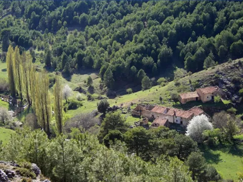
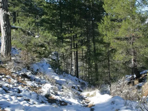
Between jaras and rosemos we will take the nine hundred meters to the crossing of the port, from where we will go back down, but now on the main road that is left, in a southwest direction. We are open to good views of the Calderon saw and the Star hill, to the north; and to the west the valley that forms the Dona Dama ravine and the Rope of the Stairs.

Our way, after crossing the waterfall again, runs in parallel to the stream, in which we can see the ruins of ancient mills, including the one that gives name to the path, the Batan Mill and another more flour built at the same time. In a little more than a kilometer of road, we will reach a sharp curve, after which we arrived at the bottom of the ravine where there is a water storage for the fire vehicles and a source, being this the end of the path.

Breve descripción

If we accept the proposal that we are made with this path, we will discover agricultural sites and representative landscapes of Despeñacolos, where the pulse of nature - flora, fauna, hydrography, geology... - still beats with strength, and human work is perceived as a historical challenge in pursuit of coexistence rather than domination.

Latitud
37.7796
Longitud
-3.7849
Distrito
Municipio
Ubicación en el mapa
POINT (-3.7849 37.7796)
imagen
Image
706_SS_01.jpg
Imagen principal
Activado
imagen
Image
Sendero%20Molino%20del%20Bat%C3%A1n.jpg
Imagen principal
Desactivado
2 h 50 min

Nature

icon-intereses-naturaleza

Friends

icon-intereses-amigos

Adventure

icon-intereses-aventura

Culture

icon-intereses-cultura

Sport

icon-intereses-deporte

Eco-friendly

icon-intereses-eco-friendly

For couples

icon-intereses-en-pareja

Family

icon-intereses-familia

Gastronomy

icon-intereses-gastronomia

Municipality

icon-intereses-municipio

Low-cost tourism

icon-intereses-turismo-low-cost

Solo travel

icon-intereses-viajar-solo
Baja
Image
a080e20c-f759-841d-d7ca-6ee1ff0fe4e8?t=1588960487655
Sendero Molino del Batán
20,7 km
980m
980m
1
2
2
2
On foot
All year round
Desactivado

It is recommended to wear safe drinking water and clothing and adequate footwear. Ensure the potability of the water from the sources. Be careful with the traffic. This path can be realized throughout the year. In summer, due to the special conditions of height, the insolation is very strong and requires important solar protection.

- Remains of mills and hydraulic batans of medieval origin.
- Miranda del Rey village.
- Las Nogueras School of Nature.
- Barrio of the Batan stream.

From Jaén, on the E-05 motorway, you have to take Exit 259 to Santa Elena, go to the town and go to the Visitors' Centre Puerta de Andalucía, where you take the road JA-7.102 to Miranda del Rey. We must pass the village house without leaving the road until we find a crossing at 150 m., where the path begins.

TRAIL OF THE CUEVA DE LOS MUÑECOS

Submitted by brandcode_deweloper on
Id
2567104
Descripción larga

The path begins at the Centre for the Interpretation of the Historical and Cultural Heritage of the Natural Park of Despeñacolos (see on the map), which is reached by the road A-6,200 from the E-05 motorway, towards Aldeaquemada. The center has been built on an old aprisco at the foot of the hill of the Castle. On the contrary side of this run through the historic passage of Despeñapeas the highway of the South.

However, on this side where we find the intense traffic of the fast track seems far away. The visit to the centre is certainly recommended, as it provides information on the natural and cultural heritage of the environment and also of this path. Around the center we see places of great ecological significance. On the umbria slopes, facing north, we will see forest formations with tree leaves, like the whine, and shrubs like doves or madroños. On the other hand, in the solana, the mountain is dominated by cobblestones with little sodoscala, made up of pyruetans, jars, rosemary, etc.

The path consists of two sections of about five hundred meters each, starting both from the interpretation center. One goes up to the hill of the Castle - towards the west - and the other goes down to the cave of Los Muñecos, in a southwestern direction. Although the order to travel them is indifferent, as in any case we must return to the interpretation center, we will assume that we will first take the climb to the hill. The sinuous path that we will take goes through a relatively lush encore that disappears around the 920 meters. Then, until the top of the hill, at 961 m, we will see more naked rock than vegetation.

There are in the high remains of a possible Iberian village and a lookout towards the plateau with overwhelming views, with St. Helena to the south and the port of the Muradal to the Plateau. In front, the impressive pettic structure of Mount Los Organos and, under us, the highway that follows the itinerary that with great difficulty opened at the end of the 18th century, as an alternative to the road of Las Ventes (by Los Pedroches) and other itineraries in use between the ports of Cadiz and Sevilla - doors of Américo - and the capital of the kingdom.

After walking the way to the center of interpretation, we will head towards our second destination, the cave of Los Muñecos. We will descend on a soft slope by the skirt of the hill of the Castle, and in parallel to the electric slope, towards the road we arrived for, we will cross the lower part of the same oak that we have already met up to the hill, in which we will also see alcornoques and junips of great bearing.

In two hundred and fifty meters we will reach a point very close to the road, where we will change course to surround the cut we see on our right, in which environment we can distinguish maples of Montpellier and abundant cornicabra. We must be careful with some slopes and pozas of the numerous excavations around here, as we are in a rich area of archaeological deposits, with the cave of Los Muñecos as the center of them, where the path ends.

Breve descripción

The culture of the Iberians keeps many mysteries that may never be explained. Their beliefs are almost unknown, but no one is surprised that they had in these places one of their main places of worship, and even more so that the Romans would take on him to satisfy their gods.

Latitud
37.9801
Longitud
-3.0504
Distrito
Municipio
Ubicación en el mapa
POINT (-3.0504 37.9801)
imagen
Image
7bf891e7cd51422669fbe9bfa4ec577e.jpg
Imagen principal
Activado
imagen
Image
Sendero%20de%20la%20Cueva%20de%20los%20Mu%C3%B1ecos2.jpg
Imagen principal
Desactivado
imagen
Image
Sendero%20de%20la%20Cueva%20de%20los%20Mu%C3%B1ecos.jpg
Imagen principal
Desactivado
1 h 42 min

Nature

icon-intereses-naturaleza

Friends

icon-intereses-amigos

Adventure

icon-intereses-aventura

Culture

icon-intereses-cultura

Sport

icon-intereses-deporte

Eco-friendly

icon-intereses-eco-friendly

For couples

icon-intereses-en-pareja

Family

icon-intereses-familia

Gastronomy

icon-intereses-gastronomia

Municipality

icon-intereses-municipio

Low-cost tourism

icon-intereses-turismo-low-cost

Solo travel

icon-intereses-viajar-solo
Medium
Image
b5e34fb6-b091-5c60-4d06-3974839debc2?t=1588960148343
Image
addfdc00-5c39-b0e1-c182-ea84a4571baa?t=1588960133035
Sendero de la Cueva de los Muñecos
3,2 km
150m
150m
2
2
2
1
On foot
All year round
Desactivado

It is recommended to wear safe drinking water and clothing and adequate footwear. Ensure the potability of the water from the sources. This path can be realized throughout the year. In summer, due to the special conditions of height, the insolation is very strong and requires important solar protection. Caution with the strong slopes of the last stretch and the pozas of archaeological excavations.

- Centre for the Interpretation of the Historical and Cultural Heritage of the Natural Park of Despeñacolos
- Cueva de los Muñecos, which dates back to the 6th century BC and is considered one of the oldest Iberian extra-urban shrines, and also of those who had a certain character of territorial control.
- Cerro del Castillo, at 961 m altitude, old Iberian settlement.
- The organs.

The path begins at the Centre for the Interpretation of the Historical and Cultural Heritage, which is reached by the road A-6,200 which, coming from the highway A-4 (exit in the km 250, towards Cadiz), leads to Aldeaquemada.

Tramo de asfalto o cemento
 
Tramo de pista o camino forestal
 
Tramo de vía pecuaria
 
Tramo de senda
 

Trail Ravine of Valdeazores

Submitted by brandcode_deweloper on
Id
2557141
Descripción larga

We will have to be located in the forest house of Valdeazores, which is accessed from the A-4 motorway, only in the sense of Madrid- Cádiz, by a track that leaves to the right in the km 245.3, two hundred meters after passing the signal that indicates the entrance to Andalusia and shortly before the lookout of the Garden of Despeñacolos. We will climb three hundred meters along this track until we reach a forest house, from which parking is on the path.

We will go north, but at the very least we will be heading towards the west, which is the one that we will keep in the first half of the way to the head of the Valdeazores stream, following at first a water drive. As in much of the way, we will go up a smooth but continuous slope. We will see mixed forests around us that are the result of repopulations, in which pine trees abound in the solanas, and cypresses in the umbria. The indigenous vegetation is gaining ground with the height, also remaining in important stains on the other side of the stream - dark - that have a humid Mediterranean mountain with oaks, alcornoques, complaints, oaks, or oaks. On the riverside there are formations in a gallery of alles and strawberries, splintered with willows, tampas and tampas.

When we have already walked about two and a half miles, we reach a chestnut in which there is a spring that supplies the driving that accompanied us. It is a good place to rest and enjoy the beak of expired leaves, taking strength to continue with the rise. A kilometer later, already at the head of the stream, we will give with the track that goes down from the port of Muladar to the castle of Castro Ferral, which is located about a mile away. We can choose to approach this medieval fortress that protected the passage of La Losa, which was finally taken to the Almohades by Christian armies in the framework of the battle of the Saves of Tolosa. It is in ruins because it was later abandoned and destroyed to prevent its use by outlaws.

If we rule out the variant of the castle on the track we will only do about 50 meters, and we will leave it on a road that leaves it to the right in the direction of the Aviation Collado, as the signs indicate, completing a 180º turn that will set us to the east, walking on the crest of the right bank of the ravine. The humid Mediterranean mountain we saw from the other side is below us, which now again we are surrounded by pine trees.

We will walk two and a half miles further to crown the hill of Los Organos (natural monument), where there is the refuge of the Aviation Collado, a small air surveillance post of the Civil War, later used by pastors and fire devices. Following the path that continues in the same direction that we brought, we will cross a bosquet of pine trees, oaks, alcornoques and moans, to go out to a clear place where there is a small lookout with magnificent views of the Despeñacolos parade, which is where the path ends.

Breve descripción

The Valdeazores stream has a short perpendicular route to the Despeñafueros parlor, where it flows. The path borders its entire basin, a ravine of regular forms covered in one part by a rich and diverse Mediterranean mountain, and in another by coniferous introduced by forest populations. To the considerable natural values of the place are added other of historical or cultural type, related to the strategic character of the parade, from which we will have juicy views from a viewpoint located on it.

Latitud
38.0204
Longitud
-2.7802
Distrito
Municipio
Ubicación en el mapa
POINT (-2.7802 38.0204)
imagen
Image
1928831Master.jpg
Imagen principal
Activado
imagen
Image
Sendero-Barranco-de-Valdeazores-033.jpg
Imagen principal
Desactivado
5 h 30 min

Nature

icon-intereses-naturaleza

Friends

icon-intereses-amigos

Adventure

icon-intereses-aventura

Culture

icon-intereses-cultura

Sport

icon-intereses-deporte

Eco-friendly

icon-intereses-eco-friendly

For couples

icon-intereses-en-pareja

Family

icon-intereses-familia

Gastronomy

icon-intereses-gastronomia

Municipality

icon-intereses-municipio

Low-cost tourism

icon-intereses-turismo-low-cost

Solo travel

icon-intereses-viajar-solo
Medium
Image
8a951538-46cd-102e-4868-5e313957e4c2?t=1588958697173
Image
3668f15d-8b96-b9ff-ca1e-0d0c63f7738d?t=1588958670866
Sendero Barranco de Valdeazores
12,8 km
300m
300m
1
2
2
2
On foot
All year round
Desactivado

It is recommended to wear safe drinking water and clothing and adequate footwear. Ensure the potability of the water from the sources. This path can be realized throughout the year. In summer, due to the special conditions of height, the insolation is very strong and requires important solar protection.

- Parade and step of Parade.
- Arroyo de Valdeazores
- Ruins of the medieval Castle of Castro Ferral
- Natural Monument of the Organs

On the A-4 highway, towards Cadiz, we will take the track that goes right in the km. 245.3, about two hundred metres from the signal that indicates the entrance to Andalusia, which will take us - after going 300 meters - to the forest house of Valdeazores, next to which the path begins.