Saltar al contenido principal
icon-intereses-turismo-low-cost

Trail Viewpoint Reand

Submitted by brandcode_deweloper on
Id
2555234
Descripción larga

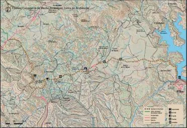
La Lancha is a village that rose for the construction of the Jandula dam, started in 1927 and completed four years later. It was inhabited by about 3,000 people in the most active moments. It is about 30 kilometres from Andújar in an unpopulated territory where malaria was endemic at that time. There is only one unasphalted road that reaches the village, the JF-5004, which comes from Los Escoriales for a journey also offered as a path marked by the Natural Park.

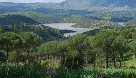
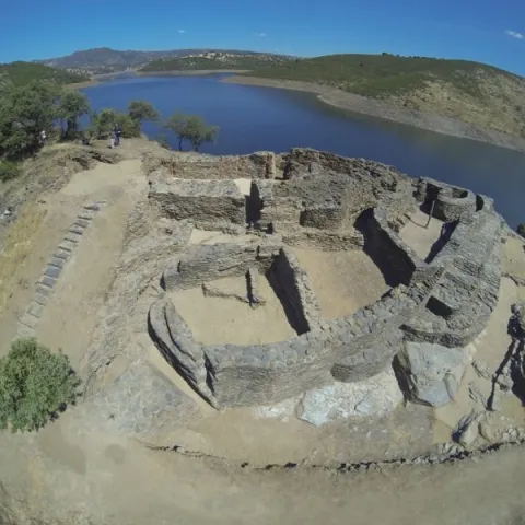
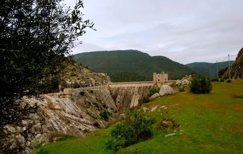
Already in La Lancha we must continue on the same road down to the dam, where the path begins. If we have reached here by car, we will leave it in this place to take a look at the Jandula reservoir first from the dam itself, and then make the short path. It has been almost eighty years since this great artificial lake was created, where the waters of the Jandula River are reinstated along about twenty kilometres from its channel, flooding its enclosed valley. The reservoir has a capacity of 322 Hm3 with a water sheet of 1,231 hectares. A new piece introduced in the geography of the saw which, of course, has had an important impact on the landscape, ecology and local and regional economy.

The variety of the local fauna, which we can see with some ease, is a clear example of such an induced transformation. Cormorans, with their lustful black plumages and bronze, are already common and it is not rare to see ducks or garzas. In the water there are species such as black-bass, carp or barb, and also a fish that is only found in these waters and tributaries of the Jandula, called the bogardilla.

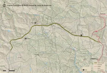
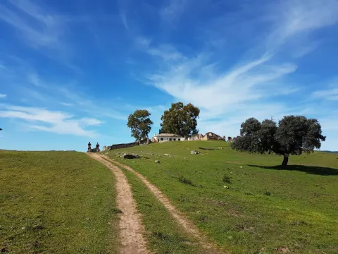
From the side of the dam to which we have reached, we will take the road that goes south on the left side of the river, a hundred meters above it. Its appearance gives us clues on the landscapes before the construction of the dam. As we move away from the dam we gain perspectives on it, and we better explain its consideration as a historical monument.

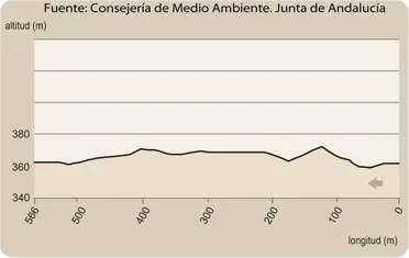
Two hundred metres from the beginning of the road we find a stretch enlarged by a excavation at the foot of the village, which is nothing other than the granite quarry that was opened and exploited only for the construction of the dam and other works related to it, case of the village. Part of the image of integration of this great wall into the landscape is due to its stone coating of the place itself. We can see around some block of granite that was left unused, and also some other witnesses of the agitated activity during the construction of the dam. A little later, the road is close at a point where we end our route.

Breve descripción

This is a brief tour along with the Jandula dam, also known as La Lancha, which in itself is a monumental construction of a high heritage and, of course, economic and social value. It is located in an agribusiness and historically depopulated area of the interior of Sierra Morena. To the value of the Mediterranean mountain that naturally dominates it, this great artificial lake adds diversity to the landscape. The path is a follow-up to another one with a greater path that reaches the dam from the Scoriales.
Latitud
38.0394
Longitud
-4.0511
Distrito
Municipio
Ubicación en el mapa
POINT (-4.0511 38.0394)
imagen
Image
IMG_1821.jpg
Imagen principal
Activado
imagen
Image
Sendero%20Mirador%20del%20Rey.jpg
Imagen principal
Desactivado

Nature

icon-intereses-naturaleza

Friends

icon-intereses-amigos

Adventure

icon-intereses-aventura

Culture

icon-intereses-cultura

Sport

icon-intereses-deporte

Eco-friendly

icon-intereses-eco-friendly

For couples

icon-intereses-en-pareja

Family

icon-intereses-familia

Gastronomy

icon-intereses-gastronomia

Municipality

icon-intereses-municipio

Low-cost tourism

icon-intereses-turismo-low-cost

Solo travel

icon-intereses-viajar-solo
Baja
Image
41aee518-2679-dabc-b969-77dc1aea6436?t=1588958225609
Image
0d6c0d94-c307-8108-88b7-a2d0310c555f?t=1588958239153
Sendero Mirador del Rey
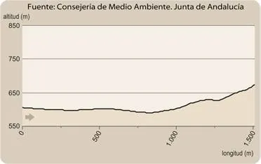
1,2 km
14m
14m
2
2
2
1
On foot
All year round
Desactivado

It is recommended to wear safe drinking water and clothing and adequate footwear. Take special care of possible falls. This path can be realized throughout the year. In summer, due to the special conditions of height, the insolation is very strong which, together with the lack of shadows, requires important solar protection.

- Granitic closed.
- Embalse of important dimensions with variable levels.
- The monumental Jandula dam, designed by the modernist architect Casto Fernández Shaw and associated village.
- granite quarry used for the construction of the dam and the village.

From Andújar you must take the road A-6177, north sense, to the sanctuary of the Virgin of the Head. After moving about 15 Km and passing the Park Visitors Center, you will turn right onto the JH-5002, towards the Jandula reservoir. We travel about 10 km to a crossing where we will have to turn left by the JF-5004. After another 10 Km we will reach the dam from where the path begins to our left
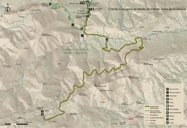
Tramo de asfalto o cemento
 
Tramo de pista o camino forestal
 
Tramo de vía pecuaria
 
Tramo de senda
 

Trail El Junquillo

Submitted by brandcode_deweloper on
Id
2553127
Descripción larga

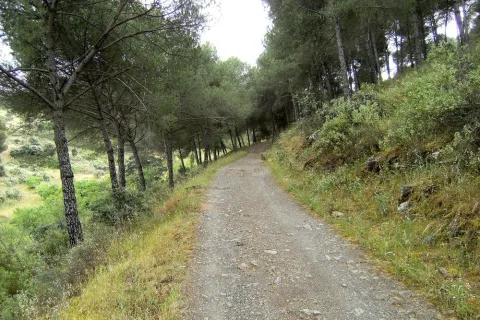
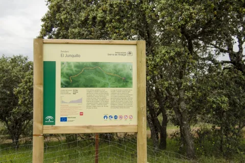
At the beginning of the path you can access the road A-6178 that comes from the shrine of the Virgin of the Head, 19 kilometres from it. We will find the path signs at a road crossing with a track that leaves to the left towards Valdelagrana (see on the map) in a place known as Junquillo. We'll start the road along the track to a geodetic vertex that we'll see very close.

We will do all the way along this track, almost always flanked by fences of farms dedicated to livestock and hunting, and would support the cultivation of cereals. The vegetation varies between real oak forests and more or less dense adhesives. Many other plants of the Mediterranean mountain find here their space, such as the wild pyruetane or pear, of bright and expired leaves, from which we can see some specimens shortly after we start the road. We will also pass in the initial section under a high-voltage line that comes from Puertollano to the Guadalquivir valley to the south, direction in which we will observe the prominent Peñón de Rosalejo (805 m.).

We will leave the Las Losas cortijo to our right, surrounded by a more clear space. Half a kilometre later we will find the so-called moruno oven, a small stone building located between oak trees on the left side of the track.

In just over a kilometer we will reach a crossroads of roads and firewalls. We will have already observed the combination of both, that there are ways through which we have clear margins to serve at the same time as firewalls. This helps to prevent and extinguish fires, which pose a major threat, especially to low-mountain cynegetic farms, which host populations of boar, deer, gamo or muflon, but also to other more clarified spaces, such as dehesas, which have a predominantly livestock use. The high biodiversity of both types of mountains is protected by these infrastructure, and also by complementary ones, such as the rafts that abound in both types of farms.

Almost a kilometer later, we will find another crossing of roads this time belonging to surrounding farms. We will continue forward and a few meters later we will turn south, moving back to a more wooded area.

It is a good place to stop and look at the mountain chains that rise on the horizon in the northwest. About ten kilometres away we will see the Quintana saw, whose summits draw the border of the provinces of Jaén and Ciudad Real, and also of the Natural Park. In it we can distinguish the Burcio from the Pino (1,291 m), the highest peak of the Andalusian Sierra Morena. Further west is the Madrona saw, where the highest levels of all Sierra Morena are reached. Between the two saws is the main step to the famous valley of Alcudia, in which Fuenhot is located, a citizen population that we can see later. Already in the last stretch of the path we pass through a new crossing near a large cordial. A mile later the path ends in a suggestive dehesa next to a Canadian step.

Breve descripción

Here is a suggestive and easy road that travels a very representative space of Sierra Morena and this Natural Park. In it there are the dehesas on almost flat grounds and Mediterranean mountain stains, both populated by numerous animal species, including various birds, easily visible, or mammals, such as deer, boars, foxes or garduñas, difficult to see, but whose traces we will find with some ease. The Madrona and Quintana saws on the horizon, behind these plains, evoke the many legends that these depopulated lands have inspired throughout history.

Latitud
37.9601
Longitud
-3.0203
Distrito
Municipio
Ubicación en el mapa
POINT (-3.0203 37.9601)
imagen
Image
S_DelBronce%20%281%29.jpg
Imagen principal
Activado
imagen
Image
Sendero%20El%20Junquillo.jpg
Imagen principal
Desactivado
2 h 23 min

Nature

icon-intereses-naturaleza

Friends

icon-intereses-amigos

Adventure

icon-intereses-aventura

Culture

icon-intereses-cultura

Sport

icon-intereses-deporte

Eco-friendly

icon-intereses-eco-friendly

For couples

icon-intereses-en-pareja

Family

icon-intereses-familia

Gastronomy

icon-intereses-gastronomia

Municipality

icon-intereses-municipio

Low-cost tourism

icon-intereses-turismo-low-cost

Solo travel

icon-intereses-viajar-solo
Baja
Image
0ce51f4e-fee4-1cb7-b0f8-a5e9b393285f?t=1588957869502
Image
de88ea9c-25e6-d6ee-890c-5d7de505414d?t=1588957887533
Sendero El Junquillo
11,4 km
54m
54m
2
1
1
2
On foot
All year round
Desactivado

It is recommended to wear safe drinking water and clothing and adequate footwear. Ensure the potability of the water from the sources. Be careful with the traffic. This path can be realized throughout the year. In summer, due to the special conditions of height, the insolation is very strong which, together with the lack of shadows, requires important solar protection. The months of October and November are especially recommended, coinciding with the deer's berrhea.

- Mediterranean mountain and oak and cork dehesas.
- Junquillo site.
- Old morun oven.
- Sierra Quintana, with the peak Burcio del Pino (1,291 m.)

On the road A-6178, about 19 kilometres from the shrine of the Virgin of the Head, you reach a crossing with signs to Valdelagrana and Las Tapas, which is where the path begins

Trail El Santuario

Submitted by brandcode_deweloper on
Id
2545140
Descripción larga

If you come from Andújar on the road A-6177 towards the shrine of the Virgin of the Head, we will have to get to its vicinity, thus walking about 30 kilometers, to be located at the point of start of the path, located next to the road two hundred meters before the last crossing to the sanctuary.

We are at the foot of the hill of the Cabezo, the promontory where the sanctuary that we have in front of us is located, less than a kilometre away in a straight line and about 50 meters away. Surrounded by a forest of black pines, we take the way to the south-west, just up to a crossing - at about three hundred meters - where we have to turn 90 degrees to our right. We soon arrived at a cortijo called La Huerta de los Fráiles, a name that makes clear reference to its use by religious guardians of the sanctuary. We will round the building by recovering the south-west direction to keep it alone for two hundred meters, until we reach a crossing at which we will deviate by a track to the right.

We will pass under a high-voltage electric line and we will immediately cross the Membrellar stream, from where we can see panoramic views towards the valley of the Jandula River as it passes through the New Place, an emblematic public mountain for its great ecological and cynetic wealth. We gradually approach the slopes of the hill of the Cabezo and the urbanized space that occupy there various cofradies and facilities linked to the sanctuary and to the famous and multitudinary Romany that is celebrated on the last Sunday of April.

Moving in the same direction on foot of the hill, we will reach the asphalt road on which we start our way, to which we will join on our left to walk it just over 50 meters, always with due caution.
Thus we will reach the steep street of the Sanctuary, which goes up to it with a considerable slope of about three hundred meters. Above the hill ends the path, although here we are offered different offers, such as visiting the sanctuary and its surroundings, or approaching the lookout from where a wide view of Sierra Morena is covered.

Breve descripción

The proverbial depopulation of Sierra Morena, and the consequent preservation of its natural wealth, has here, in the Andújar saw, one of its clearest manifestations. In an agribusiness territory, 30 kilometres from Andújar, the sanctuary of the Virgin of the Head is raised, which finds its meaning in such a strange location. For centuries he has attracted a large number of pilgrims from remote places and year by year, he has concentrated crowds in one of the country's most popular romaneries. The path brings together in its brief journey nature and history, landscapes and tradition.

Latitud
38.0394
Longitud
-4.0511
Distrito
Municipio
Ubicación en el mapa
POINT (-4.0511 38.0394)
imagen
Image
715_SS_01%20%281%29.jpg
Imagen principal
Activado
imagen
Image
Sendero%20el%20santuario.jpg
Imagen principal
Desactivado
46 min

Nature

icon-intereses-naturaleza

Friends

icon-intereses-amigos

Adventure

icon-intereses-aventura

Culture

icon-intereses-cultura

Sport

icon-intereses-deporte

Eco-friendly

icon-intereses-eco-friendly

For couples

icon-intereses-en-pareja

Family

icon-intereses-familia

Gastronomy

icon-intereses-gastronomia

Municipality

icon-intereses-municipio

Low-cost tourism

icon-intereses-turismo-low-cost

Solo travel

icon-intereses-viajar-solo
Baja
Image
0555e93c-2269-03fc-3ed8-8a63f94e61a6?t=1588956745285
Image
ff19adf8-c065-2525-6249-b708ddf99062?t=1588956878234
Sendero El Santuario
3 km
82m
82m
2
1
1
1
On foot
All year round
Desactivado

- Mediterranean mountain and oak and cork dehesas.
- Cortijo La Huerta de los Fráiles.
- Membrellar Arroyo.
- Popular sanctuary on the hill of the Cabezo with various associated infrastructure and equipment.

From Andújar, you must take the road A-6177, north-east sense, to the sanctuary of the Virgin of the Head. After 30 Km we will find the beginning of the path, located next to the road two hundred meters before the last crossing to the sanctuary.

Tramo de asfalto o cemento
 
Tramo de pista o camino forestal
 
Tramo de vía pecuaria
 
Tramo de senda
 

Trail el Rumblar

Submitted by brandcode_deweloper on
Id
2542176
Descripción larga

Sierra Morena is a great natural space of internationally recognized importance. Much of the water resources consumed in the Guadalquivir basin, especially for urban supply, come from its vast territory.

The path begins in one of its water reservoirs and runs through spaces where we will find the explanation of its valued quality, which is no other than that of the conservation of the Mediterranean mountain, the dehesas and other ecosystems where many animals live, including the Iberian lince.

Leaving the town of Baños de la Encina, which well deserves a visit, we will head for the dam of the Rumblar reservoir on the road JH-5044 (5.5 Km). After crossing it, we will find the beginning of the path (see on the map), which runs in its entirety on the unasphalt road JV-5041.

We start the road parallel to the top of the reservoir, to get away from it by the moving Lomas of the Mesonero in a west direction. We are surrounded by a Mediterranean mountain made up of characteristic species, including the oak. A place where many animals that benefit from the water, and also from the microclimate, of the large artificial lake are camped. After two and a half miles of road, the relief and vegetation change radically, entering us in a plain with olive groves and open spaces where they embrace braves. It is a suitable place to see deer, especially during the summer season in autumn.

After crossing a stream and passing through other land of work, we will surround the imposing joint of La Nava de Andújar or Santa Amalia, which has, among other buildings, its own hermitage and school, as there were many families of farm workers. Immediately after the corrijada we return to a more rugged forest land next to the Mosquila saw, whose most outstanding hill we will see in front of us.

Walking the two kilometers of dehesas that separate La Nava from the Friscalejo House we will have the opportunity to see one of the many animals that live here. It won't be hard to see deer if we go quietly and watch. They often come close to the boarders we will see in the surroundings of the house. It is much more difficult to see a lince, but we will be attracted to the collaboration between owners and Administration to protect this emblematic species, from which is reported by signs along the way.

Later on, the path surrounds the House of Gorgogil, putting us at the foot of the Mosquila saw where, after a curve, we will find the birth of the Gorgogil stream. We continue to climb up the hill of the Mosquila which, after a firewall, we find again with a denser and more wooded vegetable cover. To our right, there continue to be dehesas in a flattened land, where we will find once again brava livestock.

If we look at the fences, we will observe the use of granite pilotes, the rocky material that dominates the area. But we will also discover samples of many other uses of this noble stone, such as eating machines and all kinds of works or buildings. And when it comes to geological resources, we approach the Scoriales, where the path ends. This is an old mining enclave from which different types of metals were drawn. Its name is derived from the scum or waste from the exploitation and treatment of minerals, which were accumulated here.

Breve descripción

From Baños de la Encina will go south along the road leading to the Rumblar swamp. Arrived at the junction, we will be diverted by the JH-5044 to the right. After about 5 km, the Rumblar dam is reached, which must be crossed. Next to the relief, the path begins.

Latitud
38.1706
Longitud
-3.7744
Distrito
Ubicación en el mapa
POINT (-3.7744 38.1706)
imagen
Image
Sendero%20el%20Rumblar1..jpg
Imagen principal
Activado
imagen
Image
Sendero%20el%20Rumblar2.jpg
Imagen principal
Desactivado
imagen
Image
Sendero%20el%20rumblar%205.jpg
Imagen principal
Desactivado
7 h 6 min

Nature

icon-intereses-naturaleza

Friends

icon-intereses-amigos

Adventure

icon-intereses-aventura

Culture

icon-intereses-cultura

Sport

icon-intereses-deporte

Eco-friendly

icon-intereses-eco-friendly

For couples

icon-intereses-en-pareja

Family

icon-intereses-familia

Gastronomy

icon-intereses-gastronomia

Municipality

icon-intereses-municipio

Low-cost tourism

icon-intereses-turismo-low-cost

Solo travel

icon-intereses-viajar-solo
Medium
Image
7cb1d67a-f19c-c38c-9426-8492cb08d823?t=1588956233179
Image
0c5e9723-aa4f-d41e-c7e4-3bca7ba6c4e0?t=1588956138798
Sendero el Rumblar
31,8 km
356m
356m
2
1
1
4
On foot
All year round
Desactivado

It is recommended to wear safe drinking water and clothing and adequate footwear. Ensure the potability of the water from the sources. Be careful with the traffic. This path can be realized throughout the year. In summer, due to the special conditions of height, the insolation is very strong which, together with the lack of shadows, requires important solar protection. The months of October and November are especially recommended, coinciding with the deer's berrhea.

- Mediterranean mountain and oak and cork dehesas.
- Presence of Iberian lince and brave cattle.
- Dam del Rumblar (1941), 65 meters high and 126 Hm3 of reservoir capacity.
- The Navy of Andújar.
- The birth of Gorgogil stream.
- Scorial mining enclave.

Leaving the town of Baños de la Encina, which well deserves a visit, we will head for the dam of the Rumblar reservoir on the road JH-5044 (5.5 Km). After crossing it, we will find the beginning of the path (see on the map), which runs in its entirety on the unasphalt road JV-5041.

Circular path

Ascent to Pico Mágina

Submitted by brandcode_deweloper on
Id
2541785
Descripción larga

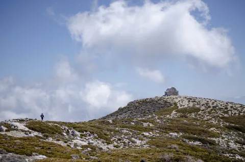
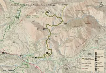
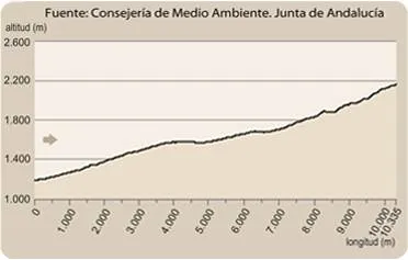
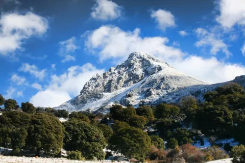
The rise to the Magina peak (2167 m.) will take you to the roof of the province of Jaén. This level assigns to the Natural Park of Sierra Magina the third altitude of Andalusia, after Sierra Nevada and the Sierra de Baza. The effort is demanding, but it has the reward to know a unique landscape. The Sierras de Cazorla, Segura and the Villas, Sierra Nevada, the Sierra Sur de Jaén, La Loma de Ubeda or the Valle del Guadalquivir are some of the panoramic views from the summit area.
The tour is divided into three sections: the forest area, altiplanicie livestock and high mountain section.
At the beginning of the path, in a curve there is a detour that goes to the Chaganton ravine, which we will not take. Our path is always ascending, on a wide and firm track of land. Zigzagando gains height for four kilometres, while passing through a dense repopulation pine. This first stage of approach begins to show us views, and takes us to the interior of Sierra Magina.

Once the first climb has been crowned, we will be flying along a mile and a half by the Barranco de las Salinas, which serves as a transition to the last stretch of ascension. This is an area of pastures in which we find a very diverse vegetation such as complaints, larice pines and juniper, natural representatives of this bioclimatic floor. The transition ends slightly above the Tincada de la Cruz, a very characteristic livestock construction.

A few hundred meters above the dye the track is over and the path begins, which ascends in the east direction, and is marked enough to follow it without difficulty. Only in conditions of strong snow can the path mark be lost. The Barranco de las Covatillas, the first stretch of the path, leads us to the Port of Bolos, which is located on the east side, towards the Barranco del Garganton and beyond the Valley of the Jandulilla. At this point the path turns left facing north towards the summit area.
From here on the path passes through a stony area, on limestone. The landscape leaves the pineapples behind, and it will be the rake savannas that accompany us to the summit. Only something above we find the fork towards the summit of Miramundos, to the right. We will continue on our path, to the left and gradually gain height. Then we lose height at the head of a ravine slightly cooler. From this point on we start the final stretch until the peak of the Magina peak. The road is adapted to the relief. First by a few rocky steps, to reach a circular rocky depression on the hillside (a dolin or limestone sink), where one of the restored snow wells is. The end is a stone's throw. The maximum level is a high surrounded by other immediate summits (Jails, Peña de Jaén, Miramundos...), so the summit is one more of a crest.
The return will always be in decline, on the same path of ascent, provided that we do not choose other alternatives of return or combination with different paths, only recommended for those who have the experience and information to connect them.

Breve descripción

From the Miramundos peak, we can see a landscape panorama that covers a wide range from Cazorla to Sierra Nevada: to the south, the Sierra Arana and Sierra Nevada granadinas; to the north in the foreground, the summits of Mount Cazorla and, to the west, the towns of Ubeda, Baeza, Sabiote, etc.; to the east the summit of La Morra de Magina and, to the bottom, the mountains of Quesada belonging to the Cazorla mountains; to the west we have the summit of Peña de Jaén and the Almaden.

Latitud
37.6681
Longitud
-3.5742
Distrito
Municipio
Ubicación en el mapa
POINT (-3.5742 37.6681)
imagen
Image
Subida%20al%20Pico%20M%C3%A1gina.jpg
Imagen principal
Activado
imagen
Image
726_SS_12.jpg
Imagen principal
Desactivado
imagen
Image
726_SS_11.jpg
Imagen principal
Desactivado
imagen
Image
726_SS_10.jpg
Imagen principal
Desactivado
7 h 15 min

Nature

icon-intereses-naturaleza

Friends

icon-intereses-amigos

Adventure

icon-intereses-aventura

Culture

icon-intereses-cultura

Sport

icon-intereses-deporte

Eco-friendly

icon-intereses-eco-friendly

For couples

icon-intereses-en-pareja

Family

icon-intereses-familia

Gastronomy

icon-intereses-gastronomia

Municipality

icon-intereses-municipio

Low-cost tourism

icon-intereses-turismo-low-cost

Solo travel

icon-intereses-viajar-solo
Alta
Image
519e64a5-51f1-70de-3dc0-460bf8287fe9?t=1588954464336
Image
5dabdf15-d7c6-706c-033e-dea29636ec30?t=1588954970132
Subida al Pico Mágina
10,3 km
980m
980m
3
2
3
4
On foot
All year round
Desactivado

Caño del Aguadero

This path can be realized throughout the year. In winter, its high mountain conditions can make it complicated, due to low temperatures, snow accumulation, ice, and strong wind showers. There are no drinking water points available on the tour, and sufficient hydration is recommended. In summer, due to similar high conditions, the insolation is very strong, linked to the lack of shadows, will be an important solar protection.
This path has the alternative, on the stretch of high mountain, towards the summit of Miramundos, and from there to the Caño del Aguadero, and the northern side of the massif. This complete alternative would be a different planning, requiring more than ten hours of intense walking, with the added inconvenience of having another car at the end point.

- In spring, botanical endemisms can be seen in flower, such as the Viola cazorlensis or the Lithodora clear (the only world representation of specimens of this species in these areas). Both are small seasonal herbaceous plants. Their very high fragility and the protection to which they are subject, prohibit any handling or taking of samples.
- Livestock landscape in the middle area of the tour, with traditional constructions such as wells and tinada.
- Panoramic of Jaén and adjacent provinces.
- The formation of rake savannas.
- Snow well in the summit area.
- High mountain landscape, with endemisms, geological formations, shelter...
- The sighting of royal eagles in flight, and mountain goats at the summits, is common.

In the km 6.5 of the road A-324 (Huelma-Cambil), direction Camil, as the CEDEFO passes, part to the right a wide lane. Later, coinciding with a cortijo, we found a crossing over a closed curve, the point of beginning of the path.

Tramo de asfalto o cemento
 
Tramo de pista o camino forestal
 
Tramo de vía pecuaria
 
Tramo de senda
 

Trail Paso Puerto de la Mata

Submitted by brandcode_deweloper on
Id
2541394
Descripción larga

The tour is a permanent rise, not very pronounced, but long. This path will take us from the valley bottom to the Sierra Mágina Natural Park summit area, traditional summer grazing sites, high-rise local boarders or pastures. This is therefore a traditional livestock road, from the transsterminery - local movement of cattle from valley to mountain.

The recreational area of Cuadros is the starting point, the place where we can leave our vehicle. The track rises for several kilometres between the pine slopes. In this first stretch, to the right of the track, we will have the view of the deep valleys of mountain torrents that converge and collect all the waters of this sector of the massif. The valley of the river Cuadros, the ravine of Mosquito and Peru, interesting for its cornicabral, vegetation characteristic of this area.

The first stretch of the path ends in the Control of the Valley, building next to a control barrier that has an explanade where we can rest. Depending on the season here we will find water to refresh.
But the stop must be brief because we have not yet made a third of the climb route. On the right side of the road you will find a path, with stone reclining, a path restored years ago in a field of work. It is a shortcut, which we do not recommend for its inclination.

We still have to reach the Era del Curilla, right on the roof of the Barranco del Atanor's head at 1100 meters of altitude; a natural step that connects with the east side of the massif. The era that was located there used the currents between the two sides to feed the wheat by taking advantage of the permanent passage of air.
We are left with the longest stretch, just over eight kilometers still until the end of the climb. During this part of the journey the road is adapted to the slope of the Sierra de la Cruz, drawing the rails, which one behind the other allows us to gain height. The landscape changes to a mountain of salgarean pines, tall tree, combined with cornicabra and even nozzles. Let us not forget that we are on the northern side of Magina, something more humid than the rest of the Sierra. To the left of the road we will find different mortars, or high and isolated hills. On the right we enjoyed the impressive view from the top of the rails we saw at the beginning of the itinerary.
The road loses its inclination, and there is only a plain until the Caño del Aguadero. The tour is flanked by high pastures, traditionally frequented by sheep flocks. When you pass through the Hoya de la Laguna - to the left of the walk - a small dolina or depression in the rocky limestone background, you will be very close to your destination. The appearance of chopos announce the presence of water, of the jets of the spring of the Caño del Aguadero.

The tincture, the fountain and the vents are the end of the road. This place is a resting place in the middle of the massif, and is part of a royal canyon. The meadows, the constant presence of water, the bearing and the shadow of the chopos invite you to spend a good time of rest in this corner of the Andalusian mountain. Peña Grajera (2014 m.) crowns the landscape and reminds us of the high mountain conditions we are in.

The return will be made by moving the way up, or by connecting with other paths of different sides. This option requires careful planning and experience in mountain orientation, in addition to many more hours to return to the villages around the massif.

Breve descripción

This route allows one of the best preserved mountains in the Sierra Magina area, the public mountain Mata Bejid. The main characteristic of this is the dehesa: the clear forest of oaks and complaints of majestic bearing that appear interspersed with mountain pastures and numerous shrubs of the Mediterranean mountain. It also offers the opportunity to visit vestiges of the past, such as the castle of Mata Bejid and its era, declared Good of Cultural Interest.

In short, it is a very complete route with which to enjoy landscapes of great beauty presided by the spectacular image of the Peña de Jaén.

Latitud
37.6681
Longitud
-3.5742
Distrito
Municipio
Ubicación en el mapa
POINT (-3.5742 37.6681)
imagen
Image
2.jpg
Imagen principal
Activado
imagen
Image
1224_SS_06.jpg
Imagen principal
Desactivado
imagen
Image
1224_SS_05.jpg
Imagen principal
Desactivado
4 h 10 min

Family

icon-intereses-familia

Friends

icon-intereses-amigos

Nature

icon-intereses-naturaleza

Adventure

icon-intereses-aventura

Solo travel

icon-intereses-viajar-solo

Culture

icon-intereses-cultura

Gastronomy

icon-intereses-gastronomia

Sport

icon-intereses-deporte

Municipality

icon-intereses-municipio

Low-cost tourism

icon-intereses-turismo-low-cost

Eco-friendly

icon-intereses-eco-friendly

For couples

icon-intereses-en-pareja
Medium
Image
ef42c165-0343-62be-1a8f-0872713fa9be?t=1588952015624
Image
5ccbb9e3-8e93-abdd-12ad-751e55bdc10a?t=1588952061290
GR-7 - Paso Puerto de la Mata
12,88 km
677m
300m
2
2
2
3
On foot
All year round
Desactivado

This path can be realized throughout the year. In winter, conditions in the mountain port, the highest area and surrounded by high mountain peaks, can make it complicated by low temperatures and snow accumulation, although the road route is not complicated. In the course, water points are only available at the beginning (private source in the Mata Behid corrijada) and at the end in the Fuenmayor. However, none is treated water, although they are traditionally used for consumption. In summer the insolation is very strong, linked to the lack of shadows, will be an important solar protection.
This path, once reached the port, offers the possibility to ascend to the peaks Almadén (2032 m.) and Ponce (2005 m.), by paths of unstable firm. Both summits, divided by this mountain port offer possibilities for lovers of the great panoramic. From the Almadén to the north and the Depression of the Guadalquivir, and from the Ponce to the south, overlooking the province of Granada, crowned by the Sierra Nevada National Park. These alternatives would significantly extend the time of implementation, as well as the difficulties.

In the km 13 of the A-324 Road (Cambil-Huelma) there is a sway on the road, where you can park the car, next to the Mata Behid cordial that gives name to these sites. Right here begins an ascending lane by an olive tree, which is marked in the beginning. This path is part of the GR-7, as it passes through the province of Jaén. It is advisable to leave a second vehicle at the end of the path, near the site of Fuenmayor, near the village of Torres.

- In the spring, at the beginning of the path the flowering of the forest of the Adelfar de Cuadros, a formation of the riverside forest formed by huge specimens of tellifas, breaks out.
- In the first third of the ascent, to the right of the track, the Carluco, mountain that hosts the largest cornicabral of Spain (the cornicabra, Pistacia terebinthus, is a shrub characteristic of the Mediterranean vegetation) is raised.
- Landscape of high Mediterranean mountain-Andalusian, in the area of the Caño del Aguadero, with traditional constructions such as abrevadero and tinada. This area is about 1600 meters above sea level. At this point a number of municipal terms coincide, a fact that, increased by its value, has served as a popular dispute of who it belongs to.
- Geological formations like dolinas, on the last part of the tour.
- The sighting of royal eagles in flight, and mountain goats at the summits, is common.

The path begins in a lane that part of kilometer 13 of the A-324 road that unites the towns of Cambil and Huelma, close to the visitor center Mata Bejid.

It has access from the A-324 (Cambil-Huelma) road, at the height of Mata-Bejid. From this town part a road to the west leading to the starting point of the path, located at the crossing of the road with the road A-324.

Trail Caño del Aguadero

Submitted by brandcode_deweloper on
Id
2537641
Descripción larga

The tour is a permanent rise, not very pronounced, but long. This path will take us from the valley bottom to the Sierra Mágina Natural Park summit area, traditional summer grazing sites, high-rise local boarders or pastures. This is therefore a traditional livestock road, from the transsterminery - local movement of cattle from valley to mountain.
The recreational area of Cuadros is the starting point, the place where we can leave our vehicle. The track rises for several kilometres between the pine slopes. In this first stretch, to the right of the track, we will have the view of the deep valleys of mountain torrents that converge and collect all the waters of this sector of the massif. The valley of the river Cuadros, the ravine of Mosquito and Peru, interesting for its cornicabral, vegetation characteristic of this area.

The first stretch of the path ends in the Control of the Valley, building next to a control barrier that has an explanade where we can rest. Depending on the season here we will find water to refresh.
But the stop must be brief because we have not yet made a third of the climb route. On the right side of the road you will find a path, with stone reclining, a path restored years ago in a field of work. It is a shortcut, which we do not recommend for its inclination.

We still have to reach the Era del Curilla, right on the roof of the Barranco del Atanor's head at 1100 meters of altitude; a natural step that connects with the east side of the massif. The era that was located there used the currents between the two sides to feed the wheat by taking advantage of the permanent passage of air.
We are left with the longest stretch, just over eight kilometers still until the end of the climb. During this part of the journey the road is adapted to the slope of the Sierra de la Cruz, drawing the rails, which one behind the other allows us to gain height. The landscape changes to a mountain of salgarean pines, tall tree, combined with cornicabra and even nozzles. Let us not forget that we are on the northern side of Magina, something more humid than the rest of the Sierra. To the left of the road we will find different mortars, or high and isolated hills. On the right we enjoyed the impressive view from the top of the rails we saw at the beginning of the itinerary.

The road loses its inclination, and there is only a plain until the Caño del Aguadero. The tour is flanked by high pastures, traditionally frequented by sheep flocks. When you pass through the Hoya de la Laguna - to the left of the walk - a small dolina or depression in the rocky limestone background, you will be very close to your destination. The appearance of chopos announce the presence of water, of the jets of the spring of the Caño del Aguadero.

The tincture, the fountain and the vents are the end of the road. This place is a resting place in the middle of the massif, and is part of a royal canyon. The meadows, the constant presence of water, the bearing and the shadow of the chopos invite you to spend a good time of rest in this corner of the Andalusian mountain. Peña Grajera (2014 m.) crowns the landscape and reminds us of the high mountain conditions we are in.

The return will take the way up, which will take about three and a half hours or four. It would be possible to connect with other paths of different aspects. This option requires careful planning and experience in mountain orientation, in addition to many more hours to return to the villages around the massif.

Breve descripción

Up to Bedmar on the A-320 (Real-Bedmar) road, which connects to the A-401 (Ubeda-Moreda) and to the A 316 (Estepa-Ubeda). From there you have to take the road JA-4111, to the chapel of Cuadros. Before crossing the bridge, take the right track. In the recreational area of the Adelfar de Cuadros you can leave the car to start the path that passes the main track.

Latitud
37.7704
Longitud
-3.4702
Distrito
Municipio
Ubicación en el mapa
POINT (-3.4702 37.7704)
imagen
Image
725_SS_01.jpg
Imagen principal
Activado
imagen
Image
Sendero%20Ca%C3%B1o%20del%20Aguadero.jpeg
Imagen principal
Desactivado
imagen
Image
725_SS_02.jpg
Imagen principal
Desactivado
imagen
Image
725_SS_08.jpg
Imagen principal
Desactivado
imagen
Image
725_SS_13.jpg
Imagen principal
Desactivado
9 h 15 min (ida y vuelta)

Nature

icon-intereses-naturaleza

Friends

icon-intereses-amigos

Adventure

icon-intereses-aventura

Culture

icon-intereses-cultura

Sport

icon-intereses-deporte

Eco-friendly

icon-intereses-eco-friendly

For couples

icon-intereses-en-pareja

Family

icon-intereses-familia

Gastronomy

icon-intereses-gastronomia

Municipality

icon-intereses-municipio

Low-cost tourism

icon-intereses-turismo-low-cost

Solo travel

icon-intereses-viajar-solo
Alta
Image
3c42a9b8-deb3-5293-2c57-6fbe54e005af?t=1588950277171
Image
d73a4cd9-1d6f-f12c-328c-8b2e32699d5c?t=1588954075308
Sendero Caño del Aguadero
3
2
2
4
On foot
All year round
Desactivado

Recreational area of the Adelfar de Cuadros

This path can be realized throughout the year. In winter, the conditions in the high mountain meadows, in the last stretch, can make it complicated by low temperatures and snow accumulation, although the road path is not complicated. The tour only has water points in the Valley Control - only stationary - and in the Aquadero Caño, at the end of the climb, so it is advisable to carry sufficient hydration. However, none is treated water, although they are traditionally used for consumption. In summer, due to similar high conditions, the insolation is very strong, linked to the lack of shadows, will be an important solar protection.

This path, once reached the site of the Caño del Aguadero, offers the possibility to ascend to the Miramundos peak, by a small path of unstable firm. Miramundos is one of the summits of the central crest of the Sierra Magina massif. From there you can connect with other trails on the northeast side.

- In the spring, at the beginning of the path the flowering of the forest of the Adelfar de Cuadros, a formation of the riverside forest formed by huge specimens of tellifas, breaks out.
- In the first third of the ascent, to the right of the track, the Carluco, mountain that hosts the largest cornicabral of Spain (the cornicabra, Pistacia terebinthus, is a shrub characteristic of the Mediterranean vegetation) is raised.
- Landscape of high Mediterranean mountain-Andalusian, in the area of the Caño del Aguadero, with traditional constructions such as abrevadero and tinada. This area is about 1600 meters from
altitude above sea level. At this point a number of municipal terms coincide, a fact that, increased by its value, has served as a popular dispute of who it belongs to.
- Geological formations like dolinas, on the last part of the tour.
- The sighting of royal eagles in flight, and mountain goats at the summits, is common.

Tramo de asfalto o cemento
 
Tramo de pista o camino forestal
 
Tramo de vía pecuaria
 
Tramo de senda
 

DETOUR 11: Source of Guadalquivir

Submitted by brandcode_deweloper on
Id
2537581
Breve descripción

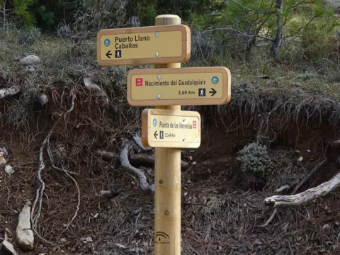
This long derivation of more than 16 km near the Southern Forest Path to one of the most visited places in all the protected space, the Birth of the Guadalquivir, developing for the most part by closed track to the transit of vehicles, so it is one of the most pleasant walks that can be done along with streams of crystalline waters, boats, castellones and exceptional forests of larix pine, with cornicabra and majajelos that splash the autumn landscape.

It is a privileged alternative, which runs parallel roads to the traditional forest track of access to the Birth from Puente de las Herrerías, much more traveled by vehicles.

Walking the quiet valley formed by the Arroyo de los Habares, at the foot of the Poyos de la Mesa, we will gradually ascend to travel later next to the Arroyo Amarillo, which under us, when hastening over the Guadalquivir, forming spectacular jumps of water and impregnating the grey limestone on which it runs.

Later on, we will cross the Navahondona Barrio, the heart of the Navahondona Reserve Area - Guadahornillos, one of the three most protected areas of this protected space where many of the existing botanical endemisms and ecosystems are just altered by man. The highest point of this tour is when you reach the forest track to Puerto Llano, at 1600 meters of altitude, very close to the Pino de las Tres Cruces and the head of the Gualay Valley, a place well known and frequented by the mountaineers who visit the Natural Park.

From there, in descent, we will discover the seasonal waterfall of Los Goterones, where the Arroyo de la Luz strolls from the peaks to the canyon and the Barrio de los Tjos Milenarios, to which we can access through another signposted path. In the Cañada de las Fuentes there are several streams between strawberries, mapes and majuelos, feeding seasonally to the river Grande, which is as the Arabs knew it to Guadalquivir, and very close to it we end the route in what is officially considered the Birth, located next to a plaque reproduces a poem by the brothers Álvarez Quintero.

Latitud
37.9102
Longitud
-2.9801
Municipio
Ubicación en el mapa
POINT (-2.9801 37.9102)
imagen
Image
1.jpg
Imagen principal
Activado
imagen
Image
2.jpg
Imagen principal
Desactivado
imagen
Image
3.jpg
Imagen principal
Desactivado
imagen
Image
4.jpg
Imagen principal
Desactivado
imagen
Image
5.jpg
Imagen principal
Desactivado
imagen
Image
6.jpg
Imagen principal
Desactivado
imagen
Image
7.jpg
Imagen principal
Desactivado
imagen
Image
8.jpg
Imagen principal
Desactivado
imagen
Image
9.jpg
Imagen principal
Desactivado
imagen
Image
10.jpg
Imagen principal
Desactivado
imagen
Image
11.jpg
Imagen principal
Desactivado
imagen
Image
12.jpg
Imagen principal
Desactivado
imagen
Image
13.jpg
Imagen principal
Desactivado
imagen
Image
14.jpg
Imagen principal
Desactivado
imagen
Image
15.jpg
Imagen principal
Desactivado
4 h 16 min

Nature

icon-intereses-naturaleza

Friends

icon-intereses-amigos

Adventure

icon-intereses-aventura

Culture

icon-intereses-cultura

Sport

icon-intereses-deporte

Eco-friendly

icon-intereses-eco-friendly

For couples

icon-intereses-en-pareja

Family

icon-intereses-familia

Gastronomy

icon-intereses-gastronomia

Municipality

icon-intereses-municipio

Low-cost tourism

icon-intereses-turismo-low-cost

Solo travel

icon-intereses-viajar-solo
Medium
Nacimiento del Guadalquivir
16,2 km
589m
669m
319m
1
1
2
3
On foot
All year round
Activado
Coordenadas / Huso 30S
According to Projection UTM Datum ETRS89
Tramo de asfalto o cemento
0
Tramo de pista o camino forestal
0.01
Tramo de vía pecuaria
0
Tramo de senda
0

Route card

Km 0

Puente de las Herrerías

Cuentan en la zona que en el siglo XV, cuando Isabel La Católica viajaba hacia la conquista de Granada desde Córdoba, llegó a este punto donde el Guadalquivir estaba tan crecido que no permitía su paso. En una sola noche –según la leyenda- sus caballeros levantaron este robusto puente que le permitió llegar a Baza y Guadix.

El inicio de esta Derivación se sitúa justo en el puente, debiendo tomar una estrecha pista forestal hacia el sur, que cuenta con una barrera para prohibir el acceso a vehículos a motor y que discurre inicialmente en paralelo a otra pista forestal más ancha por la que se desarrolla la Etapa 2 de la Variante GR 247.3. Entre ambas pistas discurre inicialmente el Río Guadalquivir, con un magnífico bosque de pino laricio que nos acompaña durante todo el recorrido.

Km 0,7

Pista Arroyo de los Habares

Dejamos el cauce principal para desviarnos hacia la izquierda por el valle del Arroyo de los Habares, uno de los principales afluentes del Guadalquivir en su cabecera, que discurre por la base de los Poyos de la Mesa, formación calcárea muy característica que visualizaremos más tarde desde otros tramos del recorrido. Deberemos vadear en varias ocasiones su cauce, pues la pista discurre a ambos lados indistintamente.

Es zona muy propicia para la observación de fauna ligada a los bosques y roquedos por los que transitaremos, por lo que podremos observar a cualquiera de las especies de grandes mamíferos existentes en el parque.

Km 2,1

Bifurcación

Encontramos una bifurcación de pistas. La de la izquierda, con aspecto de antiguo jorro, debemos desecharla, para cruzar de nuevo el Arroyo de los Habares por la pista de la derecha y continuar nuestra ruta. En este punto hay señalización de otros senderos que indica Poyos de la Mesa hacia la izquierda y

Pino de las Cruces hacia la derecha. A los 200 metros encontraremos una bifurcación de arroyos y nuestro camino prosigue por el arroyo derecho que se conoce como la Cañada del Halcón, dejando el Arroyo de los Habares hacia la izquierda. A partir de este momento nuestra ruta comienza un ascenso bastante más exigente y pronto serpentea cogiendo altura.

Km 5,4

Vistas Valle del Guadalquivir

Por encima de los 1300 metros de altitud damos vista hacia el oeste, al encajado Valle del Guadalquivir, frente al Castellón de los Cierzos y La Lagunilla. Abajo, en el valle, podemos contemplar el Cortijo del Calerón, restaurado recientemente, y algo más lejos el Parador de Cazorla, del que destaca su blancura y su ubicación, entre el verde de los bosques.

Hacia el este, una magnífica vista sobre los Poyos de la Mesa, el Picón de los Halcones y los Torcales de Pedro, todos por encima de los 1600 metros, que son un exponente claro de formaciones características de los paisajes kársticos, al igual que los lapiaces que observaremos a lo largo de toda la ruta. Los lapiaces son suelos rocosos cubiertos por surcos y huecos de pequeñas dimensiones separados por agudos tabiques o paredes, que conforman un medio poco transitable para el ser humano, pero inmejorable para la reina de estas montañas, la cabra montés.

Km 7,65

Arroyo Amarillo

En los meses de lluvia y deshielo, durante un pequeño tramo nos acompañarán las aguas de Arroyo Amarillo. Este pequeño afluente debe su nombre al color con el que se impregnan las rocas calizas al precipitarse hacia el Río Guadalquivir, frente al Picón del Rey, formando numerosos y espectaculares saltos de agua. Este cromatismo es visible sobre todo desde el valle del Río Guadalquivir, por donde transcurre la pista tradicional de acceso al Nacimiento desde el Puente de las Herrerías.

Cuando finalicemos nuestro recorrido tendremos dos opciones de regreso a Puente de las Herrerías, la primera por el mismo camino de ida, y la segunda por el valle del Guadalquivir, acompañando siempre al río. Si optamos por esta segunda opción, pasaremos frente a los saltos de Arroyo Amarillo.

Km 10

Cruce

En este punto descartaremos un camino hacia la derecha que cuenta con señalización de otros senderos de pequeño recorrido. Continuamos de frente para pasar cerca de la Pradera de Navahondona, frente al cerro rocoso del mismo nombre, que dejaremos a la derecha. Seguimos por la pista sin desviarnos de ella.

El paisaje ha cambiado profundamente desde que iniciamos el recorrido, ya que ahora nos encontramos en zona de alta montaña, por encima de 1500 metros, y las duras condiciones invernales provocan fenómenos erosivos bruscos aflorando la roca en estado puro, excepto en las pequeñas vaguadas y hondonadas, donde existen tierras más fértiles. Los pinos laricios o salgareños se adaptan a todas las condiciones, salpicados con majuelos, arces y algunos enebros.

Km 12,4

Barrera

Cruzamos una barrera que limita el acceso de vehículos a motor y desembocamos en la pista forestal de Puerto Llano, que deberemos tomar hacia la derecha para continuar el itinerario. Este es el punto más alto de la ruta, a 1600 metros de altitud, a partir del cual descenderemos hasta finalizar la misma. Antes de ello, merece la pena desviarse hacia la izquierda unos 600 metros para admirar el Pino de las Tres Cruces, uno de los ejemplares de laricio más longevos existentes, de dimensiones considerables.

Las vistas desde el lugar merecen la pena, y además es el punto de acceso hacia el Arroyo de los Tornillos de Gualay, donde se ubica la famosa Cerrada del Pintor.

Siguiendo nuestra ruta, continuamos en descenso por la pista forestal a la que habíamos salido después de la barrera, disfrutando de excepcionales vistas sobre el Barranco de los Tejos, la Loma de los Agrios y el Aguilón del Loco hacia el suroeste. En el kilómetro 14,2 dejamos a la izquierda la bonita cascada estacional de Los Goterones, formada por el Arroyo de la Luz, conocido también como Arroyo de Santo Domingo.

En esta zona llama la atención la cantidad de muérdago (Viscum album) existente sobre los pinos laricios. Se trata de una planta parásita –mágica para la cultura celta- que necesita la cooperación de diversas aves (zorzales y mirlos fundamentalmente) para la propagación de sus semillas. Las aves comen sus frutos pegajosos y, después de pasar por su estómago, las semillas quedan depositadas junto a sus excrementos sobre las ramas de nuevos huéspedes, creciendo otra generación de muérdagos que obtendrán directamente la sabia de dichas ramas.

A 15 kilómetros del inicio dejamos hacia la izquierda una pista estrecha y cerrada, que nos adentraría en el Barranco de los Tejos Milenarios, situados a 1,2 kilómetros del punto en el que nos encontramos.

Km 15,8

Cañada de las Fuentes

La Casa Forestal de la Cañada de las Fuentes se enclava en un lugar privilegiado que invita al descanso, entre arroyos y verdes praderas con fresnos, encinas y cornicabras. Encontramos una fuente y una pequeña alberca junto a algunas mesas y bancos de piedra. Parece que este podría ser el verdadero nacimiento del río, ya que la palabra fuentes podría referirse a diferentes arroyos que aquí se encuentran. Para finalizar la ruta, continuaremos la pista dejando la Casa Forestal a la derecha.

Km 16,1

Nacimiento del Guadalquivir

Cruzamos un puente sobre el Arroyo de la Cañada de las Fuentes y a la derecha un pequeño mirador, desde el que podemos contemplar una gran roca vertical bajo la que se ubica esta surgencia. A escasos 100 metros más adelante, hacia la derecha, existe un acceso al mismo.

Podremos regresar por el mismo camino de ida, o bien continuar la pista hacia abajo 100 metros más, girar hacia la derecha y seguir sin desviarnos la pista forestal de tierra hasta el Puente de las Herrerías. En esta segunda opción, de 12 kilómetros de recorrido, caminaremos durante la mayor parte del trayecto junto a las cristalinas aguas del Guadalquivir, pasando junto la Cerrada Picón del Rey, las cascadas de Arroyo Amarillo y la Cerrada de los Cierzos, entre otros lugares de interés.

DETOUR 10: Las Acebeas - Navalperal

Submitted by brandcode_deweloper on
Id
2535766
Breve descripción

This route, which coincides with the PR-A 176 path, allows you to admire one of the most unique botanical enclaves of the Iberian Peninsula and enjoy wonderful panoramic views. A particularly humid and fresh microclimate is given in the area of Las Abeas. Thanks to him, under the canopy of pine larice grows an amazing hazelnut - the southernmost of Spain - with plenty of large stalks.

There are many climbing plants such as ivy and clematide, and there are very few species in Andalusia, such as wild strawberry and noble liver. The set transmits a sense of freshness and plant abundance that is typical of the northern forests.

As we ascend, there are oaks, maples and oaks mixed with the pines, and finally the clare vegetation giving way to the piornal and to the lastoning. The route ends in the surveillance shed, promontory air from which very wide views are dominated. Before you go down, you recommend a walk through the Calar de Navalperal to enjoy its praises and its typical karmic landscape.

The exceptional nature of the hazelnut and acebos forest in southern Spain, together with the presence of many endemic or endangered plant species, has made this area a reserve area of Las Acebeas- Nava del Espino. It therefore enjoys the highest level of protection within the Natural Park.

Latitud
38.1001
Longitud
-2.5503
Municipio
Ubicación en el mapa
POINT (-2.5503 38.1001)
imagen
Image
1.jpg
Imagen principal
Activado
imagen
Image
2.jpg
Imagen principal
Desactivado
imagen
Image
3.jpg
Imagen principal
Desactivado
imagen
Image
4.jpg
Imagen principal
Desactivado
imagen
Image
5.jpg
Imagen principal
Desactivado
imagen
Image
6.jpg
Imagen principal
Desactivado
imagen
Image
7.jpg
Imagen principal
Desactivado
imagen
Image
8.jpg
Imagen principal
Desactivado
imagen
Image
9.jpg
Imagen principal
Desactivado
imagen
Image
10.jpg
Imagen principal
Desactivado
1 h 28 min

Nature

icon-intereses-naturaleza

Friends

icon-intereses-amigos

Adventure

icon-intereses-aventura

Culture

icon-intereses-cultura

Sport

icon-intereses-deporte

Eco-friendly

icon-intereses-eco-friendly

For couples

icon-intereses-en-pareja

Family

icon-intereses-familia

Gastronomy

icon-intereses-gastronomia

Municipality

icon-intereses-municipio

Low-cost tourism

icon-intereses-turismo-low-cost

Solo travel

icon-intereses-viajar-solo
Medium
Las Acebeas - Navalperal
3,35 km
295m
319m
35m
1
1
2
2
On foot
All year round
Activado

The Azebeas

Navalperal

Coordenadas / Huso 30S
According to Projection UTM Datum ETRS89
Tramo de asfalto o cemento
0
Tramo de pista o camino forestal
83.58%
Tramo de vía pecuaria
0
Tramo de senda
16.42%

Route card

Km 0

Las Acebeas

Los primeros 600 metros de la ruta discurren por un ancho y delicioso camino, casi llano, entre acebos, avellanos, hiedras y otras plantas que nos hacen sentirnos casi como en un bosque del norte de España. La presencia de jabalíes, ciervos y gamos es notable en esta parte baja de la ruta.

Poco antes de llegar a la Casa Forestal de Las Acebeas cruzamos con una senda señalizada a la izquierda, a contramano, que corresponde a la Etapa 21 del Sendero Bosques del Sur. Es muy recomendable desviarse por dicha senda y recorrer unos 500 metros para internarse en este impresionante bosque hasta el Barranco de los Acebos.

La Casa Forestal tiene fuente y consta de dos hermosas viviendas, que en el pasado fueron usadas por los guardas y los ingenieros forestales, habiendo junto a ellas varios tejos plantados. Las casas se encuentran bien conservadas y en 2011 se firmó un acuerdo entre la Junta de Andalucía y el Instituto Catalán de Ciencias del Clima para su utilización como observatorio del impacto del cambio climático. El lugar no puede ser más adecuado, ya que precisamente la singularidad de la vegetación de Las Acebeas es un testimonio excepcional del gran cambio climático que supuso la última glaciación.

Junto a la Casa, la pista forestal se estrecha y gira a la izquierda, que es por donde continúa nuestra ruta. A la derecha seguiríamos el recorrido de la Etapa 21 hacia la Peña del Olivar.

El camino asciende entre pinos, con algunos robles (quejigos), encinas, arces y acebos. Poco a poco van a apareciendo grandes vistas hacia el este y el norte, pudiendo divisarse los característicos perfiles aplanados de los calares de la Sierra de Segura. La vegetación va escaseando según subimos, para reducirse en lo alto del calar a algunos pinos retorcidos, majuelos y piornos.

Km 2,4

Senda

Dejamos la pista forestal y giramos a la izquierda por una pequeña senda que ataja en dirección a la caseta de vigilancia forestal. La senda pasa por una pequeña pradera y se dirige hacia el riscal donde se asienta la caseta.

Km 3,1

Caseta de vigilancia forestal

Está situada en el extremo sur del largo calar de Navalperal, a 1640 metros de altitud, y constituye uno de los mejores miradores del Parque Natural. Las impresionantes panorámicas abarcan territorios de las provincias de Jaén, Ciudad Real, Albacete y Granada. Hacia el norte se divisan las llanuras manchegas, el Cambrón y las montañas de la Sierra de Alcaraz, donde destacan La Sarga y el Almenaras.

Hacia el oeste, los acantilados de Segura La Vieja, el valle alto del Trujala, Orcera y la torre del homenaje del castillo de Segura de la Sierra. Hacia el sur vemos El Yelmo y al fondo el Banderillas, la gran mole de La Sagra y las Sierras de Las Villas y Cazorla. Y al este contemplamos los calares del Mundo, el Mentiras, el Navalespino y el Morillas.

Es frecuente la observación de cabras monteses, buitres y rapaces como el halcón peregrino y el águila culebrera.

Para volver, se recomienda hacerlo por el tramo de pista que abandonamos al tomar la senda, que hace un amplio y suave bucle dando un rodeo por la zona central del calar. Ello nos permitirá, alargando el regreso unos quince minutos, dar un relajante paseo por su plataforma y asomarnos a sus bordes para descubrir nuevas panorámicas y divisar algún paraje sorprendente, como la pequeña Laguna de la Hueta, que solo tiene agua durante los meses húmedos y que constituye uno de los escasísimos humedales endorreicos del Parque Natural.

DETOUR 09: Calar del Espino

Submitted by brandcode_deweloper on
Id
2535555
Breve descripción

This Derivation places its beginning in the middle of the road to Stage 20 of the Southern Forest Path, specifically 8.1 kilometres from Prado Maguillo. It is a route with two well-differentiated parts, the first linear, which will have to be done back and forth with a length of 1.8 km and the second a circular route of 4.1 km.

Therefore, if we choose to perform the complete Stage 20 and the Derivation to the Calar del Espino in one day, it will mean to travel approximately 24.9 kilometres.

This is one of the most attractive routes in the Sierra de Segura, due to the ecological relevance of the area and the landscapes that are seen. The path is a real balcony from which you can see almost all of the areas and summits of the Park.

To the north we will see the Sierra del Agua, whose name is due to the existence in distant times of ingenious hydraulic mechanisms for sawing wood, driven by the water of the Tu River, which is born in the vicinity.

The route runs entirely through the Reserve Area of Las Acebeas- Nava del Espino, which as such enjoys the highest level of protection within the Natural Park due to the presence of numerous endemic and endangered plant species. We will go through impressive pine pineapple pineapples, splattered with acebos, maples, complaints and majuelos, as well as a well-preserved engraving on half-hillside.

At the top of the calar, at the north end of which there are remains of the old fire surveillance shed of the Fuente del Tejo, we will see the typical karmic modeling, as well as rich pastures, piornal and sandstone. The views that give us two magnificent panoramic viewpoints strategically to the north and east are deep and great.

Much of the great fauna of the Park frecounts these sites, such as the montane goat, the deer, the royal eagle and the leonate vulture.

Latitud
38.0704
Longitud
-2.6102
Distrito
Municipio
Ubicación en el mapa
POINT (-2.6102 38.0704)
imagen
Image
1.jpg
Imagen principal
Activado
imagen
Image
2.jpg
Imagen principal
Desactivado
imagen
Image
3.jpg
Imagen principal
Desactivado
imagen
Image
4.jpg
Imagen principal
Desactivado
imagen
Image
5.jpg
Imagen principal
Desactivado
imagen
Image
6.jpg
Imagen principal
Desactivado
imagen
Image
7.jpg
Imagen principal
Desactivado
imagen
Image
8.jpg
Imagen principal
Desactivado
imagen
Image
9.jpg
Imagen principal
Desactivado
imagen
Image
10.jpg
Imagen principal
Desactivado
imagen
Image
11.jpg
Imagen principal
Desactivado
imagen
Image
12.jpg
Imagen principal
Desactivado
imagen
Image
13.jpg
Imagen principal
Desactivado
imagen
Image
14.jpg
Imagen principal
Desactivado
imagen
Image
15.jpg
Imagen principal
Desactivado
imagen
Image
16.jpg
Imagen principal
Desactivado
imagen
Image
17.jpg
Imagen principal
Desactivado
imagen
Image
18.jpg
Imagen principal
Desactivado
imagen
Image
19.jpg
Imagen principal
Desactivado
imagen
Image
20.jpg
Imagen principal
Desactivado
imagen
Image
21.jpg
Imagen principal
Desactivado
2 h 41 min

Nature

icon-intereses-naturaleza

Friends

icon-intereses-amigos

Adventure

icon-intereses-aventura

Culture

icon-intereses-cultura

Sport

icon-intereses-deporte

Eco-friendly

icon-intereses-eco-friendly

For couples

icon-intereses-en-pareja

Family

icon-intereses-familia

Gastronomy

icon-intereses-gastronomia

Municipality

icon-intereses-municipio

Low-cost tourism

icon-intereses-turismo-low-cost

Solo travel

icon-intereses-viajar-solo
Medium
Calar del Espino
7,7 km
285m
359m
373m
2
1
2
2
On foot
All year round
Activado
Coordenadas / Huso 30S
According to Projection UTM Datum ETRS89
Tramo de asfalto o cemento
0
Tramo de pista o camino forestal
51.94%
Tramo de vía pecuaria
0
Tramo de senda
48.06%

Route card

Km 0

Pista a Calar del Espino

Entre los Cortijos de La Viuda y el Collado de Góntar arranca la pista estrecha que recorreremos en la parte inicial del recorrido. Es muy fácil identificar el lugar exacto por la existencia de barandales de madera que delimitan una zona de aparcamiento, además de encontrarse el panel de inicio de este recorrido.

Además de la señalización propia de la derivación en blanco y rojo, encontraremos balizas y marcas blancas, rojas y amarillas, al coincidir parte de recorrido con el antiguo PR-A 178 y además podemos encontrar balizas con flechas blancas también para indicar la correcta dirección. Al poco de iniciar el camino entre un espeso y húmero bosque de pino laricio, contemplaremos algunos ejemplares de acebo, especie norteña, que encuentra en estos parajes el microclima adecuado para tener uno de sus últimos paraísos meridionales.

A 1,3 kilómetros del inicio, dejamos a la izquierda una pista por la que llega el citado PR-A 178, que a partir de ahora nos acompañará en nuestra ruta. 300 metros más adelante pasamos junto a varias zonas valladas, una de ellas con una antena, y otra es un capturadero de cabra montés que se ha usado fundamentalmente con fines sanitarios, pasando la pista junto a un pequeño cobertizo que forma parte del mismo.

Km 1,8

Ruta circular

En este punto comienza el tramo circular. Conviene recorrerlo en sentido contrario a las agujas del reloj, para suavizar el ascenso. Hacia la izquierda vemos el camino ancho y poco transitado por el que luego regresaremos a este punto.

Estamos en uno de los enclaves de mayor relevancia ecológica del Parque, por lo que es importante que pasemos lo más desapercibidos posible para que nuestro paso no provoque alteraciones.

Es relativamente fácil sorprender a las esquivas cabras y machos monteses y a los elegantes ciervos, así como ver sobrevolar buitres y diversas rapaces.

Km 2,2

Fuente Hoya del Trigo

La estrecha pista por la que hemos transitado desde el inicio parece perderse y encontramos un tornajo (fuente-abrevadero) a la derecha. Justo en este punto dejamos la pista para seguir el ascenso por una senda restaurada hacia la izquierda entre encinares a media ladera. En los tornajos es frecuente encontrar renacuajos de varias especies de anfibios, alguna de ellas de distribución muy reducida.

A medida que ascendemos la vegetación arbórea se ve más limitada, y comienzan a tener cierto protagonismo los piornales y arenarías, entre pedregales y roquedos. Cuando finalizamos el ascenso nos sorprenderá un amplio calar de casi dos kilómetros de longitud.

Km 3

Bifurcación de sendas

La senda en el Calar es muy fácil de seguir y se encuentra delimitada lateralmente en su mayor parte por filas de piedras. A contra mano hacia la izquierda, vemos otra senda de las mismas características que recorreremos más tarde, pero antes debemos continuar hacia el extremo norte del Calar, continuando la senda señalizada hacia el norte.

Km 3,3

Mirador Cerro del Espino

Llegamos al punto geodésico del Espino y al mirador Norte del Calar, con vistas profundas sobre la Sierra del Agua, el Valle del Tus, el Calar del Mundo y el Cerrico de las Mentiras, entre otros.

La derivación como tal y el PR-A 178 solo cuentan con señalización hasta este punto, pero merece la pena recorrer la senda que hemos dejado previamente hacia la izquierda, pues forma parte de un sendero restaurado recientemente por la Consejería de Medio Ambiente. Está acondicionado de la misma manera que el que nos ha traído a este punto y se puede seguir sin lugar a equívocos posibles. Así nos adentraremos en el corazón del calar, permitiéndonos panorámicas de 360º.

Km 4,3

Mirador Calar Nava del Espino

Nos ofrece la mejor panorámica posible sobre el propio calar y parajes como el Collado de Góntar, el castillo de Segura de la Sierra, el Banderillas, la Sagra de (Granada), el Calar del Mundo (Albacete) y la llanura manchega (Ciudad Real), entre otros muchos lugares.

A partir de este mirador la senda discurre hacia el extremo sur del calar, donde podremos observar nada menos que varios ejemplares de tejo encajonados sobre los roquedos. Después la senda gira hacia el noreste, para descender vertiginosamente entre los roquedos hacia el lugar donde habíamos comenzado el recorrido circular, encontrando un cartel que indica fin del sendero y llevando recorridos en ese punto 5,9 kilómetros desde el inicio.

A partir de ahí giramos hacia la derecha por la pista que recorrimos al comienzo para volver al punto de inicio de la Derivación.

NOTA: Los puntos 7 y 8 del Perfil coinciden con los puntos 2 y 1 respectivamente, por tratarse de una ruta con un tramo circular.