
Ascent to Pico Mágina
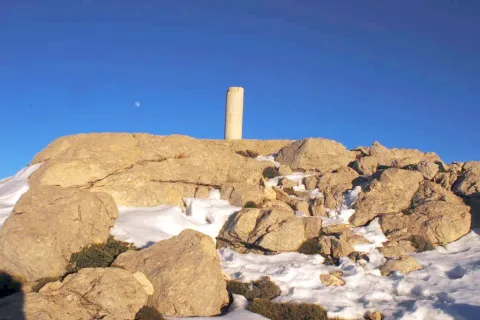
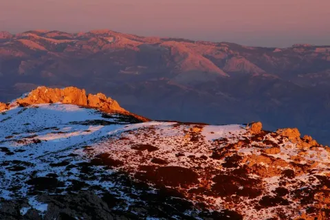
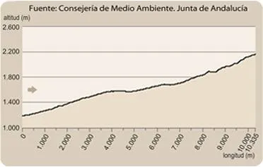
The rise to the Magina peak (2167 m.) will take you to the roof of the province of Jaén. This level assigns to the Natural Park of Sierra Magina the third altitude of Andalusia, after Sierra Nevada and the Sierra de Baza. The effort is demanding, but it has the reward to know a unique landscape. The Sierras de Cazorla, Segura and the Villas, Sierra Nevada, the Sierra Sur de Jaén, La Loma de Ubeda or the Valle del Guadalquivir are some of the panoramic views from the summit area.
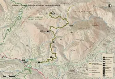
The tour is divided into three sections: the forest area, altiplanicie livestock and high mountain section.
At the beginning of the path, in a curve there is a detour that goes to the Chaganton ravine, which we will not take. Our path is always ascending, on a wide and firm track of land. Zigzagando gains height for four kilometres, while passing through a dense repopulation pine. This first stage of approach begins to show us views, and takes us to the interior of Sierra Magina.
Once the first climb has been crowned, we will be flying along a mile and a half by the Barranco de las Salinas, which serves as a transition to the last stretch of ascension. This is an area of pastures in which we find a very diverse vegetation such as complaints, larice pines and juniper, natural representatives of this bioclimatic floor. The transition ends slightly above the Tincada de la Cruz, a very characteristic livestock construction.
A few hundred meters above the dye the track is over and the path begins, which ascends in the east direction, and is marked enough to follow it without difficulty. Only in conditions of strong snow can the path mark be lost. The Barranco de las Covatillas, the first stretch of the path, leads us to the Port of Bolos, which is located on the east side, towards the Barranco del Garganton and beyond the Valley of the Jandulilla. At this point the path turns left facing north towards the summit area.
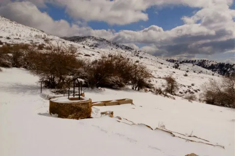
From here on the path passes through a stony area, on limestone. The landscape leaves the pineapples behind, and it will be the rake savannas that accompany us to the summit. Only something above we find the fork towards the summit of Miramundos, to the right. We will continue on our path, to the left and gradually gain height. Then we lose height at the head of a ravine slightly cooler. From this point on we start the final stretch until the peak of the Magina peak. The road is adapted to the relief. First by a few rocky steps, to reach a circular rocky depression on the hillside (a dolin or limestone sink), where one of the restored snow wells is. The end is a stone's throw. The maximum level is a high surrounded by other immediate summits (Jails, Peña de Jaén, Miramundos...), so the summit is one more of a crest.
The return will always be in decline, on the same path of ascent, provided that we do not choose other alternatives of return or combination with different paths, only recommended for those who have the experience and information to connect them.
From the Miramundos peak, we can see a landscape panorama that covers a wide range from Cazorla to Sierra Nevada: to the south, the Sierra Arana and Sierra Nevada granadinas; to the north in the foreground, the summits of Mount Cazorla and, to the west, the towns of Ubeda, Baeza, Sabiote, etc.; to the east the summit of La Morra de Magina and, to the bottom, the mountains of Quesada belonging to the Cazorla mountains; to the west we have the summit of Peña de Jaén and the Almaden.

Caño del Aguadero
This path can be realized throughout the year. In winter, its high mountain conditions can make it complicated, due to low temperatures, snow accumulation, ice, and strong wind showers. There are no drinking water points available on the tour, and sufficient hydration is recommended. In summer, due to similar high conditions, the insolation is very strong, linked to the lack of shadows, will be an important solar protection.
This path has the alternative, on the stretch of high mountain, towards the summit of Miramundos, and from there to the Caño del Aguadero, and the northern side of the massif. This complete alternative would be a different planning, requiring more than ten hours of intense walking, with the added inconvenience of having another car at the end point.
- In spring, botanical endemisms can be seen in flower, such as the Viola cazorlensis or the Lithodora clear (the only world representation of specimens of this species in these areas). Both are small seasonal herbaceous plants. Their very high fragility and the protection to which they are subject, prohibit any handling or taking of samples.
- Livestock landscape in the middle area of the tour, with traditional constructions such as wells and tinada.
- Panoramic of Jaén and adjacent provinces.
- The formation of rake savannas.
- Snow well in the summit area.
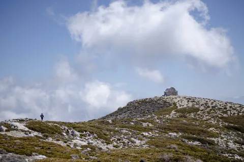
- High mountain landscape, with endemisms, geological formations, shelter...
- The sighting of royal eagles in flight, and mountain goats at the summits, is common.
In the km 6.5 of the road A-324 (Huelma-Cambil), direction Camil, as the CEDEFO passes, part to the right a wide lane. Later, coinciding with a cortijo, we found a crossing over a closed curve, the point of beginning of the path.
