Saltar al contenido principal
icon-intereses-viajar-solo

San Juan

Submitted by brandcode_deweloper on
5890484
Descripción larga

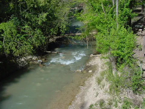
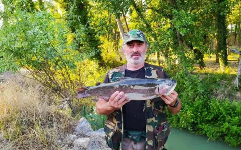
The San Juan district is located in the town of Alcaudete. In it, the rainbow trout may be fished during the working periods. San Juan is the perfect setting for fishing and enjoying the environment and nature.

Teléfono
953 560 000
Latitud
37.591020
Longitud
-2.87039
Distrito
Municipio
Ubicación en el mapa
POINT (-2.87039 37.59102)
imagen
Image
11.jpeg
Imagen principal
Activado
imagen
Image
la-pesca-vuelve-a-castillo-de-locubin.jpg
Imagen principal
Desactivado
Desactivado
Loading map
Preparing points of interest and routes...

Taberna / Tavern M

Submitted by brandcode_deweloper on
Id
10995466
Redes sociales
Facebook
https://www.facebook.com/TabernaMTorredelcampo
Descripción
Breve descripción

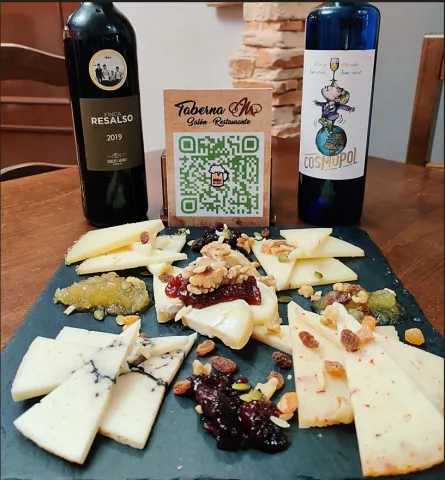
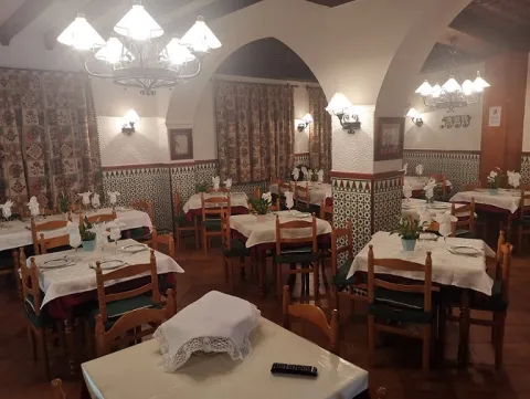
Bar and restaurant tavern M bases its dishes on typical traditional food, but with a modern and avant-garde touch. A wide variety of very suggestive dishes, cheeses tables, varied salads of salmon, chicken and caviar. Variety of home croquettes of Iberian ham, bull tail, boletus and shrimp among others. As well as eggs with ham, gulas, with overcooked and goat cheese.

Información de contacto
Teléfono de contacto
621 248 696
Correo electrónico
tabernam2017@gmail.com
Ubicación
Código Postal
23640
Latitud
37.770360
Longitud
-3.901190
Dirección
C/ Manuel Pancorbo, 21
Distrito
Municipio
Ubicación en el mapa
POINT (-3.90119 37.77036)
Tipo de restaurante
Imágenes
imagen
Image
taberna%20M%20entrada.jpg
Imagen principal
Activado
imagen
Image
taberna%20M%20sal%C3%B3n.jpg
Imagen principal
Desactivado
imagen
Image
Captura.JPG
Imagen principal
Desactivado
Capacidad
80
Tipo de cocina
Horario
Monday to Sunday: 12: 00 - 16: 00 and 20: 00 - 00: 00. Tuesday's closed.
Loading map
Preparing points of interest and routes...

Restaurant Noche de Ronda

Submitted by brandcode_deweloper on
Id
10581517
Redes sociales
Facebook
https://www.facebook.com/nochederondacazorla/
Instagram
https://www.instagram.com/nochederonda/?hl=es
Descripción
Breve descripción

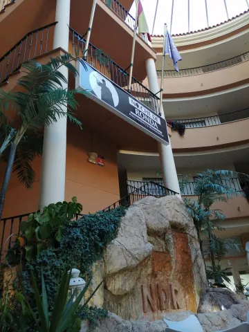
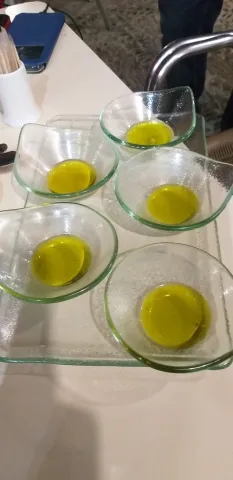
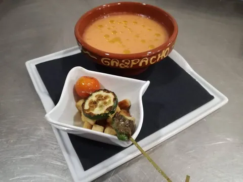
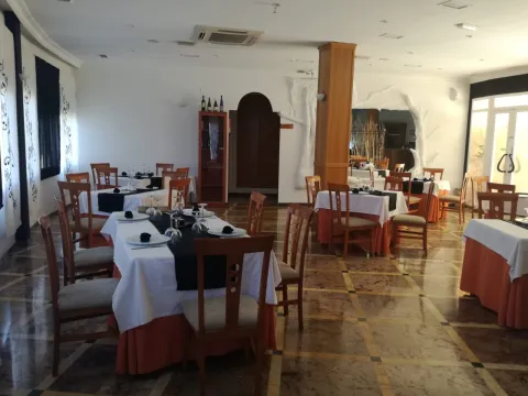
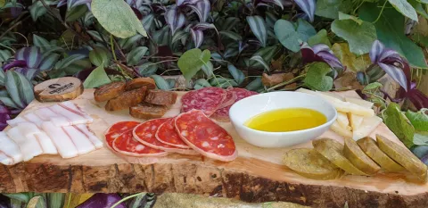
The "Noche de Ronda" restaurant is a charming establishment, where you can feel at home from the moment you arrive, you will receive the best deal and all the attention you deserve, because for us, the satisfaction of our customers is what matters most to us. We guarantee you a magnificent experience, having at the hand delicatessen that you can enjoy and the kitchen that characterizes us because it is made with the heart. We adapt to all kinds of audiences, we try to please those who visit us with a personalized treatment. Our facilities love all travelers, because we care to offer the best qualities. "


"Night of Ronda" is made up of a fraternal team, we like to consent to our customers and offer them such a wonderful experience, that they will stay with the desire to repeat it, the smiles are the ones that distinguish us, because we love what we do and enjoy seeing everyone around us happy.

Información de contacto
Sitio web
www.nochederonda.es
Teléfono de contacto
639 789 955
Correo electrónico
direccion@nochederonda.es
Ubicación
Código Postal
23470
Latitud
37.913356
Longitud
-3.007063
Dirección
C/ Magistrado Ruiz Rico, 3
Municipio
Ubicación en el mapa
POINT (-3.007063 37.913356)
Imágenes
imagen
Image
IMG_20200620_205409.jpg
Imagen principal
Activado
imagen
Image
1601634236258-20200930_150348.jpg
Imagen principal
Desactivado
imagen
Image
degustacion-de-aceites.jpg
Imagen principal
Desactivado
imagen
Image
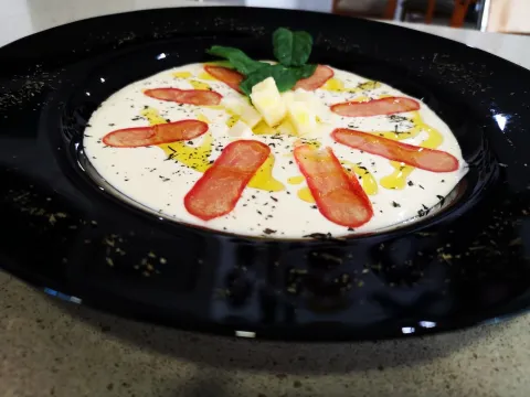
GAZPACHO.jpg
Imagen principal
Desactivado
imagen
Image
IMG-20190905-WA0013.jpg
Imagen principal
Desactivado
imagen
Image
tabla%20embutidos3.jpg
Imagen principal
Desactivado
imagen
Image
IMG_20190809_193923_753.jpg
Imagen principal
Desactivado
Microsite al que pertenece
Loading map
Preparing points of interest and routes...

Hotel-Restaurant Torrezaf

Submitted by brandcode_deweloper on
Id
10998648
Descripción
Breve descripción

The customer will be able to enjoy Mediterranean cuisine, specialising in seasonal products such as snails, matured meats and fresh fish, to the brasa, as well as a delicious Iberian carnifried. His elaborate dishes are much demanded by his customers.

Información de contacto
Sitio web
www.hoteltorrezaf.com/
Teléfono de contacto
953 567 100
Correo electrónico
hoteltorrezaf@hoteltorrezaf.com
Ubicación
Código Postal
23640
Latitud
37.773460
Longitud
-3.900690
Dirección
C/ San Bartolomé, 90
Distrito
Municipio
Ubicación en el mapa
POINT (-3.90069 37.77346)
Tipo de restaurante
Imágenes
imagen
Image
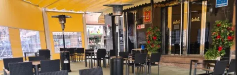
terraza%20restaurante%20hotel%20Torrezaf.JPG
Imagen principal
Activado
imagen
Image
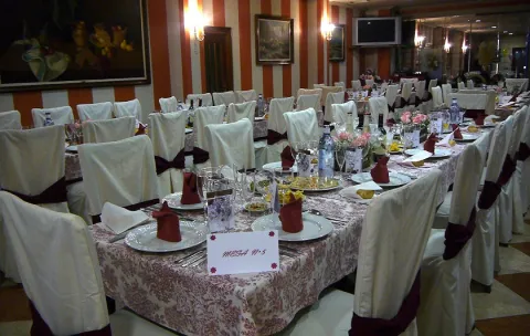
interior%20hotel.jpg
Imagen principal
Desactivado
Capacidad
80
Tipo de cocina
Horario
Restaurant: 13: 30 - 16: 00 and 20: 30 - 23: 30. Terrace: 13: 30 - 16: 30 and 20: 30 - 01: 00. Coffee shop: 07: 00 - 00: 00.
Loading map
Preparing points of interest and routes...

Restaurant Casa Vacas

Submitted by brandcode_deweloper on
Id
10992851
Redes sociales
Facebook
https://es-la.facebook.com/pages/category/Restaurant/Restaurante-Casa-Vacas-103523351269840/
Descripción
Breve descripción

Casa Vacas Restaurant offers its customers traditional food. As well as chotto al jillo, paletilla and some exquisite fries. The guest can also taste homemade tapas such as flaminquins and stuffed potatoes. They have a menu from Tuesday to Friday. They show a close and family environment that will make the customer feel at home.

Información de contacto
Teléfono de contacto
953 567 724
Correo electrónico
blancavacaspedro@gmail.com
Ubicación
Código Postal
23640
Latitud
37.772700
Longitud
-3.899510
Dirección
Paseo de la Estación, 31
Distrito
Municipio
Ubicación en el mapa
POINT (-3.89951 37.7727)
Imágenes
imagen
Image
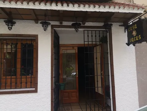
casa%20vacas%20fachada%20%281%29.jpg
Imagen principal
Activado
imagen
Image
casa%20vacas%20%281%29.jpg
Imagen principal
Desactivado
Capacidad
60
Horario
Open from Tuesday to Sunday.
Loading map
Preparing points of interest and routes...

Malak

Submitted by brandcode_deweloper on
Id
10685892
Redes sociales
Facebook
https://www.facebook.com/malakrestaurantejaen
Instagram
https://www.instagram.com/accounts/login/?next=/malakrestaurante/
Descripción
Descripción larga

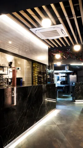
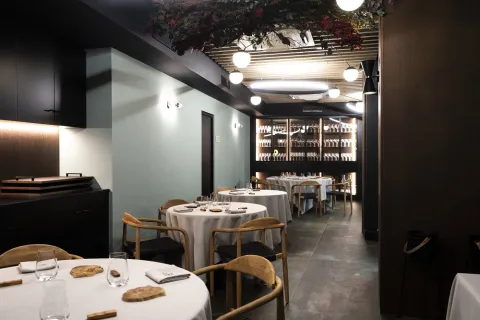
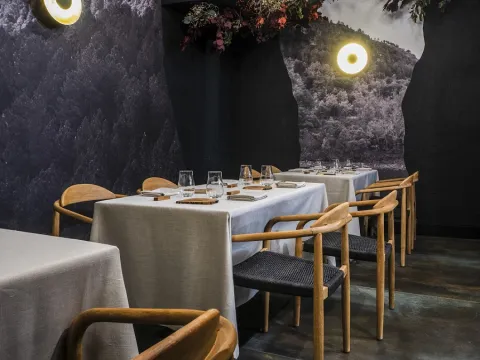
Malak restaurant is born to be a gastronomic space where nature and gastronomy come together to show the richness and quality of raw material that characterizes the Sierra de Segura, hence its philosophy, "Gastronomic Nature."
Javier Jurado, chef and owner of Malak has always been rooted in the Sierra de Segura, hence his inspiration arises by creating a letter with which he rescues and near the heart of Jaén the traditional recipe of the area.
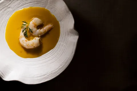
Accompanied by a great and professional team offers a seasonal card with the best products of the area and a tasting menu with which you will travel the favorite corners of the chef of the Sierra Segureña, through 11 passes and 2 succulent desserts.
A genuine journey and a great gastronomic experience based on excellence, quality and high cuisine

Breve descripción

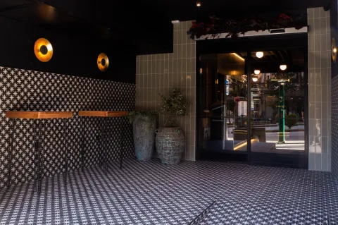
Our gastronomic proposal consists of a small seasonal card and a tasting menu, we also have closed menu for groups of more than 10 people. Both the seasonal card and the gastronomic menu have it perfectly translated and explained in English.

Información de contacto
Sitio web
https://restaurantemalak.com/
Teléfono de contacto
687 018 620
Correo electrónico
info@restaurantemalak.com
Ubicación
Código Postal
23001
Latitud
37.767557
Longitud
-3.787281
Dirección
Plaza de la Constitución, 11
Distrito
Municipio
Ubicación en el mapa
POINT (-3.787281 37.767557)
Tipo de restaurante
Imágenes
imagen
Image
P1420865.JPG
Imagen principal
Activado
imagen
Image
Malak%20Restaurante.jpg
Imagen principal
Desactivado
imagen
Image
Malak%20Restaurante%20%281%29.jpg
Imagen principal
Desactivado
imagen
Image
Malak%20Restaurante%20%282%29.jpg
Imagen principal
Desactivado
imagen
Image
Malak%20Restaurante%20Prensa_16.jpg
Imagen principal
Desactivado
imagen
Image
Malak%20Restaurante%20%283%29.jpg
Imagen principal
Desactivado
imagen
Image
Malak%20Restaurante%20%284%29.jpg
Imagen principal
Desactivado
Microsite al que pertenece
Loading map
Preparing points of interest and routes...

El Duque

Submitted by brandcode_deweloper on
Id
10999096
Redes sociales
Facebook
https://www.facebook.com/pages/category/Restaurant/Restaurante-El-DUQUE-104744638164355/
Descripción
Breve descripción

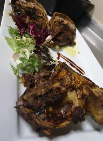
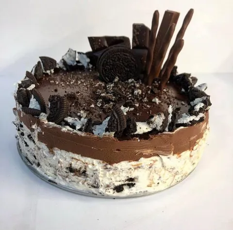
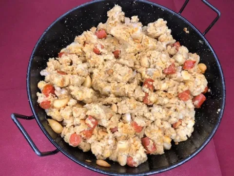
The restaurant offers traditional and Mediterranean food, tapas, roasts, rations and grilled meats. Home and high quality dishes such as solomillo, paletilla, goat leg, fish and delicious desserts. Your good service and cordial customer treatment are always present.

Información de contacto
Teléfono de contacto
650 438 293
Ubicación
Código Postal
23640
Latitud
37.768840
Longitud
-3.899090
Dirección
C/ Antonio Machado, 2
Distrito
Municipio
Ubicación en el mapa
POINT (-3.89909 37.76884)
Tipo de restaurante
Imágenes
imagen
Image
plato%20de%20carne.JPG
Imagen principal
Activado
imagen
Image
El%20duque%20tarta.jpg
Imagen principal
Desactivado
imagen
Image
El%20duque%20migas%20%281%29.jpg
Imagen principal
Desactivado
Capacidad
60
Loading map
Preparing points of interest and routes...

Café-Bar Tuareg

Submitted by brandcode_deweloper on
Id
11004955
Redes sociales
Facebook
https://es-es.facebook.com/pages/category/Bar/Caf%C3%A9-Bar-Tuareg-313190552661766/
Descripción
Breve descripción

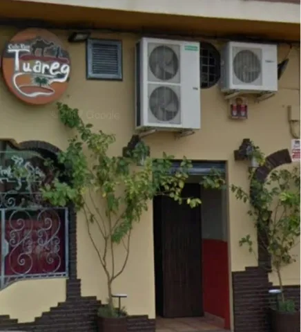
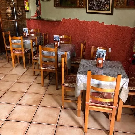
The Tuareg coffee and bar offers its customers a wide variety of high-quality tapas and rations. In this one you can taste just the pepper, the roquefort, the sherry, also fried squid, skewers, and home flaminkers. As well as threads and alparacts of loin, cheese and ham among others. Great service and customer service.

Información de contacto
Teléfono de contacto
953 567 703
Ubicación
Código Postal
23640
Latitud
37.770700
Longitud
-3.899980
Dirección
Plaza de España, 11
Distrito
Municipio
Ubicación en el mapa
POINT (-3.89998 37.7707)
Imágenes
imagen
Image
tuareg%20exterior.JPG
Imagen principal
Activado
imagen
Image
el%20tuareg%20interior.jpg
Imagen principal
Desactivado
Capacidad
60
Tipo de cocina
Horario
Tuesday to Sunday: 12: 00 - 16: 30 and 20: 30 - close.
Loading map
Preparing points of interest and routes...

Castle of La Iruela

Submitted by brandcode_deweloper on
Id
2275391
Descripción
Descripción larga

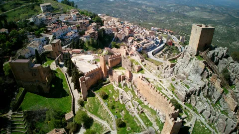
It is located at the highest point of a promontory that provides a natural defense, with strong cuts to the north and east, and which is extended to the west by a relatively wide and flat spur, from which the entrance tower to the castle is accessed.

A Almohad occupation developed between the XII-XIII centuries, the oldest recorded, has been documented. In this period the fortress would be built, which is organized in three enclosures with towers of troncopyramidal section, steps from north to south and made in high-quality tapial with a lime mortar lining simulating a false silery split. To the south of this set would extend the Islamic village, around the area where a vaguada was running.

In the 14th century several works will be carried out in the village, such as the construction of the first church of the town or the wall surrounding the area of access to the castle and the village. It will also be when various repairs are made in the castle and the so-called Torre del Picacho is raised on the top of the rock.

In the 15th century, at the point where the access door to the fortress was located, which was inserted in the canvas that separated the population from the square of arms, it was replaced by a torre-gate, which currently continues to function as access to the castle. This structure has rectangular plant, the first body, the only original part that is preserved, since the upper bodies are very restored, was built slightly wider than the rest with the aim of giving it greater strength.

In the following century the church of Santo Domingo was built on the south flank of the castle. With a typical Renaissance living room, it is organized in three ships, the centre of double width than the sides, and flat tester. The header has two cylindrical turreons on the corners. Its state of deterioration in the 19th century would lead to the suppression of the cult in the church and the abandonment of it, using it as a municipal cemetery until the mid-20th century.

The origin of the population appears to be related to the construction of the Almohade castle, which rises on a rocky spur dominating the town. It is most likely to be built as a center of a castral district that would cover much of what will then be the Cazorla advance. The high level of construction seems to indicate the State's participation in its construction in order to strengthen the Al- Andalus border.

In 1231, Fernando III, before conquering the area, granted the lordship of the village of Quesada to the church of Santa María de Toledo. Months later the prized Archbishop of Toledo Don Rodrigo Ximénez de Rada began the conquest of this territory, including La Iruela, thus taking over the lands that will later constitute the Lordship of the advance of Cazorla. The conversion of Cazorla to the capital of the advance must have had an impact on the development of the populations of its surroundings, so that the castle of La Iruela would be almost abandoned when the strengths of Cazorla were built.

In the second half of the 14th century, during the civil war that faced King Peter I with his stepbrother Henry II Tratámara, while Cazorla remained faithful to the king, Iruela supported the Archbishop of Toledo, who had placed himself on the sublevate side. After the end of the conflict after the victory of Henry II, in thanks for the support given, Archbishop Don Pedro Tenorio granted him the status of a villa in 1378.

From now on, the town will experience a progressive development, which will be reflected in the emergence of new buildings and in the reform of its defensive structures. After the conquest of Granada the advance would remain until 1812, but already without the tutelage of the figure of the military advance, a direct result of the loss of its strategic and border position.

The population of La Iruela tripled in the 16th century, growth that resulted in the construction of the first urban town, breaking with the walled structure that had characterized the population during the Middle Ages.

In the course of the War of Independence the population would be attacked on several occasions by the Napoleonic troops, suffering significant damage.


Breve descripción

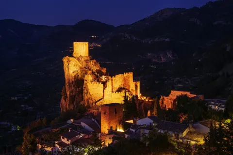
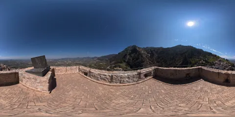
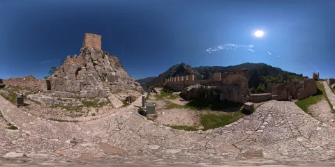
The castle of La Iruela dominates the homonymous town from a rocky promontory, located 1.5 km north-east of the town of Cazorla. The mothade-origin fortification consists of three walled enclosures with towers and arranged in a step in a north-south direction. It is an interesting ensemble that is accessed by a 15th century door tower, and from which stands out its Tribute Tower, located in the highest part of the river and visible from a great distance. Next to the castle you can see the ruins of the Renaissance church of Santo Domingo, from the 16th century.
The Iruela had its origin in a small house associated with a strategic fortress. After his conquest, the prized Archbishop of Toledo Don Rodrigo Ximénez de Rada will be the lordship of the advance of Cazorla, of which he will be a part. His support for the archbishopric and Henry II Tratámara in his confrontation with King Peter I was worth the village's rank in 1378, with a strong development of the town. It currently maintains the urban plot, with steep and narrow alleys that adapt to the level curves and in which the usual serrana architecture is maintained.

Telecomunicaciones
Sitio web
www.ayuntamientolairuela.es
Teléfono de contacto
953 720 712 / 626 811 583
Correo electrónico
info@ayuntamientolairuela.es
Ubicación
Código Postal
23476
Latitud
37.921075
Longitud
-2.989891
Dirección
Carretera Santo Domingo, s/n
Municipio
Ubicación en el mapa
POINT (-2.989891 37.921075)
Tipos de punto de interés
Imágenes carrusel
imagen
Image
_DSC5265.jpg
Imagen principal
Desactivado
imagen
Image
_DSC4822.jpg
Imagen principal
Desactivado
imagen
Image
castillo de iruela
Imagen principal
Desactivado
imagen
Image
castillo de iruela
Imagen principal
Desactivado
imagen
Image
castillo de iruela
Imagen principal
Desactivado
imagen
Image
castillo de iruela
Imagen principal
Desactivado
imagen
Image
castillo de iruela
Imagen principal
Desactivado
imagen
Image
castillo de iruela
Imagen principal
Desactivado
imagen
Image
castillo de iruela
Imagen principal
Desactivado
Imágenes cabecera
imagen
Image
CyB_Iruela_01
Imagen principal
Desactivado
imagen
Image
CyB_Iruela_02
Imagen principal
Desactivado
Horario
Nov - sea: 10: 00 - 14: 00 and 16: 00 - 18: 00. 1 abr - 12 may: 10: 00 - 14: 00 and 17: 00 - 19: 00. 15 May - 19 Jun: 10: 00 - 14: 00 and 17: 00 - 20: 00. 19 Jun - 15 sept: 10: 00 - 14: 00 and 19: 00 - 22: 00. 18 sept - 29 sept: 10: 00 - 14: 00 and 17: 00 - 20: 00. October: 10: 00 - 14: 00 and 17: 00 - 19: 00. Monday and Tuesday closed.
Modelo 3D
Experiencia 360
Image
CyB_Iruela
Image
CyB_Iruela
Loading map
Preparing points of interest and routes...
Marcas de calidad

Santa Catalina Castle

Submitted by brandcode_deweloper on
Id
321305
Descripción
Descripción larga
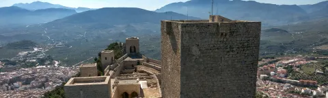
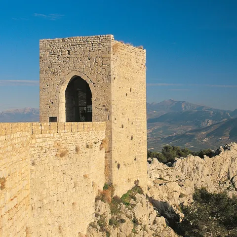
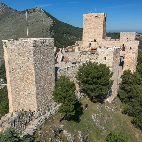
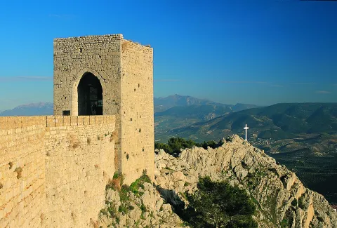
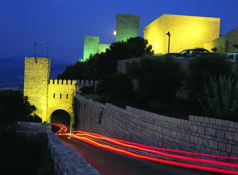
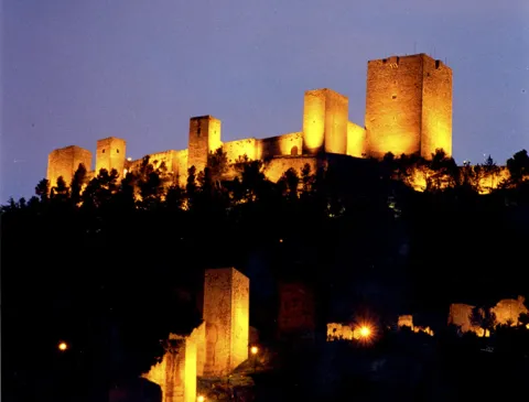
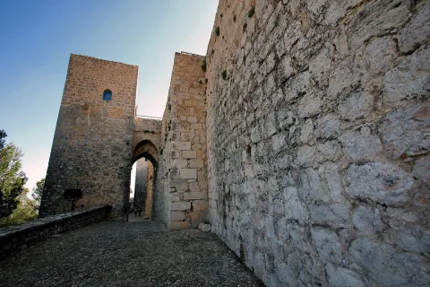
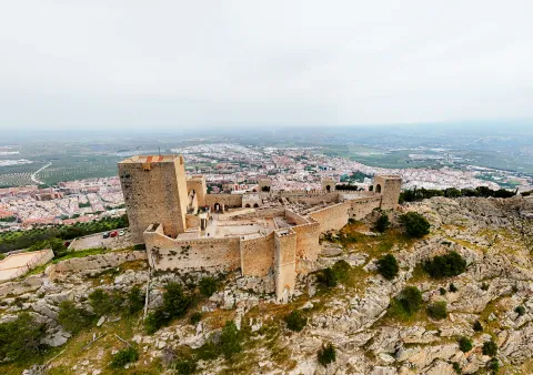
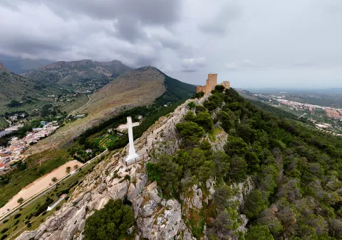
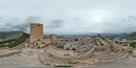
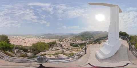
After the Muslim conquest, between the 8th and 9th centuries, a walled complex was built structured in two spaces: a large enclosure or fortress at the summit and the fortress itself, on the northern slope, which takes advantage of the remains of the Roman wall. The citadel was a large defensive-residential enclosure, in which a rectangular building with a porticoed patio has been documented, which could have been the residence of the first governors of the city during the Emiral-Califal era. The transfer of the capital from the Kura to Jayyān in the 9th century led to a strong development of the city, restoring the existing fortification structures, while new walls and towers were built. The changing political situation in al-Andalus between the 11th and 13th centuries caused an intense reform of the walls, which culminated in the transformation of the summit fortress into a large and complex fortress. Thus, a large fortified complex structured in two enclosures is configured: at the west end, a first enclosure is erected in mortar mud, with an irregular floor plan, known as Castillo de Abrehuí; To the east is the main enclosure, known as Alcázar Viejo, which was accessed through a gate protected by two parallel towers. At the same time, a new political-administrative space was built in the eastern area of ​​the Alcázar Viejo, a palace of which archaeological investigations have managed to recover various vestiges, as well as determine how its distribution was, differentiating the lower and upper rooms, in which the palace was located, adorned with a profuse and luxurious decoration of plasterwork and ornate plinths that covered its walls (part of which are exhibited in the Museo Provincial de Jaén). The conquest of Jaén in 1246 determined an important alteration of the urban fabric of the city, and its defensive structures. The rammed earth walls and towers are covered with masonry linings. The old Islamic fortification on the summit maintained its old layout, except for the construction, between the 13th and 14th-15th centuries, of a new fortress that would occupy its eastern end, called Alcázar Nuevo. Its external perimeter is delimited by a walled enclosure that incorporates 6 towers, built in masonry. The towers are square in plan, except for the easternmost one (Sailing or Guard Tower) which has a pentagonal shape at the bow, by embedding an ancient Islamic tower inside. All of them are connected to each other by crenellated walkways. The Homenaje is divided into three rooms. The first, covered with four brick vaults that converge into a single central pillar and lacks exterior lighting, would have a storage function. The second is covered by a spherical brick vault supported at each corner by a stone column. The third floor has a polygonal brick vault and would have a residential function. In the archaeological excavations, decorated plasters also appeared, dated between the 14th and 15th centuries, which would cover the walls of the Santa Catalina chapel, perhaps introduced after the reforms carried out by Constable D. Miguel Lucas de Iranzo. To the east of the castle gate, on the north side of the enclosure, there are two albarran towers, the westernmost one, solid at the bottom and with an outbuilding at the top, houses the Capilla de Santa Catalina, patron saint of the city. The eastern one, much restored, would have a military function, lacking dependency, so it would form a solid cube crowned by a crenellated roof. On the south side there is a gate or postern next to Torre de las Troneras, which houses some latrines. Within the walls there were rooms and elements for the internal functioning of the castle: cisterns, a grinding area and other rooms. In the third quarter of the 15th century, during the civil war that took place during the reign of Enrique IV, Constable Miguel Lucas de Iranzo once again reinforced the city's defenses, providing the walls with a rampart and a moat, demolishing part of the walkways and blocking off some towers of the North wall, accentuating the city's contestability against the enemies of the Castilian monarch. Between the 16th and 18th centuries, remodeling took place in some rooms of the Alcázar Nuevo, which changed their function, new ones were built and the postern in the southern sector was blinded. At the beginning of the 19th century, the war of independence caused important changes in the structure of this fortress, despite which the external appearance of the medieval fortification is maintained. The renovations, which caused the destruction of structures and outbuildings, include the repair of walls, the cancellation of gates, the construction of new defensive structures, and the erection of large buildings for various uses, stables, barracks, hospital, guard posts, magazines, etc., of which there are hardly any remains today, as a consequence of the construction of the Parador de Turismo between 1963 - 1978 and the execution of various restoration works carried out in the 80s. The Santa Catalina hill has been populated since the Copper Age, although the oldest documented structures belong to an Iberian oppidum, dated around the 9th century BC, and identified as Oringis. Between the 2nd and 1st centuries BC. The Romans transformed it into a new fortified settlement with a polygonal plan. The constitution of the Flavio Aurgitano Municipality, at the end of the 1st century AD, caused the rapid urbanization of the space currently occupied by the La Magdalena neighborhood, delimited by a walled enclosure. The abandonment and looting of buildings that formed the Roman forum or the presence of isolated tombs and garbage dumps show the progressive transformation of the city under imperialism between the 3rd and 4th centuries AD, a mutation that would continue in the Visigothic era. After the Islamic conquest, the first news about present-day Jaén (Ŷayyān) dates back to the mid-19th century. IX when the Umayyad emir Abd al-Rahman II converted the city into the new capital of the Cora, erecting the citadel, the seed of the current castillo de Santa Catalina, as well as part of the walls that linked it to the city. At this time, the first palaces were being built, which would end up forming the fortress located in the medina. From the s. XI, and especially during the Almohad period (1169-1246), the city expanded towards the south. There was also the renovation and expansion of the Umayyad and Taifa castle located in the medina itself, equipped with lavishly decorated gardens and palaces, while a residential-administrative area was created in the castle. After the Castilian conquest in 1246, the urban configuration of Jaén must not have experienced major changes until the 14th-15th centuries. Fernando III proceeded to repopulate and distribute it, remaining in the hands of the Council and becoming an episcopal see. The instability of the territory until the conquest of Granada in 1492, and the noble struggles during the reign of Henry IV caused constant repairs to the defensive elements: the Almohad wall was covered with masonry, while the construction of a New Alcázar began at the eastern end of the Cerro de Santa Catalina. For its part, the Almohad fortress located in the epicenter of the city was in the hands of the Castilian crown until 1382 when it became the Santo Domingo convent. At the beginning of the 19th century, during the invasion of Spain by Napoleonic troops, Jaén and its defenses once again played a prominent role, maintaining control of the city in the face of the attack and looting of 1808, before passing into the hands of the French in 1810. The instability prevailing between 1808 and 1814 led to important remodeling of the fortifications of the hill, converting them into a large garrison from which to exercise control of most of the province and the roads to Granada and Córdoba After the end of the war of independence, the defensive structures of the hill and the city remained standing, although suffering a progressive process of deterioration, which became even more accentuated throughout the 20th century, at the end of which various restoration works were carried out. The castillo de Santa Catalina is a symbol for the people of Gienne and Juan Eslava Galán echoes it and continually introduces it in his works, as he does in The Templars and the Table of Solomon. (…) During my stays in Jaén I had gone up to castillo de Santa Catalina several times. After glimpsing the secrets of its builder, Alfonso X, I visited it again with a different spirit (…) The Templars and Solomon's Table. Chapter 18. LEGENDS Legend of the appearance of Santa Catalina. Legend has it that during the siege of Jaén, Santa Catalina de Alejandría appeared to King Ferdinand III in his dreams and showed him the keys to Jaén, taking it as an omen. The next day, the Muslims handed over the fortress to the Christian troops and in gratitude, Fernando III named Santa Catalina patron saint of the city, naming the newly conquered fortress after her. The chamber of statues. In the Old Castle there was a secret room with a tightly closed door, to which each king added a new lock. When he was already 24, a usurper who seized the throne refused to continue the tradition, ordering the ranch to be opened. Inside he found a high relief, made of metal and wood, with fearsome Arab warriors on horseback and an inscription that prophesied "If any hand opens the door of this castle, the flesh warriors who look like the metal warriors will take over the kingdom." Before the year was over, Tarik took the fortress. Legend of the castle cross. Legend says that when King Ferdinand III entered the fortress of Jaén, after conquering the Muslims, one of his captains thrust a sword, as a sign of triumph, into a rocky promontory at the southern end of the hill, from which the lands of Jaén are dominated. The shape created by the blade and the crossbar of the weapon resembled a Christian cross. King Ferdinand III, fascinated, decided that there would always be a large cross at that same point to remember the conquest of the Christian troops. A legend that ended up becoming tradition.
Breve descripción
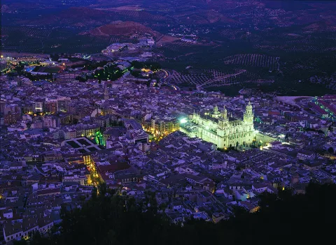
The defensive structures of the city of Jaén, which occupy the summit and southern and northern slopes of the Santa Catalina hill, have experienced a complex historical-architectural evolution. The Muslims erected a fortified complex on the summit and the northern slope of the Cerro de Santa Catalina, at the foot of which the city of Jaén extends, formed by two clearly differentiated enclosures: the castillo de Abrehuí and the Alcázar Viejo, which housed a luxurious palace building. After the Christian conquest in 1246, the Castilians built a final enclosure, the Alcázar Nuevo, which today maintains its original structure: a masonry enclosure with six towers. The preserved sections of wall descend down the slopes of the hill until they surround the ancient city. Although populated since the Copper Age, and occupied in Iberian and Roman times, it was in the Middle Ages when the most important defensive elements were erected. The transfer of the capital of the Chora from La Guardia (Mantisa) to Jaén (Jayyān) by 'Abd al-Rahman II led to the development of the city and its fortifications, which were expanded between the 11th and 12th centuries, while the main mosque, new baths, mosques and palaces were built. During the Christian conquest of the Guadalquivir valley, Jaén resisted several sieges until, in 1246, the king of Granada Ibn al-Ahmar, handed the city over to Ferdinand III. A first-rate border town, it took part in the continuous noble struggles, especially those carried out by Constable D. Miguel Lucas de Iranzo, a supporter of King Enrique IV, against the rebellious nobility. At the beginning of the 19th century, during the War of Independence, Jaén and its defenses once again played a prominent role in the control of the Alto Guadalquivir.

Ubicación
Nombre
Castillo de Santa Catalina
Código Postal
23003
Latitud
37.768384
Longitud
-3.799968
Distrito
Municipio
Ubicación en el mapa
POINT (-3.799968 37.768384)
Tipos de punto de interés
Imágenes carrusel
imagen
Image
Mon310.jpg
Imagen principal
Desactivado
imagen
Image
Castillos_Cacbecera_jaen.jpg
Imagen principal
Desactivado
imagen
Image
castillo santa catalina
Imagen principal
Desactivado
imagen
Image
castillo santa catalina
Imagen principal
Desactivado
imagen
Image
castillo santa catalina
Imagen principal
Desactivado
imagen
Image
castillo santa catalina
Imagen principal
Desactivado
imagen
Image
castillo santa catalina
Imagen principal
Desactivado
imagen
Image
castillo santa catalina
Imagen principal
Desactivado
imagen
Image
castillo santa catalina
Imagen principal
Desactivado
Imágenes cabecera
imagen
Image
CyB_Jaen_01
Imagen principal
Desactivado
imagen
Image
CyB_Jaen_02
Imagen principal
Desactivado
Horario
Winter: Monday to Saturday 10:00 - 18:00 (last access 17:30), Sundays 10:00 - 15:00 (last access 14:30). Free admission Wednesday 3:00 p.m. - 6:00 p.m. Summer: Monday to Saturday 10:00 - 14:00 and 17:00 - 21:00, Sundays 10:00 - 15:00. Free admission Wednesday 5:00 p.m. - 9:00 p.m.
Otros servicios
Parking in the vicinity of the Parador with capacity for buses. Castillo de Santa Catalina Interpretation Center.
Modelo 3D
Experiencia 360
Image
CyB_Jaen_360
Image
CyB_Jaen_360
Loading map
Preparing points of interest and routes...