Saltar al contenido principal
icon-intereses-viajar-solo

Marchena

Submitted by brandcode_deweloper on
Id
918937
Descripción
Descripción larga

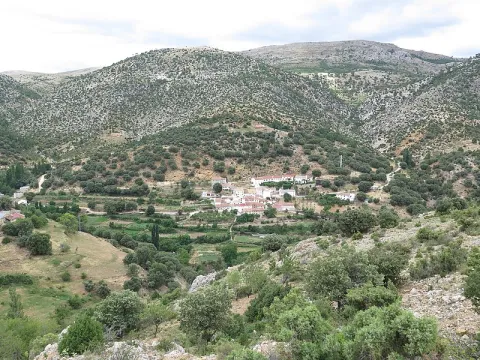
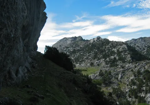
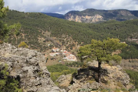
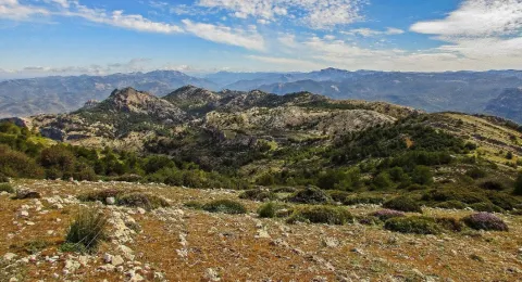
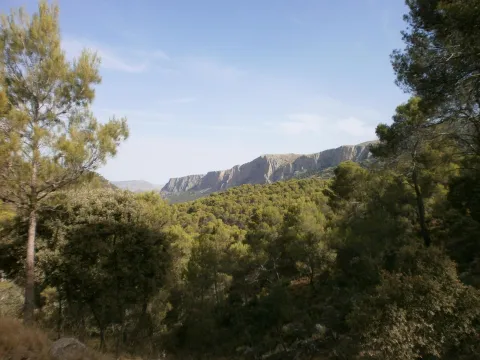
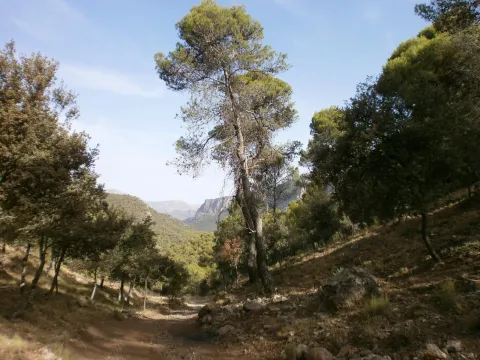
A spectacular rise in which we gain height in a dizzy way, elevation curves and great precipities that make them as natural glances: this is what you can find in Marchena. You can't miss the houses attached to the rock known as the Mound right in the village of the same name on the way to Marchena. We find the olive tree, fruit trees and orchards next to oak and pine trees.

In Marchena you can make three small paths PR-A 107 known as "Arab Alquerías," the PR-A 101 that goes from the Picachos to the Tutubiero Age and the PR-A 102 known as the Mirabete road.

Breve descripción

Marchena sits on a hillside next to a small valley. Streets, stairs, up and down. Rinses surrounded by silence and tranquility only broken by the sound of water. It is surprising the number of orchards, whose survival is explained by the remoteness from trading populations. Recovecos, windows and doors for statures of another time, calmed and dazzling alleys that contrast with the green of the forest surrounding the village.

Ubicación
Latitud
38.188620
Longitud
-2.498080
Ubicación en el mapa
POINT (-2.49808 38.18862)
Tipos de punto de interés
Imágenes carrusel
imagen
Image
fuente_1_7736.jpg
Imagen principal
Desactivado
Imágenes cabecera
imagen
Image
800px-Marchena%2C_Ja%C3%A9n_24J_01.jpg
Imagen principal
Activado
Loading map
Preparing points of interest and routes...
Marcas de calidad

Wildlife Observation Sites

Submitted by brandcode_deweloper on
Id
921316
Descripción
Descripción larga


A continuación referimos los senderos y algunas de las especies de más interés que se pueden observar en cada una:

Cerrada del Utrero

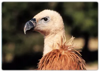
Buitre leonado, martín pescador, mirlo acuático, chova piquirroja, oropéndola, vencejo real.

Laguna de Valdeazores

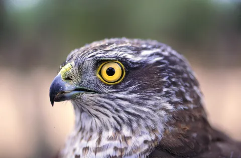
Gavilán, azor común, garza real, zampullín común, gallineta común, ánade azulón, focha común, somormujo lavanco, cárabo, oropéndola.

Río Borosa

Azor común, búho real, águila real, gavilán, cárabo, mirlo acuático, martín pescador, oropéndola, lúgano, golondrina dáurica.

Cueva de La Malena

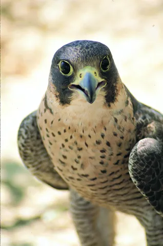
Buitre leonado, halcón peregrino, ratonero, martín pescador, reyezuelo listado, piquituerto, mosquitero papialbo.

El Chorro

Águila calzada, buitre leonado, alimoche, azor, halcón común, avión roquero, piquituerto.

La Presilla

Halcón peregrino, buitre leonado, mochuelo, chova piquirroja, collalba negra, escribano soteño, roquero solitario, avión roquero, lúgano, zorzal alirrojo.

Paraje Natural del Alto Guadalquivir – Puente de la Cerrada

Gallineta común, aguilucho lagunero, aguilucho cenizo, milano negro, rascón europeo, ánade friso, pato cuchara, porrón europeo, carricero común, andarríos chico, chorlitejo grande.

El Chillar

Halcón peregrino, cernícalo vulgar, búho real, mochuelo, alcaraván, collalba rubia, buitrón, bisbita pratense, gorrión chillón, abejaruco, carraca, garcilla bueyera.

Barranco del Guadalentín

Quebrantahuesos, águila real, águila culebrera, águila calzada, águila perdicera, halcón peregrino, gavilán, azor, verderón serrano, oropéndola, mirlo acuático, reyezuelo listado, mosquitero papialbo.

Arroyo Guazalamanco

Gavilán, ratonero, azor, críalo europeo, golondrina dáurica, rabilargo, mirlo acuático, chochín, oropéndola, petirrojo.

ZONAS DE AVISTAMIENTO DE FAUNA SALVAJE

El avistamiento relativamente frecuente de fauna salvaje es uno de los atractivos más conocidos y destacados del Parque Natural. Ciervos, gamos, muflones, cabras monteses, jabalíes y diversas aves rapaces son muy abundantes, como consecuencia de lo agreste del territorio, de su gran extensión y de su buen estado de conservación.

Pero es preciso tener en cuenta una serie de consideraciones para no ver defraudadas tus expectativas y para que tu actividad no perturbe la vida animal:

  • La presencia de los animales salvajes es siempre imprevisible. En ningún lugar ni en ningún momento se puede asegurar que va a haber avistamientos. Aunque sea obvio, no olvides que el Parque no es un zoo.

  • La mayoría de los avistamientos se producen a larga distancia. Es importante llevar prismáticos.
  • La observación de fauna en estado salvaje depende de diversas condiciones ambientales, sobre todo las climatológicas, así como de la época del año y de la hora del día. Generalmente, para ver grandes herbívoros hay que aprovechar las primeras y últimas horas del día. Sin embargo, las grandes rapaces se hacen más visibles durante las horas centrales del día, ya que aprovechan las cálidas corrientes térmicas para el vuelo.
  • El color del pelaje de los grandes herbívoros los camufla en el medio, por lo que es preciso tener paciencia y constancia en la observación. Lo más frecuente es detectar su presencia cuando se mueven.
  • Las alteraciones que producimos cuando estamos en el medio en el que viven los animales deben ser mínimas. Algunas normas y actitudes te facilitarán la observación y supondrán menos molestias para ellos:
    • Ante todo, sé respetuoso y mero espectador de la naturaleza.
    • Intenta pasar desapercibido. Es mejor ir solo o en pequeños grupos, y con vestimenta apropiada de colorido poco llamativo. Ten en cuenta que, con toda probabilidad, los animales detectarán tu presencia mucho antes que tú la suya, ya que el temor hacia nosotros está inscrito en su memoria genética tras miles de años de ser perseguidos por el ser humano.
    • El silencio es imprescindible. Aprovecha para escuchar e interpretar los mil sonidos de la naturaleza que suelen pasar desapercibidos.
    • Jamás intentes perseguir a los animales o acercarte a su medio más íntimo, como nidos o zonas de paridera y cría. Puedes causar daños irreparables y exponerte a respuestas agresivas.
    • Se recomienda no salir de las pistas y senderos.
    • Todas las especies están protegidas por la normativa correspondiente, que hay que respetar. Siguiendo los consejos anteriores, no tendrás ningún problema.
  • En el Parque Natural hay empresas especializadas que están autorizadas para llevar a los visitantes en vehículos todoterreno por zonas donde está prohibido el acceso a coches particulares. Son zonas donde el avistamiento de fauna es frecuente.
  • La berrea del ciervo es uno de los acontecimientos más seguidos en el Parque. La zona tradicionalmente más popular es la de Bujaraiza, en el embalse del Tranco. Pero hay otras de berrea menos frecuentadas, muy cerca del Parque Natural, en las estribaciones de Sierra Morena cercanas a Génave, Puente de Génave y Arroyo del Ojanco. Se trata de grandes fincas privadas dedicadas a la caza mayor, donde los venados son muy abundantes, aunque hay que observarlos desde el otro lado de las vallas de cerramiento de las propiedades.
  • En el Parque de Fauna Silvestre de Collado del Almendral podrás ver con gran comodidad ciervos, gamos, muflones y cabras monteses en semicautividad.

Por otra parte, ten presente que, además de los grandes herbívoros y las rapaces, el Parque Natural está lleno de otros muchos animales cuya observación te puede resultar muy gratificante.

Las ardillas son abundantísimas, así como las avecillas forestales (carboneros, herrerillos, mitos, pinzones, etc.) y otros muchos pájaros. El inconfundible canto de pequeñas rapaces nocturnas, como el cárabo y el autillo, son habituales en los bosques del Parque y en el entorno de pueblos y aldeas.

En los ríos podrás ver al mirlo acuático, habitante de las aguas rápidas y limpias. Y, por supuesto, a las truchas. Miles de especies de invertebrados, así como pequeños anfibios y reptiles se ofrecerán a tu vista… a veces, no hay escena de caza más apasionante que la de una simple salamanquesa que acecha con infinita paciencia a los mosquitos posados sobre las blancas paredes de un cortijo, en las frescas y estrelladas noches del verano.

En todo el Parque Natural se puede avistar fauna salvaje, pero en este mapa te sugerimos una serie de áreas y enclaves donde es más fácil la observación de los grandes herbívoros y las rapaces.

Breve descripción

SENDERS OF ORNITOLOGIC INTEREST

In the southern area of the Park and its nearby environment there are ten paths of Ornithological Interest. They are all in easily accessible places of great landscape beauty and at the beginning they have a panel with very complete information about the species of birds that can be observed, the route and the environment.

Ubicación
Latitud
37.772886
Longitud
-3.788329
Distrito
Municipio
Ubicación en el mapa
POINT (-3.788329 37.772886)
Imágenes carrusel
imagen
Image
2.png
Imagen principal
Desactivado
imagen
Image
1.png
Imagen principal
Desactivado
imagen
Image
3.png
Imagen principal
Desactivado
imagen
Image
Natu083.jpg
Imagen principal
Desactivado
imagen
Image
Natu094.jpg
Imagen principal
Desactivado
imagen
Image
Natu098.jpg
Imagen principal
Desactivado
imagen
Image
Natu156.jpg
Imagen principal
Desactivado
imagen
Image
Natu136.jpg
Imagen principal
Desactivado
imagen
Image
Natu186.jpg
Imagen principal
Desactivado
imagen
Image
Natu193.jpg
Imagen principal
Desactivado
imagen
Image
Natu207.jpg
Imagen principal
Desactivado
imagen
Image
Natu155.jpg
Imagen principal
Desactivado
imagen
Image
Natu212.jpg
Imagen principal
Desactivado
imagen
Image
Natu240.jpg
Imagen principal
Desactivado
imagen
Image
Natu262.jpg
Imagen principal
Desactivado
imagen
Image
Natu257.jpg
Imagen principal
Desactivado
imagen
Image
Natu256.jpg
Imagen principal
Desactivado
imagen
Image
Natu244.jpg
Imagen principal
Desactivado
Imágenes cabecera
imagen
Image
muflon.png
Imagen principal
Activado
Loading map
Preparing points of interest and routes...

The Hanging Gardens: La Vegetación de Las Rocas

Submitted by brandcode_deweloper on
Id
882062
Descripción
Descripción larga

Due to the presence of numerous rocky walls, both wet and dry, the rupic formations (small rock plants) are very abundant in the Park, forming true hanging gardens.

The limestone acts as a sponge by storing water, making life possible between its fissures and small shelves of a multitude of species that adapt to it. Some of these species live on the rocks for simple need, as only in them do they find shelter in front of the tooth of the herbivores.
Among the plant formations that populate the rocks we will distinguish two, those that are in dry walls and those that prefer wet and slender walls, much more scarce. A good place to see both very close is in the Las Villas saw, in Poyo Sequillo the dry walls and in the Cerrada de San Ginés the wet walls.
In the area of Poyo Sequillo we will enjoy a magnificent panoramic view of the Sierra de las Villas and its geological formations in bed. Rupicular plants such as the Cazorla violet (Viola cazorlensis), pipyrimañas (Sanguisorba rupestris), rock tea (Jasonia glutinosa), geranium of the waterfalls (Geranium cataractarum), stone breakers (Teucrium rotundifolium), tomils (Thymus orospedanus), and five branches (Potentilla caulescens), among others.
In the Cerrada de San Ginés, we will find the endemic carnivora plant known as the Andalusian grasilla (Pinguicula vallisnerifolia), as well as the widow's flower (Trachelium caeruleum), the Cazorla (Silla reverchinii), the five-in-branch (Potentilla caulescens), which lives in both dry and humid environments, and unnamed species such as Galium erytrirhizon, ferns as the hair of Venus (Adiantum capilluls- venerans and others as Aplentians). The tour has a little more than a kilometer and we advise to do it, because in this small closed the dry walls are alternating with rezummers.

_

As we enter the Las Villas mountains from Mogón, Sao Tomé or Chilluévar, we pass the reservoir of Aguascebas, and a few kilometers later, in the area known as the Collado del Pocico, a series of rocky cuts that flank the road, colonized by a lot of rupeal species, begins on our right.

_

From the previous site, following the road and after overcoming the Collado de la Traviesa and the cortijo of the same name, we reached the recreational area of Gil Cobo. In it we left the vehicle and took a track that goes right before crossing the bridge over the river Aguacebas of Gil Cobo. As soon as we walk, we'll start to see the slimming walls. Just half a mile, on our right, we'll have a big wall with a rupic community of wet wall.

Breve descripción

Poyo Sequillo and Cerrada de San Ginés

Ubicación
Latitud
37.913410
Longitud
-3.003750
Municipio
Ubicación en el mapa
POINT (-3.00375 37.91341)
Tipos de punto de interés
Imágenes carrusel
imagen
Image
cerrada.jpg
Imagen principal
Desactivado
Imágenes cabecera
imagen
Image
16283_ue3ikjl8bzcgqs12.jpg
Imagen principal
Activado
Loading map
Preparing points of interest and routes...

Los Anchos

Submitted by brandcode_deweloper on
Id
659877
Descripción
Descripción larga

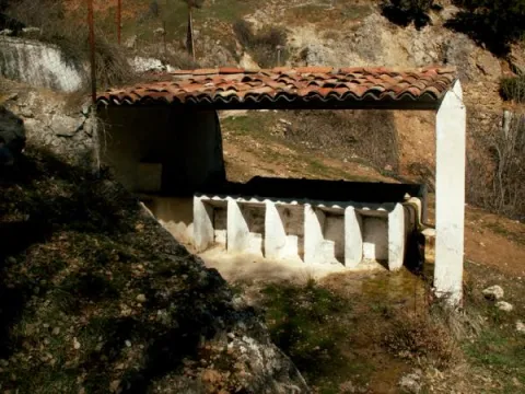
After a first group of houses, in which the Alma Serrana Ethnological Museum is located, we come to the Anchos to move us to another time. Baked streets, a laundry room that conveys tranquility through the water reflection, an oven or a small hermitage.

The Anchos conserves houses with a barely altered construction, the common being the wood, the gilded walls and the forging bars. A railing marks the limit between the houses and the gardens, being an unbeatable place to view the landscape and make a stop on the way. The village is located on a plain surrounded by mountains and next to the houses are the gardens that are still cultivated today.

Through the Anchos passes the GR 147, so we can do the path towards the River Madera or towards the Toba.

Breve descripción

From the crossing of the Venta Rampees a very narrow road leads us to the village of Los Anchos. The road seems to be lost to the interior of the mountain for just over four kilometres until we begin to see some gardens on terraces that indicate the beginning of human presence.

Ubicación
Latitud
38.223587
Longitud
-2.584503
Ubicación en el mapa
POINT (-2.584503 38.223587)
Tipos de punto de interés
Imágenes carrusel
imagen
Image
601_image_1.jpg
Imagen principal
Desactivado
imagen
Image
601_image_2.jpg
Imagen principal
Desactivado
imagen
Image
Vegetaci%C3%B3n%20Los%20Anchos.jpg
Imagen principal
Desactivado
Imágenes cabecera
imagen
Image
Fuente_Anchos037.JPG
Imagen principal
Activado
Loading map
Preparing points of interest and routes...

Hillside / Ridge of los Castellones

Submitted by brandcode_deweloper on
Id
4485791
Descripción
Descripción larga

Location: To the south of the town, in the natural park of Cazorla, Segura and Las Villas.

Distance: 19 km

Medium: In vehicle tourism and on foot.

Access route: On the road A-319 towards La Iruela; at this point, after going 13 km, we will take the Chorro road, then turn away by a horseshoe road leading to the Port of Tejo.

Breve descripción

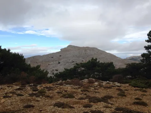
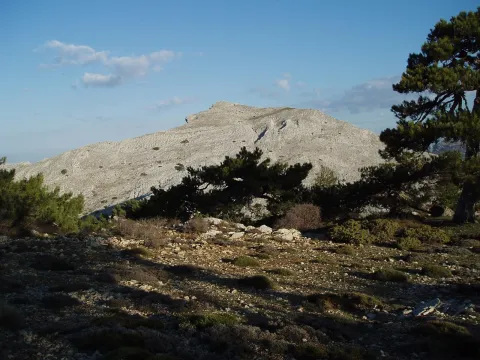
From this abrupt enclave we can see the impressive rocky cliffs and eroded stone blocks that rise in their surroundings. The landscape is unique.

Ubicación
Código Postal
23470
Latitud
37.883210
Longitud
-2.976650
Municipio
Ubicación en el mapa
POINT (-2.97665 37.88321)
Tipos de punto de interés
Imágenes carrusel
imagen
Image
lomacastellones2.png
Imagen principal
Desactivado
Imágenes cabecera
imagen
Image
lomacastellones.png
Imagen principal
Activado
Loading map
Preparing points of interest and routes...

Hillside / Ridge of Cagasebo

Submitted by brandcode_deweloper on
Id
877485
Descripción
Descripción larga

The complex formed by the union of these two cavities is located in the Loma de Cagasebo, at an altitude of about 1890 m.; within the Natural Park of Cazorla. The discovery of this cavity takes place during the exploration campaigns that the Montaña de Valencia University Club has been conducting in this area since 1987.

A succession of wells interspersed with some narrow steps, whose explorers had previously to unblock, give way to a rosary of new vertical, accompanied by a small course of water.

Breve descripción

Cagasebo's loin

Ubicación
Latitud
37.842982
Longitud
-3.066921
Municipio
Ubicación en el mapa
POINT (-3.066921 37.842982)
Tipos de punto de interés
Imágenes carrusel
imagen
Image
4499132Master.jpg
Imagen principal
Desactivado
imagen
Image
19376807%20%281%29.jpg
Imagen principal
Desactivado
Imágenes cabecera
imagen
Image
5543589Master.jpg
Imagen principal
Activado
Loading map
Preparing points of interest and routes...

Plains of Palomares-Cárcheles

Submitted by brandcode_deweloper on
Id
5849330
Descripción
Breve descripción

Altiplanicie in height, surrounded by mountains. Border space between the municipal terms of Los Cárcheles and Jaén. It is ideal for all-terrain bike and hiking and is accessible, by unasphalted slopes, from the Monte de la Sierra peri-urban park (Jaén) and from Carchelejo (Cárcheles).

Ubicación
Latitud
37.636740
Longitud
-3.639830
Distrito
Municipio
Ubicación en el mapa
POINT (-3.63983 37.63674)
Tipos de punto de interés
Imágenes carrusel
imagen
Image
Llanos%20de%20Palomares-C%C3%A1rcheles.jpg
Imagen principal
Desactivado
Imágenes cabecera
imagen
Image
Llanos%20de%20Palomares-C%C3%A1rcheles1.jpg
Imagen principal
Activado
Microsite al que pertenece
Loading map
Preparing points of interest and routes...

Alharilla Plain

Submitted by brandcode_deweloper on
Id
4861638
Descripción
Breve descripción

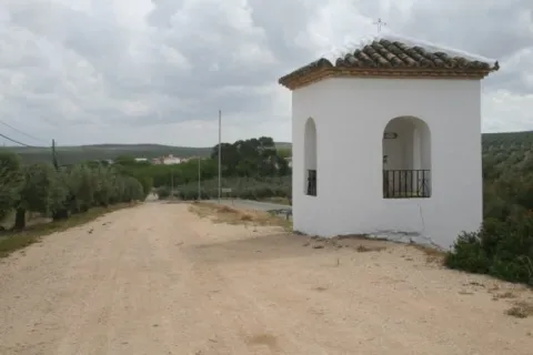
A place that has a large tree and is ideal for a day of field, as it has a magnificent road. There is the hermitage of the Virgin of Alharilla, in whose honor a rosemary is organized every year.

Ubicación
Código Postal
23790
Latitud
37.870860
Longitud
-4.183340
Distrito
Municipio
Ubicación en el mapa
POINT (-4.18334 37.87086)
Tipos de punto de interés
Imágenes carrusel
imagen
Image
Alharilla-humilladero28720180501-696x464.jpg
Imagen principal
Desactivado
Imágenes cabecera
imagen
Image
llano.jpg
Imagen principal
Activado
Microsite al que pertenece
Loading map
Preparing points of interest and routes...

Iberian Lynx

Submitted by brandcode_deweloper on
Id
1914733
Descripción
Descripción larga

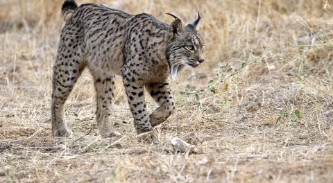
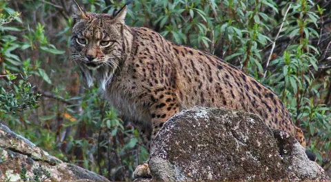
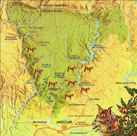
Although Iberian lince has been a protected species since 1966, this wonderful feline is in danger of extinction. At present, only two populations are viable and consolidated for the development and proliferation of this species: the one in Doñana and the one in the natural spaces Sierra de Cardeña and Montoro Natural Park and Sierra de Andújar Natural Park, where the most important population of the nail cat is located.

To see a lince in Andújar

To try to locate and observe an Iberian lince we must look for a good observatory from which we see a lot of saw, many slopes, rosquets, bushes and above all, many clear pasture. Among the best areas for an observation day are:

Road of the boat on its last stretch.

Road and recreational area of the Encinarejo.

Embalse of the Encinarejo from the north bank.

All the viewpoints in the south of the park.

Jabali Path.

Recreative area of the line in New Place.

Located at the observatory, it is essential to be always very attentive and silent, so, even in plain sight, we can distinguish a lineage moving if it is not too far away. We will also start a sweep of the area by means of binoculars. With them we will be looking at the clear and the exits of the land; so we can discover some cat placed on a rock. The telescope should be left for the last search, to go looking further and to go looking very slowly or even to look at the animal once we have discovered it.?

As with almost all predators, the corvids are also very aggressive with the Iberian lince (perhaps this is the animal with which they are most rattled), so we have to be very long-awaited of the movements and demands of the urracas. 50% of the success of observing a lince can come from being able to interpret the corvids.

For the sake of the species and the future visitors who seek to see the great cat, we must respect all the rules of public use, be respectful of the environment, always remain silent and do not in any way disturb animals. Nor should we enter privately owned farms without authorization or deviate from established paths.

Breve descripción

The largest number of the nail cat population

Ubicación
Latitud
38.039236
Longitud
-4.050560
Distrito
Municipio
Ubicación en el mapa
POINT (-4.05056 38.039236)
Imágenes carrusel
imagen
Image
Anotaci%C3%B3n%202020-04-16%20083233.jpg
Imagen principal
Desactivado
imagen
Image
Anotaci%C3%B3n%202020-04-16%20083330.jpg
Imagen principal
Desactivado
Imágenes cabecera
imagen
Image
Anotaci%C3%B3n%202020-04-16%20083259.jpg
Imagen principal
Activado
Microsite al que pertenece
Loading map
Preparing points of interest and routes...

Old Wash House

Submitted by brandcode_deweloper on
Id
4520112
Descripción
Breve descripción

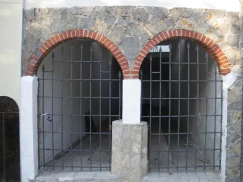
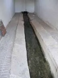
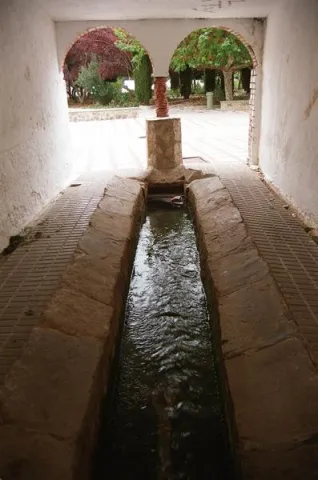
A few meters from the Fuente de la Negra is another public building related to water, the laundry, whose origin dates back to the 17th century, with architectural elements characteristic of the popular baroque such as the access panels arches or the small central salomonic column that is based on a pillar. Its use, markedly social, has been maintained until almost today. Incidentally, it is an elongated rectangular ship (10 x 2.5 meters), of argamase and lime, with a central channel, covered by a skylight, which constitutes the proper laundry.

Telecomunicaciones
Sitio web
www.fuensantademartos.es
Teléfono de contacto
953 565 000
Ubicación
Código Postal
23610
Latitud
37.647140
Longitud
-3.905260
Distrito
Ubicación en el mapa
POINT (-3.90526 37.64714)
Tipos de punto de interés
Imágenes carrusel
imagen
Image
lavadero%202.jpg
Imagen principal
Desactivado
imagen
Image
lavadero.jpg
Imagen principal
Desactivado
Imágenes cabecera
imagen
Image
Monumentos6Lavadero.jpg
Imagen principal
Activado
Loading map
Preparing points of interest and routes...