Saltar al contenido principal
icon-intereses-viajar-solo

Viewpoint of Camino Viejo

Submitted by brandcode_deweloper on
Id
5860474
Descripción
Breve descripción

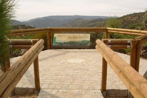
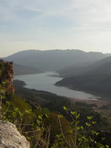
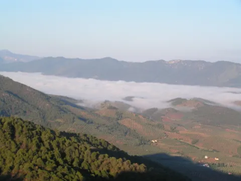
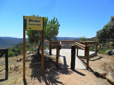
Near the Sanctuary of the Virgin of the Head, right on the path that goes from here to New Place. The Viewer of the Old Way of Andújar is located in a place where landscapes, history and tradition take their own life. The road leading to the lookout is traveled throughout the year by a multitude of pilgrims on their journey to the Sanctuary of the Virgin of the Head, Queen and Lady of Sierra Morena, which is also the oldest known Romry. To the attractive views of the place we must add this added value, as it is part of the culture, idiosyncrasy and fervor of its people. From the balcony we can see the refreshing beauty of the valley of the Jandula River (tributary of the Guadalquivir, to which it is joined later) with a typical and lush riverside forest, where the olmos take special prominence. Right across the street, covered with a pine cloak, the Marquitos hill stands out and, to its left down, the area called the New Place, where you can see the facilities of a forest nursery. The vegetation is typically Mediterranean, alternating areas of oak with pine and black areas.

Telecomunicaciones
Teléfono de contacto
953 549 030
Ubicación
Latitud
38.037700
Longitud
-4.053800
Distrito
Municipio
Ubicación en el mapa
POINT (-4.0538 38.0377)
Tipos de punto de interés
Imágenes carrusel
imagen
Image
miradorcaminoviejo.jpg
Imagen principal
Desactivado
Imágenes cabecera
imagen
Image
M_Camino_Viejo01.jpg
Imagen principal
Activado
Loading map
Preparing points of interest and routes...

Viewpoint Castle of Segura de la Sierra

Submitted by brandcode_deweloper on
Id
7480918
Descripción
Breve descripción

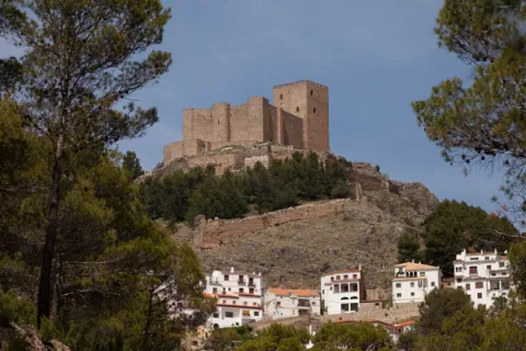
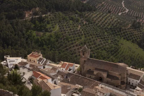
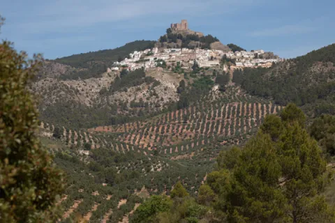
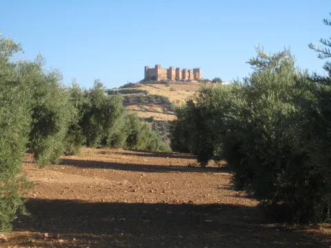
One of the treasures of the Sierras de Cazorla, Segura and Las Villas natural park, lifts the visitor over the mountains and shows on one side the mountain olive groves and on the other the most extensive forests of the Iberian Peninsula.

Ubicación
Código Postal
23379
Latitud
38.299210
Longitud
-2.649790
Dirección
C/ Castillo, s/n
Distrito
Ubicación en el mapa
POINT (-2.64979 38.29921)
Tipos de punto de interés
Imágenes carrusel
imagen
Image
Segura_de_la_Sierra_PM_091677_E.jpg
Imagen principal
Desactivado
imagen
Image
Segura_de_la_Sierra_PM_091756_E.jpg
Imagen principal
Desactivado
Imágenes cabecera
imagen
Image
Segura_de_la_Sierra_PM_091670_E.jpg
Imagen principal
Activado
Microsite al que pertenece
Loading map
Preparing points of interest and routes...

Viewpoint Castle of Santa Catalina

Submitted by brandcode_deweloper on
Id
7477305
Descripción
Breve descripción

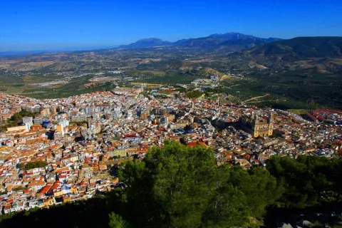
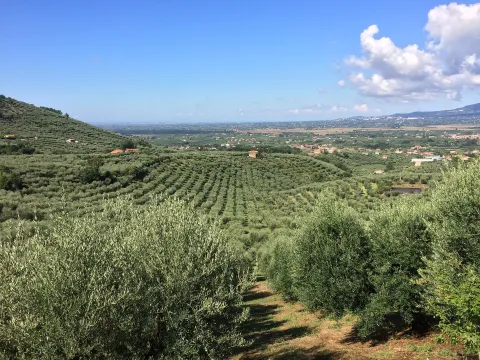
A walk outside the Parador offers an aerial view over the olive groves of the countryside, between Jaén and Sierra Morena.

Ubicación
Código Postal
23003
Latitud
37.767780
Longitud
-3.799800
Dirección
Cerro, C/ Sta. Catalina, s/n
Distrito
Municipio
Ubicación en el mapa
POINT (-3.7998 37.76778)
Tipos de punto de interés
Imágenes carrusel
imagen
Image
image_104368.jpeg
Imagen principal
Desactivado
imagen
Image
image_217365.jpeg
Imagen principal
Desactivado
Microsite al que pertenece
Loading map
Preparing points of interest and routes...

Viewpoint Castle of la Peña de Martos

Submitted by brandcode_deweloper on
Id
7474476
Descripción
Breve descripción

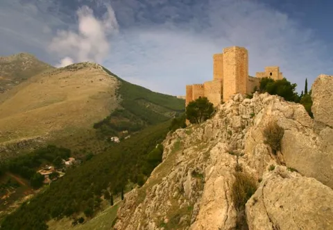
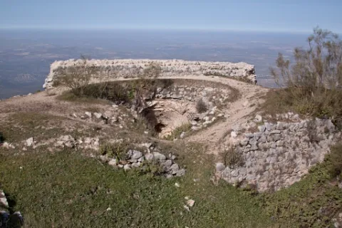
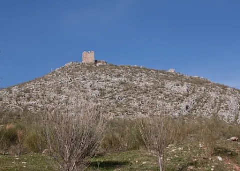
An excursion from the city centre of Martos will lead you to the ruin of the mystery-filled castle. It is a great lookout over the longest olive groves in the province.

Ubicación
Código Postal
23600
Latitud
37.718020
Longitud
-3.960870
Distrito
Municipio
Ubicación en el mapa
POINT (-3.96087 37.71802)
Tipos de punto de interés
Imágenes carrusel
imagen
Image
castillo-martos.jpg
Imagen principal
Desactivado
Imágenes cabecera
imagen
Image
castillo-pena.jpg
Imagen principal
Activado
Microsite al que pertenece
Loading map
Preparing points of interest and routes...

Viewpoint Castle of Baños de la Encina

Submitted by brandcode_deweloper on
Id
7473108
Descripción
Breve descripción

One of the oldest castles in Europe, a film scene, magnificent Almohad military construction, allows us an extensive view of the olive grove near Sierra Morena.

Ubicación
Nombre
Cerro del Cueto
Código Postal
23711
Latitud
38.170310
Longitud
-3.775320
Dirección
Plaza de Santa María, 1
Distrito
Ubicación en el mapa
POINT (-3.77532 38.17031)
Tipos de punto de interés
Imágenes carrusel
imagen
Image
mirador.jpg
Imagen principal
Desactivado
Imágenes cabecera
imagen
Image
banos-encina.jpg
Imagen principal
Activado
Loading map
Preparing points of interest and routes...

Viewpoint Casco Histórico de Iznatoraf

Submitted by brandcode_deweloper on
Id
7504663
Descripción
Breve descripción

One of the highest towns in Andalusia, this urban town is located at 1000 meters of altitude, as a watchhouse over tens of kilometers of olive trees in all directions. The view of the Sierra de Las Villas is spectacular.

Ubicación
Código Postal
23338
Latitud
38.157390
Longitud
-3.033010
Municipio
Ubicación en el mapa
POINT (-3.03301 38.15739)
Tipos de punto de interés
Imágenes carrusel
imagen
Image
image_148449.jpeg
Imagen principal
Desactivado
imagen
Image
image_148455.jpeg
Imagen principal
Desactivado
Imágenes cabecera
imagen
Image
image_165313.jpeg
Imagen principal
Activado
Loading map
Preparing points of interest and routes...

Viewpoint Campos de Larva

Submitted by brandcode_deweloper on
Id
8094285
Descripción
Descripción larga

Over the past decades, the landscape of Larva has changed according to agricultural needs. The fields seen, originally, have been occupied by large cereal crops, being the main food support for their inhabitants. Over time, the steppe landscape has undergone a great transformation, leaving the cultivation of the olive tree, and occupying the largest area for agricultural use, passing to a second level the cultivation of the cereal.

Breve descripción

One of the most unknown corners of the Sierra Magina region is the village of Larva. Larva is located in a privileged place between two Natural Parks in the province of Jaén.

Telecomunicaciones
Teléfono de contacto
953 781 500
Correo electrónico
ayuntamiento@larva.es
Ubicación
Código Postal
23591
Latitud
37.760203
Longitud
-3.202937
Distrito
Municipio
Ubicación en el mapa
POINT (-3.202937 37.760203)
Tipos de punto de interés
Imágenes carrusel
imagen
Image
MIRADOR%20larva%20%281%29.jpg
Imagen principal
Desactivado
Imágenes cabecera
imagen
Image
MIRADOR%20larva2.jpg
Imagen principal
Activado
Microsite al que pertenece
Loading map
Preparing points of interest and routes...

Mine of the Avellanar

Submitted by brandcode_deweloper on
Id
4749429
Descripción
Breve descripción

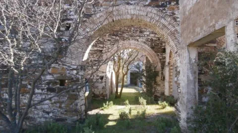
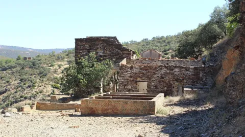
It's a galena mine in operation until recently. To get there you have to go along the road that leaves Aldeahermosa and goes towards the estate "El Puerco," after crossing the door of this estate you follow the road for 1.5 km, you reach a sign that indicates that to the right is the mine, by the river Dañador.

Ubicación
Latitud
38.342560
Longitud
-3.103740
Distrito
Municipio
Ubicación en el mapa
POINT (-3.10374 38.34256)
Tipos de punto de interés
Imágenes carrusel
imagen
Image
minaavellanar.jpg
Imagen principal
Desactivado
Imágenes cabecera
imagen
Image
20.jpg
Imagen principal
Activado
Microsite al que pertenece
Loading map
Preparing points of interest and routes...

Escañuela Municipal Picnic Area

Submitted by brandcode_deweloper on
Id
4479295
Descripción
Descripción larga

Location: West of the city centre.
Distance: 600 m.
Medium: Tourism vehicle.
Access route: Directly from the urban centre via the asphalt road JV-2,044.

Breve descripción

A leisure place with shade areas, banks, tables and water sources.

Telecomunicaciones
Sitio web
www.escanuela.es
Teléfono de contacto
953 345 101
Ubicación
Código Postal
23657
Latitud
37.878690
Longitud
-4.033390
Distrito
Municipio
Ubicación en el mapa
POINT (-4.03339 37.87869)
Tipos de punto de interés
Imágenes carrusel
imagen
Image
Merendero%20Municipal%20Esca%C3%B1uela.jpg
Imagen principal
Desactivado
Imágenes cabecera
imagen
Image
merendero%20esca%C3%B1uelas.jpg
Imagen principal
Activado
Microsite al que pertenece
Loading map
Preparing points of interest and routes...

Melojar

Submitted by brandcode_deweloper on
Id
880471
Descripción
Descripción larga

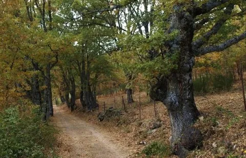
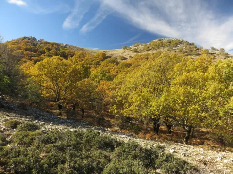
Just get out of the car, we will find ourselves surrounded by twins (Quercus pirenaica), in a thick and very closed forest. Melojar is one of the most demanding ecosystems in soil quality, depth of this and humidity, in the Park is poorly represented, only a few nuclei of the Segura saw. They maintain a entourage of plant species that accompany the melojo, forming one of the most important and interesting forests in the Park.

These forests were more abundant and extensive in past times, but the use of their wood, the transformation of the soil they occupy and sometimes the plunder to which they have been subjected, reduced them to small spots or enclaves, reaching very low today, especially in southern Spain. In the park already it must have been small the extension that would occupy this forest, but at present only a few very small enclaves remain, where the twins form bosquets, and there are also isolated specimens intermingled in the pineapples (salgareños).

The twins are oily and, therefore, to the melojar environment reminiscent of that of the Atlantic forests, moist, with bruises, of stray trunks and covered with moss, specific to Galicia, Asturias or Centro Europa. The melojar extends through the Atlantic area of the Iberian Peninsula, but also through the central system and other areas of the interior, reaching Sierra Morena.

In the melojar we find other arboreal elements such as the pespejón (Sorbus tormentinalis), the complaint (Quercus faginea) (with which it is sometimes hybrided producing a hybrid called Quercus x welwitschii), arches (Acer granatense) and salgarean pines (Pinus nigra salzmannii) generally repopulation. They also abound shrubs such as majuelos (Crataegus monogina), black thorns (Crataegus laciniata), aligustres (Ligustrun vulgare), skirmishes (Rosa spp.), magullos (Malus sylvestris), zarzas (Rubus ulmifolius, R. canescens) and some willows or sarctiles (Salix atronaea).

On the ground of the melojar we find herbaceas, including Poa nemoralis, Brachypodium sylvaticin and medium Briza, other companions are the gold button (Geum sylvaticum), primavera (Primula vulgaris), violets (Viola odorata), filipendales (Filipendula vulgaris), orchids (Orchis langei, O. coriophora), narcissos (Narcissus triandus palidulus), and species of Solomon (and the area of the idatus).

LOCATION

It is on the verge of the track that accesses Las Herrerias, which we take from the road that goes from Siles to Rio Madera (JF-7038), to take the detour after passing through the CEDEFO de Navalhora. We'll go up to see the start of a forest track that goes left, to counter if we go to the Wood River. It's well indicated as the Herrerías. We can park or continue by vehicle, we advise parking and walking on the track a few meters.

Breve descripción

Canyon of Poyo Torres

Ubicación
Latitud
38.387861
Longitud
-2.582637
Distrito
Municipio
Ubicación en el mapa
POINT (-2.582637 38.387861)
Tipos de punto de interés
Imágenes carrusel
imagen
Image
melojar.png
Imagen principal
Desactivado
imagen
Image
melojar.jpg
Imagen principal
Desactivado
Imágenes cabecera
imagen
Image
617_img.png
Imagen principal
Activado
Loading map
Preparing points of interest and routes...