Saltar al contenido principal
icon-intereses-viajar-solo

Church of San Juan Bautista

Submitted by brandcode_deweloper on
Id
4678416
Descripción
Descripción larga

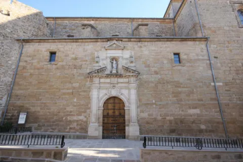
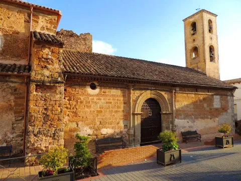
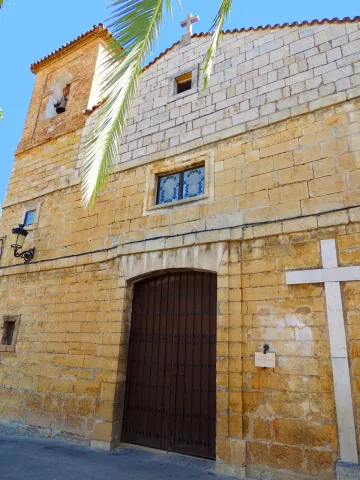
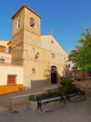
He dedicated himself to St. John the Baptist and the first cleric to serve it was Michael of Biedma. During the 17th century the need to expand that small temple was experienced, and even the insignia architect Eufrassio López de Rojas came to realize a simple project, which was not carried out due to lack of means.

In May 1785 the vice-president and factory butler Manuel de Arredondo requested the reform and expansion of the temple given its poor condition. In June of that year, the master of works Ramón Maroto issued a detailed report on the precise works to secure the ancient area and expand the temple. The cost was estimated at Rat 11,718.

The works were authorized and started by the architect Miguel de Aranderas, who was at that time one of Jaén's most accredited. The works were carried out, among others, by the singers Agustín Peinado, Manuel Caballero, Juan de Armenteros, Juan de Ortega and Pedro Caballero. The new temple was opened to worship in 1798. In 1829, he was redesigned by the Jiennese architect Manuel Paedilla. In the events of the Civil War, the parish was seized on 3 August 1936 and was dismantled and lost its small but interesting movable heritage.

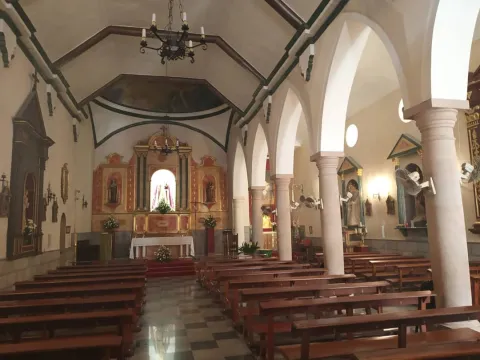
In general terms it retains its primitive arrangement typical of the mannerist religious architecture: a single ship with small hornacino chapels marked on the walls; a short cruise covered with a half-orange dome; an open chapel on the side for Our Lady of the Dolores and chorus at the foot of the temple.

It retains images of Jacinto Higueras (Virgin of the Rosary and Our Father Jesus) and a small but select collection of goldsmiths. The main facade is very simple and its lines are in harmony with that of the nearby Conistory House.

Breve descripción

The original temple was arranged by Juan de Requena and Bastián Ruiz del Salto on April 22, 1539, giving its plant a measure of 50 rods long by 41 wide.
Ubicación
Latitud
37.689080
Longitud
-3.818150
Dirección
C/ Sacristía, 1
Ubicación en el mapa
POINT (-3.81815 37.68908)
Tipos de punto de interés
Imágenes carrusel
imagen
Image
53.JPG
Imagen principal
Desactivado
Imágenes cabecera
imagen
Image
52.JPG
Imagen principal
Activado
Microsite al que pertenece
Loading map
Preparing points of interest and routes...

Church of Saint John the Baptist

Submitted by brandcode_deweloper on
Id
1476759
Descripción
Descripción larga
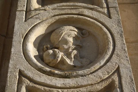
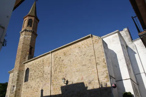
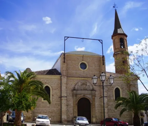
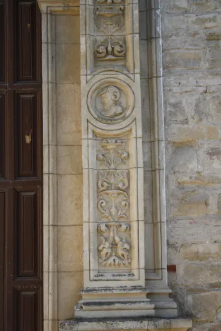
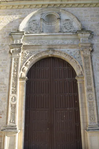
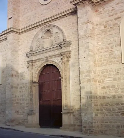
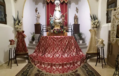
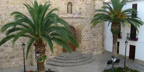
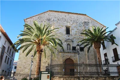
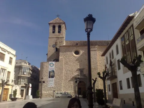
This reconstruction has lasted until the beginning of the 21st century, when serious structural problems were detected that forced the main vault to be demolished. (Currently under reconstruction). Currently, its interior follows a Neo-Gothic style, with a plan of three naves separated by pointed arches that rise on pillars that imitate large jambs, which lead to a ribbed vault, the central nave being higher than the side ones. The presbytery is elevated and has an altar, in whose central street there is a dressing room in which the Virgin of Sorrows is located, patron saint of the town, the work of the Granada artist Navas Parejo. Of its primitive construction, only one door remains, currently placed at the foot of the church, this being not its original location. This doorway was made by Juan Marquina in 1531, in the Plateresque style, formed by a semicircular arch with voussoirs decorated by angels, medallions appear on imposts and spandrels, topped with a round pediment in whose tympanum there is a niche, with two emblems that were originally those of Cardinal Merino, all on Corinthian pilasters with candelieris decoration. Inside, together with the already mentioned image of Nuestra Señora de los Dolores, we find the image of the owner, San Juan Bautista, the work of Jose Risueño, Nuestro Padre Jesús Nazareno de Palma Burgos, the Santísimo Cristo de la Expiración by José Garcés or the San Antonio, the work of the Granada sculptor Pedro de Mena, to which Navas Parejo added the Child in 1942 (All these images are currently distributed in the different Churches of the locality, due to the restoration works that are being carried out in the Iglesia de San Juan). Along with the previously mentioned imagery, we must highlight the Tabernacle, which was made by the Archpriest of Arjona Juan Antonio León, thanks to the donations of gold and silver given by parishioners in donations around 1950. Iglesia de San Juan Bautista is only mentioned once in Juan Eslava Galán's book, specifically on the last page, but it is of great importance, since it is where the Templar tombstone was found, in an underground burial (the Crypt of Barón de Velasco, Barón de Velillos in the work).
Breve descripción
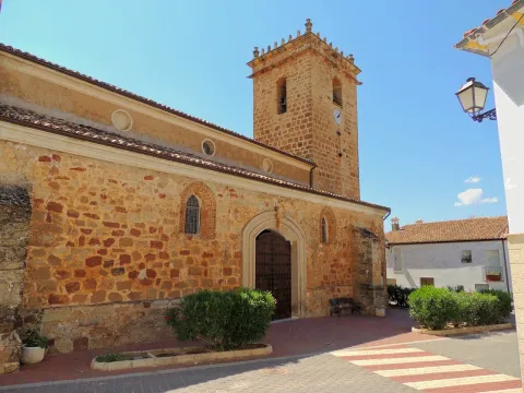
Religious building that stands on the same site, which some scholars and historians attribute, was the Roman temple dedicated to Bacchus and later Jewish Synagogue. The current temple began to be built in the 16th century, although it was practically destroyed in 1936 as a result of the events that occurred in the Spanish Civil War. Its reconstruction was left in the hands of Devastated Regions directed by Fernando Wilhemi Manzano, who modified the floor plan quite a bit, adding a more framed bay over two towers, of which only one was raised.
Ubicación
Código Postal
23760
Latitud
37.934240
Longitud
-4.055780
Dirección
Plaza Juan Antonio León García, s/n
Distrito
Municipio
Ubicación en el mapa
POINT (-4.05578 37.93424)
Tipos de punto de interés
Imágenes carrusel
imagen
Image
IMG_0109.jpg
Imagen principal
Desactivado
imagen
Image
IMG_0126.jpg
Imagen principal
Desactivado
imagen
Image
p1310006c3b1.jpg
Imagen principal
Desactivado
imagen
Image
IMG_0115%20%281%29.jpg
Imagen principal
Desactivado
imagen
Image
IMG_0118.jpg
Imagen principal
Desactivado
Imágenes cabecera
imagen
Image
00034629.jpg
Imagen principal
Activado
Microsite al que pertenece
Loading map
Preparing points of interest and routes...

Church of San Bartolomé

Submitted by brandcode_deweloper on
Id
7970469
Descripción
Descripción larga

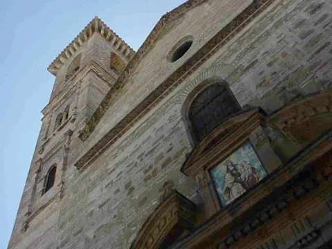
Its plant, basilical, has a wide and deafan space structured on three ships covered with flat roof. The ships are divided by five half-point arches that stand on pillars of unequal size, the lines being greater with the central ship. Both sides are located chapels. The architectural element that volumetrically stands out on the whole is the presbyterium, covered by a half-orange vault on pechines ornamented with trapezoidal geometric elements, to which it is accessed through a large half-point spinal arch. At the foot of the temple and raised on pillars is the choir.

From the artistic point of view the most valuable element is the altarpiece, inspired by the Italian model of Vignola, more specifically in his masterpiece, "the Gesu" of Rome, of great interest not only for its structure and the colossal use of the classical orders, but also for the richness and complexity of the iconographies both sculptural and pictorial that it houses.

The factory, which alternates the regular with the irregular, differentiates the basic plant and the head of the presbytery, and both the cover and the window voids of the first facade body are pointed and aboculated. The central body, of higher height, has three circular voids laterally to give light to its interior. The tower is a unique element due to the quality of the silo, the amplitude of its dimensions, the first of the small half-point voids arranged to axis with the wider window of the bell tower, the successive well-cared cornels - one adorned with gargolas, another long-lasting molding - and the four vases that crown its angles, work of the brothers John and Iñigo Mojica (1,553)

Breve descripción

The parish church of San Bartolomé was built between the 15th and 16th centuries with constructive schemes that respond to both the Renaissance and Baroque.

Telecomunicaciones
Sitio web
http://www.villarrodrigo.es/el-municipio/patrimonio-historico.html
Ubicación
Código Postal
23393
Latitud
38.485880
Longitud
-2.635110
Dirección
C/ Iglesia, 53
Distrito
Municipio
Ubicación en el mapa
POINT (-2.63511 38.48588)
Tipos de punto de interés
Imágenes carrusel
imagen
Image
san-bartolome-villarodrigo%20%281%29.jpg
Imagen principal
Desactivado
Imágenes cabecera
imagen
Image
bartolome_Villarrodrigo.jpg
Imagen principal
Activado
Microsite al que pertenece
Loading map
Preparing points of interest and routes...

Church of San Bartolomé

Submitted by brandcode_deweloper on
Id
4873484
Descripción
Breve descripción

It responds to a medieval project, still visible in the sacristy and major altar. Most of its current configuration takes place in the 16th century, involving the architects, Francisco del Castillo "El Viejo" and Francisco Castillo "El Mozo." In its bell tower is located the shield belonging to the bishop of the Diocese of Jaén. Inside it houses the Christ of the Vera Cross (16th century).

Telecomunicaciones
Sitio web
www.torredelcampo.es/index.php?option=com_content&task=view&id=115&Itemid=135
Teléfono de contacto
953 567 086
Ubicación
Código Postal
23640
Latitud
37.770410
Longitud
-3.896550
Dirección
C/ Cruces, 2
Distrito
Municipio
Ubicación en el mapa
POINT (-3.89655 37.77041)
Tipos de punto de interés
Imágenes carrusel
imagen
Image
Iglesia%20de%20San%20Bartolom%C3%A9.jpeg
Imagen principal
Desactivado
imagen
Image
Iglesia%20de%20San%20Bartolom%C3%A9%202.jpg
Imagen principal
Desactivado
Imágenes cabecera
imagen
Image
torredelcampo%20%281%29.jpg
Imagen principal
Activado
Microsite al que pertenece
Loading map
Preparing points of interest and routes...

Church of San Andrés

Submitted by brandcode_deweloper on
Id
4639682
Descripción
Breve descripción

The church of San Andrés de Villanueva del Archbishop is located in the historical center of this town of the province of Jaén. The present temple, dating back to the 16th century, was erected on a previous one that had to occupy the courtyard of weapons of the medieval fortress, of which still today two of the four original towers are preserved, attached to the temple factory. This building ensemble perfectly synthesizes military and religious architecture.

Telecomunicaciones
Sitio web
www.villanuevadelarzobispo.es
Teléfono de contacto
953 452 454
Ubicación
Código Postal
23330
Latitud
38.169570
Longitud
-3.011640
Dirección
C/ Puerta del Sol
Ubicación en el mapa
POINT (-3.01164 38.16957)
Tipos de punto de interés
Imágenes carrusel
imagen
Image
Mon140.jpg
Imagen principal
Desactivado
Imágenes cabecera
imagen
Image
San_andres.jpg
Imagen principal
Activado
Loading map
Preparing points of interest and routes...

Church of Nuestra Señora del Carmen

Submitted by brandcode_deweloper on
Id
5621126
Descripción
Breve descripción

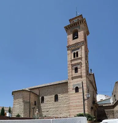
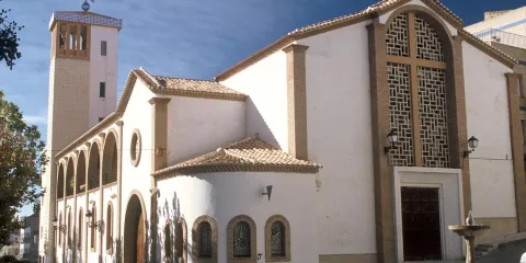
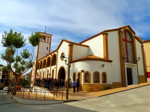
It began to be built in 1898. A historical style, with a gothic tardo plant on its only central ship. Neo baroque on its stone cover, with tile for the image of its headline in curved front. The presbytery welcomes in its central altarpiecea magnificent image of the Virgin of Carmen.TheNeo-mudejar tower, slender and elegant, with brick and tile masonry.

Telecomunicaciones
Sitio web
www.portalarjonero.com/pagina/ElCarmen.html
Teléfono de contacto
669 968 626
Ubicación
Código Postal
23760
Latitud
37.934790
Longitud
-4.057540
Dirección
Plaza del Carmen, s/n
Distrito
Municipio
Ubicación en el mapa
POINT (-4.05754 37.93479)
Tipos de punto de interés
Imágenes carrusel
imagen
Image
Iglesia%20de%20Nuestra%20Se%C3%B1ora%20del%20Carmen_ARjona.jpg
Imagen principal
Desactivado
Imágenes cabecera
imagen
Image
89eb830f27a00b3df69c1e509b97f76c.jpg
Imagen principal
Activado
Microsite al que pertenece
Loading map
Preparing points of interest and routes...

Church of Nuestra Señora de la Presentación

Submitted by brandcode_deweloper on
Id
4979309
Descripción
Breve descripción

Its construction began in the centuryXVIand rises in the square of the municipality. Its plant is rectangular and one-ship, divided into four sections covering half-barrel vaults with pseudo-fajon arches. Thesquare base headerwas added in the 17th century.The towerbuilt in the 20th century, it is the least valuable and is not integrated into the whole.

Telecomunicaciones
Sitio web
https://www.facebook.com/parroquiatorresdealbanchez
Teléfono de contacto
953 494 003
Correo electrónico
parroquiatorresdealbanchez@gmail.com
Ubicación
Código Postal
23391
Latitud
38.414770
Longitud
-2.677400
Dirección
Plaza Iglesia, 7
Distrito
Ubicación en el mapa
POINT (-2.6774 38.41477)
Tipos de punto de interés
Imágenes carrusel
imagen
Image
Nuestra%20Se%C3%B1ora%20de%20la%20Presentaci%C3%B3n%20en%20Torres%20de%20Alb%C3%A1nchez.JPG
Imagen principal
Desactivado
Imágenes cabecera
imagen
Image
DSCN0867.jpg
Imagen principal
Activado
Loading map
Preparing points of interest and routes...

Church of Nuestra Señora de la Fuensanta

Submitted by brandcode_deweloper on
Id
4518526
Descripción
Descripción larga

Its interior consists of a single floor of drawer - or of what is also known as contender - divided into three ships that hold columns of smooth fuse with docile capitals and poorly decorated eye arches.

Outside, the church has two bodies separated by molding with two leftovers covered by half-point arches. The side facade, which looks at the Fuente de la Negra, is of greater proportions than the side that is located in the perspective with the street of access to the town center.

The most unique element of the church factory is its tower, located laterally in the corner between the two covers. It is not exempt, but integrated into the building, to which it overcomes and adds a third body for bell tower, with holes covered by half-point arches.

Breve descripción

The most valuable cultural good of this industrious town, from a strictly architectural point of view, is the parish church of Our Lady of the Fuensana. Its origin dates back to the 16th century and its artistic lexicography is Renaissance, although without stylistic elongations or great pretensions as to its proportions or constructive solutions.

Telecomunicaciones
Sitio web
www.fuensantademartos.es/el-municipio/patrimonio-historico.html
Teléfono de contacto
953 565 000
Ubicación
Código Postal
23610
Latitud
37.647420
Longitud
-3.905840
Dirección
Plaza de la Constitución, 13
Distrito
Ubicación en el mapa
POINT (-3.90584 37.64742)
Tipos de punto de interés
Imágenes carrusel
imagen
Image
Iglesia%20de%20Nuestra%20Se%C3%B1ora%20de%20la%20Fuensanta1_Fuensanta%20de%20martos.jpg
Imagen principal
Desactivado
Imágenes cabecera
imagen
Image
Iglesia%20de%20Nuestra%20Se%C3%B1ora%20de%20la%20Fuensanta_FuensantaMartos.jpg
Imagen principal
Activado
Microsite al que pertenece
Loading map
Preparing points of interest and routes...

Church of Nuestra Señora de la Encarnación

Submitted by brandcode_deweloper on
Id
4673834
Descripción
Breve descripción

This church was raised in the mid-sixties of the 20th century over another previous temple, with the same advocation, whose origin went back to the seventeenth century. Its cover features a vain intellized access, Latin cross and hastial, and it stands out for its volume the tower, with a square base, decorated with geometrical elements.

Telecomunicaciones
Teléfono de contacto
953 738 105
Ubicación
Código Postal
23485
Latitud
37.705440
Longitud
-2.933670
Dirección
Plaza del Ayuntamiento, 3
Municipio
Ubicación en el mapa
POINT (-2.93367 37.70544)
Tipos de punto de interés
Imágenes carrusel
imagen
Image
DSCN4095.JPG
Imagen principal
Desactivado
imagen
Image
igleisa-pozo-alcon-2.jpg
Imagen principal
Desactivado
Imágenes cabecera
imagen
Image
iglesia-pozo-alcon.JPG
Imagen principal
Activado
Loading map
Preparing points of interest and routes...

Church of Nuestra Señora de la Encarnación

Submitted by brandcode_deweloper on
Id
4555129
Descripción
Descripción larga

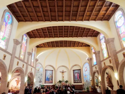
The project is carried out by Mr Manuel Sancho Sánchez, a master of the quarry, in charge of the construction of a large mason called Mr Benito el Santo. The conditions are established among which the realization of two arches dances to separate the three ships of the temple, having each dance three arches, resulting in a total of nine sections. The main cover and the bell tower were carried out by the master of the quarry Mr Manuel Sancho Sánchez. The construction of the church had to be completed on a provisional basis in order to celebrate the Holy Offices. In 1618 the Major Retablo was built, destroyed in the Spanish Civil War, occupied the whole tester of the presbytery raised on pedestal with reliefs on two very high floors, was topped with an attic finished in a broken fronton with eardrum where the figure of the Eternal Father was holding the sphere of the world in his right hand.

Both floors and the attic marked three streets, being the largest central than the sides and separated with Corinthian columns even and advanced on the general plane of the altarpiece. On the side streets, reliefs were framed with scenes of the life of Jesus Christ and of the Virgin. The central street was occupied by a great Sagrario-manifestator on the second floor, a relief with the mystery of the Incarnation. The attic was presided over by a calvary with figures of Christ Crucified, the Virgin Ruins of a glorious past in and St. John. The figure of the Eternal Father closed the whole set that also had sculptures of Saints on the capitals and cornels. The side streets were topped with shields from Bishop D. Baltasar of Moscoso and Sandoval who ruled the Diocese in 1618. Its style was Renaissance in transition to Baroque, and it was decorated with elements of the time, but without too many ornaments. The presbytery was completed on its side walls, with two large oil-painted paintings.

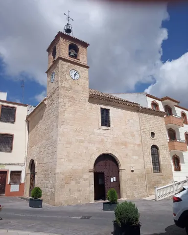
The organ was placed in the choir in the middle of the 18th. The bells were installed in 1858. On the façade of the tower that gives to the main square and under the main bell, if it installed in 1906, a time clock with dial in Roman numbers, costed by the Board of repair of the temple and assigned to the City Council for its conservation; it is of the so-called "round system" with compensating pendulum. It was acquired from Mr Lorenzo Redondo, a neighbour of Cuenca.

He had a hammer that gave the hours in the bell. In the 1980s, the clock machinery was cancelled and an electronic device was placed in place to keep the hours and bells marked. In 1996, the old machinery was withdrawn, restored and is currently in an exhibitor in the Hall of Plenos of the City Hall.

Breve descripción

On the site marked to this effect, 120 feet long and the same wide, the Parish Church was built in the place occupied by a small chapel dedicated to the Most Holy Sacrament. The construction contract is dated 24 March 1579.

Ubicación
Código Postal
23130
Latitud
37.555590
Longitud
-3.635190
Dirección
Plaza de Andalucía, 13
Distrito
Municipio
Ubicación en el mapa
POINT (-3.63519 37.55559)
Tipos de punto de interés
Imágenes carrusel
imagen
Image
IMG_1151.JPG
Imagen principal
Desactivado
Imágenes cabecera
imagen
Image
Iglesia%20de%20Nuestra%20Se%C3%B1ora%20de%20la%20Encarnaci%C3%B3n_Campillo.jpg
Imagen principal
Activado
Microsite al que pertenece
Loading map
Preparing points of interest and routes...