Saltar al contenido principal
icon-intereses-viajar-solo

El Ojuelo y el Robledo

Submitted by brandcode_deweloper on
Id
919095
Descripción
Descripción larga

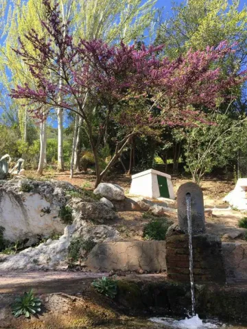
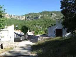
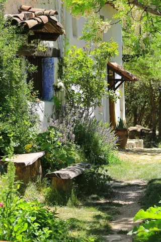
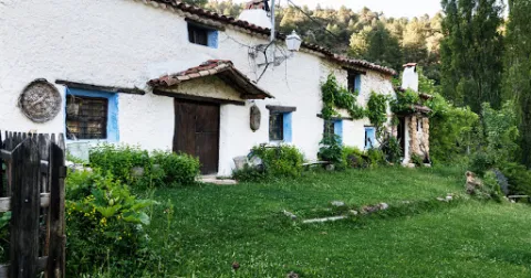
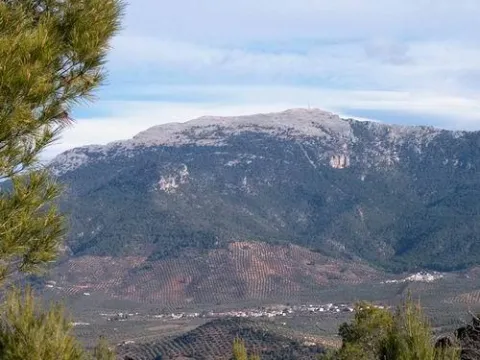
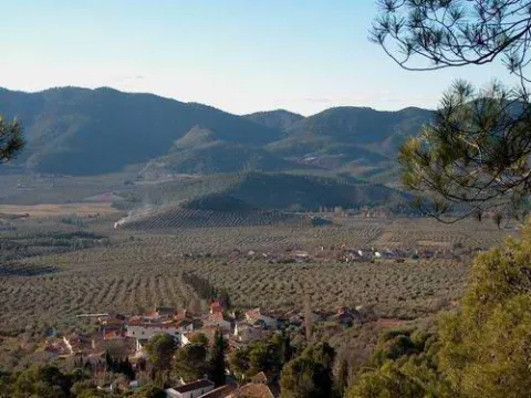
If you go through the fertile vein on which the Ojuelo sits, you will reach the Robledo right at the feet of the Yelm. A long street with houses on both sides leads us to a small square with a hermitage and a little higher a forest house, which will be the headquarters of a Thematic Air Space starring free flight sports, as the take-off of the Yelmo is very close.

The Robledo marks at 900 meters of altitude the cut between the cultivation of the olive tree and the pine tree. By going through a forest track you can climb up to the Yelmo, making a stop at a lookout next to the track that offers spectacular views over the valley.

Breve descripción

The Ojuelo extends around a road crossing next to the one with a small park and a hermitage. A great source is a stop to fill the canteen with fresh water and talk with the neighbors. Although it celebrates parties in June, the olive-tree parties, the Ojuelo is known for those it celebrates in the first week of August, with verbenas that people from all over the region come to.
Ubicación
Latitud
38.298857
Longitud
-2.651877
Distrito
Ubicación en el mapa
POINT (-2.651877 38.298857)
Tipos de punto de interés
Imágenes carrusel
imagen
Image
ojuelo.jpg
Imagen principal
Desactivado
Imágenes cabecera
imagen
Image
00010472.jpg
Imagen principal
Activado
Loading map
Preparing points of interest and routes...
Marcas de calidad

El Nacimiento

Submitted by brandcode_deweloper on
Id
4573220
Descripción
Descripción larga

The landscape is determined by human perception and is the result of the interaction of the elements of nature and man, then human action has conditioned the transformation of the natural landscape and the inclusion of cultural elements that give it value, so it is necessary to preserve and enhance them. We are therefore facing a natural resource that has allowed not only subsistence but also economic activity since man arrived on these lands.

It is now difficult to imagine what this spring and its immediate course would be like without that interaction by which human beings have created a laundry room, which is what we now see in the Birth, or downstream in the Matias and the Birth mills, in the Balsa, the Charcón, the Pileta and Arroyo launchers, or the numerous pools and the network of waterfalls for the irrigation of the place known as the "Site." At some point these infrastructures must have been created and we are likely to have to reassemble long before the repopulation of the Cabrilla Site. Today we will deal only with the environment closest to the Birth, so the relative to what we find downstream of this stream that so much life has spread since time immemorial will be part of the future of a new post.

To try to imagine what those places were like not long ago, when they still fulfilled the task for which they were created, we counted, of course, on the impagable photographic work of Arturo Cerda and Rico, so that we can see in some of their photos also a certain evolution, is the case of the same spring in its natural state prior to its channelling, for not so long ago, until 1910, where today we see the seven years, there was only a plateau from which the crystal waters of the Sierra Cruzada were kept.

Breve descripción

There would be no Cabra of the Holy Christ without this spring. With this very categorical statement I intend to highlight its enormous value, because those waters that have been irrigating our fields for centuries have brought the necessary energy to our mills, have gathered along their journey to long lavenders, have taken their waters to the abrevaderos, fountains and streets of the urban centre and not only to give to drink, but also to the domestic tasks, the works, or the irrigation of the gardens so characteristic of the interior of our homes.

Ubicación
Latitud
37.705870
Longitud
-3.286837
Dirección
Cabra del Santo Cristo
Distrito
Ubicación en el mapa
POINT (-3.286837 37.70587)
Imágenes carrusel
imagen
Image
nacimiento%20%281%29.jpg
Imagen principal
Desactivado
Imágenes cabecera
imagen
Image
18.jpg
Imagen principal
Activado
Microsite al que pertenece
Loading map
Preparing points of interest and routes...

El cubo

Submitted by brandcode_deweloper on
Id
4868835
Descripción
Descripción larga

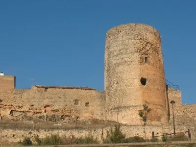
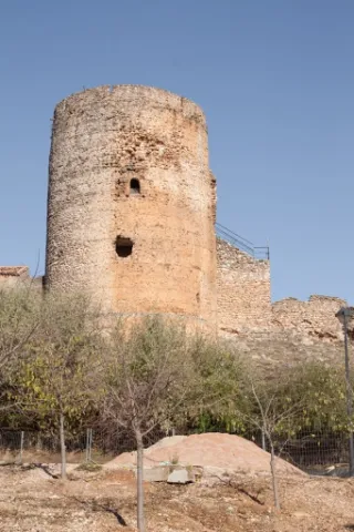
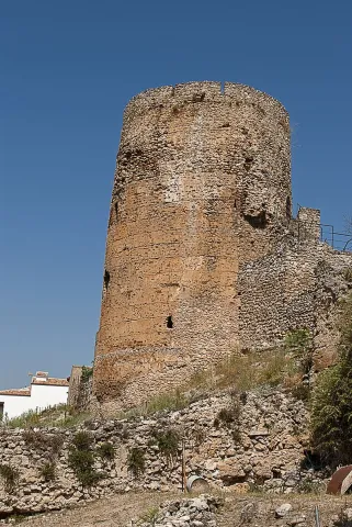
Within the Cube we can consider up to four spatial and functional levels: At the lower level or ground floor, we find ourselves in front of a circular floor room of approximately 8 m in diameter with a half-orange vault with a height of approximately 10 m.

Due to this considerable height it could have been divided into several levels with structures and wooden entwels. The site available in these defence towers was so valuable that it took advantage of the smallest space for the storage of food, utensils and the shelter of people that the Order of Santiago kept under its protection.

The intermediate level or first floor is a circular room of smaller size because it contains the staircase access to the roof. It has a vault pointed on nerves where its intermediate cloth is also made of stone.

From the roof, we can see the plain where the Kurah was framed in the time of Al-Ándalus, this allowed the control of the four cardinal points against the fronts of advance.

Breve descripción

The tower has a height of 21.5 m and is made of masonry with lime mortar. The average diameter is 8.5 m and the thickness of the walls is more than 2.75 m.

Ubicación
Código Postal
23380
Latitud
38.386690
Longitud
-2.582460
Distrito
Municipio
Ubicación en el mapa
POINT (-2.58246 38.38669)
Tipos de punto de interés
Imágenes carrusel
imagen
Image
8.jpg
Imagen principal
Desactivado
imagen
Image
9.jpg
Imagen principal
Desactivado
Imágenes cabecera
imagen
Image
5%20%285%29.jpg
Imagen principal
Activado
Loading map
Preparing points of interest and routes...

El Cerro de Castellón

Submitted by brandcode_deweloper on
Id
8088833
Descripción
Descripción larga

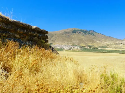
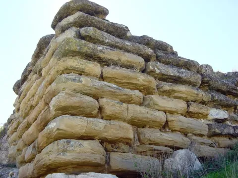
It has a rectangular plant facing from northeast to southeast and a walled enclosure. The best preserved wall is the northeast, 18.70 meters long and 4 meters high in its highest corner. It consists of several rows of large-scale stones, on which a wall of tapial, now missing, would be raised. In its interior it retains a seam of regular armchairs, smaller than those of the outer wall, of 6.30 meters in length and 2 meters in width.

Although it dates from Iberian chronology, both ceramic decorated with Iberian ceramic bands andterra sigillataRoman, so you can deduce a continued occupation of the land; as well as medieval ceramics.

Its mission was to monitor and control the communication routes, as it is closely linked to the corridor of the Guadiana Minor River, which communicates the upper valley of Guadalquivir with the highlands of Guadix and Baza.

In 1985 it was declared Good of Cultural Interest.

Breve descripción

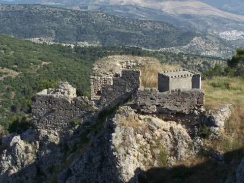
On the hill of Castellón are preserved the remains of an Iberian cyclopian fortress between the II and I BC centuries It is a walled enclosure, with a quadrangular structure and an aljibe inside it, built with limestone armchairs that reach a meter and a half in length.

Telecomunicaciones
Sitio web
www.larva.es/el-municipio/patrimonio-historico.html
Correo electrónico
ayuntamiento@larva.es
Ubicación
Código Postal
23591
Latitud
37.770410
Longitud
-3.192560
Distrito
Municipio
Ubicación en el mapa
POINT (-3.19256 37.77041)
Tipos de punto de interés
Imágenes carrusel
imagen
Image
El%20Cerro%20de%20Castell%C3%B3n2.JPG
Imagen principal
Desactivado
imagen
Image
El%20Cerro%20de%20Castellon3%20%282%29.jpg
Imagen principal
Desactivado
Imágenes cabecera
imagen
Image
El%20Cerro%20de%20Castell%C3%B3n.jpg
Imagen principal
Activado
Microsite al que pertenece
Loading map
Preparing points of interest and routes...

El Batanejo

Submitted by brandcode_deweloper on
Id
4524622
Descripción
Breve descripción

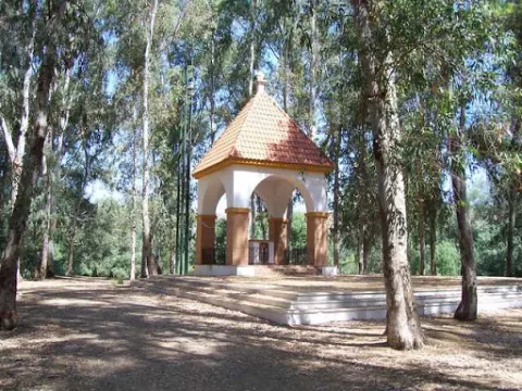
In the vicinity of the town of Villanueva de la Reina we can visit the beautiful and traditional area known as El Batanejo. It is located on the banks of the Guadalquivir River, where the large amount of eucalyptus and its conditioned places will allow us to enjoy an ideal place for rest.

Ubicación
Código Postal
23730
Latitud
38.026220
Longitud
-3.910080
Distrito
Ubicación en el mapa
POINT (-3.91008 38.02622)
Tipos de punto de interés
Imágenes carrusel
imagen
Image
batanejo.jpg
Imagen principal
Desactivado
Imágenes cabecera
imagen
Image
unnamed.jpg
Imagen principal
Activado
Microsite al que pertenece
Loading map
Preparing points of interest and routes...

Alma Serrana Ethnological Eco-Museum

Submitted by brandcode_deweloper on
Id
2335206
Descripción
Descripción larga

It highlights its website where we find the various activities that can be developed and the publications of its cultural association.

Breve descripción

The eco museum is a cultural center where you can travel in time to understand the history of the following people. There you can know and learn the customs and traditions, ancient techniques of the trades, the relationship of man to the territory, the exploitation of natural resources, as they dressed, ate, lived, etc.

Telecomunicaciones
Teléfono de contacto
608 695 623
Correo electrónico
concienciados@gmail.com; almaserrana@tecnosegura.com
Ubicación
Nombre
Eco - Museo Etnológico Alma Serrana
Código Postal
23294
Latitud
38.221410
Longitud
-2.584580
Distrito
Municipio
Ubicación en el mapa
POINT (-2.58458 38.22141)
Imágenes carrusel
imagen
Image
descarga%20%2817%29.jpeg
Imagen principal
Desactivado
imagen
Image
aldea-de-los-anchos-sierra-de-segura-69466-sm.jpg
Imagen principal
Desactivado
Imágenes cabecera
imagen
Image
unnamed%20%2822%29.jpg
Imagen principal
Activado
Horario
Monday to Sunday: 10: 00 - 18: 00.
Loading map
Preparing points of interest and routes...

Dolomites of the Presa de la Vieja

Submitted by brandcode_deweloper on
Id
876025
Descripción
Descripción larga

Aflation of the upper Cretaceous dolomies, which form a small ruiniform relief, as they are in contact with margous materials of the Ambient (facies "utrillas"), in the east, and attached to a meandro of the Zumeta River in the west.

At this point there is an old dam, which gives a special charm to the place. The Zumeta River is the border of the province of Jaén, and of Andalusia, with the province of Albacete in that area, so that the eastern margin of this area already belongs to Castilla - La Mancha.

Source: Inventory of Georresources of Andalusia. Environmental Council. Junta de Andalusia.

Breve descripción

Old-Age Dolomies

Ubicación
Latitud
37.772886
Longitud
-3.788329
Ubicación en el mapa
POINT (-3.788329 37.772886)
Tipos de punto de interés
Imágenes carrusel
imagen
Image
12939.jpg
Imagen principal
Desactivado
imagen
Image
184219_molino-de-la-norberta_0772102001456948645_o.jpg
Imagen principal
Desactivado
Imágenes cabecera
imagen
Image
embalse_lavieja.jpg
Imagen principal
Activado
Loading map
Preparing points of interest and routes...

Dolomites of the Piedra de los Agujeros

Submitted by brandcode_deweloper on
Id
875964
Descripción
Descripción larga

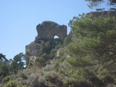
The dolomies of the upper Cretaceous of the Prebetic in the Sierra de Segura afloat extensively, configuring much of the main reliefs of it. In the sector of Siles there is an North-South mountain alignment, the main reliefs of which are Navalperal (1620 m) and Bucentaina (1395 m).

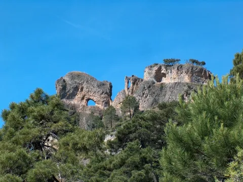
Between them is the peak called "Hole Stone" (1290 m), which is a magnificent example of ruiniform relief in dolomies. These are dolomies with subhorizontal stratification with several caves that cross the peak, and with a very well developed "dentado" relief.

Source: Inventory of Georresources of Andalusia. Environmental Council. Junta de Andalusia.

Breve descripción

Dolomies of the Hole Stone

Ubicación
Latitud
38.387861
Longitud
-2.582637
Distrito
Municipio
Ubicación en el mapa
POINT (-2.582637 38.387861)
Tipos de punto de interés
Imágenes carrusel
imagen
Image
piedras%20%281%29.jpg
Imagen principal
Desactivado
imagen
Image
9100370.jpg
Imagen principal
Desactivado
Imágenes cabecera
imagen
Image
siles%20%281%29.jpg
Imagen principal
Activado
Loading map
Preparing points of interest and routes...

Gorge of Puerta Arenas

Submitted by brandcode_deweloper on
Id
7991049
Descripción
Descripción larga

Location: On the highway of Granada, just at the limit of the municipal terms of Campillo, Cárcheles and Cambil.

Distance: 7 km.

Medium: Tourism vehicle.

Access: Directly via the Granada Highway (A-44)

Breve descripción

The river erosion, which has a limestone wall of about 400 meters high, is the result of the river erosion. There is a teaching path dedicated to local botany.

Telecomunicaciones
Sitio web
www.campillodearenas.es/el-municipio/patrimonio-natural.html
Teléfono de contacto
953 309 004
Correo electrónico
general@campillodearenas.es
Ubicación
Nombre
Hierro
Código Postal
28340
Latitud
37.555820
Longitud
-3.635560
Dirección
Campillo de Arenas
Distrito
Municipio
Ubicación en el mapa
POINT (-3.63556 37.55582)
Tipos de punto de interés
Imágenes carrusel
imagen
Image
Desfiladero%20de%20Puerta%20Arenas.jpg
Imagen principal
Desactivado
imagen
Image
Desfiladero%20de%20Puerta%20Arenas2.jpg
Imagen principal
Desactivado
Imágenes cabecera
imagen
Image
Desfiladero%20de%20Puerta%20Arenas3.jpeg
Imagen principal
Activado
Microsite al que pertenece
Loading map
Preparing points of interest and routes...

Gorge of Despeñaperros

Submitted by brandcode_deweloper on
Id
4555232
Descripción
Descripción larga

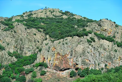
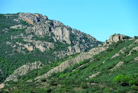
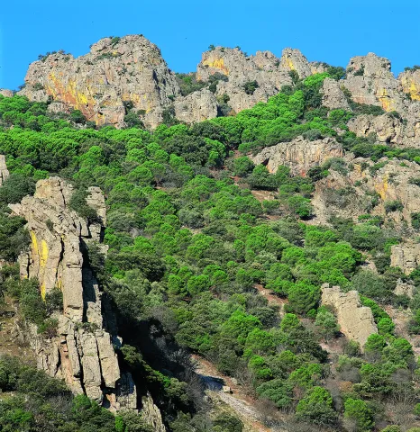
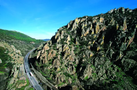
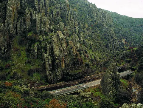
The river erosion, which has a limestone wall of about 400 meters high, is the result of the river erosion. There is a teaching path dedicated to local botany.

Location: On the highway of Granada, just at the limit of the municipal terms of Campillo, Cárcheles and Cambil.

Distance: 7 km.

Medium: Tourism vehicle.

Access: Directly via the Granada Highway (A-44).

Breve descripción

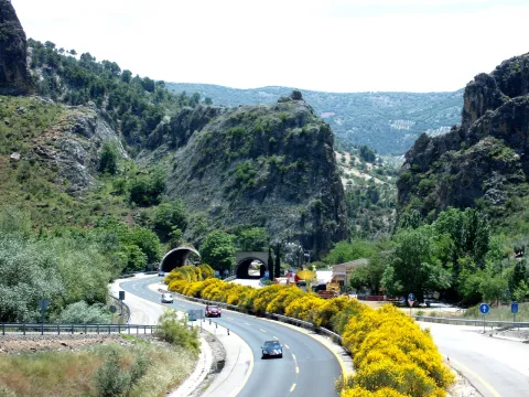
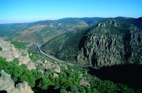
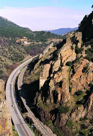
TheDespeñacolos parloris a great geological formation that makes the border between the plains of Castilla la Mancha and the Valle del Guadalquivir, declared Natural Park. Many of you will have been able to observe as you pass through the road that passes through Despeñacolos, the great mouth open in the rock caused by the erosion of the river's channel, on which the old route was built, which communicates Andalusia with the neighbouring community.

Ubicación
Código Postal
23213
Latitud
38.409930
Longitud
-3.560880
Distrito
Municipio
Ubicación en el mapa
POINT (-3.56088 38.40993)
Tipos de punto de interés
Imágenes carrusel
imagen
Image
Natu268.jpg
Imagen principal
Desactivado
imagen
Image
Natu140.jpg
Imagen principal
Desactivado
imagen
Image
Natu169.jpg
Imagen principal
Desactivado
imagen
Image
Natu176.jpg
Imagen principal
Desactivado
imagen
Image
Natu229.jpg
Imagen principal
Desactivado
imagen
Image
Natu232.jpg
Imagen principal
Desactivado
Imágenes cabecera
imagen
Image
Natu016.jpg
Imagen principal
Activado
Loading map
Preparing points of interest and routes...