Saltar al contenido principal
icon-intereses-viajar-solo

Control Checkpoint of La Cabrera

Submitted by brandcode_deweloper on
Id
2854602
Descripción
Descripción larga

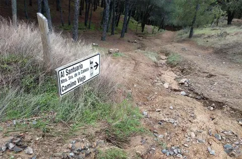
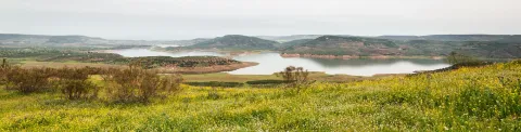
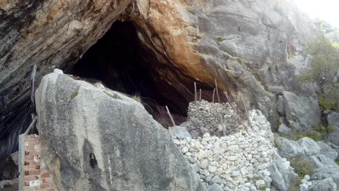
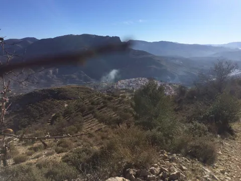
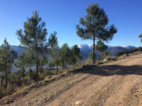
The access road runs through a relatively easy forest track; this track is taken from the same town of Marmolejo, after crossing the bridge over the Guadalquivir River at the height of the spa.

Right on the north bank of the river a right turn is taken towards the Aliseda, follow those signs and this way for 12.5 km until you reach the closed control door. There you can leave the vehicle and put things on the other side by entering the pedestrian door.

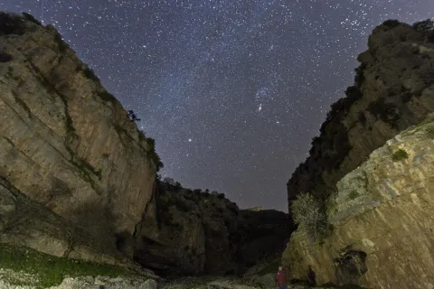
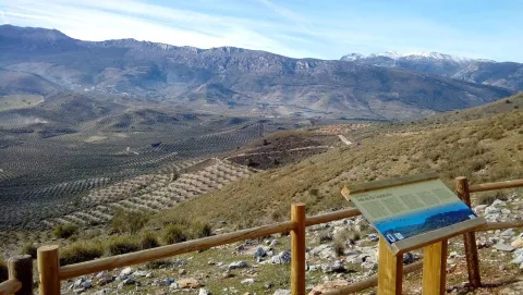
This point is especially suitable for those fans with telescopes and their own means in search of an outstanding sky and with light-taking to connect their equipment.

Breve descripción

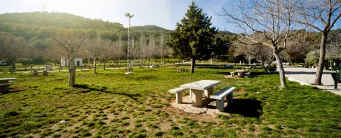
Another privileged place is La Cabrera Control, in Marmolejo. The great advantage of this enclave is that it currently has an electric current that can be taken directly from an external plug that is located on the wall of the guard's surveillance shed.

Telecomunicaciones
Sitio web
www.andalucia.org/es/marmolejo-turismo-cultural-control-de-la-cabrera
Ubicación
Latitud
38.044893
Longitud
-4.170983
Distrito
Municipio
Ubicación en el mapa
POINT (-4.170983 38.044893)
Tipos de punto de interés
Imágenes carrusel
imagen
Image
Sendero%20Control%20de%20la%20Cabrera-Santuario%20Virgen%20de%20la%20Cabeza2.jpg
Imagen principal
Desactivado
Imágenes cabecera
imagen
Image
JJG_1117%20%281%29.jpg
Imagen principal
Activado
Microsite al que pertenece
Loading map
Preparing points of interest and routes...

Archaeological ensemble of the Ibero-Roman city of Cástulo

Submitted by brandcode_deweloper on
Id
5868069
Descripción
Descripción larga

The Archaeological Set of Catulo and its monographic museum in Linares are the ideal sites to know the cultural diversity of Andalusia. The Ibero-Roman city is located on the right bank of the Guadalimar River, it is one of the capital centers of the peninsular noon during the antiquity, both for the extension of its walled enclosure (70 hectares), and for its strategic position in the Alto Guadalquivir and its mining holdings of silver, lead and copper. The "oppidum"- or fortified city - of Cattulo, first, was the most important nucleus of the population of the Iberian Oretania and, later, was formed as a Roman municipality, becoming episcopal headquarters in the lower-imperial era.

Catulus, Ibero-Roman city

The archaeological area of Catulo comprises a vast surface where multiple evidence is overlapping which are expression of other forms of occupation. There are necropolis, factories, public infrastructure and other suburban facilities related to the Ibero-Roman city, but also other settlements from Prehistory to the low Middle Ages, which complete the historical value of this archaeological area. This complex stratigraphic and temporal sequence, which has reached our time in exceptional conditions of conservation and integrity, is a significant segment of the entire history of Andalusia.

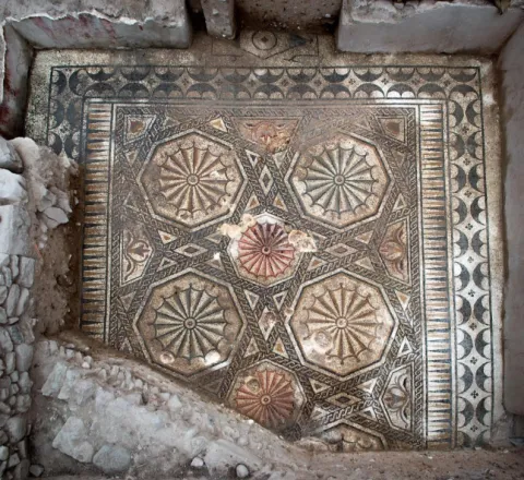
The tour begins with the reception center, where the visitor will find all the keys to understand the historical development of the site. In the walls you can make a stop in the highest part of the city and visit the Gate of the Lions of the Republican period, where the famous León de Catulo, the best preserved of the entire Iberian peninsula, was discovered. In the central area of the plateau do not forget to make a tour of the different archaeological areas and to contemplate the spectacular "Mosaic of the Amores," considered one of the ten greatest discoveries of 2012 by the magazine National Geographic. Also in the same area you can see an important religious building within which the "Patena de Cristo" was discovered, a fourth-century glass dish with one of the best preserved images of Christ which is currently exposed in the Museum of Linares. At the most eastern end of the settlement, you can see the Castle of Santa Eufemia, a fortification that dates from the Arab period and is also part of the cultural itinerary Route of the Castles and the Battle.

Archaeological Museum

This museum cannot be understood in its integrity without reference to the Archaeological Set of Cattulo, as they are intimately related. In fact, an important impetus in the development of the Museum occurs when the expropriation of the lands of the former Cattulo is carried out, a process that began in 1968 and concluded in 1972, thus facilitating the research work that has been carried out in these areas since 1958 and from where the most important and numerous part of the collection comes from.

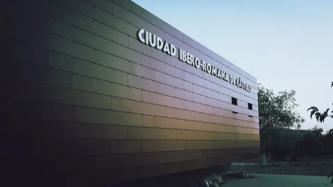
The tour is arranged on several floors, a covered courtyard and the basement. Its rooms treasure the most important findings of Catulus, including the Ibero-Roman Lion dating back to the 1st century BC and the Patena of Christ dating back to the 4th century AD.

Breve descripción

The archaeological set of Catulo and its monographic museum in Linares are the ideal sites to know the cultural diversity of Andalusia. The Ibero-Roman city is located on the right bank of the Guadalimar River, it is one of the capital centers of the peninsular noon during the antiquity, both for the extension of its walled enclosure (70 hectares), and for its strategic position in the Alto Guadalquivir and its mining holdings of silver, lead and copper. The "oppidum"- or fortified city - of Cattulo, first, was the most important nucleus of the population of the Iberian Oretania and, later, was formed as a Roman municipality, becoming episcopal headquarters in the lower-imperial era.

Telecomunicaciones
Sitio web
www.castulolinares.com
Teléfono de contacto
953 106 074
Correo electrónico
museoarqueologicolinares.ccul@juntadeandalucia.es
Ubicación
Código Postal
23700
Latitud
38.087695
Longitud
-3.640179
Distrito
Municipio
Ubicación en el mapa
POINT (-3.640179 38.087695)
Tipos de punto de interés
Imágenes carrusel
imagen
Image
mosss-346-jpg
Imagen principal
Desactivado
Imágenes cabecera
imagen
Image
139234900--62l4x468.jpg
Imagen principal
Activado
Horario
Archaeological Set of Catulus: Tuesday to Saturday 09: 00 - 18: 00, Sundays and holidays 09: 00 - 15: 00, Monday closed. Archaeological Museum of Linares - 1 abr - 15 Jun: Tuesday to Saturday 09: 00 - 21: 00, Sundays and holidays 09: 00 - 15: 00, Monday closed. 1 Jul - 31 Aug: Tuesday to Sunday 09: 00 - 15: 00, Monday closed. 1 sept - 31 sea: Tuesday to Saturday 09: 00 - 21: 00, Sundays and holidays 09: 00 - 15: 00, Monday closed. Closed: 1 and 6 ene, 1 may, 24, 25 and 31 Dec.
Microsite al que pertenece
Loading map
Preparing points of interest and routes...

Complex Arroyo de la Rambla (PB-4)

Submitted by brandcode_deweloper on
Id
875717
Descripción
Descripción larga

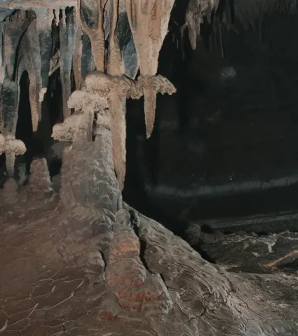
Discovered in 1992. It currently reaches a total of 5.117 m of development with important prospects for exploring new galleries. This very important complex is located in the vicinity of the Pantano de la Bolera, in the Barrio known by Arroyo de la Rambla, the two mouths of access are opened in the municipal term Peal de Becerro (Jaén) and much of the cavity is developed under the term Cazorla (Jaén). Along with this large complex, several more cavities have been located that have not been able to communicate to date (PB-1, PB-2, PB-5, PB-7), which were certainly part of it at the time, and these cavities are currently being explored.

The main entrance, of small dimensions, provides access to a floor room that is damaged by the blocks that cover it, ceilings between two and four meters high and spacious, allowing to accommodate several dozen people. At the bottom, between blocks, the sinuous continuation is opened. Close steps and several descending highlights lead almost to the level of the ravine, and it is often found flooded. The water input is done through the PB-6 sink. A narrow corridor with clay-covered floor, followed by several climates, leads again to the level of the entrance room, out of reach of the waters. The transit through them is balized, to try to mitigate as much as possible the alteration of the floor, after the steps to be followed you have to climb to a top floor with the help of a small staircase of about 10 m.

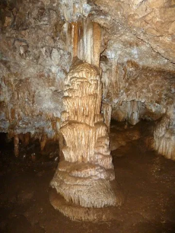
This apartment is characterized by a succession of steps between blocks that once stranded back down to the level of the gallery. From this point the continuation is more problematic, as the succession of ramps, steps between blocks, des climes, etc. make their description very monotonous. The second staircase opens a large room and an almost horizontal corridor of about 100 meters with the floor covered with gours and ceilings with large stalactic blankets, flags, etc. We meet about 700 meters from the mouth. A new drop to a siphon (usually dry) allows the passage, also between blocks, rips, and narrow steps of about 300 meters of very accidental gallery that leads to the final room or the siphon. Large room with different possibilities of continuation.

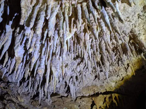
The 60-meter-long siphon with a penetrable gap to 6 meters under water leads to a descending gallery that connects with a large cavity, circulated by an active river that spills its waters in the Valentine's Source (PB-1 and PB-5). Currently in exploration of spelologists. This succession of rooms is beautifully decorated by spelotems in various ways, among which are predominantly ceilings covered with stalactite stylized.

About a hundred meters from the mouth, a new succession of weeds return us to the theoretical level of water, changing the morphology of the cavity strongly. After several stretches and decreases the dimensions of the gallery increase. In this area the two possible entries to the Network of the Talegas are located (flooded sectors, Red Gallery, Sala Alicia, etc.). Continuing through the main gallery you can reach the Paso Javi, a small laminator that cuts a rock barrier (this step is very common to find it flooded), if it is under the waters, the pass is carried out by a strong ramp to the right of the pass, followed by a vertical - easy to overdo - descent that goes down to the level of the main gallery, after the Paso Javi. The continuation is obvious, just follow the gallery, yes, with some other narrowing and passage between blocks, until you reach the gallery of the Levels, easy to recognize by the calcite sidewalks that go through all the walls, blocks and other speleotems.

From here a new rebound between blocks and slices lead to the header of some scarves. A few meters before reaching them and on the left wall, several narrow steps are opened, between blocks, which reach the base of these scarves. It is entering the Cebra Gallery, thus called by the successive levels of floating calcite that have been fixed on the clay walls; corresponding to different flood stadiums.

Source: Inventory of Georresources of Andalusia. Environmental Council. Junta de Andalusia.

Breve descripción

Arroyo de la Rambla complex

Ubicación
Latitud
37.912140
Longitud
-3.124060
Municipio
Ubicación en el mapa
POINT (-3.12406 37.91214)
Tipos de punto de interés
Imágenes carrusel
imagen
Image
7-0.png
Imagen principal
Desactivado
imagen
Image
201712-01%20Columna%20%281%29.jpg
Imagen principal
Desactivado
Imágenes cabecera
imagen
Image
espeleologia_cazorla-2.jpeg
Imagen principal
Activado
Loading map
Preparing points of interest and routes...

Santa María de los Reales Alcázares Collegiate Church

Submitted by brandcode_deweloper on
Id
5742066
Descripción
Descripción larga
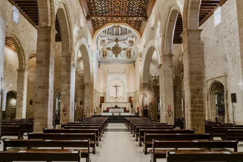
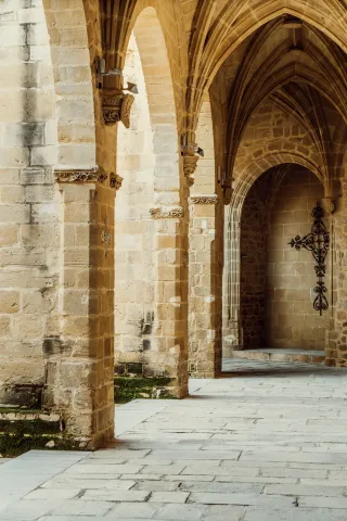
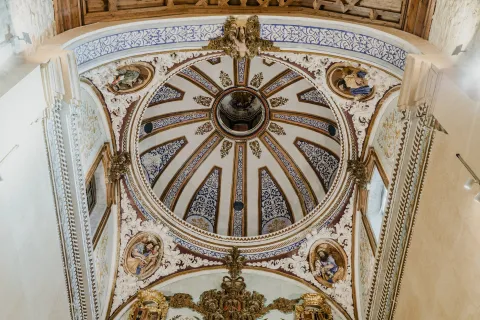
It contains an interesting Cloister from the 15th century as well as noble chapels from the 15th and 16th centuries and numerous pieces of metalwork and painting of maximum artistic representation. Part of the most representative sequences of the movie "Capitán Alatriste" were filmed in this location. Its connection with San Juan de la Cruz is given because the relics of San Juan de la Cruz were guarded and venerated in the Collegiate Church from the exclaustration of the Discalced Carmelites in 1836 until their return in 1905.
Breve descripción
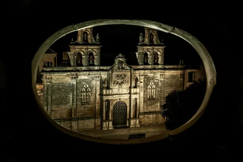
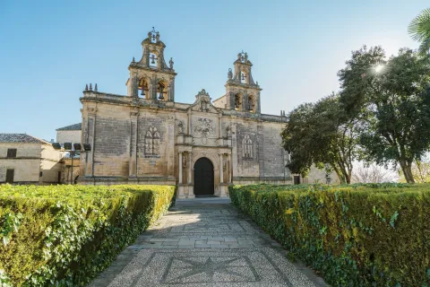
This temple, Iglesia Parroquial Mayor de Úbeda, constitutes the most significant superposition of architectural styles in the city. On the main doorway, late Renaissance like the side doorway, the relief of the Adoration of the Shepherds stands out, based on a portrait by the Italian painter Zuccaro. The eastern gate, called Consolada, is emblematic for being where our Father Jesús Nazareno makes his departure at dawn on Good Friday.
Ubicación
Código Postal
23400
Latitud
38.007080
Longitud
-3.368340
Dirección
Plaza Vázquez de Molina
Municipio
Ubicación en el mapa
POINT (-3.36834 38.00708)
Tipos de punto de interés
Imágenes carrusel
imagen
Image
plaza-vazquez-de-molina69-jpg
Imagen principal
Desactivado
imagen
Image
basi-ulica-de-santa-mari-ua-de-los-reales-alca-uzares80-hdr-jpg
Imagen principal
Desactivado
imagen
Image
basi-ulica-de-santa-mari-ua-de-los-reales-alca-uzares67-jpg
Imagen principal
Desactivado
imagen
Image
basi-ulica-de-santa-mari-ua-de-los-reales-alca-uzares89-hdr-jpg
Imagen principal
Desactivado
Imágenes cabecera
imagen
Image
plaza-vazquez-de-molina16-1-jpg
Imagen principal
Activado
Microsite al que pertenece
Loading map
Preparing points of interest and routes...

Alma Serrana Ethnographic Collection

Submitted by brandcode_deweloper on
Id
924849
Descripción
Descripción larga

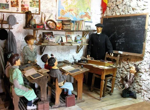
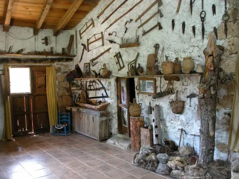
The museum offers us a tour of different aspects of traditional life, such as the stays of the serrana house, the rural school, the barbershop, the old inn, the stable and the trades related to the forest. There is also a small shop for crafts and food.

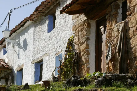
The small and isolated valley of Los Anchos, surrounded by mountains, is of an overwhelming beauty, especially in the autumn, when the wings of the stream become yellow.

The village of Los Anchos is one of the best preserved in the Natural Park. Very close to it there are two others around which you have to take a walk, which are those of Prado Maguillo and La Cañada del Saucar. From this last part a senderist route marked PR-A 196, which goes up to the Calar del Cobo, specifically to the Puntal of the Mass, one of the best viewpoints of the Natural Park. In Prado Maguillo there are also signposted trails.

Breve descripción

This museum, despite its small space, houses a large collection of ancient objects of daily use to the traditional serrana life, and is in an absolutely surprising place, where it is not expected to find something like this. It is shortly before the village of Los Anchos and transmits authenticity, not only for the pieces it exposes, but also for the traditional cortijo it occupies and for the extraordinary landscape of which it is part.

Telecomunicaciones
Teléfono
<p>José Laso Flores</p>
Teléfono de contacto
608 695 623
Correo electrónico
concienciados@gmail.com
Ubicación
Nombre
Majada Oscura
Código Postal
23294
Latitud
38.221480
Longitud
-2.584320
Dirección
Accede desde Venta Rampias (carretera JF-7038) por pista forestal asfaltada
Distrito
Municipio
Ubicación en el mapa
POINT (-2.58432 38.22148)
Tipos de punto de interés
Imágenes carrusel
imagen
Image
DSCN2563.JPG
Imagen principal
Desactivado
imagen
Image
DSCN2582.JPG
Imagen principal
Desactivado
Imágenes cabecera
imagen
Image
Eco-Museo%20de%20Los%20Anchos.jpg
Imagen principal
Activado
Horario
Weekends, bridges and holidays and summer: 10: 00 - 13: 30 and 17: 00 - 20: 30. Rest of days only concerted visits.
Otros servicios

Price of entry: 3 €with tasting included (children and retirees, free entry).

Loading map
Preparing points of interest and routes...

Giribaile Fortified City.

Submitted by brandcode_deweloper on
Id
308631
Descripción
Descripción larga

You can visit the Interpretation Centre in Vilches (currently closed by reforms) and learn about the historical evolution of this important site, but there is a fence that closes the passage to the fortified city, so it is necessary to telephone the City Hall in advance, on working hours from 8: 00 to 14: 00, to make an appointment.

In the archaeological enclave you can visit a prehistoric sanctuary, an Iberian village, a cenobium or eemite paleocristian or visigode and a Almohad castle, all surrounded by beautiful landscapes between olive and saw. Landscape, culture, heritage, history, nature, hiking... are intermingled in Giribola, where it is possible to appreciate the footprint left by different peoples and cultures over the centuries.

Thus, along with the vestiges of the castle, the traveller will also be able to see the remains that are still preserved from the great wall surrounding the Iberian oppidum, an important city that occupied a strategic place on the road of connection between Catulo and the Levant and that was abandoned after being swept away by the Romans. Similarly, the numerous caves that are distributed on the slopes of the hill, the so-called Cuevas de Espeluca, are also interesting.

Breve descripción

Giribola is located in the confluence of the Guadalimar and Guadalén rivers, in the municipal term of Vilches. The archaeological area occupies a prominent position at the end of a plateau interrupted by a barrier-type fortification that serves as a limit and, at the same time, a main access to the Iberian city. It can be considered, with its 18 hectares, one of the largest Iberian villages in the province of Jaén.

Telecomunicaciones
Teléfono
<p>Visitas concertadas por teléfono.</p>

<p>&nbsp;</p>
Teléfono de contacto
953 630 075 / 637 784 927
Correo electrónico
turismo@vilches.com
Ubicación
Código Postal
23220
Latitud
38.203092
Longitud
-3.508578
Dirección
Cerrillo, s/n
Distrito
Municipio
Ubicación en el mapa
POINT (-3.508578 38.203092)
Tipos de punto de interés
Imágenes carrusel
imagen
Image
vilches_giribaile_8.jpg
Imagen principal
Desactivado
imagen
Image
Cabecera-Ciudad%20fortificada%20de%20Giribaile.jpg
Imagen principal
Desactivado
imagen
Image
vilches_giribaile_3.jpg
Imagen principal
Desactivado
imagen
Image
vilches_giribaile_1.jpg
Imagen principal
Desactivado
Imágenes cabecera
imagen
Image
IMG_2037%20giribaile.JPG
Imagen principal
Activado
Horario
Interpretation centre closed for reforms.
Microsite al que pertenece
Loading map
Preparing points of interest and routes...

Roman Cistern La Calderona

Submitted by brandcode_deweloper on
Id
13375131
Descripción
Descripción larga

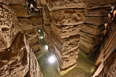
Declared Good of Cultural Interest in 2014, the La Calderona tank in Porcra (Jaén) is a water tank in the Roman city of Obulco, which is presumed to be linked to a water infrastructure of themunicipum,Maybe public hot springs. In the time of the Roman Empire, the growth of the large walled city led to the area being covered with large stone pillars on which new constructions were settled, thus starting what became its final burial.

In the Spanish civil war the tank served as an anti-aircraft shelter. In a fortuitous way, there was a finding that put the experts on the track of the original infrastructure: as they went down to the ground to protect themselves from the bombing, the neighbors observed that the wells they had in their homes were part of a more complex structure.

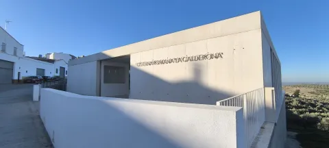
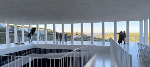
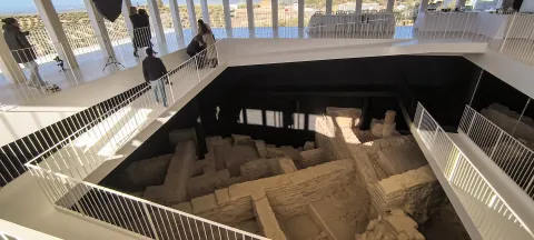
After a long and complex restoration, the tank currently in operation has been opened to the public. In order to access the level of the deposit, the intervention required, first, to build a new building, to serve as a reception centre for visitors and to integrate in turn the helicoidal ramp of down with 100 meters suspended, that do not touch the archaeological remains. In order to locate the new construction, an empty area was taken advantage of, located on one of the margins of the nearest road, so that the houses located on the Roman complex were not affected. In this way, the search for access to the tank ended up generating as added in addition to the new construction, a bridge that crosses San Marcos street and a tunnel that passes below the houses.

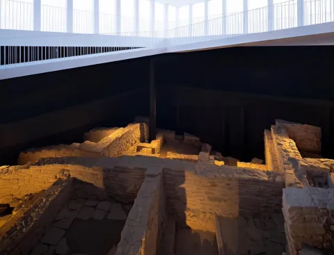
The project, led by the architect Pablo Millán, is based on the interrelationship of opposite realities and that, in the face of complexity, proposes a discourse based on the simplicity of a clean, geometrically precise architecture that does not conflict with the heritage architecture, present both in the Roman tank and in all the domestic buildings that appear during the archaeological intervention. In front of the space under the railing, hidden, in which the light does not enter, there is a new clear and deafan space through which the visitor travels, establishing a dialogue between the archaeological heritage and contemporary architecture.

Breve descripción

It is an underground hydraulic complex more than two millennia old, located in the municipality of Porcra. Accidentally rediscovered by one of the inhabitants of the contemporary houses above him and used during the civil war as an anti-air shelter, it was originally a large public water tank with several years of rainwater collection and three catchment wells. Its construction, by means of walls and built-in pillars of cyclopean armchairs that support the architrabada deck with huge slabs of local calcarenita, makes it unique and unique at all levels.

Telecomunicaciones
Teléfono
<p>Oficina de Turismo</p>

<p>Plaza de Andalucía, 3&nbsp;</p>
Teléfono de contacto
953 545 130
Correo electrónico
oficinaturismo@porcuna.es
Ubicación
Código Postal
23790
Latitud
37.872025
Longitud
-4.189043
Dirección
Camino de San Marcos, s/n
Distrito
Municipio
Ubicación en el mapa
POINT (-4.189043 37.872025)
Tipos de punto de interés
Imágenes carrusel
imagen
Image
cisterna-porcuna-jpg
Imagen principal
Desactivado
imagen
Image
473630070_1066239135548190_4988771702868297360_n-jpg
Imagen principal
Desactivado
imagen
Image
473611344_1066239522214818_5207770888572245213_n-jpg
Imagen principal
Desactivado
imagen
Image
473660714_1066240128881424_4094374543181858277_n-jpg
Imagen principal
Desactivado
Imágenes cabecera
imagen
Image
la-calderona-2-jpeg
Imagen principal
Activado
Horario
Guided tours after booking in Porcra Tourist Office. Tuesday to Sunday: 10: 00 - 13: 00.
Microsite al que pertenece
Loading map
Preparing points of interest and routes...

Virgen de la Cruz Pool

Submitted by brandcode_deweloper on
Id
8094481
Descripción
Descripción larga

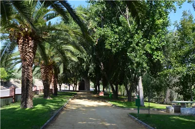
Near the population centre is theContón de la Virgen de la Cruz, recreational area located on an old landfill recovered as a green area and crossing through a bridge the first of the previous streams. Linked to these watercourses we find a typical vegetation of riverside, in which they stand out reels, carrizos, canes, calves, and eucalyptus, alms, olmos and weeping willows.

Breve descripción

The feast that the hunters celebrate is the one that takes place on the third of May, dedicated to the Marian advocation of theVirgin of the Cross, and in which there is the custom to go in Romeria to a place located on the road of Villanueva de la Reina called the Charcón.

Telecomunicaciones
Teléfono de contacto
953 537 131
Correo electrónico
castalla@cazalilla.es
Ubicación
Código Postal
23628
Latitud
37.987020
Longitud
-3.888300
Distrito
Municipio
Ubicación en el mapa
POINT (-3.8883 37.98702)
Tipos de punto de interés
Imágenes carrusel
imagen
Image
thb_g_DSC_0124%20%28Copy%29.jpg
Imagen principal
Desactivado
Imágenes cabecera
imagen
Image
thb_g_DSC_0131%20%28Copy%29.jpg
Imagen principal
Activado
Loading map
Preparing points of interest and routes...

Hill San Cristobal

Submitted by brandcode_deweloper on
Id
4281365
Descripción
Descripción larga

Its northwest face belongs to Jaén and is a private mountain, with a repopulation pine. Its southeast face belongs to La Guardia and corresponds to a mountain of oak and low mountain, very altered by man's hand. In spite of this, it has the attraction of the rise to the hill on the "old road," the visit to the Cabrera Cave (whose neolithic vestiges have just passed into history by burning the entire cave) and the arrival in the recreational area of the Allanadas del Santo. It has the Hermitage of San Sebastián (pattern of La Guardia), tables, barbecues, a small football field and one of the seven geodetic vertices of the municipality of Jaén. This one with the appeal of being placed at the top of a pillar about five meters high, with a ladder to be able to climb.

The proximity to Jaén (15 to 20 minutes) allows you to visit in the summer evenings with the possibility of eating there with the family, after the small route. Access is made from La Guardia, next to the Castle of the town.

Breve descripción

El Cerro San Cristóbal on a mountain that delimits the municipal terms of Jaén and La Guardia de Jaén.

Ubicación
Latitud
37.745911
Longitud
-3.712489
Distrito
Ubicación en el mapa
POINT (-3.712489 37.745911)
Tipos de punto de interés
Imágenes carrusel
imagen
Image
cerrosancristobal.jpg
Imagen principal
Desactivado
imagen
Image
cumbresancristobal-jpg
Imagen principal
Desactivado
imagen
Image
cumbresancristobal1-jpg
Imagen principal
Desactivado
Imágenes cabecera
imagen
Image
30.jpg
Imagen principal
Activado
Microsite al que pertenece
Loading map
Preparing points of interest and routes...

Hill Miguelico

Submitted by brandcode_deweloper on
Id
4873420
Descripción
Breve descripción

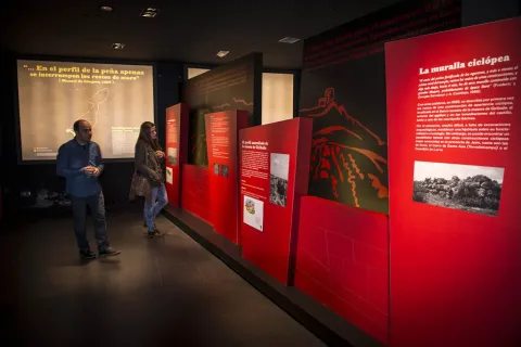
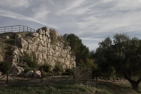
On the surface of an old oppídum and taking advantage of a cyclopeia wall (9th and X century), a plateau that would be the germ of the present town of Torredelcampo is consolidated.On its west side, acyclopoeia walland in the south-east is still preserved aVisigoda necropolis. On the east side is the hermitage of Santa Ana.

Ubicación
Código Postal
23640
Latitud
37.753720
Longitud
-3.904730
Distrito
Municipio
Ubicación en el mapa
POINT (-3.90473 37.75372)
Tipos de punto de interés
Imágenes carrusel
imagen
Image
miguelico.png
Imagen principal
Desactivado
Imágenes cabecera
imagen
Image
Muralla_Ciclopea_Cerro_Miguelico.jpg
Imagen principal
Activado
Loading map
Preparing points of interest and routes...