Saltar al contenido principal
icon-intereses-viajar-solo

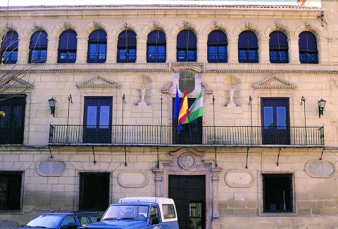
Town Hall

Submitted by brandcode_deweloper on
Id
4523734
Descripción
Breve descripción

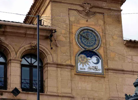
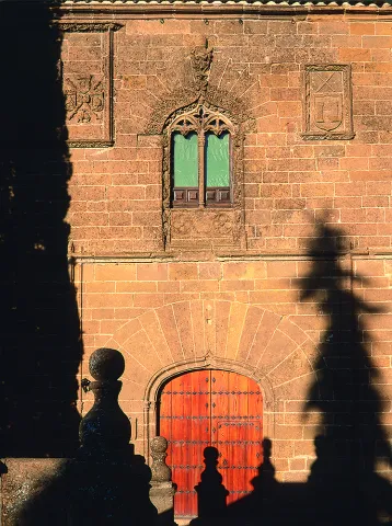
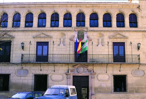
Its construction dates back to the 18th century and is characterized by the use of Sillería on its façade in which a half-point arch is opened. Another of the materials used in its design is the Forged Iron, which predominates on the adjoining balcony.

Ubicación
Código Postal
23730
Latitud
38.005168
Longitud
-3.914698
Distrito
Municipio
Ubicación en el mapa
POINT (-3.914698 38.005168)
Tipos de punto de interés
Imágenes carrusel
imagen
Image
Mon222.jpg
Imagen principal
Desactivado
imagen
Image
reloj-tapia.jpg
Imagen principal
Desactivado
imagen
Image
Mon556.jpg
Imagen principal
Desactivado
Imágenes cabecera
imagen
Image
Mon222%20%282%29.jpg
Imagen principal
Activado
Loading map
Preparing points of interest and routes...

A-316 Road, Torreperogil-Villacarrillo-Villanueva del Arzobispo Section

Submitted by brandcode_deweloper on
Id
7468197
Descripción
Descripción larga

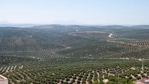
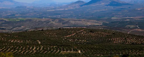
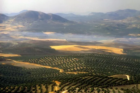
In particular this stretch of road runs almost air in the interflude of the valleys of the Guadalimar and the Guadalquivir. From this area you can see thousands of hectares of olive trees in a single look, framed by the horizons of Sierra Morena on one side, and Sierra de Segura and Sierra de Las Villas on the other.

Breve descripción

It is just an example of the great olive groves that can be seen when travelling through the province of Jaén.

Ubicación
Latitud
37.772886
Longitud
-3.788329
Municipio
Ubicación en el mapa
POINT (-3.788329 37.772886)
Tipos de punto de interés
Imágenes carrusel
imagen
Image
272ca59b7f36e64b14d2565ff1caba3a.jpg
Imagen principal
Desactivado
imagen
Image
olivos%20%281%29.jpg
Imagen principal
Desactivado
Imágenes cabecera
imagen
Image
miradores.png
Imagen principal
Activado
Loading map
Preparing points of interest and routes...

Road a Cabra de Sto. Cristo

Submitted by brandcode_deweloper on
Id
5845675
Descripción
Breve descripción

The best place to enjoy the last foothills, to the east, of Sierra Magina and also of the valley of the River Guardana Minor, characterized by its subaridity. The floral elements are numerous because they have to colonize different bioclimatic floors on different types of soils: saline, plaster, margous, limestone, etc. What is most striking are their carcabas and badlands formations.

Ubicación
Latitud
37.704030
Longitud
-3.286750
Distrito
Ubicación en el mapa
POINT (-3.28675 37.70403)
Tipos de punto de interés
Imágenes carrusel
imagen
Image
Carretera%20a%20Cabra%20de%20Sto.%20Cristo.jpg
Imagen principal
Desactivado
Imágenes cabecera
imagen
Image
106616866_3694094363937974_2481093797201150654_o.jpg
Imagen principal
Activado
Microsite al que pertenece
Loading map
Preparing points of interest and routes...

Carbonates of the Sector de Cabañas

Submitted by brandcode_deweloper on
Id
874642
Descripción
Descripción larga

The stratigraphic section of Cabañas is a mandatory reference of the Jurassic to Cretaceous transit in the Prebetic Zone. The materials that apflorate are essentially carbonates, in which the tidal levels stand out with marked cyclicity and magnificent examples of surfaces with drying cracks.

Reef faces, levels of accumulation of ferruginous oils, and limestones with spectacular sedimentary structures caused by traction currents are also observed. In addition to the section itself, the panorama contains an example of angular discord between the Jurassic materials and various Cretaceous terms of high paleogeographic interest.

Source: Inventory of Georresources of Andalusia. Environmental Council. Junta de Andalusia.

Breve descripción

Carbonates of the Cabins sector

Ubicación
Latitud
37.842982
Longitud
-3.066921
Municipio
Ubicación en el mapa
POINT (-3.066921 37.842982)
Tipos de punto de interés
Imágenes carrusel
imagen
Image
IMG_7746.JPG
Imagen principal
Desactivado
imagen
Image
100_3241.jpg
Imagen principal
Desactivado
Imágenes cabecera
imagen
Image
Natu004%20%281%29.png
Imagen principal
Activado
Loading map
Preparing points of interest and routes...

Guadalentín River Canyon

Submitted by brandcode_deweloper on
Id
874522
Descripción
Descripción larga

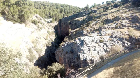
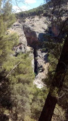
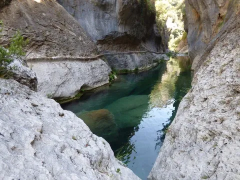
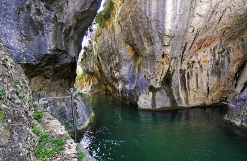
The canyon of the Guadalanimín River is a river form generated by the fitting of the Guadalanimin River in the dolomies of the upper Cretaceous of the Sierra del Pozo. This river also takes advantage of a fracture of medium direction N-S. The formation of this morphology has therefore involved river, karctic and tectonic processes.

Source: Inventory of Georresources of Andalusia. Environmental Council. Junta de Andalusia.

Breve descripción

Guadalentín River Canyon

Ubicación
Latitud
37.912893
Longitud
-3.003887
Municipio
Ubicación en el mapa
POINT (-3.003887 37.912893)
Tipos de punto de interés
Imágenes carrusel
imagen
Image
6341791Master.jpg
Imagen principal
Desactivado
imagen
Image
6341846Master.jpg
Imagen principal
Desactivado
imagen
Image
cerrada-de-la-canaliega-rio-guadalentin-senda-de-los-pescadores-56367-xl.jpg
Imagen principal
Desactivado
Imágenes cabecera
imagen
Image
Pil%C3%B3n%20del%20Ciervo.jpg
Imagen principal
Activado
Loading map
Preparing points of interest and routes...

Caño del Aguadero

Submitted by brandcode_deweloper on
Id
5846600
Descripción
Breve descripción

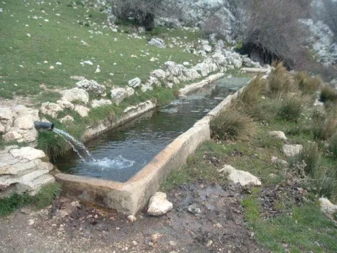
Weakening of cattle in the Sierra Mágina summit area, in the municipality of Bedmar. A place used for the perterminance, or seasonal local movement of the cattle to take advantage of the summer pastures. The whole is made up of a traditional abrevadero and a construction for herding shelter. It is a landscape of high Mediterranean mountain, with meadows and chopos bosquet. It is accessed on foot by track from Bedmar.

Ubicación
Latitud
37.743770
Longitud
-3.430490
Distrito
Municipio
Ubicación en el mapa
POINT (-3.43049 37.74377)
Tipos de punto de interés
Imágenes carrusel
imagen
Image
Ca%C3%B1o%20del%20Aguadero2.jpg
Imagen principal
Desactivado
Imágenes cabecera
imagen
Image
Caxo_del_Aguadero.jpg
Imagen principal
Activado
Microsite al que pertenece
Loading map
Preparing points of interest and routes...

El Paso Livestock Trail

Submitted by brandcode_deweloper on
Id
8100194
Descripción
Descripción larga

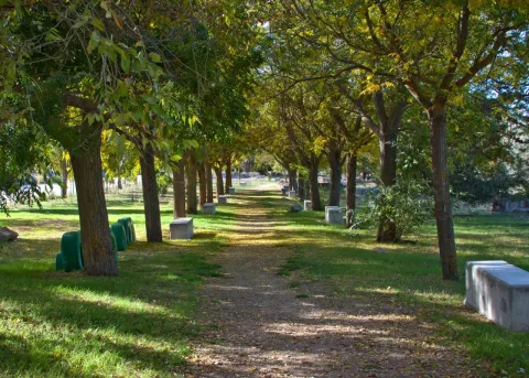
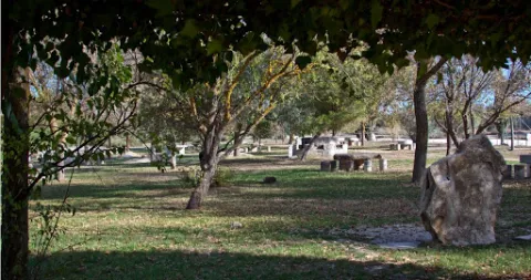
The recreational area in the initial section consists of various elements for the recreation of the users such as children's games, kiosks, fountains, barbecues, tables and benches, trees, football field, etc., making this environment a great place to spend a day in the field.

It is currently in the process of preparing and revaluing tourism under the premise of providing an intervention and rehabilitation that is environmentally friendly, with its traditional character and respecting its current physionomy.

Breve descripción

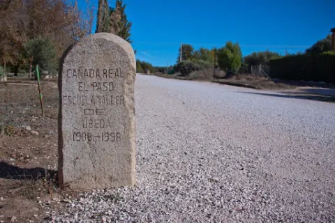
La Via Pecuaria Cañada Real de El Paso is part of the Cañada Real Conquense, one of the 10 main Cañadas Real included in the UNESCO Indicative List, which crosses the provinces of Cuenca, Ciudad Real and part of Jaén.

Telecomunicaciones
Teléfono de contacto
953 776 000
Correo electrónico
info@torreperogil.es
Ubicación
Código Postal
23320
Latitud
38.037680
Longitud
-3.311100
Municipio
Ubicación en el mapa
POINT (-3.3111 38.03768)
Tipos de punto de interés
Imágenes carrusel
imagen
Image
ca%C3%B1ada%20real%20el%20paso.jpg
Imagen principal
Desactivado
imagen
Image
ca%C3%B1ada%20real%20el%20paso2.jpg
Imagen principal
Desactivado
Imágenes cabecera
imagen
Image
ca%C3%B1ada%20real%20el%20paso3.jpg
Imagen principal
Activado
Loading map
Preparing points of interest and routes...

Campos Hernán Perea

Submitted by brandcode_deweloper on
Id
911990
Descripción
Descripción larga

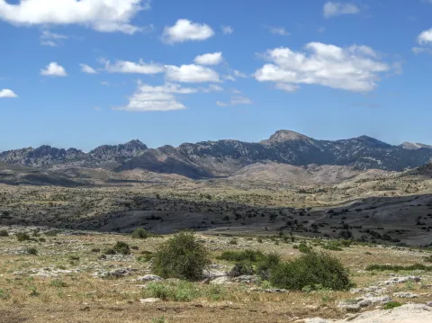
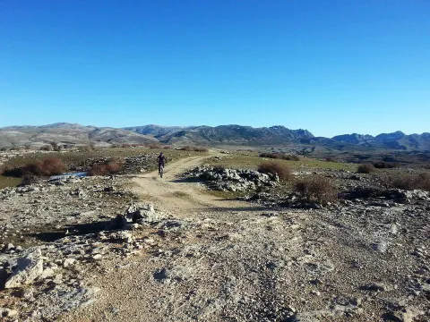
Its landscape is an exponent of karmic modeling. No one can say that he knows the Park in depth if he has not traveled the overwhelming plains of the Campos. The high mountain grazing is here the real protagonist; an activity that has, for centuries, allowed life in these remote territories, the homeland of the Segurean sheep.

They say that in Los Campos solitude is felt. There are no fewer people here than in the wooded areas of the Park, because it is common to find some shepherd. What happens is that the clear breadth that our eyes perceive makes us more aware of our small than in dense forest areas.

The real beginning of the Hernán Perea Campos is about 11 km from Don Domingo, after having passed the Cañada Hermosa shelter, first of the three shelters that support the mountaineers on this route. They were built by the ICONA in the 1970s and are located next to the main road, which is surrounded by light depressions, dolins and sour rocky cords of limestone origin.

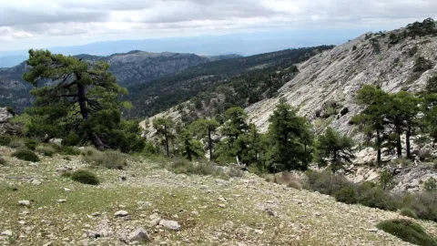
The harsh weather conditions have created a very adapted vegetation of piorns, albar thorn and common juniper (rake). We will also find some sown pieces of cereal, and of course many herbaceous plants from which the livestock is fed.

If we make the way in winter, with the snow covering its unique orography, we have the feeling of crossing an Arctic landscape. We must be very well informed of the weather, because a strong snow can put us in serious trouble. Spring is the best time to visit the Campos, when conditions are less demanding, although a good advice for any time is not to abandon at any time the main road that crosses the altiplanicie from north to south.

We suggest:

  • About 3.5 km from Don Domingo is the famous Pino Galapán, a 39-metre-high larix pine specimen in the area. A respectful visit to this "giant" in the Segura saw is required.
  • Rapist birds fly this place majestically throughout the year. The prismatics will be of great use to you to try to distinguish the royal eagle, the leonate vulture or... maybe the broken bones? The muflons are very abundant.
  • We must not forget that the beauty and grandiosity of the Campos is a major danger in certain times of the year. Winter, which here covers almost all autumn and part of spring, can be surprised by huge snowfalls that may eventually catch visitors, or leave them without the few visual references in the altiplanicie. In any case, in order to travel through these sites, you always have to use all-terrain vehicles, at least two cars, to provide support, as there is no telephone coverage. It is not advisable to stay in the winter months or in the twilight or night hours, and always to let third parties know that the tour begins.

From Santiago de la Espada we take the A-317 towards La Puebla de Don Fadrique. At 2.1 km, on the right, we find the JF-7091 road to La Matea. We take this road and follow it to the village of Don Domingo. The forest track towards Rambla Seca leads us to the fields of Hernán Perea.

Breve descripción

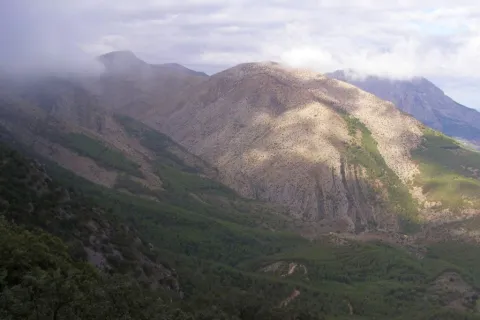
The fields of Hernán Pelea - or Perea, as is often called in the many mapas - make up the most extensive altiplanicie in Spain: they have an average altitude of 1600-1700 meters and an extension of more than 5,000 hectares. This vast altiplano represents one of the largest and most original landscapes of the Natural Park, quite different from all others.

Ubicación
Latitud
38.298857
Longitud
-2.651877
Distrito
Ubicación en el mapa
POINT (-2.651877 38.298857)
Tipos de punto de interés
Imágenes carrusel
imagen
Image
perea.jpg
Imagen principal
Desactivado
Loading map
Preparing points of interest and routes...

Fields of Hernán Perea

Submitted by brandcode_deweloper on
Id
2980186
Descripción
Descripción larga

The fields of Hernán Perea make up the most extensive altiplanicie in Spain. They have an average altitude of between 1,600 and 1,700 metres and an area of more than 5,000 hectares. This vast altiplano represents one of the largest and most original landscapes of the Natural Park Sierras de Cazorla, Segura and Las Villas, very different from all others. The harsh weather conditions have created a very adapted vegetation of piorns, albar thorn and common juniper (rake). Rapist birds fly this place majestically throughout the year. The prismatics will be of great use to us in trying to distinguish the royal eagle, the leonate vulture or... maybe the broken bones? The muflons are very abundant. About 3.5 km. From the village of Don Domingo is the famous Pino Galapán, a 39-metre-high larix pine specimen in the area. A visit to this botanical "giant" is required.

Breve descripción

In Santiago de la Espada we will take the road A-317 towards La Puebla de Don Fabrique (Granada). At 2.1 km, on the right, we will find the JF-7091 road leading to La Matea. We'll follow her to the village of Don Domingo. The forest track towards Rambla Seca will lead us to the fields of Hernán Perea.
Ubicación
Código Postal
23290
Latitud
37.981285
Longitud
-2.731904
Dirección
Camino de Pontones Don Domingo
Distrito
Municipio
Ubicación en el mapa
POINT (-2.731904 37.981285)
Tipos de punto de interés
Imágenes carrusel
imagen
Image
Campos_de_Hern%C3%A1n_Perea_24J_01.jpg
Imagen principal
Desactivado
Imágenes cabecera
imagen
Image
hernan-perea.jpg
Imagen principal
Activado
Loading map
Preparing points of interest and routes...

Calvary

Submitted by brandcode_deweloper on
Id
4885042
Descripción
Breve descripción

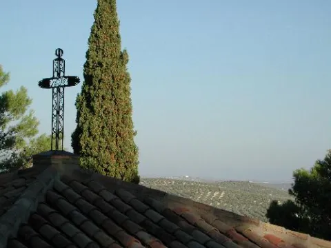
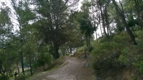
It's one of the local lungs. Located to the south-east of the city centre, it is a hill where there is pine mixed with oak and Mediterranean bushes. Through a wide and soft sidewalk, along which there are several stone crosses, you reach the top where you find theSan Cristóbal hermitage. On this path, at the evening of Holy Monday, the crucified Christ is processed.

Ubicación
Código Postal
23650
Latitud
37.763230
Longitud
-3.960880
Distrito
Municipio
Ubicación en el mapa
POINT (-3.96088 37.76323)
Tipos de punto de interés
Imágenes carrusel
imagen
Image
calvario.jpg
Imagen principal
Desactivado
Imágenes cabecera
imagen
Image
Calvario_de_Torredonjimeno.jpg
Imagen principal
Activado
Loading map
Preparing points of interest and routes...