Saltar al contenido principal
icon-intereses-viajar-solo

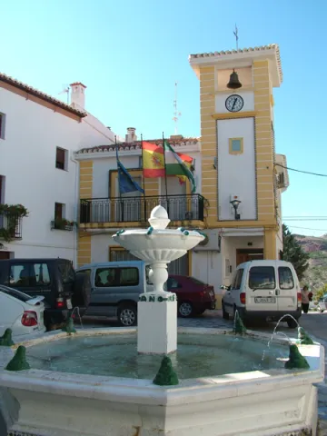
Town Hall of Torredonjimeno

Submitted by brandcode_deweloper on
Id
6229629
Descripción
Breve descripción

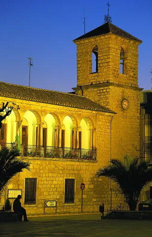
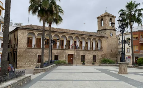
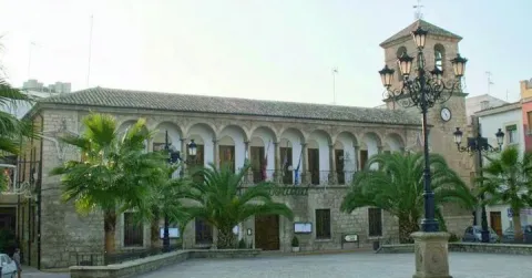
With an elegant and proportionate facade, it is typical of the classicism of the 17th century. The facade is divided into two floors, the one below has in the center a cover and on the double sides of the rectangular windows intellized. The superior features a gallery with 11 half-point arches supported on double columns. The open character of the gallery contrasts with the solid and sober underfloor in the style of the Italian palaces of Quatrocento. The building housed the Casas de los Cabildos, which occupied the top, the prison, on the lower right and the Posite on the left, and was completed by 1,642. In 1983 it was declared Good of Cultural Interest.

Telecomunicaciones
Sitio web
www.tosiria.com
Teléfono de contacto
953 571 950
Ubicación
Código Postal
23650
Latitud
37.765780
Longitud
-3.958840
Dirección
Plaza Constitución, 1
Distrito
Municipio
Ubicación en el mapa
POINT (-3.95884 37.76578)
Tipos de punto de interés
Imágenes carrusel
imagen
Imagen
Mon147.jpg
Imagen principal
Desactivado
imagen
Imagen
IMG_9105-scaled.jpg
Imagen principal
Desactivado
Imágenes cabecera
imagen
Imagen
1495729982_630930_1495730497_rrss_normal.jpg
Imagen principal
Activado
Horario
Monday to Friday: 08: 00 - 14: 00. Saturday and Sunday closed.
Loading map
Preparing points of interest and routes...
Town Hall of Rus

Submitted by brandcode_deweloper on
Id
4554789
Descripción
Breve descripción

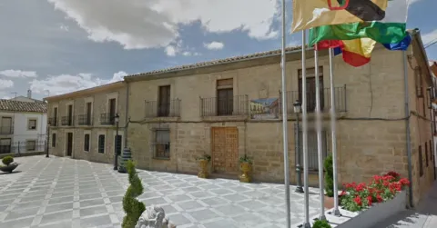
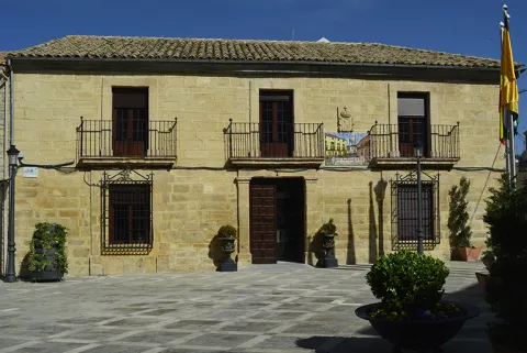
The City Hall, a building of the 20th century silery, of a classic air, is the president of the Plaza de la Constitución. It has a door flanked by pilassas, intellized and recercated holes and, in the upper part, the shield of the municipality.

Telecomunicaciones
Sitio web
www.rus.es
Teléfono de contacto
953 770 002
Correo electrónico
web@rus.es
Ubicación
Código Postal
23430
Latitud
38.048000
Longitud
-3.461810
Dirección
Plaza de la Constitución, 1
Municipio
Ubicación en el mapa
POINT (-3.46181 38.048)
Tipos de punto de interés
Imágenes carrusel
imagen
Imagen
rus.jpg
Imagen principal
Desactivado
Imágenes cabecera
imagen
Imagen
Ayuntamiento%20Rus.jpg
Imagen principal
Activado
Loading map
Preparing points of interest and routes...
Town Hall of Pegalajar

Submitted by brandcode_deweloper on
Id
4658310
Descripción
Breve descripción

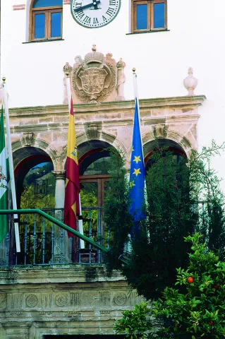
Its construction is linked to the repopulation of the southern part of Jaén in the time of Charles V. It preserves the18th century facade. It is fully rebuilt and only maintains its original track, the two-story cover of the 17th century.

Telecomunicaciones
Sitio web
www.ayto-pegalajar.org
Teléfono de contacto
953 360 003
Ubicación
Código Postal
23110
Latitud
37.737840
Longitud
-3.650930
Dirección
Plaza de la Constitución, 10
Distrito
Municipio
Ubicación en el mapa
POINT (-3.65093 37.73784)
Tipos de punto de interés
Imágenes carrusel
imagen
Imagen
Mon474.jpg
Imagen principal
Desactivado
imagen
Imagen
pegalajar-ayuntamiento-1--644x362.jpg
Imagen principal
Desactivado
Imágenes cabecera
imagen
Imagen
ayuntamiento.png
Imagen principal
Activado
Microsite al que pertenece
Loading map
Preparing points of interest and routes...
Town Hall of Noalejo

Submitted by brandcode_deweloper on
Id
4867653
Descripción
Breve descripción

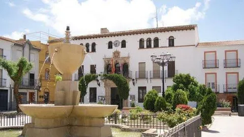
Building built at the end of16th century. At first it was a convent under the title of Our Lady of the Assumption, and this is the reason for the small image that presides over the facade. In the 18th century it became for the first time the House of the Council. The original construction corresponds to athree-storey building and swordsmanI had a bell with three crunches. It had different units anda central courtyard.A big ladderimperial two meters, immense and majestic, raised us to the second floor. On the third floor the schools were installed.

Telecomunicaciones
Sitio web
www.noalejo.es
Teléfono de contacto
953 306 134
Correo electrónico
noalejo@andaluciajunta.es
Ubicación
Código Postal
23140
Latitud
37.529460
Longitud
-3.653660
Dirección
Plaza España, 1
Distrito
Municipio
Ubicación en el mapa
POINT (-3.65366 37.52946)
Tipos de punto de interés
Imágenes carrusel
imagen
Imagen
noalejo.jpg
Imagen principal
Desactivado
Imágenes cabecera
imagen
Imagen
noalejo3.jpg
Imagen principal
Activado
Microsite al que pertenece
Loading map
Preparing points of interest and routes...
Town Hall of Hinojares

Submitted by brandcode_deweloper on
Id
4591486
Descripción
Descripción larga

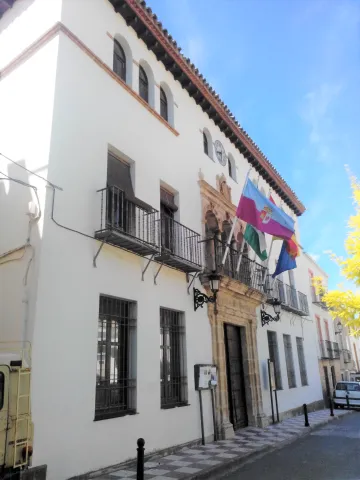
With three heights and bounds, the most outstanding is that of the balcony on the first floor, in a vertical line with the access door, and crowned by a small attic with a watch that imitates that of the municipalities colonized in the 18th century, but which is located not in the center but on one of the sides of the building, and on which a small bell is installed.

Breve descripción

The other significant building of Hinojares is the City Hall, also in the same line of architectural austerity and without concessions to decoration and aesthetics.

Ubicación
Latitud
37.715363
Longitud
-2.999162
Dirección
Plaza Constitución, 14
Municipio
Ubicación en el mapa
POINT (-2.999162 37.715363)
Tipos de punto de interés
Imágenes carrusel
imagen
Imagen
AYNT%20HINOJARES.jpg
Imagen principal
Desactivado
imagen
Imagen
AYNT%20HINOJARES%202.jpg
Imagen principal
Desactivado
Imágenes cabecera
imagen
Imagen
113.jpg
Imagen principal
Activado
Loading map
Preparing points of interest and routes...
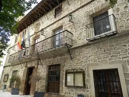
Old Town Hall, Former Prison, and Cabildo

Submitted by brandcode_deweloper on
Id
2293022
Descripción
Descripción larga

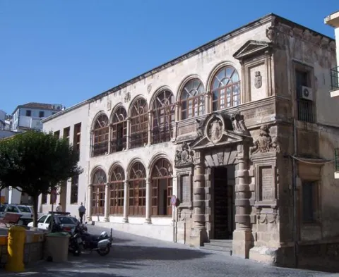
The construction is part of an ambitious plan for the beautification of the city of Martos, seeking to create a capital worthy of the Endowment according to its Roman legacy. Urbanistically the façade of the Cárcel would vertebrate the space of the main square of the city (current Plaza de la Constitución), also remodeling the nearby church of Santa Marta and the Sanctuary of Nuestra Señora de la Villa, and having in the central part of the square the Fuente de Neptuno, disappeared work of which we have references in the History of the Peña de Martos de Diego de Villalta. In addition to this intervention in the main square, new roads and spaces would be built, such as the street and the square of the Fuente Nueva, the district of the Heras, the street of the Albollón, etc., and a series of convents and churches were also founded.

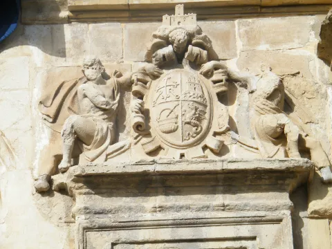
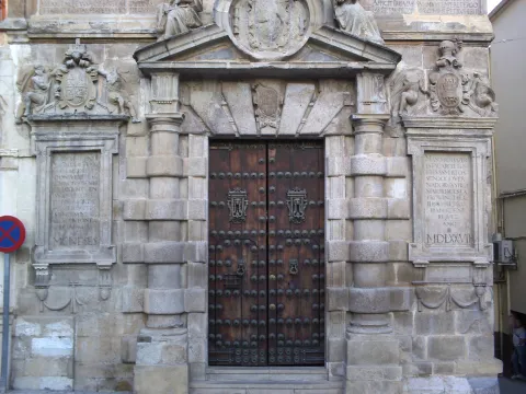
The main façade of the Prison is structured as a double gallery of half-point arches supported by dogrous columns (four arches on the lower floor and six on the upper floor), the cover being located in a decentralized way on the right side (on which a blind balcony is available as a temple, topped with a straight fronton). In the jets of the central part of the upper arcade we find heraldic shields, killing the whole facade with a large cornice.

Breve descripción

The building was built by the architect Francisco del Castillo between 1557- 1577 on behalf of Governor Pedro Aboz Enríquez and Mr Antonio de Padilla Meneses, Justice Mayor of Calatrava in the Kingdom of Jaén.

Telecomunicaciones
Sitio web
www.martos.es
Teléfono de contacto
953 704 005
Ubicación
Código Postal
23700
Latitud
37.722920
Longitud
-3.965830
Dirección
Plaza de la Constitución, 21
Distrito
Municipio
Ubicación en el mapa
POINT (-3.96583 37.72292)
Tipos de punto de interés
Imágenes carrusel
imagen
Imagen
Martos-Escudo-C%C3%A1rcel.jpg
Imagen principal
Desactivado
imagen
Imagen
P1100304-1024x768.jpg
Imagen principal
Desactivado
imagen
Imagen
Martos_-_Portada_del_Ayuntamiento_K03.jpg
Imagen principal
Desactivado
Imágenes cabecera
imagen
Imagen
main_image_43929.jpeg
Imagen principal
Activado
Horario
External visit.
Loading map
Preparing points of interest and routes...
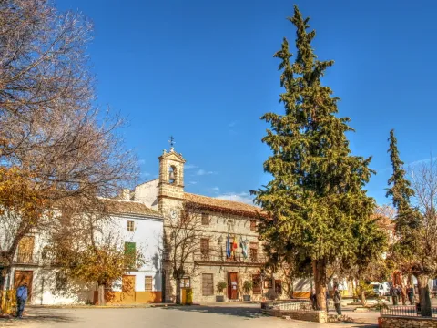
Avellanares

Submitted by brandcode_deweloper on
Id
919885
Descripción
Descripción larga

The hazelnut is presented in several places in the Park, usually in the area of Segura and in it we will see it. In the high valley of Segura, between Pontones and the Utrera Strike, one of the most extensive hazelnuts of the Park is spread, presenting a good state of conservation, as it has preserved it from the transformation of the area by the human being.

In the recommended area the hazelnut (Corylus avellana) is abundant, forming an extensive plant community, in which we find lanthanes (Viburnum lantana), worlds (Viburnum opulus), vidars (Clematis vitalba), liver, (Hepatia nobilis), parnasias (Parnassia palustres), wild strawberries (Fragaria vesca), orchids (Listera ovata, Dactyliorhiza elata), cardos (Cirsium pyrenaucas and several sagulis (S.), and Sallicola (S.). We also found repopulation choperas with the Populus x canadensis hybrid. This whole set forms a thick and wide forest in gallery, where hazelnut is the protagonist.

For our visit to the hazelnut we choose the head of the Segura River. We will go to Pontones and from there we will take the track that passes to the side of the Segura River, downstream, in the direction of the Masegoso cortijo. We can make it walk or by vehicle, but we will enjoy more of the walk, as it does not reach 5 km to the end.

Breve descripción

When we have talked about the "North in the South" we invite to discover the hazelnuts in the area of Las Azebeas, but there are them in many other places, forming exceptional exceptional plant communities, authentic more northern plant shelters that live in the South.

Ubicación
Latitud
37.772886
Longitud
-3.788329
Ubicación en el mapa
POINT (-3.788329 37.772886)
Tipos de punto de interés
Imágenes carrusel
imagen
Imagen
ave%20%281%29.jpg
Imagen principal
Desactivado
imagen
Imagen
avellanares%20%282%29.jpg
Imagen principal
Desactivado
Imágenes cabecera
imagen
Imagen
1.JPG
Imagen principal
Activado
Loading map
Preparing points of interest and routes...
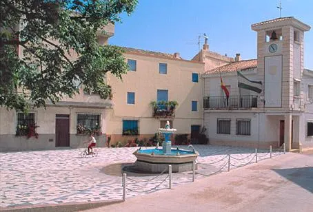
Atochares

Submitted by brandcode_deweloper on
Id
919830
Descripción
Descripción larga

These semi-arid areas are the result of the gradual degradation of the ancient Mediterranean forest, which with an aridization of the climate has sculpted landscapes whose beauty is only overcome by their hostility and dryness, causing the plants to pass hard tests in order to live in these environments.

This vegetation is called xerophyll, because it lives in dry environments, with precipitation below 300 mm. annual. Among them are species such as albaida (Anthyllis cytisoides), sosas or salsoles (Salsola oppositifolia), salates (Suaeda spp., Hammada articulata), herb of the conjunctures (Ephedra fragilis), garbancers (Ononis fruticosa) and rabbit garbancillo (Ononis tridata). At times there are sabinas (Juniperus phoenicea), rosemary (Rosmarinus officinalis), male rosemary (Cistus clusii), rethemes (Retama sphaerocarpa), tomilos (Thymus zigis), some carrasco pine (Pinus halepensis) and some other lenticus (Pistacia lenticus), reminding us that this vegetation is the result of the destruction of an ancient Mediterranean forest.

But one of the most significant species of these areas is the caparra (Capparis spinosa), a culinary plant that its preparation in vinegar has been known from very old, and is now an essential element in the best European kitchens.

We suggest:

  • The best times for this visit are in autumn and early spring.

On this trip we will not spare the car. We will head to Huesa and from there we will take the road of Pozo Alcón and follow it to the crossing that leads us to the village of Ceal. From this village comes a narrow and tortuous road that goes to Hinojares, which passes through a semi-arid area, populated by scavenges (Stypa tenacissima), which in the area has the name of an atocha, so a nochar is a spartal.

Breve descripción

We will not know all the wealth of the vegetation of the Park without visiting the semi-arid areas of its southern end. They are hard, unwooded landscapes, with an extreme climate of very high temperatures, but that hardness is overcome by the beauty of its landscapes, its colors and its vegetation that is extraordinarily interesting by the number of unique species in the territory it houses.

Ubicación
Latitud
37.715542
Longitud
-2.998754
Municipio
Ubicación en el mapa
POINT (-2.998754 37.715542)
Tipos de punto de interés
Imágenes carrusel
imagen
Imagen
35b5650ec4c04bdc2304a80e5ac58abd.jpg
Imagen principal
Desactivado
imagen
Imagen
hinojares9.jpg
Imagen principal
Desactivado
Imágenes cabecera
imagen
Imagen
14761066Master.jpg
Imagen principal
Activado
Loading map
Preparing points of interest and routes...
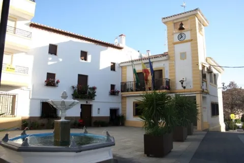
Arte Rupestre

Submitted by brandcode_deweloper on
Id
1927651
Descripción
Descripción larga
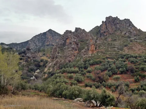
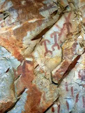
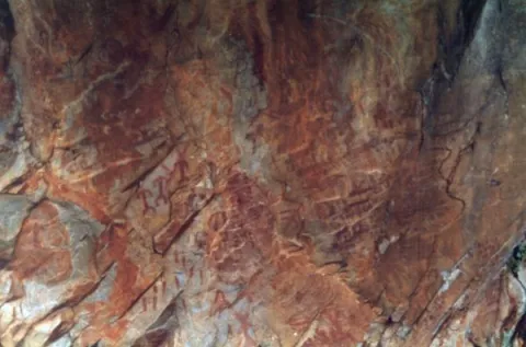
These more or less realistic but generally schematic manifestations reproduce human beings, animals and symbols, forming isolated scenes. The representations not only evoke and report part of daily life, but leave us witness to its complex v mysterious spirituality.

World Heritage Site

In Aldeaquemada, as a sample of its valuable cultural heritage, there are different groups of rock paintings, of a schematic and eulin style; distributed by fleshlands and rocky coats of the municipal term. So much so that UNESCO, meeting in Kyoto (Japan) in 1998, agreed to catalogue the Levine Rupestre Art of the Spanish Mediterranean Arc as a World Heritage Site. Meeting in assembly, he gave this important name and included in the list the 19 deposits of Rupéstre Levino and Eschematic Art discovered in this municipality, cataloguing that has come to recognize and highlight the great importance of the cultural manifestations of the former inhabitants of these lands.

Outdoor museums

These deposits, unique for their subject matter, are the most important in Andalusia and can be considered as authentic outdoor museums, of incalculable value and whose preservation concerns each and every one of us. When visiting them, we must remember with all due respect that we contemplate figures made by the primitive man; but not for that less human and intelligent, more than 4,000 years ago. They are all by law Cultural Interest Goods.
These groups of rock paintings, located on most occasions on rock coats, were studied at the beginning of the 20th century by the Abate Brehuil and M. Cabré, who catalogued the vast majority of existing groups in the area.
Subsequently, thanks to the new and relevant discoveries of the chronist Carlos Sanchez- Battle, it has been possible to have an extended relationship and a full awareness of the great heritage value that, for Aldeaquemada, represents the whole of its cave paintings.

Visit the paintings

Visiting these places is difficult and can be frustrating, not only because of their access; dangerous sometimes, but because of their poor conservation status; they make them difficult to see if they are not specialized. For this reason, before scheduling a visit, you should consult with a local connoisseur and let yourself be accompanied by a responsible local guide.
The most representative coats, on which signposted routes have been developed; not yet operational until the final protection of the paintings, but which has been announced (the Ayto. provide guides) can be visited, are those of the Poyos de La Cimbarra, Cimbarillo del Prado de Rechesa, Cave de la Mina, Garganta de la Hoz, Prado del Azogue and Cave de Los Arcos. Although there are another series of awakened groups.

Breve descripción

The Rupestre Art, "art on rock," is composed of the pictorial manifestations that our remote ancestors left on the walls of numerous covacas and petreous coats of our saws, in prehistoric times (in our region, from the Neolithic, to the Bronze Age).

Ubicación
Latitud
38.411070
Longitud
-3.374460
Distrito
Municipio
Ubicación en el mapa
POINT (-3.37446 38.41107)
Tipos de punto de interés
Imágenes carrusel
imagen
Imagen
pintlafelicita02%20%281%29.jpg
Imagen principal
Desactivado
imagen
Imagen
pintbarrancocueva%20%281%29.jpg
Imagen principal
Desactivado
imagen
Imagen
pintbarrancocueva01%20%281%29.jpg
Imagen principal
Desactivado
Imágenes cabecera
imagen
Imagen
pintpradoazogue%20%281%29.jpg
Imagen principal
Activado
Loading map
Preparing points of interest and routes...
Marcas de calidad

Recreational Area La Recta

Submitted by brandcode_deweloper on
Id
2980342
Descripción
Descripción larga

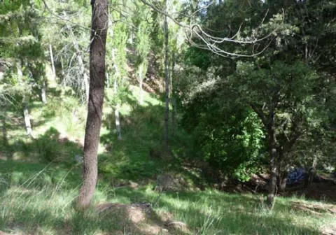
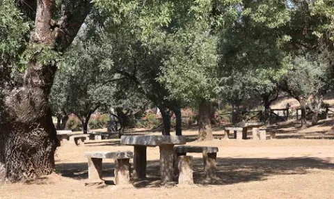
La Recta is a recreational area that has barbecues and tables and is accessed by a signposted path. Its characteristic vegetation is made up of the typical riverside forests of the Sierras de Andújar Natural Park: alarms, sargas, talles, strawberries, which serve as a refuge to faunistic species such as royal herons, zampullines, water cocks, otters. Very close is a watershed to give water to the abundant deer of this saw, next to the dam of the Encinarejo

Breve descripción

It is accessed by the road J-5010 of Andujar to the Sanctuary of the Virgin of the Head, turning left by a track leading to the New Place, very close to the Jandula River.

Telecomunicaciones
Sitio web
www.turismodeandujar.com/areas-recreativas
Teléfono de contacto
953 504 959
Correo electrónico
turismodeandujar@andujar.es
Ubicación
Código Postal
23740
Latitud
38.154730
Longitud
-4.021100
Dirección
Carretera A-6177
Distrito
Municipio
Ubicación en el mapa
POINT (-4.0211 38.15473)
Tipos de punto de interés
Imágenes carrusel
imagen
Imagen
%C3%81rea%20recreativa%20La%20Recta%202.jpg
Imagen principal
Desactivado
imagen
Imagen
%C3%81rea%20recreativa%20La%20Recta%203.jpg
Imagen principal
Desactivado
Imágenes cabecera
imagen
Imagen
%C3%81rea%20recreativa%20La%20Recta%20%281%29.jpg
Imagen principal
Activado
Microsite al que pertenece
Loading map
Preparing points of interest and routes...