Saltar al contenido principal

Bravoleum

Submitted by brandcode_deweloper on
10884794
Descripción larga
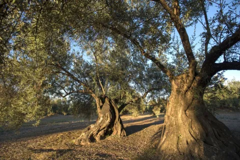
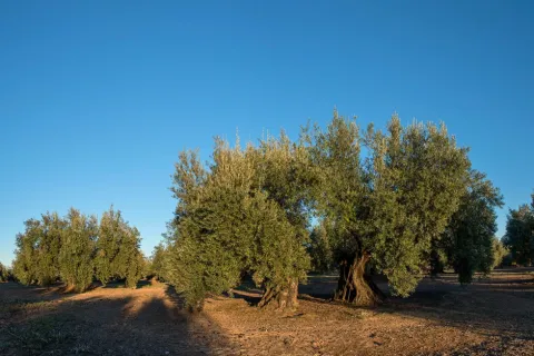
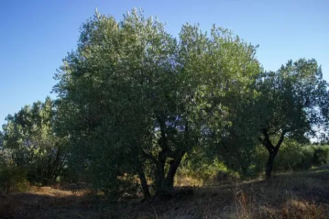
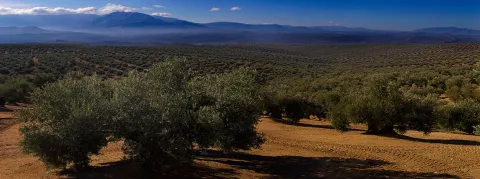
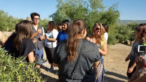
Aceites Hacienda El Palo is an olive oil mill that produces, and is passionate about, the finest olive juices, striving for the utmost excellence in its extra virgin oils since 1941. The mill is located in Villa Conchita, in a privileged setting just minutes from Jaén, the world capital of olive oil. A special spot in the municipality of Villargordo, perfect for enjoying olive oil tourism in state-of-the-art facilities.
Teléfono
953 377 190
Sitio web
https://www.bravoleum.com/es
Correo electrónico
contacto@bravoleum.com
Latitud
37.94763378567765
Longitud
-3.747471228495055
Dirección
Cortijo Villaconchita. Ctra A-6000, Km 16,35
Municipio
Ubicación en el mapa
POINT (-3.7474712284951 37.947633785678)
imagen
Image
BRAVOLEUM%20OLEOTURISMO%201.JPG
Imagen principal
Activado
imagen
Image
BRAVOLEUM%20OLEOTURISMO%202.JPG
Imagen principal
Desactivado
imagen
Image
BRAVOLEUM%20OLEOTURISMO%204.jpg
Imagen principal
Desactivado
Desactivado
Loading map
Preparing points of interest and routes...

Restaurante-Asador El Recreo

Submitted by brandcode_deweloper on
Id
2182115
Descripción
Descripción larga
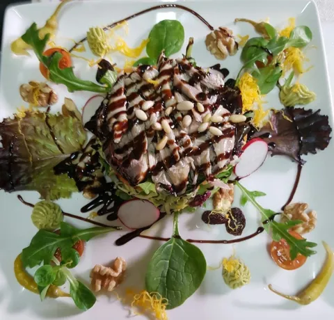
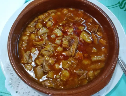
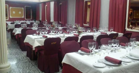
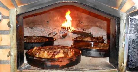
This blend of traditional, artisan Andalusian cuisine with touches of creative, avant-garde cooking creates the perfect mix to delight and surprise even the most demanding, gourmet palates. Thanks to the outstanding quality of the ingredients, their skill at the stove, and the warm, family-style treatment of guests, they ensure that when you sit down at their table, you'll remember the excellence of good cooking and the quality of their dishes with gratitude. Restaurante Asador "El Recreo" was founded by Miguel Ramírez Navarro in 1934. His sons, Pedro and Manolo Ramírez, carried on the hospitality business, and today it is the grandchildren and great-grandchildren who continue this saga of restaurateurs. Today, this third and fourth generation have given the establishment the dynamic, innovative touch that characterises it today.
Información de contacto
Sitio web
www.restauranteasadorelrecreo.es
Teléfono de contacto
953377072
Correo electrónico
contacto@restauranteasadorelrecreo.es
Ubicación
Código Postal
23630
Latitud
37.94008
Longitud
-3.72933
Dirección
Plaza de la Constitución, 53
Municipio
Ubicación en el mapa
POINT (-3.72933 37.94008)
Tipo de restaurante
Imágenes
imagen
Image
6.jpg
Imagen principal
Activado
imagen
Image
7.jpg
Imagen principal
Desactivado
imagen
Image
7%20%281%29.jpg
Imagen principal
Desactivado
imagen
Image
6%20%281%29.jpg
Imagen principal
Desactivado
Capacidad
80
Número de tenedores
1
Tipo de cocina
Horario
• Monday: 11: 00-1: 30 • Tuesday: 11: 00-1: 30 • Wednesday: 11: 00-1: 30 • Thursday: 11: 00-1: 30 • Friday: 11: 00-1: 30 • Saturday: 11: 00-2: 30 • Sunday: 11: 00-2: 30
Microsite al que pertenece
Loading map
Preparing points of interest and routes...

Lupión

Submitted by brandcode_deweloper on
Id
M-09
Perfil de redes sociales
Facebook
https://www.facebook.com/ayuntamientolupion/
Descripción
Breve descripción

Lupión is a small municipality in the La Loma region, occupying its north-western tip, and located at the geographic centre of the province. 

In addition to Lupión itself, the hamlet of Guadalimar also forms part of this municipality. Its municipal area slopes from east to west down to the Guadalimar river, within the Guadalquivir basin, in the northernmost part of the Baetic mountain range. 

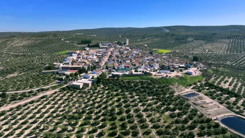
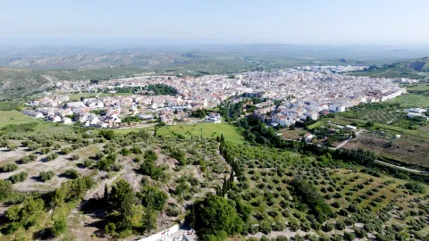
It occupies a flat-topped hill, surrounded by olive groves which, along with the olive oil milling industry, are the town's main sources of income, complemented by income from cotton farming carried out in the fertile plain of the Guadalquivir. 

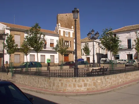
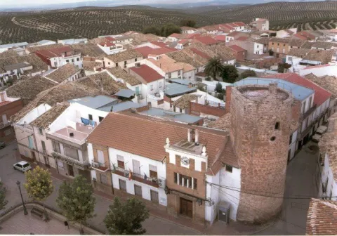
From its historical heritage, we can mention the Church of Nuestra Señora de la Asunción, its defensive Torreón, and the Fountain.

Telecomunicaciones
Teléfono
953 763 008
Sitio web
www.lupion.es
Correo electrónico
ayuntamiento@lupion.es
Ubicación
Nombre
Lupión
Latitud
-3.54654
Longitud
37.99728
Google Maps Url
https://www.google.es/maps/place/23528+Lupi%C3%B3n,+Ja%C3%A9n/@37.9970331,-3.5466043,17z/data=!3m1!4b1!4m6!3m5!1s0xd6e88da31980ce3:0x8edc6ce9fccbfbc4!8m2!3d37.9972866!4d-3.5464812!16s%2Fm%2F0czbngw?entry=ttu&g_ep=EgoyMDI2MDkwNi4wIKXMDSoASAFQAw%3D%3D
Municipio
Ubicación en el mapa
POINT (-3.546733 37.996612)
Imágenes
imagen
Image
28e8c976-e95e-2430-997a-adf310199ddc?t=1610992264762
Imagen principal
Desactivado
imagen
Image
89af72ef-9c78-ca3c-2d70-d9716d16ebbe?t=1609852374024
Imagen principal
Desactivado
imagen
Image
98df1a0b-c970-9625-0d18-3f84cf619171?t=1609852374503
Imagen principal
Desactivado
imagen
Image
688a9f56-52ac-3004-120b-e261a7e7d2d3?t=1610992264928
Imagen principal
Desactivado
Imágenes cabecera
imagen
Image
Lupion
Imagen principal
Desactivado
Datos de interés

Tourist area: Úbeda/Baeza 

Distance to the provincial capital (km): 42 

Altitude above sea level (m): 503 

Area (km²): 24 

Population: 842 

Demonym: Lupionenses 

Postcode: 23528

Videos
Video file
Cultura

Artistic Heritage Details: 

  • Church of Nuestra Señora de la Asunción. Construction of the building began in the 14th century, but successive renovations have obscured its original Gothic style, which can only be appreciated in the presbytery area. Its modest size reflects its medieval typology: a three-nave floor plan of unequal width. The pillars separating the naves vary in plan, and the arches connecting the central nave with the side naves are semicircular, except in the Gothic presbytery area, where they are pointed. A barrel vault covers the three bays of the central nave. The 14th-century presbytery is built of ashlar and roughly hewn stone, though partly whitewashed, and is covered by a rib vault with tiercerons and diagonals. It is accessed through a pointed transverse arch. The exterior is quite plain, with whitewashed masonry walls, and the entrance doorway features a semicircular arch built of ashlar with radial voussoirs resting on jambs. 
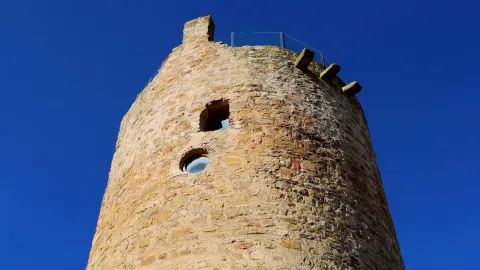
  • Torreón (Tower). Once part of an old medieval castle datable to the 13th century, built of masonry in irregular courses with roughly hewn stone facings. Square in plan on the inside, the oldest part, while round on the outside — perhaps the result of a later modification aimed at reducing the destructive effects of artillery. It has two floors, each covered with brick domed vaults. The terrace preserves its crenellated structure with corbels and the remains of a now-vanished defensive machicolation. Declared a Site of Cultural Interest in 1985. 
  • La Fuente (The Fountain). In the Town Hall square stands an old fountain, built of both regular and irregular ashlar, with a front topped by a cross-shaped gable cornice with curved sides. It has two spouts set above inverted truncated-cone-shaped basins, decorated with tiles bearing religious imagery.
Naturaleza

This is the last town of La Loma de Úbeda and lies in an area between two rivers, namely the Guadalquivir and its tributary the Guadalimar. 

Its municipal area slopes from east to west down to the Guadalimar river, within the Guadalquivir basin, in the northernmost part of the Baetic mountain range, where the second largest settlement in the municipality is located: the village of Guadalimar. 

Most of the territory consists of rich olive-growing countryside, interspersed with small areas devoted to herbaceous crops and the fertile plains of the Guadalquivir and Guadalimar rivers, where irrigated crops are particularly prominent. 

Cotton farming is also of great importance in this area. 

Within the municipal area, three distinct ecosystems can be identified: that of the olive groves, that of herbaceous crops, and finally that of the rivers and wetlands. 

These ecosystems host great plant diversity, since alongside the olive trees there is riparian vegetation developing along the riverbeds, including white poplars, ash trees, oleanders, elms, brambles and common reed. This gallery woodland, besides enriching the local flora, adds a splash of colour to the landscape as the seasons change, particularly in autumn. 

As for wildlife, many species can be found in the municipality of Lupión, some as emblematic as the hoopoe, the red-necked nightjar, the kingfisher, the mallard, the hen harrier, the grey heron, the purple heron, the fox, the European otter, the genet, the deer, the Guadiana barbel-relative fish, the Andalusian barbel, the horseshoe whip snake, the ladder snake and the viperine snake.

Fiestas y Eventos

The town of Lupión enjoys the following festivals: 

  • La Candelaria, on 2 February. Today, this festival consists of lighting a number of bonfires at night, around which locals gather to grill chorizo, chops and more, all while having fun together. 
  • Day of the Virgen del Lorite, on 5 March. This commemoration has been held since 1918, with a triduum in the preceding days, a floral offering the day before, and a Mass in honour of the Virgin on the 5th itself. Once the religious events are over, a communal paella is shared by all. In the afternoon, a procession takes place with a drum and bugle band, and on the way back to the church the townspeople sing songs in honour of their patron saint. In the evening, there is dancing in the town square. 
  • San Marcos, on 25 April. It is traditional for the brothers responsible for organising the festival that year to prepare bread rings known as "caridad" ("charity"), made with wheat flour and aniseed. These are paid for by the town and distributed door to door after Mass and the procession. The day ends with a lively open-air dance. 
  • San Isidro Labrador, 15 May. Farmers honour their patron saint with a festival held on the Camino de la Redonda, beginning the night before with a popular open-air dance. On the 15th, after Holy Mass, a procession is held around the outskirts of the town so that San Isidro can bless the fields. Once it ends, a communal meal is shared by the whole town, with paella and appetisers. 
  • Fiestas Mayores (Main Festivities). Held on the first weekend of August in honour of the Virgen del Lorite and the Santísimo Cristo de la Veracruz. On Friday morning, Mass is held in honour of the patron saint Nuestra Señora del Lorite, and in the afternoon her image is carried in procession accompanied by the band and the townspeople of Lupión. On Saturday, the same religious events take place, but in honour of the Santísimo Cristo de la Veracruz. In addition to these events, there are many and varied activities, with sporting events being especially prominent. Until recently these festivities were held in September, but they have since been moved to August so that Lupión's residents living elsewhere can attend. As a final flourish to the celebrations, the Town Hall invites all attendees to "Tortas a la Calda", accompanied by good wine.
Gastronomía

Among the dishes of our local cuisine, we find: 

  • Habas de San Antón (San Antón broad beans). Prepared with dried broad beans, a pig's ear, onion, tomato and cumin. 
  • Carnival stew. Made with pork and chopped soft pork fat for the meatballs, along with onion, garlic, tomato, parsley, bay leaf, white wine, salt, water, potatoes and flour. 

For the festivals: 

  • Rice with rabbit, a dish served during the patron saint festivities, and Migas, prepared for all attendees on the last day of the celebrations, in the early hours of the morning. 

Pastries: 

  • Hornazos: bread dough with eggs, oil, aniseed and sugar. 
  • Arroz con DUL (rice with DUL). A dish of mountain origin, likely introduced into local cuisine by families from the Sierra de Segura who settled in the village of Guadalimar. Made with rice, water, saffron, sugar, cinnamon sticks, orange peel, olive oil and a clove of garlic. 
  • Gachas. Made with oil, flour, fried bread croutons, ground cinnamon, aniseed and water. It is a very old tradition to make gachas on the night of All Saints' Day. 
  • Mantecados tontos ("simple" mantecados). Made with lard, olive oil, ground sugar, flour, egg whites, cinnamon and lemon zest. 
  • Roscos de vino (wine-flavoured rings). Made with olive oil, white wine, aniseed and flour.
Historia

Given its natural conditions — abundant water and pasture — human settlement here was frequent. The earliest dates back to prehistoric times, based on remains found within the municipal area. 

During the Roman period it was linked to Cástulo, an ancient Ibero-Roman city, and developed an active and intense trade with Rome, mainly sending oil, cereals, wool, silver, copper and bronze. From this period comes the archaeological site known as "Horno" ("Kiln") on the Guadalimar, where an Iberian kiln was found. 

At the height of Roman Cástulo, "Luparia" is mentioned as a residential area. With the arrival of the Visigoths, Lupión was completely destroyed; it has been written that "everything that smelled of Rome was struck down". 

During the Islamic period, it must have been one of the small hamlets scattered across the La Loma region, and after its conquest by Ferdinand III, it was granted to Baeza. The Torreón and the small fortifications of "Retamal" and "Castillejos", within the municipal area, date from this time. 

It remained under the jurisdiction of Baeza until, during the reign of Charles III, feeling heavily oppressed, it petitioned the king to be freed from that city's authority and for Lupión to become an independent "villa", in exchange for a sum in reales de vellón that would allow it to purchase its independence. 

After securing a loan of 6,000 reales, the king granted its independence, but Baeza did not accept this royal decision, and it was not until 1795, during the reign of Charles IV, that Lupión was "exempted, removed and freed from the authority held over it by the aforementioned City of Baeza, making it a villa in its own right and for itself". 

As a result of the so-called "Plan de Obras, Colonización, Industrialización y Electrificación de la provincia de Jaén" (Plan for Public Works, Colonisation, Industrialisation and Electrification of the province of Jaén), the settlement of Guadalimar was built in the 1950s. It is now part of the municipality of Lupión.

Loading map
Preparing points of interest and routes...
Imagen principal
imagen
Image
Lupion
Imagen principal
Activado

Villatorres

Submitted by brandcode_deweloper on
Id
M-03
Perfil de redes sociales
Facebook
https://facebook.com/concejalia.dejuventudvillatorres/
Descripción
Breve descripción

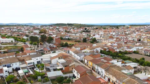
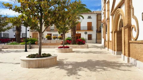
Villatorres is a small municipality located in the north-central part of the province of Jaén, just 23 km from the provincial capital. This municipality was created in 1975 as a result of the merger of the towns of Villargordo and Torrequebradilla, later joined by the settlement of Vados de Torralba, known for its white houses and tree-lined streets. Both the Town Hall building and other municipal offices are located in Villargordo. Strictly speaking, Villatorres has only a few decades of history as such. It is an area close to the Guadalquivir river, with very gentle terrain — what is known as "campiña" — where much of the land is occupied by irrigated olive groves as well as cereal crops. The fertile plain areas have made it possible to grow asparagus and spinach, the latter destined for the canning industry.

Telecomunicaciones
Teléfono
953 377 000
Sitio web
http://www.villatorres.es/
Correo electrónico
oficinas@villatorres.e.telefonica.net
Ubicación
Nombre
Villatorres
Latitud
-3.68268
Longitud
37.93776
Google Maps Url
https://www.google.es/maps/place/+Villatorres+jaen/@37.93776,-3.68268
Municipio
Ubicación en el mapa
POINT (-3.729907 37.939982)
Imágenes
imagen
Image
ea82ee35-80ae-4797-ea13-a242d06be0a4?t=1610975877311
Imagen principal
Desactivado
imagen
Image
484de5df-2ed5-4a9b-a161-3b2ceecbfda5?t=1610975877429
Imagen principal
Desactivado
imagen
Image
b09c58d8-35b3-fdde-2200-9605c957244a?t=1610975877554
Imagen principal
Desactivado
imagen
Image
a23f3d88-9ea7-7a30-5496-107d272a8930?t=1610975877772
Imagen principal
Desactivado
Imágenes cabecera
imagen
Image
Villatorres
Imagen principal
Desactivado
Datos de interés

Distance to the provincial capital (km): 23 

Altitude above sea level (m): 349 

Area (km²): 73 

Population: 4,351 

Demonym: Villagordeños, Churrianeros and Bodenos 

Postcode: 23630

Videos
Video file
Cultura

Due to the way it came into being, Villatorres's historical heritage is spread across the three towns that make it up. The most notable are: 

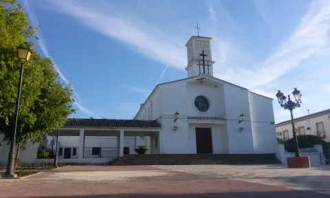
  • Parish Church of Nuestra Señora de la Asunción in Villargordo (16th century), recently restored, retaining its Renaissance façade; inside, the Mudéjar coffered ceiling of the choir stands out. 
  • Parish Church of San Francisco de Paula in Torrequebradilla, consisting of a nave with a gabled roof covered in Arabic tiles; a slightly pronounced transept, a Latin-cross floor plan, a dome covered externally with a hipped roof, and the bell gable marking the church's highest point. 
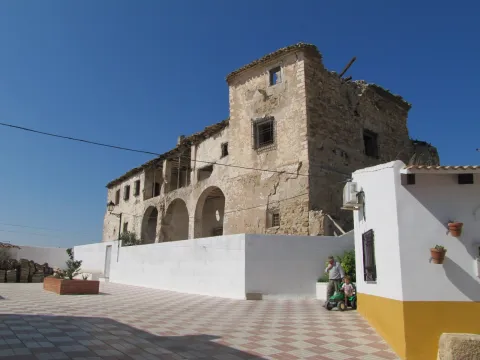
  • Hermitage of the Santo Cristo de la Salud. Built outside the town walls in the 16th century, using stones from the Iberian ruins of Maquiz, this was originally the Hermitage of Santa Ana, converted at the end of the 19th century into the Hermitage of the Santo Cristo de la Salud. Its most notable features are the ashlar semicircular-arched doorway and the single-tier bell gable. 
  • Palace of the Fernández de Córdoba family, located in Torrequebradilla. Built in the 17th century, it is structured over two levels, the upper one as an open gallery (solana) and the lower one as the entrance, accessed through large semicircular arches. It currently stands abandoned. 
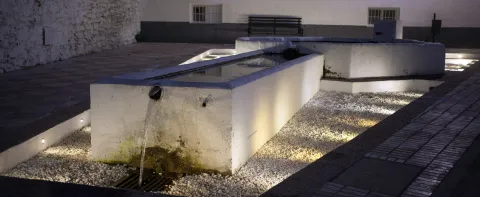
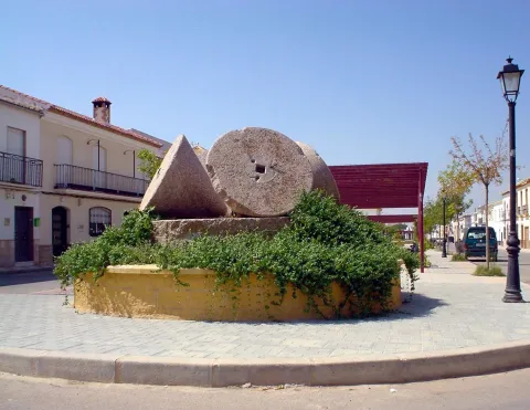
  • Pilares (stone water troughs), one of which, circular in shape, was where labourers and pack animals would refresh themselves after long days working in the fields. Other troughs were used as washing places for clothes. 
  • Cerezo Moreno Museum, the municipality's most valuable source of cultural wealth, housing a large collection of works by the painter Francisco Cerezo: oil paintings from various periods (portraits, still lifes and landscapes), a set of twelve pen-and-ink drawings, and a series of oil-on-panel paintings depicting traditional scenes from the village of Segura de la Sierra. Due to its artistic value, this museum has become a benchmark for painting in the province of Jaén and throughout Andalusia. 
  • Church of Vados de Torralba, representative of post-war colonisation architecture. Notable features include its side stained-glass windows, the crosses on its façade, and its tall tower, a symbol of Vados de Torralba's tradition.
Naturaleza

The terrain is very gentle, with the highest points found in Torrequebradilla, reaching 458 m above sea level. The first impression one gets is of an extensive fertile plain surrounded by the mountain ranges of the Sierra de Andújar.

Fiestas y Eventos

Each of the towns that gave rise to Villatorres continues to preserve its own festivals and traditions. Among them, we can mention the following: 

  • Holy Week: A total of seven brotherhoods process through the streets of Villargordo during Holy Week, a tradition dating back to the 16th century. The emotional intensity of the processional floats, as well as the high level of local participation, stand out. 
  • Fiesta de las Flores (Festival of Flowers), held in May in honour of Villargordo's patron saint, the Virgen del Amor Hermoso. The celebration includes a cultural week featuring a wide range of activities for all ages. 
  • Descent and ascent to the Hermitage of the Cristo de la Salud. Held on 29 July, this tradition brings together many residents of Villargordo. The day before, on the 28th, the traditional "pesos" (weighings) take place, in which children and adults are weighed on a Roman scale, then donate a sum of money equivalent to the price of wheat of that same weight. 
  • Bonfires of San Antón. On the eve of San Antón, 17 January, Villargordo celebrates with traditional bonfires, around which chorizo and morcilla (blood sausage) are enjoyed. The following day, a procession circles the hermitage to ask for the saint's protection over domestic animals. 
  • Feast of San Marcos, celebrated on 25 April in Torrequebradilla, with the making of the traditional roscón (ring-shaped cake). 

Its folklore includes Christmas carols, saetas (flamenco-style religious songs), threshing songs, carnival songs, and dances, the best known of which is "el bolero antiguo", danced at the end of the olive harvest or at weddings.

Gastronomía

The distinct character of each of the three towns merged into Villatorres also comes through in its cuisine. 

This is a cuisine rooted in the culinary traditions of the Jaén countryside. Among the best known dishes are: 

  • "Ajillo mulero", once the meal of farmhands working on the region's farms. It is made with boiled potatoes, vinegar, salt, pepper and oil, all blended into a purée, then spread on bread.
  • "Migas de harina" (flour-based migas), served with a fried mixture of garlic, pork crackling, chorizo, lomo de orza (preserved pork loin) and dried choricero peppers. 
  • "Salpicón de melón", made using unripe melons, cut into small pieces and mixed with crushed garlic and salt, peeled tomato, breadcrumbs, oil, vinegar and very cold water. 
  • "Pipirrana", which, in addition to the usual ingredients of Jaén-style pipirrana, also includes hard-boiled eggs, pickled tuna and lean cured ham. 
  • Pickled partridge. 

We must also mention the delicious and varied pastries: Roscas de San Marcos (Torrequebradilla), aguardiente-flavoured roscos, borrachuelos and alfajores for carnival. And for All Saints' Day, "gachas dulces con tostones" (sweet porridge with toasted bread), a day on which the leftover dough is used to plug keyholes, so that the souls in purgatory — who are believed to ask for a prayer of charity to help them leave Purgatory — cannot enter. 

The finest expressions of Villargordo's fantastic cuisine can be found in the municipality's two most renowned restaurants: Restaurante «El Tropezón» and Restaurante-Asador «El Recreo». Both are considered among the best dining establishments in the province of Jaén, enjoying a well-deserved reputation at regional level.

Historia

Although the municipality of Villatorres was officially created by decree in 1975, remains of earlier civilisations have been found in the settlements of the towns that merged to form it. 

On the hill of La Pedriza, remains of an Ibero-Roman settlement were discovered. During the Second Punic War, these lands were the scene of battles between Carthaginians and Romans. 

Under Islamic rule, the population remained scattered across small hamlets (alquerías), seeking refuge in a fortified location in times of danger — probably on the hill of La Pedriza. 

Ferdinand III the Saint conquered Torrequebradilla in 1230, and it subsequently became part of the Order of Calatrava. Under the Catholic Monarchs, it was granted the same charter as the city of Jaén, and in the 17th century it came under the lordship of Don Íñigo Fernández de Córdoba y Mendoza. 

During the Early Modern period, Villargordo held great importance for livestock farming, not only due to the passage of transhumant herds, but also because of the extensive areas devoted to pasture.

Loading map
Preparing points of interest and routes...
Imagen principal
imagen
Image
Villatorres
Imagen principal
Activado

Torreblascopedro

Submitted by brandcode_deweloper on
Id
M-02
Perfil de redes sociales
Facebook
https://www.facebook.com/ayuntamientodetorreblascopedro.cultura/
Descripción
Breve descripción

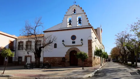
A municipality located in the centre of the province, within the La Loma region, made up of two local entities called Torreblascopedro and Campillo del Río, around 8 km apart. The Guadalquivir river to the south and its tributary the Guadalimar to the north run through the municipal area. Traditionally, olive cultivation has been the main activity of its inhabitants, although in recent years, thanks to its location in the Guadalquivir plain, irrigated crops have diversified. Campillo del Río, for its part, has the largest white asparagus production in the province, has had a photovoltaic plant since 2007, and has seen a resurgence in tomato growing for canning. This part of the municipality consists of a fertile irrigated plain, developed through rural colonisation plans carried out throughout the 20th century. Its heritage includes the Casas Señoriales (noble houses), the Parish Church of San José in Torreblascopedro, and the Parish Church of the Asunción de Nuestra Señora in Campillo del Río.

Telecomunicaciones
Teléfono
953 626 001
Sitio web
www.torreblascopedro.es
Correo electrónico
torreblascopedro@jaen.com
Ubicación
Nombre
Torreblascopedro
Latitud
-3.63529
Longitud
37.99782
Google Maps Url
https://www.google.es/maps/place/+Torreblascopedro+jaen/@37.99782,-3.63529
Municipio
Ubicación en el mapa
POINT (-3.636735 37.99743)
Imágenes
imagen
Image
dbb152ae-767d-2a16-4117-1bc6bb525d6c?t=1595430123243
Imagen principal
Desactivado
imagen
Image
9405a9ac-9972-83ca-6cd5-95d26f4fd94e?t=1595430123360
Imagen principal
Desactivado
Imágenes cabecera
imagen
Image
Torreblascopedro
Imagen principal
Desactivado
Datos de interés

Tourist area: Sierra Morena/Sierras de Andújar and Despeñaperros 

Distance to the provincial capital (km): 54 

Altitude above sea level (m): 333 

Area (km²): 61 

Population: 3,044 Demonym: 

Torreños Postcode: 23510

Videos
Video file
Cultura
  • Casas Señoriales (Noble Houses): The oldest building within the town, built with rendered masonry, is a traditional Andalusian noble house, three storeys high and of large dimensions. The ground-floor windows have wrought-iron grilles with lead ornamentation, and the five balconies on the upper floor rest on corbels, with iron parapets and trapezoidal moulding. Engraved on the lintel of one of the windows is the date 1714. The entrance door, framed with a jamb, is off-centre. Next to this house is another, with a doorway featuring a semicircular arch resting on impost blocks and a cross at the keystone. The original ashlar stonework has disappeared, but above the arch a barred window survives, flanked by 17th-century Baroque-style stone coats of arms. 
  • Parish Church of San José: Built in the mid-20th century. The interior is accessed through a semicircular arch, above which sits a circular window, topped by a pyramid-shaped bell gable with three bells and a whitewashed façade. Inside, the altarpiece has three sections with three niches, separated by columns and topped with pinnacles. The central niche houses the patron saint. 
  • Parish Church of the Asunción de Nuestra Señora: The most notable building in Campillo del Río is the parish church, representative of post-war colonisation architecture. It has a rectangular floor plan and a very spacious interior. Externally, the presbytery is built in exposed brick, while the rest of the building is whitewashed. It was built in 1953 and has recently undergone improvement works.
Naturaleza

The municipal area of Torreblascopedro has a gentle, slightly undulating terrain, with its highest points near Cagasebo (452 m) and its lowest, around 230 m, reached to the west of the municipality at the confluence of the Guadalquivir and Guadalimar rivers. These two rivers, forming the southern and northern boundaries respectively, act as the drainage arteries into which the area's various streams flow. 

This municipality forms one end of the La Loma region. It is an area characterised by extensive olive groves stretching as far as the Guadalquivir river. Nearby, a fertile plain is formed where cotton, sugar beet and sunflowers are mainly grown, alongside numerous family vegetable gardens. It has abundant water resources. 

The olive grove is the predominant crop, and the mainstay of the municipality's economy. New plantations continue to appear, many of them intensive, aimed at greater mechanisation of harvesting and lower production costs. 

Due to farming, very little natural vegetation remains, found only along the riverbanks, forming what is known as gallery forest, made up of willows, poplars and tamarisks. The rest of the river vegetation forms the typical riparian growth, abundant in reeds, common reeds, rushes and brambles. 

This riparian vegetation is of great importance, as it contributes to the area's plant and animal diversity, forming true biological corridors between the extensive farmland areas. This deciduous vegetation along the riverbeds and streams paints a splash of colour into the landscape through the seasons, especially in autumn. 

The local wildlife is typical of the Jaén countryside: hares, rabbits, partridges, quail, foxes, and more. Storks are also easy to spot, along with a wide variety of birds of prey, not forgetting the birdlife that lives along the riverbanks. 

The hamlet of Campillo del Río, located 8 km south of the town, is one of the settlements built under the agricultural colonisation programme, benefiting from the Plan Jaén, which increased irrigated land and introduced new, more profitable crops. This caused a significant population increase in the 1950s, reaching as many as 4,017 inhabitants. Today, it is a benchmark in the cultivation and profitability of white asparagus production.

Fiestas y Eventos
  • Fiesta de la Candelaria, on 2 February: locals gather in neighbourhoods, streets or the Town Hall square around bonfires, sharing food and using the fire to roast potatoes and sardines. The Town Hall makes hot chocolate and hands out cakes. To attract good luck, some practise the tradition of jumping over the fire. 
  • Festivities in honour of the Virgen de Fátima: over two or three days in the second week of August, chess and dominoes tournaments are held, along with traditional dish competitions and children's games; typical food stalls are set up, and there are evening open-air dances. During these festivities, tribute is paid to the town's oldest female resident, who is presented with a bouquet of flowers and invited to take part in the procession. 
  • Patron saint festivities: The main festival is held on 1 May, the feast of San José Obrero (Saint Joseph the Worker). Over the course of the festivities, there are sports tournaments, cultural and religious activities, street parades, open-air dances, and the typical stalls along Paseo del Ayuntamiento. 
  • San Isidro Labrador in Campillo del Río: On 15 May, the feast of the patron saint of farmers, patron saint festivities are held in Campillo del Río. They last a week and include recreational, sporting and cultural activities, as well as the traditional stalls and open-air dances.
Gastronomía

Torreblascopedro has a traditional Campiña-style cuisine, in which produce from its fertile lands takes centre stage. White asparagus and piquillo peppers are grown in Campillo del Río. 

  • Pipirrana: All kinds of variations of this dish are made using the finest quality vegetables. 
  • Gachamiga: A stew made with flour, potatoes and olive oil. 

The tradition of the pig slaughter (matanza) is still carried on, producing dishes such as: 

  • Lomo de orza, ribs and pork jowl: In all cases, the preparation is the same — marinated, briefly fried, then stored in oil to be eaten throughout the year. 
  • Bacalao encebollado (salt cod with onions). Typical of Holy Week is salt cod, either fried in fritters or in the traditional style, along with tortas dormidas or hornazo bread. 
  • Gazpachos, ropa vieja... 

From traditional pastry-making, we can mention: 

  • Ochíos, made with the same dough as hornazo, but with added sugar. 
  • Sponge cakes, homemade madeleines, mostachones, or bizcocho cuajado, made with almonds, eggs and sugar among its ingredients. This is an old sweet with Moorish roots.
Historia

The first reliable references date back to the 18th century, when the town appears mentioned in maps and books relating to the municipal area of Baeza. The oldest surviving structure dates from 1714, marked on a trapezoidal moulding still preserved on a building in the town. 

Torreblascopedro is believed to have originated from several scattered farmsteads (cortijadas), of great economic value due to their rich pastures for livestock. In addition to belonging to Baeza, it was also for a time a hamlet of Lupión. In 1813, independence for the municipality was requested for the first time, but it was not achieved until 1871, when the town definitively took on its current name. By the mid-19th century, the town's main production was olive oil, alongside a notable presence of sheep farming, which led to a significant population increase. 

The town's consolidation and growth occurred in the 1950s. This dramatic population increase was due to new plantations and more profitable crops resulting from irrigation and the Plan Jaén, along with the creation of the colonisation settlement of Campillo del Río. After this decade, as happened in many other towns, insufficient wages and scarce job opportunities led to significant emigration in search of better-paid work. This trend continued until the 1980s. 

Campillo del Río is one of the newly created settlements resulting from agricultural colonisation in Andalusia. It is the largest of the settlements built under the Plan Jaén.

Loading map
Preparing points of interest and routes...
Imagen principal
imagen
Image
Torreblascopedro
Imagen principal
Activado

Olivar del Llano de Motril

Submitted by brandcode_deweloper on
Id
7463682
Descripción larga

This enclave is located just over 1 km away. of the city centre of Martos, at the foot of the road of Martos to Santiago de Calatrava. It occupies an extension of 84 hectares., with 5,394 centenary trees, some of them, true living sculptures. It is a fully productive olive tree with an average of 150 kg. By tree.

Breve descripción

In the municipality of Martos more than 60% of the plants are over 200 years old. In this olive forest, the so-called Centennial Olives stand out. It is known from an oral tradition that some of the olive trees on the Motril Plane are over 500 years old.

Latitud
37.731186
Longitud
-3.990593
Distrito
Municipio
Ubicación en el mapa
POINT (-3.990593 37.731186)
imagen
Image
olivar-llano-motril.jpg
Imagen principal
Activado
imagen
Image
olivar-llano.jpg
Imagen principal
Desactivado
imagen
Image
olive-tree-2026741__340.jpg
Imagen principal
Desactivado

Friends

icon-intereses-amigos

Nature

icon-intereses-naturaleza

Solo travel

icon-intereses-viajar-solo

For couples

icon-intereses-en-pareja

Family

icon-intereses-familia

Adventure

icon-intereses-aventura

Culture

icon-intereses-cultura

Sport

icon-intereses-deporte

Municipality

icon-intereses-municipio

Eco-friendly

icon-intereses-eco-friendly

Leisure

icon-intereses-cultura
Olivar del Llano de Motril
Desactivado

Promotion: Internet, Guides.

Coordenadas / Huso 30S
30S x = 412711 and = 4176452
Tramo de asfalto o cemento
 
Tramo de pista o camino forestal
 
Tramo de vía pecuaria
 
Tramo de senda
 

Routes de Olivo

Submitted by brandcode_deweloper on
Id
7435987
Descripción larga

Discover Jaén and olive oil doing oleoturism

The province of Jaén, with its more than 60 million olive trees, is the largest producer of olive oil worldwide, the culture and traditions surrounding its cultivation, its fully humanized "olive sea" landscape throughout the centuries, the production of olive oil in its almazaras, the traditional and mechanized collection of olive oil, the visit to the Museum of the Olive Culture of the Hacienda la Laguna, emblematic cortijos and the enjoyment of its rich gastronomy irrigated with the "liquid gold," are some of the activities that Ritas del Olivo Interior offers for our Paradise.
Our company, specialized in activities around the Olive and Olive Oil, has been offering for a decade Oleoturism experiences, for all ages and for groups and individuals, making one of our main signs of identity known.

We perform any kind of experience to the letter, either for individuals in small groups with our own vip van and a very personalized professional guide service or for incentive groups, congresses, major or school with bus transfer and with unique and unrepeatable activities that you will never forget.

Let the people who love their fields and "feel the land of the olive land" be taken for us, discover our millennial culture.

Breve descripción

A new option to know the world of Extra Virgin Olive Oil with custom routes.

Latitud
37.991831
Longitud
-3.472649
Municipio
Ubicación en el mapa
POINT (-3.472649 37.991831)
imagen
Image
1sliderppal.jpg
Imagen principal
Activado
imagen
Image
79e08f32fa8a036f84441baab7b7a7ff_3_XL.jpg
Imagen principal
Desactivado
imagen
Image
79e08f32fa8a036f84441baab7b7a7ff_2_XL.jpg
Imagen principal
Desactivado

Nature

icon-intereses-naturaleza

Friends

icon-intereses-amigos

Adventure

icon-intereses-aventura

Culture

icon-intereses-cultura

Culture of the Bull

icon-intereses-cultura-del-toro

Sport

icon-intereses-deporte

Eco-friendly

icon-intereses-eco-friendly

For couples

icon-intereses-en-pareja

Family

icon-intereses-familia

Gastronomy

icon-intereses-gastronomia

Municipality

icon-intereses-municipio

Business

icon-intereses-negocios

Seniors

icon-intereses-senior

Low-cost tourism

icon-intereses-turismo-low-cost

Solo travel

icon-intereses-viajar-solo
Rutas de Olivo
All year round
Desactivado
Coordenadas / Huso 30S
30S x = 458498 and = 4205014

Oleopack by PICUALIA

Submitted by brandcode_deweloper on
Id
10486014
Descripción
Breve descripción
Visit a modern mill and learn AOVES tasting
Ubicación
Latitud
38.096787
Longitud
-3.776560
Dirección
Autovía Madrid-Cádiz, Km. 298 (Salida 299)
Distrito
Municipio
Ubicación en el mapa
POINT (-3.77656 38.096787)
Imágenes
imagen
Image
PANTALLA_01.jpg
Imagen principal
Activado
Precio
15.00€
Loading map
Preparing points of interest and routes...
Duración
approximately 1 and a half hours
Tipo de visitante
Enlace reserva
https://fareharbor.com/embeds/book/oleoturismo-picualia/?full-items=yes&u=144e2df1-3ef3-464e-a639-483e28f1986d&from-ssl=yes&ga4t=G-5J7P7SCH26,1411949374.1686217046__1686217045%3B&g4=yes&a=yes&back=https://www.oleoturismoenjaen.com/

Olive-activities and Olive-packs at the Olive Grove and Oil Visitor Centre of Úbeda

Submitted by brandcode_deweloper on
Id
7435309
Descripción
Descripción larga

VISITA UNA ALMAZARA

Conoce in situ el proceso de elaboración del aceite de oliva virgen visitando una almazara, donde, de la mano de nuestro guía, vas a aprender las modernas técnicas del proceso de elaboración del aceite de oliva virgen, desde la recepción del fruto hasta el almacenamiento en bodega.

Además se puede añadir un paseo entre olivos, contemplando el maravilloso mar de olivos de la provincia de Jaén. Conoce su historia, ciclo vegetativo, variedades de aceitunas, proceso de maduración, métodos de recolección y técnicas de cultivo que se realizan en el olivar.

Esta actividad suele desarrollarse en horario de mañana y en algunos casos por la tarde. El comienzo puede variar en función de la época del año y tiene una duración de 2 horas aproximadamente, siempre acompañado de guías especializados en la materia.   

El precio puede variar en función de la almazara a visitar. Rondan entre los 6 y los 20 €. Es una actividad en la que es necesaria la reserva previa, ya que no se realiza diariamente. Todo ello radica en función de la disponibilidad. 

AGRICULTOR Y ALMAZARERO

Conviértete en agricultor pasando una jornada estupenda en un Olivar. Aprenderás cómo poner un “mantón” o cómo “varear” una oliva . Una vez aprendas cómo se cultiva y cómo se recolecta nuestra aceituna pasarás a conocer el interior de una Almazara, donde se molturará la aceituna para fabricar tu propio aceite.

Serás el “Maestro de almazara” siguiendo el camino que hace tu aceituna hasta conseguir un oro líquido que llevarte a tu casa.

¡Una experiencia inolvidable que recordarás toda la vida!
Disponible sólo en campaña y previa consulta y reserva.

DESAYUNO MOLINERO

Disfruta de un típico desayuno molinero, base de la gastronomía local y de la dieta mediterránea. En esta actividad de oleoturismo podrás visitar el Centro de Interpretación y aprenderás todos los conceptos que son necesarios para entender la recolección, elaboración y características sensoriales del AOVE.  Al finalizar la visita se llevará a cabo un típico desayuno molinero compuesto de: zumo, pan, aceite de oliva virgen extra, tomate, ochíos (tortas típicas de Úbeda) y agua.

Actividad de oleoturismo en Jaén para grupos y previa reserva. Consulten precios y condiciones. Duración aproximada de 2,5 horas (visita +desayuno).

MENÚ TEMÁTICO, SHOW-COOKINGS, TALLERES DE COCINA Y CENAS PRIVADAS
Una experiencia pensada para disfrutar y vivir una jornada puramente gastronómica  con el AOVE como protagonista. Visita el Centro de Interpretación Olivar y Aceite sumergiéndote en el apasionante mundo del aceite de oliva y su elaboración para después terminar degustando un estupendo maridaje en forma de menú viviendo de primera mano las sensaciones que nos aportan las diferentes variedades de aceituna. Un menú degustación que podrá degustar en un restaurante de calidad. 

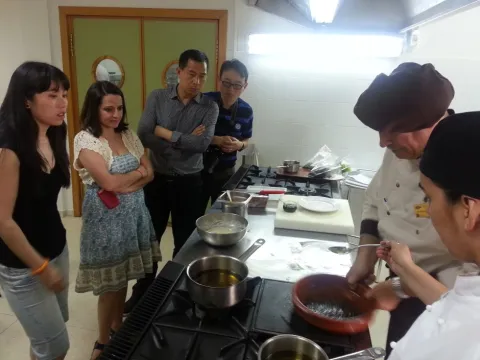
Otras opciones gastronómicas en nuestro aula de cocina son los show-cooking, talleres o actos privados gracias a los mejores chefs de Jaén, nos enseñan a cocina y maridar los diferentes aceites de oliva virgen extra en la cocina. 

Actividad de oleoturismo en Úbeda, Jaén,  previa reserva. Consúltenos.

TOUR UBEDA, BAEZA & ACEITE
El matrimonio perfecto: renacimiento y aceite de oliva virgen extra. Una combinación perfecta para tu viaje a tierras jiennenses. Da un paseo, en dos medias jornadas, por las calles de Úbeda y Baeza, y disfruta de sus principales monumentos acompañados de expertos intérpretes .
Y para redondear tu viaje , añade a tu visita cultural una experiencia de oleoturismo en Jaén con la visita al Centro de Interpretación Olivar y Aceite. 
Actividad previa reserva. Consúltanos precios y condiciones.

Y  ADEMÁS:

Talleres de Cosmética
Aprende a elaborar tus propios jabones y descubre las propiedades del AOVE en la cosmética.

Taller de esparto
Un taller de esparto dirigido por un maestro experto en tejer alfombras, serones, cestas.

Taller de cerámica
También se ofrece realizar un taller de cerámica y rememorar tiempos pasados y en el que realizar a mano piezas de barro mediante las técnicas más básicas como la técnica del churro, la de placa, la de bola y bajo relieve. 

Taller de Forja
En el taller de forja conoce la fabricación de todo tipo de herramientas y aperos agrícolas en hornos que alcanzan la temperatura de 900ºC, para así martillear e ir moldeando la labor deseada.

Sólo grupos. Consulte precio por persona y condiciones. 

Y LA OPCIÓN MÁS EXCLUSIVA: OLEOTURISMO A LA CARTA
Crea tu propio paquete turístico con un guía/experto en olivar y cata de aceite solo para tí. Si te apetece una visita a un olivar o visitar una almazara en alguna localización concreta puedes hacerlo con esta opción de actividad de oleoturismo en Úbeda a la carta. Puedes hacerlo en medio día o en una jornada completa. Tú decides la duración y la localización (siempre que sea posible)
Esta es tu mejor posibilidad. No lo dudes y contrata tu guía oleo turístico exclusivo para vivir tu propia experiencia única.
Previa consulta y reserva.

Breve descripción

A series of activities around Olive Oil and Olive in our Interpretation Center.

Telecomunicaciones
Teléfono
953 755 889
Sitio web
www.centrodeolivaryaceite.com
Correo electrónico
info@centrodeolivaryaceite.com
Ubicación
Latitud
38.011626
Longitud
-3.371333
Dirección
C/ Corredera de San Fernando, 32
Municipio
Ubicación en el mapa
POINT (-3.371333 38.011626)
Imágenes
imagen
Image
visita-y-cata-4-jpg
Imagen principal
Activado
Horario de apertura

The availability should be consulted and made upon reservation.

Loading map
Preparing points of interest and routes...
Tipo de visitante

Tastings at the Olive Grove and Oil Visitor Centre of Úbeda

Submitted by brandcode_deweloper on
Id
739103
Descripción
Descripción larga

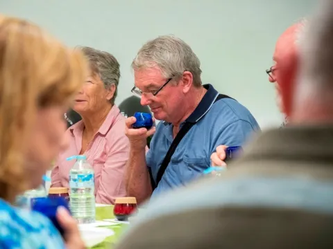
The visitor acquires the basic notions necessary to know how to differentiate the olive oils we find on the market, while enjoying the symphony smells and flavors offered by extra virgin olive oils.

We offer Tata workshops for groups with a maximum of 50 people per session. With official materials and adapted to each type of audience, and also in English.

  • Tasting courses of Virgin Olive Oil,in our facilities and in the customer's facilities, of different duration and levels according to the needs of the customer (for professionals in the Oleícola sector and the Hostelero).
  • Children's tasting workshops.
Breve descripción

Enjoy a world of sensations!

InOlive and Oil Interpretation Center, we teach you the pleasure of discovering quality and to enjoy, appreciating the aromas and flavors offered by the different varieties of olives.

You will discover the secrets of the Oil Tasting by simple, enjoyable and fun methods, to know its sensory qualities, while improving your olfat- taste memory and learning the positive attributes and defects of the oils.

You will learn everything you need to know to start in the world of oil tasting, guided by professionals, learning to distinguish oils by their most outstanding characteristics.

Telecomunicaciones
Teléfono
953 755 889
Sitio web
www.centrodeolivaryaceite.com
Correo electrónico
info@centrodeolivaryaceite.com
Ubicación
Latitud
37.604714
Longitud
-3.841673
Dirección
C/ Corredera de San Fernando, 32
Municipio
Ubicación en el mapa
POINT (-3.841673 37.604714)
Imágenes
imagen
Image
taller-de-cata2-jpg
Imagen principal
Activado
Horario de apertura
  • Tasting workshop of virgin olive oils (approximately 1 hour): Tuesday to Saturday, 11: 00 in Spanish and 12: 30 in English.
  • Tasting and pairing workshops (about 1 hour and 30 minutes): Sundays at 12: 30.

Check prices and availability on request.

Loading map
Preparing points of interest and routes...
Duración
45 min
Tipo de visitante
Tipo de experiencia