Saltar al contenido principal

Finca El Collado de los Jardines Country Estate

Submitted by brandcode_deweloper on
Id
2796447
Redes sociales
Facebook
https://www.facebook.com/pages/Finca-El-Collado-de-los-Jardines/174958192527999
Descripción
Breve descripción

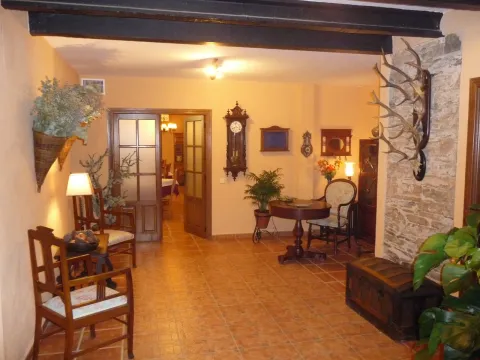
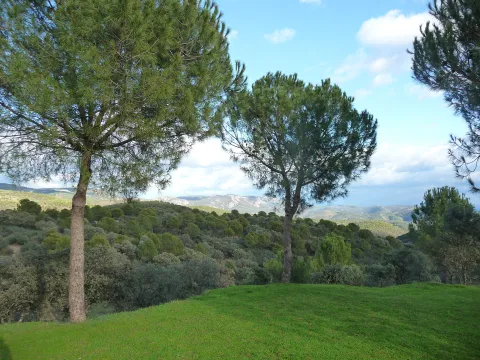
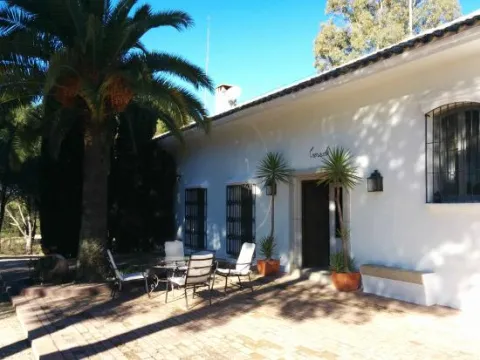
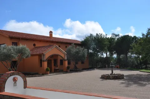
The Collado de los Jardines is an old cortijo of over 150 years located in the heart of the Natural Park of Despeñacolos. The estate, of more than 800 hectares, surrounds it and separates it from civilization.
Información de contacto
Teléfono
610 553 381
Sitio web
www.parquenaturaldp.com
Correo electrónico
reservas@parquenaturaldp.com
Ubicación
Código Postal
23213
Latitud
38.393759
Longitud
-3.490249
Dirección
Ctra. de Aldeaquemada, km. 6,6
Distrito
Municipio
Ubicación en el mapa
POINT (-3.490249 38.393759)
Tipo de alojamiento
Imágenes
imagen
Image
casarural_38.jpg
Imagen principal
Activado
imagen
Image
casarural_2.jpg
Imagen principal
Desactivado
Aforo
20
Las habitaciones

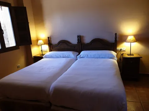
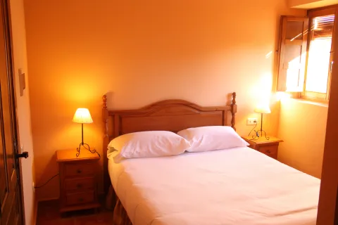
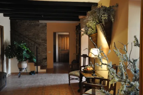
The 8 spacious and welcoming rooms have their own personality based on the different combination of colors, stone walls, canopy beds and upholstery in soft tones. All beds have latex mattresses and various types of pillows to ensure their rest.

Qué ofrece

Swimming pool, outdoor Jacuzzi, barbecue, garden and baby cot

Otros servicios

Relaxing body massage, decontracturant with aromatherapy / chocolatherapy. Cupcake cleaning. Manicure. Pedicure. Paraffin treatment for hands. Paraffin treatment for the feet. Antiellultic and circulatory body treatment. Kangaroo service.

Loading map
Preparing points of interest and routes...
El Hotel

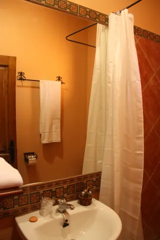
It is a fairly large estate, has more than 800 hectares, its rooms are beautiful and has a maximum capacity to accommodate 20 people. It has: 8 huge rooms, all with double double beds, latex mattresses and pillow set, some include one or two single beds. Each has a bathroom, with beautiful bathrobes and showers. A huge kitchen equipped with all appliances and restaurant service.

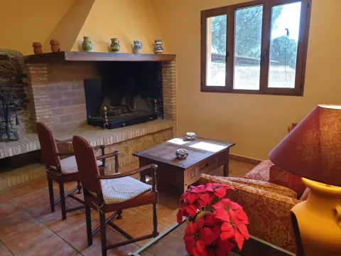
The living room has a fireplace that maintains elegant decoration and warm temperature. There is also a convention room, as many meetings, meals or business meetings have this room and all other services. It has a large area of gardens, where to get lost in long walks in the sunsets, can take the bikes of the house, and so spend a day in the countryside. A pool, perfect for a dip in the morning before breakfast or having an afternoon of laziness immersed in its waters. The terrace is the ideal place for many where they take breakfast, snack or a dinner prepared on their barbecue. And whoever loves plants can take a walk through the green garden that the house has.

Rooms:

Arce de Montpellier room: This room has mostly a rural style with a modern touch, the colors and stones of its walls perfectly combine with the fabrics of its bed clothes and the different accessories and classic and elegant furniture. It has a double bed or two single beds, with soft and exquisite bedding, some beds have canopy, this gives a more romantic and magical touch to the room. The bathroom is mostly tiles and stones, which gives a rural style without losing the art in each corner, has spacious rooms, some have two washbasins. It has air conditioning and heating, so at any season of the year the temperature will be perfect.

El Roble Room: It is provided for small families, with an additional single bed. It has a decoration in oak wood, fabrics and prints on bed linen, which make its landscape and spaces a real beauty. Double bed, with comfortable latex mattress and different types of pillow designed for deep rest in harmony. A great bathroom with hot tub, ideal for bathrooms with mint, jasmine or lavender essences.

The Olivo Room: It is the upper room, has a wide space and special decoration, as it was restored and designed while maintaining the balance and essence of the courtship. It has: A double double bed and two single beds with comfortable mattresses and a set of pillows of different types. A wooden and different comfortable furniture where you can save your outfits. A bathroom of stones, tiles and spectacular washbasins where the hot tub bathrooms are ideal.

El Madroño Room: It has room for 2 people, and consists of: A couple of single beds and a full bathroom.

El Cantueso Room: It is a spacious bedroom; one of the largest we have, has room for 5 people inside, and consists of: single beds for 5 people and a full bathroom.

El Clavel Silvestre Room: It has space for 3 people inside this suite, which has: Beds for 3 people, in a wide space. A full bathroom with the best features. Heating, and also air conditioning.

El Romero Room: It is a spacious suite with all the amenities you can imagine, which has excellent features to make you feel at home. We have capacity for 4 people, and consists of: Broad beds, for a family stay and a full bathroom.

La Jara Room: It is a romantic space and has all the amenities. We have room for 2 people, and consists of the following rooms: a rest area, with a double bed and a full bathroom.
Mesa del Rey Alfonso VIII Country House

Submitted by brandcode_deweloper on
Id
2791637
Descripción
Breve descripción

This rural house is located in the surroundings of the Natural Park of Despeñacolos in an area of exceptional beauty, from where it dominates Sierra Morena, in the heart of nature and only 2 km from the motorway of Andalusia (exit 257 A-4). In this place, the famous battle of the Navas de Tolosa was celebrated in 1212 and precisely on this estate was located the Christian camp of Alfonso VIII, still there are countless historical remains of this contest.

Información de contacto
Teléfono
637 137 429
Sitio web
www.mesadelrey.com
Correo electrónico
gemma_santaelena_@hotmail.com
Ubicación
Código Postal
23213
Latitud
38.366020
Longitud
-3.568184
Dirección
Ctra. Miranda del Rey, s/n. Santa Elena
Distrito
Municipio
Ubicación en el mapa
POINT (-3.568184 38.36602)
Tipo de alojamiento
Imágenes
imagen
Image
CR43.jpeg
Imagen principal
Activado
imagen
Image
CR43A.jpeg
Imagen principal
Desactivado
imagen
Image
CR43B.jpg
Imagen principal
Desactivado
imagen
Image
CR43C.jpg
Imagen principal
Desactivado
imagen
Image
CR43D.jpg
Imagen principal
Desactivado
imagen
Image
CR43E.jpg
Imagen principal
Desactivado
imagen
Image
CR43F.jpg
Imagen principal
Desactivado
imagen
Image
CR43G.jpg
Imagen principal
Desactivado
imagen
Image
CR43H.jpg
Imagen principal
Desactivado
imagen
Image
CR43I.jpg
Imagen principal
Desactivado
imagen
Image
CR43J.jpg
Imagen principal
Desactivado
Las habitaciones

They are two houses divided into one of 8 rooms (only one room adapted) and one of 4 rooms.

Qué ofrece

Fireplace in living and dining room

Loading map
Preparing points of interest and routes...
El Hotel

The farmhouse provides restoration services to its guests, both in its cozy dining room with fireplace and on its outdoor terrace with barbecue, with very cheap and convenient menus depending on the seasonal products. Speciality in all types of potages, cooked, beans with perdiz, crumbs or paella, all depends on the season of the year.

La Caracola Country House

Submitted by brandcode_deweloper on
Id
2796305
Redes sociales
Facebook
https://www.facebook.com/La-Caracola-CASA-RURAL-114635671906144/
Instagram
https://www.instagram.com/caracolarural/
Descripción
Breve descripción

Located in a privileged area, in the vicinity of the Sierra de Andújar Natural Park, you will find our rural accommodation. La Caracola, a 19th century house in Andújar, fully renovated and adapted to make your stay as comfortable as possible.

Información de contacto
Teléfono
953 331 924 / 640 777 325 / 640 758 273
Sitio web
www.lacaracolahotelrural.com
Correo electrónico
info@lacaracolahotelrural.com
Ubicación
Código Postal
23740
Latitud
38.126347
Longitud
-3.949837
Dirección
Ctra. del Santuario, km. 13,800
Distrito
Municipio
Ubicación en el mapa
POINT (-3.949837 38.126347)
Tipo de alojamiento
Imágenes
imagen
Image
la-caracola-hotel-rural.jpg
Imagen principal
Activado
imagen
Image
caracola.jpg
Imagen principal
Desactivado
Aforo
16
Horario
Entry: from 13: 00. Exit: from 12: 00. Breakfast: 08: 00 - 11: 00.
Las habitaciones

The rooms are double, you can choose with double bed or two beds. The rooms can be made triple or quadruple depending on the need of the moment.

Qué ofrece

Swimming pool and garden area

Otros servicios

Restoration service

Loading map
Preparing points of interest and routes...
El Hotel

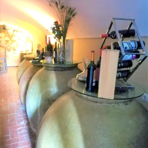
The house has capacity for 16 people + 2 extras, has 7 rooms, 6 of them with bathroom, two living rooms with fireplace, equipped kitchen, dining room and wineries-bar. Swimming pool and garden area, where you can enjoy spectacular landscapes.

Camping Despeñaperros

Submitted by brandcode_deweloper on
Id
2170648
Descripción
Breve descripción

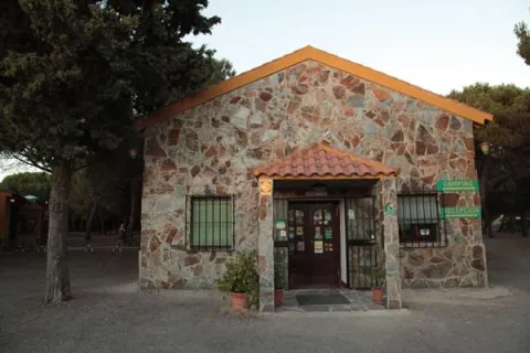
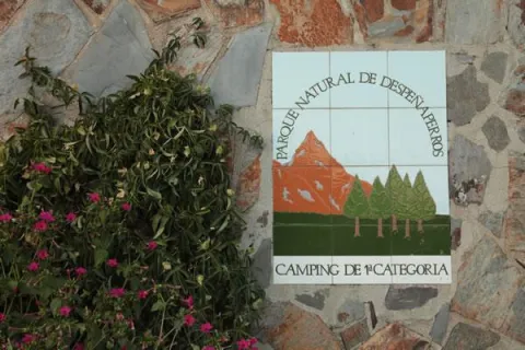
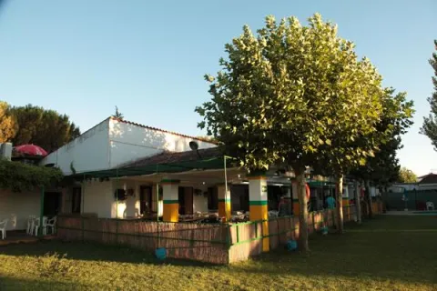
The Camping Despeñacolos offers multiple user attractions, from modern and well-equipped facilities where each plot can have water, electric light, parabolic antenna, residual water arquette, electricity and even the best services that an establishment of its category requires.

Información de contacto
Teléfono
953 664 192
Sitio web
www.campingdespenaperros.com
Correo electrónico
info@campingdespenaperros.com
Ubicación
Código Postal
23213
Latitud
38.343783
Longitud
-3.536127
Dirección
Santa Elena
Distrito
Municipio
Ubicación en el mapa
POINT (-3.536127 38.343783)
Tipo de alojamiento
Imágenes
imagen
Image
despenaperros.jpg
Imagen principal
Activado
imagen
Image
parque-natural.jpg
Imagen principal
Desactivado
imagen
Image
piscina%20%281%29.jpg
Imagen principal
Desactivado
imagen
Image
camping-despenaperros.jpg
Imagen principal
Desactivado
imagen
Image
camping-despena.jpg
Imagen principal
Desactivado
Aforo
336
Loading map
Preparing points of interest and routes...
El Hotel

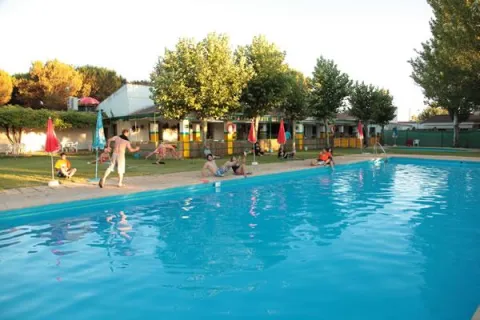
Camping Despeñacolos has a restaurant, pool, sports court, supermarket and children's attractions such as swings and others. In addition for photography, hiking, equestrian tourism and other mountain sports, the surroundings of the Camping offer interesting options to make the most of their holidays in Despeñacolos.

Balneario de San Andrés ***

Submitted by brandcode_deweloper on
Id
799662
Descripción
Breve descripción

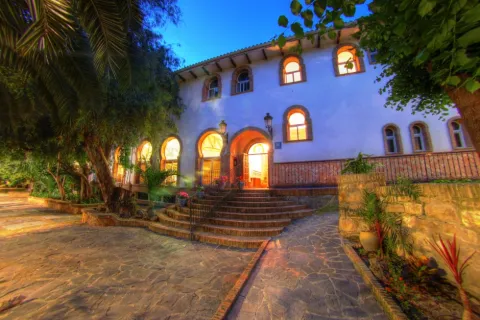
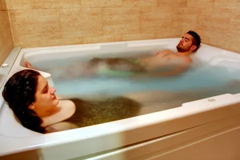
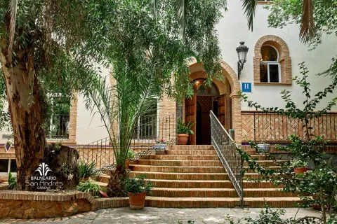
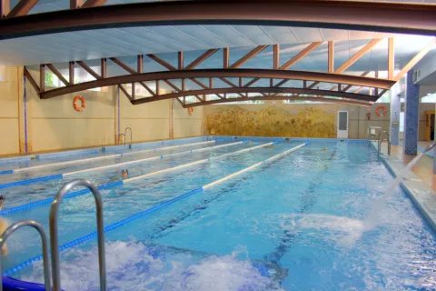
Officially declared as Balneario in 1853, the waters were declared of public utility in 1948, currently being the only one in operation within the province of Jaén.

Información de contacto
Teléfono
953 770 062
Sitio web
http://www.balneariosanandres.com/
Correo electrónico
reservas@balneariosanandres.com
Ubicación
Código Postal
23420
Latitud
38.047807
Longitud
-3.489632
Dirección
Ctra. Córdoba-Valencia, km. 137
Municipio
Ubicación en el mapa
POINT (-3.489632 38.047807)
Tipo de alojamiento
Imágenes
imagen
Image
ebe9ac202a3149b75a8ae8adb2e1d8a7_XL.jpg
Imagen principal
Activado
imagen
Image
ebe9ac202a3149b75a8ae8adb2e1d8a7_3_XL.jpg
Imagen principal
Desactivado
imagen
Image
9-Balneario-Canena.jpg
Imagen principal
Desactivado
imagen
Image
hotel.jpg
Imagen principal
Desactivado
imagen
Image
ebe9ac202a3149b75a8ae8adb2e1d8a7_2_XL.jpg
Imagen principal
Desactivado
imagen
Image
_MG_0037.jpg
Imagen principal
Desactivado
imagen
Image
DSC_0072.JPG
Imagen principal
Desactivado
Aforo
130
Horario
Information: 09: 00 - 14: 00 and 17: 00 - 20: 00. Reservations: 07: 00 - 23: 00.
Precio por noche
80.00
Marcas de calidad
Número de estrellas
3
Loading map
Preparing points of interest and routes...
El Hotel

Located in an area of authentic beauty, surrounded by pine and olive groves, it offers the visitor with extensive facilities with more than 45,000 square meters in which you can enjoy a quiet and relaxed atmosphere, ideal for rest and to discover olive oil.

The spa is located in the beautiful town of Canena, in which its imposing castle-Renaissance palace of the 16th century stands out. The proximity of the Ubeda and Baeza World Heritage Cities offer a perfect complement to your stay.

Castle of Villardompardo

Submitted by brandcode_deweloper on
Id
PUN-0002
Perfil de redes sociales
Descripción
Descripción larga
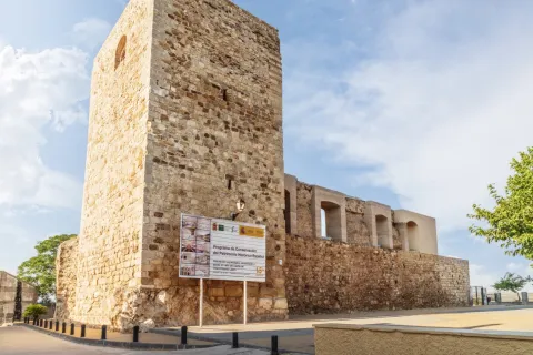
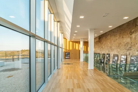
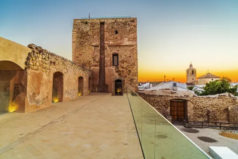
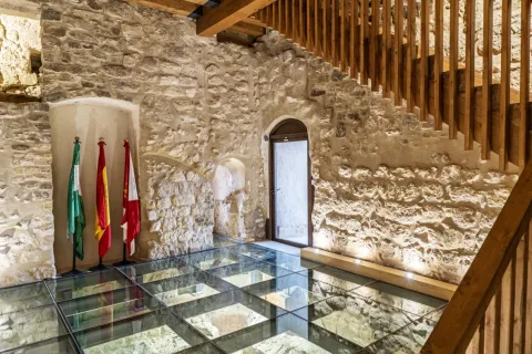
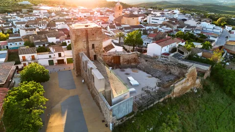
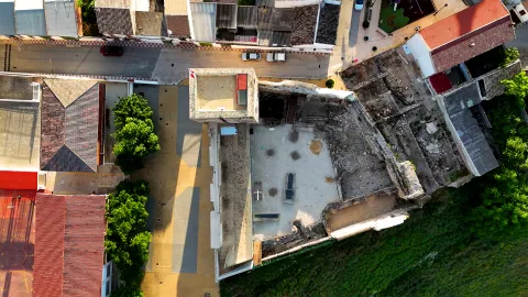
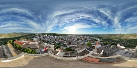
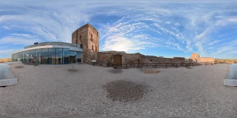
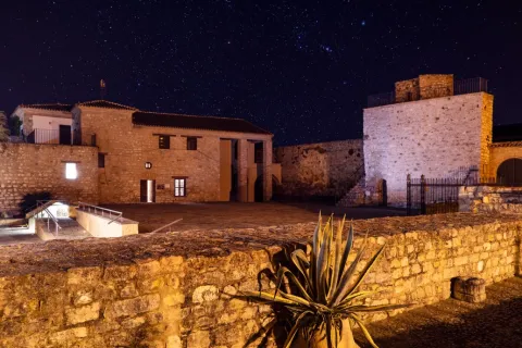
En la zona en que se asienta el castillo se han documentado estructuras de hábitat y almacenaje (una estructura hidráulica, silos y fondos de cabañas) pertenecientes a un poblado de la Edad del Cobre. Del asentamiento romano se puede distinguir un doble recinto amurallado, protegido por un foso en el lado norte, que reforzaba su defensa. Probablemente se articularía en torno a una torre situada al suroeste, a la que corresponderían los mampuestos de gran tamaño que cimientan el torreón medieval. En su interior se levantarían edificios de los que han quedado pocos vestigios, con estructuras de almacenaje de producción agrícola y de agua. La fortaleza medieval, erigida entre los siglos XIII y XIV, aprovechando los restos de época romana, consistía en un recinto amurallado en forma de trapecio irregular, con cuatro torres, de las que en la actualidad se conservan tres: una gran torre rectangular que ocupa el ángulo suroeste; una pequeña y circular al noroeste de la que solo se conserva la base; y otra rectangular, maciza, al noreste, que defendía la puerta del castillo. En la esquina sureste existió una cuarta torre, desaparecida en el siglo XIX. El conjunto está construido en mampostería, excepto el muro sur, con alzado de tapial. El torreón suroeste, o torre del Homenaje, se divide en tres plantas más una baja, ocupada por un aljibe. En algunos puntos de la torre del homenaje se pueden distinguir aún restos de la decoración original que cubriría los muros de la fortificación, un dibujo de hojas o gotas mediante técnicas de esgrafiado, decoración que cubriría también las murallas y la torre maciza. La puerta original de la torre estaba fuertemente defendida, de doble hoja, tendría una buhedera para arrojar líquidos o piedras sobre los atacantes y un rastrillo. Este acceso se cegó al construirse un aljibe en el interior de la torre, que ocupa casi toda la planta baja de la torre. La cubierta abovedada del aljibe ha desaparecido, pero aún se conservan dos elementos relacionados con el mismo, una estructura de decantación y un pozo para la extracción del agua. Las intervenciones arqueológicas que sacaron a la luz este depósito de agua, recuperaron también la escalera original embutida en el muro norte de la torre. Ambos pueden contemplarse en la visita, pudiéndose caminar sobre el aljibe. La subida al torreón culmina en la terraza, que ofrece un amplio control visual del territorio, divisándose emplazamientos como El Berrueco, Andújar, Arjona o Martos, lo que explica la elección de este emplazamiento para la construcción de la fortificación. Su ubicación sobre una pronunciada ladera actuaba como defensa natural, pero los lados norte y oeste, más accesibles, estaban protegidos por un amplio foso de unos 7 m de anchura y una profundidad máxima de 2,10 m, oculto hasta su recuperación en intervenciones arqueológicas recientes. El foso se extendía entre dos torres reforzadas mediante escarpas aún visibles. A partir del siglo XVI se abre una nueva puerta en la muralla oeste, con una portada renacentista que aún se conserva, realizada en piedra de cantería. Está formada por dos cuerpos, el inferior con arco de medio punto sobre pilastras y el segundo con un gran cartelón rectangular en el centro, que alberga las armas de don D. Fernando de Torres y su primera esposa Dª. Francisca de Carvajal y Osorio. La mayor transformación fue la construcción de cuerpos adosados a las murallas, formando un gran espacio residencial. La torre del Homenaje y la muralla sur conservan vanos que los comunicarían entre sí. Actualmente se reconocen las plantas bajas de estas construcciones, aunque habrían alcanzado entre dos y tres pisos de altura. Estos cuerpos albergaron el “espacio privilegiado” del palacio, es decir, las habitaciones del conde y la condesa, la capilla, la cripta, el zaguán y un corredor-galería o atrio, en el cuerpo oeste, mientras que en el edificio sur se dedicaba la planta baja al almacenaje, reservando la primera para el principal espacio representativo del palacio, un gran salón con una chimenea tallada en la fachada de la torre. Las estructuras situadas al norte y al este estarían dedicadas principalmente al servicio, incluyendo las caballerizas, cocinas y un sótano. Las intervenciones arqueológicas confirmaron la existencia de un asentamiento prehistórico, de la Edad del Cobre, en la loma en que hoy se encuentra el castillo. La presencia de dientes de hoz, molinos y silos de almacenaje apuntan hacia una economía agrícola basada en el cultivo de cereales. Se han localizado también una estructura hidráulica, estructuras de hábitat subterráneas y de hoyos de poste. No parece existir una continuidad en la ocupación del espacio, por lo que debió producirse un abandono temporal del asentamiento. Desde principios del siglo I a. n. e. hasta el II d. n. e. se produjo en la campiña un incremento de asentamientos agrícolas dedicados al cultivo del cereal. En esos momentos, se produce una reocupación de este espacio, un asentamiento fortificado, cuyo mayor apogeo se situaría entre el primer cuarto del siglo I y el siglo II d.n.e., a partir del cual se abandona nuevamente. El termino villar en la Baja Edad Media identificaba un lugar con restos de un asentamiento antiguo abandonado. Tras la conquista del territorio, los castellanos se establecen en el lugar cuando aún serían visibles las estructuras romanas, optando por reaprovechar algunas, así como material de construcción, para erigir el castillo. La aldea de El Villar de Don Pardo, se menciona ya en las fuentes en 1251, pero el castillo no se construirá hasta finales del siglo XIII o principios del XIV, aludiéndose por primera vez a la fortificación en 1416, como lugar perteneciente aún al Concejo de Jaén. Posteriormente Fernando Ruiz de Torres conseguiría la cesión de la aldea. En la segunda mitad del siglo XV, siendo señora del lugar Teresa de Torres, casada con el Condestable de Castilla Miguel Lucas de Iranzo, Villardompardo se convierte en una de las líneas de defensa de los partidarios de Enrique IV frente a la nobleza levantisca, acaudillada en la zona por la Orden de Calatrava. El fallecimiento sin herederos de su hijo, hizo pasar el señorío a una rama lateral de los Torres, que entroncó con la familia de Pedro I de Portugal. Felipe II lo erigió en cabeza de condado al nombrar a Don Fernando de Torres y Portugal conde de Villardompardo en 1576. Entre finales del siglo XVI y principios del siglo XVII se realizará la conversión del castillo en palacio, como vivienda habitual de los condes. Sus sucesores, sin embargo, instalaron su residencia en la Corte, en Madrid, lo que inició un proceso de ruina, por falta de mantenimiento. La abolición de los mayorazgos en el reinado de Fernando VII obligó a repartir la herencia, desvinculándose el castillo de Villardompardo de la rama nobiliaria principal. A finales del siglo XIX o principios del XX, se derribaron los edificios construidos en el siglo XVI, dejando solo los muros perimetrales, allanando la superficie y tallando gradas en la muralla norte para convertir temporalmente el recinto en una plaza de toros. El castillo ha sido objeto de diversos trabajos de consolidación de urgencia, excavaciones arqueológicas y restauración entre 2012 y 2023.
Breve descripción
The castle of Villardompardo, built between the 13th and 14th centuries, is a walled enclosure built mainly in masonry. It was pulled by four towers, among which the great tower of tribute stands out, and protected on its northwest side by a pit. From the 16th century a profound transformation of the fortress will begin, until its conversion into a large rural building, the residence-palace of the Condes de Villardompardo, of which the monumental cover or the aljibe that occupies the ground floor of the torreon stands out. The space in which it is located has housed a town of the Copper Age and a fortified Roman settlement dated between the beginning of the 1st and the 2nd century d.o.d., of which numerous structures are preserved. After the Spanish conquest of this territory, the Spanish raised a fortress that played an important role in the nobility struggles of the 15th century, becoming one of the lines of defense of the supporters of Henry IV. Philip II raised him to the head of the county by naming Don Fernando de Torres and Portugal Count of Villardompardo in 1576.
Ubicación
Código Postal
23659
Distrito
Municipio
Tipos de punto de interés
Imágenes carrusel
imagen
Image
Castillo de Villardompardo
Imagen principal
Desactivado
imagen
Image
Castillo de Villardompardo
Imagen principal
Desactivado
imagen
Image
Castillo de Villardompardo
Imagen principal
Desactivado
imagen
Image
Castillo de Villardompardo
Imagen principal
Desactivado
Imágenes cabecera
imagen
Image
CyB_Villadompardo_01
Imagen principal
Desactivado
imagen
Image
CyB_Villadompardo_02
Imagen principal
Desactivado
Microsite al que pertenece
Experiencia 360
Image
CyB_Villadompardo_03_360
Image
CyB_Villadompardo
Marcas de calidad

Palacio Sirvente de Mieres Apartments

Submitted by brandcode_deweloper on
Id
2638401
Descripción
Breve descripción

The Sirente Mieres Palace is a restored 18th-century building in the historic centre of Andújar. It is just 10 metres from the church of Santa María and offers 3 air-conditioned apartments.

Información de contacto
Teléfono
616 935 401
Sitio web
www.palaciosirventedemieres.com
Ubicación
Código Postal
23740
Latitud
38.037035
Longitud
-4.056028
Dirección
C/ Altozano Serrano Plato, 4
Distrito
Municipio
Ubicación en el mapa
POINT (-4.056028 38.037035)
Tipo de alojamiento
Imágenes
imagen
Image
Palacio_Sirvente_de_Mieres.jpg
Imagen principal
Activado
imagen
Image
4.jpg
Imagen principal
Desactivado
imagen
Image
3.jpg
Imagen principal
Desactivado
imagen
Image
5%20%281%29.jpg
Imagen principal
Desactivado
Las habitaciones

2 keys

Loading map
Preparing points of interest and routes...
El Hotel

The apartments of the Sirente Mieres Palace have a colorful decoration and have a living area, dining area and open-floor kitchen. They are also equipped with washing machines, dryer and bathroom with shower.

The accommodation is a 5-minute drive from the Sierra de Andújar natural park, a 30-minute drive from the Virgin of the Cabeza shrine and a 1-hour drive from Córdoba airport.

Albergue Las Nogueras Hostel

Submitted by brandcode_deweloper on
Id
2155530
Redes sociales
Facebook
https://www.facebook.com/Las-Nogueras-106590816068963/
Descripción
Breve descripción

Las Nogueras, is a large-school, multi-adventure center, located on a 40-hectare farm in the natural park of Despeñacolos (Jaén) that has been developing school visits, camps and celebrations since 1992.

The magnificent facilities of the estate - horses, swimming pools, basketball courts, squash, football fields, rocodrome, archery, tyrolin, lake, pyroguas, canteens and dormitories -, its splendid natural and cultural environment and the wide range of activities that the monitors develop, specifically formed in our facilities, will make your stay an unforgettable sports, natural and cultural experience.

Información de contacto
Teléfono
915 730 565
Sitio web
www.lasnogueras.com
Correo electrónico
info@lasnogueras.com
Ubicación
Código Postal
23213
Latitud
38.367011
Longitud
-3.597238
Dirección
Ctra. de Miranda del Rey, s/n
Distrito
Municipio
Ubicación en el mapa
POINT (-3.597238 38.367011)
Tipo de alojamiento
Imágenes
imagen
Image
las-nogueras.png
Imagen principal
Activado
imagen
Image
albergue_10.jpg
Imagen principal
Desactivado
Aforo
150
Loading map
Preparing points of interest and routes...
El Hotel

The school of Nature Las Nogueras has an area of 40 hectares and a total capacity of 150 children. It has porches for activities in the event of rain. A splendid kitchen in which our cooks take care to serve the traditional Mediterranean cuisine and dining. 10 individual bathroom apartments (8 children per apartment), 6 rooms (8 to 14 children per room) sharing 6 bathrooms, teacher residence with meeting room and exclusive bathrooms. See flat rooms.

Nursing. Swimming pool, children's kitchen workshop and art workshop, indoor basketball court, football field, archery field, rocodrome, lake with embarkation, rocodrome tirolina, horse stew, blocks, cocheries, corrals, orchard and fruit tree field.

Vilches

Submitted by brandcode_deweloper on
Id
787264
Perfil de redes sociales
Facebook
https://www.facebook.com/profile.php?id=100068958337736
Descripción
Breve descripción

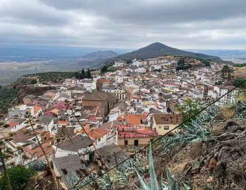
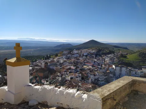
Vilches is a municipality located in the north of Jaén, in the district of El Condado, located in the foothills of Sierra Morena. The pedanias of Guadalén and Miraelrio are also part of it.

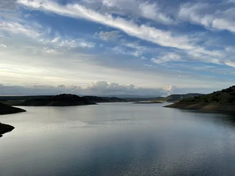
Its municipal term is crossed by the Guadalén, Guarrizas and Guadalimar rivers, which pour their waters in the reservoirs of Guadalén, La Fernandina and Giribola, respectively.

Its varied landscape has great tourist potential, highlighting its areas of environmental interest, reservoirs, oak dehesas, extensive olive trees, farmland, not forgetting its cynetic and fish resources.

The historical-artistic heritage is relevant. The church of San Miguel, the hermitage of the Virgin of the Castle, the remains of the castles of Vilches and Giribola, belonging to the Route of the Castles and the Battle of Jaén, and archaeological sites such as Giribola, of Iberian times, are highlighted.

Telecomunicaciones
Teléfono
953 63 00 75
Sitio web
www.turismovilches.com
Correo electrónico
turismo@vilches.com
Ubicación
Nombre
Vilches
Latitud
38.211660
Longitud
-3.512960
Distrito
Municipio
Ubicación en el mapa
POINT (-3.51296 38.21166)
Imágenes
imagen
Image
c4eb1866-6864-211d-8b8d-5d6240b72c0e?t=1687277240860
Imagen principal
Desactivado
imagen
Image
e203e5aa-0c7b-55bc-bb18-7f2ad2a50893?t=1687277240664
Imagen principal
Desactivado
imagen
Image
36f5d348-3269-39d2-d70f-6d5b005c43c2?t=1687277240761
Imagen principal
Desactivado
imagen
Image
61e83072-e72e-55d4-da7b-2cbab669b212?t=1585852470283
Imagen principal
Desactivado
imagen
Image
b8aaede2-095b-503f-349d-1f204fe0ddee?t=1687277240934
Imagen principal
Desactivado
imagen
Image
de02a0ed-f04e-7e2f-c703-d8c7d6baea37?t=1687277240590
Imagen principal
Desactivado
Imágenes cabecera
imagen
Image
Vilches
Imagen principal
Desactivado
Datos de interés

Tourist area: Sierra Morena / Sierras de Andújar and Despeñacolos
Distance to the capital (km): 80
Altitude over sea level (m): 543
Extension (Km2): 273
Number of inhabitants: 5086
Gentillo: Vilcheños
Postal code: 23220

Videos
Video file
Cultura

Its artistic heritage includes:

  • Church of San Miguel Archangel, This church dates back to the last third of the 16th century. The main cover is simple and with a half-point arch. It appears decorated with a stone shield made of quarry, typical of the Renaissance and Spanish mannerism. On a side it has a cover with a tile image of the Virgin of the Castle. The tower is of rectangular floor, which is unusual, and with relief decoration of the bell tower, similar to work in brick. The interior is one-ship and at the bottom is a half-barrel vault with the arms shields of Bishop Calderón. The majestic baroque altarpiece of the 18th century, the work of sculptor Diego de Briones, the chapel in which the so-called "trophies" of the battle of the Navas de Tolosa are kept (1212) and, in another chapel, a canvas of the Final Judgment are kept.
  • Ermita- shrine of the Virgin of the CastleHe rose in the 18th century on the ancient church of Santiago, at the top of the hill of the castle. It houses the image of the patron of Vilches, who every August 14, on the occasion of the holidays in his honor, is brought down in procession to the parish of San Miguel.
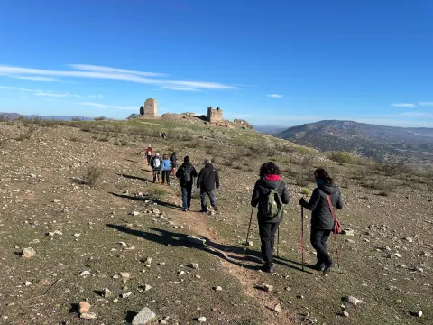
  • Vilches Castlelocated on a high hill to which it gives name and from where you can enjoy a wonderful view, is the castle of Vilches. A fortress castle that played a very important role as a point of defense of the high Guadalquivir, served as a refuge for the inhabitants of the environment in the face of the advance of Christian troops during the Reconquest and starred in famous war episodes, in the Middle Ages, between Arabs and Christians. Although we know that the hill has been populated since the time of the Iberians, the origins of the castle are uncertain. There are only a few remains of the fortress: a esquinero turret, known as "Cube de la Villa," part of another turret and a passage with a slightly pointed vault of armchair. With the passage of the years and the consolidation of Christian culture, much of the towers and parts of the walls of the castles were used to build small churches and hermitage. In the courtyard of arms the church of Santiago was built, on which the hermitage of the Virgin of the Castle was later built. It was declared Good of Cultural Interest in 1985.
  • Archaeological site of Giribola. It is an archaeological site of great importance located in the confluence of the Guadalimar and Guadalén rivers, from where you can enjoy excellent panoramic surroundings. From what has been known so far, it is known that it was home to an Iberian city, which some scholars associate with Orisia, which was destroyed in the Second Punio War, a prehistoric sanctuary, a Paleocrist or Visigode cenobium and a Almohad castle built after the battle of the Tolosa Navas.
Naturaleza

TheNorthfrom the term Vilches extends through Sierra Morena, with altitudes reaching 800 m. The vegetation in this higher part is very varied and is associated with the Mediterranean forest: encinars, alcornocals, complaints. There are also shrubs and areas of wood pine plantations.

More to Southin the foothills of Sierra Morena, with altitudes between 400 and 500 m., the adhesitated surfaces and pastures predominate. With a soft orography of constant undulations, where the olive grove predominates and we also find low mountain with acuchals and madroños.

Here live numerous animal species, such as birds, mammals and arthropods, easily observable in their natural habitat.

Thewet areass are around the reservoirs(Guadalén, Girirbola and Fernandina), in theriver banksGuadalén, Guadalimar and Guarrizas. The banks of the rivers and streams welcome mimberas, tarays, adelfas and other tree species such as the white chopo or the black Alamo.

The reptiles abound, highlighting the populations of theleprous galapagoin the rivers Guadalén and Guarrizas, as well as theViper de Latastein the Sierra. They will also be easily observable fishing and real eagles, common and black vultures, royal owls, lynches, gines, badges, etc.

Fiestas y Eventos

Vilches is a municipality of deep-rooted traditions, with popular celebrations, both religious and profane, that take place throughout the year and with activities for all ages.

  • San Antónwhich is held on 17 January. The streets are filled with bonfires of olive branches, which come from the pruning of these trees, to honor the pattern of the animals.
  • San Sebastián, Vilches pattern, which is held on January 20. That day the saint leaves his hermitage to process the streets.
  • Carnival parties, in which the neighbors participate, in which they dress up and sing mockery cokes (the City Council awards the best). They take place in the Caves del Zahaní district.
  • Holy Week. A week marked by religious acts and processions from Palm Sunday to Resurrection Sunday.
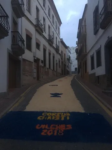
  • Festival of Corpus Christi. After Mass, in the church of St. Michael, the Lord will take a tour of the people accompanied by children of first communion. It is tradition to paint the streets using multi-color sawdust to reproduce allegorical drawings to the day of Corpus.
  • Saint GregoryOn May 9, in the neighborhood of the Mesones, a mass is held in the church of St. Gregory. At the end of the day, the rosses of blessed bread are distributed and the image of the saint is moved to the church of San Miguel.
  • Patrons in honor of the Virgin of the Castleon the 14th of August the transfer of the patron from her hermitage to the parish is carried out, remaining there until 8 September. The next day, on the 15th, the Holy Mass is celebrated in his honor and the floral offering. The festivities will last five days, in which there will be sports events, enclosures, capeas, gastronomic samples and popular verbenas.
  • The Vilches bell-bearers, they are a gang of Vilcheños who, when Christmas comes, go through the streets, singing their stanza. They sing ancient and villain senses. It is a tradition in which Arab reminiscent is observed, both in its melodies and in its stanza. The song is initiated by a soloist and the chorus chorus. The accompaniment is very unique: guitar, bandurry, laud, bell, triangle, Spartan alpargata, plow, wooden drawer, almirez and saucers.
Gastronomía

Vilches is a municipality very fond of its traditions and this is also reflected in its gastronomy. Meat obtained from hunting is often used to make its dishes.

We highlight among the best known:

  • The harls, a hare stew, flour, tomato, onion, olive oil and pepper.
  • The countrysideA stew with hare and potatoes.
  • The brain, on this dish is cod, with onion, tomato and olive oil, which takes the lead.
  • The crumbswhich consists of bread, garlic, olive oil, all accompanied by some products from the slaughter of the pig.

From the pastry shop we want to highlight:

  • PapajotesIt's traditional sweet. This dessert is consumed at breakfast or at snack, and is one of the most widespread sweets in the province.
  • Sweet peas for the Day of All Saints.
  • Tickles, drunks and flowersHoly Week.
  • Bake and bread with matalauva in San Gregorio.
Historia

In the municipal term of Vilches, about a hundred archaeological sites have been invented. From the Copper age the field of Santagon. The occupation of this settlement had to end at the beginning of the Bronze Age, when the consolidation of metallurgical activity and the fertility of the surrounding lands involved the emergence of small villages in the area, some of them fortified, such as the Cañada de Malaguo, Giribola or Cerro Santo. This settlement has the novelty of having a large defensive tower.

In the Iberian stage, GiridanceThe metallurgical centers were controlled from here. The town has an urban layout defined by streets, houses and public areas, delimited by a large wall. From this Iberian period, many settlements and small fortifications have been invented, including the first occupation of the castle hill.

In the Roman times Vilches is identified as BaesucciAccording to a stone located on the hill of the castle. The Emperor Vespasian granted him the title of municipality. In Santagon, remains of ancient villas with mosaics have been found in the noble areas.

Also the people Visigode He settled in Vilches. A visigode architrabe has been found and is preserved in the Jaén Provincial Museum.

It's in the Islamic period when the current Vilches site is consolidated, being occupied from 711. It was part of al- Andalus for five centuries, from the first years of the 8th to the 13th century. This long period makes Vilches a typical Muslim cityfrom which we can guess vestiges today. As the 12th century progressed, the castle of Vilches became very vulnerable by the proximity to Despeñacolos, where the Spanish-Latvian troops practiced acts of harassment over the possessions of al- Andalus.

In 1212, the Christian kings of Castile, Aragon and Navarra, beat the Muslims in the the battle of the ships of Tolosa. Three days later, the castle is conquered and the population exterminated, which will force this area to be repopulated with inhabitants from beyond Sierra Morena. The Christians will stay in the Vilches castle And the Muslims will return to Giribola.

It will be King Fernando III who gives up the territory of Vilches to the Council of Baeza, until Felipe IVin 1627, release him and grant him the The title of Villa.

The number of Vilches with railway station, already in 1900.

Loading map
Preparing points of interest and routes...
Imagen principal
imagen
Image
e2fdf917-2e2c-2a08-49fc-21c32566e218?t=1687277240494
Imagen principal
Activado

Torredonjimeno

Submitted by brandcode_deweloper on
Id
751667
Perfil de redes sociales
Facebook
https://www.facebook.com/aytodetorredonjimeno/
Twitter
https://twitter.com/ATorredonjimeno
Youtube
https://www.youtube.com/@ayuntamientodetorredonjimeno
Instagram
https://www.instagram.com/aytotorredonjimeno
Descripción
Breve descripción

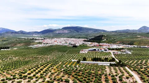
The municipality of Torredonjimeno is located to the southwest of the province of Jaén, 17 km. to the west of the provincial capital.

It is not administratively included in the Sierra Sur region, but is considered a bridge head towards the countryside and therefore initiator of another route. However his history and art are so linked to the rest, always by the common denominator of the Order of Calatrava.

Torredonjimeno is an olive town with a certain industrial development. It is characterized by the development of agricultural activity, where olive trees constitute 97% of the cultivated land.

The industry is on the rise in recent years. On the outskirts of Torredonjimeno is the industrial polygon "Mirabueno," where most industries are located: workshops, upholstery, textile fibres... There are companies dedicated to the construction, highlighting the crafts of metal, the forge and especially a factory of casting of bells, which has been in existence since 1881, being the only one in Andalusia following traditional artisanal techniques and performing works that in many cases go beyond the national level, to be exported to other continents.

It is quite linked to the capital by its closeness and excellent road communications.

This city offers us corners, monuments and places, culminating in a city centre full of attractions.

Telecomunicaciones
Teléfono
953 571 950
Sitio web
www.tosiria.com
Fax
953 341 326
Correo electrónico
secretaria@tosiria.com
Ubicación
Nombre
Torredonjimeno
Latitud
37.765769
Longitud
-3.958760
Distrito
Municipio
Ubicación en el mapa
POINT (-3.95876 37.765769)
Imágenes
imagen
Image
e001aa8c-ca72-9178-b82d-e3fa54956708?t=1621473670658
Imagen principal
Desactivado
Información adicional
Curiosidades

Casa Municipal de Cultura.

Telfs.  953 572 202 – 620 525 273

cultura@tosiria.com

culturatorredonjimeno@gmail.com

Horario de atención: 

Invierno:

De lunes a viernes: 9:00h. - 14:00h. / 16:00h. - 21:00h.

Verano: 

De lunes a viernes: 9:00h. - 14:00h. / 17:00h. - 21:00h

Imágenes cabecera
imagen
Image
Torredonjimeno
Imagen principal
Desactivado
Datos de interés

Tourist area: Sierra Sur and Campiña de Jaén

Distance to the capital (km): 17 '3

Altitude over sea level (m): 587

Extension (km ²): 157 '68

Number of inhabitants: 13,696

Gentilicon: Toxirians

Postal code: 23650

Videos
Video file
Cultura

The declaration of Historical set It is justified in 2005 by the presence of several monumental buildings in the old town, as well as by the medieval route.

We highlight the following monuments:

Civil architecture:

  • Castle (12th and 13th centuries). The castle of Torredonjimeno was built by the Arabs to protect the population from a small rural house. It was a rectangular fortress, of medium size, which after the reconquest was widely reformed by the Order of Calatrava. The Fortaleza, of a mannerist style, is one of the most important monuments of the historical and archaeological heritage of Torredonjimeno. As a matter of curiosity, the castle served as an accommodation for Fernando III in one of his perils and, according to tradition, in the room of which he was Torre del Tribute, the commando of the Order of Calatrava wrote the first book of which the art of the bullfighting is recorded. From this book, printed in the 16th century, only one preserved copy is known in the Salamanca Library. At the end of the Middle Ages the castle became a church residence. Inside the compound we can see part of that 16th century palace house in which several of its dependencies are highlighted with polychrome potters of Mudejar style. After its restoration, the castle has become a cultural center in which much of the activity of Torredonjimeno is developed and which also houses the Visigode Treasury Interpretation Centre which was found in the surroundings of the municipality fortuitous in the early 20th century. Considered the second most important visible legacy of the Peninsula after the one found in Guarrazar (Toledo), its original pieces are today distributed by several Spanish museums. Declared Good of Cultural Interest with the type of Monument in 1985 (BOE 29 / 06 / 1985).
  • San Sebastián Bridge. On one side of the missing Gate of Martos and on the other side with the pillar of the same name and it rises on the way of the Salado River.
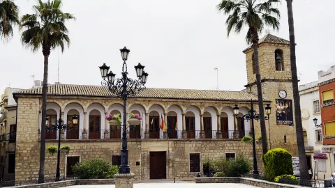
  • City Council (17th century, mannerist). Of elegant and proportionate facets, typical of the classicism of the 17th century. The facha is divided into two floors, the one below has in the center a cover and on the double sides of the intellized windows. The superior presents a gallery with 11 arches of half points supported on double columns. The open character of the gallery contrasts with the solid and sober underfloor in the style of the Italian palaces. Declared B.I.C. in 1983.
  • Cube mill. It is a fortified flour mill that takes the name of the stream of the cube, is built by the Order of Calatrava in 1437. It is the largest and best preserved fortified mill built by the South Peninsular Military Orders. In this place, down to the river of the Cube, we find an area of high ecological and landscape value.
  • Torres- Fortress. In the municipal term of Torredonjimeno there are numerous towers such as: Castle of the Fucovert, Castle of Torre Venzala and Castle of Torre Alcázar.

Religious architecture:

  • Church of Santa Maria.Built in the early 16th century, in late Gothic style. It is a temple dedicated to the Mystery of the Immaculate Conception of Mary, of one ship, with two chapels on each side, flat tester and tower at the feet. The ship is divided into three sections, with star gothic vaults separated by pointed arches. The main facade, at the foot of the temple, stands out on the volume of the whole by the body of the torre-bell tower attached to the wall, has a small furnace flanked by two shields of the Order of Calatrava.

    The first extension of the temple is in 1671, consisting of a chapel next to the presbytery for the Most Holy. The second enlargement, in the first third of the 18th century, is dedicated to Our Lady of the Dolores. It is worth noting the Camarín, which is accessed from the sacristy. Declared B.I.C. with the type of Monument in 2010 (BOJA 9 / 11 / 2010. p. 50).

  • Church of St. Peter the Apostle (S. XVI), Renaissance style, designed by Francisco del Castillo "El Mozo" and built in 1592. It is divided into three ships by sober columns of Tuscan order that support a Mudejar artisan: that of the right dedicated to the Virgin of the Angustias, that of the left is occupied by the Christ of Love and at the bottom the Chapel of the Virgin of Carmen. On the presbyterium is the fourth-sphere vault, on pechines, covered with frescoes of the Celestial Glory. The altarpiece, from the first third of the 17th century, originates from a convent of Valladolid. It also highlights the large number of pictorial works of Easter.
  • Convent of Our Lady of the Piety (16th century), popularly known as "Las Dominicas." Founded by Don Jerónimo de Padilla and Pacheco around the year 1540, belonging to the Order of Santiago and with a triple function: to house a convent of Dominican nuns, to be a family pantheon for the founders and to serve as a school for homemade maidens. The church presents one ship divided into three sections, with side chapels embedded in the wall. It has double choruson the feet and on the side of the presbytery. The altarpiece is baroque from 1728. The ship is divided into three sections with star Gothic vaults and separated by half-point arches, columns and capitals. The profusion of santiaguine shells and the general composition of late and Renaissance Gothic elements are a decorative element. In the interior of the convent you can highlight the double floor cloister, you cannot visit it as a closing convent.
Naturaleza

The municipal term of Torredonjimeno has a surface area of 157, 68 km ²and is at an average altitude of 587 m. over sea level.

The municipal term is characterized by the abundance of hills and a shortage of very flat areas. The altitude of the term varies between 300 m from the lowest areas to the west to 800 m in the south-east, being a transition area between the Sierra Sur and the Campiña.

Although there are no notable geographical accidents, there are many natural spaces and attractions who will make the delights of lovers of nature. It is these places that make nature in this municipality a real sign of identity.

The indigenous vegetation corresponding to the term is made up of oats, a small forest with different species such as lentils, retama, zarzas, rosemary, madroño and thorn.

The fauna the species that have been able to adapt to these lands without almost forest area: sedentary birds, jellyfish, greens, partridges. Migratory birds coming from the African continent, such as the tortola, the cuckoo, the swallow and the victor, who come to these lands to feed and reproduce. They also abound in the Tusrian rabbit field, hares and all kinds of rodent animals.

We highlight the following areas:

  • Las Quebradas Park. Frondosa grove in the old town of Torredonjimeno where there is an area conditioned for leisure and free time consisting of a children's park and a picnic area.
  • Calvary. It's one of the local lungs. Located to the south-east of the city centre, it is a hill where there is pine mixed with oak and Mediterranean bushes. Through a wide and soft sidewalk, along which there are several stone crosses, you reach the top where you find the San Cristobal hermitage. On this path, at the evening of Holy Monday, the crucified Christ is processed. From here we'll have some Exceptional panoramic views of the helmet of Torredonjimeno.
  • The site of the Cube Mill. It is located 3 km away. from the town and near the Green Way of Oil. It is an area with a high ecological and landscape value. There is the Cube Mill, a fortified flour mill of the 15th century. Here we can observe various water jumps and the riverside vegetation.
  • Salinas de San José. Old saline exploited from the Roman era to well in the 1990s. They are now out of activity.
  • Paqua source. Small area 2.5 km from the town, crossed by the Arroyo del Barranco. We can discover the river vegetation and the Mediterranean forest. The best way to get to this place is through the Green Way.
  • Laguna de la Casilla and Laguna de las Navas. They are seasonal lagoons located in the western part of the municipality. Since 2007 they have been registered in the inventory of wetlands in Andalusia. These two lagoons are ideal for the observation of aquatic and amphibian birds at some times of the year.
  • Green Way of Oil.It is presented as a new and attractive offer of indoor tourism based on the use and recovery of the old Jaén- Campo Real railway (Córdoba) as green corridor, ideal for the practice of cycling, hiking and other sports in contact with nature. Built between 1882 and 1893, this railway belongs to the line Linar- Puente Genil, and was dedicated for much of the 20th century to the transport of different metals from the mines of Liares and especially from the abundant olive oil produced in the region. It was finally closed in 1985, to passengers and goods. It was possibly called "Oil train.". The tour begins in the sports "Las Fuentezuelas" of the jienese capital, continues by Torredelcampo, Torredonjimeno, Martos and concludes the jienese part of the Green Route, on the great iron bridge over the Guadaljoz River, right in the tail of the Vadomojón swamp, in the municipal term of Alcaudete. On his way through Torredonjimeno, right in the km. 15, the Green Way of Oil is in a 120 m tunnel. After passing by the site of the station (km 15.5), a gentle rise of about 5 km is started. La Vía directed her path to the imposing Peña de Martos, with a winding track, crossing through a lower step (km 20) and two new metal walkways, the A-316.

Gastronomía

The gastronomy of Torredonjimeno is very linked to the products obtained from the orchards, to the animals that were raised in the corrals and to the minor game animals. Simple and easy to prepare dishes, where virgin olive oil is never missing. Among the most prominent are:

  • Pipirrana: is a salad whose basic ingredients are onion, tomato, green pepper and cucumber. Sometimes it is added cooked egg, some kind of fish, meat priet or even sausages.
  • Gazpacho: It is a drink with several ingredients such as olive oil, vinegar, water, bread, raw vegetables, usually tomatoes, cucumbers, peppers, onions and garlic.
  • Migas and gachas. They argue that the crumbs are made with bread and the gaches are made with flour. It was the breakfast of the quadrillas on the long days of the olive collection. They were added, grapes, chorizo, morcilla, eggs, cod... As far as possible.
  • Cucumbers: Owner of Holy Week, where the main ingredient is cod.
  • Handmade French fries, product "Degusta Jaén" as a sign and distinctive of quality.

Warehouse: rosquettes, meringues, coffins, saintly bones and pestions.

Drinks:

  • Pitch: It is the general term for a wide variety of cocktails, alcoholics or not, that may contain fruit or juices, and other estival drinks such as crow, turf, lemonade and different types of bleeding.
  • Coffee solution

Historia

The the geographical location of Torredonjimeno, located in an area of fertile land and in a crossing of roads that links the lands of Jaén with the Cordobese countryside, has allowed the presence of human communities throughout history.

The oldest data retract us to the existence of an Iberian population called Cosiria (hence the Gentile applied to the inhabitants of Torredonjimeno, of "the Syrians").

After Roman conquest, joined to Martos gets the rating of a colony with the name Augusta Gemina.There is little news about the Spanish-Muslim stage. To highlight inclusion as part of Martos.

In 1224 he became part of the Spanish crown, and years later Fernando III would grant this entire territory of the countryside to the Military Order of Calatrava, so that it would repopulate and defend it as a border until well advanced in the 15th century.

This border condition will determine the lifting of a good number of watchmen to defend the territory: Tower of the Foncada, Tower of the Alcázar and the existing one in Venzala

From this time it is born its current name which refers to the existence of a military enclave (Tower) and the name of one of its first warlords, D. Ximene of the Raya.

Around 1369, in the middle of the border in the area, Torredonjimeno, already has a walled enclosure that defended the whole city.

By 1526, when the Emperor Charles I went to Seville to marry Isabel of Portugal, he stayed in the palace of Gonzalo de Villalta.

The Year 1558 will be decisive for the history of Torredonjimeno, as, this year, the Princess Joan of Austria, governor of the kingdoms of the Monarchy in the absence of Philip II, grants independence to the villa, definitely taking her away from the dependence of Martos.

The 15th century will be a stage of expansion and prosperity. However, the XVII will know the bad crops, epidemics, hunger, the fall of the population... Despite this, in 1637, the construction of one of the most beautiful buildings is started: the City Council.

In 18th century, it starts a recovery in the style of the new illustrated society promoted by Charles III. During these years, cultivated areas are growing, and olive trees will replace other arable crops in many places.

The years of drought and poor crops, as well as the periods of war and emigration to industrial cities, meant that people were lost in these localities.

In year 2005is declared by the Council of Culture of the Junta de Andalucía, Good of Cultural Interest in the category of Historical set, in recognition of the historical and urban values of the city.

Loading map
Preparing points of interest and routes...
Imagen principal
imagen
Image
Torredonjimeno
Imagen principal
Activado