Saltar al contenido principal

Torredelcampo

Submitted by brandcode_deweloper on
Id
751545
Perfil de redes sociales
Facebook
https://www.facebook.com/Ayuntamiento-de-Torredelcampo-580850341935480/
Twitter
https://twitter.com/torredelcampo_
Instagram
https://www.instagram.com/torredelcampoturismo/
Descripción
Breve descripción

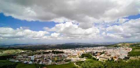
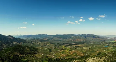
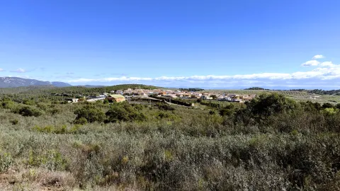
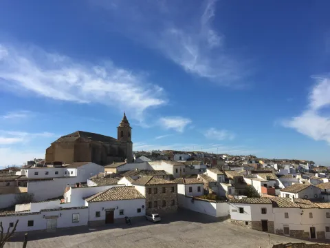
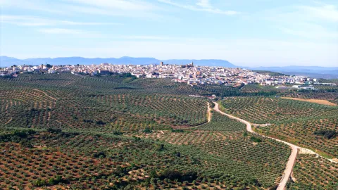
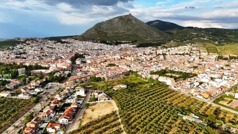
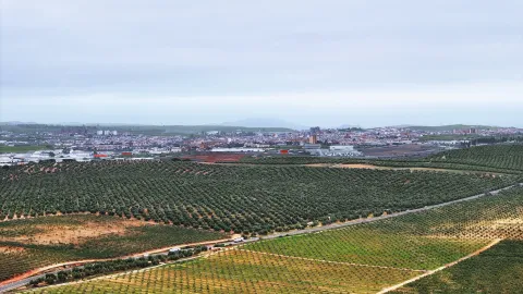
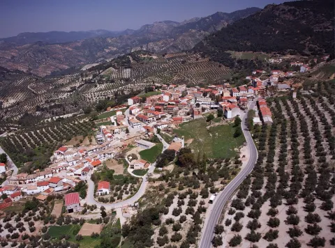
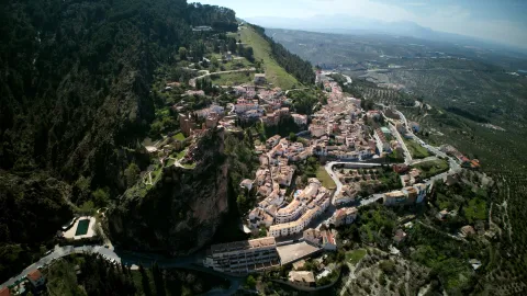
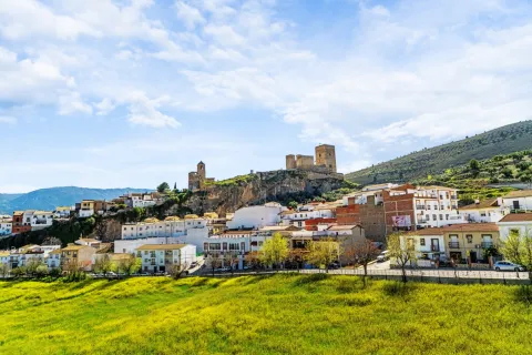
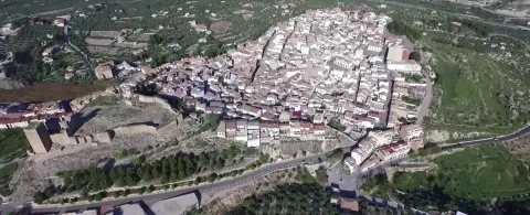
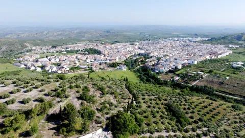
Torredelcampo is a municipality that is located located 11 km. to the northwest of the capital of province. Posee a characteristic landscape in which they contrast the smooth and moist forms of the countryside with the abrupt and accidental reliefs of the saw. It has an extension of 182 km2, with an average altitude of 640 m. over the sea level and presents the typical landscape of the countryside, splashed with the typical Andalusian cortijos.

Its strategic geographical location, on the edge of the A-316 motorwaywhich connects Jaén, Córdoba, Madrid and Granada, gives it a decisive role in economic and social development of the region. In primary sector, the cultivation of the olive tree stands out, being among the first ten municipalities of the province in the production of oil olive. The 90% of surface of the municipality is cultivated.

The polygon of "The Llanos" welcomes important industries of computer technology, clothing, mechanics, wood, upholstery, ferralla... The construction sector is the one that gives occupation to many torrecampeños who move daily to Jaén to work.

The Services sector, trade, bars, restaurants, transport, education, health... reach to 47 per cent of the occupied population.

Many families in the municipality have spent years in the holiday sector. Tradition that has passed from parents to children. The town is characterized because much of the population is dedicated to this trade

From an agricultural point of view, olive crops are an important income injection for family economies.

Torredelfield now has extraordinary prospects for further progress in the future.

It has two pedanias: Garciez and Megatín.

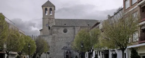
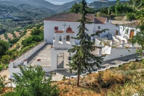
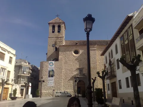
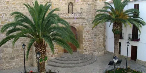
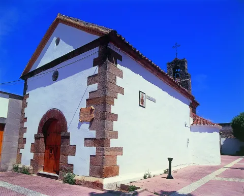
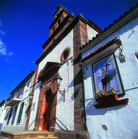
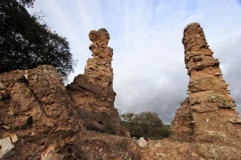
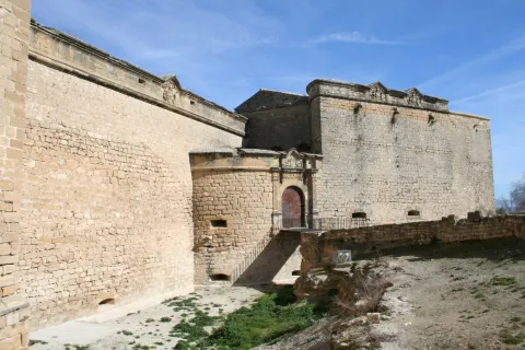
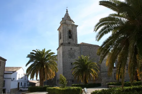
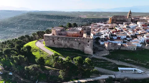
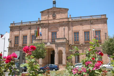
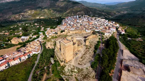
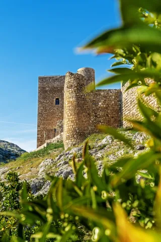
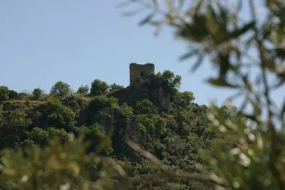
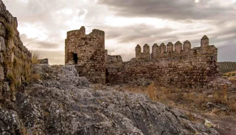
In his monumental heritage We have to highlight: Parish de San Bartolomé, Ermita de Santa Ana, Castillo del Berrueco, Torre de la Muña, Torre Forgotten and the Torre de la Aldehuela.
Telecomunicaciones
Teléfono
953 567 000
Sitio web
www.torredelcampo.es
Fax
953 567 505
Correo electrónico
tcampo@dipujaen.es
Ubicación
Nombre
Torredelcampo
Latitud
37.770200
Longitud
-3.897230
Distrito
Municipio
Ubicación en el mapa
POINT (-3.89723 37.7702)
Imágenes
imagen
Image
0e0ac6ee-3afc-4005-25c8-7d9c2f313d7f?t=1598629449622
Imagen principal
Desactivado
imagen
Image
38a8a650-c81d-b25e-c74d-a2ff6ede559f?t=1656693147615
Imagen principal
Desactivado
imagen
Image
9f70404b-a542-bc46-9883-89852eccf1d3?t=1598629470396
Imagen principal
Desactivado
imagen
Image
b01bef73-4b28-687b-6538-24b9483cac0e?t=1598629480623
Imagen principal
Desactivado
imagen
Image
70544180-97ab-0b92-f046-00b0c8d52777?t=1598629490849
Imagen principal
Desactivado
imagen
Image
3bd6b7f2-a3d9-3619-8fb0-d14ae040aa3d?t=1598629501777
Imagen principal
Desactivado
imagen
Image
f7664660-2964-9060-2747-b09e2516adb3?t=1598629538250
Imagen principal
Desactivado
imagen
Image
83b5f911-ef2b-37e8-970f-f8c1cb050461?t=1598629885950
Imagen principal
Desactivado
Información adicional
Curiosidades

Punto de información en Torredelcampo Jaén

Patronato de Cultura, Quinto Centenario, s/n

Teléfono 953 568 649
Imágenes cabecera
imagen
Image
Torredelcampo
Imagen principal
Desactivado
Datos de interés

Tourist area: Jaén and surroundings

Distance to the capital (km): 11

Altitude over sea level (m): 640

Extension (km ²): 182

Number of inhabitants: 14,565

Gentilicon: Torrecampeños

Postal code: 23640

Videos
Video file
Cultura
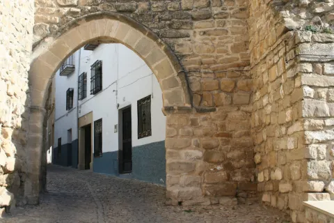
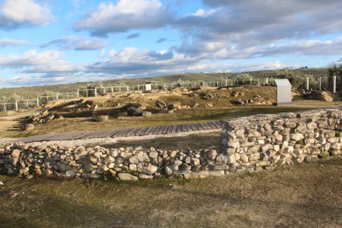
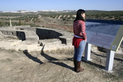
  • Cerro Miguelico. On the surface of an old oppídum and taking advantage of a cyclopeia wall (9th and X century), a plateau that would be the germ of the present town of Torredelcampo is consolidated. On its west side, a cyclopoeia wall and in the south-east is still preserved a Visigoda necropolis. On the east side is the hermitage of Santa Ana.
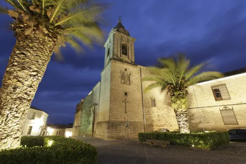
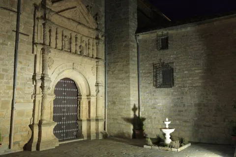
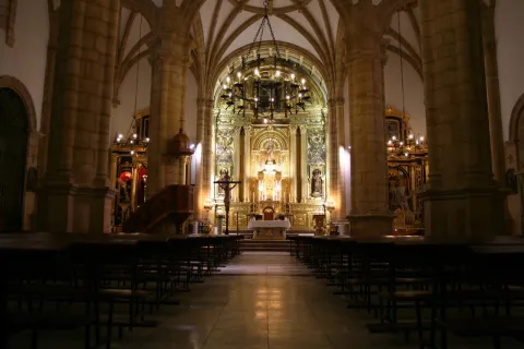
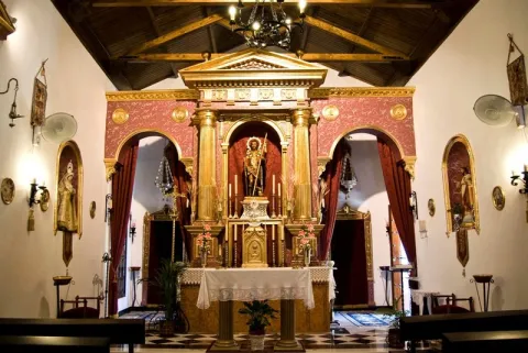
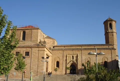
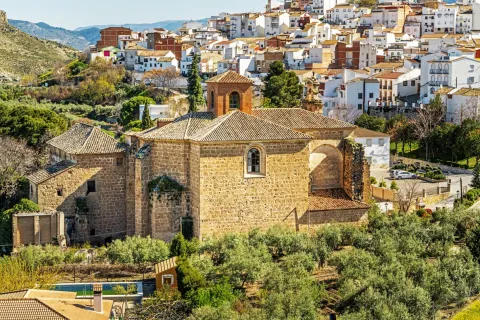
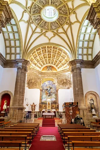
  • Church of San Bartolomé. It responds to a medieval project, still visible in the sacristy and major altar. Most of its current configuration takes place in the 16th century, involving the architects, Francisco del Castillo "El Viejo" and Francisco Castillo "El Mozo." In its bell tower is located the shield belonging to the bishop of the Diocese of Jaén. Inside it houses the Christ of the Vera Cross (16th century).
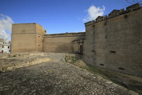
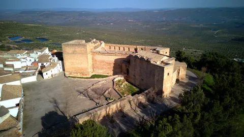
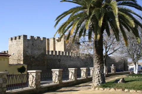
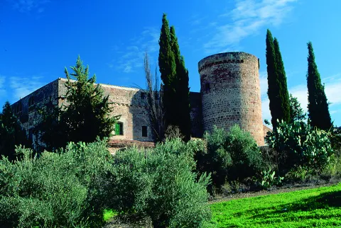
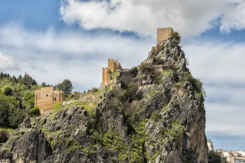
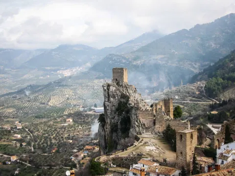
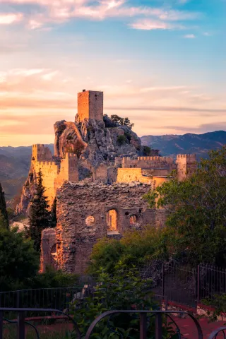
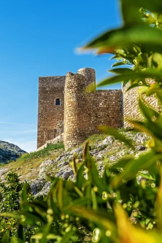
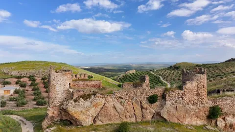
  • Berrueco Castle. It is located next to an old road crossing (Jaén-Arjona-Martos) of high strategic value, as attested by the settlement of Cerro San Antón. The fortress is built on a rocky exit, structured in two spaces, of which the upper one is delimited by two circular towers and one of a square floor, all with internal dependencies.
  • Torre de la Muña. Located at the top of a small ameseado, it is defined as a fortification under medieval (XIV-XV century), several wall canvases and a magnificent square-floor tower, built in masonry and structure in two rooms covered with pointed vaults.
  • Tower of La Aldehuela. Square floor fortification, structured on two floors covered with pointed vault. The remains of a hydraulic system used for field irrigation can still be seen next to them.
  • Forgotten Tower. It is located on an Ibero-Roman settlement and next to the road from Jaén to Arjona. It is believed to date from the second half of the 13th century. It was built in the Andalusian era and reformed after its conquest by the Spanish. It has a cylindrical shape, 8 m in diameter and has a height of about 7 m., with a door located several meters from the level of the ground. It has breathtaking panoramic views, oak and complaint sketches, fountains and venerations at every step, as well as a large number of animal species, which make the mountain saw a small ecological paradise.
Naturaleza

The flora of the term is dominated by olive, located in a large percentage of the land of the municipality. It also exists indigenous vegetation of the Mediterranean forest in the mountain areas, where we see species such as: the oak, coscoja, white jara, cornicabra, complaining and abundant number of aromatic plants such as lavender, rosemary or thyme.

The fauna is mostly made up of animals of medium or small size. The large vertebrate fauna associated with forests and bushes is currently very little due to the agricultural transformation and persecution of many species. The great Iberian mammals: the bear, the wolf and the lince... disappeared. Other species of great natural value such as the royal eagle or the royal owl They still have some couples.

In addition to invertebrates, small fauna is particularly interesting. Insectivorous birdsthe ecological role they play. Birds like look at it, the zorzal, the red petrored, the curled... play a very important role in insect control to avoid possible harmful pests.

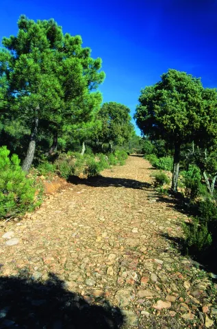
For nature lovers, Torredelfield offers various natural resources to make routes, tour theGreen Oil Way or close to the natural space of the Bañizuela, offers unparalleled views of the landscape of the countryside and the surrounding mountains.

  • Green Oil Way. It is presented as a new and attractive offer of interior tourism based on the use and recovery of the old Jaén - Campo Real (Córdoba) railway as a green corridor, ideal for the practice of cycling, hiking and other sports in contact with nature. Built between 1882 and 1893, this railway belongs to the line Linar- Puente Genil, and was dedicated for much of the 20th century to the transport of different metals from the mines of Liares and especially from the abundant olive oil produced in the region. It was finally closed in 1985, to passengers and goods. It was commonly called "Oil Train." The tour begins in the sports "Las Fuentezuelas" of the jienese capital, continues by Torredelcampo, Torredonjimeno, Martos and concludes the jienese part of the Green Route, on the great iron bridge over the Guadaljoz River, right in the tail of the Vadomojón swamp, in the municipal term of Alcaudete.

  • Bañizuela Forest.This Natural Monument has the interest of being an island forest of a Mediterranean character and of a small extension which, although located in a dry climate, has a large number of species of unique beauty: up to 22 trees and 15 types of mushrooms of subhumid climates, presenting botanical specimens of great antiquity. Surrounded by olive trees, it is characterized by the presence of complaints and underwoods made up of durillo, slime, coscoja, yellow jasmine, madreselva... and the interesting legume called "spindles." There are examples of arrayan or myrtle, usually of arbustive bearing, but this one we find in the Forest of Bañizuela stands out precisely for its large size and the thickness of its trunk, more specific to a tree than to a bush. Located very close to the urban core of Torredelcampo, to the west of Jaén capital, it presents small witnesses of gallery forest, such as the Barranco Megatín, where there are chopos.
Fiestas y Eventos

Another reason to stop at Torredelfield are their multiple and colorful parties:

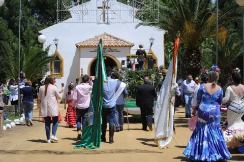
  • Romeria de Santa Ana. It is celebrated on the first Sunday of May, and is considered one of the most fun and frequented romaneries in the province. This day almost all the people meet in Cerro Miguelico, where the hermitage that houses the patron is located. A spraying mass is held and the patron is processed on the hill. It is declared a National Tourist Interest Party.
  • The Fair in honor of Santa Ana and the Virgin Girl. It is celebrated around July 26, and in it the fun and the musical performances of quality are guaranteed. The image of Santa Ana and the Virgin Girl is lowered in the Rosary of the Aurora to the church of San Bartolomé, after the ninth, the Virgin Girl is exposed in a besieged devotee.

Other celebrations include:

  • The night of the crumbs, is a celebration that is framed later than the San Antónwhich is January 17 and coincides with the end of the pruning of olive trees and branches, in which they are made "lumbres" in the streets. In Lthe night of the crumbs,groups of friends and families gather to make crumbs in the bonfires, among the participants a draw is made, usually the prize is a cochinillo that gives away the City of Torredelcampo. Fun and entertainment are guaranteed.
Gastronomía

The Torredelfield cuisine has top quality ingredients: virgin olive oil, orchard products and game meat (gamo, corzo, hare, perdiz, rabbit...), among the most traditional:

  • Chickpeas, especially of Easter. They can carry acergas, spinach, muffins...
  • Potato tabletThey can bring lamb, kid, rabbit, hare... For these places, given the orography, the caprine cattle are better adapted than the sheep.
  • Migas and gachas. They argue that the crumbs are made with bread and the gaches are made with flour. It was the breakfast of the quadrillas on the long days of the olive collection. They were added, grapes, chorizo, morcilla, eggs, cod... As far as possible.
  • Rhinestones, calandrajos and tallarines. They are made with a fine mass of flour, and may be hare or cod.
  • Other: chorizos, morcillas and "angellos" (this name is given the mass of meat before it is infused). The area has good meat industries and make chorizos, salchichon with the meat of game animalsthat give it a very particular taste.
  • Pipirrana:tomato, green pepper, onion, garlic, canned tuna and hard egg. Add extra virgin olive oil and salt produced and produced in the local

In pastry: mantecados, pestiños, almond sweets, bread rosches, with and without wine, pebbles, biscuits, canutilos, mazapans, alfajores, ajonjolí...

Historia

The first signs of human occupation on torrecampeña lands go back to Calcolytic, according to the findings found in deposits near the municipality.

Although the most important date from the Iberian periodin particular the Cerro Villarfato (Cerro del Pintado), being a network of fortified settlements called "oppidum."

During Roman occupation the Iberian population scheme, with an abundant number of agricultural centressome of them considered villae, like the one in La Muña, Forgotten Tower, Cerro de San Anton, La Divina. The set would be complemented by towers or defensive settlements (Turres) from which one example is preserved in the New Cortijo.

The origin of the present municipality would be very related to the former inhabitants of the Iberian oppidum of Cerro Miguelico. A settlement that, after a deep crisis, is abandoned in the first and second centuries of the century, moving the population to the north-west slope and to the current Torredelcampo site, establishing small settlements aimed at the agricultural exploitation of the irrigated area (gardens).

This situation continues until the final settlement of Muslims in the eighth century. During the Omeya Caliphate (10th century) the current term is attached to two of the main fiscal districts, the Aqalim de Martus (Martos) and Yayyan (Jaén).

This small village, along with others, is consolidated and fortified during the Almohade period, due to the proximity of the border with the Christian territories.

After the conquest by Fernando III "el Santo," is integrated into the realingo territories under the jurisdiction of Jaén.

Once the border with the kingdom of Granada has been disconnected, at the end of the 15th century, some municipalities begin the procedures to segregate themselves from the domain of the great councils.

It will be the case of Torredelcamp, which is bound by the Chancellery of the Catholic Kings to remain under the jurisdiction of Jaén.

The segregation disputes would continue until the 10 June 1804, date on which it is finally segregated, obtaining the title of Villa by Charles IV.
Loading map
Preparing points of interest and routes...
Imagen principal
imagen
Image
Torredelcampo
Imagen principal
Activado

Segura de la Sierra

Submitted by brandcode_deweloper on
Id
751057
Perfil de redes sociales
Facebook
https://www.facebook.com/ayuntamiento.segura/
Youtube
https://www.youtube.com/channel/UC0tAxfUQ5z6fv74Z3R6BrGg
Instagram
https://www.instagram.com/seguradelasierra_/
Descripción
Breve descripción

Segura de la Sierra is a beautiful villa located in the heart of the Sierra de Segura, located in the northeast of Andalusia. It is certainly one of the most beautiful peoples in Andalusia and, as such, is part of the most beautiful Peoples Network in Spain.

Segura gives name to a river, to a region and is synonymous with history. Visiting this town we can pack history and heritage in its urban centre or taste nature in its maximum expression in the many villages of its large municipal territory.

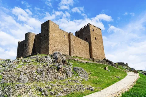
From its castle, of Muslim origin, you can see impressive panoramic views of the whole area, which is distinguished by its wide serrania, with an enormous natural and forest wealth. It is part of the Natural Park of the Sierras de Cazorla, Segura and Las Villas, the largest protected area in Spain.
This wonderful environment, its streets and historical corners make Segura de la Sierra has been declared a Historical-Artistic Set and Pintoresque Park.

Segura de la Sierra and its high peaks served to illuminate the best literature of the Renaissance, by the hand of Jorge Manrique, author of the "Cops to the death of my father."

Telecomunicaciones
Teléfono
953 480 280
Sitio web
www.seguradelasierra.es
Fax
953 481 012
Correo electrónico
administracion@seguradelasierra.es
Ubicación
Nombre
Segura de la Sierra
Latitud
38.298850
Longitud
-2.651870
Distrito
Ubicación en el mapa
POINT (-2.65187 38.29885)
Imágenes
imagen
Image
18670190-05e7-df1b-a17a-e92e0d671cef?t=1603979935869
Imagen principal
Desactivado
imagen
Image
despegue-el-yelmo-jpg
Imagen principal
Desactivado
imagen
Image
84676aeb-bfa8-a851-5550-3b4d15c74706?t=1621445408264
Imagen principal
Desactivado
imagen
Image
6fde7b00-3201-46c4-e6c3-528a9d11093d?t=1595353573804
Imagen principal
Desactivado
imagen
Image
a66e4f4c-435d-565a-2c1d-47799e04c4ce?t=1595353573833
Imagen principal
Desactivado
imagen
Image
4e21d820-8e51-89a4-0274-af8aeb2894f0?t=1621445408309
Imagen principal
Desactivado
imagen
Image
8668c55e-f4f0-0979-0f1b-fbd53f037c7e?t=1621445408354
Imagen principal
Desactivado
imagen
Image
78496ace-41be-4e6a-cd26-a6097356a63d?t=1621445408397
Imagen principal
Desactivado
imagen
Image
d1c73291-0577-d6d3-7c68-b4cea6f8ac35?t=1595353574079
Imagen principal
Desactivado
imagen
Image
5a350abd-951a-6543-e791-3a83e2a39938?t=1621445408446
Imagen principal
Desactivado
imagen
Image
307ca2fa-ccf4-8ce0-302a-896577682bb1?t=1595353574160
Imagen principal
Desactivado
imagen
Image
4d621b1f-d10e-8b22-6bc0-9c2c2c218615?t=1621445408494
Imagen principal
Desactivado
imagen
Image
b5bce32c-dbd5-c32b-b191-af98ea79ea34?t=1621445408543
Imagen principal
Desactivado
imagen
Image
aeb6f7e7-dfc2-de87-6f7f-daaaadba363b?t=1621445408593
Imagen principal
Desactivado
imagen
Image
49a44de3-3e7c-ef37-cfb0-56a999ea436d?t=1602789076574
Imagen principal
Desactivado
Información adicional
Imágenes cabecera
imagen
Image
segura-de-la-sierra1-jpg
Imagen principal
Desactivado
Datos de interés

Tourist area: Serras de Cazorla, Segura and the Villas
Distance to the capital (km): 160
Altitude over sea level (m): 1145
Extension (Km2): 224
Number of inhabitants: 1986
Gentillo: Segureños
Postal code: 23379

Videos
Video file
Cultura

The villa offers the physiognomy of past times, preserving its steep and silent streets. From its rich and varied heritage, we highlight:

  • Castle.Of Mudejar origin, eternal vigil located in the highest of the village and surrounded by an old wall that still retains some turreons. The tower of tribute, which reaches 18.50 m in height and from which you can see impressive panoramic views of the Segura saw. Inside the castle we find: chapel, adarves, covered with wood and roofed in two waters, aljibe and Arab baths.
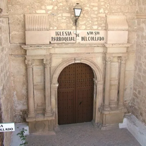
  • Parish Church of Saint Mary of the Collado. It was built in the 16th century on the site of the old Romanesque temple. The Napoleonic troops set it on fire and would be restored between 1814 and 1817. Its only ship is rectangular and of vaulted roof. On the outside, his tower built with masonry. With a quadrangular plant, it has its first body with a flask and a second body covered with an octagonal pyramid on which a forged iron cross goes. He has accumulated a rich religious iconography during his history.
  • City Hall. Other Renaissance paradigm, old house of the Society of Jesus. It opens with an arched arch of highlighted keys, to which they flank crate pilastras and dotal column. The second body is embellished by a curved balcony, a triangular fronton decorated with tacos and noble oval shields with plucked helmets.
  • Imperial source. A monument that reflects the transition between the Gothic and the Renaissance. It is built in front of the church and dates from the year 1517. Presents a large fronton divided into three streets separated by Ionian columns. A large shield with the weapons of Carlos V. is displayed on the central street
  • Casa de Jorge Manrique. The façade has a half-point arch decorated with vegetable motifs, flanked by crate pilasters and complemented by small Ionian columns. The nobility shield of arms of the Figueroa, the mother family of Jorge Manrique, was carved in stone.
  • Church of the Jesuit. It is built in the last quarter of the 16th century. It has Renaissance decoration, with a half-point arch with reliefs of the apostles. This building has now been remodeled and turned into an event and exhibition room.
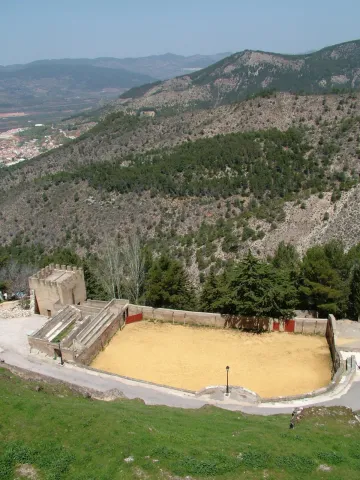
  • Bull's Square. It is located on the outskirts of the village in the old courtyard of weapons and chivalry. It's one of the oldest and most curious, being quadrangular.
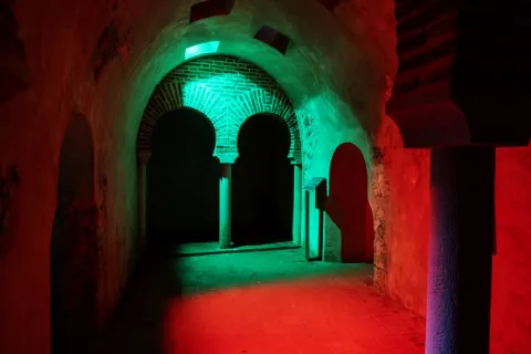
  • Arab baths (hammam). Used not only for hygiene and toilet, but also as social assembly centres. They were used by both men and women, but at different times. They consist of three longitudinal ships, corresponding to thecold room, the most external,tempered and hot, the innermost. They were tied with double horseshoe arch and canyon vault with skylights. It is estimated to be built between the 11th and 12th centuries.
  • Wraith and defense. Many sections of the local walls can still be observed. One of the best preserved is the water tower, It is called that because its mission was to protect a water spring that supplied the plateau. Other still preserved are: The Era tower, the School tower and the Snow well. The latter space was used to store water and snow during the winter period and then to use them through drains that existed at the bottom.
  • Access doors. The way to access the Segura de la Sierra fortification was 4 doors: The New, the Gontar, the Catena and the Orcera.


Naturaleza

Segura de la Sierra is located in the center of the mountains to which it gives name, the entire municipal term is part of the PN Sierras de Cazorla, Segura and the Villas.

The flora, when there is such a great difference in height in the municipal term, it is different: high mountainLet's find the pino laricio, flexible and resin-rich wood, and lacquer; half mountain live the black pine, whose wood is very resistant to rot and can reach 45 m in height and tejoof slow growth, but of a longevity that can reach the age of 5,000; low mountainthe Pine carrasco, complaining, melojo oak, the oak, the oak, the coscoja, olive and other endemic and aromatic plants.

The fauna is also, like the flora, very diverse. So, we'll meet. Rapist birds and scavengers(eagles, lethand vultures, alimoche vultures...), animals of major game(deer, muflon, gamo, boar...) and minor hunting (perdiz, rabbit, hares, crow, crows, tortoises, doves and foxes).

They also live in various species of fish, like trout, barbo, boga, etc., andmammals,Like bat, mountain cat, chickenpox, badger, otter, fox and gin.

An area with enormous natural and forest wealth, place to feel that nature is alive.
 

Fiestas y Eventos

The Segureños celebrate the following parties:

  • Patrons of the Virgin of the Rosary. They have a place of 4-8 Octoberand are celebrated in honor of the patron. On the 8th the most emotional act takes place: the procession of the Virgin on the shoulders of the women of Segura. During these days there are taurine celebrations, which are held in the peculiar square of quadrangular bulls, and serrano bolus competitions.
  • Saint Vincent. It is the patron saint of the town and is celebrated the January 22. In his honor fire is on in the extramides of the villa. It is a custom that is very rooted in the saw that the winter festivities turn on "Luminaires"(bonfires). This is the day of" La Pura "(8 December), in Saint Lucia (13 December), Christmas Eve, New Year's Eve, San Antón (17 January), in San Vicente (22 January) and ending at the Candelaria (2 February).
  • Romeria de San Isidro. It is the pattern of the New cuts, the most important pedany of the many that Segura has. It is held in the area of the Lomilla, by the village The Ojuelo.
Gastronomía

The gastronomy of Segura de la Sierra is rich and full of tradition, has been able to combine the agricultural customs with those of the pastors or those dedicated to the works of the wood, carried out by the cut of pine trees in this saw.

The diversity of the dishes that we find in the town is characterized by the use of the products we find in the area: olive oil, mountain meat in hunting season (boar, perdiz, rabbit, soybean sheep) and, in concrete seasons, mushrooms and niscalos (guízcanos) or asparagus that are so well given in the saw.

  • Galians, bread cakes, rabbit and spices.
  • Andrajoswith flour, meat and spices.
  • The Migasof bread, to which is added chorizo, torrezos...
  • The Gachamita, flour and potato that is accompanied by all kinds of dressing, both sweet and salty.
  • Lamb to the young shepherd, pastoralist chard, lamb in cabañil garlicIn all these dishes, the base is the same: the following sheep's meat.
  • Pisto gandul, made of goat, lamb or rabbit and is to then consume in fairs or evenings. Hence the name of the gangul.
  • Cecinaof sheep's or goat's meat that has been cured.
  • Ajopringueis consumed in the massacres and is made with the pig liver It's a bit.

In pastry, the bake, a dessert of oil cake that carries a hard egg in the middle.

Historia

The history of the term Segura de la Sierra dates back to the 4th millennium BC, according to the many archaeological sites that testify to the human presence in those times.

Very close to the city centre is the settlement called The Old Onea few kilometres from the village of Moralejos and that it has always been attributed to peoples as Iberians and Phoenicians, being later the scene of wars between Romans and Carthaginians.

But it is, no doubt, with the Islamic people (781) when the population they call Saqura lived the golden era as a strong square in the area. In the 9th and 10th centuriesAfter the collapse of the Cordoba caliphate, Segura de la Sierra has several periods of independence that make it important.

It will be conquered by the Christian troops, becoming dependent on the Order of Santiago by the donation of Alfonso VIII. In 1243, with King Fernando III, he passed to the crown of Castile and within the kingdom of Murcia until 1833, the year in which the current province of Jaén was created.

In 1517, after the visit by Carlos I to the square, the fountain is built in his honor. A Renaissance source, though clearly of transition. In 16th century had a a time of great splendor, provided by the large amount of wood produced in its territory and which, transported by the Guadalquivir River, supplied all of Andalusia.

In 18th century, the State has converted the saw, under the name of saw of Segura, Maritime Province, No doubt you need wood for the construction of your ships. The Napoleonic invasion (1810) turned the population into a huge stake, destroying the files and taking part of its history.

illustrious characters:

  • Jorge Manrique (1440-1479), a Spanish poet and author of "Cops for my father's death," considered one of the capital works of Spanish literature. The origin of his birth is discussed with Paredes de Nava (Palencia)
Otra información

We want to place on record two traditions that are very deep-rooted in Segura de la Sierra:

  • The serrana jack. Of the popular dances of Segura de la Sierra, no doubt, the serrana jota is the one with the greatest personality. It is interpreted alone or with whole or half-ways, usually, in popular parties.
  • Via living crucis. It is interpreted by the neighbors of the village and is developed in different places of the town, with excellent views of the Segura saw.
     
Loading map
Preparing points of interest and routes...
Imagen principal
imagen
Image
53a920a5-6491-8831-30ac-3d989e48192e?t=1603979644641
Imagen principal
Activado
Literatura

This town may have been the birthplace of the warrior-poet, since his father was Commander of Segura de la Sierra, the most important commandery of the Order of Santiago. In fact, the Manrique family home is still preserved today.

Segura de la Sierra pays tribute to the poet not only by marking the Manrique family home, but also by building part of its tourism offer around Jorge Manrique, dedicating several rooms of the castle to interpretation spaces devoted both to the poet and to the Order of Santiago.Segura de la Sierra also pays tribute to the illustrious writer with a statue-monument and with a magnificent viewpoint offering sweeping views of the Natural Park from the village itself.

The tribute to Jorge Manrique culminates with the biennial Jornadas Manriqueñas, an event combining academic and leisure activities as a way of honouring this illustrious figure.

Santa Elena

Submitted by brandcode_deweloper on
Id
750455
Perfil de redes sociales
Facebook
https://www.facebook.com/AyuntSantaElena/
Twitter
https://twitter.com/santaelenajaen
Youtube
https://www.youtube.com/user/santaelenajaen
Descripción
Breve descripción

Nice town, located in the northernmost area of the Sierra Morena regionnext to the provincial border with Ciudad Real.

The northern part of its term is found within the Natural Park of Despeñapores and its geographical position makes it the greatest point of passage between Andalusia and the plateau so it receives the nickname "Puerta de Andalucía. "

It is one of the few municipalities with little agricultural interest, only 1% of its term is cultivated land.

Its economy is based mainly on the exploitation of the mountain, among which the forest, cynegetic, mushroom collection and livestock, usually cattle. The passage of the motorway of Andalusia has developed a relevant hotel offer.

It has two nests: Miranda del Rey and Venta Nueva.

From its historical heritage we highlight the St. Helena Parish Church, Iberian Shrine of the Collado de los Jardines, Urban Helmets and Rupestrian Paints in St. Helena.

Telecomunicaciones
Teléfono
953 664 010
Sitio web
www.santaelena.es
Fax
953 664 253
Correo electrónico
santaelenajaen@gmail.com
Ubicación
Nombre
Santa Elena
Latitud
38.340230
Longitud
-3.539800
Distrito
Municipio
Ubicación en el mapa
POINT (-3.5398 38.34023)
Imágenes
imagen
Image
56f3a98d-b73d-3f55-8527-4d32fc56ae8f?t=1621425534983
Imagen principal
Desactivado
imagen
Image
e0fb7c79-3e7f-346a-cc16-3c8006bb9462?t=1610986998582
Imagen principal
Desactivado
imagen
Image
3429e098-1c49-2cdf-4ef5-179be64fce14?t=1621425535119
Imagen principal
Desactivado
imagen
Image
4e91cd6e-bea0-d427-df82-939c7ce7f23c?t=1621425535162
Imagen principal
Desactivado
imagen
Image
10c50cba-ee4b-ebcf-0e3e-0d11e8e97728?t=1621425535219
Imagen principal
Desactivado
imagen
Image
0c44f832-9d15-336d-b8e7-72044fea6e76?t=1610986998629
Imagen principal
Desactivado
imagen
Image
b5682c3b-4bf3-f730-fe45-52d0391f170c?t=1621425535421
Imagen principal
Desactivado
imagen
Image
78ede978-44df-d8c2-c363-f10c79bea024?t=1621425535584
Imagen principal
Desactivado
Información adicional
Curiosidades

OFICINAS DE INFORMACIÓN Centro de Visitantes LLANO DE LAS AMÉRICAS

  • Autovía A4, salida 257. Ctra. Miranda del Rey, Km. 2   
  • (Abierto de jueves a domingo)
  • Tfno.: 610 282 531
  • Email: puertanatura@hotmail.com
Imágenes cabecera
imagen
Image
Santa Elena
Imagen principal
Desactivado
Datos de interés

Tourist area: Sierra Morena / Despeñacolos

Distance to the capital (km): 78

Altitude over sea level (m): 742

Extension (Km2): 144

Number of inhabitants: 1,003

Gentilicon: Santaeleneros

Postal code: 23213

Videos
Video file
Cultura
  • St. Helena Parish Church: It was erected in 1793 on an ancient medieval hermitage, which had been raised to commemorate the Christian victory in the battle of the Navas de Tolosa, which had these sites on stage and to guard the Cross to which the miracle was attributed. Built of redesigned and painted masonry, with a simple facade, of small dimensions. A staircase stands out the access door, composed of a half-point arch on imposts, flanked by Tuscan pillars that give way to an inlet finished with triangular fronton and two bones, one on each side. On the top of the first body, the pyramidal structure is raised to three levels, with pinacles at the ends and half-point holes for bells. Inside it is a single drawer ship, covered with a half-canyon vault and double lunetes on the sides. The presbyterium is opened with a spinal arch, covered with an arista vault and illuminated with two large bone-shaped windows. The header is presided over by the image of its patron saint, St. Helena, between dogrous columns that support an injunction and a curved fronton. It was remodeled in 2001.
  • Iberian Shrine of the Collado de los Jardines: It is located in the heart of Sierra Morena Oriental, on the most important traditional road of communication between Alta Andalucía and the Plateau. For the Iberian shrines they chose places, usually caves, located next to springs and forests, where it was thought that the divinity lived and where the faithful went to worship, pray and deliver offerings to their divinities. These offerings were what we know as "exvotes," small statues, between eight and twenty cm, made of bronze, stone or mud. In Iberian Shrine of the Collado de los Jardines There have been many exvotes, most of them bronze, representing men and women offering, priests, warriors and objects. It is part of the whole town that was excavated on the hill adjacent to the castle, where a wall, a sacred enclosure and a cast of metal exvotes have appeared. We meet before one of the three great Iberian shrines of the peninsula.
  • St. Helena's Urban Helmets:Given its geographical location, a forced passage between the plateau and Andalusia, has experienced many historical events. The Battle of the Navas de Tolosa in 1212 in which King Alfonso VIII of Castile defeated the Almohades. To commemorate this battle, a hermitage was erected in honor of the Empress St. Helena, who would later name this place and the new population, which King Charles III founded in 1767. In the colonizing urbanism of Sierra Morena, the most important element is the large rectangular square, from which they leave streets on each side and where are the important buildings, such as the Church, the City Hall and the posite of Diezmos and Labradores. The rest of the town is organized from the Plaza. The streets are dominated by axial perspectives, houses of the same height and proportions, reticular fabric and geometric structure. It only deviates from the neoclassical model on its perimeter, to adapt to the road. It has been declared Good for Cultural Interest.

  • Rupestrian Paints: The province of Jaén has more than forty points with rock paintings, declared World Heritage Sitewithin the whole Mediterranean arc. Some of them are found in St. Helena with exceptional testimonies of schematic and seminaturalist paintings, located in coats of the area, including those of the Cave of the Cows of the Retamoso in the area of the bodies, Cave of the Holy, the Cave of the Schools and some more.
  • Mining Heritage. The landscape of ancient mines and Mediterranean mountains of the former Minero District extends to eight municipalities: Linares, La Carolina, Bailén, Baños de la Encina, Vilches, Guarroman, Santa Elena and Carboneros. This mining activity has left in these municipalities an exceptional concentration of remains, unique vestiges in the world and representative of the industrial revolution in the 19th century.
Naturaleza

St. Helena is located in the northernmost sector of the northern region, next to the border with the province of Ciudad Real.

It is of the few municipalities of the province without agricultural vocation, only 1% of the total area. So its economy is based on development of the mountainincluding forest, cicnetic, mushroom collection and livestock (cattle).

The passage of the highway of Andalusia through the municipality has developed in the town a certain hotel offer of importance.

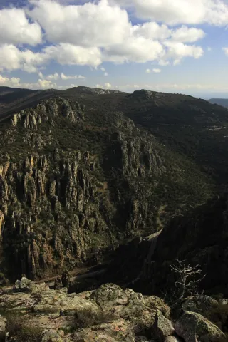
By its term the rivers run Caraway and Bell.The northern part of the municipality of St. Helena belongs to the Natural Park of Despeñacolos, of great landscape, faunistic and botanical interest.

The Park includes, among others:

  • Place of the bodies, declared a Natural Monument of Andalusia. A place where a set of huge rock columns that resemble the tubes of the organ of a cathedral. Increases the beauty of this place the chromatic contrast of the grey of the coas with the intense yellow and orange of the different species of lichens that survive in them. On these rocks, oaks, alcornoques and shrubs form a Mediterranean forest in which they inhabit ginets, chickpeas and numerous rapacious birds.
  • Embryo de los Organos: It is an affront place that was inhabited from very old, as shown by the rock paintings found. From here we can discover the pineapples of repopulation (carrascos, black, pineapples), sodas of alcornoques, complaints, oaks and madroños.
  • The Empedraillo: These are the interesting remains of a small section of the Roman road that unites Catulo (Linares) and the Galena mines of El Centenillo with Toledo.
  • Quejigal del Collado de los Jardines: Also located in the Natural Park of Despeñacolos, its biodiversity stands out. In the plant species we find complaints, alcornoques, maples and other species typical of the Mediterranean forest. With regard to the faunistic species that inhabit this place quote the wolf, lince, the otter, imperial eagle, royal eagle and azor.

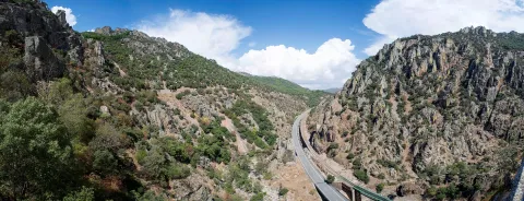
If anything characterizes Despeñacolos are their unique geological formations. The Despeñapoerno de Despeñaperes, with 4 km of extension is the product of the erosion of the stream of the same name on a natural failure of the Iberian Macizo and the main means of communication between Castilla La Mancha and the lower lands of the Guadalquivir valley.

Fiestas y Eventos
  • Sunday of Resurrection: From the Central European settlers who came in the 18th century, only the tradition of painting cooked eggs, which are eaten in the area of La Aliseda, is left. Before you have to meet the rite of making them roll by a earring of grass so they don't break. This has meant that, in St. Helena, the feast of this very well-known day is known as Rolaeggs.
  • Romeria de San Isidro: On May 15, the neighbors of St. Helena accompanied San Isidro, in gilded carrots for that party until the site of The Aliseda. In this place, of incomparable beauty, a mass is held in honor of the Holy and a whole day of field is spent.
  • Patron parties: In honor of their patron saint St. Helena, parties are held between 17 and 21 August. During all these days there are many and varied leisure and sports activities. On the 17th, with the traditional repeat of bells, the beginning of the parties is announced and the three rocket warnings indicate the beginning of the cobblestones in the streets of the town. In the afternoon, taurino show. We arrived at 18 August, big day. In the morning Mass in honor of the Holy and invitation to all attendees in one of the houses. At night, the most important event of the whole fair that is the procession of the Patronthat accompanied by a music band runs through the streets of the village. On the 20th and 21st days, the morning and evening cobwebs and taurino festival return. The fair ends with a powerful haze on the 21st of the morning.
Gastronomía

St. Helena for its location in Sierra Morena is a very suitable place to take mountain meat, either from major game (deer, boar or gamo) or from small game (perdiz, rabbit or hare).

  • Andrajos: Made with a mass of flour (andrajo) that is cooked in a broth of hare meat with a saffrito of peppers and tomatoes flavoured with mint.
  • Pipirrana: Salad made from roasted peppers, olives, cooked eggs, tuna and olive oil.
  • Sage in salsa: It is made with deer meat, onion, tomato, flour, water, thyme, rosemary, peppers, olive oil and almonds.
  • Niselos al ajillo: Niscalos, olive oil, ham, garlic, parsley white wine and salt.
  • Tortilla Alfonso XIII: Made of eggs, ham, lamb kidneys, mushrooms, salt, fried tomato and olive oil.

Warehouse:

  • Sweet Gachas: With toast, hot milk or boiler honey, flour, sugar, cinnamon powder olive oil. They are preparing for the feast of All Saints.
  • Pestiños: They are made with olive oil, wine, dry spirits, sugar, cinnamon and flour.
  • Lis flower: Eggs, flour, milk, sugar and olive oil, salt and cinnamon or melted honey for irrigation.
  • Risol: A drink made with sweet anis, coffee, mejana and water.
Historia

The area has been occupied from prehistoric periodAs shown by the rock paintings located in the area's coats, with more than five thousand years old and declared a World Heritage Site in 1998.

In time of the Iberiansin the term of St. Helena was one of the most important centres of worship: Shrine of the Collado de los Jardineswhere many Iberian exvotes and the remains of what could have been a village have been located, not only in Iberian times but also in Roman and medieval times. The sanctuary also known as Cave of the Dolls has been used by the Romans for religious worship.

In the Age of Mediathe most important event is the Battle of the Navas de Tolosain 1212. The town is very close to it, in the vicinity is the Museum of the Battle de las Navas de Tolosa. The Almohade army was defeated and King Alfonso VIII of Castilla, ordered to build in the place a hermitage to guard the Cross to which they attributed the miracle of victory and a window-castle, to commemorate the triumph over the Almohades and that currently It is part of the Route of the Castles and the Battle.

In this same place in the 18th century, one of the New populations of Sierra Morena, project driven by the King Charles III. One of these populations is St. Helena. With the settlers, farmers from Centroeuropa (French, German and Flemish), efforts were made to establish a population and generate wealth in the depopulated areas of Sierra Morena while ensuring the passage of Despeñacolos.

In 1793, the population was in a ruinous state and it was King Charles IV who ordered it to demolish and build a new colonial type..

Otra información

It has recently been built in the municipal term, the Museum of the Battle of the Navas de Tolosa. The museum is one of the most interesting points on the route of the Castles and the Battle and is the starting point for the seventeen municipalities that make up this tourist product. Very close is the Iberian Sanctuary of La Cueva de los Muñecos and The "Llano de las Américas" Interpretation Center.

Loading map
Preparing points of interest and routes...
Imagen principal
imagen
Image
Santa Elena
Imagen principal
Activado

Sabiote

Submitted by brandcode_deweloper on
Id
750335
Perfil de redes sociales
Facebook
https://www.facebook.com/AyuntamientoSabiote/
Twitter
https://twitter.com/SabioteAyunt
Descripción
Breve descripción

Sabiote is a municipality in the centre of the province of Jaén, located in the region of La Loma and Las Villas, on the top of the inter-river plateau, bordered by the north by the Guadalimar River and the south by the Guadalquivir River.It is the third vertex of the call "La Loma Renaissance triangle," Chair of the best Renaissance along with Ubeda and Baeza.

It is also part of the widest "South Renaissance Route"along with Ubeda, Baeza, Canena and Villacarillo, a whole range of monuments, corners and places of the region with which it is intended to attract the interest of tourists.Walking through Sabiote is nice, as the entire villa has an excellent state of conservation. Their homes and their preserved and cobbled streets are splashed with blasphemed houses.

The economic base of the municipality agriculture of the olive tree, in the form of a monoculture as in the rest of the region. The crafts It also has implementation in the locality: articles made with sparto and palm, gardening made with leather and wool carpets.

The exploitation of its historical attractions is being enhanced to boost the attraction of tourism.

The best sample of the local architectural heritage is, no doubt, the Castle, which has its origin in an ancient Spanish-speaking alcazaba, which later, Mr Francisco de los Cobos, transformed into a Renaissance palace.

The parish church of San Pedro, a mixture of Gothic, plastic and Renaissance style; Hermitage of San Ginés de la Jaraof the 18th century and the Monastery of Carmelitas Descalzas of Renaissance ethyl.

Telecomunicaciones
Teléfono
953 773 002
Sitio web
www.sabiote.com
Fax
953 773 503
Ubicación
Nombre
Sabiote
Latitud
38.070120
Longitud
-3.309740
Municipio
Ubicación en el mapa
POINT (-3.30974 38.07012)
Imágenes
imagen
Image
75d4600b-20b5-6914-cb11-863b8e9bfb6c?t=1621358282523
Imagen principal
Desactivado
imagen
Image
898d58ff-f025-34e2-21e5-3806a8805773?t=1621358721532
Imagen principal
Desactivado
imagen
Image
071b9b26-8ccb-9642-ec42-2832066b9210?t=1621358721697
Imagen principal
Desactivado
imagen
Image
dacdacbe-d81f-539a-e826-17dea56944f3?t=1621358282578
Imagen principal
Desactivado
imagen
Image
ffa72b86-f7d5-9dd1-f0fa-034389cb7f22?t=1621358721746
Imagen principal
Desactivado
imagen
Image
6573dcf7-4b5e-9f6e-45a3-4919d96eaf83?t=1585842724448
Imagen principal
Desactivado
imagen
Image
3eeff34b-f2d1-a061-0424-a93bf0e083cc?t=1627996237182
Imagen principal
Desactivado
imagen
Image
ae0f9b59-9086-4bb0-7307-05de12e62bd4?t=1621358282756
Imagen principal
Desactivado
imagen
Image
d2a39c8f-945d-8fe9-3b46-a7786229e5d8?t=1621358282806
Imagen principal
Desactivado
imagen
Image
c9db30f7-6ee4-738d-b3e6-2193bea160df?t=1621358282866
Imagen principal
Desactivado
imagen
Image
73b43b3e-6187-c512-d2fe-7636bb7c4286?t=1621358282919
Imagen principal
Desactivado
Información adicional
Imágenes cabecera
imagen
Image
Sabiote
Imagen principal
Desactivado
Datos de interés

Tourist area: Ubeda / Baeza
Distance to the capital (km): 64
Altitude over sea level (m): 840
Extension (km ²): 112
Number of inhabitants: 4,302
Gentillo: Sabioteños
Postal code: 23410

Videos
Video file
Cultura

In general the villa has an excellent state of conservation, so when walking through its streets it easily transports us to preterito times.

The views from the walls or from the viewpoints are truly spectacular. Among the most prominent monuments are:

  • Sabiote Castle. It was built on 13th century, Although this hill must have been a fortified place in all previous civilizations. The ancient Muslim alcazar is placed on a small mound, where it rises its signage door preceded by a pits. The current appearance of strong walls and elegant and imposing bastion is due to the reconstruction in the 16th century, Mr Francisco de los Cobos, Secretary of Carlos V., The reform was carried out by Andrés de Vandelvira and is inspired by the Italian Renaissance fortifications. Unfortunately it was Flying by the Napoleonic troops, so internally there is only one outline of what was an outstanding work of art. It has an accused military character. Its great Renaissance facade of silery and quarry, as well as the large pentagonal towers, stands out. declared Good of Cultural Interest since 1931 and its walled enclosure Historical-Artistic Set in 1972..
  • Parish Church of San Pedro. The perspective it offers is oversized for a parish temple. Reconstructed in the 16th century, with a drawing of Alonso Barba, disciple of Vandelvira. The North cover It's style. isabelin Gothicbut in the south, or Puerta del Sol, the protoplatereco. A large corner arch holds all the weight of the monument in that southern part. Your magnificent tower is striking.
  • The wall. That until just over a century ago surrounded the villa in its entirety. They stand its two-thirds share, as well as two of the six doors, that of the Saints and that of Granada, plus the arch opened in the 19th century.
  • Convent of Barefoot Carmelites. This convent recalls the presence in La Loma de San Juan de la Cruz. It was founded on 1584 by Francisco de los Cobos and his wife, Maria de Mendoza. With a Renaissance style, it has a beautiful cloister with half-point arches and dórica columns. This cloister was designed by Alonso de Vandelvira and Luna, "Architect Mayor de Sabiote," in 1586. The church, under the title of St. Mary, was built on an earlier Romanesque. Inside it is preserved the high chorus grille, the large wooden beam that holds it and at its extremes it is viscated with angels and the shield of the Order of Carmelites. It is believed that the cover of the temple is due to the great Alonso of Vandelvira. The City Council has now rehabilitated it as a House of Culture.

  • Hermitage of San Ginés. Apart from the historical core, it is dedicated to the pattern of the villa. It was built in the 18th century. It has a half-point and triangular front cover.
  • Barrio del Albaicín. Of the different neighborhoods that make up the urban town, this is the one that best preserves the taste of the past, that of the old neighborhood where the streets are of pebbles worn out by hundreds of years of traffic, of gone and coming, where each house has its own history.
Naturaleza

Sabiote with an extension of 112 km2 and at an average altitude of 840 m. on the sea level, it is on the top of the plateau of La Loma, framed by the Guadalimar River to the north, and by the Guadalquivir River to the south.

The view that offers us its term is typical "olive seas " that in a soft way, both on the north and south slopes, they go down until they find the valleys of the Guadalimar and Guadalquivir rivers, to the north and to the south, respectively.

From the urban centre panoramic that are visible are spectacular: to the north the foothills of Sierra Morena, to the south Magina saw and the depression of Guadalquivir, and to the east the Serras of Cazorla, Segura and Las Villas.

But in addition to this great framework in which it is located, Sabiote has places of special interest, including:

  • Cañada Real del Paso, recreational area just 3 km. of the town of the town.
  • The Source of the Corridor. It is a natural mushroom of great beauty with a natural waterfall and a cave in the vicinity.
  • The Source of HealthIt's his stalactites and the birth of a stream.
  • Olvera's jump, a water jump over the Guadalimar River, where we can practice the fishing of the barb.

The Sabioteños the plant resources which offers them the ground to maintain some traditional activities. We can still find samples of the craft made with spartum and palmand the most traditional gardening made of leather and wool carpets.

Sabiote, in the shadow of Ubeda can go unnoticed, but we have already seen that it is a town with a historical-artistic heritage and a natural heritage that makes it a worthy representative of the most characteristic of the region of La Loma Fuck you.

Fiestas y Eventos
  • Holy Week. When Holy Week comes, Sabiote, he takes his works of religious art to the streets to commemorate the Passion of Christ. Its origins start in the 16th century when the first cofradies were created, Our Father Jesus Nazarene, Our Lady of Soledad and that of the Most Holy Christ of the Exhibition. An assistance that is increasing over the years, both for the quality and value of the sizes and for the bands of music, which are dressed in nazarene perform process marches.
  • San Ginés, whose celebration dates back to the times of Fernando III. They take place between 22 to 26 August. The day 25, day of the Patron, the image of the Saint Gines is processed from the church of St. Peter the Apostle to the hermitage that bears his name. At the end of the procession, the traditional auction of the threads takes place. As a farewell to the parties, a pyromuscular show is held.
  • Horse racing. On the occasion of the Festivals of the Virgin of the Star (May 1) The Middle Ages-style horse races are developed. The races take place on the football field and are held at 12 in the morning and 6 in the afternoon.
  • The bulls. The Taurin tradition of this town dates back to the 16th century, celebrated in portable squares until 1914, Sunday of Resurrection, the day on which the fixed bullring was opened. The day 24 August, local copattern party, is the Main Taurin Day. The first swords of the tauromaquia have passed through this square.
  • The fire of Saint Anton, January 17. The day begins with a religious feast attended by farmers, farmers, craftsmen and the Big Brother. At the end of the Mass the procession of the saint through the streets of the town. At the end of the procession, the Big Brother offers a refreshment to the attendees. In the afternoon the traditional fires where smoke cigarettes of matalahuga and eat chickpeas.
  • Virgin of the StarMay 1. She's the patron of Sabiote. In the early morning of this day she is processed on the streets. In the Rosary of the Aurora it is moved to the hermitage of San Ginés, where the Eucharist is celebrated, the Maya are sung and the traditional one is offered to the faithful charity of bread and oil, green beans and wine. In the afternoon, after the prayer of the Rosary, Our Patron is processed until the parish done will remain during the month of May for the offering of flowers, being returned to his sanctuary on the last Sunday of May.
  • The Virgin of the Head. The Sabiote Brotherhood is one of the oldest to attend the Romany.
  • La Candelariaon February 2.
  • San Isidro Labrador, patron of farmers who exhibit their machinery.
  • Santa Rita, on May 22, although the hermitage of this saint is in the jurisdiction of Villacarillo.
  • Corpus Christi.
  • Carnival.
Gastronomía

This town has a wide variety of traditional dishes and some with clear reminiscent of the civilizations that have been on these lands. Among the dishes with the most roots in the population, we highlight:

  • "Andrajos": cooked in the broth of boiling minor game pieces with peppermint and a saffrito of vegetables and strips of flour made of jirones that take the name of "talarines."
  • "Ajoharina": A saffrito is made with tomato, onion, potato and eggplant. In the frying pan, dry red peppers are tasted, once toast is crushed in the mortar with cumins and salt. When everything is ready, water is added and at the end flour is to be weighed.
  • "Bread migas." They are accompanied by chorizo, torreznos, rabanillos, olives, and fruits like grapes or melon.
  • "Hare hair soup." That's what the tomato soup is called.
  • "Sabioteña Salad." It has cucumber, melon, orange, tomato seasoned with olive oil, chopped garlic, oregano, salt and vinegar.
  • "gazpachos salad." The aquasal, oil and vinegar are added with chopped onion and toast.
  • "Stand up." It is a modest spicy dish of La Loma that is made with saffrito of vegetables, trimmed with flour, toast and colored with pimenton.

Among the daily dishes are:

  • "Muchero," The one who in Sabiote is called "widower" when he has no meat.
  • Cortiser riceIn addition to the dressing, it only has a few chopped potatoes.
  • Eggplant tortilla.
  • Panets: are meatballs made with bread miga and unscratched cod pieces.

From the sweetness stand out:

  • Roscos de San Ginés. They are deposited in the ways of the saint when he moves to his hermitage, auctioning himself at the end of the procession.
  • "Whites."Of Morisca tradition, it is a mass of oil, flour, egg, and covered with a fragile layer of sugar, egg clear and a lemon chorreon, then taking a solid consistency the white or white bath.
  • Other: drunks, buds, cinnamon and powder.
Historia

It is likely that first settlements daten of the Copper Age, and they would be located in the fertile lands by the Guadalimar River. These settlements are characterized by being watertight settlements, establishing platforms on which the houses would be located, with stone sockets. Remains of these settlements have been found in the area called "The Coward" and "Cerro de la Mula."

We will no longer have any information until the end of the Iberian stage, between the 2nd and 1st centuries. C., where we find a town on the flat on the site "Avenazar's Cortijo," on a terrace of the Guadalimar with 20 or 30 houses.

In the Roman era, the first century, the population is occupied by the small peasants, known as villas.

With the Muslim era, centuries VIII - X, the strategic situation of being on the hill would lead to a "hisn," a shelter, to which the occupants of the houses would come in case of danger. This core would be fortified in the ninth century.

This settlement would be conquered by Fernando IIIbetween 1227 and 1229, and that years later, his son, Alfonso X, to the Order of Calatravawhich would strengthen medieval fortification, to which it would belong until the early 16th century. The Military Order would sell the villa with its land to Francisco de los Cobos, Secretary of Charles V, and after his son Philip II. At this time the castle would be reformed to make it a palace.

The Napoleonic troops when Sabiote left, 1808They would fly the interior of the palace.

As of this date, stability is reflected in the population increase from Sabiote, which at the beginning of the 20th century already had with 7,000 inhabitants. A population that lives from agriculture, mainly from cereal and vineyard cultivation. It will be from the last century when we begin to replace the cultivation of the cereal with that of the olive tree.

The social convulsions of the first half of the 20th century, as well as the Civil War and the emigration to the provincial capitals or industrial areas, will be the causes of population loss to reach 4,302 inhabitants at present.

Loading map
Preparing points of interest and routes...
Imagen principal
imagen
Image
Sabiote
Imagen principal
Activado

Porcuna

Submitted by brandcode_deweloper on
Id
749735
Perfil de redes sociales
Facebook
https://www.facebook.com/AyuntamientoDePorcuna/
Twitter
https://twitter.com/aytoporcuna
Instagram
https://www.instagram.com/ayuntamientoporcuna/
Descripción
Breve descripción

Among large plains of green olive trees is a noble atalaya in which is found Porcra, a universe in stone carved through its six thousand years of history.

Canteros of all times recorded in their walls the mark of an illustrious past, leaving for eternity the echo of their master's. In it the sculptural set of Cerrillo Blanco was modeled; the solid foundations of the Roman Obulco were raised; it served as the custody of an Andalusian bulwark and was the site of matres and calatraves.

Its golden stone carved by hand looks majestic in monuments and squares that open to the astonishment of those who contemplate it.

Our earth, changing in appearance, but unchanging spirit, has traveled through time wrapped in names that narrate the same essence: Ipolca, Obulco, Bulkuna... Porcella.

Today, Porcilla invites you to enter into its charms, to lose you through its serene streets, to feel the closeness of its people and to taste, without haste, the truth of its gastronomy. Because here, every stone tells a story and every story awaits you.

Telecomunicaciones
Teléfono
953 544 004
Sitio web
www.porcuna.es
Fax
953 544 606
Correo electrónico
ayuntamiento@porcuna.es
Ubicación
Nombre
Porcuna
Latitud
37.871140
Longitud
-4.183990
Distrito
Municipio
Ubicación en el mapa
POINT (-4.18399 37.87114)
Imágenes
imagen
Image
img_5364-jpg
Imagen principal
Desactivado
imagen
Image
2531-0120-1-jpg
Imagen principal
Desactivado
imagen
Image
2438-1439-jpg
Imagen principal
Desactivado
imagen
Image
_mg_3740-jpg
Imagen principal
Desactivado
imagen
Image
img_9531b-jpg
Imagen principal
Desactivado
imagen
Image
2241-0082-jpg
Imagen principal
Desactivado
imagen
Image
04-1-jpg
Imagen principal
Desactivado
imagen
Image
img_7925-jpg
Imagen principal
Desactivado
imagen
Image
02-1-jpg
Imagen principal
Desactivado
imagen
Image
img_6720-2-jpg
Imagen principal
Desactivado
imagen
Image
foto-parroquia-jpg
Imagen principal
Desactivado
imagen
Image
img_9364-jpg
Imagen principal
Desactivado
imagen
Image
1657-0934-jpg
Imagen principal
Desactivado
Información adicional
Curiosidades

Oficina de Información Turística

Plaza de Andalucía, 3

Tlf.: 953 545 130

oficinaturismo@porcuna.es


Imágenes cabecera
imagen
Image
Porcuna
Imagen principal
Desactivado
Datos de interés

Tourist area: Sierra Sur and Campiña de Jaén

Distance to the capital (km): 42

Altitude over sea level (m): 427

Extension (km ²): 174.5

Number of inhabitants: 7,055

Gentilicon: Porcunenses

Postal code: 23790

Videos
Video file
Cultura

Ibero site of White Crow

The pale tone of its rocks gives meaning to the name of this small hill located two and a half kilometres from the urban core of Porcra: White Crow.

Archeologically involved during the 1970s of the last century, the process of human use of the field is delimited in three moments.

First, during the tartesic period, there is a distinction between an inhumation necropolis dated around the 7th century BC. There are twenty-four individual graves and a double-chamber grave.

From a second epoch, around the 5th century BC, is the largest Iberian sculptural ensemble of the national territory. A thousand three hundred fragments among which are more than thirty sculptures. The warrior of double armor, symbol by anthonomasia of the Iberian world in general, stands out.

Finally, necropolis continued to be used for such purposes from the 5th century BC to the 1st century BC, changing the first rite of imhumation to the rite of incineration.

Roman Amphitheatre of Obulco

The Roman Amphitheatre of Obulco was one of the largest show buildings of the Roman Hispania, an example of the enormous magnitude of the ancient Ibolca-Obulco police. It was the largest of the cities of the Protohistoric and Roman Iberia in the time of Julius Caesar.

This amphitheater shows the imposing archaeological reality of Municipality Pontificensis Obulconensis in the 1st century BC, when it was raised about five hundred meters from the walls.

After the last great intervention of this colossal amphitheatre, its monumental remains, of more than one hectare of surface, have been managed to size and integrate in harmony with the existing neighborhood, allowing its visitors to walk through a large section of the southern façade with its imposing counterstrong of piled chairs in the Hellenistic style, see the doors and volitories, the outer access routes and the large falls of cyclopeia blocks, then be able to enter the cavies or steps, and come down from the wall of the podium to the space of the sand and carcerwhere to appreciate the dimensions and panorama that the old gladiators who fought in the seaweed or games.

Cisterna Romana de La Calderona

The Roman Cistera de La Calderona is a colossal underground hydraulic complex of the Pontifical Municipality of Obulco, intended to store water, which has been in use for more than two millennia and has arrived to this day in exceptional state of conservation.

It was accidentally rediscovered by one of the neighbors of the three contemporary houses that are available over it and intended for air-raid in the Spanish War of 1936. It was originally a large public water tank with several years of rainwater collection and three catchment wells.

The project has been completed by building a contemporary building of access through ramps to the complex and with the excavation of approximately 500 m ² of the large Roman neighborhood of the poniente, where part of a cross-sectional enlisted street have been exhumed, three houses organized around patios, a shop and a butcher-carnage, which allow to qualify this block of the neighborhood as a handicraft and commercial sector of the city.

Boabdil Tower

In an era of invasions and conquests, during the Middle Ages, two names express the same reality. The Muslim Bulkūna and the Christian Porcella live together and share the same territory.

On the remains of an Andalusian bulwark, which in turn was erected on Roman vestiges, the Castle of Porcra is fortified with new defenses to become a Christian alcazar.

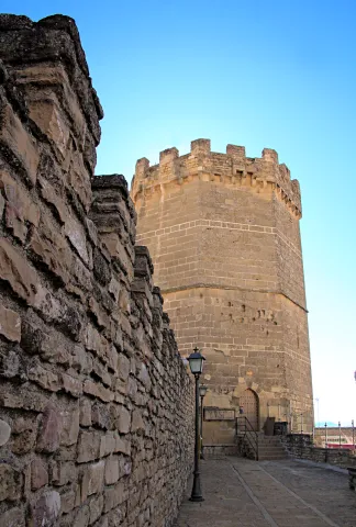
Ten are the towers that make up the castle's walled enclosure and one of them, the last to be built, which is maintained until today. The New Tower was raised during the first half of the 15th century by the precept of the Calatravo gentleman Don Luis de Guzmán.

It is also called the Tower of Boabdil for what happened in 1483 when the last sultanate of the Nazarí Kingdom of Granada, Boabdil, was taken as a prisoner to that tower after being arrested in the Battle of Lucena.

The tower is octagonal base, is 28 meters high and has an ochavada shape. Its interior, of two floors and a terrace, will house the medieval rooms of the Archaeological Museum Municipal Obulco.

Church of Santa Ana

The first data that are held from the hermitage of Santa Ana are from the late 15th century although its exact origin is unknown, being able to be reassembled at the end of the 13th century.

Santa Ana is drawn like a hermitage of a ship, with several adjacent dependencies such as the house of the santera and some corrals. During the later centuries the whole is spread and consolidated until in the 19th century it is closed to worship. In the 20th century, the property is sold to the Juárez family for use as a bread oven.

The recent intervention carried out by the City of Porcra has involved the restoration and recovery of the original building. These works have brought to light important findings: unique pavements, numerous burial or wall paintings in the altar area.

Today, the ancient church of Santa Ana has become the Visitors' Reception Centre.

Royal meat stores

This is one of the most modest buildings, which was mentioned in the 15th century, next to the organization of the square: the carnage of the villa, the Church Mayor and the Cabildo.

The Royal Carniceries, called for the Crown's control over meat, supplied the population with beef and sheep for more than five hundred years, from the Middle Ages to the Second Republic.

From this moment on, the city's library is located in the building and, in addition, the work-bag functions are performed there, to be, before its restoration, the Comarcal Court.

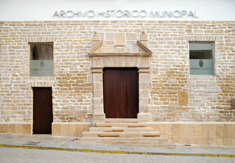
In 2015 this space was opened after the rehabilitation and value that the City Council of Porcilla carried out, hosting, there, the municipal services of Historical Archives and Tourist Information Office.

There are some of the vestiges that can be seen inside the building. It is also worth the attention to stop and observe its inclinated facade witness to the Lisbon earthquake of 1755.

The Royal Posite of Charles IV. City Council
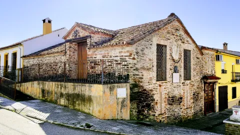
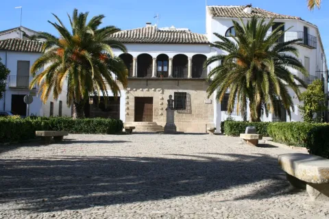
In the square of Andalusia was built in the Enlightenment of the King Charles IV in 1798 the Royal Po'sito, that is, a public warehouse of grain for consumption and sowing. It is a functional building offacade of silleri ́ a with beautiful classic cover, which consistsof three ships, one main and two lateral, separated by stone arches on which the deck rests. The building is accessed after climbing a step, an element that allows to generate a lower level or ventilation gallery.

After the Civil War contest, the building was ruined and a major reform had to be made.Although the works were directed by Ramón Pajares Pardo, the project is due to the architect and National Architecture Prize José Luis Fernández del amo, the first project he signed.

The building currently houses the headquarters of the City of Porcra. The large "glass yard" is a bright space that acts as a distributor of the entire ground floor and also functions as a main public service room.

Galleries of the Royal Posite of Carlos IV. Municipal Archaeological Museum of Porcilla
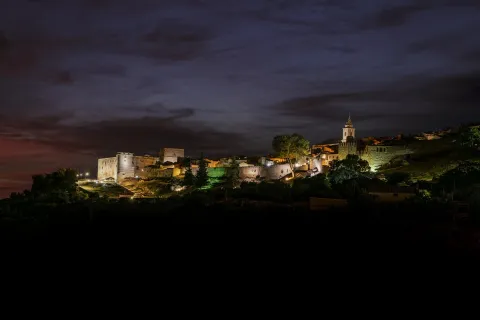
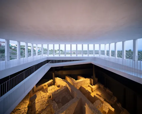
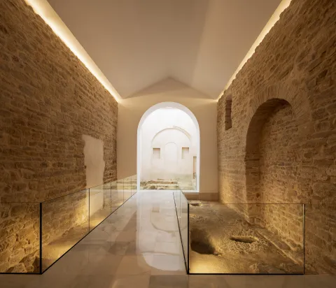
This is abouta space located under the building of the Royal Posite, current City Hall.In its day were the ventilation galleries and prevented the moisture from reaching the grain store. In origin they had no direct access from the outside, only one registration trap. Over time, several entry doors were opened, allowing this place to take different uses, from construction materials storage to dungeon or hardware shop.
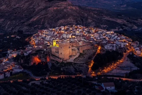
Following the major reform in 2017, the space was restored and opened to the public. During the intervention, archaeological remains of Roman and medieval times, now integrated into the journey, came to light. The vaults system used in its construction is particularly noteworthy.

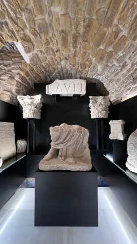
In 2023, two museum rooms were incorporated into the whole, which greatly enrich the understanding of the past of Porcra: one dedicated to the world of the Turdulum and the other to the Roman period. Both offer a clear and accessible journey through the cultures that left a deep mark on the ancient Obulco.

Ntra Parish. Sra. de la Asunción

The Parish Church of Our Lady of the Assumption of Porcilla, concluded in the early 20th century thanks to a popular subscription, rises on the site of the ancient Church of Santa Maria la Mayor. The building, wide and bright, has a Neo-Byzantine style and is articulated in three ships covered with cross vaults. The sacristy, attached to the head, belongs to the temple of the 17th century and is connected to the rectoral house, which houses the residence of the parish priest, the archive, the office and the parish hall.

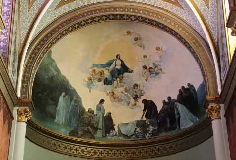
After the construction of the new temple, Julio Romero de Torres was commissioned to paint the vault of the apse, where the artist represented the Assumption of the Virgin, surrounded by a chorus of angels. The work was so impressed that he was asked for two new murals for the capels of the cruise. In one of them he made the Holy Supper, showing the apostles attentive to the moment when Jesus instituted the Eucharist. On the other, he represented The Holy Family in a serene sunset, with the Child Jesus in Mary's arms and the silent presence of St. Joseph. In addition, the temple retains five more works of the painter: an oil of St. John the Baptist in prayer and four canvases of the evangelists located in the pechines of the cruise.

House of the Stone

Summary of the millennial craftsmanship of the stone in Porcra. The bartender and marmolist Antonio Aguilera Ruedas (1896-1980) built it in the middle of the 20th century for 30 years with considerable personal effort and firm mastery.

Its extravagant and eclectic combination of solutions, techniques and decorations exalt the work of the stone. Their personal and unusual explanations that portray in an unusual way the complex parallel trajectory between building and author draw attention.

In August 2018 it was reopened following the reforms that the City Council of Porcilla made. After an important work of cleaning and restoring the stone a sophisticated lighting system is chosen to bring all the beauty to the craftsmanship of the stone. At the same time, an extensive set of ramps, built in marble concrete, gives access to a glass elevator, a unique dissonant element but that will allow access to the entire building.

Naturaleza

The natural environment of Porcilla forms a unique environmental heritage, modelled by thousands of years of history, a marked Mediterranean climate and the constant presence of the olive tree as an identity element of the landscape.

Geological description

The municipality is based on extensive margous formations of the Mioceno Medio-Superior, shaping a homogeneous and gently undulating relief, characterized by rounded hills and looms. In a timely way, the spurs and rocky outflows of sand-calcareous litology, more resistant to erosion.

Edaphology

The soils of the municipal term are mostly limestone and little or medium-evolved. Clear margas, with shallow but fertile profiles, and a slightly basic pH that promotes the development of crops characteristic of the countryside, predominate.

Climate

The climate of Porcilla is continental-temperate Mediterranean. The average annual temperature is around 17 ° C and precipitation is 563 mm, with marked annual irregularities and long periods of drought. Winters are temperate, with diurnal peaks close to 13 ° C, while in summer they are easily reached 40 ° C, with few rains.

Hydrogeology and hydrology

The municipality is located on two aquifers: the Porcra aquifer, which occupies almost the entire municipal area, and the Aluvial aquifer of Guadalquivir, located to the north. The term is integrated into the Guadalquivir watershed, and its main channels are the Salado stream, which crosses the municipality from southwest to northwest to the Guadalquivir, and the Saladillo stream, its main tributary.

Flora and vegetation

Porcula is integrated into the Mediterranean region, and has a dry climate with mild temperatures in winter and hot summers.

The olive tree is today the dominant agrosystem and a true monoculture that occupies almost the entire territory, although there are also areas with natural herbaceous species. Porcilla also houses four endemic species of great biological value: Hispanic, Betic, Ibero-Atlantic Mediterranean-Maghreb and Bético-Maghreb.

Fauna

Agricultural activity conditions the availability of habitats, but the olive tree offers a plant cover that allows the presence of a diverse fauna. Birds, small mammals, reptiles and invertebrates find in this ecosystem an enabling space for their food and shelter.

In it we can observe species such as: the green and the green; and in winter the capirate curved, the red petrored and the common zorzal.

The biodiversity of the olive tree is very much increased when, together with it, streams with riverbank forests or Mediterranean bushes, made up of carrizos, adelfas and tarajes. And so we find: sparrows, pinches, jilgueros, nightingale, cogs, cordnices and cornejas. Amphibians: common toad, green frog, salamander; reptiles: rib, lizard and lizards; mammals: hares, rabbits, foxes, badges, jinetas...

Some areas are highly recommended where we can look at the nature we have described in that paragraph:

  • Jesus' walk. We're in front of the big garden of Porcra. It is an extensive public park with a large grove built in the late 19th century. It is the center of the city's playful and social life as it brings together the important parties of Porcra, from the Real Fair to the Oil Fair. This important green space with countless botanical species is populated by monuments or unique elements of the city's heritage, such as the church of Jesus, the house of the Stone or the important viewpoint of the round, a place from which you can see the beautiful landscape of the olive tree, as well as various villages neighbouring the countryside to the Subbetic Sierra of Córdoba and Jaén.
  • Llano de Alharilla. The village of the Alharilla located just 4 km from Porcilla is characterized by a large plain surrounded by ancient olive houses, many of them today become cozy recreational houses. A lush tree offers shade and freshness, creating an ideal environment for rest and coexistence. In addition, the space has a road, making it an ideal place for family recreation or to enjoy a field day in full nature.
  • Pillars and aljibes.The current pillars have their origin in the fountains or springs whose waters were channeled in time and date, perhaps protohistoric, to collect it in receptacles, the pillars, in order to have it available so that the cattle could easily be watered, for use in laundry or in pools for the irrigation of the many gardens that were established in their way. Taking as a driving thread the pillars and sources, you can make a hiking and visiting route: the pillar of La Galga, María Cotilla, the Great Source, the Girl Fountain, Uncle Pago and the Fuenhot, among others.

Fiestas y Eventos

Ride de Reyes (5 January).On the night of January 5, the streets of Porcra are filled with magic and illusion for the coming of His Majesties the Kings of the East. A variety of carrots, parades and musics make it shine, au ́ n ma's if it fits, tonight so special.

Day of Andalusia (28 February). The City Hall of Andaluci ́ a, an autonomous festival, is held in Porcra an institutional event in which the City Council holds the Concession of Honours and Distinctions to different personalities related to this city.

Carnival (February).Its tradition in this town dates back to the dawn of the 20th century, although it has been more recently when it has become particularly relevant. On the one hand, in the Cine- Teatro "Mari ́ a Bellido" a Carnival Gala takes place in which the letters and chords of different carnival groups intermingle with the rhythms of three by four of the local murgas. On the other hand, during the afternoon of the carnival season, there is a spectacular passage in which hundreds of people gather to show the elaborate work carried out for months. The color, music and dance flood everything, and the diversity takes hold of all those who encourage themselves to contemplate it.

San Benito, Patron de Porcilla (21 March).The devotional to San Benito in Porcra dates back to the 13th century and we have been aware that such religious functions have been carried out since the 16th century. It is therefore not to be removed that the veneration of the Holy Patro is so rooted among its neighbours. On March 21 of each year, a solemn celebration of the Eucharist takes place in its honor and subsequent process of the image, which is accompanied by the local music bands.

Holy Week.During Lent, Porcella is filled with tradition and solemnity. The streets of Porcra make up an exceptional framework for the processing of their cofradi'as that, with their knowledge of being, they move us to an environment or a nico of sobriety, devotion and beauty. Ten are the cofradi ́ as and hermandades that process in Porcra from Palm Sunday to Resurreccio Sunday.

San Marcos (25 April).In honor of this evangelist, a religious and later process is held to end with a popular verbena from the same neighborhood to which it gives name. It is worth noting the curious tradition of the "Spark of San Marcos." This is the realization of fires that traditionally light up in squares and high places, with wood and old things that were discarded and that the young people stacked for their subsequent burning. This tradition was carried out in order to invoke San Marcos Evangelista to bring rain beneficial to agriculture. At present, one of these fires continues to be made next to the hermitage.

May Crosses (first weekend of May).In various squares, streets and neighborhoods of the village, gilded with care for the occasion, the traditional Cruces de Mayo, a holiday that inundate each rinco with a festive air full of color, are raised. The streets are dressed in floral motifs and personal details, self-reflective of the life and traditions of the place, while the neighbors, with dedication and pride, compete to create the most beautiful and striking cross.

Romeria de Alharilla. Tourist interest party of Andalusia.The second Sunday of May takes place in Porcra one of the most important romeri's of Andaluci, which is celebrated in honor of the Santi-sima Virgen de Alharilla, Patrona and Alcaldessa Perpetua of the town. The previous week, the municipality is set up and its streets are filled with people to celebrate the holiday in honor of its patron. Among others, they highlight the spectacular ride of horses, in the afternoon of the evening, with riders and carriages that spread through the main streets. On Sunday, say great, thousands of devotees and rosemary gather to live a day of deep faith, culminating in the longed process of the Virgin, carried in paths between the two and the prayers.

Bervena de San Benito (11 July).San Benito de Nursia, patro ́ n de Porcra and de Europa, has a second holiday in July in which, following the religious feast, a popular verbena takes place in the neighborhood with its same name.

MiaqueFest (first weekend of August).This is one of the largest music festivals in the province of Jae'n. With an open and diverse spirit, the festival does not focus on a specific musical style, but rather accommodates a wide range of ideas in which consolidated figures from the national musical landscape are combined with others that begin to unpoint.

San Lorenzo (10 August).Following the celebration of the Holy Mass, the San Lorenzo process takes place on the main streets of the town. Subsequently, one of the popular verbenas is held with the most raigambre of Porcilla.

Real Fair (September).The so-called "Real Fair" unio ́ la devocio ́ n by San Benito and the Virgin of Soledad, miraculous intercesors in the face of a great storm, with the tradition of holding an annual cattle fair granted by Queen Elizabeth II to the City of Porcra. At present, these parties are held in the first days of September and it is worth noting its Flamenco Besana, Porcra Electronic Night, the young night with musical performances or the parade of giants and heads.

Oil Fair (last weekend of October). This is a holiday celebrated around olive oil, the main economic engine of the town, which had its orien in 2007. At the Porcilla Oil Fair there is a wide exhibition of agricultural machinery, numerous places where to taste the gastronomy, to you, crafts, conferences, oil tasting... All this closed on Sunday with the taste of the traditional hole of bread with extra virgin olive oil and olive harvested in our land.

Gastronomía

On horseback between Jaén and Córdoba, Porcella brings together in its kitchen the best of each of these provinces, always with its star ingredient: extra virgin olive oil. This liquid gold, the fruit of the extensive olive trees surrounding the municipality, not only permeates its recipes of an unmistakable taste, but also becomes the symbol of a tradition that defines its culinary essence.

At the table of Porcilla, the piirranas and the jiennese sparragados with the flaminquins and the Cordobese salmorejo live together in a perfect balance that enriches its gastronomic heritage. However, it is in his native recipes that the true essence of this land is found.

Among its most peculiar dishes are the rape, a small square cake that is formed by folding a wafer over a spicy minced meat filling. This craftsmanship dish becomes an essential for those who seek to taste something unique and authentic.

On the other hand, chicken in milk It surprises both his name and his history. This typical sweet, similar to the mazapan and the alfajor, evokes with its almond aroma an Andalusian past that has been recorded in the gastronomic memory of Porcella.

For lovers of the good table, the visit to Porcra would not be complete without testing these specialties, which represent a bridge between the past and the present, between tradition and innovation. In addition, local restaurants and bars offer the opportunity to enjoy these delights in a welcoming atmosphere, surrounded by the hospitality that characterizes the porcunenses.

Historia

The origins of Porcra go back to a group of villages of the Final Neolithic located in its surroundings. In the Copper Age (3rd millennium BC) the area becomes a nuclear centre of the countryside. Archaeological research has discovered on the hill of the Alcores one of the oldest fortifications documented in the Alto Guadalquivir, with double walled fence surrounded by circular cabins. Another similar village is located on the hill of Albalate and both remained during the Bronze Age (II millennium BC).

In the 7th and 6th centuries BC the Iberian culture was formed on these lands and so, on the hill of the Alcores, there appears a new urban planning, of geometric layout, with rectangular houses of adobe walls that are raised on stone zócalos, sometimes covered with mud. The area maintained its status as a great center of the countryside and in this Iberian era an aristocracy emerged with heroic political models, as did other Mediterranean regions. This elite, to perpetuate its stretch, represented its exploits and its origins, by passing on to us the wonderful sculptural ensemble of the warriors of Cerillo Blanco, who are already emblem of this culture. These sculptures were in a sacred enclosure on the hill of the Alcores, but shortly after their erection they were buried in the necropolis of Cerillo Blanco.

The Roman Obulco was the origin of the current Porcula, confirmed by the epigraphic findings and texts of Plinio, Ptolomeo and Estrabón. During the republic and the first Empire the city was of great importance and enjoyed some autonomy, as it coined its currency.

When the second civil war between Caesar and Pompey was about to end, a uprising led by the children of Pompey broke out on the Peninsula. In the face of this situation, Caesar was forced to quickly mobilize his legions towards the rebel areas. The chronicles report that it took only 27 days to travel the distance between Rome and Obulco, an example of the impressive logistics capacity of the general.

Once in Obulco, Caesar reorganized and concentrated his troops there before marching towards Córdoba, where the famous battle of Monda would take place. The triumph in this confrontation definitely consolidated its power.

Otra información

Water Footprint

The Water Hole is a road through Porcra and its surroundings, whose main thread is the water, that is, the water system in Porcra from early times to the present. It is proposed, therefore, a tour of the missing water tank of San Cristóbal and the current one of the street of the Cross; the so-called El Albercón street; Maria Bellido and his role in the Battle of Bailén (1808); the Roman Cisterna de la Calderona, as well as the different pillars and aljibes located, these already, outside the urban town of the Pilar, the Pilar, the Pilar and the Pilar, the Pilar, the Pilar, the Pilar, the Pilar and the Pilar.

Route of the Stone

The Route of the Stone proposes a tour of one of the most unique and defining elements of Porcilla: its golden sandstone. This rock, which has been taken from the local quarries for over 6,000 years, has been the leading thread in the history of the municipality, since with it the most emblematic monuments have been raised from the Iberian era to the present.

The quarry in Porcra is a millennial trade that has never been interrupted. Already the Iberians of the ancient Ipolca-Obulco used this stone for their sculptures, such as the well-known pieces of the set of White Cerrillo, which show an extraordinary technical domain. In Roman times, the local sandstone was again a protagonist in public buildings, foundations, decorative elements and hydraulic conductions. Later, during the Middle Ages and Modernity, it continued to be used in walls, churches, noble houses, civil spaces and hydraulic works, becoming the material identity of the city.

The route invites you to know the historical quarries, where still today the stone is extracted in a artisanal way, maintaining techniques that have passed from generation to generation. There you can see how you cut, size and prepare this material that has shaped Porcra for millennia.

Loading map
Preparing points of interest and routes...
Imagen principal
imagen
Image
Porcuna
Imagen principal
Activado

Martos

Submitted by brandcode_deweloper on
Id
747103
Perfil de redes sociales
Facebook
https://es-es.facebook.com/AytoMartos/
Twitter
https://twitter.com/aytomartos?lang=es
Descripción
Breve descripción

Martos is located to the north of the Sierra Sur region, being the largest municipality and population of this region. There are other populations that are part of the municipality, such as Monte Lope Álvarez, Las Casillas, La Carrasca and Villarbajo.

Its municipal term is essentially olive tree, in its landscape of countryside the olive tree is the protagonist, extending to the horizon. Because of the great quantity and quality of olive oil produced in the city, it is called the "Olivar Cot." Around it has developed an important olive industry that together with the automotive-related factories and their auxiliary industries are the engine of employment and wealth for the municipality and its region.

It has an important historical heritage, among other monuments we quote: the Old Cárcel and Cabildo, Castles of the Peña and the Villa, Puente Romano, Urban Wall, Castle of the Endowment, Pilar of the New Source; with respect to the religious architecture: Royal Parish Church of Santa Marta, Sanctuary of Mary Most Holy of the Villa, Monastery of the Most Holy Trinity, Ermita of San Bartolomé, parish of San Amador and Santa Ana, etc.

This is the cultural wealth and beauty of its historical ensemble, which since 2003 has had the status of Good Cultural Interest.

Telecomunicaciones
Teléfono
953 210 000
Sitio web
https://turismo.martos.es/
Fax
953 553 309
Correo electrónico
turismoycomercio@martos.es
Ubicación
Nombre
Martos
Latitud
37.722260
Longitud
-3.970320
Distrito
Municipio
Ubicación en el mapa
POINT (-3.97032 37.72226)
Imágenes
imagen
Image
7470103a-fede-6cf5-54b2-edb356074e03?t=1603121821734
Imagen principal
Desactivado
Información adicional
Imágenes cabecera
imagen
Image
Martos
Imagen principal
Desactivado
Datos de interés

Tourist area: Sierra Sur and Jaén
Distance to the capital (km): 24
Altitude over sea level (m): 753
Extension (Km2): 259
Number of inhabitants: 24520
Gentillo: Marteños
Postal code: 23600

Videos
Video file
Cultura

Old Jail and Cabildo. Building built in the 16th century, considered a masterpiece of Spanish mannerism. It is currently the City Hall of the city.

In his spectacular main façade We can highlight the huge, dogrous columns with piled armchairs, the sculptures of Justice and Prudence, (both were beheaded), the great doors and their bronze aldabones and a great shield of the Austrians crowning the whole. It was declared a National Historical Monument in 1931. Below the City Hall, the Convent of the Trinitarian, work of the late 16th century, and on the same street, but in the opposite sense the Hospital of San Juan de Dios, of baroque bill of the 18th century. All this high part of the intramurous historical centre is of great quaint and from it you can enjoy beautiful panoramic.

  • Santa Marta Parish Church. It rose in the 13th century, in the years following the taking of the city by Fernando III the Holy, on an Arab mosque. It is consecrated to the patron of the city and has the title of Real since 1617. Gothic Mudejar style. The Baptisterium, the Major Chapel, was later built and embellished with the slate-cross vaults and a large cover of the isabelin Gothic. In the 16th century the interior is expanded and remodeled, raising large columns of Tuscan order and building the original Bell Tower with three bodies.
  • Pilar of the New Source. Ornamental source located in the Manuel Carrasco Municipal Park. It was built in the 16th century, reflecting the most new and outstanding aspects of the Manier architecture. The set stands out for its monumental beauty and austerity. It consists of an abrevadero pillar and a smaller one in which two lions make water pipes. In the center is the Austrian shield, and on the sides is the shield of Martos and that of Governor Aboz Enríquez.
  • The hermitage of San Bartolomé. Located in the skirts of the Peña de Martos, dates from the 14th century and houses the venerated image of Mary Most Holy of the Victory, Queen and Lady of the Peña.
  • Roman Bridge of Martos. Important engineering work, built in the Roman era on the Salado stream in the vicinity of Martos to facilitate the passage between the two shores.
  • Sanctuary of Mary Most Holy of the Villa. Temple in which Mary Most Holy of the Villa, known as "La Labradora," is sold. It was built on dates near the delivery of Martos to the Kingdom of Castilla. In the 16th century the temple was remodeled and a bell tower was built. This sanctuary was burned and destroyed during the Spanish Civil War. The current was rebuilt in the 1940s of the last century, in a Neobaroque style. The Torre-Campanario dates from the 16th century, is separated from the main building and is the only original element of the ancient Sanctuary. It has a square floor with half-point arches.
  • The ruins of Castillo de la Peña which we know today are not those built by Muslims but correspond to the strength that the Calatravos built from 1340. The floor of the castle is trapezoidal adapted to the surface of the plateau on which it sits and its entrance, for security reasons, marked a zigzag drawing. The compound was divided into alcázar and a courtyard of weapons protected by a walled enclosure. The alcázar, where the tower of tribute is raised, takes advantage of a natural podium that lifts it about three meters above the courtyard of weapons, separated by a wide, also natural.

  • Castle of the Villa. It was an alcazaba or citadel surrounded by canvases of almenada wall, as well as passageways and towers, leaving the central space for the construction of administrative and religious buildings: church of Santa Catalina, headquarters of the governorate, cavalries, tahonas, lagores, aljibes, etc. According to evidence from an inspection carried out by the Visitors of the Order of Calatrava in the 16th century in order to repair the deficiencies of the Lower Fortress.

Naturaleza

The orography of the municipal term of Martos is characterized by being quite accidental, with plenty of mountain grounds above all the southern part, instead the north-western part corresponds to soft reliefs and plain characteristic of the Guadalquivir depression, which extends in the west and north of Martos.

Among the greatest levels are the Sierra de la Caracola, with 1340 m., located in the south and to the north is located the Sierra de La Grana with 1254 m. and this is the extension of the Sierra de Jabalcuz, and we would like to mention the well-known Peña de Martos with its 1003 m. on whose slopes the city of Martos is located.

The hydrographic network is composed of a set of rivers and streams which are used for both human consumption and irrigation.

They are two rivers the main ones that pass through the municipality: Eliche Riverwhich is born by the saw of the Grana, and the river Víboras which is born in the term of Valdepeñas de Jaén. The channel of this river is used in the a reservoir of the same name, next to the pastry of Las Casillas.

The flora of the term is dominated by the olive, located in a large percentage of the land of the municipality. It also exists indigenous vegetation of the Mediterranean forest in the mountain areas, where we see species such as: the oak, coscoja, white jara, complaining and abundant number of aromatic plants such as lavender, rosemary or thyme.

In the banks of the river Víboras coexist riverside species as they can be: white, strawberry, elves, olms, zarzamoras and carrizos.

In the fauna exists a great diversity of species, from rapacious birds, both diurnal and nocturnal; aquatic birds, paseriforms, reptiles, amphibians and minor-game mammals.

For nature lovers, Martos offers an interesting natural offer to make different routes, climb to the top of the Peña, offers unparalleled views of the countryside landscape and the surrounding mountains.

Other very interesting routes are also the rise to the Sierra de la Grana, the Sierra de la Caracolera and the setting that forms the reservoir of the Víboras River and the Víboras Castle.

Fiestas y Eventos

Among the main festive celebrations of Martos are:

  • Romeria in honor of the Virgin of Victory. The last weekend of May is held. The festivities begin on Friday with the departure of the procession of the image from the hermitage of San Bartolomé to the Church of Santa Marta with the streets where it passes adorned with flags, reunions, retamas, altars and rosemary in typical suits. The next day the Virgin leaves the parish to go to the hermitage of the Virgin of Peña followed by carts, chariots and horsemen. On Sunday, the day of the rosemary, the virgin returns to her hermitage carried on a cart thrown by oxen and accompanied by gilded carrots with floral ornaments and various decorations. During the tour the atmosphere is fun and cheerful. They sing songs, they eat cheese, ham and rebujito. Once in the Peña, the solemn mass is celebrated and at the end of the rosemary they prepare to eat in the surroundings of the hermitage. This party is declared the Festival of Tourist Interest of Andalusia.
  • Fair and parties in honor of San Bartolomé. At the end of August, Martos is preparing for the largest celebration. Many and many different activities are organized during the days of pre-fair and fair, such as concerts, theatre, cultural and sports activities, horseback riding, pasacalles and taurinos (traditional the brandy torillo). The festivities begin with the official turn on of the cover and the fun is centralized in the fairgrounds, where various musical performances are offered.
  • Olive party. Typical celebration of Martos that symbolizes the official start of the olive collection campaign and pays tribute to the olives that work in the campaign. It takes place during several days of December with the celebration of many cultural activities related to the olive grove. The brooch of party end takes place on December 8, with the most outstanding events: reception of authorities at the City Hall, followed by a floral offering at the Monument to the Olives and the invitation to the attendees of a olive hole (bread, oil, cod and olives). And to put the final point to the party, the Martos' almazara teachers extract the first olive oil of the year.Declared holiday of Tourist Interest of Andalusia.
  • Holy Week. It is one of the most important popular and religious manifestations of Martos. The existence of co-fradies in the 16th century is recorded. Part of its Reciprocity in the narrow, tortuous and very considerate streets for which the hermandades run. All this linked to the incomparable frame offered by the millennial city of La Peña and the beauty of the images and thrones. It has been declared Tourist Interest Festival of Andalusia in 2002.
Gastronomía

In the gastronomy of Martos, extra virgin olive oil is a fundamental ingredient.

  • HoyoIt's bread and oil.

It retains two salads with origins of the Arabian-Andalusian cuisine: The orange chopper and the granate salad, where other vegetables are accompanied by orange or seasoned grenade grains.

  • Potage of beans and eggplants.

Meat dishes:

  • The rabbit with olives, which is prepared in the pastry of Las Casillas from which is found its replica in North Africa.

Dishes attached to the festive cycle:

  • Carnival filling, onions of Easter, the Sweet peas typical of the holiday of All Saints.

The of the Trinity mothers like the crotch or the buds, among many others.

Many traditional Martos dishes are shared with the rest of the Mexican cuisine Like, crumbs, gazpacho, pipirrana, white...

Historia

The origins of Martos they go back to Prehistory. Its strategic location, the existence of springs and the natural defense it offered were factors that caused the human settlement in the area.

There is evidence of different lytic materials belonging to the Paleolithic, however, the oldest documented statements are from the Neolithic. Remains of this period have been found in "El Molinillo," "Huertas Viejas" and "La Alberquilla." They are underground housing, funeral and defensive structures.

The city is known from very old, the Iberians named it Tucci and an important Iberian oppidum located in the upper part of the Peña is cited in the works of Ptolemy. There will be many settlements around Martos, such as Castlejo de Belda, La Atalaya, El Alamillo...

The Iberian city of Tucci, being occupied by the Romans, it became a colony that was named after Augusta Gemella Tuccitana. Many remains of this time are preserved such as mosaics, coins, ceramics, weapons, marble portraits..., the most important being the collection of Roman tombstones exposed on the façade of the Casa Consistorial de Martos.

From the visigode period, the paleocristian sarcophagus which is preserved in the Provincial Museum is the most important archaeological piece appeared in the town.

In the year 711 The Visigodic monarchy on the Iberian peninsula ends with the arrival of Muslims. Since the 9th century it was a very disputed border city. From this time are the castle of the Peña, the walls and torreons of the castle of the Villa. In 1225, Martos became part of the kingdom of Castilla, which King Fernando III will donate to the Order of Calatrava.

From the 13th century it acquired great splendor that will be increased with King Fernando the Catholic and the arrival of settlers from Castile and the Moorish of the Alpujarras.

The 16th century was a stage of economic, social expansion and of great transformation of the villa with the construction of new buildings, the remodeling of others and the expansion of the urban town.

During the 20th century, With the development of the olive grove, the arrival of the railway and the road there was a great population growth that decreased in the decades of the 50 and 60 of the last century caused by emigration.

The urban, social and demographic development of the city has now been increased by industrialization, being considered as one of the main industrial centres of Andalusia.

Loading map
Preparing points of interest and routes...
Imagen principal
imagen
Image
Martos
Imagen principal
Activado

Lopera

Submitted by brandcode_deweloper on
Id
741414
Perfil de redes sociales
Facebook
https://www.facebook.com/aytolopera/
Twitter
https://twitter.com/aytolopera
Descripción
Breve descripción

Municipality located to the northwest of the province of Jaén, in the region of the Jienese countryside. It's the most western urban core of the province, limiting to the west with villages of Córdoba.

Geographically it is characterized by a soft orography, typical of the olive countryside. Its economy is based on agriculture, being the cultivation of olive trees the most prominent, although there are others like cotton, sunflower, sugar beet, corn... that are sown in the vegas of the Salado stream. There are still some reductions of white grape and cereal vineyard, which were important at the time. It has a long wine tradition, but at present there are very few hectares of wine planted.

Its economy is complemented by the wood furniture industry, the service sector and construction, among other activities.

The river Guadalquivir crosses the municipal term in the north and its tributary Salado stream that runs from north to south with low flow rate.

Among its rich heritage is the Castle of Lopera, the parish church of the Immaculate Conception, the Casa de la Tercia, the City Hall and the hermites of Jesus El Nazarene, the Humilladero Christ and San Roque.

Telecomunicaciones
Teléfono
692 190 335
Sitio web
https://www.loperaturismo.es/
Fax
953 516 275
Correo electrónico
info@loperaturismo.es
Ubicación
Nombre
Lopera
Latitud
37.945550
Longitud
-4.214220
Distrito
Municipio
Ubicación en el mapa
POINT (-4.21422 37.94555)
Imágenes
imagen
Image
56866ff2-22f5-568f-f643-5fb1a0a9424c?t=1585684397066
Imagen principal
Desactivado
imagen
Image
9c5819e8-fb86-f1a5-339f-8c4ec83e12a4?t=1585684398702
Imagen principal
Desactivado
imagen
Image
ff14aacb-0c29-32e1-56d7-2726cc528538?t=1585684398444
Imagen principal
Desactivado
imagen
Image
e9030804-e601-1a3c-eae6-d402ed5ff0f3?t=1621261041691
Imagen principal
Desactivado
imagen
Image
006a5946-133d-54ac-0b05-f1859dde001b?t=1621261041810
Imagen principal
Desactivado
imagen
Image
a8f92b1e-344d-c428-c2ea-be5f59c06d6c?t=1621261041890
Imagen principal
Desactivado
imagen
Image
c2cd706e-56a0-e2f0-bd34-3480a8c8ba88?t=1621261042027
Imagen principal
Desactivado
imagen
Image
c226e437-67f2-1204-2d87-ed3744baf796?t=1585684397884
Imagen principal
Desactivado
imagen
Image
1c44ce87-14e0-d860-4414-d7194f29b26c?t=1585684397588
Imagen principal
Desactivado
imagen
Image
039ef38e-7424-2f61-46f8-a72839ddd988?t=1621261042106
Imagen principal
Desactivado
imagen
Image
a0eb714a-09d6-7447-2157-c6953e231d95?t=1621261042199
Imagen principal
Desactivado
Información adicional
Imágenes cabecera
imagen
Image
ad1e8a5c-0a8e-53d3-eb04-9a0b21da55a8?t=1659630640074
Imagen principal
Desactivado
Datos de interés

Tourist area: countryside of Jaén
Distance to the capital (km): 54
Altitude over sea level (m): 276
Extension (km ²): 67
Number of inhabitants: 4,028
Gentilicon: Loperans
Postal code: 23780

Videos
Video file
Cultura

Of the ancient artisan trades in Lopera, only two activities related to the ebanistía have been maintained to this day: the silery and the tortería. In both cases work is done following a classic Spanish line, of Renaissance air and close to the furniture that characterized Granada in the first half of the 20th century. Among the different wood used are those of beech and chestnut.

Other craft works, carried out today only by hobby, are reluctant to disappear. This is the case of the "guarines," made with olive pods, which were used to transport water pitchers or agricultural utensils to the loins of the beasts; or the anea works, especially those made for the "asses" of the traditional chairs.

In the Plaza Mayor of Lopera we find the three factual powers: the military power, represented by the castle-fortress of the Order of Calatrava; the religious power, represented by the Church of the Immaculate Conception and the civil power, represented by the City Council.

  • The Castle of Lopera. The castle is located in the centre of this town. It was built by the Order of Calatrava, to whom this population was given after its conquest in 1242. It has irregular pentagonal plant, defending its corners with cylindrical and prismatic towers or cubes. The interior of the fortress has a large courtyard of weapons, with a magnificent almost rectangular alcazar in the center formed by two towers joined by two wall canvases that form a large aspired adarve, supported by half-point arches on counterstrengths. The tower of San Miguel, which controls the main door, houses two vaulted rooms, one of which later became a curious palomar as witnessed by the dozens of ceramic cubes that cover its walls. The tower of Santa María is rectangular, with two overlapping rooms. The one on the ground floor was completely remodeled in 1535 after the works undertaken by the Comandador D. Juan Pacheco for the construction of an oratory, a small chapel that completed the significant transformation carried out in the castle to make it a nobility residence. These works also affected the skate between the two towers, transformed into the palace yard. The Lopera Castle belongs to the promotional database and has complete information sheet.
  • The tower of Santa Maria or of the Tribute, keeps in its interior remains of a Gothic chapel, made in the 16th century, when the castle became a nobility residence. We can now enjoy a centre of interpretation dedicated to the Order of Calatrava.
  • Our Lady of the Immaculate Conception. The date of its construction is not exactly known, some historians place the beginning of its construction at the beginning of the 14th century. There is a clear succession of styles ranging from the Gothic, the Order of Calatrava, to the Baroque. The basic plant is divided in three ships, highlighting the centre as being wider and higher than the sides. These ships are separated by cylindrical pillars that support the vaults of the deck, warheads and multiple nerves. The altarpiece It's neoclassical. On its outside stands the tower with a square base on which rests an octagonal body and a circular third, with four moons and half-point arches for the bells. Finishing with a pointed polygonal needle chapitel with glazed tile.
  • Casa de la Tercia. It was the old posite that is currently called "Casa de la Tercia." The building that was to be built in the 16th century is made of brick in its thick interior and thick tapial in its external walls, with quarry stones that reinforce the corners of the building. It has no decorative elements except two crosses at the top of the deck horse. It was used to store grain in the Modern Age and as a winery in the Contemporary. Don Miguel de Cervantes passed by in order to raise funds for the Invincible Navy.
  • The hermitage. It has several and very interesting hermitage, among which we highlight: The Hermitage of the Christ of the Humiliaderoof the 18th century and of Baroque style; the Hermitage of San Roqueof the 16th century, also baroque; Hermitage of Jesus Nazarene, where the 18th century cover is again baroque.
Naturaleza

Lopera, located in the area called the lower countryside and the Andújar valley, is the westernmost core of the Jienian municipalities. The Guadalquivir River crosses its municipal border on the north side, while the Salado stream, tributary to the east, serpents from south to north, forming fertile vegas.

The orography is soft, with wavy hills, the typical olive countryside, which has other irrigation crops located in the lower vegas of the Salado stream, such as cotton, sunflower, corn or sugar beet.

The vegetation, with a clear predominance of the olive tree, presents next to the channels of the rivers what we call the gallery forest: willows, strawberries, tarais, mimberas, white chopos and black alms.

The fauna is composed, among others, by Rape: a brine eagle, black millano, close it; carnivores: fox, rabbit, hare, weasel, chickpea, gineta, badger; reptiles: the lizard, snakes, and the fauna own of the riverside forests: the imperial garza, the martinete, or the aquilucho lagoon.

Lopera, due to its soft orography, is an ideal place to travel in direct contact with nature. Among the areas of the area we highlight the New Pilar site.

A short mile from the village of Lopera, along the way of the Spinillas, is the location of the New Pilar, true environmental lung of this area. The site has a pilar-abrevadero dating from 1875, and a meadow populated with trees and chaired by the hermitage of the farmers' pattern, San Isidro Labrador. No doubt an ideal place to spend a day in the field.

Fiestas y Eventos

Throughout the year, many and many different parties are held in Lopera.

  • La Candelariais celebrated since the 17th century on the night of February 1 around the typical "candelas" of olive thrones, which each group of neighbors organizes in their neighborhood. Next to these fires there will be games, songs and dances.
  • Romeria of the Virgin of the Head. On the penultimate Sunday of April, the image comes in procession through the streets of the town. The following weekend the rosemary moves to the Cerro del Cabezo (Andújar) to participate there in the Romeria de la Virgen de la Cabeza.
  • Romeria de San Isidro. On the 15th of May, in the place called "Pilar Nuevo," where the hermitage of the saint is located, this deep-rooted feast of farmers is celebrated. The image is processed, and behind it are the carts and chained cavalry, a show of color, songs and joy.
  • The Mayans. They are a kind of wooden frame, which is supported on a few sides and is covered with colored paper, ribbons, flowers... and decorated with wind thighs. In the center of the frame are two or more floors, and in them are placed biscuit cakes. It is used to honor someone, child or older, on their birthday or onomastic... The May is taken to the house of the honorado and along the way songs are sung. After the procession all together taste the rosses and sweets.
  • Tunas de Lopera competition, is one of the most expected events of Lopera's neighbours. The last weekend of July is held. There are young and not so young tunes from many parts of the world. It's all those days it's all joy, good humor, round songs... Tradition that has been transmitted from generation to generation.
  • Corpus Christi, for the celebration of this day's procession, Lopera's neighbors adorn their streets with pots, small altars, flags, flowers and junks that adorn the ground. The children who have made communion that year participate, and when it ends, they are in charge of collecting the jungle from the ground and preparing small whips.
  • Celebrations in honor of San Roque. The saint was named patron of Lopera in 1644. The parties are held between August 14 and 16, the day 16 being the big day. Start this day with a major Diana, in charge of the Band of Tambores and Corneto. In the parish the religious feast is celebrated in honor of the patron and there is the blessing of bread threads that will be distributed among the devotees. But the most striking thing is that children light up San Roque with lights made from watermelons and melons that have previously been emptied.
  • Feria de los Cristos. Fiesta Mayor, Fiesta Real or Feria Grande are appeals that mention the same celebration: the Feria de los Cristos which, after having undergone several changes of date and by popular referendum, takes place during the last Sunday of August. In Lopera, there are two crucified Christos that are venerated: that of the Vera Cross or the Great Christ and that of the Humiliadero or the Chico Christ; qualifications that refer to the size of the sizes of the Divinity. On Sunday, the image of the Great Christ is processed, first in receiving worship and whose fellowship dates back to the 16th century; the next day, there is the raging of the Chico Christ: the shooting of saved ones made at dawn by the cofrades. The religious feast is closed on Tuesday with the procession of the image of the Christ of the Humiliadero accompanied by his soldadesque that was founded in the 18th century. In the festivities of this town, known for its canned wine, they stand out: the race of the Galgos (tradition lost and recovered today), the leagues of two vaguels each day tasting their flesh on the last day of the feast on the Paseo de Colón and the animation of the Municipal Caseta with a verbena is extended until the early hours of the morning.
  • Medieval fair, which has been held over the last few years in the Castle, within the program of the route of the Castles and the Battle.
Gastronomía

The gastronomy of Lopera follows the common denominator of the villages of the region, uses virgin olive oil on all its dishes, in addition to the products obtained on its land, whether they are vegetables, fruits or game meat.

Among its most traditional dishes, we highlight:

  • "Pelao wheat", to different vegetables of the orchard like tomato, onion, garlic... are added bowels, clams and wheat grains. The wheat, you have to put it in water, peel it and let it cook for about 20 minutes, before bringing it together to the rest of the ingredients.
  • Chickpeas, to which cod and spinach are added.
  • Bread. The chopped parsley is added garlic, egg and grated bread that are milled and make balls that are then fried.
  • Trout to the mill. The trout must be put in milk for a few hours and then removed, rinsed and fried.
  • Maimons. Milk, sugar and pieces of bread will be the basic ingredients of this dish.
  • Pest in Doraillo, previously a saffrito of vegetables is made, to which must be added the chopped perdiz.

From the pastry shop a dish with much roots in Lopera:

  • CordialAlmonds, water and sugar should be added to egg whites.
Historia

The first data go back to the Bronze Age by the remains found in some cortijos. From the Iberian era there are several deposits in the municipal term, the Cerro de San Cristóbal one of the most important of Alta Andalucía.

There are remains of the Roman era in various areas of the municipality. His name was "Polesi." Many of the Roman settlements remained occupied in the Visigodic era. The most studied site is that of the Roman-Visigoda city of the "Morrones" which had a Visigoda basilica.

The current population core would probably emerge around the X and XI centuries in a small house that gradually consolidated the population. In 1240, Fernando III the Holy, conquered Lopera to the Muslims and from then until the 16th century it was under the jurisdiction of the Order of Calatrava.

Philip II decides in 1559, declare it villa that was materialized by the payment that the neighbors made to the coffers of the Royal Hacienda.

As early as the 19th century, with the decriminalization of the Church's property, the bourgeois people increased their heritage. It is worth noting the purchase of the Castle by a deputy and mayor of Lopera.

It has been a great wine center, reaching ten wineries. At present there is only one left.

The Spanish Civil War was held in the municipality from 27 to 29 December 1936. Battle of Loperabetween the Nationals and the XIV International Brigade. The result of this historic event, there are now two important nests of machine guns popularly known as "trenches".

It has a Museum dedicated to the civil war in the tower of San Miguel, and there is also a monument to the International Brigadists in the Old Pilar.

The town commemorates the confrontation on the third weekend of April, in which a "living museum" in the courtyard of the castle, a military passageway through the village and closes the day with a time dance in the town square.
 

Loading map
Preparing points of interest and routes...
Imagen principal
imagen
Image
1192d1af-0a67-bb54-0858-e023eebdf0e3?t=1603894063798
Imagen principal
Activado
Literatura

Discover Lopera through Miguel Hernández: visit the space dedicated to the poet and take the opportunity to learn more about the epic Battle of Lopera, one of the most important confrontations of the Civil War in Andalusia, knowledge of which would go on to profoundly influence the poet's work.

Linares

Submitted by brandcode_deweloper on
Id
741239
Perfil de redes sociales
Facebook
https://www.facebook.com/TurismodeLinares
Twitter
https://twitter.com/TurismoLinares
Youtube
https://www.youtube.com/user/turismolinaresofi
Descripción
Breve descripción

This popular and important city is located to the north of the province of Jaén, in the first foothills of Sierra Morena and close to the depression of the high Guadalquivir. It enjoys a privileged geographical location as a road crossing close to the main roads of the south peninsular.

Linares has amining heritageof the most important and best preserved in Spain. In their lands it is common to see remains of chimneys and other industrial vestiges, silent witnesses of a past of mining splendor that left in Linares an architecture linked to industry and to bourgeois and proletarian society.

The basilica of Santa María la Mayor, a mixture of Gothic and Renaissance style, or the Marquis hospital, of a neo-Gothic style, are two good samples of its artistic heritage.

Especially interesting is the archaeological legacy of the archaeological ensemble of the Iberian city of CatulusJust five miles from the city. It was in Roman times one of the ten most important cities of the Peninsula, thanks to its mines of lead and silver, of which today there remain vestiges as important as the mosaic of the Amores, the mosaic of the Octogones, a palleocrist of glass of the 4th century or the sculpture of the Lion, of the IIa centuries. C.

On the other hand, Linares owns a remarkable monumental ensemble, as well as the owner of an accused and musical character. The bullring square of Santa Margarita, located on the side of the emblematic promenade of Linarejos, has witnessed great afternoons and tragedies such as the death, in 1947, of the right hand Manolete. In addition, the city in which the famous guitarist Andrés Segovia was born has a long musical tradition linked to the taranta, a flamenco song born around mining.

The La Garza golf course is the only one in the province of Jaén. It is located a few kilometers from the city, in a privileged enclave with the mining landscape as a backdrop.

Telecomunicaciones
Teléfono
953 648 810
Sitio web
www.ciudaddelinares.es
Fax
953 648 813
Correo electrónico
ayuntamiento@aytolinares.es
Ubicación
Nombre
Linares
Latitud
38.092880
Longitud
-3.635550
Distrito
Municipio
Ubicación en el mapa
POINT (-3.63555 38.09288)
Imágenes
imagen
Image
717b4559-d8aa-43fd-4c6c-9c08a1541fd7?t=1620666050927
Imagen principal
Desactivado
imagen
Image
e4f5be42-25eb-8780-b90c-b1581819c8ba?t=1620666050609
Imagen principal
Desactivado
imagen
Image
39d78aac-4357-f5c4-91ae-a3d9d63960dd?t=1585838352419
Imagen principal
Desactivado
imagen
Image
703abb91-4bea-1ffb-3037-438af2c5bb18?t=1585838354473
Imagen principal
Desactivado
imagen
Image
42160d5d-b5b9-5fa8-da43-ff885202d248?t=1620666050784
Imagen principal
Desactivado
imagen
Image
5cb04542-9fff-58cb-7826-c022d4be2e83?t=1620666050980
Imagen principal
Desactivado
imagen
Image
278f0651-1ac2-64cb-c271-07d8e3a236e0?t=1585838353321
Imagen principal
Desactivado
imagen
Image
d28ffb7b-e8b5-2882-e0d7-b55f650ecb22?t=1620666050684
Imagen principal
Desactivado
imagen
Image
4a291902-03f8-1724-b60a-6cf3613c0eec?t=1620666050832
Imagen principal
Desactivado
imagen
Image
c7bc271c-c88c-b709-bb90-1ee3ea569ef8?t=1585777337631
Imagen principal
Desactivado
imagen
Image
de6c8ca4-32fa-3650-f257-539779c5466c?t=1603125039699
Imagen principal
Desactivado
imagen
Image
0e513dc5-1b59-8502-fbbe-4fb055c3a80f?t=1620666051035
Imagen principal
Desactivado
imagen
Image
663b4497-8d8e-f89e-2699-1b166c9c5197?t=1603138489292
Imagen principal
Desactivado
Información adicional
Curiosidades

ÁREA DE TURISMO
Iglesia, 5 – 23700 Linares, Jaén
Tel.: 953 10 01 83
http://www.turismolinares.es/
Email: turismo@aytolinares.es

Imágenes cabecera
imagen
Image
Linares
Imagen principal
Desactivado
Datos de interés

Touristic area: Sierra Morena / Jaén Toro Culture / Linares- La Carolina / Sierras de Andújar and Despeñacolos
Distance to the capital (km): 49
Altitude over sea level (m): 419
Extension (Km2): 196
Number of inhabitants: 57,414
Gentilicon: Linarians
Postal code: 23700

Videos
Video file
Cultura

Linares has a varied set of buildings (churches, palaces, solariegal houses) of different styles and times, from the simplicity of the Romanesque to the preciosism of the modernist buildings of the 19th and 20th centuries linked to their past of mining splendor.

The Basilica of Santa Maria la Mayorbuilt during the 13th to 15th centuries, with a mixture of Gothic and Renaissance styles, it has a beautiful silver altarpiece.

The city of Cástulo It has a historical trajectory of more than 4000 years, a history in which the presence and influences of Mediterranean cultures have been reflected, which have left their mark on the site and its territory. Cástulo offers us a heritage that we gradually recover from archaeological research, a legacy that we must know and protect.

The city has also not wanted to forget what its past was, good proof of it are the museums we found in it: Archaeological Museumin which the remains of previous civilizations that occupied these lands are preserved, and the Centre for the Interpretation of the Mining Landscapewhere we find samples of the mining works, pieces and videos on the location of the mining heritage in the region. And with the statue of the Miner, the inhabitants want to pay tribute to the generations who laid the foundations of the city that today is Linares.

The Casa - Museum of Andrés Segoviaor Raphael MuseumWe are reminded of illustrious people who took the name of Linares all over the world.

Naturaleza

As it is located in the first foothills of Sierra Morena, Linares has a beautiful natural location and enclaves.

The spaces of greatest landscape value are found to the north of its municipal term. The best example of this is the natural monument of "The Bat.". To the spectacular tour of the river Guarrizas during its high course, the beauty of the Roman bridge of Vadollane, which is part of the Via Augusta.

Linares enjoys an extensive network of trails of a small route duly marked that they travel part of their natural and mining heritage, and that they can be visited on foot, on horse or by bike, adding one more incentive to the visit of this area. Sendas that complement with "Green routes"whose tracks take advantage of the old railway tracks.

The set of plant species in the municipality of Linares is distributed in three well-defined spaces:

  • The countryside, on which much of the surface is intended for olive trees and dried cereals.
  • The dehesas, for livestock use and in which the tree species that stands out is the oak.
  • The pastures, little or no trees, which are used for cattle pasture or grasses or forage.

Next to the rivers Guadalimar, Guadiel and Guarrizas we find the vegetation called the riverside: strawberries, willows, white wings...

Fiestas y Eventos

Among the most rooted parties in the tradition of the Linarians, we have:

  • Holy Week, declared as the National Tourist Interest Party of Andalusia, a week with a mixture of party and veneration.
  • San Agustín Fairalong with Holy Week is Linares' most important holiday. They take place between August 27 and September 1. Among the most diverse activities, there are also bullfighting in the Santa Margarita.
  • Ibero-Roman Festivals of CatulusMay. A wide range of programming and activities immerse the city of Linares and the Archaeological Set of Catulus in its Ibero-Roman past. Historical recreations of a Roman circus, camps, workshops, parades, combat tactics, gastronomy, guided tours and gladiator struggles, among others, are the sign of identity of this tourist-cultural event.
  • Santa Barbaraon December 1. In these days Linares wants to remember his past mining with different demonstrations of trades in the mine and other activities for all ages that includes a multititling road through the mining district.

In addition to these most named, the May Crosses, Christmas, Carnival and the party of VoteIt's next to the hermitage of Linarejos.

Gastronomía

Linares has made the Tampoo a delicious sign of identity and one of the city's greatest attractions. Tabernas and bars fine-tune their ingenuity to make the exquisite tapas culinary miniatures that never fail to accompany the drink for free.

The Spanish gastronomy is very linked to the gastronomy of the province: olive oil as a common denominator of its peas and salads, not to mention sour olives, which are common as an appetizer. Among the most traditional are: gazhas, migas, gazpacho, andrajos, pipirrana and anis roses.

It also has others of clear mining descentsuch as potatoes with cod, potatoes with pimenton, mining and soaking based on orange salad, cod, olives, onions and olive oil.

In the letters of the Linarian restaurants, tradition, variety and innovation are given hand, and the most intense flavors are made of. It stands out among its local creations, the characteristic white sweet chachepol, a delicious biscuit soaked in syrup and spirit.

Historia

The history of Linares has always been very linked to the mining. The lead filons of their lands attracted different peoples and cultures to this enclave. It was a claim for the Tartessa, Greek, Phoenician, Carthaginian, Visigodic and Arab peoples. Of all of them, archaeological vestiges have been found in the area.

Within the municipal term was founded in the 6th century BC the Iberian city of Catuluswhich would later become the capital of Oretania (a large territory that also included areas of Ciudad Real and Albacete) with great mining, agricultural and flourishing trade wealth.

They would also exploit these mines for the extraction of lead and silver. To ensure control of the main mining sites, General Anibal took the Princess Ibera Homily (born in Catulus), but without success, as the Carthaginians were defeated.

The Romans will magnify this city through all kinds of privileges (such as the continued coining of their own currency), making Catulo a city with first-class infrastructure such as hot springs, aljibes and even a forum and an amphitheater. The wealth of Catulus was such that chronists of the size of Estrabón, Polibio, Plinio el Viejo or Tito Livio speak of it in their writings. With the wars, Cástulo disappeared, and the population took refuge in the atalaya of the mines, becoming dependent on Baeza. The current city owes its name to a place close to Cástulo, called Linarium.

Liners it does not appear in the historical archives until 1155, reign Alfonso VII, which at that time was a village that depended on Baeza. In the mid-16th century, thanks to agriculture and livestock, commercial activity and the population are increasing, giving Philip II the title of villa. During the 17th and 18th centuries, mining activity increases considerably and focuses on lead extraction.

As early as the 19th century, the city is considered one of the most important centers in the province of Jaén. With the arrival of the new machinery and mining techniques, as well as the development of the rail as a means of transport of the mineral, Linares reaches its further progress. The intense mining activity attracts migrants to the new jobs generated by mining and makes the population more than six-fold in a short time. In 1875, King Alfonso XII granted him the title of city.

The mining area Liners - The Carolina would become the first producer of lead of the world. The first labour movements are emerging as a result of wage inequalities between workers and employers.

But in the 20th century, mining activity is beginning to decline to the point where all mines are closed. In parallel, a powerful industry, of which Santana Motor It's the flagship.
With the arrival of the 21st century and the end of Santana Motor, the activity of the city is focused on the services as one of its main economic axes.

Otra información

There are many people born in the city of Linares who have had an outstanding career in their professional activity:

  • Andrés Segovia, guitarist and composer.
  • Raphael, singer.
  • Sebastian Palomo Linares, bulldozer.
  • Carmen Linares, flamenco singer
  • Francisco Baños, plastic artist.
  • Miguel Ángel Belinchón Bujes, Belin, plastic artist (grapher).
Loading map
Preparing points of interest and routes...
Imagen principal
imagen
Image
Linares
Imagen principal
Activado

La Iruela

Submitted by brandcode_deweloper on
Id
739553
Perfil de redes sociales
Facebook
https://www.facebook.com/profile.php?id=100067577744297
Twitter
https://twitter.com/lairuela
Instagram
https://www.instagram.com/ayuntamientolairuela/
Descripción
Breve descripción

La Iruela, a small and beautiful town located in the north-east of the Sierra de Cazorla region. In its western part there are the cultivated lands, the rest of the municipal term is a mountain area reforested with pine trees. It belongs to the Natural Park of the Sierras de Cazorla and Las Villas, being its main entrance door.

The municipality of La Iruela, as if it were a puzzle, is composed of numerous cores, 17 pedanias are the ones that make it up. Burunchel, El Palomar, El Burrueco, Arroyo Frio, Fontanares, La Estrella, Mortalejos, Tramaya, El Pocico, San Martín, Pasada Barrero, Los Tísanas, Arroyos de Plaza, Juntas de Muriel, Nubla, Cortijo Enroque and Cañamares.

The economic activity of the municipality rests on two basic pillars: olive cultivation and nature tourism, also highlighting forest activity.
Among its historical heritage we quote the medieval castle, the ruins of the church of Saint Domingo de Silos and the conistory house.

The Iruela has been declared Artistic Historical Set in 1985.

Telecomunicaciones
Teléfono
953 720712
Sitio web
www.lairuela.es
Correo electrónico
info@ayuntamientolairuela.es
Ubicación
Nombre
La Iruela
Latitud
37.920350
Longitud
-2.994140
Municipio
Ubicación en el mapa
POINT (-2.99414 37.92035)
Imágenes
imagen
Image
00aa1637-c873-62dd-9f08-19a8dc93b82a?t=1594840447803
Imagen principal
Desactivado
imagen
Image
cascada-calavera-jpg
Imagen principal
Desactivado
imagen
Image
142fcccc-1b78-b00f-12b9-9861653aa985?t=1594840446686
Imagen principal
Desactivado
imagen
Image
984dda33-81c5-6dfc-f4c8-879496a017f7?t=1594840444901
Imagen principal
Desactivado
imagen
Image
cf00562e-66a8-42de-cafc-977dfa1c9576?t=1619544364548
Imagen principal
Desactivado
imagen
Image
0427da0e-3bb3-5495-44e8-9e5136623cc5?t=1611000362766
Imagen principal
Desactivado
imagen
Image
arroyo-de-las-truchas-la-iruela-2-jpg
Imagen principal
Desactivado
Información adicional
Imágenes cabecera
imagen
Image
La Iruela
Imagen principal
Desactivado
Datos de interés

Tourist area: Serras de Cazorla, Segura and the Villas
Distance to the capital (km): 106
Altitude over sea level (m): 954
Extension (km ²): 123
Number of inhabitants: 1,899
Gentilicon: Iruelenses or Firuqueños
Postal code: 23476

Videos
Video file
Cultura
  • La Iruela Castle. The imposing castle rises on an abrupt rock and at its feet a medieval district of unquestionable architectural value is spread. It is of mothade origin and is built on pre-Berber foundations. In the eighth century, La Iruela was occupied by Muslims, who in order to cultivate the land created alqueras, then walls to defend themselves from the enemies and, already in the twelfth century, the first fortress of the three that it currently presents. The second, also the work of the Almohades, was a courtyard of weapons surrounded by a series of defensive torreons united with each other by thick wall canvas. Inside the courtyard of arms are the remains of a large aljibe. When Fernando III conquers this area, Christians reform the castle and build the tower of tribute in the highest part of the rock. An auditorium with artistic and cultural activities has been created between the castle and the rock. It was declared a Historical Monument in 1985.
  • Ruins of the church of Saint Sunday. 16th century Renaissance Church, raised inside the walled castle enclosure. The church was composed of three ships, the largest central and where the presbytery was to be found, the sides had chapels. A building attached to the church would be the old tower-door of Muslim origin that would give entrance to the interior of the Almohad fortress and that Christians reused as a bell tower. During the French invasion, La Iruela suffered attacks and fires, in one of them (1810) the building was severely damaged. Some of its noble areas are still standing today.
  • Consistory house. It is a Mudejar-style monument that in its day was posited and grain storage. It dates back to the late 15th century. He was looted and burned in the War of Independence. In the mid-19th century it was set up as the municipality of La Iruela. A remodeling made at the end of the last century gave him the present look.

Naturaleza

The Iruela is in the skirts of the saw of Cazorla, crowning the Guadalquivir valley. It is located 932 m above sea level, which means it is the highest municipality in the entire region, and the one that has the most portion of the Natural Park of the Sierras de Cazorla, Segura and Las Villas.

If something characterizes the area is the variety in the landscapes and ecosystems, with altitudes ranging from 2,100 m in the Cabilla saw to 360 m in the vicinity of the Cerrada bridge.

The region is characterized by landscapes where the high peaks are mixed with deep ravines, soft reliefs and large valleys, forests, olive groves and high mountain pastures, orchards, humid, dry and arid areas. The altitude rises from the west to the east, but not continuously, but forming saw teeth, whose rising and incoming with progressively more pronounced, alternating river courses and summit lines.

The traditional useof these lands has been of pastures for livestock, forestry, small areas of traditional crops (olive, cereal, orchard), hunting, fishing, collection of mushrooms, wild fruits of the forest and spartum and wicker for the varied popular crafts, mainly.

These traditional uses have given way to new economic activities, mainly service companies, especially tourism, in the area of the Natural Park. Today La Iruela has a large tourist infrastructure that, together with those of the cities of Ubeda and Baeza, are the most important in the province of Jaén.

At present the olive tree has been displacing the other crops, the loins are occupied by a sea of olive trees interrupted, sometimes, by orchards, all framed in the surrounding saws. In the drier and driest areas the almonds spatter in white spring.

A space with many ecosystems in which infinity of species that make up rich and varied fauna:: from the rapacious birds, the carrionies, the cynetic species, both of major and minor hunting, the fish, amphibians, reptiles, as well as the characteristic fauna of the riverside vegetation that exists next to the stream and river.

Without a doubt, a true natural paradise to recreate. It is almost compulsory to make direct contact with one of the wonderful places that this territory hides, where in addition to observing "in situ" both vegetation and fauna, we can enjoy a fabulous panoramic view of the mountains and the jienese countryside.
Most of the land in La Iruela belongs to Mount Público Guadahornillos, with just over 6,740 hectares.

In the municipality of La Iruela, the following public equipment is highlighted:

  • Nature Hall "El Cantalar."
  • Recreative area "Tejina"
  • "Air Pass" lookout
  • Path Rio Borosa (partial)
  • Path Cold Arroyo to Cerrada de Utrero (partial)
  • Mirador "Ribera del Guadalquivir", located on the path Arroyo Frio to Cerrada de Utrero.
  • Several sections of GR-247 Southern Forests. Stage 10 "Refugio CF La Zarza - La Iruela" and derivation stage "Port of the Doves - Cold Arroyo".
  • Most of the GR-7 "Coto Rios a Vadillo Castril" and some trips of the Vadillo Castril - Quesada section.

Fiestas y Eventos

We began the festive cycle of La Iruela in January:

  • Saint Anton, January 17. It is tradition to light fires and bless animals so that Saint Anthony Abad will protect them throughout the year.
  • San Blason February 3. The traditional doughnuts are distributed and a joint raffle is made with the products that the neighbors have donated. A few days before the celebration of the party, the image is brought from its Nubla hermitage. During the procession, the saint is the reason for many offerings in thanks to the favors received.
  • Celebrations in honor of the Virgin of the Unprotected and Holy Silos Sunday. They are held in the last days of August. There are many and varied activities that are carried out: fireworks, barter championships, serrano bolus, domino tournaments, local garden and gastronomy products competition, children's theatre, pasacalles, recitals and verbenas. The Virgin is brought from her hermitage to the parish, where she will remain until the fall, when she will return to her.
  • Saint Martin and the Virgin of the Rosary. Romeria that is celebrated the first weekend of October since time immemorial. In the pedania of San Martín
  • Party in honor of the Assumption of the Virgin Mary. It is celebrated between the 13th and the 15th of August and takes place in the pedanias of Arroyo Frio and El Palmar.
  • Celebrations in honor of the Immaculate Conception and Saint Julian. From 22 to 25 August, it is held in the pedanía of Burunchel. The saint is transferred from the hermitage of Saint Julian to Burunchel, where it is processed.
Gastronomía

It shares its gastronomy with the region where it is located. In general, peas are made from land products. Among the most characteristic are the following:

  • Gachamita, which is made from olive oil, flour, water and potatoes. You can eat with chorizos, torreznos...
  • Farmed flour, which are made with hard pasta.
  • Tallarines. It consists of a stew of meat, vegetables and mushrooms in which wafers of mass are cooked that are broken.
  • Rin-Ran. It has red pepper, onion, potatoes, cod, black olives and olive oil.
  • Serrano eggs. They are usually served in saucepan with pork products, such as chorizo, scratched bacon and meat from game animals.
  • Other: In Easter the dishes made with cod and Fried artichokes.

Warehouse:

  • Lis flowers. They are made of a very liquid mass of flour and passed through the frying pan in hot iron mold.
  • Fried milk and sugar roses.

Historia

The first signs of human presence in the Iruela environment date from the Copper Age, with great occupation until the Bronze Age. Then there was a depopulation of the area for which the researchers have no explanation, since after time we attended a proliferation of settlements. One of them is that of Nubla, with remains of fortification and that was active from the Iberians to the medieval era, the same happening in the times of the Romans, the bridge of the Mill that crosses the Cañamares River is attributed to this period.

It has been said that the Carthaginians founded the city, that it was popular in Roman times, and that the Arabs destroyed it and then populated and rebuilt it.

During the Islamic period it must have been one of the villages that populated the region. Around the 11th century this population was walled and the top of the promontory served as a refuge.

In the time of King Fernando III and thanks to the troops of the Archbishop of Toledo, conquer the castle and the rest of the municipality. In thanks the king gives him the jurisdiction of these lands within the advance of Cazorla. By the end of the 13th century, in order to strengthen the Alfoz of Cazorla, they donate to him La Iruela as a village, but La Iruela did not want to accept this privilege given to Cazorla.

He sometimes got the privilege of a villa, but for very short spaces of time.
Francisco de los Cobos, Secretary of Charles I, got the monarch to give him the villa to the detriment of the archbishop of Toledo, who pleaded until in 1606 he recovered it again. In this short period of time, the Cobos, large mecenas on the lands of their lordship, ordered to build the church of Saint Sunday of Silos in the interior of the castle.

The archbishops of Toledo always maintained the possession of this villa until 1811, when the Cortes of Cadiz abolished the territorial jurisdiction of the archbishop of Toledo. The spiritual jurisdiction over these lands reaches 1958, when it passed to Jaén.

Loading map
Preparing points of interest and routes...
Imagen principal
imagen
Image
Castillo La Iruela
Imagen principal
Activado

La Guardia de Jaén

Submitted by brandcode_deweloper on
Id
739432
Perfil de redes sociales
Twitter
https://twitter.com/laguardiadejaen
Instagram
https://www.instagram.com/LaGuardiadeJaen/
Descripción
Breve descripción

Small municipality located in the west of the Sierra Mágina region, a few kilometres from the capital. The urban core, located at the eastern end of the Cerro de San Cristóbal, looking at the Guadalbullion River, conserves the tipism of its white houses and its steep and narrow streets.

Among the natural enclaves of interest of La Guardia are the Cerro de San Cristóbal, whose summit is repopulated with pine trees, and the Vega of the Guadalbullón river itself, which continues to preserve an abundant riverside vegetation.

La Guardia offers many possibilities for walking, horse or bicycle excursions, such as the Cañada del Santo or the banks of the Guadalbullion River. Of archaeological interest are the settlements of Guadaola (period of emiral), the Roman villa of the Yuca, or the different Ibero-Roman necropolis of Las Eas de San Sebastián and Barranquillo.

The castle, of Arab origin, which was remodeled as a palacio-citadel by the Messias in the 14th and 15th centuries, is the main architectural jewel of the town, along with the parish Church of the Assumption, a work of the 16th century that was originally convent of the Dominicans.

Telecomunicaciones
Teléfono
953 327 100
Sitio web
www.laguardiadejaen.com/
Fax
953 327 100
Correo electrónico
ayuntamiento@laguardiadejaen.es
Ubicación
Nombre
La Guardia de Jaén
Latitud
37.742970
Longitud
-3.695140
Distrito
Ubicación en el mapa
POINT (-3.69514 37.74297)
Imágenes
imagen
Image
9f2f7fe1-a2e3-2526-e4c0-a2eb7280a6c5?t=1619533436230
Imagen principal
Desactivado
imagen
Image
8b59eaa2-d788-aed5-41ef-2192c85235ad?t=1619533436351
Imagen principal
Desactivado
imagen
Image
14f0c086-e569-5556-8020-16841cd1ee8e?t=1619533436430
Imagen principal
Desactivado
imagen
Image
9207c7d4-f324-733d-8c04-aefef5419649?t=1619533436560
Imagen principal
Desactivado
imagen
Image
f2cc53fd-32de-a38a-bb84-c117db911ddb?t=1619533436616
Imagen principal
Desactivado
imagen
Image
2a63b17a-f270-00f3-7dee-1fc530826cce?t=1585673921591
Imagen principal
Desactivado
imagen
Image
4f197d68-aa37-4f2a-a768-56d87694e115?t=1585673920649
Imagen principal
Desactivado
Imágenes cabecera
imagen
Image
la guardia
Imagen principal
Desactivado
Datos de interés

Tourist area: Jaén and Environment
Distance to the capital (km): 10
Altitude over sea level (m): 645
Extension (Km2): 38
Number of inhabitants: 4465
Gentilicon: Guards
Postal code: 23170

Videos
Video file
Cultura

The most important monuments of La Guardia are:

  • Castle of the Jaén Guard. It is a fortress of considerable dimensions, settled on Iberian vestiges. Most of its defensive structure was built in the period of Al-Ándalus, with subsequent remodeling, mainly of the alcázar to serve as a church or palaciega residence in the 15th and 16th centuries. From the Tower of Tribute a stunning panoramic that shows us Sierra Magina, Sierra Morena and the fields of La Loma.
  • Old convent of Santo Domingo. The church is the best preserved building of the Old Convent of Santo Domingo de La Guardia, the rest being in advanced state of ruin or hidden by the reforms of the last century when it is occupied by an almazara. After the deamortization and abandonment of the church of Santa Maria on the grounds of the castle, the church of the convent was converted into Parish of Our Lady of the Assumption.Decoratively, the temple is of a pure classicist style, typical of the Vandelvira of the second half of the 16th century, hired in 1542 by the Dominicans for its project and execution. With a one-ship Latin cross plant, respecting the patterns of the Dominican order, it stands out its header, in which the date of 1556 is recorded. A Renaissance work of great beauty that has been declared Artistic Historical Monument, protected as Good of Cultural Interest in 1975.
  • Public laundry of the Second Republic. A place with a special charm, in which it still seems to be impregnated by the atmosphere that the people occupied in daily hygiene created every day. The utensils they used and which have been donated by the neighbors can still be seen in it. On the first floor is the Fountain Lavadero Museum.
  • Set Plaza Isabel II. It's another major enclave in La Guardia. The historical set was built to illustrate the greatness of the Marquise granted by King Philip II in 1556 to the first Marquis of La Guardia, Gonzalo Messia Carrillo de Fonseca.

The square concentrates several monuments concerning the 16th century and the Renaissance:

  • The Source of the five years, they are bronze and they used the water of a local spring.
  • The Source of Mary Magdalena, a central fountain topped with a sedent virgin that belonged to the ancient convent of the Dominicans.
  • Sole house of the Ochoa familywhich was built in 1813 and which seems to preside over the square.
Naturaleza

The Jaén Guard is a town on horseback between Sierra Sur and Sierra Mágina.

Since privileged area at 635 m altitude The Guadalbullan River is dominated in its search for Guadalquivir, Sierra Morena, Sierra Mágina and the fields of the region of La Loma, most of which are populated by olive trees.

Its vegetation in the high area, slopes and top of Cerro San Cristóbal, is the one of the Abrupt and steep land, highlighting the repopulation pines on the top and slopes of the hill, as well as shrubs and aromatic plants. The rest of the land is colonized by olive trees except for the area of the Vega del Guadalbullón on whose fertile land fruit trees, cereals, maize and vegetables grow.

The fauna is the characteristic of the small hunt: hares, rabbits, partridges, foxes and numerous rapacious birds nesting on the steep rocks of the hill. In the area near the river, the typical avifauna of the gallery forests.

The best way to get to know this area and discover the living nature is to walk one of the many paths that are serpentating for its municipal term. One of the most representative and best panoramic on the region is the so-called "San Cristobal Hill Path."

The path ascends by the area of Monte Prieto, and descends by the vicinity of the Peña de San Cristóbal, the point of beginning and ending being the municipality of La Guardia itself. We will find the impressive coat of Cave, with remains of human occupation from the Neolithic. At the flat summit of the Cerro de San Cristóbal you can enjoy a pleasant walk between the pines. The north and south slopes have spectacular views, being authentic natural views of the mountain reliefs of the south and the province of Jaén.

Fiestas y Eventos

The set of parties held in La Guardia, the Guardeños are grouped into two blocks: the major parties (San Sebastián and Divina Pastora), and, on the other hand, the rest of events and celebrations.

  • Celebrations in honor of San Sebastián. He is the patron of La Guardia and are the most loved by the neighbors, and especially by those who emigrated and return to their own in these days of feast. The 20 January and last from the 19th to the 22nd. It is a feast of agricultural origin, and the tradition consisted of taking the image of the saint to the ages, the place where the harvest was torn.
  • Fair and Festivals of Our Lady The Divine Pastor. The day is celebrated 10 August and its origins are related to the world of agriculture and the blessing of crops and crops.
  • Fair and Festivals of our Patron Our Lady of the Rosary. They take place around the first Sunday of Octoberand are characterized by one of the oldest traditions: the Song of the Aurora Or just La Aurora. It consists of the departure of a group of people, the "auroros"in the early morning, accompanied by musical instruments, they go through the streets of La Guarda singing to call the brothers of the brotherhood to the prayer.
  • Romeria de San Sebastián. The Third Sunday of May in honor of the patron saint, a tradition of more than four centuries. It is held in the natural area and recreational area called "Allanadas del Santo." The rosemary begins with the transfer of the image of the saint to his hermitage, located in this place. In the morning the Mass is held, and in the afternoon the saint is processed in the surroundings of the hermitage.
Gastronomía

La Guardia's gastronomy presents a wide variety of flavors, textures and ingredients, whose secret lies in the Arab reminiscent of typical recipes. A whole culinary mosaic that has been enriched throughout history to this day.
Among the most typical dishes, we highlight:

  • Wigs: is a stew made with wheat cakes, clams, bowels, meat and different vegetables.
  • Cod, a typical dish that is consumed especially at Easter.
  • CatsThe bread is added chorizo, ham, peppers... and other ingredients that change depending on the time of year.
  • Pomegranates.

They are also made sweets that are typical of this locality:

  • Pumpkin, the dessert par excellence of La Guardia. It is made with pumpkin, pepper and sugar.
  • Gusanillo, a typical gardena confectionery.
  • Sweet peas, which are consumed on the Day of All Saints, on November 1.
  • Other: fried rosses and Peach punch.
Historia

The San Marcos slope The Guard is a strategic enclave, a silent witness to the different peoples and cultures that have passed through this place. The remains that have been found thus attest to it from the Neolithic to the present. For this reason, La Guardia is known as "Cult Gate."

Apart from its important border role between Castile and Granada, what really distinguishes La Guardia from other border areas is the location of a ancient and illustrious population settled in the current location For centuries. The Guard was an important Iberian oppidium called Bastia lie About 1500 years ago.

During the Roman era it will reach its highest splendor. He was known as the Great Mentess. A strong, economic, social and political city. With a population that reached 5000 mentesans. They exploded the gold from their mines, which came to Rome, and coined coins.

With the Muslim invasion In the eighth century, the city was looted and burned. It will be during this century when the construction of the castle's defensive structures begins.

In 1244, Fernando III El Santo conquered the city and again became a defensive bastion of Castile in the Guadalbullion Valley until the conquest of Granada.

With the taking of Granada and the loss of value as a strategic and defensive position, it begins its stage of peace and immerses itself in the Modern Age.

Family Messiah is established here in the 16th century, modifying the castle to adapt it as a palaciega residence, reusing the existing tower as a church dedicated to Santa Ana. The bell tower is built on it and will be the Parish church until the mid-19th century.

Also in the 19th century, the Ochoa family sits in the municipality and decides to build a solarium house next to the fountain of the Pilar de los Messia.

Little remains of the glory of Mentesa, since since the 19th century its main sustenance was agriculture and oil and flour mills, an economy that precipitates the migrations of the people during the post-war period.

At present, its situation near the capital has encouraged the revitalization of the municipality.

Loading map
Preparing points of interest and routes...
Imagen principal
imagen
Image
Castillo La Guardia
Imagen principal
Activado