Saltar al contenido principal

La Carolina

Submitted by brandcode_deweloper on
Id
739288
Perfil de redes sociales
Facebook
https://www.facebook.com/AyuntamientoLaCarolina
Twitter
https://twitter.com/aytolacarolina
Youtube
https://www.youtube.com/channel/UCBY6A3TaSP3JqhViYdshufw
Instagram
https://www.instagram.com/ayto_la_carolina/
Descripción
Breve descripción

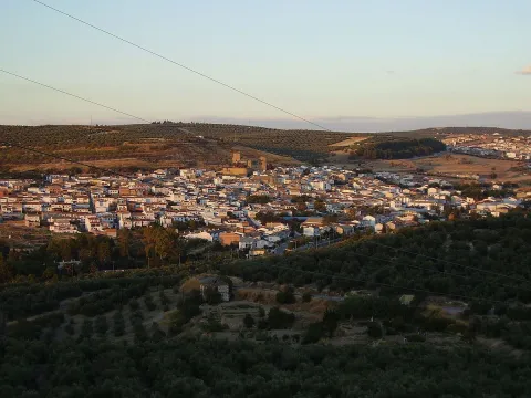
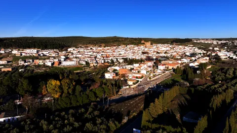
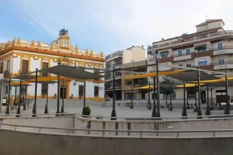
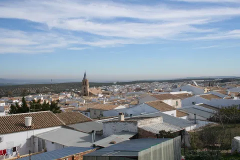
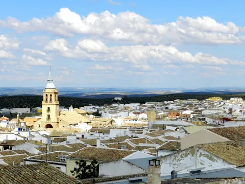
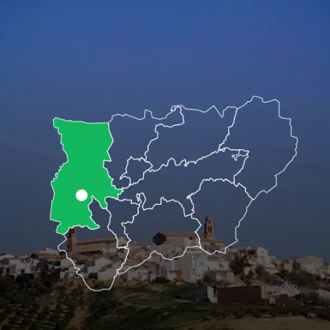
La Carolina is a city at the foot of Sierra Morena and the Caraway, natural mountain port that links Castilla with Andalusia.

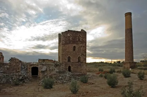
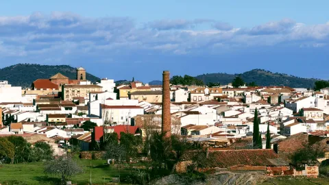
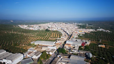
Its area is made up of extensive olive trees, but also the dehesas and the half-mountain areas populated by oak and pine trees. It is easy to find abandoned mine chimneys, clear signs of their past related to this activity.

It was the capital of the New People of Sierra Morena, a political project by the enlightened king, Charles III, in 1767. The main objective was to colonize and take advantage of the lands of Sierra Morena and to provide security to the mountain port, as it was a very unsafe place, where bandits and malefactors were camping. The population is made of settlers who came from central Europe, France and Germany mainly. A close collaborator of King Charles III, Pablo de Olavide, would be appointed responsible for the project, with the title of Superintendent of the New Populations of Sierra Morena.

The municipality of La Carolina is composed of five population centres: La Carolina, as main, Navas de Tolosa, La Fernandina, la Isabela and the Guindo. It is surrounded by natural areas such as the nearby Natural Park of Despeñacolos, the Fernandina reservoir or the small urban nucleus of the Guindo, which evokes its mining past.

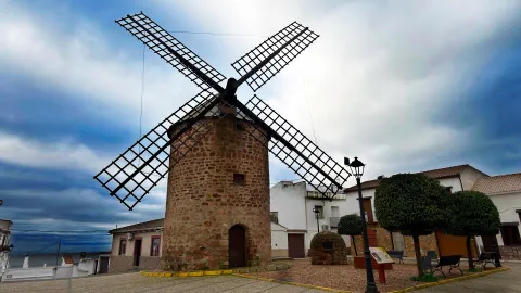
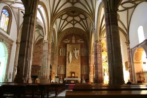
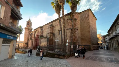
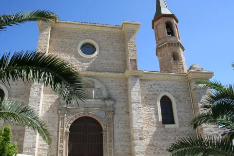
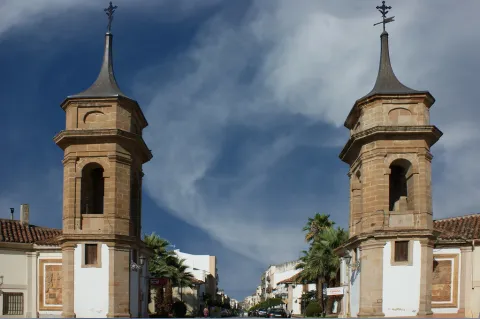
In its artistic heritage are: The Palace of the Intendente Olavide, in Baroque style; the parish church of the Immaculate Conception, the seat of the ancient Carmelite foundation of San Juan de la Cruz, the Torrecillas del Molino de Viento and the Torres de la Aduana.
Telecomunicaciones
Teléfono
953 660 034
Sitio web
www.lacarolina.innovasur.es
Fax
953 681 626
Correo electrónico
info@lacarolina.es
Ubicación
Nombre
La Carolina
Latitud
38.274240
Longitud
-3.615270
Distrito
Municipio
Ubicación en el mapa
POINT (-3.61527 38.27424)
Imágenes
imagen
Image
f91faa0d-bd7e-a921-740d-33c048ef2e8f?t=1619532688353
Imagen principal
Desactivado
imagen
Image
1aacd6bf-6d2b-6336-9456-d95923815de8?t=1594142871900
Imagen principal
Desactivado
imagen
Image
9e49b509-9667-17c5-697b-fc861d03bf8c?t=1619532688419
Imagen principal
Desactivado
imagen
Image
e2b43921-6f14-e958-7cb1-de980f088f48?t=1594142869986
Imagen principal
Desactivado
imagen
Image
131f904e-ba6e-379c-daec-e19a7d0d88b4?t=1619532826514
Imagen principal
Desactivado
imagen
Image
4b85bd84-f1c0-34bb-d56a-a343c5bea6c1?t=1619532688547
Imagen principal
Desactivado
imagen
Image
07cad3d1-017c-774f-16d7-c166133050a9?t=1619532688596
Imagen principal
Desactivado
imagen
Image
fc7e8a03-c91f-3245-be11-c83899c22fe4?t=1603128351869
Imagen principal
Desactivado
Información adicional
Imágenes cabecera
imagen
Image
La Carolina
Imagen principal
Desactivado
Datos de interés

Tourist area: Sierra Morena / Sierras de Andújar and Despeñacolos
Distance to the capital (km): 66
Altitude over sea level (m): 595
Extension (km ²): 201
Number of inhabitants: 15,261
Gentilicon: Carolinenses
Postal code: 23200

Videos
Video file
Cultura
  • The municipal term of La Carolina is full of archaeological vestiges from Prehistory. Places like La Calera, El Minado or El Ochavo, so they testify. We met with Rupéstre art fields like Dona Lady, the Puntal or the Guindo. And also former mining holdings, mainly Roman, like Fountain Spis, or El Guindo.
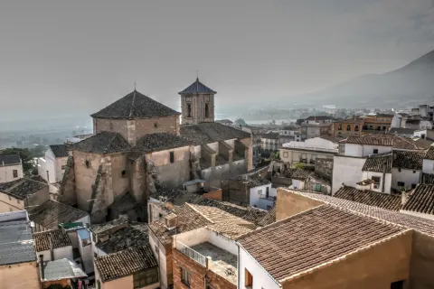
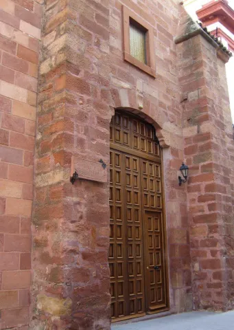
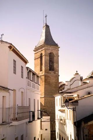
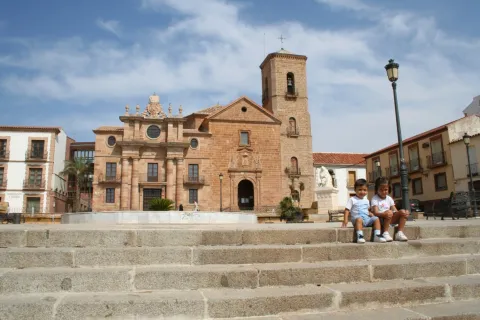
  • The Church of the Immaculate Conception, built as a church of the convent of the barefoot Carmelites of the Peñuela, after the Colonization it is extended to serve as a parish to the nascent population. It has undergone several reforms over the years, and in 1899 the tower was built.
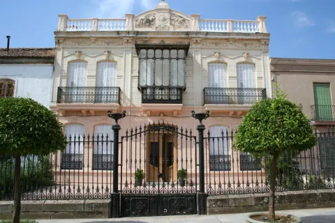
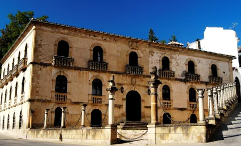
  • Palacio del Intendente Olavide, which was the residence of Mr Pedro Olavide, executive of the Sierra Morena Repopulation project. It was built in 1775, in neoclassical style and is located in the center of the village, right next to the parish church.
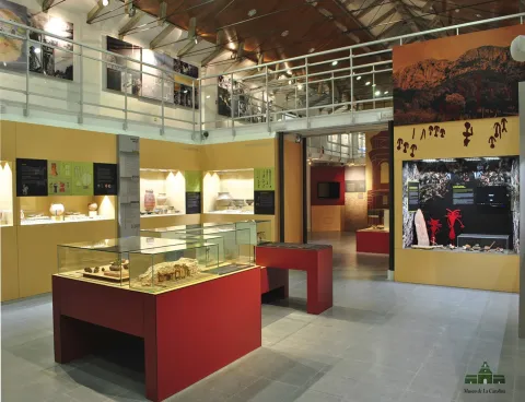
  • La Carolina Museum,The Centre for the Interpretation of the History of Mining in the New Populations of Jaén, integrated in the majestic building of the Palacio del Intendente Olavide, offers countless possibilities of knowledge, culture, history and research of the city, with the latest technologies, an unbeatable infrastructure and a human team that make it an inescapable cultural and tourist resource when visiting the city.
  • The Customs Towers, neoclassical style and airy architecture flank the main entrance to the city coming from Madrid.
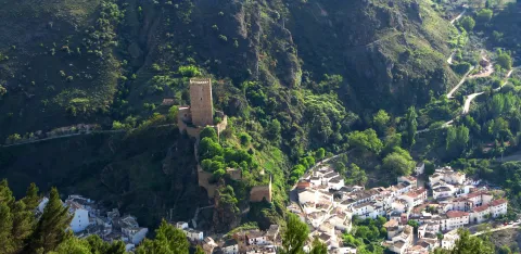
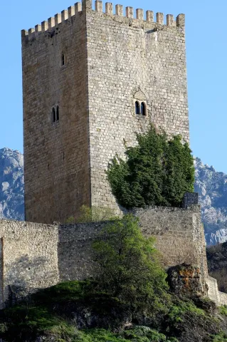
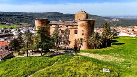
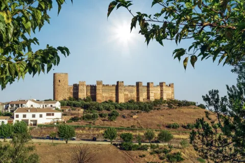
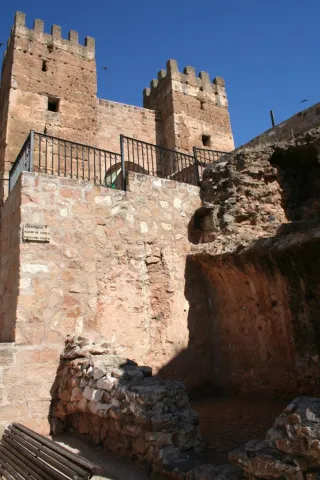
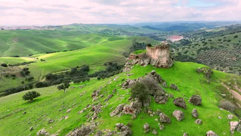
  • Castillo de Navas de Tolosa: For more than two hundred years, it served as a defense and vigilance for the Muslim kingdom of what we know today as the passage of Despeñacolos, once Paso del Muradal. Today the silhouette of its tower stands out in a typical Sierra Morena dehesa in which you can also see braves.

Other monuments of interest are:

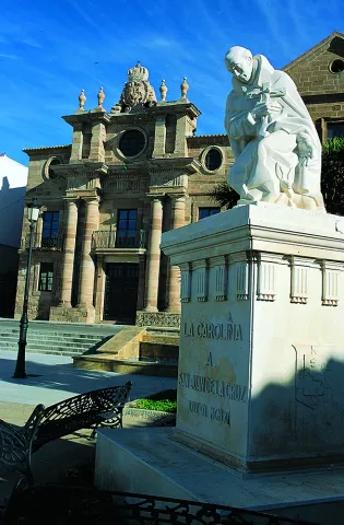
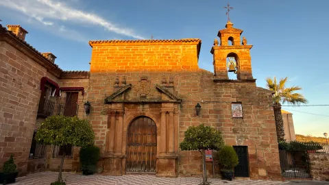
  • Hermitage of San Juan de la Cruz.
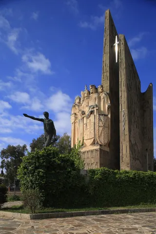
  • Monument to San Juan de la Cruz.
  • Old jail.
  • Monolitos de la Fundación.
  • Monument to the Battle of the Navas de Tolosa.
  • Mining heritage.
Naturaleza

Its enclave at the foot of Sierra Morena and at the limits of the Natural Park of Despeñacolos, makes La Carolina a municipality especially attractive to nature lovers. The visitor has the opportunity to enjoy a landscape full of contrasts, with steep mountains and wide dehesas, on which it is easy to see majestic birds.

The cultivated land represents only 10% of its extent, mostly dedicated to olive trees. The main agricultural activities are the cultivation of olive trees, livestock and hunting, greater and lesser. It also highlights its mining landscape, heritage of an industry that supported the life of the Carolinians: remains of abandoned mines, lavatories, remains of smelters...

The vegetation is very abundant and heterogeneous: olive, oak, cork, chestnut, eucalyptus, alms and oaks. The fauna, both in larger game animals (boar, goose, cords, reels...) and smaller (rabbits, hares, parrots, quail) is very abundant. There are also cattle of wild cattle, sheep and goats.

Part of the term La Carolina covers the mountains of Sierra Morena to the north, while towards the south the landscape becomes adhesitated, thus offering beautiful and contrasting landscapes. In the area of saw, the highest peak of the mountain range, La Estrella, with 1,300? m altitude. The nearby Natural Parks of Despeñacolos to the East and the Sierra de Andújar to the West.

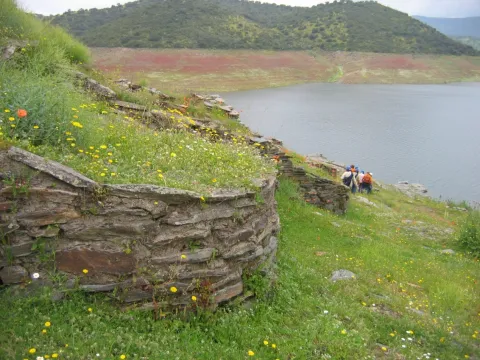
To the South, the Embalse de La Fernandina allows sports fishing and presents beautiful images of the Mediterranean forest, being an ideal place for the development of a rich extensive livestock.

The villages abound in their term as well as the natural sites, making La Carolina a municipality of special human and natural appeal. It has three urban cores or pedanias, these being:

  • The village of Los Guindos, to the north of the term and in the surroundings of the saw, evokes its mining past.
  • Aldea La Fernandina: presents one of the simplest traces of the New Populations, of rectilinear and orthogonal design.
  • Aldea La Isabela: The route of this village, presents reminiscent of the European city of the Enlightenment.
Fiestas y Eventos

In addition to the Christmas and Carnival celebrations, the most rooted celebrations in the town are as follows:

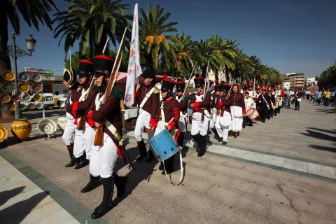
  • Festivals of the Foundationthey are held from 3 to 5 July, in an attempt to link present and past from La Carolina, to value in a fun way its history, traditions and origin. The acts include the reading of the court and the tribute to the Colonoan act to claim the persons who still keep foreign surnames.
  • May Fair, has its origin in a cattle party that is very famous and that competed with the most important in Spain. A Selected livestock morphological competition (berrenda cow, seaweed sheep and serrana goat)
  • Festivals of San Juan de la Cruz, Patron from La Carolina. The last weekend of November is held. The tradition of Shake a live pig after the celebration of the Eucharist.
  • San Carlos Borromeo, which is celebrated on November 4 and is also co-patron of the city.
  • Romeria de San Isidroon the 15th of May, and is celebrated with a Romeria to the natural area of La Aliseda, a beautiful recreational area that is located in the village of Santa Elena, at the foot of Despeñacolos.
  • Carnivals, of the most renowned in the province of Jaén.
Gastronomía

Hunting is very present in the local gastronomy, so among the most traditional dishes we have:

  • Monkey meat, first adobada and then stew in sauce.
  • Pate of perdiz, typical Jaén dish that was born on these lands.
  • Scattered perdiz, a dish that can get cold.
  • Chickpeas, which is consumed preferably in Lent.
  • Migas and Pipirrana.
  • Jars with hare.
  • Trick asparagus.
  • Cod wet.

In the pastry shop, the following are typical:

  • Sweet gazes of the holiday of All Saints.
  • Summer gazhas: with fish and peppers, according to the recipe of the miners who came from Almería and Granada.
  • Oil nuts, Rice with milk, fried milk and drunks.
Historia

In the 18th century, the enlightened king Carlos III and its ministers (Aranda, Jovellanos and Campomans) decide to create the New Populations in Sierra Morena. At the head of the repopulation he put the Superintendent Pedro Olavidewho would be responsible for the settlement of settlers from France, Germany, the Netherlands and Switzerland.

In 1767, the The strength of the New Populationsestablishing the regulations and rules governing these new settlements, different from those of the rest of the country. This year, and near La Peñuela, a former Carmelite convent, La Carolina is founded, which would be the capital of all the new settlements in Sierra Morena.

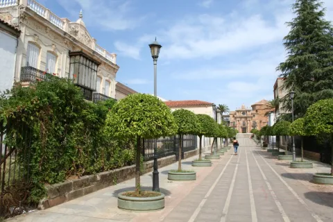
The beautiful city of La Carolina is the best example of the city of Enlightenment. It is known as the City Jewel of the Holy Kingdom. This was designed as a Roman camp; that is, following two axes that are crossed, one from N to S, which is called cardo and another called decumano, from E to O that in the City Hall square is where they are, indicating this crossing the city center, according to the design of Simon Desnaux, supervised by Olavide. The avenues of Las Huertas and Juan Carlos I are the main lines for the division of the land. The result of its urbanization is an orthogonal mesh that divides it into squares, with streets and straight and wide avenues.

In the mid-19th century, La Carolina began the exploitation of its rich Argentine lead filons. Previous mining work already existed, but it will now be when a large-scale exploitation begins that will lead you, in the early and mid-20th century, to become the world's largest Argentine lead producer along with the nearby Linares, under the territorial delimitation of Linares- La Carolina mining district.

This led to a strong immigration of workers from nearby provinces that significantly changed their demography and sociology, even to the birth of populations around these farms such as El Centenillo or El Guindo.

But the mining crisis meant the closure of all the mines in the 1970s. Thus today, the buildings linked to this activity have become part of the landscape as witnesses to its industrial past, being inscribed in the catalogue of the Institute of Historical Heritage of Andalusia.

For a few decades, La Carolina has been in the industrialization sector and is now a city full of future.

Otra información

The village of The Guindsbecause of its geographical location it is a great place to make astronomical observations, especially in the autumn and winter months. In fact, it is included as a Mirador within the "Reserve Certification and Starlight Tourist Destination of Sierra Morena."
Loading map
Preparing points of interest and routes...
Imagen principal
imagen
Image
La Carolina
Imagen principal
Activado

Jódar

Submitted by brandcode_deweloper on
Id
739118
Perfil de redes sociales
Facebook
https://www.facebook.com/ayuntamientodejodar/
Twitter
https://twitter.com/AytodeJodar
Instagram
https://www.instagram.com/aytodejodar/
Descripción
Breve descripción

A population belonging to the Sierra Magina region, located to the north-east of it, in a landscape composed of large extensions of olive trees on one side and saws on the other.

It is the most populated municipality of the region, its southwestern end is included in the Natural Park of Sierra Magina, which is part of the Subbetica and offers beautiful and spectacular landscape. The Guadalquivir, Jandulilla and the Arroyo de la Countess rivers go through their municipal term.

The cultivation of olive trees, asparagus and spartum-related crafts are part of their economic activity.

Among its artistic heritage are the Parish Church of the Assumption, the Muslim Castle, the Church-Sanctuary of the Christ of Mercy, the surroundings of the church, streets and squares where you can see traditional buildings of the region with its peculiar layout and the cave houses.

The Artistic Historical Set of Jódar has been in the cultural interest of Andalusia since 2014. Since 1983, together with the Castle and the Church of the Assumption, but the declaration as opened is from the Ministry of Culture.

Telecomunicaciones
Teléfono
635 609 943
Sitio web
www.jodar.es
Fax
953 785 487
Correo electrónico
ayuntamientojodar@hotmail.com
Ubicación
Nombre
Jódar
Latitud
37.840680
Longitud
-3.354860
Distrito
Municipio
Ubicación en el mapa
POINT (-3.35486 37.84068)
Imágenes
imagen
Image
fd00355d-d748-a12a-b7ee-55f5181bf972?t=1595343295258
Imagen principal
Desactivado
imagen
Image
030c38d0-26f7-b111-77a1-44b30528b2b3?t=1595343409514
Imagen principal
Desactivado
imagen
Image
0f1d8f13-742b-a426-a9bd-2b7de31790f0?t=1595343444832
Imagen principal
Desactivado
imagen
Image
63cff0aa-90d1-321d-c72d-cdf5ec8ec82d?t=1619531938975
Imagen principal
Desactivado
imagen
Image
3c652ab6-a47e-0046-f798-ff8965c1ca52?t=1619531939033
Imagen principal
Desactivado
imagen
Image
d64f2f3e-b34c-f649-229a-d56dfa2face3?t=1619531939079
Imagen principal
Desactivado
imagen
Image
6ad3041b-cdb6-901d-366d-7565b6d22278?t=1619531939122
Imagen principal
Desactivado
Información adicional
Curiosidades

Museo de Jódar (Punto de información turística de Jódar)
Casa Municipal de la Cultura
Calle Juan de Mata Carriazo, 4. 2ª Planta - 1ª Puerta.
Tfno: 953 784 012
Web: www.saudar.com
correo@saudar.com 
Horario: De lunes a viernes, de 8 a 15 horas (verano: de 8 a 14 horas).
Domingos: De 11 a 13 horas.

Imágenes cabecera
imagen
Image
jódar
Imagen principal
Desactivado
Datos de interés

Tourist area: Sierra Magina
Distance to the capital (km): 54
Altitude over sea level (m): 600
Extension (km ²): 149
Number of inhabitants: 11,667
Gentilicon: Galduriens
Postal code: 23500

Videos
Video file
Cultura
  • The Church of the Assumptionbuilt between the 16th and 17th centuries, of classical Renaissance façade and of great proportions. It has a Latin cross plant, with chapels among the contrasts. The deck is of canyon vault and dome on breast on the cruise. The presbytery, the major chapel and the cruise are 1775. The tower of the mid-17th century is decorated with episcopal shields and the neoclassical cover is one of the best in the province for its proportions. Located on the wall is the valuable "Ibero-Latin inscription of Galdur," mythological city and ancient cradle of Jódar, is from the 1st century BC
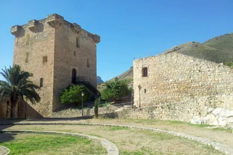
  • Jódar Castle. In the historical core of Jódar, on a rocky podium is the castle, mentioned in documents of 860. It is known that the castle is erected in Iberian times, as indicated by the inscriptions found in one of the armchairs, cthe most dean of the province and one of the oldest in Andalusia. It takes on importance in Muslim times with the Muladian revolts. This fortress has two towers of tribute, one of Arab origin and one raised by Christians. Both are almost square, in the Old Tower the entrance is located at the height of the first floor and has two series of saetera. The New TowerIt consists of a central wall and a central wall. Its saetries similar to those of the North Tower and the interior decks are vaulted vaults of the 16th century. It preserves mudejar stucco remains. Both towers have been restored. The South Tower is currently the Reception and Interpretation Centre of the Natural Park of Sierra Magina. The North Tower has been enabled to recreate and make known the history of the castle and the municipality.declared Historical Monument, under the protection of Good Cultural Interest, in 1985.
  • Sanctuary Church of the Christ of Mercy. It was built in 1700 on an ancient hermitage. It is of one ship and there is an extraordinary size of the 16th century of the Christ of Mercy. A baptismal stack of 1660 must also be highlighted.
  • Tower of the Pinars, declared Well of Cultural Interest, as Historical Monument in 1985. It sits at the southeast end of a hill that controls the right bank of the Jandulilla River, so its strategic position is beyond doubt. The tower is circular, with a door in height, which divides it into two bodies; the lower one is fully solid and the upper one has a small room also circular. It has an irregular masonry-based mating with plaster argamase, the same material that is used to cover the entire surface of the tower.

Naturaleza

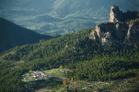
Jódar is located to the north-east of the Sierra Mágina region, in the skirts of the Cerro de San Cristóbal, belonging to its southwestern end to the Sierra Magina Natural Park. From here its territory descends to the Guadalquivir rivers and Jandulilla where the crop fields are given.

Half the territory is farmland in which the olive tree is the majority crop. In the vegas of the rivers, horticultural crops are produced and in the dry cereals.

Economic activity is based on olive groves and the olive industry, although it is raising high expectations for cultivation and industrial processing of vegetables.

The main altitudes of the term are the peaks Carboneras (1,511 m.), the saw La Golondrina (1,258 m.), Jodar's. (1,200 m.) and Altarillas (1066).

To the north of the municipality are the reservoirs bathing this area of the municipal term: Ms Aldonza, Pedro Marín and La Cerrada Bridge, and Natural area of Alto Guadalquivir, along with the river sections between them. Also declared as Special Protection Area for Birds (ZEPA); and Special Conservation Zone (ZEC).

In these mountains the Mediterranean vegetation in which the oak is frequent prevails. In the Vega del Jandulilla the sparthals abound, the result of the abandonment of cereal cultivation due to the scarcity of rains. In the course of the Jandulilla River, the tarays, alffas, common cane and canals are abundant between the main flora.

Of the fauna, the spartal birds, including granivorous birds such as the cogujada, the calandria, totovia and the common terra, draw attention.

  • Garden of the Cora:Located in the heart of the city centre, it is a unique garden that houses the recovery of more than 400 types of missing seeds and plants. It has formed a reservoir of mother plants recovered from extinction.
  • Hiking route the Pocco:From the peri-urban park of Traschatina is a marked hiking route called "El Pocico" that ascends through the skirt of the Sierrezuela de Jódar and has as its goal the hill of San Cristóbal, where one of the most wonderful views of the province, the valleys of Guadalquivir, Guadiana Menor and Jandulilla, or the Lomas of Ubeda and the saws of Cazorla and Magina, are seen, as well as an unparalleled view of the city.
  • Via Verde "El Paso" Y Barranco Del Cañaveral:Next to the old Royal Road to Granada, called "El Paso," you will find the Barranco del Cañaveral, a small gift splashed with alffas and juncos, in which ruins of several flour mills can be observed, including the call of Marcón, a true monumental relic. The area was splattered with watchtowers from the Middle Ages, on its wide road we found remains of industrial archaeology of the irrigation channel of the Jandulilla River, as well as one of the largest landlords in the area. The royal road ends on the Roman bridge of the Guadalquivir River, called "The old bridge" next to the ruins of "Ubeda la old."
Fiestas y Eventos

Among the most popular parties, they include:

  • Holy Week. Its origins are they go back to the 16th century. It is one of the most prestigious and rooted celebrations in Jódar. Currently is considered one of the most important and popular in the province of Jaén. It stands out for the quality of its sizes of famous imaginers and for the solemnity of its steps.
  • Festivals of Corpus Christi. The streets through which the procession passes are embellished with the ornaments of palm trees, banners with Eucharistic motifs, altars where the best joules and many others are displayed. The floor is rugged with joint, mastranzo and drawings made with colored sawdust. The Most Holy One goes in a magnificent step and in an overgold silver Custody of the year 1669.
  • Festivals of the Cross of May, 2 and 3 May. They are celebrated from the beginning of this century in honor of the Most Holy Christ of Mercy, pattern of Jodar. Two monumental arches of flowers are raised, popular altars with crosses also of flowers. The day 3 is held the procession of the Christ of Mercy that goes through most of the streets of the population, and after the end of the religious act, Christ returns to his hermitage.
  • Festivity of San Isidro, May 15. Every 14 May it is moved to San Isidro from its hermitage located in the "Fuente Garcíez" to Jodar. The following day, after the Eucharistic celebration, the Holy one returns to his hermitage, but accompanied by riders with chained horses, gilded reels for the occasion many rosemary who will spend the holiday between dances and singers taking as their stage the beauty of Sierra Magina.
  • Real September Fair. Founded by Royal Decree of Elizabeth II in 1837. As in Jódar, traders and farmers had no date to meet and be able to sell and deal with all genders, it was decided that the fair would be held on September 2.3 and 4. Today, many activities are planned, but we highlight their important bullfighting that have in sign the main taurine figures and the lively verbenas that are very busy.

Gastronomía

The gastronomy of Jódar is rich and varied, based on the products of the earth. We have to highlight the quality of your olive oil that enters as an ingredient in most of your dishes. We highlight those with the greatest roots:

  • Pipirrana. It is a salad with tomatoes, green peppers, onion, cucumbers, olive oil salt and tuna.
  • Gazpacho of the reapers. Warm stew based on chunks of cake and accompanied by meat from small game pieces, such as rabbit, perdiz or hare.
  • "The Morrococo." They are cooked chickpeas, tomato, onion, olive oil, salt and cumin.
  • Gachamas. Made of flour, water, olive oil, salt and potatoes. To accompany, longanize, pancake, chorizo...
  • Andrajos. flour cakes with tomato saffrito, onion, garlic, red pepper, and sometimes cod or rabbit.
  • The capers. Salted or curved capers that are taken as an appetizer mainly.

In pastry: The "twists," the wine roses, empanadas and chickpeas.
  • The "risol"is a traditional drink made of coffee, sugar, cinnamon, rose petals and spirits.
Historia

The human presencea in the vicinity of Jódar is documented from prehistory, being the site of The Quebrades the oldest known, dated towards the third millennium a. C.

The remains of the Ibero-Roman period, following the course of the Jandulilla River, including the funeral stone found in the old Villa Xandulilla or the Sphinx del Jandulilla located in Alamus cutamong others.

During Middle age the area remained heavily populated by Islamic settlements, with several alqueras and a castle shelter. In the 10th century it was considered an important urban core and noted oil producer.

About 1,229, the produces the Christian conquest of the city by the troops of Fernando III. From this moment on the town is growing in population and importance, so Alfonso X gives it the title of Villa Leal and the Fuero de Lorca.

During the 15th century it belonged to several owners, and the Catholic Kings created the Largest of Jodar, giving it to the Sanchez Day of Carvajal, his major guard.

The 16th century is prosperous and churches and buildings are built. The work of the spartum It also favours many of its inhabitants, on the contrary, in the following two centuries in which secular hunger, forced migrations and the terrible epidemic of the plague, which occurred in 1681, drastically reduce the population, which doubled in the 19th century and this caused problems, including the lack of housing and which many families moved to live in caves.

With the arrival of the railway and improvements in access, new migrants arrive, exceeding 10,000 inhabitants.

In 1919, Alfonso XIII, gives the villa thecity title, and to the City Council the treatment of Very impressive..

Loading map
Preparing points of interest and routes...
Imagen principal
imagen
Image
jódar
Imagen principal
Activado

Jaén

Submitted by brandcode_deweloper on
Id
735516
Perfil de redes sociales
Facebook
https://www.facebook.com/Turjaen-880368115409952
Twitter
https://twitter.com/turismodejaen
Instagram
https://www.instagram.com/turismodejaen/?hl=es
Descripción
Breve descripción

Jaén is an extensive municipality located in the south-west centre of the province, and in which the capital is located.

In its term two areas are distinguished: the countrysidewhich is located to the north and another, smaller, located to the south, which is the mountain.

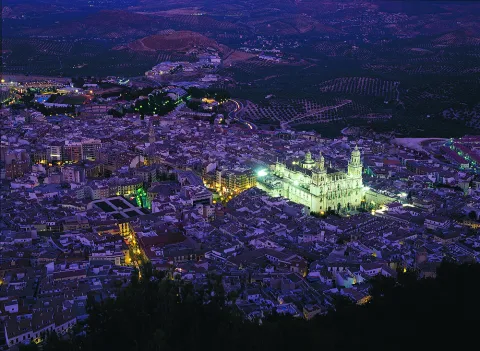
As we go through its historical centre, in streets, corners and monuments we discover the richness of the coexistence of three cultures: Christian, Jewish and Muslim. We will walk through the narrow streets of the Jewish Quarter, we can visit the Arab baths of the 11th century in the basements of the palace of Villardompardo and admire the rosary of churches, some of them raised over ancient mosques and numerous convents. And visible from all points of the historical center is the Cathedrala true jewel of the Spanish Renaissance.

On the hill of Saint Catherine the imposing castle of the same name, from where you can admire extraordinary panoramic views over the Guadalquivir valley, the countryside and the Sierra Sur behind your back.

Jaén, the world's capital of olive oil, is today a modern city as its squares, gardens and large avenues testify.

Telecomunicaciones
Teléfono
953 313 281
Sitio web
https://www.jaencityofgastronomy.com/ www.culturayturismojaen.es
Correo electrónico
otjaen@andalucia.org
Ubicación
Nombre
Jaén
Latitud
37.772770
Longitud
-3.787970
Distrito
Municipio
Ubicación en el mapa
POINT (-3.78797 37.77277)
Imágenes
imagen
Image
565c6eb4-5942-2554-4006-8ceab143b8db?t=1619526386769
Imagen principal
Desactivado
imagen
Image
b424e57e-dc79-a428-daca-35eeb083bea1?t=1619526386986
Imagen principal
Desactivado
imagen
Image
55d454b0-8c1d-d414-0b1e-e823a8ec112e?t=1603985313163
Imagen principal
Desactivado
imagen
Image
7715a631-5b75-15b6-5980-62fd2f46d2e7?t=1603985472695
Imagen principal
Desactivado
imagen
Image
01dc3f35-ff78-28a9-7c8e-35e481da450c?t=1619526387099
Imagen principal
Desactivado
imagen
Image
0fa84b0a-05ed-c54d-7d4b-22183bb3e3a6?t=1619526387156
Imagen principal
Desactivado
imagen
Image
14937a6a-998e-3821-a140-fd3fd1ca419f?t=1603985313279
Imagen principal
Desactivado
imagen
Image
d06ab30b-57dd-c08d-06c5-3ede89eecc14?t=1585768371068
Imagen principal
Desactivado
imagen
Image
e6950987-2c4d-dd30-5a67-62a547b05db3?t=1619526387274
Imagen principal
Desactivado
imagen
Image
3540dc4f-fdd4-e549-c395-e4da63d47419?t=1619526387340
Imagen principal
Desactivado
imagen
Image
bfd586f4-48bc-d3aa-18ee-68705b3b0e19?t=1619526387391
Imagen principal
Desactivado
imagen
Image
144298d6-85db-03e9-e4c2-49526aac5889?t=1619526387572
Imagen principal
Desactivado
imagen
Image
0c7d68e7-f21d-8966-856c-2e62cd746a9f?t=1619526387623
Imagen principal
Desactivado
imagen
Image
48b3d107-5960-f7f2-e080-3c725a30800c?t=1619526387677
Imagen principal
Desactivado
imagen
Image
e1522135-9be2-ee72-37d1-29d49c34f935?t=1603115329866
Imagen principal
Desactivado
imagen
Image
7cae4916-09df-b35e-2986-f704ed193a4f?t=1619526387748
Imagen principal
Desactivado
imagen
Image
30754f84-6bf0-8bce-d131-7832dd6a306b?t=1619526387799
Imagen principal
Desactivado
imagen
Image
d5a8b2be-e7d6-1b7a-01b8-f4412b3d1e07?t=1603117566668
Imagen principal
Desactivado
imagen
Image
32ae96fb-7f94-4623-2b3d-b7fac51e241a?t=1619526387876
Imagen principal
Desactivado
imagen
Image
fcb67e8f-ebc1-467f-7b33-183b53cf1e8f?t=1619526387922
Imagen principal
Desactivado
imagen
Image
fedd54a5-2237-fd6e-425e-7237a8d0f26b?t=1619526388085
Imagen principal
Desactivado
imagen
Image
ec4ce20b-7984-d4fe-3bdf-d035228f9528?t=1619526388368
Imagen principal
Desactivado
imagen
Image
a3a10c78-37e3-21bd-b9d8-813f1849eefc?t=1619526388625
Imagen principal
Desactivado
Información adicional
Curiosidades

Horarios de visita


Oficina de información turística de Jaén.
C/ Carrera de Jesús, 2.
23002 Jaén
Tel. 953 190 455

Imágenes cabecera
imagen
Image
b963ff18-ff49-21ea-0900-3e68f5e313be?t=1606405214909
Imagen principal
Desactivado
Datos de interés

Tourist area: Jaén and surroundings
Altitude over sea level (m): 573
Extension (km ²): 424
Number of inhabitants: 120,021
Gentilicon: Jiennenses
Postal code: 2300x

Videos
Video file
Cultura

Jaén's architecture bears witness to the many civilisations that have inhabited the city and its surroundings throughout the centuries, resulting in an outstanding monumental heritage that includes both religious and civil buildings. Its historical and artistic legacy showcases a variety of architectural styles, including Gothic, Mudéjar, Renaissance, Baroque, and Neoclassical.

Among its most important monuments are the following:

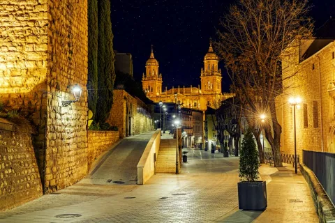
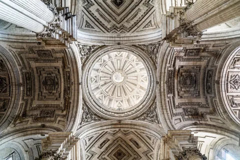
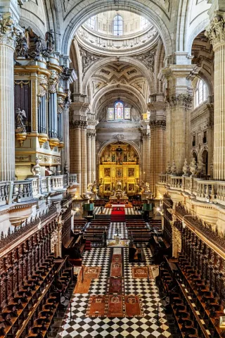
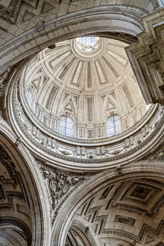
  • Cathedral of the Assumption of the Virgin, a masterpiece by one of the greatest Renaissance architects, Andrés de Vandelvira, and the inspiration for the construction of many cathedrals throughout Latin America. It is regarded as one of the finest examples of Renaissance architecture in Andalusia, which is why the process to obtain UNESCO World Heritage status for the cathedral began several years ago. The city's first cathedral was built on the foundations of the former Great Mosque following the conquest of Jaén by King Ferdinand III of Castile, known as Saint Ferdinand, in 1246. Later, during the 14th century, Bishop Nicolás de Biedma brought to the city the relic of the Holy Face (Santa Faz or Santo Rostro), believed to be one of the three cloths that, according to Christian tradition, Saint Veronica used to wipe the sweat and blood from Jesus' face on his way to Calvary. The presence of this relic in the first Christian cathedral transformed it into an important pilgrimage destination, making its expansion necessary in the Gothic style. Elements of this Gothic phase can still be seen in the apse of the present cathedral. Due to structural problems that arose during the 14th century, a new Renaissance cathedral was commissioned from the architect Andrés de Vandelvira. Although construction continued for nearly three centuries, Vandelvira's original design remained largely faithful throughout the project, resulting in what is considered the most architecturally balanced, harmonious, and proportionate cathedral in Andalusia, with one of the most solemn and majestic interiors in the region.
  • Basilica of Saint Ildefonsus. After the Cathedral, it is the largest church in the city. The earliest records of the original building date back to 1248, when it was established as a chapel serving the Cathedral. Two centuries later, in 1430, it became the setting for the famous miracle of the descent of the Virgin Mary to the city of Jaén. Following this event, it became a sanctuary dedicated to the image of the Virgin housed inside, under the title of Our Lady of the Chapel. In the 16th century, the Virgin of the Chapel was proclaimed the patron saint of Jaén. Finally, in 2010, Pope Benedict XVI granted the church the status of Minor Basilica. The building features three entrances: the oldest, in Gothic style, is located at the rear of the church. The side entrance, in Renaissance style, displays a relief depicting the Chasuble Bestowal upon Saint Ildefonsus. The last to be built was the Neoclassical main façade, crowned by a statue of the saint to whom the basilica is dedicated.
  • Santa Catalina Castle. An ancient Caliphal fortress stood on the summit of Santa Catalina Hill as early as the 9th century. Centuries later, following the conquest of the city by King Ferdinand III in 1246, the Christian castle that survives today was built. During the 19th century, the castle underwent several modifications to strengthen its defensive structures in response to the Napoleonic invasion. Close to the castle, the building that now houses the National Parador was constructed in the 1960s. From the summit there are spectacular panoramic views of the city and its surroundings, especially from the Cross Viewpoint. The fortress also houses an Interpretation Centre that explores the history of the castle.
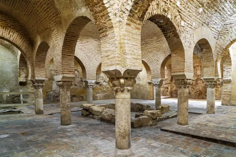
  • The Arab Baths. They are the largest and best-preserved Arab baths in Spain. Built in the 11th century during the reign of Abd al-Rahman II, they are located beneath the Villardompardo Palace in the heart of the city's historic centre. Covering an area of 450 square metres, they still preserve Almohad decorative elements, suggesting that they were restored towards the end of the 12th century. Between the 14th and 15th centuries, after they ceased functioning as public baths, the rooms were converted into tanneries. Later, at the end of the 16th century, Fernando de Torres y Portugal, Count of Villardompardo and Viceroy of Peru, built his palace above them. At the beginning of the 20th century, together with several adjoining buildings, they became part of a women's hospice. A section of the baths was rediscovered in 1913 and, a few years later, they were declared a National Monument. Today, following a restoration project that received the Europa Nostra Award, they form part of the "Arab Baths" Cultural Centre, which also houses the Museum of Popular Arts and Customs and the International Museum of Naïve Art.
  • Chapel of Jesús (Camarín de Jesús). The chapel and the convent church of Saint Joseph are the only surviving remains of the former Convent of Saint Joseph of the Discalced Carmelites, founded in the 16th century. The recently restored church, with its characteristic Carmelite façade featuring a niche, houses both the chapel and the Camarín de Jesús, created in the 17th century to enshrine the celebrated Renaissance sculpture of Nuestro Padre Jesús Nazareno ("El Abuelo"). The image belongs to the brotherhood founded in this very convent in 1588 and is carried in procession during the early hours of Good Friday before thousands of worshippers and pilgrims. The façade is adorned with a beautiful terracotta sculpture of Saint Joseph by the renowned ceramic artist Paco Tito.
  • Church of La Magdalena. Originally the city's Great Mosque during the Islamic period, it was converted into a parish church following the Christian conquest. Its main façade and interior are Gothic in style, while one of its towers still preserves the former Arab minaret. The church contains several important works of art, including Calvary by Jacobo Florentino "El Indaco", a panel of Our Lady of the Pillar attributed to Pedro Machuca, the 16th-century Christ of Clemency by Salvador de Cuéllar, and the 18th-century image of Saint Mary Magdalene by Mateo de Medina. The courtyard of the former mosque, with its rectangular ablution pool, served various public purposes during the Christian era and was landscaped with gardens and ornamental fish during the 20th century.
  • Church of Saint Bartholomew. It is one of the oldest churches still standing in the province of Jaén. Dating back to the medieval period, this religious monument features a Baroque exterior and a Mudéjar interior. Among its highlights is a green glazed ceramic baptismal font decorated with 15th-century Gothic inscriptions.
  • Provincial Council Palace. This palace was built in the mid-19th century by architect Jorge Porrua. Originally, the site was occupied by the Convent of Saint Francis, commissioned by King Ferdinand III in the 13th century. A century later, King Peter I of Castile ("Peter the Cruel") granted it to the Franciscan friars. Following the ecclesiastical confiscations, the building became public property and was eventually converted into the headquarters of the Provincial Council. Today, visitors can explore its central courtyard and the lower galleries.
  • Oppidum of Puente Tablas. The fortified Iberian settlement of Puente Tablas is located just 4 kilometres from Jaén. Over more than thirty years of archaeological research, the site has revealed its outstanding historical importance through evidence of continuous human occupation from the Bronze Age to the Islamic period. However, its most significant phase dates from the Iberian period, particularly the 4th century BC. Visitors can discover how the Iberians of the Upper Guadalquivir lived while exploring one of the most impressive defensive systems of the period, with more than 300 metres of preserved walls standing over 5 metres high. Visitors can enter the settlement by following the same route once used by its ancient inhabitants, passing through the famous Sun Gate.
Naturaleza

Half of the municipality of Jaén lies within the Baetic Mountain Range. This impressive landscape can best be appreciated from Santa Catalina Castle, an exceptional viewpoint overlooking both the city and the surrounding countryside.

To the south stretch rugged mountains and rocky peaks, forming the peri-urban parks of Santa Catalina and Monte La Sierra, where visitors can enjoy a wide variety of hiking trails and mountain routes just a short distance from the city centre.

To the north lies the fertile countryside, with gently rolling hills covered by centuries-old olive groves. Further afield, the landscape gradually gives way to pine forests, terebinths and holm oaks, announcing the arrival of the mountains.
Activities such as hiking, cycling, rock climbing and via ferrata are all within easy reach for both residents and visitors, only minutes from the city centre.

Fiestas y Eventos

The Bonfires and the San Antón International Urban Night Race, declared a Festival of National Tourist Interest, is held on the weekend closest to 17 January. More than 12,000 runners enjoy a unique atmosphere along the route, with music, flaming torches and enthusiastic crowds cheering them on. Afterwards, bonfires are lit in neighbourhoods and squares throughout the city. Around these fires, people gather to sing, dance and enjoy the traditional "melenchones", while sharing local cured meats, regional wines and rosetas (popcorn), creating a warm and festive atmosphere where unforgettable moments are shared.

Carnival. Carnival celebrations in Jaén have a history spanning more than 700 years. For over a month, comparsas, chirigotas and other carnival groups parade through the streets to the Darymelia Theatre, where they perform humorous, satirical and socially critical songs as part of the competition organised by the City Council. Local groups and individuals also take part in the fancy-dress competition, delighting spectators during the colourful parade through the city centre.

Holy Week in Jaén is a religious, cultural and tourist event of outstanding importance. Its brotherhoods and confraternities preserve a legacy dating back to the 16th century, renowned for the beauty and artistic quality of their religious sculptures. Holy Week has been declared both a Festival of National Tourist Interest and of Andalusian Tourist Interest. Twenty-one brotherhoods take part in the processions from Palm Sunday to Easter Sunday, with one of the most moving moments taking place during the early hours of Good Friday, when El Abuelo is carried through the streets.

The International Olive Oil and Related Industries Fair (Expoliva), held every two years at Jaén's Exhibition and Conference Centre, is recognised as one of the world's leading events in the olive oil sector. Over four days, it brings together farmers, machinery manufacturers, transport companies, olive oil producers from around the world, scientific symposiums and conferences, making Jaén the international capital of the olive-growing and olive oil industry.

San Lucas Fair. This fair originated in the 14th century through a privilege granted to the city by King Henry IV of Castile. Originally held in August to coincide with the harvest season, it was moved to October during the 19th century to coincide with a livestock fair. From 12 to 18 October, the city hosts numerous events including bullfights, concerts and theatre performances. At the Alfonso Sánchez Fairground, visitors can enjoy open festival tents serving traditional cuisine, live music, dancing and fairground attractions, as well as the traditional tents at the "La Vestida" fairground.
Music plays an important role in the city's cultural life. Jaén hosts the Autumn Festival, the prestigious Jaén International Piano Competition, Oleosónica, Jaén Sounds Like Opera, the Bolero and Latin American Music Festival, many other music festivals throughout the year, and the internationally recognised Jaén International Jazz Festival: "Jazz Among the Olive Trees".

Other Festivals and Events:

The Bonfires of Saint Anthony, held on 17 January. Amid singing and dancing, the traditional "melenchones" are performed while people share laughter, conversations and "rosetas" (popcorn). This festival has been declared a Festival of National Tourist Interest.

May Crosses Festival. A tradition in which local residents decorate crosses beside churches, in squares and other iconic places throughout the city. Both locals and visitors tour the crosses, enjoying the festive atmosphere, gastronomy and community spirit that surrounds them. Children also take centre stage on Friday afternoon, parading through the city centre with small floats decorated with crosses, Christs and Virgins of their devotion. They are dressed in traditional mantillas and accompanied by civil, religious and military representatives, delighting everyone who watches the procession.

Corpus Christi.

Festival in Honour of the Virgin of the Chapel, co-patron saint of the city. These festivities take place in the popular San Ildefonso district, combining religious devotion to the patron saint with celebrations in Jaén's best-known gastronomic quarter, where bars and restaurants extend their terraces into the streets to offer their finest dishes. The City Council also organises a wide programme of cultural and tourist activities throughout the festival. Every 11 June, the Lola Torres Choirs and Folk Dance Association holds a floral offering to the Virgin. Participants parade dressed in the traditional pastira costume (for women) and chirri costume (for men), joined by many other residents of Jaén. The celebration concludes with the performance of the traditional Bolero de Jaén before the Virgin's image. In the afternoon, the Virgin is carried in procession through the city centre to the cathedral.

25 November – Saint Catherine's Day. The feast day of Jaén's co-patron saint is celebrated on Santa Catalina Hill. After the procession climbs to the castle, a religious service is held inside. Afterwards, visitors enjoy food from the stalls and bars set up around the castle, where grilled sardines, barbecued meats, patatas a lo pobre and paella are among the traditional dishes served in a wonderful atmosphere of celebration and togetherness.

From the beginning of December, the city enjoys a wonderful Christmas atmosphere with the switching on of the festive lights and the start of an extensive programme of activities, including concerts, street music and theatre for all ages. The popular central street, Calle Carrera, is beautifully decorated and welcomes everyone who wishes to share moments of joy and celebration with the people of Jaén.

Gastronomía

Jaén's gastronomy is varied and is based on the Mediterranean diet, in which extra virgin olive oil gives dishes their distinctive aroma and flavour.

Among the city's most traditional dishes are:

  • Pipirrana, made with finely chopped ripe tomatoes and dressed with a mixture of extra virgin olive oil, green pepper, garlic, egg and salt. It is often topped with grated boiled egg and, optionally, tuna.
  • Homemade partridge pâté.
  • Migas with traditional accompaniments.
  • Scrambled eggs with broad beans and Iberian ham.
  • Broad beans, campion greens or spinach with pine nuts, showcasing the quality of Jaén's vegetable gardens.
  • Roast kid goat, chicken, young goat or lamb.
  • Trout from the rivers of Jaén.

Among the desserts, we should mention gachas dulces (sweet porridge), fried milk, and, of course, the traditional pastries made in the local convents (the Bernardas, Santa Clara and the Carmelite nuns).

If you would like to enjoy a unique culinary experience, the San Ildefonso district is home to two Michelin-starred restaurants: "Bagá" and "Dama Juana".

Historia

The human presence in the present city is seen from the calcolitic stage, also called the Copper Age, when there were several villages scattered around the area. In the surroundings of the city, rock paintings and remains of megalithic architecture have been found.

Otra información

Jaén is a city that houses a large number of legends very imbricated in the soul of its people. Maybe the most famous of them is the "Maline lizard"or"Jaén lizard. "The influence is such that it has become one of the symbols of the city, being present in its architecture, rides and concerts. It is based on the existence of a dragon (lizard) that had the population afraid and that with ingenious tactics its inhabitants managed to get rid of it.

Loading map
Preparing points of interest and routes...
Imagen principal
imagen
Image
a4c3eb80-f7b7-801d-a6f0-4d01416611b6?t=1603979481525
Imagen principal
Activado

Hornos de Segura

Submitted by brandcode_deweloper on
Id
731780
Perfil de redes sociales
Facebook
https://www.facebook.com/profile.php?id=100093559135446
Descripción
Breve descripción

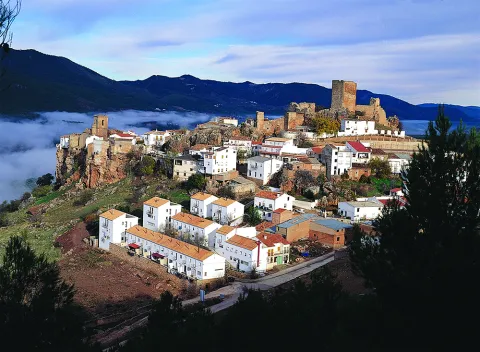
Nice town located in the Sierra de Segura, fully included within the Parque Natural de las Sierras de Cazorla, Segura and Las Villas. Next to the reservoir of the Tranco de Beas and the valley of the Guadalquivir River at its beginning.

The municipality of Hornos belongs to several villages spread throughout the municipality: Cañada Morales, La Capellanía, El Carrascal, Fuente de la Higuera, Guadabraz, Hornos El Viejo, El Majal, La Plantera, El Tovar, El Tranco and La Venta. Some of them are located in places of great beauty, such as La Plantera or La Capellanía, and others are more active thanks to their situation, such as Cañada Morales or El Tranco. The rest with a marked agricultural character, where peace and tranquility are assured, are currently developing interesting quality tourist infrastructure such as rural houses.

Furnaces are essentially forest, the pinars occupy about 80% of their municipal term.

The urban core is surprised to be located on a large peñasco. Its medieval character gives it a special charm. It has been declared an Artistic Historical Set in 1985.
Its economy is based on tourism, forest use and olive cultivation. Without forgetting the very important activities and fishing.

It has a rich heritage: the Castle, the Church of Our Lady of the Assumption, the Castle of Bujaraiza, the Puerta de la Villa, the Mirador del Aguilón and the Tower of Bujarcaiz.

Telecomunicaciones
Teléfono
953 495 002
Sitio web
www.hornos.es
Fax
953 495 031
Correo electrónico
secretaria@hornos.es
Ubicación
Nombre
Hornos de Segura
Latitud
38.216730
Longitud
-2.719170
Distrito
Municipio
Ubicación en el mapa
POINT (-2.71917 38.21673)
Imágenes
imagen
Image
d562cab0-e866-6fc2-5039-73ea3dbf7a78?t=1617879834093
Imagen principal
Desactivado
imagen
Image
4684996b-b0d2-b0c9-6c52-78a920a820ba?t=1617879834360
Imagen principal
Desactivado
imagen
Image
3cec6640-bac7-3c8e-ffdb-f6c872b5e0cb?t=1617879834408
Imagen principal
Desactivado
imagen
Image
d4899350-18e9-f1b0-db9d-0b24730b8c30?t=1595609312667
Imagen principal
Desactivado
imagen
Image
barco-solar-jpg
Imagen principal
Desactivado
imagen
Image
f206640e-6f53-e174-aeb5-00637460fe64?t=1617879834950
Imagen principal
Desactivado
imagen
Image
1466792f-a098-2464-a39e-1dcc797b36fa?t=1595609312725
Imagen principal
Desactivado
imagen
Image
e4ae55d5-e1fc-f627-48a6-8b65c462cff8?t=1602772415163
Imagen principal
Desactivado
imagen
Image
830bbe2f-9ca3-3494-3786-ada91c4ef032?t=1617879835016
Imagen principal
Desactivado
Información adicional
Imágenes cabecera
imagen
Image
Hornos de Segura
Imagen principal
Desactivado
Datos de interés

Tourist area: Serras de Cazorla, Segura and the Villas
Distance to the capital (km): 103
Altitude over sea level (m): 865
Extension (km ²): 117
Number of inhabitants: 679
Gentillo: Horneros or Hornenses
Postal code: 23292

Videos
Video file
Cultura

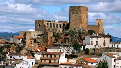
Castle. Hornos was granted by Fernando III the Holy, after his conquest in 1239 to the Order of Santiago. The time at which the castle would be built, probably on an earlier Muslim fortress from which the aljibe is preserved.

Of a purely defensive nature, the trapezoidal shape set is built with small masonry. It is made up of a magnificent Tribute Tower, three slender torreons square floor and the outer wall of a room that closed the courtyard of arms.

The Tower of Tribute in square shape and rounded corners, something common in the constructions of the Order of Santiago, has only one entrance at half height.

In its interior two overlapping rooms supported by vaults and communicated by a staircase carved in thick wall.

By the end of the 20th century, the rehabilitation of the castle that was very damaged began. After many attempts, in 2011 the works of their total restoration were completed. It has been declared Good of Cultural Interest in 1985.

Located inside the castle you can visit one of the most important tourist resources of the area as is the Cosmolarium.It is a centre for the dissemination of astronomy that consists of a digital planetarium, with a dome of 8 meters in diameter that shows enveloping audiovisual productions, complete exhibition rooms on the Universe, spaces for workshops and educational games, as well as a terrace for astronomical observations.

Parish Church of the Assumption. Data from the first half of the 16th century. Its construction follows the style of the Order of Santiago. Of a square floor, with one ship and side chapels, it is divided into three square sections separated by fajon arches.

The decks are gothic, the 16-century renaissance-style altarpiece as it is recorded. The cover is one of the first plateresque in the province of Jaén, although it is currently damaged by time.

The tower stands out for the gargobles of the cornice and the Gothic crest of the mast. We can say it's a magnificent example between Gothic and Renaissance.

In it was found the ornamental vessel in the form of a Nazi-style amphora, with motifs glazed in blue and gold on white enamelled background that is preserved in the National Archaeological Museum.

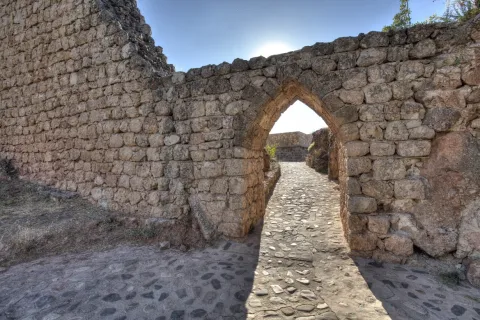
The Villa Gate. It's a door on the wall dating back to the 11th century. It is built in elbow to make access to the enemy difficult, which makes you think of a mothade origin. Made of masonry and red brick in the vaults, as well as a small window of the facade. Declared Good of Cultural Interest in 1985.

Bujaraiza Castle. It rises on a the island in the waters of the Tranco reservoir. It is a small fortress formed by a walled polygonal enclosure and a tower of tribute. It is built with small-size masonry yarn, with lime mortar. Declared Good of Cultural Interest in 1985.

Tower of Bujarcaiz. It is currently submerged under the waters of the Tranco reservoir. It was part of the surveillance system of the Hornos castle. It is a square floor construction and a troncoconic form.

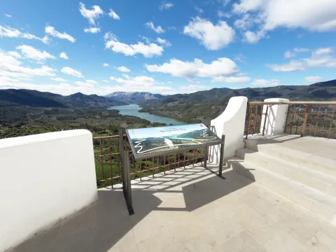
Aguilon Viewer. Located next to the City Hall shows one of the best views of the Natural Park and an impressive view of the waters of the Tranco reservoir.

Naturaleza

The municipal term of Hornos is located in the heart of the Sierra de Segura, and by it they run the waters of the high courses of the Segura and Guadalquivir rivers, it takes its waters to the Tranco reservoir.

The water is present in much of its term and makes that nature is overflowingboth in the arid High summits villages of larive pine trees and high-rise tiles, as in the lower areas where the black pines grow, whose wood is very resistant to rot, oaks, oaks, moans and chopos.

Here we find more than thirty endemic species that cover the steep surfaces of the rocks, such as aromatic plants or the curious trapping.

The variety of ecosystems also makes the number of animal species living in these areas very diverse. In the higher and more steep areas live the large-game, muflon, deer, go and boar species; Rapes and scavengers like, eagles, broken bones and lethargy vultures. And in the less high areas, the cynetic species of minor hunting: badgers, foxes, hares, rabbits or gines. Without forgetting the fauna that lives in the crystalline waters of these rivers: trout, barbs, otters, salamanders. No the birds who either live in olive trees, or feed on their fruits in their migratory movements: carboneros, abbullas, jilgueros, petriroreds, ratoneros...

The municipal term of Hornos will present us with thousands of routes to discover and that it will surely leave a deep footprint on us when you go through them.

We point out three places that we should not miss:

  • The Tranco Pantano. It is an inner sea between pine trees, given the abundant vegetation surrounding it and the olive sea that goes down to the banks of the reservoir. The main and regulator of the Guadalquivir River. The village of Tranco had chapel, schools, event hall, sound cinema, post office and civil guard headquarters. Dolorosa was the disappearance under the waters of the Lordship of San Miguel de Bujaraiza, loaded with history and whose castle still stands out challenging above the waters, when the swamp is at its highest level. From time to time, in El Tranco water sports have proliferated. This activity is designed to be enhanced by public institutions as an alternative to tourism in one of the essential visiting places for all nature lovers.
  • Cynegetic park. An interesting nature reserve where animals live together in semi-freedom, highlighting especially deer and go. It is visited following a perfectly marked itinerary that has sources and viewpoints. It is near the Tranco swamp.
  • The Celadillas. A promenade area with a view towards the village and the Tranco swamp. The views are unbeatable.
Fiestas y Eventos

These are the parties that are held in Hornos:

  • Patron parties. In honor of Our Lady of the Assumption and Saint Roque and are held in mid-August. For a week there are dances, Turkish bowling championships, summer cinema and the most important things: "The Vickles". On the new door, you can release the poplars that are run through the streets of the village. This taurina tradition has a deeply popular character.
  • Saint Anton. The 17 January And it's the pattern of the animals. The day before, fires are lit, around which they dance, sing and eat and drink. As long as the light lasts, chorizos, morcillas and other viandas of the pig are prepared, such as the carette accompanied by traditional drinks such as the crow and the mistelle.
  • Romeria under the title of the Virgin of Fatima, is held since the mid-last century. A teacher from the school of La Capellanía donated an image of the Virgin of Fatima to the parish of Hornos and asked the parish priest to perform a mass so that the children of the village and the surrounding cortijos could make the first communion. Today is celebrated in the beautiful The Control site.
  • Holy Week. Emotional procession that takes place on the Sunday of Resurrection in which the encounter of Mary and her Risen son. The hornilleros celebrate this day by shooting their shotguns in the air, for the time the process course lasts.

They are also held Other parties as: San José, in Cañada Morales and the Virgin of Carmen in the Tranco.

Gastronomía

Among the most typical dishes of Furnaces are:

  • Pig derivatives. The products derived from the pig have an important place. Chorizos, loins, ribs, solomiles, stored in the oil of the traditional orza. The morcillas, longanizas and faces that are left to be consumed on the day of Saint Anton around the bonfires.
  • Garlic. It is made with the liver of the fried pig that is added to a saffrito of green peppers, tomato, garlic and pepper, to end up adding mist of bread, water and spices. It is also known as Killing garlic.
  • Garlic of flour. With potatoes and vegetables, but with the unmistakable taste of nisthem from the saws.
  • Bread crumbs. They have the particularity that they are cooked in a meat broth with crushed peeled tomato.

To highlight the drinks which are usually taken on festive occasions. This is about "the crow," a mixture of wine and water with a lot of sugar and pieces of fruit; "Mistel." made up of spirits, coffee and spices.

To accompany these drinks you will take some traditional sweets, including the panets and Fried roses.

Historia

The site currently occupied by Hornos He was busy. for the period Copper age and remained busy during the Bronze age. This place was subsequently abandoned.

From the Roman times There are many remains of tombstones, coins and ceramic pieces in the La Laguna field.

It's in the Middle age when this population reaches its greatest splendor, mainly due to its strategic and defensive situation. The Arabs know her as Fornus and was a small village inaccessible for its situation.

The Islamic Age in the area of Hornos, and in the mountains in general, she was convulsed by the struggles between the leaders who wanted to impose her authority. The population for the most part was Muladi. During the X and XI centuries, is a zone of great splendor, Since along with the surrounding populations are the border between Christians and Muslims, they will be the starting point of war expeditions against Christians.

The Christian conquest was carried out by the knights of the Order of Santiago in 1239, in particular by Pedro Pelayo Correa, master of the Order and was attached to the commission of Segura de la Sierra, dependent on the spiritual of the diocese of Cartagena. Fernando III will grant you the Villa title.

Hornos was one of the places, along with Segura de la Sierra, from which members of the Manrique family actively participated in the Spanish politics of the 15th century. This family was generally confronted with the kings of Castilla Juan II and Henry IV, as they always controlled a large part of the forces and resources of the Order of Santiago, of which Don Rodrigo Manrique, the commander of Segura, came to proclaim himself Grand Master, resisting and defeating in Hornos the troops sent against him by John II and his valid Don Álvaro de Luna.

In 1833 the demarcation of the municipality within the province of Jaén, after a stage of secondment and belonging to the province of Murcia.

The period of the largest expansion of this population was between the mid-19th and mid-20th centuries. From this date its population has declined to reach the just over 700 inhabitants at present.

Otra información

A characteristic sport in Furnaces are the serrano bowling, which consists of throwing a ball without passing a line and giving the "mingo" of wood to send it as far away as possible. They are made championships and come neighbors of the rest of the villages that make up the municipality.

Loading map
Preparing points of interest and routes...
Imagen principal
imagen
Image
Hornos de Segura
Imagen principal
Activado

Cazorla

Submitted by brandcode_deweloper on
Id
727503
Perfil de redes sociales
Facebook
https://www.facebook.com/ayuntamientode.cazorla
Twitter
https://twitter.com/AytodeCazorla
Descripción
Breve descripción

Cazorla is a municipality located to the east of the province of Jaén, declared a historical-artistic complex and within the Natural Park of the Sierras de Cazorla, Segura and Las Villas, the largest protected space in Spain, the second in Europe and declared a Biosphere Reserve by Unesco since 1983.

It is the main urban enclave in these serranies. Its urban centre is located in the shadow of the Hawks' rock, with the saw behind its back and an immense sea of olive trees towards the sunset.
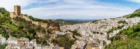
On the whole, the majestic castle of the Yedra stands out, from which you can see fantastic panoramic views of the urban warp of white houses, narrow and steep streets, with traditional houses and master houses, and a large number of monuments of outstanding artistic interest.

The waters of its slopes are collected by the River Cerezuelo, tributary of the Guadalquivir. A place where nature is expressed in its greatest splendor.

Telecomunicaciones
Teléfono
953 710 102
Sitio web
www.cazorla.es
Correo electrónico
hola@cazorla.es
Ubicación
Nombre
Cazorla
Latitud
37.913000
Longitud
-3.002700
Municipio
Ubicación en el mapa
POINT (-3.0027 37.913)
Imágenes
imagen
Image
85b80621-7b8b-3b9c-8a00-a8148aeeb028?t=1603980245902
Imagen principal
Desactivado
imagen
Image
b594df67-f959-109e-c0ba-7e18a6472567?t=1604611878998
Imagen principal
Desactivado
imagen
Image
c1c05e33-7065-7f4b-98d0-102559d70087?t=1617642311354
Imagen principal
Desactivado
imagen
Image
ddf4ab98-9081-e8a6-be4e-1de1e18fa35f?t=1585601103888
Imagen principal
Desactivado
imagen
Image
cascada-de-la-malena-jpg
Imagen principal
Desactivado
imagen
Image
5a4be7ef-845e-1311-4465-5d93ee402b65?t=1585662613147
Imagen principal
Desactivado
imagen
Image
6b0f484b-a6df-5339-56ce-d36c1b3447bf?t=1585662608904
Imagen principal
Desactivado
imagen
Image
98013154-7e60-0798-f8a2-8276d4558831?t=1585662610794
Imagen principal
Desactivado
imagen
Image
8e6fbd9b-cd54-a1bb-152d-26517851640a?t=1585662606458
Imagen principal
Desactivado
imagen
Image
53c2b0f0-ae8b-4c68-be4a-65a62d56213a?t=1585662608209
Imagen principal
Desactivado
imagen
Image
6dfc9684-2c39-5bcb-6034-5f683a2d4fe7?t=1585662610402
Imagen principal
Desactivado
imagen
Image
d05370ad-6492-179e-94f9-f68a1f31a13e?t=1617642404091
Imagen principal
Desactivado
imagen
Image
984decb5-d613-1794-5c3d-c6906af63538?t=1617642404161
Imagen principal
Desactivado
imagen
Image
19447111-87cb-503d-367d-48d3479d9dff?t=1617642477177
Imagen principal
Desactivado
imagen
Image
843cba48-ecf2-71bb-65c4-4c96633d6c17?t=1617642477250
Imagen principal
Desactivado
imagen
Image
b3601395-6287-90b8-0503-7c31c7d3cbb8?t=1617642477422
Imagen principal
Desactivado
imagen
Image
cazorla-1-jpg
Imagen principal
Desactivado
Información adicional
Curiosidades

https://cazorla.es/turismo/
turismo@cazorla.es

Imágenes cabecera
imagen
Image
castillo-de-la-yedra-6-jpg
Imagen principal
Desactivado
Datos de interés

Tourist area: Serras de Cazorla, Segura and the Villas
Distance to the capital (km): 105
Altitude over sea level (m): 836
Extension (km ²): 305
Number of inhabitants: 8527
Gentilicon: Cazorleños
Postal code: 23470

Videos
Video file
Cultura

Cazorla, at the gates of the Natural Park of the Sierras de Cazorla, Segura and Las Villas, is a lesson of how man and nature have forged an alliance that comes to this day. Its rich cultural heritage includes places that cannot be lost.

The castle of the Yedra, whose origins could be Muslims, perhaps from the Almohad era (12th century), although throughout the 13th, 14th and 15th centuries Christians finished giving it their definitive configuration, which explains that in many of their inner stays the Gothic style predominate. The tower of tribute houses the Museum of People's Arts and Costumbres of Alto Guadalquivir. It is a place where you can learn more about how the ancestors lived on these lands.

From its enclave, 831 meters above sea level, it is seen the town of Cazorla and its surroundings.

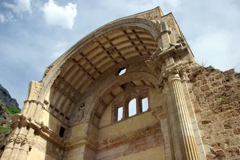
The ruins of the church of Santa Mariaa sample of the Andalusian Renaissance. It is very likely that its author was Andrés de Vandelvira, as many of its elements can be recognized in the temples of its author located in Ubeda.

It is built on the Cerezuelo River, which was forced to channel previously, and which enters a large visitable vault under the main altar, across the whole church, to follow its course under the square of Santa Maria. It is very likely that the church was never fully completed and that the serious damage caused by the terrible storm and flood of 1694 would further make it difficult to complete it. It is the only church built on the bed of a river.

The City of Cazorla currently houses the Municipal Office of Information and Tourism and the Multipurpose Spacewhere concerts and shows are held.

Naturaleza

The location of Cazorla in the middle of the saw, whose historic town seems to be spilled on the rock of the Hawks, certainly makes it one of the most beautiful Jienian peoples. And the best way to discover the wonders of nature in this area is to realize one of the paths that, duly signified, exist in the environment. These include the following:

  • The Castle of the Five Skins Path.
  • Circular path of the Cerezuelo River.
  • Path of the Stairway.
  • The birth of the Guadalquivir River.

Walking these paths will be the ideal way to contemplate the maze of valleys, calares, slices, mountains and river basins, as well as the large number of rivers and streams that go along the slopes. In these walks, we will also discover the variety of Mediterranean botany of this place: pine, juniper, oak and other endemic species. Among the fauna are rapacious birds and mammals such as the rabbit, hare, deer, foxes and boars. A unique opportunity to discover the many ecosystems that exist in this environment.

Fiestas y Eventos

The Holy Week is of unique importance in this town of Cazorla. During the days of this week they process several steps in each of the days and have been carved by well-known imagers.

The Romeria de la Virgen de la Cabeza, which takes place on the last Sunday of April, has a deep-rooted devotion among the neighbors. In preparation for the rosemary, on the Sunday of April before the rosemary, a parade of lambs decorated with colored ties is held to be offered to the Virgin and will be auctioned in the following days.

From the City Hall, numerous cultural and sports events are organized and promoted, including the following: Blues Cazorla Festival, International Theatre Festival, Festivals of the advance of Cazorla, Nocino de la Tragantía (a local theatrical association), Marathon BTT Sierra de Cazorla.

Gastronomía

The gastronomy of the 26 municipalities that form this Natural Park of the Sierras de Cazorla, Segura and Las Villas is influenced by both Andalusian and Castile La Mancha cuisine.

The raw materials they use are game meat, river fishing, vegetables and vegetables from their own harvest. That's right, all of it properly decorated with the oil of their olive groves.

Among the most typical dishes, we will mention the following:

  • The gachfriend, crumbs of flour, water, oil, dried and fried peppers, chorizo and, depending on the time of year, melon, cherries, grapes...
  • Ajoflour: flour, garlic, peppers, potatoes, tomatoes, pepper, water and salt.
  • Thalarines or rhinestones: fine flour mass cakes with hare or rabbit.
  • The rhin-ran.: a good entrance at any table. The traditional serrano bread is attached in a purée of pyrrrrrama or gypsy salad: made of onion, pepper, tomato, garlic, cumins, extra virgin oil, vinegar and salt.
  • The serrana trout, trout in almond sauce or trout with truffle.
  • Grape bread: an outstanding dessert made with dried figs and mixed with nuts, minced almonds and a chorrit of anis.
Historia

Around 2000 BC, on the ancient terraces of the Cerezuelo River, the first inhabitants are established.

During the romanization, the Romans settle in this region and exploit the wealth of silver and salt that existed in the area. It will be during the Muslim occupation that Cazorla, like its neighbouring localities, will be fortified by the construction of castles.

In this way the Lord of Cazorla in the Middle Ages will become a major border enclave. This shows the number of castles and fortresses that delineate the advance, created in 1231.

The Christian conquest of these territories was carried out by Mr Rodrigo Ximénez de Rada, Archbishop of Toledo, in 1235. It will be King Ferdinand III who gives in feud to the archbishopric of Toledo these territories under the name of the advance of Cazorla.

The lordship will continue until the abolition of the Lordships in the early 19th century, although in this time space there are jurisdictional conflicts between the inhabitants and the diocese of Toledo.

The Cortes de Cadiz gave him the title of City in 1813 for his participation in the War of Independence.

Loading map
Preparing points of interest and routes...
Imagen principal
imagen
Image
cazorla
Imagen principal
Activado

Canena

Submitted by brandcode_deweloper on
Id
726500
Perfil de redes sociales
Facebook
https://www.facebook.com/Canena-Ayuntamiento-797777960269910/
Twitter
https://twitter.com/aytodecanena
Descripción
Breve descripción

Canine is a small municipality in the province of Jaén, located in theNorth slope of the region called The Loma.

It is an olive town, as the almost whole of its municipal term is dedicated to the cultivation of the olive tree. Canine is a municipality with a 14 km ², very small compared to the villages around him: Ibros, Rus, Baeza or Ubeda.

It has an impressive castle - palace of the Renaissance period, ordered to build by Mr Francisco de los Cobos, secretary of King Charles I.

The parish church dedicated to Our Lady of Conception is Renaissance in style and is raised in the first half of the 16th century.

Special mention deserves the interesting spa of thermal waters dating from the Roman era and was officially declared as a spa in 1853. Its mineromimicinal waters were declared public utility in 1948, currently being the only spa in operation within the province of Jaén.

Telecomunicaciones
Teléfono
953 770 161
Sitio web
www.canena.es
Fax
953 770 157
Correo electrónico
canena@canena.es
Ubicación
Nombre
Canena
Latitud
38.048160
Longitud
-3.481680
Municipio
Ubicación en el mapa
POINT (-3.48168 38.04816)
Imágenes
imagen
Image
bcadd46f-d550-47db-93e9-04bf1a97ab12?t=1617622860093
Imagen principal
Desactivado
imagen
Image
7287a0e8-f3ef-ba63-26c4-01565406f663?t=1586302332591
Imagen principal
Desactivado
imagen
Image
52ff6eaf-5b0e-9aaa-cdee-031ee1621868?t=1610987722402
Imagen principal
Desactivado
imagen
Image
8e65ff68-4368-5691-a789-da9cbf865678?t=1610987769453
Imagen principal
Desactivado
imagen
Image
deb4b4cb-b7fa-bb24-46a6-6b78ffc33f0e?t=1610987805783
Imagen principal
Desactivado
imagen
Image
f9119661-9354-8645-7628-9c3c22feab2e?t=1593796058632
Imagen principal
Desactivado
imagen
Image
88783720-57b3-bc14-567e-66e1738fbf73?t=1610987851073
Imagen principal
Desactivado
Información adicional
Curiosidades

ADR La Loma y las Villas: www.adlas.es

Imágenes cabecera
imagen
Image
canena
Imagen principal
Desactivado
Datos de interés

Tourist area: Ubeda / Baeza
Distance to the capital (km): 47
Altitude over sea level (m): 525
Extension (Km2): 14
Number of inhabitants: 2096
Gentilicon: Caneneros
Postal code: 23420

Videos
Video file
Cultura

From its artistic heritage we highlight:

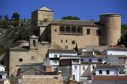
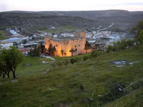
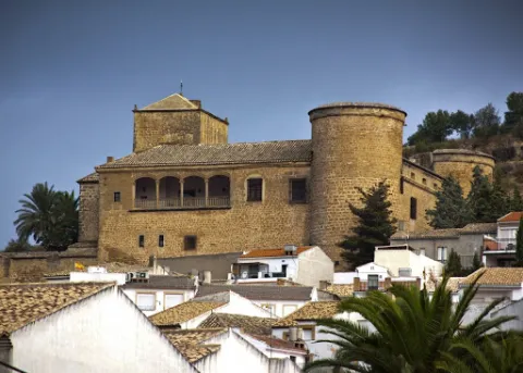
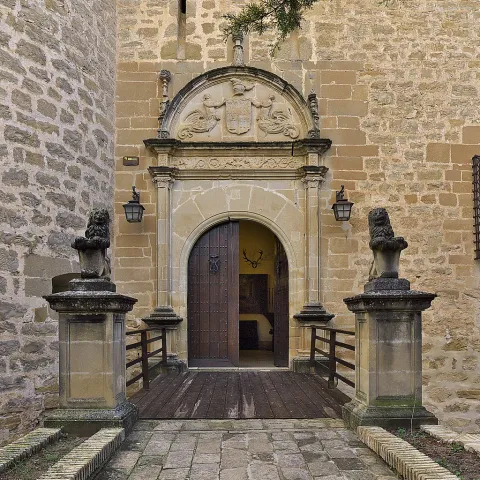
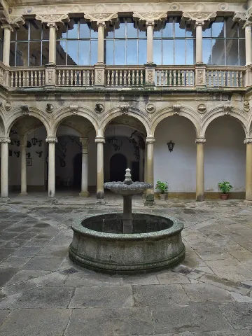
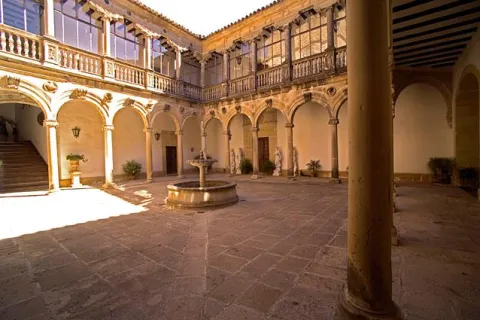
  • The Castle-palace, which belonged to Francisco de los Cobos, and was built in the second half of the 16th century, after the purchase of the town by Francisco de los Cobos. Of almost square floor, with four circular towers on the corners, two larger on the main facade. The tower of tribute, square floor. Antaño was surrounded by a moat, now blinded, the slots are preserved to lift the old lift bridge. The cover, with a half-point arc, it is flanked by Corinthian pilasters, with an architrabed, cold setting decorated with grotesques and a cornice on which the half-point arch is raised, which welcomes, in its eardrum, the shields of the founders, and on its fantastic sides, tenants figures with the lower half of their bodies transfigurated in wing and vegetation. On the facade are scattered windows with conventional-style bars. The castle has a inner courtyard It has double gallery of half-point arches with Ionic columns and claustral staircase. The upper gallery, also Ionian, repeats the intellized structure, with the peculiarity of large zapatas on the columns, which support in plintos decorated with military motifs and, it borders a railing of balaustres. The set offers a constructive sobriety and a balance and harmony that demonstrates the authorship of an artist builder like Andrés de Vandelvira. It was declared a National Monument in 1931. It is currently in private hands.
  • Our Lady of Conception parish church, It is built in the first half of the 16th century and is of Renaissance style. It is made up of three ships, the largest central than the sides, separated by half-point arches that are based on columns. It also has a crypto of great robustness, dated around 1000.
  • Hermitage of Our Lady of RemediesIt was built in the 15th century and finished in the first half of the 18th century thanks to alms, as indicated on the facade. The entrance is protected with a small cancel with three more lower-than-usual carpanel arches and supported by dogrous columns on plintuses.
  • Molinillo. It is a hydraulic construction of the Roman era, intended for the grinding of the cereal, and is located on the left bank of the Yedra stream, about 700 m from the urban centre. It was improved at the time of Carlos V, when the villa was bought by Francisco de los Cobos.
  • Sources, dedicated to the solace of its inhabitants and the irrigation of gardens. There are several of us: New Source, Caño Source, Ark Source and Pilarejo.

Naturaleza

A Canine is considered as the entrance door to the region of La Lomaa plateau above the basins of the two rivers, to the north the river Guadalimar and to the south the Guadalquivir.

The landscape that is presented to us when we are located in the lands of Canena is really spectacular, a true sea of olive trees, the most representative image of La Loma jiennense. The promontories are low and the earrings are soft. Some small areas are reserved for the cultivation of cereals. In the areas near the Guadalimar the vegetation changes by what we know as the riverbank forest: willows, alms and low bushes.

The small extension of the municipal term, Only 14 km ², compared to the extent of the villages around you. Although in recent years it has been increasing as farmers have to buy other land in the nearby municipalities: Baeza, Ubeda, Ibros, Torreperogil... among others. The agriculture in these places is very mechanized.

The fauna of this municipality is made up of the minor game animals: rabbits, hares, foxes, parrots, codornices... And it is very common to see the silhouette of the rapacious birds fly.

There are many roads and paths that go through the term Canena, with ideal points from which to obtain extraordinary panoramic views of the region of La Loma.

Fiestas y Eventos

The festive celebrations in Canena have as their main reference the celebration of the celebrations of the employers: Saint Mark and the Virgin of Remedies popularly known as the August Virgin.

At the parties of the Virgin of the Remediestogether with the religious spirit, migrants from the town are also received and welcomed who, on these summer dates (August), return to their people on holiday.

In late April, on the 25th, the canaries celebrate the holiday of his pattern, San Marcos. It tells the tradition that in the 17th century,It had to be processed through the streets to free the people from a plague of locusts that devastated their fields, and at the passage of the procession, the locusts were disappearing.

Since then, the grateful people have held the feast in the surroundings of their hermitage, to which they have to come, men, women and children... Barefoot! And it was also stipulated that they would not eat meat that day.

On that day, the superior of the Holy Brotherhood gives the "roscas of charity" to all the neighbors and visitors that there is that day in the town.

The San Isidro holidayin which farmers participate, processing the Holy Labrador to one end of the village to bless the fields.

The owner of the Castle lends its dependencies for the celebration of the Music Festival "Villa de Canena" held every year, on the weekends of July.

Gastronomía

The inhabitants of the town retain the custom of distributing "roscos of Charity" to all those present at the feast of their patron, San Marcos, in the times when Canena had vineyards, the neighbors accompanied the roscos with wine from their harvest, and in years of bonanza and prosperity also for stewed meat.

From the Moorish cuisine There's still a relic in the gastronomy, it's the call "sweet omelet."which consists of a light mass of yeast flour, which once made pieces is fried in olive oil, then bathed in honey.

Of the most traditional dishes of the local gastronomy, we list the following:

  • "Migas de breads con torreznos", to which is added chorizo, sardines, herring and other ingredients that we want to add.
  • "Mower soup" that reminds us quite a lot of garlic soups and they were taken in the morning. At lunch time, the refreshing gazpacho was taken, which is prepared with oil, vinegar, bread and grilled garlic, to which pieces of tomato and cucumber were added.
  • "Wink with hare" name known in the region of La Loma to the alrajos.

At the parties, both at the San Marcos and the Virgin of August, the "meatball stew." and take the traditional ones "pigeons" consisting of dry anis mixed with water, accompanied by sugar and lemon juice.

On the Sunday of Resurrection the bakeand for the Saints the "Cucumbers candy."

At Christmas they are unique to this villa the "Home-packed syrup" who are filled with angel hair, and the "Wine doughnuts."

Canena Castle is a family company that offers an exclusive, unique and 360º experience about the exciting world of Extra Virgin Olive Oil, with olive tradition since 1780.

Historia

The origin of the municipality can be traced back to the Prehistory, since in the vicinity have been found stone axes polish.

Although it is in the Roman era that the first stable populations appear in the area of the spa, as shown by the location of mosaics and a hydraulic work of the same time.

The current enclave has its origin in the Arab era. The settlement of the Banu Kinana tribe was produced in this territory around 750. Everything seems to indicate that the name of Canena comes from the name of this tribe.

1226 will definitely be conquered by King Fernando III the Holy as it advances to the lands of the Jaen countryside. After the conquest, he was handed over to the district of Baeza; shortly after, King Alfonso X would hand over these conquered lands to the military orders of Santiago and Calatrava; finally, in 1302, Fernando IV took it to the Order of Calatrava and gave it to the city of Ubeda.

At the end of the 15th century Sancho de Benavides took over from Canena in the context of his dispute over the Calatrava de Canena and began the construction of a castle, without real permission, and with the subsequent complaints of Baeza to the Catholic Kings, who had prohibited new fortresses in the territory to put an end to the struggles between the nobility sides.

In 1538 Don Francisco de los Cobos, secretary of the Emperor Charles V and great patron of the Renaissance in Ubeda and its region, buys the village of Canena. And it will be he who transformed the ruins of a castle into a sumptuous palace, whose path and direction of works were in Andrés de Vandelvira.

From then on, the town became part of an extensive Lordship of the Marquesado de Camarasa until well into the 20th century.

The image of the municipality in the 19th century was marked by the imprint of one for the care in the labour of the crops and by the presence of a property distributed from the Military Orders that exploited them in the form of a colonate, and thus would remain well into the 20th century.

The main crops were olive trees, cereal, vineyards and also orchard.

Otra información

Other points of interest in his artistic heritage:

  • San Andrés Spa, of Roman origin and with waters indicated for therapeutic treatment.
  • Canena Telecommunications Museum. It provides visitors with an overview of the evolution of communications and technologies that have made it possible.
  • House of Culture, located in an ancient house of the 16th century, also restored, with a treadmill arch and framed by the mould and cross of Calatrava.
  • San Marcos Cross, order to rise by the farmers.
Loading map
Preparing points of interest and routes...
Imagen principal
imagen
Image
can
Imagen principal
Activado

Baños de la Encina

Submitted by brandcode_deweloper on
Id
780098
Perfil de redes sociales
Facebook
https://www.facebook.com/AyuntamientoBanosdelaEncina
Twitter
https://twitter.com/ayto_banos
Youtube
https://www.youtube.com/user/bdelaencina2
Instagram
https://www.instagram.com/ayuntamientobanosdelaencina/
Descripción
Breve descripción

Baños de la Encina is a town located to the north-west of the province of Jaén, in the heart of Sierra Morena, being part of its municipal term included in the Sierra de Andújar Natural Park.

It is a town characterized by a rich cultural and natural heritage. Its abundant natural enclaves have a high ecological and landscape value.

The Rumblar reservoir or the brazen cattle shops give special beauty to the bathing landscapes. A picturesque place is the town of El Centenillo, a pedany with a past linked to mining that has inherited us very interesting vestiges of that extractor activity maintained until the second half of the 20th century.

Telecomunicaciones
Teléfono
953 613 338
Sitio web
www.bdelaencinaturismo.com
Fax
953 613 455
Correo electrónico
ayuntamiento@banosdelaencina.es
Ubicación
Nombre
Baños de la Encina
Latitud
38.175110
Longitud
-3.774660
Distrito
Ubicación en el mapa
POINT (-3.77466 38.17511)
Imágenes
imagen
Image
bb43412b-0b09-92e1-b5dd-2a3baaeef265?t=1616762819308
Imagen principal
Desactivado
imagen
Image
6e061618-da10-6b26-ebe5-300517ba8230?t=1616763048514
Imagen principal
Desactivado
imagen
Image
74310b79-8179-fae7-5b3e-b576735fa133?t=1616763048565
Imagen principal
Desactivado
imagen
Image
62832d7e-b9c5-e2e7-8c96-eaa006430cf6?t=1616763048614
Imagen principal
Desactivado
imagen
Image
7d8309d2-8fe8-afaa-52e1-30fa5ffd4344?t=1616763048663
Imagen principal
Desactivado
imagen
Image
5ad5a6f6-be90-af33-a942-c398c15eac8e?t=1585087446209
Imagen principal
Desactivado
imagen
Image
b8fc307b-b54e-2067-4fa8-d7b7e20df730?t=1616763335903
Imagen principal
Desactivado
imagen
Image
e80f5c5a-9de3-0a08-2ea9-d6e40613fec0?t=1616763335957
Imagen principal
Desactivado
imagen
Image
d5d6f262-ceaa-09c3-3124-4f3017e71822?t=1616763336007
Imagen principal
Desactivado
imagen
Image
5be66f78-cbbc-a026-651d-ffaef3679132?t=1616763336058
Imagen principal
Desactivado
imagen
Image
48647967-2b83-bcef-38bc-adf042b0be7d?t=1603119701256
Imagen principal
Desactivado
imagen
Image
8c045208-3641-3c84-2c69-e31fba4f077c?t=1616763336138
Imagen principal
Desactivado
imagen
Image
87fdbe3b-186b-19bd-8f89-e4a40bd26929?t=1616763491946
Imagen principal
Desactivado
imagen
Image
058a9ced-9222-cd95-ed71-43d8be494159?t=1616763492048
Imagen principal
Desactivado
imagen
Image
e6f47c26-b02d-fa14-8b66-df7a4cee0858?t=1616763492173
Imagen principal
Desactivado
imagen
Image
6de90817-a9cc-79c6-b605-f2af76b1648f?t=1616763336188
Imagen principal
Desactivado
imagen
Image
d4bc33bd-166f-3120-184e-4f2e5b6efdd7?t=1616763336243
Imagen principal
Desactivado
imagen
Image
1a4b34e9-0517-fd82-1815-920fb58433f6?t=1616763492470
Imagen principal
Desactivado
imagen
Image
798beea5-5af1-63e7-ac7d-4dceabb4b9ee?t=1616763492614
Imagen principal
Desactivado
imagen
Image
9c5a19f0-40c7-8be4-dbf1-e323dfae9bf9?t=1616763336434
Imagen principal
Desactivado
imagen
Image
43bfe44f-fb3e-b00e-99ad-015db6e53e10?t=1616769905170
Imagen principal
Desactivado
Información adicional
Curiosidades

Oficina Municipal de Turismo:

  • Avda. José Luis Messía, s/n. Centro de interpretación “Torreón del Recuerdo”
  • Tfno.: 953 613 338
  • https://www.laencinaturismo.com/
  • De Martes a domingo (lunes cerrado): de 10:00 h. a 13:30 h.
  • De Jueves a domingo: de 16:30 h. a 18:30 h. (verano de 18:30 h. a 20:30 h.)
Imágenes cabecera
imagen
Image
baños de la encina
Imagen principal
Desactivado
Datos de interés

Tourist area: Sierra Morena / Sierras de Andújar
Distance to the capital (km): 52
Altitude over sea level (m): 420
Extension (Km2): 392
Number of inhabitants: 2582
Gentillo: Bañuscos
Postal code: 23711

Videos
Video file
Cultura

Baños de la Encina has accumulated a rich artistic heritage that has been able to preserve and care for. To visit it is to connect with the tracks of other peoples and cultures that have passed through this territory.
From its heritage, we highlight:

  • The castle of Bury al-Hamma (Burgalimar). The impressive silhouette of the castle dominates the rural landscape of Baños de la Encina. He rose in 968, in the califal period. It is flanked by a sturdy, almond wall with 14 towers, plus the Christian tower of tribute, and it has suffered little damage, constituting the best preserved fortified set of the time. The main Christian modification was introduced on one of the original 14 turreons: the Tribute Tower (also known as the "Gorda Tower"). This tower does not look to the countryside, but to the interior of the population, projecting itself above it, which indicates the transformation into a church building. It is Gothic and is built with irregular masonry, presenting cylindrical shape to the outside.
  • The Church of St. Matthew. It is Gothic, although the tower has Renaissance finishes, as does the main cover. The most important element in it is the sacred one, one of the jewels of the sacred art of the province dating from the 17th century. It is built of ebony wood, ivory, silver and shell of Carey that make up a plateau with baroque dome, framed by four columns of shell with capitals and silver basements.
  • Hermitage of the Jesus of the Llanus. Located in the middle of the Mesteño (sheep) rest, this sober building is raised, with a single ship and a bell tower in swordsman on the main facade. The construction takes place from the 16th to the 17th century. What surprises the interior is the Camarín Tower of the venerated image. Of clear granadine influence, it is a manifestation of the most expressive baroque of the 18th century.
  • Hermitage of the Virgin of Encina. The shrine of the Virgin of Encina is 4 km away. from Baths. It was built on a smaller and primitive one from the late 13th and early 14th century. In the 17th century a remodeling was carried out, leaving it as it is today.
  • Conistory house. It dates from the 16th century, and stands out for its sober and simple aspect, nuanced by the simplicity of the grating. The cover is made up of a half-point arch, on which a balcony is opened with the typical bathrobe.
  • Wind Mill. Old wind mill of the 17th century, located in the upper part of the municipality.

Naturaleza

The Centenillo. It is a pedany that is located north of the municipal term and is located 18 km away. of the town of Baños de la Encina. A very old population, a result of the exploitation of their mines.

The year 1865 is the best time in this town, with the arrival of English entrepreneurs and the creation of a mining group that grouped 41 mines. A splendor that will be extinguished in 1963, year in which all the mines will be closed, passing the neighbors to live from the cynegetic activity.

To visit this landscape enclave to see the remains of the mining activity is to immerse us in the mining environment of that time: town of the miners, houses of the English leaders, scavengers, vagonets, laundry... Don't miss it!

Fiestas y Eventos

In addition to the celebrations of Christmas, Carnival or Holy Week, the following festivities are held in Baños de la Encina:

  • La Candelariawhich is celebrated on February 2 and the neighbors gather around great bonfires made with "ramon," remains of the pruning of the olive trees, as they eat, drink, sing and dance.
  • Romeria of Jesus of the Way. It is celebrated on the first Sunday of May, as before the great day of the Romeria de la Virgen de la Encina. This hermitage is on the way to the hermitage of the Virgin of Encina.
  • May Patronal Festivals. They take place during the second weekend of May. The main event is the Romeria de La Virgen de la Encina, in which on the 2nd Sunday of May, the image is moved to the sanctuary and all the bathrobes are accompanied by gilded carts, gilded horses or on foot. All with music, fair houses and good wine.
  • Medieval parties. They have been held for a few years in the square and the castle. Artisans stand, dramatic representations of the castle's take between Moors and Christians, stories of the time and dances.
  • Emigrant party. A party that takes place around the 15th of August, in honor of the bathrobes that are outside the village, with various cultural and sports events, in addition to the procession of the Virgin of Encina, which carry the migrants who cannot come to the rosemary. In the end, a migas contest, in which more than a hundred rocks participate, extends along the explanade.
  • Feast of All Saints (1 November). It is certainly one of the most rooted parties in Baños. This day men, and also women, form groups or "parañas," leaving the town leaving to cordijillo or huts of the saw, where they spend several days with their nights, dedicated to hunting birds with "liria," sharing bread, wine and jokes.

Gastronomía

The extra olive oil is harvested in the town and is an ingredient that enriches and gives a special taste to the gastronomy. Hunting meat, from both minor and major game animals, will also be the protagonist of many dishes.
Among the most typical, we highlight:

  • Knives, it is a "bread song" (what is left of a bread after taking off the miga) with oil and tomato that is accompanied by the traditional olives, beans, radishes and cod.
  • Carne de monte guisada (boar or deer). Due to the proximity of Sierra Morena there is an abundance of hunting, both smaller and larger.
  • Sweet peas, also called healthy gachas.
  • Migas serranas or healthy migas, are accompanied by melon, radishes or chocolate.
  • SobaA big, crispy oil cake.
  • Cigarettes, which can be acquired in any of the bakeries of the village. They are used in a special way at Easter.
  • Other typical products are: Coiled olives in various ways, honey, royal jelly, capers and capers in vinegar.

Historia

The settlements in these areas have been documented since early prehistoric times. The geological characteristics of the area, where there are cracks, cannons, caves or natural shelters, served to leave us evidence of its rock art. Thus:

  • The settlement of El Tambor dates back to the Copper Age.
  • And to the Bronze Age would correspond the three settlements that are located on the banks of the Rumblar River, with habitat on terraces and with powerful fortification systems: The Veronica, Peñalosa and Cerro de la Obra.

In the second millennium BC the mining of deposits rich in copper and bronze began. This would attract the Mediterranean civilizations of Greeks and Phoenicians.

During Roman times, In particular during the Empire, the exploitation of the silver mines and traces of this mining past we found them in The Centenillo, a paedania of Baños de la Encina. There are still traces of this exploitation in what is called the Roman trench of the Polygon.

In the period of Al-Andalus The fortress was built, which ended in 968 and was ordered to be built by Alhakem II.

The first Christian conquest will be carried out by Alfonso VII in 1147. It will then be passed from Christian to Arab hands to the final conquest in 1225 by Fernando III, the Holy One. This new territory will be incorporated into Baeza until 1246.

During the century XV It was the scene of clashes between the Constable Iranzo and the Maestres of the Orders of Calatrava and Santiago, a faithful reflection of the confrontation between the nobility and the Modern State.

At the end of the 17th and early 18th century the villa will take a new impulse with the intensification of agriculture and livestock.

But it's a end of XVIII when a number of events are emerging that will undermine the wealth of the villa:

  • On the one hand, it lost territory, in 1767, by the creation of Guarroman, Carboneros, La Carolina and Santa Elena, within the New Population Plan for Sierra Morena.
  • The ecclesiastical deamortization of Mendizábal, of 1835, as well as the Madoz's civilian,of 1855, they end up with the public mountains that brought wealth to Baños.
Otra información

Other places of interest belonging to the artistic heritage:

  • Court / House of Consumer. The current facilities of the Court are part of an old building for the collection of arbitrios (taxes) for the sale of perishable products in the town. Its construction dates back to the 17th and 18th centuries.
  • Hermitage of Jesus of the Way. This small hermitage is located 1 km away. of the hermitage of the Virgin of Encina, and a rosemary is performed on the first Sunday of May.
  • Ancient hermitage of Santa María del Cueto, of which part of a small tree that existed under it is preserved. These remains were dug up on the occasion of the remodeling works in the surroundings of the castle of Burgalimar.
  • Roman or Royal Road of the Port of the King. It is a stretch of a paved road of Roman origin that led from Toledo to the Guadalquivir valley.
  • Well of the Vega, It is a set made up of a well with a birch for cattle built with a cyclopean armchairs.
  • Plaza Mayor. This space located between the two hills that form the villa, equipped with water through the venero that would be the pillar of San Mateo, was a knot of encounter of the different pecuaries. It was a nerve center in the city.
  • Lordhouses, there are many houses blasphemed with shields that leave us witness of rich families in the town, that tell us of the glorious past of the town and that have been preserved over the years.
Loading map
Preparing points of interest and routes...
Imagen principal
imagen
Image
baños de la encina
Imagen principal
Activado

Bailén

Submitted by brandcode_deweloper on
Id
725225
Perfil de redes sociales
Facebook
https://www.facebook.com/aytobailen/
Twitter
https://twitter.com/aytobailen
Instagram
https://www.instagram.com/aytobailen/
Descripción
Breve descripción

The municipality of Bailén is located to the north of the province of Jaén, at the foot of Sierra Morena.

It is the natural passage of the communications that link the center and north of the peninsula to the South, and also the east to the west of Andalusia.

The occupation of its inhabitants alternates between activities related to olive and agriculture and industrial activity, especially in this regard the ceramic sector, both artisanal and industrial.

Among its monuments is the church of the Incarnation, built in the 15th century in the Gothic-isabelin style. The hermitage of Our Lady of Solitude (S. XV) and Gothic style are also highlighted; that of Jesus and Christ, both of Baroque style, and that of the Virgin of Zocueca, patron of the city.

Very interesting are the historical recreations that take place on the occasion of the anniversary of the Battle of Bailén, which was waged in the framework of the Spanish War of Independence and which was the end of the Napoleonic hegemony in Europe.

Telecomunicaciones
Teléfono
953 678 540
Sitio web
www.ayto-bailen.com
Fax
953 671 205
Correo electrónico
turismo@ayto-bailen.com
Ubicación
Nombre
Bailén
Latitud
38.095220
Longitud
-3.786720
Distrito
Municipio
Ubicación en el mapa
POINT (-3.78672 38.09522)
Imágenes
imagen
Image
01aef382-40cb-d886-3a48-2ceadc544e65?t=1585570572589
Imagen principal
Desactivado
imagen
Image
38d2f669-9fc3-1965-6235-3df7c2d584cb?t=1603123241475
Imagen principal
Desactivado
imagen
Image
cfaa8bc2-d8cd-29e7-cc45-974fcd634c81?t=1603123482393
Imagen principal
Desactivado
imagen
Image
img55-jpg
Imagen principal
Desactivado
imagen
Image
img20-jpg
Imagen principal
Desactivado
imagen
Image
62d37cfc-f4e4-6d3b-ef25-b36f16fbae80?t=1616523194958
Imagen principal
Desactivado
imagen
Image
4713702d-a158-e4b0-6c7a-fd1626699805?t=1616523195002
Imagen principal
Desactivado
imagen
Image
img56-jpg
Imagen principal
Desactivado
Información adicional
Curiosidades

Plaza Constitución, 1
Tfno.: 953 678 540

http://www.turismobailen.es/es/

turismo@ayto-bailen.com

Imágenes cabecera
imagen
Image
bailen
Imagen principal
Desactivado
Datos de interés

Tourist area: Sierra Morena / Sierras de Andújar and Despeñacolos

Distance to the capital: (km): 39

Altitude over sea level (m): 343

Extension (Km2): 117

Number of inhabitants: 17667

Gentilicon: Baileans

Postal code: 23710

Videos
Video file
Cultura

In literature, Benito Pérez Galdós gives the name Bailén to the fourth delivery of the National Episodes.

Within the city we must highlight the church of La Encarnación with more than 500 years old. And there are several hermites that are scattered by the municipal term: that of Soledad, which has a shrimp in plaster of Andalusian baroque; that of Jesus Nazarene, of Saint John the Evangelist and of Holy Christ.

The most recent construction is the Parish of San José Obrero, which was raised in the 1960s, and with a low relief on its façade by the sculptor José Antonio Rivas Fernández. Inside, a fresco painting by the famous painter Francisco Baños, representing the desposorios of the Virgin with San José.

On the walk known as "de las palmeras" we find the memorial of the Battle of Bailén, also by the artist José Antonio Rivas Fernández.

And the visit to the Museum of the Battle of Bailén: a striking building that recreates in plant the weapon leading to the battle: the cannon. Two parallel vaults in the adjacent gardens simulate the ammunition used by this artillery weapon. In its interior, six interconnected rooms show in an amena and didactic way the beginnings, causes and consequences of the War of Independence (1808-1814).

  • Parish Church of the Incarnation.We are facing the most emblematic building of local architecture, made of red asperon stone cut into armchairs and started its construction in the 15th century following the canons of the style known as the Catholic Kings or Isabelino, corresponding to the trends marked in other Gothic churches of the province such as that of San Ildefonso de Jaén, Santiago de Andújar or La Concepción de Lopera. Romanesque, Gothic, rebirth and baroque converge in this church declared an Artistic Historical Monument on May 2, 1983. The Mausoleum with the mortal remains of General Don Francisco Castaños and Aragorri, Duke of Bailén and Marqués de Portugalete remain in this church since 1963, when he moved to Bailén from the Pantheon of Ilustrious Men in Madrid.
  • House of Culture.This 19th century house is located in whatever the Jaén Road is; one of the main entrance doors to the city. It was used as a family house since the first third of the 20th century by its owner Don Juan Gracia Alonso, mayor of Bailén at that time, who in 1971 decided to keep inside this house the facade of whatever was the Ducal Palace of the Ponce de León, as the fortress was dismounted stone to stone until it was located on the Street of Our Father Jesus.
  • Hermitage of the Holy Christ. On this occasion we find ourselves in the face of an 18th century building, which at another time did the role of school and which would later be donated by the families of Bailén, Corchado and Barreda to the co-fradry of the Santa Vera Cruz. Through a half-point arch, the cover gives us access to the temple to contemplate the most prominent element of it, the cover of a half-canyon centralized on the cruise and presbyter, with plant motifs such as decoration in which voluminous acanto leaves surround the shields, two of them supported by a few naive children.
  • Hermitage of Our Father Jesus.The street that in the past would unite whatever the Royal High and the Bajo road is known by all with its ancient name as the Cuesta of Jesus, giving greater identity to this 18th century hermitage, which initially responded to the name of the hermitage of the Holy Christ of Nazareth. As we enter the rectangle that delimits its interior, we see two different areas in a presbyter with a half-barrel vault and a quadrangular space with a half-orange dome over four half-point arches. The pechines decorated with baroque plaster next to the oval shields with the symbols of the Passion of Christ adorn the oratory.
  • La Soledad hermitage.The Gothic is reflected in the rectangular ship, segregated in four spaces by three pointed arches, all settled since the end of the XIV. Four centuries later we located the baroque-style camarina tower, where a pointed window serves as a link to the ship, from which in turn you can see that element. The altar presents to its left the access to the sacristy and to its right that of the shrimp, both of stone and intelated, discovering vegetable decorations in the vault.
  • The Hermitage of Clean and Pure.That day of 1808, he would see the Spanish troops parading at his side until they reached the place from which they would defend themselves from the French offensives. A Galo general, known as Dupré, would be killed during the fight when he attacked the Spanish army with his coraceros, so he would be buried in this oratory because of his proximity to the battlefield. It was a small, poor, rustic and encalada hermitage that had been built at the end of the 15th century and whose name would refer to the image of the Immaculate Conception that it guarded within it.
  • Sanctuary of the Virgin of Zocueca.Its building is in the year 1150, when a poor and thick hermitage for the Cross is raised by the MozArab Christians, where a small image of Mary was venerated for having protected its elders and later to them, by winning King Alfonso VII the fields of Bailen. From the end of the 19th century, and annually every last Sunday of September, the people of Bailén celebrate in this place the Romeria in honor of Our Lady the Virgin of Zocueca, patron of Bailen who would intercede in favor of this people in the contest of July 19, 1808.

Naturaleza

Just 5 km away. of the city of Bailén, is located Burguillo Dehesa, ideal for the use of livestock (oxen and sheep) and the wood, obtained from pruning and used to make charcoal and pigeon for the braziers. This is the place that best reflects the natural characteristics of the area.

The Dehesa de Burguillos, next to the Rumblar River, is an ecological lung for the environment, a leisure space and an exemplary place for environmental education. It is located above the valley, in the foothills of Sierra Morena and very close to the natural park Sierra de Andújar.

It houses a Mediterranean forest in which the oaks, acuches, retamas, jars, and a fantastic riverside forest made up of alarms, willows and strawberries predominate. And in which we can see a varied fauna: nightingale, lavender, martin fisherman, swallows... We can also observe mammals such as the chandelier, the otter, boar, foxes and rabbits. We can also detect the presence of several raptures: leonate vulture, black vulture, real eagle or common mouse.

The presence of round, eroded rocks that are named after "bowling."

El Vivero or Parque de Eduardo Carvajal
This park of extraordinary botanical wealth, popularly known as "El Vivero," is worked between 1893 and 1895, when Mr Eduardo Carvajal would be mayor of Bailén and from whom he has inherited his name.

Inside you will find a wide variety of floral and arborea like the acacia of three thorns, the tree of love, rosals, American cane, cypress, alhelis, cineraria, carraspiques, sage, rosemary...

In addition, Bailén offers different tourists hiking routes in direct contact with nature:

  • The Mill of Juan de las Vacas: for 9 kilometers by easy-to-reach trails, surrounded by oaks and jars, we will be able to admire the ruins of what was an ancient mill for the cereal while we are accompanied on our walk by a great diversity of birds.
  • The Cerro de las Trincheras: on a comfortable 5 km tour we will observe what, according to popular custom, were trenches used in the Spanish Civil War. With a little luck we'll see some sour eagle or the mud baths of the boar.
  • The Mirador de los Corrales: We increase the difficulty of the route to go from 260 to 400 meters high at a distance of just 3.5 km. As a curiosity as it is not usual, we will see on this path a tumble. Both the leonate and the black vulture will be the usual species on the itinerary, alternating with deer and bravo bulls.
  • Cerro de los Burguillos: We will have to ascend, but soon we will reach this viewpoint, as the journey has only 2 kilometres. We will get a privileged view of the Jaén olive groves, an extensive gardener and animal species such as the field rabbit or the Iberian hare.
  • River Rumblar: a pleasant walk of 6.6 km along a road that divides the dehesa into two portions and that runs in parallel to the seasonal stream of the Garnet, gives us the opportunity to contemplate numerous animal species and botanical relics until we reach the Rumblar River.
  • The Barranco of Uncle Luis: the longest of the tours with 11.2 kilometers of length, allows to make it without any effort, as it is a smooth journey to an impressive descent that offers beautiful panorama of Sierra Morena and provides the possibility to admire deer and bulls.
Fiestas y Eventos

The local parties of Bailén are held from July 17 to 22, the 19th being the commemorative day of the battle of Bailén. The presence of military units in the days of the battle is very prominent and traditional. (especially the Guzmán el Bueno X, in Córdoba).

In October, groups of Historical Recreation from all over Spain move to Bailén to rebuild the battle with uniforms and weapons of the time.

The patron of Bailén is the Virgin of Zocueca on August 5, and the Romeria on the last Sunday of September, when they prosecute the patron to the Shrine of Zocueca, a village within the municipal term of Guarroman.

On May 1, San José, the feast of the neighborhood is celebrated.

Gastronomía

The location of Bailén has contributed to the fact that for a long time it has been stopped and fused for all those who were passing through this territory, maintaining up to this day an important host tradition.

In the traditional recipe of the dance cuisine we find the "Guiñapos," also known as "Andrajos," the "Potatoes with Caldo" or the "Popes to the Poor," all made with the oil obtained from the grinding of the olive of the Picual variety, and watered by the wines of this land.

All year round, you can make "tapestry routes" in which to taste, accompanied by a refreshing drink, the well-known "tapas" of each of the bars, taverns and plateaus that are distributed throughout the city.

You can also enjoy a formal meal in the city's restaurants, with traditional cuisine dishes incorporating some of them a current touch.

Historia

The final Iberian period belongs to the Battle between the Carthaginians of Asdrúbal and the Romans of Scipion, delivered in 208 a. C. in a place called "Baécula," which some historians have identified with Bailén.

The origin of the present Bailén is in the foundation of the Visigodo Monastery, which according to Rus de la Puerta and Ximena Jurado, would be the origin of the castle, turning the church into a mosque, and attributing its construction to the Omaya period, between 976 and 1002.

After the conquest of Fernando III in 1127, several are the occasions on which their lands are mentioned during the long process of the conquest of this area; thus, in the 12th century, it appears that it was donated in 1156 by Alfonso VII to be repopulated to Abdelazis de Baeza; then in 1157, it is again mentioned as a fortress not far from Baeza, to whose jurisdiction it belonged to the Alphoz of this area, appearing as one of its parishes in the relationship of 1311. Once again it appears when it was besieged in 1172, appearing on both occasions under the name of Baly; in the chronicle of the Conquista by Almería by Alfonso VII it appears under the name of Bealim, so it is likely that close to these two forms is the name used in Arabic.

Alfonso XI sold it in 1349 to Pedro Ponce de León, lord of Marchena, for 140,000 Maravedis. In 1481 it would pass to the Montemayor, and in the 16th century it would be the family to which it will belong until the 19th century.

The main event in his history is the Battle of July 19, 1808the first great defeat in the open field of Napoleon's troops, when the French army of General Dupont faced the Spanish troops of General Castaños. The victory led to a series of honors for Bailén, granting him the Central Supreme Board in 1809 the title "Very Noble and Leal," a distinction that Fernando VII ratified in 1813. In 1850, he received the title "City" by Elizabeth II, providing that all cities with more than 10,000 inhabitants should name "Bailén" as one of its three most important streets. Special mention is worth the Historical recreation of the Battle of Bailénwhich was first held in October 2005, an aperitif and an essay of the great celebration prepared with illusion throughout the town of the Bicentennial of the Battle of 1808.

Loading map
Preparing points of interest and routes...
Imagen principal
imagen
Image
bailen
Imagen principal
Activado

Arjonilla

Submitted by brandcode_deweloper on
Id
723638
Perfil de redes sociales
Facebook
https://es-es.facebook.com/ayuntamiento.dearjonilla
Twitter
https://twitter.com/aytoarjonilla?ref_src=twsrc%5Egoogle%7Ctwcamp%5Eserp%7Ctwgr%5Eauthor
Instagram
https://instragram.comcom/ayuntamiento.dearjonilla
Descripción
Breve descripción

Municipality located to the northwest of the province and belonging to the region of La Campiña.

Eminently agricultural, since almost all of its surface is cultivated land, dominated by the olive tree. We found Arjonilla between a sea of olive trees and a wavy territory, without any relief accidents.

Its main source of income is the collection of olive oil, the production of olive oil, which has developed an important oil industry and the artisan decorative ceramic of high quality, variety and style. It's famous for its clay.

From its historical heritage, we highlight the Castle of Macias, Church of the IncarnationThe House of the Court, Hermitage of Jesus, Palace of the Marquis de la Merced, among others.

Telecomunicaciones
Teléfono
953 52 01 11
Sitio web
www.arjonilla.es
Correo electrónico
ayuntamiento@ayuntamientodearjonilla.es
Ubicación
Nombre
Arjonilla
Latitud
37.974090
Longitud
-4.106840
Distrito
Municipio
Ubicación en el mapa
POINT (-4.10684 37.97409)
Imágenes
imagen
Image
e8eed32d-840f-f332-cb5c-6fc74a0201aa?t=1605646381917
Imagen principal
Desactivado
imagen
Image
49c1498e-61c7-73c8-3bac-72a45d6b52cd?t=1595438174696
Imagen principal
Desactivado
imagen
Image
01593e43-628a-b506-38c5-0f1f9fdc6dc4?t=1605644224878
Imagen principal
Desactivado
imagen
Image
8f8483d7-6f81-ee19-11b4-57408d3895d6?t=1585924069327
Imagen principal
Desactivado
imagen
Image
09bb18a0-0306-df60-70ac-20d52d809ac3?t=1585924069139
Imagen principal
Desactivado
imagen
Image
3ffcbe1d-0e51-bbcf-2fda-eb7aea5c9e45?t=1605644113147
Imagen principal
Desactivado
imagen
Image
2a50b8e5-468f-c1bf-9032-f7ce80029d65?t=1605644113197
Imagen principal
Desactivado
imagen
Image
3f2668c2-2a93-7b32-224b-5e5ec02635fa?t=1605646382003
Imagen principal
Desactivado
imagen
Image
b27cfd04-b6fc-14d1-f4fe-0a55346a1da6?t=1605646382115
Imagen principal
Desactivado
imagen
Image
a3145961-fddb-3eba-8107-462f755a12fd?t=1605646382598
Imagen principal
Desactivado
imagen
Image
00e7340a-1935-8161-38a4-e0b7e32b9cf2?t=1605646382726
Imagen principal
Desactivado
Información adicional
Curiosidades

Oficina de Turismo
Avd. Andalucía, 13. 
oficinaturismo@ayuntamientodearjonilla.es
953520410 

Imágenes cabecera
imagen
Image
arjonillla
Imagen principal
Desactivado
Datos de interés

Tourist area: Sierra Morena / Sierras de Andújar and Despeñacolos
Distance to the capital (km): 53
Altitude over sea level (m): 348
Extension (Km2): 42
Number of inhabitants: 3876
Gentilice: Arjonilleros
Postal code: 23750

Videos
Video file
Cultura
  • The Castle of Macías: It's the most representative medieval building Arjonilla. This medieval fortification was built on an Arab fortress of 8th century. Its most outstanding and ancient element is the Tower of Tribute dating from the 13th century, from a chair with regular chains, it is based on a square-based rock socket. It has three plants that reach 17 meters high. The rest of the compound was erected in the 15th century by the Order of Calatrava. In the form of an irregular polygon of seven sides, three in relative good condition are preserved. This castle is not famous for the war that took place in it, but because in its tower of tribute he lived in prison and died. Macias el Enamorado, whose loves inspired the works of Lope de Vega, "Porfiar to die" and Mariano José de Larra. "Don Enrique the Dollient's maiden." Since 2005 included in the Route of Castles and Battles dand the Diputación de Jaén.It was declared Good of Cultural Interest in 1985.
  • Church of the Incarnation: It was built following the Gothic style from the early 16th century. Its plant consists of three ships separated by cruciform pillars and covered with a mudejar roof that in the 18th century was camouflaged with false cross vaults. The chorus and the mannerist altarpiece were destroyed in the 1936 Civil War and later restored. The sacristy is accessed by a plateresque cover. It has a pantheon and side chapels, built between the 17th and 18th centuries. Highlights the size of the tower of octagonal structure and traces mannerist, raised at the foot of the church in the early 17th century. The cover of the church is discovered behind a large half-point arch of silery at the start of the tower. It was declared an Artistic Historical Monument in 1983.
  • House of the Court: Known as Old Town Hall is the more interesting civilian building Arjonilla. Of this building built in the early years of the 17th century, only the facade made of stone is preserved. It has three bodies. In the bass, the door with lintel and wide Tuscan pilasters. In the second one a large balcony flanked by two great mannerist figures, popularly known as "the sticks of sticks" and in the third the shield of the Austrians in the center, the shield of the villa and another place on both sides.
  • The Hermitage of Jesus: Built in the 17th century, retains the cover of its only floor with canyon vault with lunetes. The 18th century facade stands out for its monocrous simplicity of the brick, the ascending verticality of lines and the articulation of spaces. From its interior to highlight the Jesus' shrimp with paintings of this century in the vault.
  • Palacio del Marqués de la Merced: Building of the late 17th century, whose facade has two intellized bodies: on the top it has a forging balcony crowned by a party fronton. It is the seat of the Arjonilla Museum Collections, opened in 2018. It has a room dedicated to the archeology of the municipality, another is the Hall of Historical Ceramic Reproductions of the pottery potter Manuel Bejarano and will shortly have other rooms dedicated to the traditions of Arjonilla to illustrious characters....

Naturaleza

The average altitude of the municipality is 315 m and is located in the surroundings of the Guadalquivir River and the Jandula River. The Arjona Salado stream represents the limit of the municipal term with the city of Andújar in the northeast. Arjonilla is a agricultural municipality, since almost the whole of its surface is a land of cultivation dominated by the olive tree, along with the one that develops a powerful oil industry.

The vegetation in the locality is influenced by agricultural use, which has led to the gradual replacement of the original shrubs and shrubs by olive trees, or by other crops such as wheat or barley. The vegetation of natural origin has therefore been relegated to road cunetas and roads. In the streams we can find remains of river vegetation like canes, tarais and alamos.

In the term of Arjonilla we can distinguish three ecosystems: the olive tree, the banks of the streams with its riverside vegetation and the godparents or liners.

  • The olive tree: The olive tree has an important ecological function. To be the main ecosystemIt's the one that determines most of its fauna. In the old logs of the centenary olive trees find numerous refuge birds, mammals and reptiles. Its fruits are a food of great energy value that takes advantage of the species that live in the olive grove as well as those migratory birds that replenish forces for their long traverses. Among the species that live in a continuous way are: the green and the green in the months of spring and summer, and in winter the curled curled, the red petrored and the common zorzal.
  • Patrons and banks of the streams: The biodiversity of the olive tree increases when, along with it, streams and godparents or lines of Mediterraneanwhere the thick vegetation can develop: carrizos, telfas and tarajes. In this case the number of species increases, both of nesting species and greenhouses: sparrow, common pinzón, jilguero, nightingale, defeat, golondrin, lettuce, corneja... To the list of birds join others amphibians looking for moisture: common toad, green frog, salamander...Reptiles Like the ripple, stair, common lizard...Mammals Like the rabbit, hare, hedgehog, fox, badger...

In the town of Arjonilla we find places of natural interest such as:

  • La Albarrada: This is an old mud quarry next to the city centre. It has an artificial water lagoon very interesting for its ecological function.
  • The Pino and the Marmolejo well: It is the symbolic tree of the town declared a protected landscape element. In its vicinity is the well of Marmolejo, whose construction dates from 1730, as it prays in a tile of the brocal of the well. He brought water to the people of Arjona and Arjonilla.
  • Source of the scribe: It has traditionally been a watershed for animals and pour its water into the stream of the Fountain of the scribe.

Fiestas y Eventos
  • The Candelas of San Antón: on the night of January 16, the eve of Saint Anton, fires are lit so that the Holy One can protect domestic animals.
  • Holy Week: The steps of the Holy Week of Arjonilla are very viscous. Some events such as Palm Sunday with the display of the palms, carried out by people of the village and on Good Friday the act of "unnailing" Christ, procession of the Holy burial and preaching.
  • Corpus Christi: The neighbors decorate some of their streets with vegetable motifs and pastries (heraldic tapestries) and raise beautifully decorated altars for this day. The night before, it's tradition to walk those streets...
  • Romeria de la Virgen de la Cabeza: they feel the arjonilleros special devotion for the Virgin of the Head to whose Romeria they come with their own fellowship.
  • Festival of San Roque, August 16: It is celebrated in honor of San Roque, patron of Arjonilla since the 17th century. During these days, playful activities take place, highlighting the popular verbenas in which you can taste the typical "punch." In the early morning of the 15th, the Virgin of the Rosary's Brotherhood awakens its neighbors with songs of aurora. It is a tradition that dates back to the 16th century. It's tradition to eat this day "bean potage with eggplant." Tradition dating from 1602, when the people of Arjonilla, to win the favors of the Holy One, promised to refrain from eating meat on the day of their holiday.
  • Festivals of the Virgin of the Battle the second Sunday of October: It is organized by three families of the town. The most important act is the drawing of the "Los Cargos," flag, scepter and cane, of the Virgin of the Battles, who is the patron of Arjonilla, received worship in the hermitage of San Roque.
  • Medieval Macy Festivals, Last weekend of September. Medieval market that takes place around the Castle, with many sales posts and many activities, such as exhibition of fighting, cetries, archery, street animation, creative workshops

Gastronomía

The traditional cuisine of Arjonilla is identified with the customs of the region to which it belongs, with some gastronomic particularities, as it can be "the potage of beans with eggplants"that the arjonilleros take the day of their patron's feast, San Roque.

I sing arjonillero: a piece of bread in which a hole is made, to pour olive oil accompanied by crushed tomato, ham, cheese, sausages, olives....

In addition to the traditional gazpachos, the "Salmorejo Old, of clear influence and that is a heavy gazpacho with yolks of eggs cooked and adorned with the clear of them. They are also typical of Arjonilla's kitchen, "skimmed or spun bobbins," "crumbs with stumps" or "chestnut stew"which is prepared for the feast of the Saints on November 1. We can't forget "the Torrijas","The Tickles of San Blas "" the Hole " or "Bread of the Saints.".

Historia

Arjonilla is located in an important archaeological area, the cradle of the Iberian civilization, as the Iberian settlements and funeral cores of the nearby Cerro Venate show. This town must have disappeared around 600 to C. And when centuries later a new nucleus is established it does so in the place that today occupies this town. The existence of clay in the area facilitated the establishment of Roman settlements, proof of this are the material remains found. Also highlight the abundance of Roman coins in the area of San Antón. At this time belongs the stone found in the 19th century and is exposed at the entrance of the bishopric of Jaén. A visionary settlement was also located

For most of his history, It belonged to Arjona, which was conquered by Fernando III around 1244. In the early 14th century, the administrative control of much of the countryside was assumed by the Order of Calatrava and among the fortresses he administered was the castle of Arjonilla. King John II forced the Order to dwell and rebuild the castle in the first half of the 15th century.

The first reference documentary by Arjonilla data of 1282 when the town is given to the archdiacon of Ubeda, forming a lordship, which lasted a few years, as the same archedian, sells it to the village of Arjona. It will be in the 16th century when Arjona gets jurisdictional independenceby Carlos I. From the 17th and 18th centuries the olive tree began to have great relevance In its agricultural landscape, an incipient industry settled in oil mills began. During the War of Independence in 1808, occurred in the term Arjonilla a great battle against the French, prelude to the later battle of Bailen. The industrial activity was encouraged by the arrival of the railway, the improvement of the roads and the installation of the electricity in 1901.

Loading map
Preparing points of interest and routes...
Imagen principal
imagen
Image
Arjonilla
Imagen principal
Activado

Arjona

Submitted by brandcode_deweloper on
Id
723497
Perfil de redes sociales
Facebook
https://www.facebook.com/AytoArjona/?ref=hl
Twitter
https://twitter.com/AytoArjona
Descripción
Breve descripción

Arjona is a municipality located in the north-west of the province, 44 km. of the capital and belongs to the region of the countryside of Jaén. It has a population of 6,000 and its municipality has an area of 158, 45 km ².

It is an eminently agricultural town with a predominance of olive cultivation. Its economy is based on agricultural activity and the olive industry, although the furniture and pastry industry has a recognized prestige and tradition.

Minor hunting is another of its attractions and the banks of the Salado stream make up areas of natural interest.

In its historical-artistic heritage is the Sanctuary of the Reliquias, designed by Juan de Aranda Salazar in the 17th century; the church of Santa María, from the 15th century and of an isabelin style, built on the remains of a medieval castle of which a aljibe is preserved, included in the Route of the Castles and the Batallas.

Other buildings are: the church of Carmen, from which stands out its Mudejar tower and the church of San Martín and San Juan with a plateresque cover.

Telecomunicaciones
Teléfono
953 523 325
Sitio web
www.arjona.es
Fax
953 523 641
Correo electrónico
consistorio@ayto-arjona.com
Ubicación
Nombre
Arjona
Latitud
37.935590
Longitud
-4.054460
Distrito
Municipio
Ubicación en el mapa
POINT (-4.05446 37.93559)
Imágenes
imagen
Image
14c228fb-4685-0007-ab13-56b94d334c04?t=1585584681223
Imagen principal
Desactivado
imagen
Image
5bfca9c9-f954-26af-ee99-4eaafdaff3da?t=1616519266775
Imagen principal
Desactivado
imagen
Image
ebbdbbbb-4195-e5cf-7332-98a1d7deea28?t=1585584680906
Imagen principal
Desactivado
imagen
Image
a991b45b-b46e-144c-a1a0-6f8db1f98f41?t=1585584680776
Imagen principal
Desactivado
imagen
Image
85d5220c-799b-d2ce-fce5-36f886b68605?t=1616519266819
Imagen principal
Desactivado
imagen
Image
506fd5fd-463b-1599-e49f-303e3c4dbadb?t=1602871305320
Imagen principal
Desactivado
Información adicional
Imágenes cabecera
imagen
Image
a575386f-120b-ebd2-537c-d68fb2875bba?t=1606405208504
Imagen principal
Desactivado
Datos de interés

Tourist area: Sierra Morena / Sierras de Andújar and Despeñacolos

Distance to the capital (km): 44

Altitude over sea level (m): 458

Extension (Km2): 158

Number of inhabitants: 5826

Gentillo: Arjoneros or Urgavonenses

Postal code: 23760

Videos
Video file
Cultura

From its abundant and rich monumental heritage, we highlight:


  • Aljibe Almohade. It is built on the 13th century, work of the pillows and is the oldest building that is preserved in Arjona. It is in the noble area of the ancient alcaza of Aryuna, under what could be the Major Mosque. It is rectangular with 3 canyon vaults, supported on half-point arches that rise on Roman alabaster baseswhich supported Roman sculptures.
  • Church of Santa Maria del Alcázar. It is an isabelin-style temple (16th century) with a single ship and short-arms cruise. Located on a sacred place since ancient times (Roman remains, Visigoths and Muslims), it was built on the remains of the primitive Arab mosque. The church custody since 1843 the images of the patrons of the town: San Bonoso and San Maximiano, next to that of Santa Maria del Alcázar, who was also a patron of the city.
  • Sanctuary of the Saints and the Sagrada Reliquias. The sanctuary was erected during the bishopric of Moscoso and Sandoval to guard the alleged remains of the martyred saints Bonoso and Maximilian, found in this villa in the early 17th century, as well as the remains of more than 3,000 martyrs of the first Christians during the Roman era. He rose between 1617 and 1619 with stone from Santiago de Calatrava and, as John of Aranda and Salazar planned, who also worked in the cathedral of Jaén, two churches were overtaken. At the bottom a camera was billed to be seen from the outside, as a crypt, with access to the cemetery of the Saints. It has a polychrome plaster altarpiece, baroque decoration, which was not finished until the mid-19th century, tombstones with the stories of the martyrs and a silver cover. The upper part has its entrance from the Plaza de Santa María, by a cover of 1659, and its plant is of a single ship covered with canyon vault with lunetes and architrabed pilasters that hold half-point arches. The upper floor was intended to house the stone images of San Bonoso and San Maximiano, which were never placed. In the year 1843, with the Decriminalization of Mendizábal, the images are moved to the church of Santa Maria, and the relics of the martyrs to the upper floor. The lower floor is not functional. This space currently houses the Religious Museum of the parishes of Arjona, where much of the heritage of the fellowship, as well as ancient drawings and photographs are displayed.
  • Church of St. John the Baptist. Building that began to be built in the 16th century, although it was destroyed in the Civil War. His reconstruction was in the hands of Devastated regions which quite changed the plant, adding a more framed crunch over two towers. The inside is of a neo-Gothic style with a three-ship plant separated by pointed arches. Of its primitive construction only remains a cover, of silver style, which gives access to the interior of the temple that was carved by Juan Marquina in 1531. Next to imagining should be noted the sacred made thanks to the donations of gold and silver delivered by the parishioners in donations around 1950. Under the temple of St. John is the Rhipta del Baron de Velasco, covered by a dome made up of thousands of neoByzantine-style tesels.
  • Church of Our Lady of Carmen. It began to be built in 1898. A historical style, with a tarootic plant on its only central ship. Neobarroca on its stone cover, with tile for the image of its headline in curved front. The presbytery welcomes in its central altarpiece a magnificent image of the Virgin of Carmen. The Neomudéjar tower, slender and elegant, with brick and tile masonry.
  • Church of San Martín. It was built on the pillars of an old Roman temple. Its foundations are gothic, but the remodeling of the last centuries changed its physionomy. The tower was erected in the 16th century.
  • City hall and old town hall. The building takes a seat over the old San Miguel hospital. The most important is the room of the former mayor's office, a neo-Arab stay that evokes the palatine dependencies of the Alhambra of Granada and whose decorative elements were brought from the house-palace of the Baron of Velasco. Today it is used as a reception place for official visits and one of the main tourist claims.
  • Stone of desires. This enigmatic sphere, which in Arjona is popularly known as "La Piedra de los Deseos" or "Las Casualidades," was incorporated into the city of Arjona in 1995. Despite these "titles" with which the stone currently counts or is known, it is a bethyl or sacred stone. This type of "Sacred Stone," comes from an excavation that took place in the ancient Gothic Cathedral of Jaén, which reaches Arjona by the well-known writer Juan Eslava Galán.


Naturaleza

The lands of Arjona are soft lomas with moderate slopes that are mostly dedicated to agriculture, the cultivation of the olive tree being the most occupied area, followed by cereals. The forest area is non-existent and it is only possible to observe small spots of Mediterranean bushes in the rocky areas of difficult access, in the margins of the streams and in the godparents or liners.

In the term of Arjona we can distinguish three ecosystems: the olive tree, the banks of the streams with its riverside vegetation and the godparents or liners.

The olive tree: The olive tree has an important ecological function. To be the main ecosystemIt's the one that determines most of its fauna. In the old logs of the centenary olive trees find numerous refuge birds, mammals and reptiles. Its fruits are a food of great energy value that takes advantage of the species that live in the olive grove as well as those migratory birds that replenish forces for their long traverses. Among the species that live in a continuous way are: the green and the green in the months of spring and summer, and in winter the curled curled, the red petrored and the common zorzal.

Patrons and banks of the streams: The biodiversity of the olive tree increases when, along with it, streams and godparents or lines of Mediterraneanwhere the thick vegetation can develop: carrizos, telfas and tarajes. In this case the number of species increases, both of nesting species and greenhouses: sparrow, common pinzón, jilguero, nightingale, defeat, golondrin, lettuce, corneja... To the list of birds join others amphibians looking for moisture: common toad, green frog, salamander...Reptiles Like the ripple, stair, common lizard...Mammals Like the rabbit, hare, hedgehog, fox, badger...Fish have disappeared because of the pollution of the streams, especially the Salado stream, the most cuddly.

Arjona presents to the visitor as Balcony of the Jiennense countryside. As you walk through the historical ensemble it offers the visitor four viewpoints well-cared with panoramic views to the north and south of the Jiennense countryside.


Fiestas y Eventos

Among the local parties, we highlight:

  • Fiestas de los Santos Patronos: San Bonoso and San Maximiano. These are Arjona's most important parties. They are celebrated in honor of the patron saints San Bonoso and San Maximiano, which were given by the neighbouring city of Andújar in 1629. They are known by the name of "Festivals." They take place between 11 and 24 August, when day 21 the most important dayin which the procession of the images and relics of the saints takes place. These days take place different traditions who are kept alive from their origins: the repeat of the Campanica del turrón, the transfer of the Sagradas Reliquias to the church of Santa María (August 11), the Pesos to collect donations weighing people in a Roman, to then deliver the equivalent of its weight in wheat, the procession of the luminaire, the Burn of Daciano and, to finish, the transfer of the Sagradas Reliquias to its place of origin (August 22)
  • Real Fair. The old livestock fair that has been held since the 18th century has become the only party "Arjonera" which does not develop around a religious figure. It takes place around to 15 September, celebrating the closest weekend to the date, from Thursday to Sunday. Among other activities is an exhibition and sale of livestock, especially equine. But, above all, they are four days in which the neighbors enjoy four days where singing, dancing and gastronomy are the center of the celebration.
  • Feast of San Isidro. On the 15th of May, in honor of the farmers' pattern, a parade of carrots with tallying tools and cavalers is organized to accompany the saint during the procession. It ends with the blessing of the field on the New Paseo. In this day's vergena, the City invites the typical "singing": bread with olive oil, beans and cod.


Gastronomía

Among the most characteristic dishes of Arjona's gastronomy are the following:

  • Migas: The crumbs, Roulera crumbs or shepherd crumbs, they are a culinary preparation that has been common for people who are engaged in Spanish transhumanism, are made from pieces of the roasted bread miga accompanied by minced meat and vegetables.
  • Pipirrana: Also called pimpirrana or pirirach, is a salad whose basic ingredients are onion, tomato, green pepper and cucumber. Sometimes it is added cooked egg, some kind of fish, meat priet or even sausages.
  • Bake: They receive this name a number of food preparations that have in common that are made in the oven with fat bread mass. They are usually eaten from Carnivals until shortly after Easter.

It's often a kind of Empanada filled with butcher products: loin, ham, chorizo, etc., which are cooked together with the oven mass.

  • Gachas: It is a dish that is made by cooking oats or other cereals or vegetables in water, milk or a mixture of both. They usually serve hot in a bowl or dish.

In the pastry The following are highlighted: Biscoco de los Santos (is the traditional biscuit covered with ballast sugar), Chocolate millets, Sweet sephardi of nuts, orange and spices, Oil cake and Filled peppers. We must highlight the Christmas products produced by the firm Campos.


Historia

In Archaeological Museum of Arjona, opened in 2012, we can observe more than 3,000 pieces found at the end of the town and ranging from the fossil remains to pieces related to modern archaeology. Visiting this museum will be a extraordinary lesson of the History of Arjona and the different peoples and cultures that have passed through this town.

Of the three rooms that make up the museum the first of them is dedicated to the Prehistory, where we can find material remains of the Paleolithic, Neolithic, Calcolytic and the Age of Metals. Among these remains are: Protro-Bifaces to argaric arrows of the type "Palmeta," made at the time of the Metals.

We also find the reconstruction of a Paleolithic cave and a Neolithic cabin, they become the didactic bet of this first room.

In the second room, dedicated to history, shows us some epigraphic remains Iberians, Romans and Muslims. Another type of ceramic utensils are added, in glass and marble that make this room the most complete of the Museum.

Arjona corresponds to the old Urgavo or Urgao Alba, from Roman times. After Caesar's victory in Monda (year 45 BC), Urgabo received a privileged legal status for his support to the cesarian side, as well as Lliturgi, Isturgi and Obulco.

Important epigraphic remains have been found that demonstrate the importance of the city in the imperial high time, together with the existence of temples dedicated to Augustus and Plotina, wife of Trajano.

After the conquest Muslim becomes called Oal'at Aryuna, controlled by the family Bann Bayila. After the fall of the Califate of Córdoba, the city participated in the inner struggles of the period of taifles, a time when the walls are reinforced.

Here he was born in 1149, Mohamed ibn Yusuf ibn Nâzar, known by the name of Alhamar (the Red), first futureKing Nazarí of Granada. He was born in the alcázar where today the San Miguel hospital rises. It preserves the ruins of a medieval castle. With the Christian conquest carried out by Fernando III, In 1244, the city was besieged and destroyed.

In 1430, King John II gave it to D. Fabrique de Castro with the title of ducacy. Four years later it would be sold to the constable Mr Alvaro de Luna. In Year 1891Get it. the city title. The third of the rooms is dedicated to the illustrious characters of the History of Arjona: King Alhamar and Helvia Paulina. The room is covered with a collection of audiovisual services that aim to make known the history of the city of Arjona to the visitor. An excellent way to make the history of the city of Arjona known in a friendly and well-founded way.

Loading map
Preparing points of interest and routes...
Imagen principal
imagen
Image
b8afc11d-6ba5-ac68-85db-33e46223f3c5?t=1603889351626
Imagen principal
Activado