Saltar al contenido principal

Andújar

Submitted by brandcode_deweloper on
Id
1304223
Perfil de redes sociales
Facebook
https://www.facebook.com/AyuntamientodeAndujar
Twitter
https://twitter.com/aytoandujar
Instagram
https://www.instagram.com/turismo_de_andujar/?hl=es
Descripción
Breve descripción

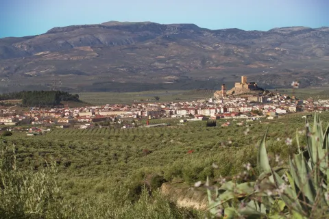
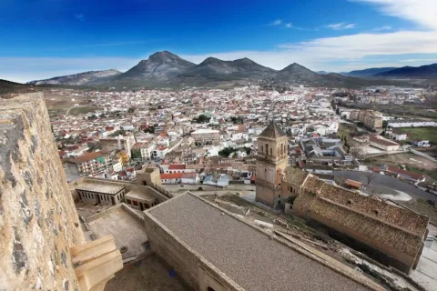
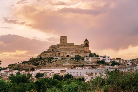
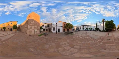
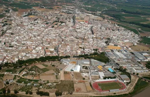
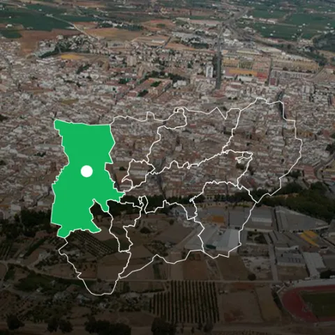
The city of Andújar is located at the foot of Sierra Morena, to the northwest of the province. Its municipal term is included in the Natural Park of the Sierra de Andújar, with half-mountain formations that contain a Mediterranean ecosystem, composed of masses of encinars, alcornoques, complaints, pineapples, oaks and bushes.

It is the most extensive and populated municipality of the region of La Campiña, on the banks of the Guadalquivir River, which divides the municipal term into two well-differentiated parts: one of Vega and countryside, to the south, and one of dehesas and Mediterranean forest in Sierra Morena, to the north.

Agriculture is very varied, with olive groves, although there are other crops such as cereals, legumes and cotton. It also has livestock and larger hunting that represent a significant economic income.

The city also stands out for a strong manufacturing presence: textile industries, concierges, ceramics... The construction activity, as well as small trade, occupy a significant number of people, although the latter, currently and due to the crisis, is resisting. In addition, the modernization and machining of the field makes it unable to absorb the group of unemployed.
Telecomunicaciones
Teléfono
953 504 959
Sitio web
www.andujar.es
Fax
953 508 207
Correo electrónico
turismodeandujar@andujar.es
Ubicación
Nombre
Andújar
Latitud
38.039610
Longitud
-4.054940
Distrito
Municipio
Ubicación en el mapa
POINT (-4.05494 38.03961)
Imágenes
imagen
Image
b0f7238b-8f63-ac27-4966-827e8a4fa6b8?t=1585581420642
Imagen principal
Desactivado
imagen
Image
b1bc38ae-53ae-5bc9-cebd-c7d32d33ba59?t=1585581420473
Imagen principal
Desactivado
imagen
Image
ca2cce8f-c738-3a80-a2c0-14697fd628ab?t=1616518390356
Imagen principal
Desactivado
imagen
Image
21589599-2dfb-bfd6-fe3d-ac2d69bc36c4?t=1616518390441
Imagen principal
Desactivado
imagen
Image
faa23b01-6f15-e7fa-755e-046cf270ce8f?t=1616518390491
Imagen principal
Desactivado
imagen
Image
b090f7c9-9aa9-8e0a-b5b0-de0cb34203b5?t=1616518390541
Imagen principal
Desactivado
imagen
Image
7cb8d394-b36c-6184-ea34-923bfdbbd7a1?t=1616518390652
Imagen principal
Desactivado
imagen
Image
0dcb1e5b-5c56-4471-e932-14f8fed5f461?t=1616518390711
Imagen principal
Desactivado
Información adicional
Imágenes cabecera
imagen
Image
bb48aa8d-9afc-13a3-7ec4-a1203be45aa8?t=1608747255282
Imagen principal
Desactivado
Datos de interés

Tourist area: Sierra Morena / Sierras de Andújar and Despeñacolos
Distance to the capital (km): 42
Altitude over sea level (m): 212
Extension (km ²): 964.9
Number of inhabitants: 36,793
Gentillo: Andujareños
Postal code: 23740

Videos
Video file
Cultura

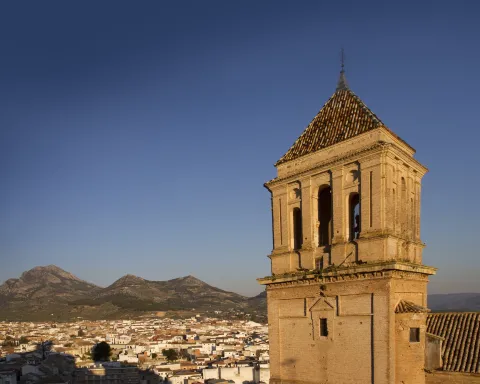
The city of Andújar continues to maintain a heritage set of great interest, for the quality of its monuments and for the diversity of artistic styles that can be appreciated.

We highlight some of them:

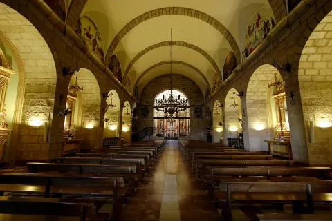
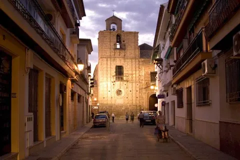
  • Church of Santa Maria la Mayor. The construction of the church Santa María la Mayor, of a basic plant, began in the 15th century and ended in the first quarter of the 17th century. Its pillars and vaults of the first stretch are Gothic and the rest of the sets of the second half of the 16th century. The plant is articulated in 3 ships of 4 sections each. Among his works of great value is the 16th century paving and two pictorial works, the Prayer in the Garden of the Greco Olives and the Immaculate of Giuseppe Cessari. It has 3 covers: Northern front, in the square of Santa Maria. Designed in the early 16th century, in purist style. South front, dedicated to San Pedro. It is from the second half of the 16th century, in the strictest purism. Foot cover. It belongs to the Herriian style, is characterized by its absence of ornate and the sobriety of its elements.
  • The chapel of the Christ of Agonyis connected to the church of Santa Maria. It is a Neogotic style, built between 1923 and 1925, by Rafael and Mª Elvira Pérez de Vargas (condes de la Quinteria). It is a private chapel conceived as a crypt of the counts. It has a single ship, organized in two sections, with nerve vaults, the header is decorated with five windows pointed with glass windows.
  • Church of San Miguel. It dates from the second half of the 15th century and is a Gothic temple, with a basic plant of three ships. The plant, wider than the sides, ends in polygonal header, while the sides are flat. The interior lacks its own luminosity by not having windows, one of the most characteristic elements. Of its covers, the one of the feet is of a plateresque style; the northern cover is in the transit between the Gothic and the Renaissance; the southern cover has a double conopial bow flanked by pinacles. The 16th century tower has undergone numerous reforms as it is damaged by the Lisbon earthquake.
  • Church of San Bartolomé.It is the first parish built to extramurus and later founded. In the initial project it is conceived as a three-ship gothic, articulated in five sections. From the different remodeling, there are signs: at the door of the sacristy the late Gothic (16th century) is observed, the primitive cross vaults are replaced by others of mannerist sensitivity. The tower, which is inconclusive, is from the 17th century and recalls that of San Miguel, is attributed to Francisco del Castillo, the Young. Of the three doors, the one that gives the runner of San Bartolomé is the most interesting. Its vanity integrates a bent bow pointed by another conopial with cardinals and flanked by pinacles.
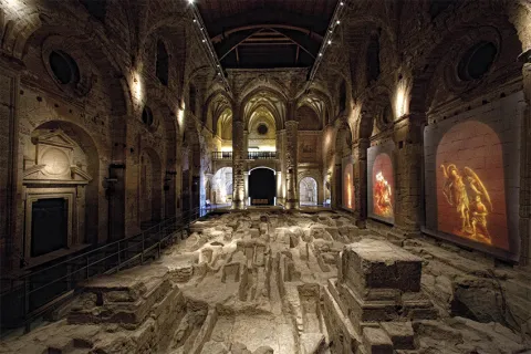
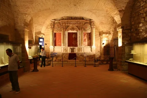
  • Church of Santa Marina.Mosque in Muslim times and Christian temple since the village was taken by Fernando III, the Holy (1225). It is a temple of three ships articulated in four sections. Its main chapel was remodeled in the 17th century, with a square section covered with a half-orange vault on the breast, in which the arms shields of Pedro and Luis Pérez de Vargas Palomino, their patrons, are located. Its two covers are of great simplicity, being that of the feet, of baroque style, which presents a greater monumental. He ceased to be a parish in 1843 although he remained open to worship until the 1970s. It is currently used as a cultural space.
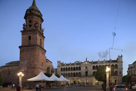
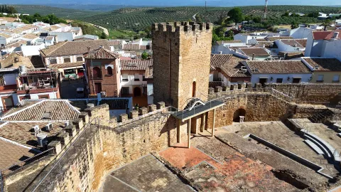
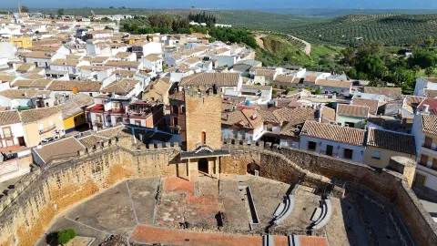
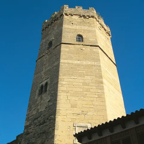
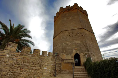
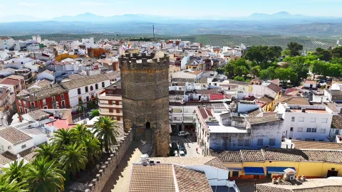
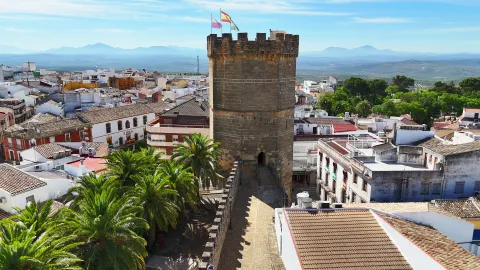
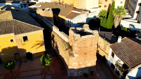
  • The Clock Tower.Mudéjar influence tower made in the time of Emperor Charles I (concluded on 20 August 1534). It was part of the royal prison and was conceived as a lookout to observe the village and the surrounding areas of the city. Head the square of Santa María, the heart of the medieval city. Its building is sober, based on alternating brick with stone armchairs. The almenas that kill the whole give it a strong tower air. Two elements stand out in this unique building: the Emperor's bicephalic shield and the beautiful silver-style watch that gives name to the tower. The towers of the church of Santa Maria, both the primitive and the modern, do not exceed the Clock tower in height, as a sign of the primacy of municipal civil power over religious power.
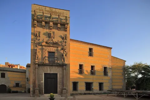
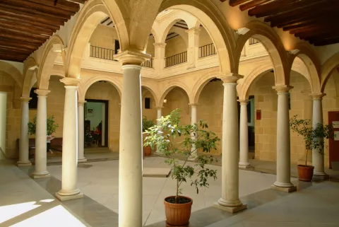
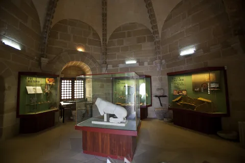
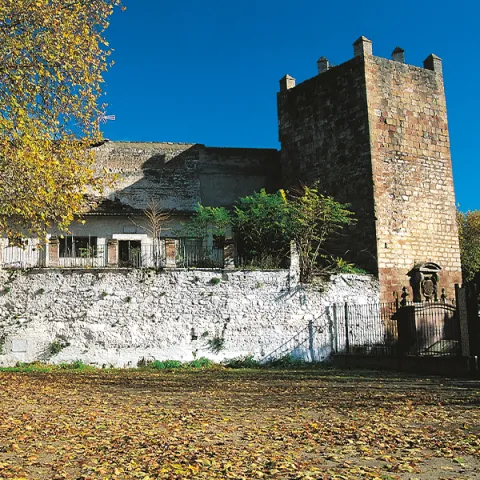
  • House of the Children of Don Gome.This single house of the Cárdenas and Valdivia is popularly known as "the Children of Don Gome," reference to the ten children who had the marriage and was built in the late 16th century. The Renaissance palace is built behind the Almohad wall and in the vicinity of the Sun gate. Torreada fachada built in late XVI and early XVII. Two elements of very different use make up the house of the Children of Don Gome, the house of the inhabitants and the cavalry. On the façade of the solariega house, built in a plane more advanced than that of the cavalry, stands out its portada- tower, built unlike the other elements of the whole in sandstone, in the second third of the 17th century, by Don Gome de Valdivia, Cárdenas and Guzmán and Dona Mayor Nicuesa, and that is in the Baroque style. The pillow cover is almost unnoticed by the exuberant decoration, two Indian-accent, repetitive heraldic, and a highlighted cornice, as more prominent elements. The Children's Palace of Don Gome is the venue of the courses of the University of Autumn. Inside is the Archaeological Museum Professor Sotomayor. The stables are preserved with part of the fish, a porticated courtyard and the winery. In the latter is the Casa del Alfarero, which includes the extensive and rich tradition of ceramics that has characterized this land.
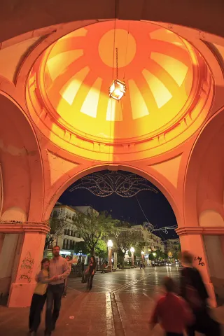
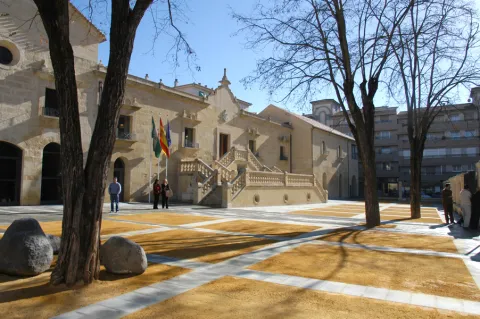
  • Comedian house - town hall.The current town hall is located in the building that was built between 1620- 1631 for comedia house, which it maintained until 1680. In 1787, the Cabildo decided to move to it, as it had lost its old function. The fruit of this remodeling is its central body of neoclassical style and the beautiful staircase of "empire style." Three floors make up their beautiful façade: In the first one a portico and in the second one, a gallery as a lookout for the taurine celebrations of the time. The building is topped with an airy balustrada, articulated in pillars topped with pinacles. This facade has an Italian orientation and can be located within the most classical mannerism.
  • Roman bridge.Its construction dates back to the end of the second century and saves the Guadalquivir River. Built with sandstone armchairs of a seine or brown colour, it has fourteen eyes, of which the twelve on the right bank are of half-point arch and the other two scarves. Like the Merida bridge, it offers lightens or drains on pillars to facilitate the passage of water in the large rivals.
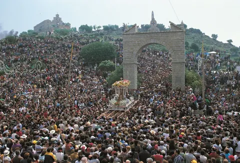
  • Basilica and Royal Sanctuary of Our Lady of the Head. Located in the heart of the Natural Park of the Sierra de Andújar, in the area known as the hill of the Cabezo, 32 km. north of the city of Andújar. The sanctuary is built between 1287 and 1304 and was reformed in the late 16th century. Since 1930 the trinitarians have served the cult in the sanctuary. The façade is made up of the door's vain, arco-sino balcony and two-body swordsman. The interior is a single ship covered with a barrel vault. The trinitarians community makes the enlargements of the two side buildings, leaving a harmonic set. In the very dependencies of the basilica is the Mariano Museum, where an important artistic, documentary and anthropological exhibition of the historical legacy has been developed through the centuries by devotion to the Virgin of the Head.
  • González Orea Museum of Plastic Arts.Located in the old convent of the Capuchino Mothers.
Naturaleza


Andújar, head of the region of the countryside of Jaén, with almost 965 km ² of area is the municipality with the largest extension of the province. The city is the third most populated in the province, with approximately 37,000 inhabitants.

Its municipal term is divided by the Guadalquivir River, with the Sierra de Andújar Natural Park in Sierra Morena in the north and the Vega and countryside in the south.

  • The Vega del Guadalquivir.The territory of the Vega del Guadalquivir is characterized by its very flat landscapes of irrigation, with intensive crops (oranges, lemoneros and orchards). The olive industry, textiles, wood furniture, crafts and ceramics are other sources of economic dynamism, along with the hotel, which takes advantage of natural tourism and its strategic location, right on the motorway of Andalusia.
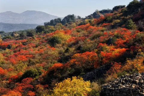
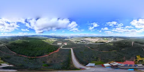
  • Natural Park of the Sierra de Andújar.It focuses important landscape and wildlife attractions. It extends through the neighbouring municipalities of Villanueva de la Reina, Baños de la Encina and Marmolejo, occupying an area of 74,774 hectares. Agriculture is very varied and dominated by the olive tree, with livestock and major hunting as the predominant agricultural activities. The natural park, in the form of an almost perfect equilateral triangle, is a sample of the typical landscape of Sierra Morena. A large number of emblematic species find here their refuge between the Mediterranean mountain and the dehesas of the heart of the park, the steep northern saws and the dense southern pine trees. The most characteristic species are the oak and the cork in adherent form, while in the higher altitudes, where the humidity is higher, we find the complaint. From the hydrography of the park we highlight the river Jandula, tributary of the Guadalquivir, with numerous streams that will lead to it and that form numerous pools and lagoons. In the end of Andújar we will find numerous sites, trails and routes that will discover the beauty of this term, like the Juncillo path.
  • Junctile Path.Suggestive and easy 5.7 km road that travels a very representative space of Sierra Morena and this natural park. On the road A-6178, about nine kilometres from the Sanctuary of the Virgin of the Head, you reach a crossing with signs to Valdelagrana and Las Tapas, which is where the path begins. In it there are the dehesas on almost flat grounds and Mediterranean mountain stains, both populated by numerous animal species, including various birds, easily visible, or mammals, such as deer, boars, foxes or garduñas, difficult to see but whose traces we will find with some ease. The Madrona and Quintana saws, on the horizon behind these plains, evoke the many legends that these depopulated lands have inspired throughout history.
  • Visit center Viñas de Peñallana. The visitor center is located on the 13th kilometer of the road A-6177 that links the shrine of the Virgin of the Head with the town of Andújar, at the entrance of the natural park, where the visitor can find a first approach to the different environments of the environment, walk through a recreated Mediterranean forest where to identify plant species and their aromas or discover numerous emblematic endangered species that find refuge in these saws; it is the case of the Iberian wolf, the imperial eagle or the Iberian lince, the most threatened feline on the planet.
  • Environmental Park Cercado del Ciprés.It is located in the town of Andújar (past the Hospital Alto Guadalquivir). The Cercado del Ciprés Environmental Park has an area of 11 hectares on which there is an artificial lake and a stream. This complex represents the ecosystems of the Mediterranean forest and the typical river vegetation. It also has different recreational areas such as a bike lane, an aviary, rustic huts, wooden kiosks, lookout, pedestrian trails. In the main building, there is an information point that offers guidance for the visit to the Sierra de Andújar Natural Park. Next to the Cercado del Ciprés Environmental Park is the only Interpretation Centre of the Honey of all of Andalusia.

Recreational areas El Encinarejo, La Recta, El Jabali. These are traditional areas of leisure and recreation on the road that reaches the shrine of the Virgin of the Head. They have banks, barbecues, tables and containers, so they represent an excellent option to spend an outdoor day in the family.

  • In El Encinarejo, the characteristic vegetation is that of the forests of riverside, strawberries, allies, sardines, thelves and tarayes, which serve as a refuge to the representative fauna of this humid area, such as royal herons, zampullines, water cocks and, if we are lucky, some otter can be observed. Following the river bank you can reach the foot of the small, lake-like Encinarejo swamp dam. From El Encinarejo you can make several hiking routes, for example, being the starting point of the so-called Encinarejo path.
  • The Recreative Area The Straight, 2.7 km, is located on the left side of the road, on the banks of the Jandula River. From there a path is left for which you have to ask for authorization 15 days before.
  • In the El Jabali Recreative AreaOn some rocks there's a granite boar. Through it passes GR-48, which comes from the Encinarejo and reaches the Sanctuary. In addition, the El Jabali trail, of 3.2 km, is started.
Fiestas y Eventos


There are numerous parties and events held in the city of Andújar throughout the year, including the following:

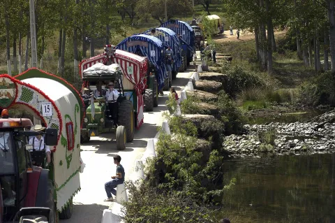
  • Romeria de la Virgen de la Cabeza. It is the most outstanding party and has its origin in the first half of the 13th century. It is celebrated in the week of the last Sunday of April:

On Thursday a flower offering is made to the Virgin of the Head in the City Hall square.
Friday is the entrance to the cofradies of all of Spain on the Roman bridge.
On Saturday, people ride up on carts and horses to the sanctuary of the Virgin.
On Sunday, with the sanctuary full of Liturgypsies, they all want to see the mother of Sierra Morena, to process through the reels.
After four hours walking through the streets, the Virgin returns to her shrimp, when the rosemary return to their places of origin to wait for the rosemary of next year. It is declared a National Tourist Interest and Cultural Interest Fair.

  • Holy Week. It is considered the big week of the town, celebrated with great recollection and religiosity since ancient times. It highlights the artistic-cultural value of the dominating images of the different cofradies and hermandades that carry out their processions on the streets. The Old Holy Week begins on Palm Sunday with the Brotherhood of the Borriquilla, with the highest splendor being reached on Holy Thursday with Our Father Jesus of Great Power.
  • Patron party in honor of San Euphrassio. It is held on May 15. This saint, a disciple of the Apostle James, has become relevant to the city since 1597, when a relic of the saint was brought to Andújar. Since then, he has been his patron and is dedicated to worship and parties in his honor every year.

In addition, these other parties are held: Festival of the Candelaria (2 February), carnival, Cruces de Mayo, Feast of the Divine Pastor (16 July) and Santiago Apostle (25 July).

The following events also take place:

  • Anducab. Since 2004 the Morfológico-Functional Anducab competition has been held, which has been consolidated as one of the five most important competitions in Spain, scoring for the competition in the International Horse Hall (SICAB) that is held annually in Seville. The main objective of this fair is to offer the exhibition and sale of everything related to the world of the horse.
  • Iron and forge competition. This is a meeting of horseshoes from all over Spain in which they come together to show their skills in this modality, making "on-site" plastic horseshoes.
  • Agricultural Fair of Andalusia. Organized by the Jaén Farmers' Association, it is held for three days in October. It includes machinery and utility companies, institutional government stands and different products, such as honey, real jelly, sweets, etc.
  • On the horse from the rock rocks. These are days of coexistence in which a pilgrimage is made on horseback to the sanctuary of the Virgin of the Head. It brings together hundreds of horsemen who with their horses and mules run along the "old road" through the Natural Park to the sanctuary of the Virgin. These days are true "girl romaneries" that they carry out during the year different rosemary collectives.
  • Flamenco. It is a flamenco fashion walkway that takes place outdoors in the market square, unique heritage environment. It is attended by more than 10,000 people for four days (Friday afternoon, Saturday morning and afternoon and Sunday morning).
  • International Fair of Iberian Lince (FILYNX). The International Fair of Iberian Lince is a three-day tourism event for nature observation, with a special focus on Iberian lince, conservation tourism and ecotourism. Its first edition was in 2019.
Gastronomía


The gastronomy of Andújar is typical of the serrano villages. Everything revolves around a culinary jewel such as extra virgin olive oil, as well as the high variety of typical products of the earth. The hunting meat that provides us the natural environment of Andújar, attached to the vegetables of the rich land that irrigates the Guadalquivir River.

We can taste the following dishes:

  • Pipirrana: is a salad whose basic ingredients are onion, tomato, green pepper and cucumber. Sometimes it is added cooked egg, some kind of fish, meat priet or even sausages.
  • Andrajos: cooked in the broth of boiling minor game pieces with peppermint and a saffrito of vegetables and strips of flour made of jirones that take the name.
  • Ajoharina: A saffrito is made with tomato, onion, potato and eggplant. In the frying pan, dry red peppers are tasted, once toast is crushed in the mortar with cumins and salt. When everything is ready, water is added and at the end flour is to be weighed.
  • Mountain meat, preferably deer, which is cooked with potatoes and vegetables.
  • Flamenquin: which originated in Andújar. There is also a variant called flarosquin, or what is the same, flamenco with circular form.

In pastries we highlight: Holy Week panets, fried rosches, sigh and entangled.

Historia

Andújar is in a privileged situation because it is a crossroads of commercial routes and roads for the displacement of populations, that would explain the penetration of artistic and cultural influences from different backgrounds. The proximity of the Guadalquivir River will be an incentive to the settlements of the populations. The oldest remains found date from the Paleolithic, but it is in the Neolithic and first part of the Bronze Age that the population of the area is intensified, for its fertile land for the development of agriculture and mining in Sierra Morena. The first people to settle would be the Oretans, the Iberians who founded the ancient Isturgi in the place that today occupies the pedany of Los Villares de Andújar.

Everything indicates that it was a flourishing city during the Roman domain, linked to the production and marketing of the high-imperial ceramic (I-II centuries). At the end of Roman rule, the population moved to a nearby place, the current Andújar, losing the name of Isturgi with the arrival of the island.In the year 711, after the battle of Guadalete, the entire southern area of the peninsula would become al-Ándalus. Moving the population from Los Villares to the current Andújar.

In 1225, the city is conquered by Fernando III, the Holythe Christian troops of the orders of Santiago and Calatrava to settle in the city. The Muslim population leaves the cities of Andújar, Martos and Baeza, the first Christian inhabitants being settled.King Henry IV, in 1467, gives him the title of city. This would begin with a period of population growth and an increase in agricultural land, reaching 13,000 by the end of the 16th century. The population is mainly made up of farmers and farmers.

In 1808 he will be occupied by French troops, where General Dupont established his headquarters. From here he would send his troops to Bailén, a battle in which he would be defeated. During the Spanish civil war, Andújar was left on the Republican side, which meant that he was bombed by the Franco troops, causing death and resentment on both sides.

Today, the city of Andújar continues to have a part of its population occupied in the agricultural sector, it also has modern industries, and the tourism sector is making way to make known its rich artistic and natural heritage, which makes it able to face its future with optimism.
Loading map
Preparing points of interest and routes...
Imagen principal
imagen
Image
e6de5d04-2828-525b-0221-966572b7fb26?t=1603888972531
Imagen principal
Activado
Literatura

Discover San Juan de la Cruz and Miguel Hernández in Andújar.

A fascinating itinerary not to be missed.
Alcaudete

Submitted by brandcode_deweloper on
Id
722589
Perfil de redes sociales
Facebook
https://www.facebook.com/AyuntamientoAlcaudete/
Twitter
https://twitter.com/aytoalcaudete
Descripción
Breve descripción

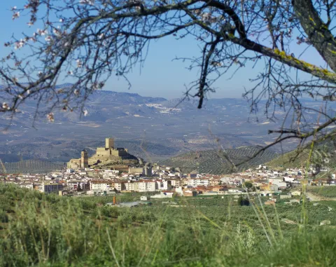
Alcaudete is located at the foot of the Sierra Achillos, on the south-west end of the province of Jaén, in the region of the Sierra Sur. Its geographical location allows it to be half an hour from Jaén, less than an hour from Granada and Córdoba and two short hours from Malaga and Seville.

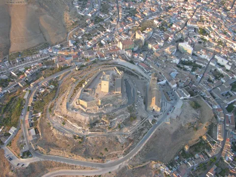
In Alcaute the story is breathed in all its corners. Its home is poured in the form of a ring on the hill side, embracing its two most important buildings: the Church of Santa Maria la Mayor and the Calatravo Castle, from which its rich olive lands and orchards are seen. It has three villages: La Bobadilla, Los Noguerones and El Sabariego, where the target of their houses stands out among the green olive tree.

The urban centre of medieval origin has an important architectural heritage since the villa has had a great expansion between the 16th and 18th centuries, building a large number of civil and religious buildings of many different styles, which embellish and embellish the streets of its historic town.

Its landscape is determined by strong slopes and areas of Vega around river courses, between the Guadalquivir countryside and the Subbetic Serras, which conditions the predominant type of crops: orchards and a "sea" of olive trees. In its term are the natural reserves of the Laguna Honda and La Laguna del Chinche, endemic complex of great ecological interest for the avifauna that inhabits it (evil, flamenco, anade real, squid...).

For its municipal term it runs the Green Way of Oil and is integrated into the route of "Castles and Battles," as well as the route of the Caliphate, belonging to the Andalusian Legate Routes.

Telecomunicaciones
Teléfono
953 560 000
Sitio web
www.alcaudete.es/index.php/es/
Correo electrónico
ayuntamiento@alcaudete.es
Ubicación
Nombre
Alcaudete
Latitud
37.590980
Longitud
-4.086670
Distrito
Municipio
Ubicación en el mapa
POINT (-4.08667 37.59098)
Imágenes
imagen
Image
80e747f2-e97c-94df-583a-42e6306567b4?t=1583262294673
Imagen principal
Desactivado
imagen
Image
castillo-desde-sierra-ahillos-jpg
Imagen principal
Desactivado
imagen
Image
img_0645a-jpg
Imagen principal
Desactivado
imagen
Image
img_0910a-2-jpg
Imagen principal
Desactivado
imagen
Image
img_0913a-2-jpg
Imagen principal
Desactivado
imagen
Image
img_1469-2-jpg
Imagen principal
Desactivado
imagen
Image
img_1594-2-jpg
Imagen principal
Desactivado
imagen
Image
img_1655-jpg
Imagen principal
Desactivado
imagen
Image
panorama_sin_titulo1-2-jpg
Imagen principal
Desactivado
imagen
Image
00716363-1d29-daf1-c47e-14878f00a61c?t=1585328067736
Imagen principal
Desactivado
imagen
Image
dji_0002-1-jpg
Imagen principal
Desactivado
imagen
Image
1w9a5696-1-jpg
Imagen principal
Desactivado
imagen
Image
1w9a1663-jpg
Imagen principal
Desactivado
Información adicional
Curiosidades

Plaza de Santa María, s/n (Junto Iglesia de Santa María la Mayor)
Tlf: 953 560 304 
E-mail: turismo@alcaudete.es

Imágenes cabecera
imagen
Image
alcaudete
Imagen principal
Desactivado
Datos de interés

Tourist area: Sierra Sur and Campiña de Jaén
Distance to the capital (km): 48
Altitude over sea level (m): 676
Extension (Km2): 238
Number of inhabitants: 11015
Gentillo: Alcaudetés
Postal code: 23660

Videos
Video file
Cultura

The urban centre of medieval origin has an important architectural heritage since the villa has had a great expansion between the 16th and 18th centuries, building a large number of civil and religious buildings of many different styles, which embellish and embellish the streets of its historic town.

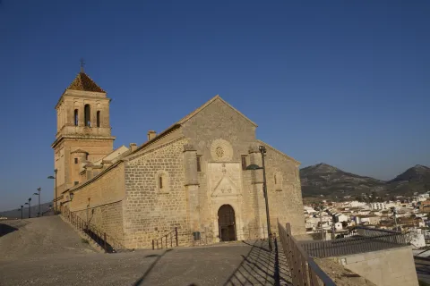
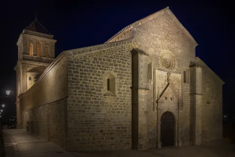
  • Church of Santa Maria la Mayor. The temple of Santa María de Alcaudete is a faithful exponent of the plurality of aesthetic offers that characterize the Spanish art of the 16th century, which explains the coexistence in its plant of two spaces or defiant structures: a Gothic body of three ships and a major Renaissance chapel. In the preserved factory book, the intervention of Vandelvira around 1558 is mentioned, when a rostrum is commissioned by Bishop Diego Tavera. It is declared BIC (Good of Cultural Interest), published in the Gazette of June 4, 1931.
  • Church of the Incarnation or of Carmen.At present, the early convent of the Incarnation only remains the church known as the Church of Carmen. In its interior it houses images of great artistic importance, such as Our Father Jesus Nazarene, the Holy Inlay, a lying, articulated Christ possibly attributed to Joseph of Mora or St. Elijah, attributed to the famous sculptor Peter of Mena and currently the most important work of imagination of Alcaudete.
  • Church of St. Peter.The Parish Church of San Pedro was created on an ancient hermitage, in the new arrabals, as a result of the spectacular increase of the population that Alcaudete experienced from the 16th century. The author is the architect Francisco del Castillo, although he was finished by his collaborator Juan de la Monja in the second half of the 16th century. A simple exterior gives way to an interior of great beauty and harmony, which also reflects an atmosphere of austerity, accentuated by the outer counterstrengths of the walls of the silery.
  • Convent and Church of Santa Clara.The convent of Santa Clara belongs to the order of the clarisas, within the order of San Francisco. The convent is made up of a set of buildings that rise in the neighborhood of its own name, highlighting among all that of its church. In the province of Jaén is the only example of full cover in stone that exists, appearing overlaid on two floors The building is rectangular, drawer type. It can be placed on the border between the 16th and 17th centuries.
  • Cemetery and Chapel of Santa Catalina: Although the oldest reference is that of its chapel, dated 1511, as regards the municipal Cemetery, in 1807 it was built to extramuras of the villa, next to the hermitage of Santa Catalina, is considered one of the oldest in Spain, and surely in the province of Jaén. The Cemetery of Alcaudete, on the occasion of the third prize in the category "Best Cemetery of Spain as a whole" of the 3rd Cemetery Contest 2016 of the Cultural magazine Adios, is included in the Spanish Cemetery Route.
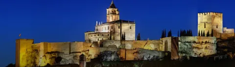
  • Castle-Palacio de Alcaudete. El Castillo- Palacio, declared a historic monument in 1985, defended the population and controlled the communication route that links Córdoba with Granada. It is one of the highest examples of the power that, in the Middle Ages, reached the Order of Calatrava, to which King Fernando III the Holy entrusted the protection of the western border of the kingdom of Jaen in front of the Nazari kingdom of Granada. The castle has a centre of interpretation dedicated to its historical evolution and, in particular, to the stage occupied by the nuns-warriors.

    The enclosure has three aljibes, on one of them, the one located next to the main door, is located the guard body, in charge of controlling access to the castle and connected directly with the adarve of the walls. In the southern area of the walled perimeter are the cavalry and above them, the capitular room. But, among all these buildings, in the center of the fortress and at the highest point of the hill, the spectacular Tower of Tribute, a symbol of the power of the Order, is prominent for its dimensions (22 meters high and walls up to three meters thick) and is practically inexorable for the difficulty of its access. In it, in addition to the aljibe and the warehouse to store the food, on the last floor, the residence of the planner was located.
Naturaleza

To the perfect comfort of a rich historical-cultural heritage and an extraordinary natural heritage. The visitor who approaches our city can enjoy beautiful walks in the heart of nature a few minutes away.

Surrounded by a mountain belt, Alcaudete is the ideal place to practice sports such as hiking or paragliding.

Within the municipal term of Alcaudete, there are two protected natural spaces: the natural reserve of the Lagoon del Chinche and Honda lagoon (natural, endorreic lagoons).

The highest heights located in the municipality are: the Sierra Ahillo with 1,455 m, Morron Redondo with 1,020 m, Morron Largo with 957 m, Cerro de los Santos with 831 m, Sierra de la Caracolera (de Codes) with 1,285 m, Sierra de San Pedro with 1,043 m, Caniles with 839 m, Torre Maestra with 812 m, Sierra Orbes with 787 m, Calvary with 688 m, Villodres with 615 m, Sierra Chircales with 1,205 m and Utrera with 979 m

In Alcaudete the aromatic plants are of great importance for their family use: (food condiments, sausages, etc.) These include: thyme, rosemary, fangs, etc. There are also another series of plants that are in a way profitable such as the oak (pig feeding); zarzals (white or red purple producers, which are very much appreciated fruits in Alcaudete); arbulagas (characterized by its large number of thorns, which makes it almost impossible to pass between them); the olive tree (species of olive whose fruit is olive, but in small size, and which is used as bait for the hunting of certain birds).

The most characteristic wild animals of Alcaudete are: the common badger, who live in almost all of the municipal term (Sierra Orbes, Ahillos, Chaparral, etc.), the hedgehog which is also common in all areas of Alcaudete and which is especially abundant in Los Noguerones, the montés cat, of which are increasingly less and less exemplary in Alcaudete, with an estimated 3 to 7 couples, most of them in the Sierra Achilos and some in the Sierra Orbes, being in extinction in the municipality. The hare that is found throughout the term Alcaudete. In addition to all the animals named in this section, it deserves special attention due to their low frequency, not only here but throughout Spain, the real eagles that are located in Alcaudete at certain times of the year, establishing themselves in the Sierra Achillos and the Sierra Orbes. There are also very small hawks in Alcaudete, but in greater numbers than eagles, because they are more extensive: Sierra Achillos, Sierra Orbes, Los Morrones, Sierra de Chircales, etc.

Víboras River. It is born in the urban centre of Fuensanta de Martos, having at the beginning the name of Arroyo de Fuensanta, to which other streams are joined, which, by thickening its waters, give it true character as a river.

San Juan River. It is born in the municipal term of the Castle of Locubin, although its birth is not very clear, it seems that it is born in the Gracia and Cerro Marroquí mountains, near Valdepeñas. It enters the Alcaudete border on the Alcalá bridge, continues on Saltobazos leaving the Ajos Tower and other places to its left.

Source Amuña. Its flow rate is very irregular, it has a very high flow rate with the rains and it decreases considerably in times of drought. The municipality for the public supply of Alcaudete, which had a private character, is part of this water source. Hence the importance of this source, which was a decisive factor in the establishment of Alcaudete in this area.

Fiestas y Eventos
  • Fruit fair: The hortellans of the region, present their best, melons, watermelons, pumpkins, apples, pears, tomatoes... and as not their excellent and odorous peaches, in all its varieties, to meet with some prizes, where the most important thing is to be winners. The participating fruits are exposed in a peculiar Fruit Exhibition. At night, on the 18th, the fruit is popularly auctioned.
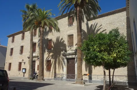
  • Festivals through:will be held on Friday, Saturday and Sunday of the second week of July. The parties will take place mainly around the Calatravo Castle of Alcaudete. The parties begin with a pasacalles with gentlemen, comics, phonies, juclars, jugarists, acrobats, balancers... The Calvia Fiestas also have a prepondero, a market, tournaments, concerts and medieval dinners, theatrical and didactic visits for schoolchildren to the castle, and as they could not miss, musical performances. The weekend before the Mediaval party is the Medieval Viandas Fair where you can taste the most exquisite Medieval tapas irrigated with good wine and beer.
  • Real Fair:originally from cattle, which is held from 15 to 19 September in the incomparable framework of the Park of Our Lady De la Fuensanta, highlighting its day fair, as well as its horticultural region competition. Another local party is the celebration of Santiago and Santa Ana on July 25 and 26.
  • Romeria Virgen de la Fuensana.The night of the 14th to the 15th of August is celebrated "La Velada," a night rosary in honor of the Virgin, and at dawn is celebrated the "Mass of the dawn." The hortellans heard this mass earlier after having processed the Virgin for her gardens accompanied by torches, then beginning the rosemary.
  • Holy Week:where about thirty steps process associated with thirteen cofradies and with images like that of St. Elijah of the 17th century. It highlights the staging of liturgical steps, such as the passage of Abraham, the Sale of the Lord, Repentance of Judas, Good and Bad Thief, Veronica, Apostles, with texts dating back to the 13th century. A characteristic element is the Roman band parade.

Gastronomía
  • Typical dishes. Typical Alcaudete dishes are the bathrobe (potato salad, beans, eggplant and spices), the overbony (green beans with artichokes and spices) and the Easter potage (chickpeas with spinach and cod).
  • The orchard will cause:Products of its gardens are the artichokes, light green, tight, soft and juicy, which are prepared in the Alcaudete style, filled with a mass of bread, egg, parsley, minced meat and wine, and boiled with a sauce made with garlic, parsley and flour. They also highlight the very used green beans in the overbone and types of salad
  • Delicious desserts.The sweet tradition of the city, of long conventional tradition and decisive Arab influence, is manifested in two large companies Doña Jimena with its excellent line in chocolates and Mata with its famous Hojaldrinas, both also with the manufacture of Christmas sweets. Not in vain, Dean Mazas, at the end of the 18th century, glossed, in his "Portrait to the Natural," something as diverse as the sugar capers who used to eat on this land. These exquisite desserts, such as peaches that are usually accompanied by resol or risoli, herbal liquor that in its origin was prepared with the grass "ros solis," that is, dew of the sun, and that in its various varieties accompanied the desks of our Golden Century. It is usually prepared with spirits in which coffee, lemon, sugar and some herbs, such as chamomile, peppermint or mejana are made
Historia

In Alcaudete, the oldest population remains date from the Paleolithic and Neolithic, identifying themselves with camps in the nearby mountains. Its occupation dates back to the third century BC, as a result of the colonization carried out by the Iberians.
The romanization of the area is sufficiently demonstrated by the presence of dozens of rural settlements. At this time belongs the Paleocristic sarcophagus of the time of Constantine, of the 4th century, found in the gardens around the street Torres Ortega at the end of the 19th century and preserved today in the National Archaeological Museum.
The Muslims will call it hoss al-Qabdaq or al-Qibdaq, attached to the Cora de Ilbira (Granada), forming part of its defensive structure along with other castles and athalayas distributed throughout the territory. After the triumph of 'Abd al-Rahman III and the implementation of its policy of Islamization, Alcaudete became the head of an administrative district (Iqlim), under the supervision of officials representing the Omeya State, whose main task was the control of the territory and the tax collection of the region.
It was conquered in 1246 by Fernando III and given to the military order of Calatrava, becoming the most advanced point of the Christian border with the Nazari Kingdom of Granada. The Calatravos carried out profound reforms in the Almohade alcázar, not only to adapt it to the conventional life of the freires, but to enhance its unbeatable or unbeatable character.
In 1312, both the fortress and the villa become part of the realingo lands and since then very close to the family Fernández de Córdoba and Montemayor. Alcaudete became a Lordship in 1385 and later, in the 16th century, Charles V transformed him into a county.
The villa had a large expansion between the 16th and 18th centuries, building a large number of civil and religious buildings of many different styles, which embellish and embellish the streets of its historic town.

Loading map
Preparing points of interest and routes...
Imagen principal
imagen
Image
alcaudete-baena-3-jpg
Imagen principal
Activado

Alcalá la Real

Submitted by brandcode_deweloper on
Id
12459695
Perfil de redes sociales
Facebook
https://www.facebook.com/excmoayuntamientode.alcalalareal/timeline
Twitter
https://twitter.com/alcala_la_real
Descripción
Breve descripción

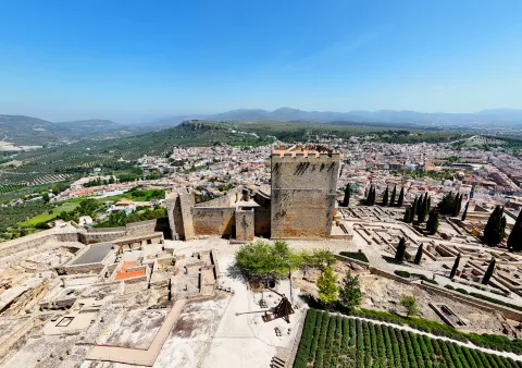
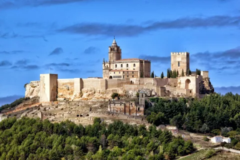
The noble and loyal city of Alcalá la Real, as stated in its title, is located to the south of the province, in the confluence with those of Córdoba and Granada, on a large plateau dominated by the hill of the Mota, in the center of a mountain region covered with olive groves.

At the foot of the famous fortress of the Mota and the surrounding walls, National Monument since 1931, the city of Alcalá la Real has been extended, with its urban structure of Arab origin, its paved streets with houses and full of surprises, master houses, churches and architectural details, samples of its splendor and its rich historical past. The church of Consolation, the church of Santo Domingo, the church of Our Lady of the Angustias, the church of St. John the Baptist, the Abacial palace, the town hall and the fountain of the Pilar of the Alamos are examples of this.

From the viewpoint of the Las Cruces district, the visitor can enjoy a magnificent view of Alcalá la Real and its old fortified city.

Telecomunicaciones
Teléfono
953 582 077
Sitio web
www.alcalalareal.es
Correo electrónico
turismo@alcalalareal.es
Ubicación
Nombre
Alcalá la Real
Latitud
37.461000
Longitud
-3.921900
Distrito
Municipio
Ubicación en el mapa
POINT (-3.9219 37.461)
Imágenes
imagen
Image
alcala-la-real-poblacion-7-jpg
Imagen principal
Desactivado
imagen
Image
alcala-la-real-poblacion-6-jpg
Imagen principal
Desactivado
imagen
Image
alcala-la-real-entorno-2-jpg
Imagen principal
Desactivado
imagen
Image
alcala-la-real-poblacion-10-jpg
Imagen principal
Desactivado
imagen
Image
castillo-alcala-jpg
Imagen principal
Desactivado
imagen
Image
mon101-jpg
Imagen principal
Desactivado
imagen
Image
mon237-jpg
Imagen principal
Desactivado
imagen
Image
natu153-jpg
Imagen principal
Desactivado
imagen
Image
alcala-la-real-jpeg
Imagen principal
Desactivado
imagen
Image
alcala-la-real-entorno-1-jpg
Imagen principal
Desactivado
Información adicional
Curiosidades

Oficina de Información Turística Palacio Abacial: 953 582 077
Oficina de Información Turística Fortaleza de la Mota: 953 102 688

Imágenes cabecera
imagen
Image
Alcalá la Real
Imagen principal
Desactivado
Datos de interés

Tourist area: Sierra Sur and Campiña de Jaén

Distance to the capital (km): 71

Altitude over sea level (m): 918

Extension (Km2): 262

Number of inhabitants: 22524

Gentillo: Alcalai

Postal code: 23680

Videos
Video file
Cultura


The extramurous expansion begins through Real Street and will replicate and build religious and civil buildings, including the Rosario and Veracruz churches, which together with San Francisco and the Alcalá gate are part of the missing heritage.

From the walk of the Alamos, with San Antón and the old convent of Capuchino, today Library and Municipal Archive, we began a tour of the Llanillo, a vertical axis from north to south that becomes the new stage of local life, whose heart is in the Compás de Consolación.

The modernist houses of the early 20th century, the Abacial Palace, the Convent of the Incarnation, the Angustias, the City Hall Square and the Houses of Enfronte are very elegant.
Today, Alcalá la Real is a cosmopolitan and hospitable town, of entrepreneurial neighbors who have known, respecting their past, to reach the 21st century with the elegance and humility of those who know of good crib.

  • Pilar of the Alamos. It is a Renaissance work, dated 1552, as seen in the legend of the frieze. It shows the frontis a great relief in which two tenants hold and keep the shield of the city, protected in turn by two fabulous hybrid wings, with lion head, dragon body and masked at the ends of the wings, which are related to the guard and defense of the city. The frontis is almond with ten malls. He took part in the work Francisco Florentin.
  • Church of the Angustias. It began construction in 1746, and was completed in the early 19th century. As a result, the Baroque and neoclassical styles occur. The vault and the main chapel, of a hexagonal plant, as well as the Neoclassical altarpieces and a meritorious collection of paintings from the 15th and 16th centuries, stand out. In his parish archive we find the baptismal games of Pablo de Rojas, Juan Martínez Montañés, Pedro de Raxis and Pep Ventura.
  • Trinidad. At the site of the ancient church and convent of the Trinity, founded in 1475, a multi-purpose building has been rebuilt that respects the typology of the existing space intended to be an exhibition and gastronomic center. In the entrance gardens remains of the former Muslim cemetery, the maqbara.
  • City Hall. The city palace is a baroque building of classical descent. It overcomes its cover, in red and black marbles, with the weapons of the city in a circle; the noble plant, with the royal shield of Philip V; and the upper gallery, which has in the key of its arches a series of masquerades alluding to the vices and capital sins. It is worth noting the watch, made by Fernando de Tapia, in 1803, with the originality of pointing out the lunar phases.
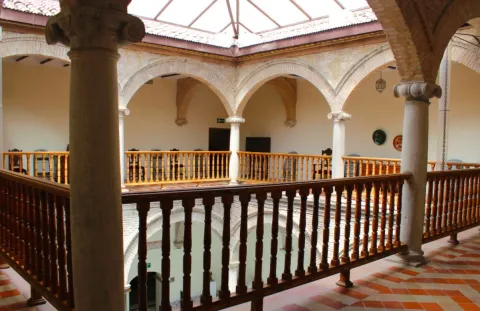
  • Abacial Palace. We could harmonically link it to an austere Baroque style, with some neoclassical contributions. It is a robust set on the outside, in which the bold alero and the monumental cover stand out. In the interior stands the enclosed courtyard, of rectangular floor, with three open bodies. It is currently the headquarters of the Elemental Conservatory of Music, Museum and Tourist Office.
  • Church of St. Anton. In front of the walk of the Alamos, the present church, built in the 18th century in the vicinity of a small chapel of the 16th century, rises. It is worth noting the perfection of its elliptical plant with brick vault and cover, with three bodies, next to which is opened a chapel to the outside where the Christ of Mercy is sold.
Fiestas y Eventos

Alcalá la Real maintains its traditions linked to agribusiness and religious parties.

  • Stop Christmas The slaughter of the pig has already been done, keeping many of its products in virgin olive oil: loin, ribs..., which fill the pantry for the time of collection of the olive.
  • In the CandelariaOn February 2, the Virgin of the Mercedes is processed, she is offered pigeons disguised as popular and meringue cakes that are then distributed among the attendees.
  • On 18 March the night of the drums, fires are lit in front of the hornacinas dedicated to the Patriarch San José in the altars of the streets Abad Palomino and Oteros.
  • Special emphasis is placed on the Holy Week, declared National Tourist Interest Festival, characterized by the mymic and ancestral representation of theatrical pregons that have their origin in the sacramental cars of the Baroque.
  • On 3 May the the day of the Cross, adorning the numerous crosses throughout the municipality and a verbena is held. And throughout the month the party of the flowersespecially in the villages.
  • Summer begins celebrating the fair girl for San Antonio (13 June) and the night of San Juanwith the burning of the witch in the church dedicated to the saint, the great moment being the Real San Mateo Fairheld from 20 to 25 September.
Gastronomía


Alkaline gastronomy is very linked to its traditions and parties. At Christmas we can see the pork butter and almonds, of course the products of the slaughter (morcilla, chorizo, salchichon...) and others preserved in olive oil (loin, ribs...).

In the Candelaria meringue cakes, and in Carnival the Fallen (mist of bread, meat and egg boiled in the pig's casing). At Easter, the sweets: pestins, wine roses, holy bones, rice and milk, papuecas...

In the summer the Alkali peas, meals among friends in the field to taste mainly a caldy rice or a secretary (tomato sauce, asparagus, mushrooms and chicken) and in autumn the membillo meat, the fig bread and the wine of the ground is prepared.

Historia


The finding of numerous archaeological remains attests to the presence of man in the area since prehistory. From the Roman era, numerous inscriptions have been found with the names of Ipopobulcola or Iliturgicola, which could have been the first names of Alcalá la Real. Among many remains found, we highlight a small marble sculpture that represents Hercules.

Under Muslim rule, in 713, we begin to have news of Alcalá, with the name Qal'at Astalir, becoming a fortified city on the top of the hill of the Mota. In the 11th century, it would be included in the kingdom of Granada. In the 12th century, he became an independent lordship under the mandate of the Banu Said family, this being the most splendid time in the Muslim history of Alcalá, which would begin to be known as Qal'at Banu Said, or Alcalá de Benzaide, for Christian sources.

The Christian conquest was carried out by King Alfonso XI in 1341. This one gives him the title of Real which he bears in his name and the privilege of founding a Royal Patronate Abbey. After the conquest of the city, Alcalá will play a very important role, as a border area, in taking over the kingdom of Granada.

The city title is granted by John II in 1432. King Henry IV gives him the title of "noble and loyal" and the Catholic Kings give him the title of "Key, guard and defence of the kingdoms of Castile."
After the reconquest of the kingdom of Granada, the mayors will leave behind the security of the walls of the fortress, which will gradually depopulation, occupying the eastern slope of the hill of the Mota to reach the plain and ascend the hill of Las Cruces, located opposite the first, and separated by the "Llanillo," name that refers to the topography of the land: a plain located between two hills.

The French occupation of the fortress city in 1810 and the subsequent withdrawal of the troops leaving this territory at the mercy of the flames of a fire, linked to the disappearance of the Abbey in the mid-19th century, will plunge this environment into an accelerated deterioration. For a few years now, important efforts have been made to rehabilitate this monumental space.

Loading map
Preparing points of interest and routes...
Imagen principal
imagen
Image
alcala-la-real-poblacion-5-jpg-1
Imagen principal
Activado

Tower of the Homenaje

Submitted by brandcode_deweloper on
Id
1908944
Descripción
Descripción larga

The Tower of Tribute is built with irregular stone armchairs except for corners, which are embellished and reinforced by regular armchairs. The basement, which was used as an aljibe, is only accessible through a trap on the ground floor. To collect the rainwater from the roof it had a conduction of ceramic tubes, and so they were stored in the aljibe.

Access to the ground floor is made from the outside. This plant is covered by an ojival vault. The first floor is accessed from the inside by a narrow staircase led on the ground floor; this floor is the main stay of the Tower and is covered by a dome made from a brick row approach, supported by pechines, also brick. Finally, when you reach the roof you get a great visibility and control of the city. This Tower was restored and is currently a visitor reception centre.

Breve descripción

The Tribute Tower is an important place in the Marteña architecture and in the panoramic image of Martos. To this day he has lost the raison d'être of defending the city but helps us to understand what it was one day: the capital of the Calatrava Endowment. It is the most significant element of the defensive architecture of the lower fortress of Martos. It is a milestone in its location as it is visible from the different accesses to Martos: roads of Alcaudete, Jaén, Monte Lope Alvarez and Santiago de Calatrava.

The Tower was built by the demand of the Order of Calatrava in the 14th century, serving at the same time as a watchtower and a headquarters of government. It has a square floor, 10 x 10 m. and consists of a basement, ground floor, first floor and roof. It is 25 m high from the basement and 22 m above the street level.

Ubicación
Latitud
37.723755
Longitud
-3.966906
Dirección
C/ Primero de Mayo, s/n
Distrito
Municipio
Ubicación en el mapa
POINT (-3.966906 37.723755)
Tipos de punto de interés
Imágenes carrusel
imagen
Image
castillo_de_la_villa2-jpg
Imagen principal
Desactivado
imagen
Image
_mg_5748-jpg
Imagen principal
Desactivado
imagen
Image
_mg_5753-jpg
Imagen principal
Desactivado
Imágenes cabecera
imagen
Image
martos-170-jpg
Imagen principal
Activado
Microsite al que pertenece
Loading map
Preparing points of interest and routes...

Palace of Villardompardo - Centro cultural

Submitted by brandcode_deweloper on
Id
6057072
Descripción
Descripción larga

During the 17th and until the middle of the 18th century, the Palace was used as a Bank, proof of this are the two inscriptions existing on the walls of the central courtyard.

At the end of the 18th century, the building was acquired by the Royal Hospice Board by passing it to the Provincial Charity and settling in it, the Women's Hospice.

In the early 19th century, modifications were made to the building, including the remodeling of the entrance door of the Palace, replacing the previously existing one and placing on its lintel an inscription in white marble in grey stone.

Likewise, on both sides of this inscription, there were two shields: on the right, that of Bishop Fray Benito Marin (1751-1769); and on the left, the shield of Castile.

In 1868, when the Provincial Benefficiency Boards were abolished, the management and administrative functions of the charitable establishments became the responsibility of the Provincial Diputations, thus becoming part of the heritage of the Provincial Institution. Between 1901 and 1903 the Hospice was extended, demolishing to this end houses adjacent to the Palace. This extension includes the construction of a Chapel adjacent to the building, opened in 1903 under the title "La Visitación."

In 1939 the center was called "Internado de Santa Teresa" and served as a residence for both sexes and chronic patients until the second half of the 20th century, thus, with the transfer of the chronicles in 1971 to San Juan de Dios and that of the elderly in 1972 to the new Residence of Santa Teresa, the building remains empty. In those years the works of restoration of the Arab Baths located in the basements of the Palace and the rehabilitation of the entire building, which would be completed in 1984 and which were awarded the same year with the Medal of Honor of the Europa Nostra Association.

The central courtyard of the Palace is made up of a square of thick walls in which the windows and doors of different rooms are opened. Within this square is inscribed another one formed by a two-level column gallery, with three columns on each side and a total of eight columns on each of the two levels.

For the construction of the lower level or floor gallery, the chosen Order was Toscano applying half-point arches very slightly reduced. On the four columns of the corners rest four arches: the two eldest, form the angle of the gallery; the two minors, are attached to the perimetral wall becoming columns "in palm," a solution that had been used by the Muslim builder who had made the great Tempered Room of the underlying Arab Baths. In the same way, the architect of the Palace used a constructive structure identical to that used in the Baths: for the columns and the capitals he uses the stone and for the arches and the slices the chosen material was the brick.

As for the gallery of the upper level or floor, although it has a scheme similar to that of the lower floor, it has modifications, as a variant of the Toscan Order was chosen. Both columns and arches are lower than those located at the lower level. At present, the intercolumns of this level are closed with an abalaustrated wooden railing.

Breve descripción

The Palacio de Villardompardo Cultural Centre rests on the Palace of the First Count of Villardompardo and Virrey of Peru, Don Fernando de Torres and Portugal, a Renaissance building in the 16th century, located in the very heart of the old town of Jaén.

Telecomunicaciones
Sitio web
www.bañosarabesjaen.es
Teléfono de contacto
953 248 068
Correo electrónico
ccbarabes@dipujaen.es
Ubicación
Código Postal
23004
Latitud
37.771038
Longitud
-3.794310
Dirección
Plaza Sta. Luisa de Marillac
Distrito
Municipio
Ubicación en el mapa
POINT (-3.79431 37.771038)
Tipos de punto de interés
Imágenes carrusel
imagen
Image
7.jpg
Imagen principal
Desactivado
imagen
Image
4.jpg
Imagen principal
Desactivado
imagen
Image
2%20%282%29.jpg
Imagen principal
Desactivado
imagen
Image
5.jpg
Imagen principal
Desactivado
imagen
Image
6.jpg
Imagen principal
Desactivado
imagen
Image
3.jpg
Imagen principal
Desactivado
Imágenes cabecera
imagen
Image
1.jpg
Imagen principal
Activado
Horario
Tuesday to Saturday and holidays: 09: 00 - 21: 00. Sunday: 09: 00 - 15: 00. Closed Monday (except 28 feb, 2 may, 15 ago and 26 Dec) and 1 and 6 ene and 24, 25 and 31 Dec. Access up to 1 h before closing.
Microsite al que pertenece
Loading map
Preparing points of interest and routes...
Marcas de calidad

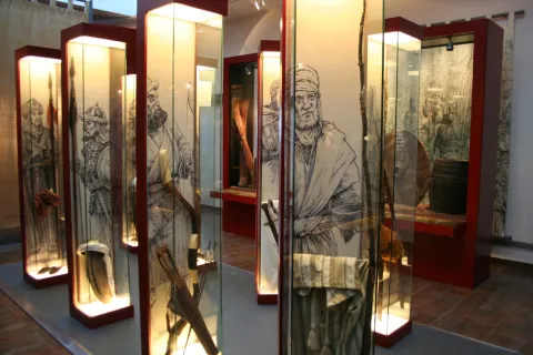
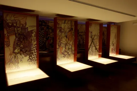
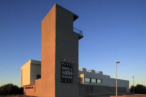
Museum of the Batalla de las Navas de Tolosa

Submitted by brandcode_deweloper on
Id
319212
Descripción
Descripción larga

The seizure of the fortress of Salvatierra, the province of Ciudad Real, by the Almohades in September 1211, prompted Alfonso VIII of Castilla to organize a campaign for the summer of 1212 with which to destroy the Almohade military capacity, inciting Innocent III to enact a bull that turned the campaign into a crusade. This is a decisive act, as it brings them together with the company across Europe and gentlemen of the different military orders.

On June 20, 1212, three troops left Toledo: Aragonese and Catalan under the command of Peter II of Aragon; Castilians with his king Alfonso VIII; and Ultramontans; Leonese and Portuguese under the orders of Don Diego López de Haro, lord of Vizcaya. The troops of López de Haro, in their advance, take the castles of Malagon (24 June) and Calatrava (1 July), the latter by capitulation. The lack of booty and the course of events began to create unrest among foreign combatants, most of whom decided to return to their places of origin.

The Almohad Caliph Muhammad al-Nasir in whose army were integrated fighters from the Maghreb, from sub-Saharan territories and from Turkish troops, set in motion his men who leave Jaén with the aim of blocking Christian troops in Sierra Morena.

Between 4 and 6 July Alfonso VIII continued his progress by taking several fortifications, including that of Alarcos. With the arrival of Sancho VII of Navarra the total of Christian armies is gathered at the foot of the castle of Salvatierra, from where they continued in search of the Almohade army.

On July 12 advanced from Don Diego López de Haro took the Puerto del Muradal, with the fortification of Castro Ferral. Two days later, after being blocked in the passage of the Slayer, they camp in the place known as the King's Table, from where they go to the battle that took place on July 16, defeating the Alphade army that will withdraw from the fortresses that defended the entrance to the Guadalquivir Valley. On July 19 they occupied Baeza and a day later they besieged Ubeda, who would eventually capitulate.

After the campaign was completed and access to the Guadalquivir Valley was assured, Christians withdrew to their kingdoms in the north.

Archaeological investigations seem to confirm some of the sites where the written sources placed the contenders' camps. The results obtained by archaeological prospecting in Mesa del Rey corroborate the presence of a camp occupied not only by the troops, but also by higher-ranking characters of the Christian army, having identified areas within the internal organization of the camp, such as that intended to change the horseshoes of the beasts. It can be proposed that the King's Bureau be the place that occupied the troops of King Alfonso VIII of Castile, but not all of the Christian armies.

Similarly, in the surroundings of the castle of Castro Ferral, the great concentration of weapons material can be interpreted as the vestiges of the assault by Alfonso VIII's troops to the fortress. Parts related to daily life have also been documented in El Ferral and its military function (horsemen, furniture elements, garrison of clothing, tools, nails and passers).

The set of recovered pieces points to the existence of a large concentration of materials related to the battle, despite the intense expolity suffered throughout the area for more than a century.

LEYENDAS

The pastor of the Navas de Tolosa. In July 1212 the Christian hosts, on their way to the heart of al- Andalus, were to cross Sierra Morena through the natural passage of La Losa, a narrow throat in the port of Muradal, defended by the fortress of Castro Ferral. Alfonso VIII sent Don Diego López de Haro to take the castle, but despite his conquest, the road remained strongly defended.

At the Christian camp came a man from the place, a connoisseur of those border lands, who showed them an alternative path between the mountains, leading Don Diego López de Haro and his troops to a high-level, ever since known as the King's Table. In it, the Christian camp was set up to launch its offensive against the Almohad army, on July 16, 1212, a confrontation that would open the door of al-Andalus to the Christian armies. The man who showed them the way was called Martin Halaja, a shepherd for some, a hunter for others and for the most pious of the same Saint Isidro.

Breve descripción

The Battle of the Saves of Tolosa of July 16, 1212 was one of the most prominent milestones in the medieval history of Peninsular, for its significance in the advance of the Christian kingdoms over al- Ándalus. Conceived as a crusade, which was preached by Pope Innocent III, he faced an army of men coming not only from the Peninsular realms, but from the other side of the Pyrenees, commanded by the Christian kings, Alfonso VIII of Castile, Peter II of Aragon and Sancho VII of Navarra, against the Almohad Caliph of Muhammad al-Nasir, in whose army were integrated fighters from the Maghreb, from sub-Saharan territories and from Turkish contingents. The Almohad defeat meant the beginning of the definitive conquest of al- Ándalus by the peninsular Christian kingdoms.
In the Park of Despeñacolos, within walking distance of the place of battle, is the Museum of the Battle of the Navas de Tolosa, in the town of Santa Elena. A centre in which visitors are guided by the history of the contest, from the prolegomens to the war, through audiovisual and scenography, teaching workshops or visits to the battlefield and the Natural Park of Despeñacolos. It is also a starting point and information of the Route of the Castles and Battle of the Kingdom of Jaén.

Telecomunicaciones
Teléfono de contacto
953 459 693
Correo electrónico
museoyturismosantaelena@gmail.com
Ubicación
Código Postal
23213
Latitud
38.342790
Longitud
-3.548910
Dirección
Carretera de Miranda del Rey, s/n
Distrito
Municipio
Ubicación en el mapa
POINT (-3.54891 38.34279)
Tipos de punto de interés
Imágenes carrusel
imagen
Image
Santa%20Elana%20-%20Museo%20Batalla%20Navas%20%281%29.jpg
Imagen principal
Desactivado
imagen
Image
PICT8132.JPG
Imagen principal
Desactivado
imagen
Image
batalla-navas-tolosa.jpg
Imagen principal
Desactivado
imagen
Image
Stoa-M%2CN%2CT020.jpg
Imagen principal
Desactivado
imagen
Image
Museo%20Navas%20039%20%282%29.jpg
Imagen principal
Desactivado
imagen
Image
Stoa-M%2CN%2CT059%20%281%29.jpg
Imagen principal
Desactivado
imagen
Image
Stoa-M%2CN%2CT024%20%281%29.jpg
Imagen principal
Desactivado
Imágenes cabecera
imagen
Image
_MG_6954%20%281%29.jpg
Imagen principal
Activado
Horario
Oct - may: Tuesday to Saturday 10: 00 - 14: 00 and 16: 00 - 19: 00, Sunday 10: 00 - 14: 00 and 15: 30 - 18: 30, Monday closed (except holidays and eve). Jun - Sept: Tuesday to Saturday 10: 00 - 14: 00 and 17: 00 - 20: 00.
Otros servicios
  • Guided tours.
  • Audio-guides.
  • Shop.
  • Coffee shop.
  • Conference and multiple-use rooms.
  • Beer area and games.
  • Parking.
  • Storage and delivery.
  • Tourist information of the province.
  • Hiking on the battlefield.
  • Routes through the Natural Park of Despeñacolos.
  • Educational workshops for schoolchildren
Loading map
Preparing points of interest and routes...
Interés

Museum of the Batalla de Bailén

Submitted by brandcode_deweloper on
Id
320829
Descripción
Descripción larga

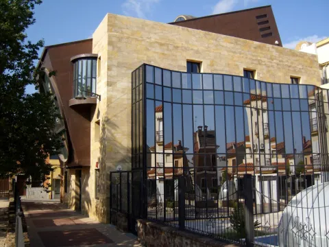
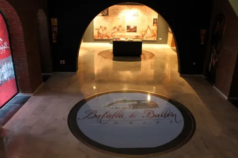
Bailén cuenta con un museo dedicado a la batalla librada en sus inmediaciones. Su visita permite al viajero conocer más acerca de este episodio, clave en la historia contemporánea de España. 

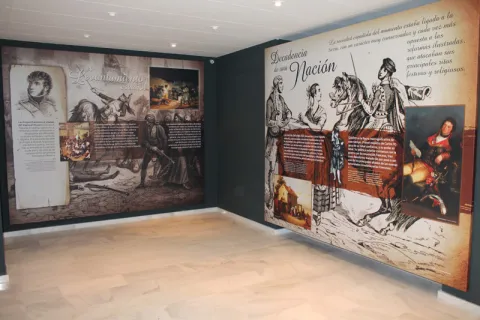
La exposición permanente del museo se estructura en varios espacios temáticos a través de cuatro plantas. En ellos se propone una aproximación histórica a los hechos de la Guerra de la Independencia, a través de un recorrido por los seis años de contienda y sus consecuencias.

La aproximación a la evolución de la Batalla se desarrolla a partir de los puntos de vista de ambos bandos, español y francés. En relación con los contendientes se puede contemplar una colección de reproducciones de los uniformes de ambos ejércitos y diferentes objetos como botones de uniformes, armas, monedas o escritos inéditos. Se completan estas colecciones con audiovisuales donde se narran detalles biográficos de los protagonistas de la Batalla de Bailén: El General Castaños, el General Reding, el general Dupont o María Bellido.

Destaca en la exposición una maqueta-croquis del campo de batalla, con cerca de 1.000 soldados de plomo en miniatura pintados a mano, sobre la que se proyecta una audiovisual con las fases más destacadas de la misma. La maqueta es una cesión del Museo del Ejército. 

El visitante puede conocer también Bailén en una sala arqueológica que muestra la narración secuenciada de su historia, su patrimonio natural, así como su potente industria alfarera.

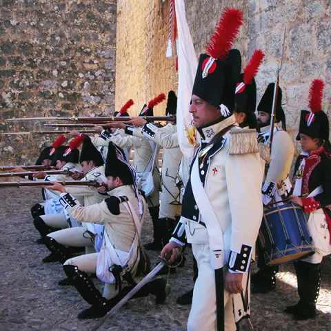
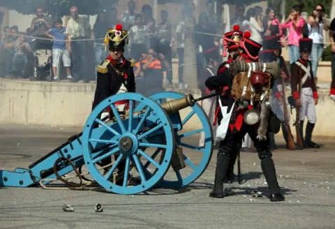
La localidad conmemora en el mes de julio la batalla con un acto en el que participan autoridades civiles y militares, mientras que en octubre tiene lugar, cada dos años, una recreación histórica de la batalla por parte de diferentes grupos y asociaciones.

En base al Tratado de Fontainebleau, que permitía a Napoleón atravesar España, el 18 de octubre de 1807 el general francés Junot entra en España con cien mil hombres, al frente de los cuales situó Napoleón al general Murat. Sin embargo, sus intenciones eran ocupar el país, colocando en el trono de España a su hermano José I tras el Motín de Aranjuez, acontecido entre el 18 y el 19 de marzo de 1808. El posterior levantamiento en Madrid del 2 de mayo de 1808, reprimido con fuerza por el general Murat, iniciará la guerra de Independencia.

En la primavera de 1808 el ejército español puede considerarse totalmente desarticulado, habiéndose producido un colapso total de la estructura militar. En Andalucía, la Junta Suprema Provincial de Sevilla organizó un ejército, bajo el mando del General Castaños, con profesionales y voluntarios civiles, a los que se sumó el refuerzo procedente de Granada al mando de Teodoro Reding. Pese a ello, la caballería del ejército francés era muy superior a la española, sin embargo, la infantería lo era por parte del español, contando además con una mejor adaptación a las duras condiciones ambientales, que influyeron de manera trascendental en el enfrentamiento. A esta situación habría que añadir, la ventaja que obtuvo la artillería española se debió al posicionamiento estratégico de sus baterías, superioridad que resultaría fundamental en el desarrollo de la Batalla de Bailén.

El 23 de mayo, Napoleón ordenó a Murat que el segundo cuerpo de Observación de la Gironda, al mando de su general, Dupont, partiera de inmediato, para proteger y rescatar la escuadra del almirante Rosilly, bloqueada por los ingleses en Cádiz.

Las tropas bajo su mando estaban compuestas por la 1ª división de infantería del general Barbou, con las brigadas de los generales Chabert y Pannetier; la Brigada suiza a las órdenes del general Rouyer; la división de caballería del general Fressia con la brigada de cazadores del general Dupré y la brigada de dragones y coraceros del general Privé; artillería e ingenieros y finalmente una división al mando de Vedel.

El 2 de junio, una vez atravesado Despeñaperros, Dupont llega a Andújar, desde donde partirá hacia Córdoba, saqueándola tras vencer a un pequeño ejército de unos tres mil voluntarios que le salió al paso el día 6 en Alcolea. Ante la noticia de la rendición de Rosilly en la bahía de Cádiz, unido a las informaciones que le llegan de la concentración de un poderoso ejército al sur de Sevilla, decide volver nuevamente a Andújar donde se le une la división de Gobert, a la espera de la llegada de Vedel. El 11 de julio, las tropas del general Castaños llegaron a Porcuna, donde se le unieron las enviadas por la Junta de Granada. El plan de Castaños consistía en crear una maniobra envolvente para cortar la posibilidad de retirada del adversario.

El día 15, Castaños llegó a las inmediaciones de Andújar. Coupigni expulsó al destacamento galo de Villanueva de la Reina, mientras que Reding amenazaba a las tropas francesas de Vedel que guardaban los vados del Guadalquivir en Mengíbar, ante lo cual Vedel emprendió un ataque contra Mengíbar, siendo rechazado por Reding. Éste, a su vez, atravesó el Guadalquivir con su división, lanzando una ofensiva contra Vedel, a la vez que lograba rechazar una carga de la caballería francesa. Tras la victoria se replegó a Mengíbar, lo que confundió a Dufour, quien supuso que el objetivo de los españoles era cortar las comunicaciones francesas en Despeñaperros, tomando la decisión de dirigirse hacia el norte y dejando Bailén desguarnecido.

Por su parte, Dupont, que ignoraba esta decisión, ordenó a Vedel que se uniera a Dofour en Bailén, quien, al no encontrarlo allí prosiguió la marcha hacia el norte, acampando también en La Carolina y Santa Elena. La ausencia total de tropas francesas en Bailén que protegieran su retirada, obligó a Dupont a replegarse camino de Bailén, pero Reding y Coupigni ya habían acampado en las afueras de la localidad, con la idea de descender hacia Andújar en cuanto amaneciera y atacarle.

El 19 de julio de 1808, sobre las tres de la madrugada, se produce el primer enfrentamiento entre las tropas de vanguardia de Dupont, que subían hacia Bailén y las de Reding, que se disponían a bajar a Andújar, marcando el inicio de la batalla. 

El general Chabert, al mando de la vanguardia de Dupont, lanzó una carga contra las líneas españolas sin aguardar la llegada del grueso del ejército, siendo rechazado por la artillería de Reding. 

Dupont, presionado por la inminente llegada del ejército de Castaños, decidió romper las líneas españolas ante la posibilidad de verse atenazado por el enemigo, sin esperar la llegada de su propia retaguardia con sus mejores tropas (caballería, artillería y los efectivos suizos). Con este fin, lanzó su ataque alrededor de las 5 de la madrugada, interviniendo la brigada Chabert y la brigada de caballería de Privé, pero la artillería decantó la balanza en favor del bando español.

Al amanecer, respaldado por los regimientos suizos y las tropas de retaguardia, Dupont lanzó su tercer ataque, pero el apoyo de la caballería no fue suficiente para afrontar el fuego de la artillería enemiga, teniendo que replegarse nuevamente. En las horas siguientes se produjeron algunas refriegas que no alteraron la disposición del frente.

El ejército francés comenzó a acusar el desgaste por los continuos ataques y bajas, a lo que se sumaron las altas temperaturas y la falta de agua, produciéndose las primeras deserciones. En el bando español, el desgaste fue menor ya que se limitaron a defender sus posiciones, al tiempo que tuvieron asegurado el aprovisionamiento de agua para beber, así como para refrigerar las piezas de artillería, a través de un continuo abastecimiento, que se llevaba a cabo desde la localidad de Bailén, a donde se evacuaba también a los heridos.

Sobre las doce y media, Dupont lanzó su último ataque contra las líneas españolas fracasando nuevamente por la acción de la artillería de Reding. Una situación que obligó a Dupont a enviar parlamentarios para solicitar la suspensión de las hostilidades y ofrecer su rendición. En este escenario, Reding exigió que la capitulación incluyera a las fuerzas de Vedel y Dufour, a pesar de no haber intervenido en la batalla.

Hacia las tres de la tarde, llegó la división de reserva española, posicionándose a la retaguardia del enemigo, cerrando así la “tenaza” en torno al ejército francés.  Dos horas más tarde, Vedel lograría alcanzar la retaguardia de las tropas de Reding, atacándola y capturando el Cerro del Ahorcado.

Finalmente, con el grueso de sus tropas atrapadas y sin recursos, Dupont ordenó a Vedel que suspendiera el ataque, reanudándose las conversaciones.
Las capitulaciones se firmaron finalmente el 22 de julio, en la casa de postas en que se había establecido Castaños entre Bailén y Andújar, en las proximidades de Villanueva de la Reina.

La victoria de Bailén tuvo importantes consecuencias, puesto que psicológicamente enalteció la moral y el entusiasmo de los españoles, que a nivel general se incrementaría con la resistencia mostrada por los habitantes de Zaragoza y Girona ante los ataques de las tropas francesas. En el plano político se impuso el argumento de la necesidad de instaurar un poder único, acatado por todos, que dirigiera la guerra, aunando y coordinando fuerzas, constituyéndose así la Junta Suprema Central y Gubernativa del Reino. En el ámbito militar se abrió el camino hacia Madrid, provocando que José I, por su seguridad, tuviera que retirarse a Vitoria. Sin embargo, estos episodios y logros, sólo fueron el capítulo inicial de una guerra que duraría 6 años, prolongándose hasta 1814.
 

Breve descripción

On July 19, 1808, the first defeat of the French imperial army took place. Divisional General Pierre Dupont, in charge of the second observation body of the Gironda, after a long day of continuous unsuccessful attacks, marked by the heat and lack of water, surrendered to the army organized by the Captain General of Andalusia, Francisco Javier Castaños. The capitulation, which was signed in a post house between Bailén and Andújar, near Villanueva de la Reina, was a decisive development in the subsequent development of the War of Independence, with political, economic and military repercussions.
The town offers visitors the opportunity to know this confrontation in depth through a museum dedicated to the battle, within the framework of the War of Independence, through an interesting permanent exhibition, temporary exhibitions, archives, cultural activities and publications. In addition, Bailén carries out events commemorative of the battle, as well as a historical recreation of the battle, represented by different local groups and associations.

Telecomunicaciones
Teléfono de contacto
953 678 394
Correo electrónico
cibbailen@ayto-bailen.com
Ubicación
Código Postal
23710
Latitud
38.094780
Longitud
-3.779260
Dirección
C/ Pérez Galdós, 19
Distrito
Municipio
Ubicación en el mapa
POINT (-3.77926 38.09478)
Tipos de punto de interés
Imágenes carrusel
imagen
Image
Castillos_ruta_bailen.jpg
Imagen principal
Desactivado
imagen
Image
batalla_bailen2-jpg
Imagen principal
Desactivado
imagen
Image
batalla_bailen.jpg
Imagen principal
Desactivado
imagen
Image
Batalla de Bailén
Imagen principal
Desactivado
imagen
Image
recreación Batalla de Bailén
Imagen principal
Desactivado
Imágenes cabecera
imagen
Image
CyB_Arjonilla_01
Imagen principal
Desactivado
imagen
Image
CyB_Arjonilla_02
Imagen principal
Desactivado
Horario
Winter (oct - may): Wednesday, Friday, Saturday and Sunday 10: 00 - 14: 00 and 17: 00 - 20: 30. Summer (jun - sept): Wednesday, Friday, Saturday and Sunday 10: 00 - 14: 00 and 18: 30 - 22: 00.
Microsite al que pertenece
Experiencia 360
Image
cyb_bailen_zonabatalla360_05
Image
cyb_bailen_museo360
Image
cyb_bailen_museo
Image
cyb_bailen_zonabatalla360_05
Loading map
Preparing points of interest and routes...
Marcas de calidad

Arjona Archaeological Museum

Submitted by brandcode_deweloper on
Id
1476831
Descripción
Descripción larga

The archaeological museum consists of three rooms, a first room dedicated to Prehistory, where you can observe all the material remains of the Paleolithic, Mesolithic, Neolithic, Calcolytic and Age of Metals.

The contents of the vitrines in this room are very rich, in a first finding from, lytic remains of the Middle Paleolithic as Proto-Bifaces to Argaric arrows of type "Palmeta," already made in the time of the metals. In this room you can see the reconstruction of a Paleolithic cave and a Neolithic Cabin, which becomes the didactic bet of this room.

The Second Hall is dedicated to history, starting from the Colonizing peoples to the modern time, highlighting an important sample of Iberian, Roman and Muslim epigraphic remains, along with an extensive and very complete collection of numomatics. To this is added all kinds of ceramic artifacts, in glass and marble that make this room the most complete of the museum. In this room it is also committed to the interpretation of archaeological monuments, in this case the real-scale reconstruction of the Plaza Principesca de la Necópolis de Piquía, a grave of important dimensions in which a prominent funerary jacuar was found, among which a total of 7 ceramic vessels, 4 of which have been restored by the team of archaeologists of the Andaluz Centre of Ibera Archaeology of the University of Jaén.

The third room is dedicated to two illustrious characters in the history of Arjona, El Rey Alhamar and Helvia Paulina, both born in the town, who have been very prominent in their respective Muslim and Roman periods respectively. This room is complemented by a Audiovisual Room, which is born with the aim of completing the activities scheduled by the museum for the visitor.

Breve descripción

The one opened on November 22, 2012, has a collection close to the 3,000 pieces, ranging from fossil remains to pieces related to modern archaeology. The museum offers the visitor a chronological tour, where the visitor will be able to discover the different prehistoric and historical stages that have been passed through Arjona, and this will make it considered the remains of the material culture that these cultures have left in our locality and its broad municipal term, all of which are focused in a very didactic and pedagogical way that makes the museum attractive to both the most scholar and those less familiar with history and archaeology.

Telecomunicaciones
Teléfono de contacto
669 968 626
Ubicación
Latitud
37.935371
Longitud
-4.054647
Distrito
Municipio
Ubicación en el mapa
POINT (-4.054647 37.935371)
Tipos de punto de interés
Imágenes carrusel
imagen
Image
7.jpg
Imagen principal
Desactivado
imagen
Image
thb_g_iberos.jpg
Imagen principal
Desactivado
Imágenes cabecera
imagen
Image
Img%20189.jpg
Imagen principal
Activado
Microsite al que pertenece
Loading map
Preparing points of interest and routes...
Marcas de calidad

Walls and Tower of Boabdil

Submitted by brandcode_deweloper on
Id
321066
Descripción
Descripción larga

El asentamiento romano de Obulco, aunque conserve su importancia, parece sufrir un significativo retroceso en época visigoda. La población que encuentran los musulmanes, de dimensiones más reducidas que la romana, necesitaría unas defensas ajustadas a su extensión real. El enclave de Hisn Bulkūna se dotó de una nueva muralla, mientras que se reforzaría el área más elevada que albergaba la mayoría de los edificios de carácter público, residencial y religioso, para lo que se reutilizan algunos elementos anteriores. Recientes investigaciones arqueológicas han aportado las primeras hipótesis del trazado de la muralla musulmana de la ciudad, que también contó con grandes arrabales extramuros. El recinto amurallado estaría jalonado por diecisiete torres, conservándose en la actualidad ocho de ellas. La población alcanzaría su máxima extensión en torno a los siglos XII y XIII, mientras que sus estructuras defensivas se mantuvieron hasta desaparecer entre los siglos XVII y XVIII.

Tras la llegada de los castellanos a Porcuna, probablemente en 1240, la Orden de Calatrava acentuaría su capacidad defensiva, conformando un enclave organizado en tres áreas claramente diferenciadas, por un lado incorporan un alcázar, convertido en fortaleza y residencia del comendador, junto a él, cabría identificar la villa, que ocuparía el antiguo espacio donde se desarrollaba la alcazaba islámica, y finalmente, las áreas residenciales amuralladas anexas al núcleo principal, cuyas barreras son conocidas como cercas bajas. Entre los siglos XIV y XV dentro del castillo se habilitó un complejo palacial, conocido a través de descripciones documentales. Por su parte, el recinto superior o castillo contaría con ocho torres, de las que se conservan restos de cinco, algunas de las cuales datarían de época musulmana, a las que hay que añadir la del Homenaje, actualmente desaparecida, que pudo emplazarse en el centro del mismo, y la imponente Torre Nueva.

Su interior se dividía en dos zonas, una militar al norte, en la que se elevaba la torre del Homenaje rodeada por dependencias de servicio (hornos, cocina, establos, etc.) y una noble al sur, con los edificios principales (la iglesia de Santa Catalina, sala de armas, y diversas salas con funciones residenciales y administrativas del Maestre de la Orden). 

Se han identificado tres de las puertas de la ciudad, la antigua Puerta de la Villa, a la que posiblemente corresponda el Arco de los Remedios, junto al ayuntamiento, la Puerta de Martos, en el entorno de la Torre Nueva, y la puerta Meridional, emplazada en una casa de la calle General Aguilera, así como una torre albarrana, adelantada a la línea de muralla con la que enlazaba a través de un pasaje central cubierto por una bóveda de medio cañón en la parte delantera, y rebajada en la trasera. 

El extremo sur del alcázar estaba protegido por la Torre Nueva, conocida popularmente como Torre de Boabdil, quien según las fuentes estuvo preso en el Castillo de Porcuna tras ser capturado en la batalla de Lucena. Se identifica como una torre de planta octogonal, de estilo gótico y mudéjar, que se adosa a las murallas y estructuras del castillo y alcanza los 28 metros de altura. La puerta de entrada está defendida por un matacán en la coronación y al igual que las interiores enmarcada por un arco apuntado. Los ventanales de la primera planta tienen un doble arco polilobulado, presente en otras fortalezas del señorío de la Orden en el Alto Guadalquivir, junto a ello, los pretiles de la terraza están volados sobre ménsulas simulando un matacán corrido. En la fachada sur se puede ver una cartela con la cruz de Calatrava flanqueado por dos escudos de la familia Guzmán y la inscripción: ESTA TORRE MANDO FAÇER EL MUI ESTRENUO E MUI NOBLE CAVALLERO DON LUIS DE GUZMAN POR LA DIVINA PROVIDENCIA MAESTRE DE CALATRAVA EL AÑO DEL SEÑOR DE MIL E CCCXXXV AÑOS. 

Internamente se estructura en una planta baja maciza y dos salas superiores más terraza, que se comunican mediante escaleras embutidas en el muro norte de la torre. Las salas se cubren con bóvedas de nervios, sobre ménsulas con decoraciones vegetales y clave con heráldica de la Orden. Actualmente alberga el museo arqueológico municipal.

A partir del siglo XVII, la pérdida de función militar del Castillo inició un proceso de deterioro que culminó con el Terremoto de Lisboa de 1755, que alcanzó gran intensidad en la localidad, provocando graves desperfectos y derrumbes en murallas y torres. Los bombardeos de la Guerra Civil también infringieron también grandes daños a los restos de la fortificación. Los cambios en la configuración urbana acabaron por enmascarar los recintos, subsistiendo lienzos de muralla y de torres entre el caserío, al ser utilizados como medianeras de las casas, pero lamentablemente algunos de ellos fueron demolidos. Desde mediados del siglo XX el espacio de la Torre Nueva ha sufrido agresivas intervenciones que han alterado su aspecto original.

El cerro del Castillo forma parte de un conjunto de cerros amesetados en parte de los cuales se extiende la ciudad. Las primeras ocupaciones de Porcuna se producen entre el Neolítico y el Calcolítico, en el tercer milenio a.n.e., sobre los cerros de los Alcores y Albalate, y se mantendrán durante la Edad de Bronce, hasta convertirse en la polis de Ibolca en época Ibérica. En torno al siglo VII a.n.e. se produjo un desplazamiento del asentamiento hacia el cerro del castillo, de mayor altitud.

Las investigaciones arqueológicas parecen indicar que en época Romana Republicana se construye una potente muralla rodeando la ciudad de Obulco que se mantendrá hasta finales de época Alto Imperial, en la que se van abandonando algunos sectores de la ciudad. La localidad, aunque conserve su relevancia en la comarca, parece sufrir un fuerte retroceso en época visigoda. 

En 1232 Muhammad ibn Yusuf ibn Nasr ibn al-Ahmar (Alhamar o Muhammad I), originario de Arjona, se proclama sultán en Jaén y un año más tarde extiende su autoridad a Porcuna y Córdoba. En 1234 Muhammad I se declara vasallo de Ibn-Hud, nombrado gobernador de Andalucía por el califa abbasí, a cambio de su vasallaje Ibn Hud lo reconocerá como rey de Jaén, Arjona y Porcuna. Entre 1240 y marzo de 1241 el rey Fernando III consigue hacerse con esta población, que inmediatamente la cedería a la Orden de Calatrava, institución que la convertirá en una de sus principales encomiendas en el señorío que ostenta en el Alto Guadalquivir. 

Los siglos XIII y XIV estuvieron marcados por la inestabilidad causada por las continuas incursiones de los musulmanes en la zona. Tras la batalla en Lucena de 1483, que supuso la derrota y la captura del rey granadino, Boabdil es enviado a Porcuna donde quedó retenido un tiempo, de ahí el nombre por el que se conoce popularmente a la Torre Nueva.

A finales de siglo XVII la Corona retiró los presupuestos para el mantenimiento de las fortificaciones a la Orden de Calatrava, lo que inició un proceso de abandono y ruina. El Terremoto de Lisboa de 1755 afectó gravemente a Porcuna, causando graves desperfectos a las estructuras defensivas, ya muy deterioradas. 


Breve descripción

Since the Islamic period Porcilla was defended by two walled enclosures, built of sandstone. The first, more extensive, compound surrounded the city, while the second, formed a space of political-military power located at the east end of the villa. The development it reached in the Middle Ages overflowed its walls, emerging fortified arrabals. Disappeared by the abandonment, the effects of the Lisbon earthquake of 1755 and the urban restructuring of the 19th and 20th centuries. The medieval defensive elements are resurrecting between the village of the present city, thanks to archaeological research. The most representative vestige of this fortified ensemble is the New Tower, with an ochavada floor, built in 1335 by the Order of Calatrava in Gothic-Mudejar style. It currently houses the Archaeological Museum of Porcilla.
The location of Porcra is characterized by its altitude, visual domain and abundance of water, which has favored its occupation from the 3rd Millennium BC to the present. The Islamic settlement of Hisn Bulkūna was built on the Roman Obulco, which has left numerous vestiges (an amphitheater, the Calderon tank, the fortified enclosures of the Comendador and Jabonero and the noble houses of the San Benito sector). Its strategic position in the Upper Guadalquivir countryside made Hisn Bulkūna the head of an administrative district (Iqlim), where all the tax collection of the region was concentrated. This enclave would reach its maximum extent around the 12th and 13th centuries. It was conquered by Fernando III in 1240, who would give it to the Order of Calatrava, making it an important envoy within the broad dominion that the Calatraves formed in the south-western sector of the kingdom of Jaén. From this moment on their defenses were increased given their proximity to the border with the Nazari kingdom of Granada. At the end of the 15th century the king of Granada Boabdil was temporarily held in the alcázar of Porcra after being defeated and captured in the battle of Lucena (1483).

Telecomunicaciones
Teléfono de contacto
953 545 130
Correo electrónico
oficinaturismo@porcuna.es
Ubicación
Código Postal
23790
Latitud
37.869780
Longitud
-4.184050
Dirección
C/ José Moreno Torres, s/n
Distrito
Municipio
Ubicación en el mapa
POINT (-4.18405 37.86978)
Tipos de punto de interés
Imágenes carrusel
imagen
Image
Castillos_ruta_porcuna.jpg
Imagen principal
Desactivado
imagen
Image
muralla_y_torre_boabdil.jpg
Imagen principal
Desactivado
imagen
Image
Murallas y Torre de Boabdil
Imagen principal
Desactivado
imagen
Image
Murallas y Torre de Boabdil
Imagen principal
Desactivado
Imágenes cabecera
imagen
Image
CyB_Porcuna_01
Imagen principal
Desactivado
imagen
Image
CyB_Porcuna_02
Imagen principal
Desactivado
Horario
Tuesday to Sunday: 10: 00 - 13: 00. No time to contact the phone indicated.
Microsite al que pertenece
Otros servicios

For groups outside these hours, contact the telephone: 953544004 / 666445513.

Modelo 3D
Experiencia 360
Image
CyB_Porcuna
Image
CyB_Porcuna
Loading map
Preparing points of interest and routes...

Walls of Andújar

Submitted by brandcode_deweloper on
Id
320995
Descripción
Descripción larga

El castillo de Arjonilla está formado por una torre de planta cuadrangular de sillarejo, de 17 m de altura, estructurada en tres plantas abovedadas, más terraza dotada de merlatura y almenas; conserva el tramo de escalera que comunica la segunda planta con la terraza, que se encuentra embutida en el muro noroeste. El torreón fue objeto de transformaciones internas, entre las que habría que destacar la demolición del lienzo original para articular una entrada en recodo al interior de la fortaleza, con arco apuntado de ladrillo. Se añadieron también las escaleras adosadas al muro sureste que comunican las plantas 2ª y 3ª, cegando parcialmente una puerta. 

A esta torre se adosó un recinto amurallado de tendencia cuadrangular, que en su flanco norte se adelanta para unirse a la torre, dando lugar a un polígono de siete lados. Sus ángulos estarían protegidos por torres de planta circular, de las que se conserva la de su extremo noreste. Las murallas contarían con caminos de ronda almenados a los que se accedería a través de rampas.

En el interior del recinto se ha documentado un posible torreón, se trata de una estructura de planta cuadrangular de 12 x 12 m, con adosamientos y refuerzos en su lado oeste, de la que sólo se conservan los cimientos. Este basamento ha sido relacionado con la cimentación de su Torre del Homenaje, que para algunos autores pudo resultar de la habilitación de la antigua torre de alquería para estos fines. Estudios futuros deberán determinar si su origen es anterior o posterior a la actual fortaleza.

La fortificación continuará ocupada una vez perdida su función militar, erigiéndose edificios que han dejado vestigios en su interior. En un primer momento, probablemente a mediados del siglo XVI, sería utilizado como lugar de enterramiento, ya que se han hallado numerosos osarios construidos en ladrillo y excavados en la base geológica. 

A esta necrópolis se superponen dos grandes edificios rectangulares que apoyan en el muro sureste de la fortificación. El resto de muros, en los que se abren estrechas puertas, fueron levantados con pequeñas piedras mezcladas con barro. Parecen datar de los siglos XVI y XVII.

Posteriormente se construyeron otras dependencias de funcionalidad desconocida, compartimentadas mediante muros de piedra y cal y canto o de ladrillo. Revocadas de yeso blanco, en las paredes se abren vanos con pilares para soportar arcadas de ladrillo. Entre estas estructuras existiría un espacio abierto o patio con un empedrado de cantos de río.

Pero la transformación más agresiva se corresponde con la demolición del muro sur del recinto para comunicar la fortaleza con un edificio residencial nobiliario, que contaría con una instalación industrial, concretamente una almazara para la obtención de aceite de oliva. La instalación de canales de ladrillo atravesando los edificios y dependencias anteriores, quizá relacionados con el nuevo uso industrial que adquiere la fortificación, indica que todos ellos se encontraban ya en desuso o demolidos. 

Finalmente, el recinto formaría parte de un antiguo grupo escolar y de un antiguo cuartel de la Guardia Civil.

La aparición de dos sarcófagos visigodos en las inmediaciones de Arjonilla, en el paraje popularmente conocido como Las Herrerías o cortijo del Mono (uno de ellos integrado en el altar de la Parroquia de la Encarnación y el otro expuesto en el Museo Provincial de Jaén), y de una lápida funeraria de mediados del s. VII que actualmente se encuentra desaparecida, apuntan a la existencia de un lugar de culto cristiano junto a una necrópolis de cierta importancia. La población de este asentamiento visigodo, cercano a Arjonilla, podría haberse visto mermada por la inestabilidad causada por los enfrentamientos entre la aristocracia local y los musulmanes recién llegados, y haber abandonado el lugar huyendo a cotas más elevadas o a lugares fortificados.

Arjonilla no aparece citada en las fuentes escritas islámicas, lo que sumado a la ausencia de un registro arqueológico parece indicar que debió ser un emplazamiento rural de relativa importancia. El origen de Arjonilla pudo estar en una pequeña alquería, ocupada entre los siglos VIII-XI, supeditada a Aryûna (Arjona), en la cual, a partir del s. XI con el surgimiento de los diferentes reinos de taifas y las invasiones almorávides y almohades, ante la necesidad de defender a su población de las agresiones externas, pudo reforzarse con la construcción de una primera fortificación, la cual pudo materializarse con la edificación de una torre de alquería, o bien cercar la población con un sencillo recinto de muralla.  

La conquista castellana de este territorio se produjo en 1244, lo que nos hace suponer que temporalmente se integraría en el Concejo de Arjona. No obstante, en 1282, Sancho IV concede el lugar de Arjonilla al arcediano de Úbeda, Gonzalo Pérez, separándola administrativamente de Arjona, aunque en 1331 fue vendida de nuevo a Arjona. En 1397 se encontraba dentro de las posesiones de Ruy López Dávalos. Sin embargo, en los documentos referentes a todos estos hechos no queda constancia de la existencia de una fortificación en esta población. El primer documento con una referencia a la misma, fue emitido durante el reinado de Juan II, en el que se exige a la Orden de Calatrava morar y reconstruir el Castillo de Arjonilla. Estos datos corroboran la permuta que el monarca castellano efectuó en 1434 con la Orden Militar de Calatrava, al cambiar los poblados de Maqueda, San Silvestre y Colmenar por Arjona, Arjonilla, La Figuera, Recena y ¾ partes de Jimena, poblaciones que a partir de este momento se integrarían en el gran señorío que esta institución ha consolidado en el sector suroccidental del antiguo reino de Jaén. En 1553 el emperador Carlos I le concedería el título de Villa.

Todos estos datos apuntan a que la fortaleza debió ser ampliada y reestructurada entre finales del siglo XIII y principios del XIV, principalmente a partir del momento en que Arjonilla se integró en los dominios calatravos.  

Entre los siglos XVI y XVII, la existencia de la ermita de Santa Catalina en el interior del recinto parece estar relacionada con su uso como necrópolis. No descartándose la posibilidad de que esta, también pudiera corresponderse con el espacio de culto erigido por los calatravos en el interior de la fortaleza. El castillo continuó en uso, ya desprovisto de su función defensiva, sufriendo profundas transformaciones, sobre todo tras el siglo XVII cuando se incorpora a la casa del Marqués de la Merced.

LEYENDAS

Macías el enamorado. Macías paje del marqués de Villena y Doña Elvira, dama de la marquesa, se enamoraron manteniéndolo durante un tiempo sus amores en secreto, hasta que, en ausencia del joven, su señor caso a Doña Elvira con Hernán Pérez de Vadillo, marqués de Porcuna. Enloquecido, Macías comenzó a cantar su pena rondando la casa de Doña Elvira. Su marido, celoso, lo denunció ante el marqués, quien ordenó encarcelarlo en la torre del castillo de Arjonilla.

Pero el trovador continuó cantado y sus cánticos se extendieron por la ciudad llegando a oídos del marqués de Porcuna que, loco de ira le lanzó un venablo a través de la ventana de su celda. Macías cayó herido de muerte. Se le enterró en la iglesia de Santa Catalina de Arjonilla y en su losa se podía leer “aquí yace Macías el Enamorado”. Se dice que todavía hoy se puede ver una figura femenina vestida de blanco deslizarse por las murallas del castillo hasta llegar a la mazmorra donde pereció Macías.

Breve descripción

Arjonilla is located in the Western countryside of Alto Guadalquivir, in an area of little relief and flanked by streams. Its castle, of Christian structure and configuration, could have its origin in an ancient Islamic fortification, probably almohade. This fortress is structured in a walled enclosure that preserves two towers: a circular skimmer and a 17 m high quadrangular floor tower, structured on three vaulted floors, which overlooks on a sunny terrace and opens access to the interior of the fortress. Within the enclosure, different vestiges are preserved, including the base of a possible turret, which has been identified with the remains of the Tower of Homage, as well as the foundations of various buildings, next to the corridors that articulated the different spaces enabled within the fortress.
La Campiña del Alto Guadalquivir was characterized by a rural population scattered around Roman villas and the subsequent Islamic houses. Although in the vicinity of Arjonilla there must have been a Visigodic settlement, its origin must be related to one of those small Islamic rural settlements, which emerged between the VIII- XI centuries. Supported to madinat Aryûna (Arjona), its first defensive elements would date from the Almohad era, in all likelihood a tower of alquería, but it will be after the Spanish conquest, around 1244, that it will be when the fortress that has come to this day is built. In this fortification the tradition places the stage of the prison and death of Macias el Enamorado, whose loves inspired works by Lope de Vega, "Porfiar to die" and Mariano José de Larra, "El doncel de Don Enrique el Doliente."

Telecomunicaciones
Teléfono de contacto
953 504 959
Correo electrónico
turismo@ayto-andujar.es
Ubicación
Código Postal
23740
Latitud
38.034960
Longitud
-4.050580
Dirección
C/ Luis Vives
Distrito
Municipio
Ubicación en el mapa
POINT (-4.05058 38.03496)
Tipos de punto de interés
Imágenes carrusel
imagen
Image
Castillos_ruta_andujar2.jpg
Imagen principal
Desactivado
imagen
Image
murallas_andujar2.jpg
Imagen principal
Desactivado
imagen
Image
Murallas de Andújar
Imagen principal
Desactivado
imagen
Image
Murallas de Andújar
Imagen principal
Desactivado
imagen
Image
Murallas de Andújar
Imagen principal
Desactivado
Imágenes cabecera
imagen
Image
CyB_Andujar_01
Imagen principal
Activado
imagen
Image
CyB_Andujar_02
Imagen principal
Desactivado
Horario
24 h.
Experiencia 360
Image
CyB_Andujar
Image
CyB_Andujar
Loading map
Preparing points of interest and routes...