Saltar al contenido principal

La Hueta

Submitted by brandcode_deweloper on
Id
659691
Descripción
Descripción larga

In the vicinity of the Hueta there are waterfalls and a lagoon that we suggest you discover. Very close to the Hueta there are other villages such as Puente Honda and you can even approach the ruins of the castle of the same name.

Breve descripción

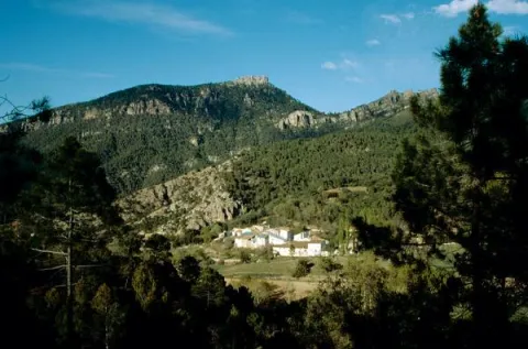
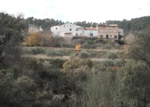
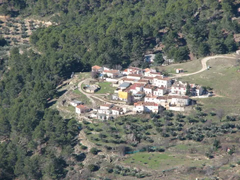
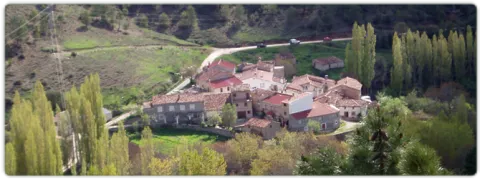
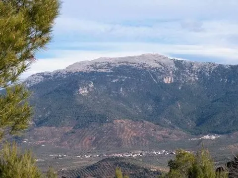
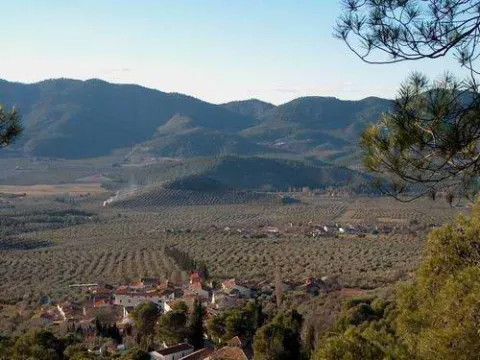
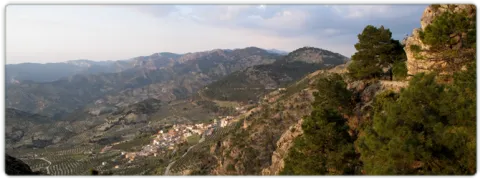
After going down a very sinuous road we reach a small valley in which La Hueta is located, which is divided into two neighborhoods. In the centre of the village you will find a laundry and a small garden with the image of the virgin of Fatima. From the set stands out the landscape that surrounds the village, highlighting at the bottom the hill of Bucentaina with the spectacular Piedra del Agujero, in a sea of pine trees sauté with complaints and oaks, which contrasts with the areas adapted to the cultivation next to the village.

Ubicación
Latitud
38.318022
Longitud
-2.661052
Distrito
Municipio
Ubicación en el mapa
POINT (-2.661052 38.318022)
Tipos de punto de interés
Imágenes carrusel
imagen
Image
599_img.png
Imagen principal
Desactivado
imagen
Image
599_image_1.jpg
Imagen principal
Desactivado
Imágenes cabecera
imagen
Image
aldeahueta.png
Imagen principal
Activado
Loading map
Preparing points of interest and routes...
Marcas de calidad

The Chaplaincy

Submitted by brandcode_deweloper on
Id
659644
Descripción
Descripción larga

A small hermitage, which at the time made the school, brings to our head memories of past times. Its position allows it to have a privileged view over the nearby mountains, which you can know more in depth if you do the circular path of the Yelmo Chico, the PR-A 150 that part of the Capellania.

Breve descripción

Jars, rosemary and pines accompany the road leading to the Capellania. Small gardens between the pine trees and some olive trees lead to the area where the village is located. It has an immense central meadow with several roads that lead to the different houses.

Ubicación
Latitud
37.913575
Longitud
-3.011814
Municipio
Ubicación en el mapa
POINT (-3.011814 37.913575)
Tipos de punto de interés
Imágenes carrusel
imagen
Image
6%20%281%29.jpg
Imagen principal
Desactivado
imagen
Image
b4b8d505ab9cd1db1bf562f9e4900a0b40f1d770.jpeg
Imagen principal
Desactivado
Imágenes cabecera
imagen
Image
Cazorla_%2814277828194%29.jpg
Imagen principal
Activado
Loading map
Preparing points of interest and routes...
Marcas de calidad

La Ballestera y Montalvo

Submitted by brandcode_deweloper on
Id
659617
Descripción
Descripción larga

The crossbow is made up of two cores of houses separated by an old laundry room that awaits the arrival of people in laundry clothes. During the winter it has only four neighbors. It surprises the cleaning of the village and the freshness of the water that runs next to it. If you close your eyes you can discover that the silence is broken only by the rooster singing, the cat's maullido or the water running.

Next to the Ballestera we find Montalvo with a completely different landscape. It dominates an elevation that is accessed by a road that zigzaguea to the village and offers us impressive views over the valley. You can see narrow streets, narrow walls, houses recovered from ruin, all surrounded by privileged views of the valley.

Breve descripción

A very narrow road surrounded by trees leads us to the Ballestera. You will pass through a bread oven and an old haystack, witnesses from another time, from the self-sufficient past of this village. The gardens are intermingled with the pines and some olive trees, the result of the need to get oil before.

Ubicación
Latitud
38.148202
Longitud
-2.693707
Ubicación en el mapa
POINT (-2.693707 38.148202)
Tipos de punto de interés
Imágenes carrusel
imagen
Image
596_img.png
Imagen principal
Desactivado
imagen
Image
IMG_7633.JPG
Imagen principal
Desactivado
Imágenes cabecera
imagen
Image
ballesteraMontalvo%20%281%29.jpg
Imagen principal
Activado
Loading map
Preparing points of interest and routes...
Marcas de calidad

Church of los Jesuitas

Submitted by brandcode_deweloper on
Id
918621
Descripción
Descripción larga

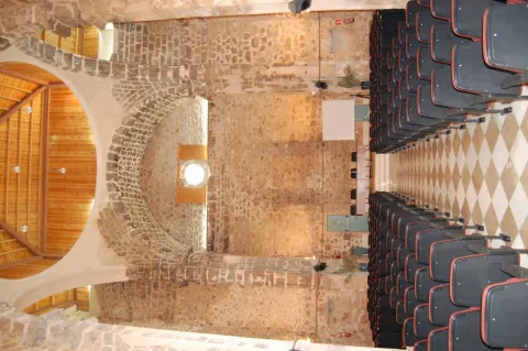
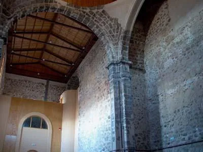
Thanks to this father's work, we know many things about the College of the Society of Jesus in Segura de la Sierra. The buildings that are preserved today in Segura de la Sierra are the result of one of its neighbours' efforts to make a religious foundation. His name was Cristóbal Rodríguez de Moya and, in the face of his wife's death, he understood that he would have a problem with his heritage of not marrying one of his three daughters. By choosing his daughters for religious life, he founded a College.

To observe the interior of the Church of the Jesuits is not to do so in the key of the history of art or to analyze the restoration that the building has suffered, it is to have a vision of society from the end of the 16th century to approach its fears and a religiosity that permeated all aspects of life, of fear of the devil or to die in sin. An approach to daily life in a small mountain community, with the poor of solemnity to which the Society of Jesus attended with its pastoral missions.

In short, it is about knowing one more episode of the history of the end of the 16th century in Segura, the plague of 1596, the famine of 1605, the charity, the fears and poverty of a large part of the population and the collective sadness of the death of Francisca de Avilés, the last daughter of Cristóbal Rodríguez de Moya. To mentally recite the passage of this woman's death puts the hairs at the top, with a mass attended by all the people and even the Franciscans of Santa María de la Peña, of Orcera, to give the last farewell to the foundress.

Breve descripción

Let's imagine for a moment an afternoon of 1606. A priest named Manuel de Arceo is finishing writing the last chapter of the history of the foundation of the College of Segura. He does not want to take the lead, nor to go into history, but only fulfils the orders he has received from Rome to record the Jesuits foundations and to prevent their process from falling into oblivion. A few days later, Father Arceo received a new assignment, to go to New Granada to take over the new Jesuit province.

Ubicación
Latitud
38.298550
Longitud
-2.652490
Distrito
Ubicación en el mapa
POINT (-2.65249 38.29855)
Imágenes carrusel
imagen
Image
segura-de-la-sierra-iglesia-2-jpg
Imagen principal
Desactivado
imagen
Image
jesuitas.jpg
Imagen principal
Desactivado
Imágenes cabecera
imagen
Image
Iglesia%20de%20los%20Jesuitas%20%28Segura%20de%20la%20Sierra%29-1%20%283%29.jpg
Imagen principal
Activado
Loading map
Preparing points of interest and routes...
Marcas de calidad

El Ojuelo y el Robledo

Submitted by brandcode_deweloper on
Id
919095
Descripción
Descripción larga

If you go through the fertile vein on which the Ojuelo sits, you will reach the Robledo right at the feet of the Yelm. A long street with houses on both sides leads us to a small square with a hermitage and a little higher a forest house, which will be the headquarters of a Thematic Air Space starring free flight sports, as the take-off of the Yelmo is very close.

The Robledo marks at 900 meters of altitude the cut between the cultivation of the olive tree and the pine tree. By going through a forest track you can climb up to the Yelmo, making a stop at a lookout next to the track that offers spectacular views over the valley.

Breve descripción

The Ojuelo extends around a road crossing next to the one with a small park and a hermitage. A great source is a stop to fill the canteen with fresh water and talk with the neighbors. Although it celebrates parties in June, the olive-tree parties, the Ojuelo is known for those it celebrates in the first week of August, with verbenas that people from all over the region come to.

Ubicación
Latitud
38.298857
Longitud
-2.651877
Distrito
Ubicación en el mapa
POINT (-2.651877 38.298857)
Tipos de punto de interés
Imágenes carrusel
imagen
Image
ojuelo.jpg
Imagen principal
Desactivado
Imágenes cabecera
imagen
Image
00010472.jpg
Imagen principal
Activado
Loading map
Preparing points of interest and routes...
Marcas de calidad

Burunchel

Submitted by brandcode_deweloper on
Id
659395
Descripción
Descripción larga

Since 2003, it has held a cattle fair in August, which had historically been one of the largest in the province of Jaén.

Breve descripción

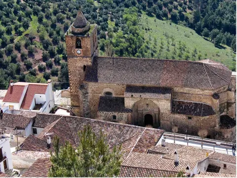
Burunchel is settled on a hillside and still today you can perceive his past as an ancient dehesa. It is one of the entrances to the Natural Park and it is worth being approached by the hermitage of San Julián, from the 15th century and its facade.

Ubicación
Latitud
37.946090
Longitud
-2.954070
Municipio
Ubicación en el mapa
POINT (-2.95407 37.94609)
Tipos de punto de interés
Imágenes carrusel
imagen
Image
593_img.png
Imagen principal
Desactivado
imagen
Image
burunchel.jpg
Imagen principal
Desactivado
Imágenes cabecera
imagen
Image
burunchel%20%281%29.jpg
Imagen principal
Activado
Loading map
Preparing points of interest and routes...
Marcas de calidad

Rock Art of Santiago-Pontones

Submitted by brandcode_deweloper on
Id
10897217
Descripción
Descripción larga

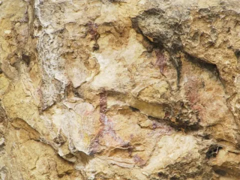
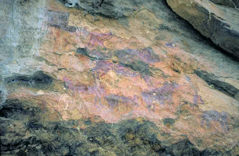
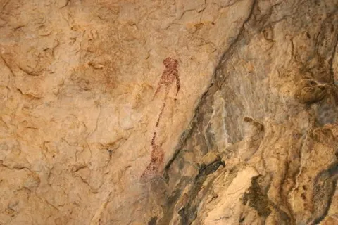
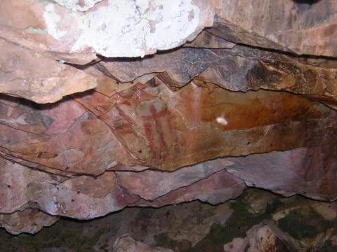
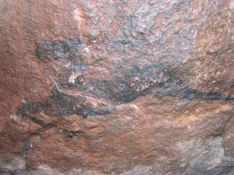
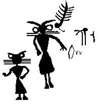
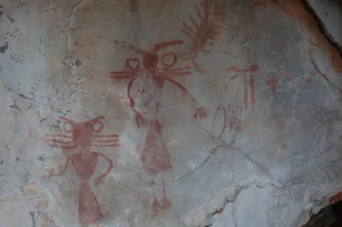
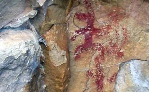
These more or less realistic but generally schematic manifestations reproduce human beings, animals and symbols, forming isolated scenes. It is a time of great changes in the way of life in which human beings move from being a predator to domesticating vegetables and animals to getting plenty of food and storing it to avoid moving continuously. The representations not only evoke and report part of daily life, but leave us witness to its complex and mysterious spirituality.

World Heritage Site

The Sierras de Segura and Cazorla are home to an interesting set of uplifting rock art; a lot of coats and caves where these first inhabitants left their art. In 1998 it became part of the UNESCO catalogue as World Heritage Site.

Outdoor museums

These sites can be considered as authentic outdoor museums of incalculable value, whose preservation concerns each and every fellow citizen. When visiting them, we must remember that we contemplate figures made by the primitive man, not least human and intelligent, more than 4,000 years ago. It's all by law, Cultural Interest Property.

Visit the paintings

Visiting these places can be difficult and frustrating, not only because of their access; it can be dangerous, but because sometimes their conservation status is the least poor; and it is recommended that they be visited with a specialist. For this purpose, before scheduling the visit, it is advisable to consult with someone familiar with the place (to advise and guide) or even to be accompanied by a responsible local guide (it is advisable to contact local authorities or associations).

In Santiagos- Pontones stands out the existence of the Abrigo de Río Frio, the Caves of Engarbo I and II and the Abrigo de Cañada de la Cruz. Just like the Cave of Birth, the only one that has been excavated.

Breve descripción

The Rupestre Art, "art on rock," is composed of the pictorial manifestations that our remote ancestors left on the walls of numerous covacas and petreous coats of our saws, in prehistoric times (in our region, from the Neolithic, to the Bronze Age).

Ubicación
Código Postal
23290
Latitud
38.112905
Longitud
-2.551663
Distrito
Municipio
Ubicación en el mapa
POINT (-2.551663 38.112905)
Tipos de punto de interés
Imágenes carrusel
imagen
Image
pontones%201.jpg
Imagen principal
Desactivado
imagen
Image
Pontones%202.jpg
Imagen principal
Desactivado
imagen
Image
pontones%203.jpg
Imagen principal
Desactivado
Imágenes cabecera
imagen
Image
pontones%204.jpg
Imagen principal
Activado
Microsite al que pertenece
Loading map
Preparing points of interest and routes...
Marcas de calidad

Rock Art of Santa Elena

Submitted by brandcode_deweloper on
Id
10894576
Descripción
Descripción larga

These more or less realistic but generally schematic manifestations reproduce human beings, animals and symbols, forming isolated scenes. The representations not only evoke and report part of daily life, but leave us witness to its complex v mysterious spirituality.

World Heritage Site

The natural park of Despeñacolos has different groups of rock paintings, of a schematic and eulin style, which gives this park an interesting cultural value, for the many coats and caves where these first inhabitants left their art. In 1998 it became part of the UNESCO catalogue as World Heritage Site.

Outdoor museums

These sites can be considered as authentic outdoor museums of incalculable value, whose preservation concerns each and every fellow citizen. When visiting them, we must remember that we contemplate figures made by the primitive man, not least human and intelligent, more than 4,000 years ago. It's all by law, Cultural Interest Property.

Visit the paintings

Visiting these places can be difficult and frustrating, not only because of their access; it can be dangerous, but because sometimes their conservation status can be at least poor; and it is recommended that they be visited with a specialist. For this purpose, before scheduling the visit, it is advisable to consult with someone familiar with the place (to advise and guide) or even to be accompanied by a responsible local guide (it is advisable to contact local authorities or associations).

The Abrigo e la Cave de los Muñecos, the Abrigo de Vacas del Retamoso and the Abrigo de Los Organos are highlighted.

Breve descripción

The Rupestre Art, "art on rock," is composed of the pictorial manifestations that our remote ancestors left on the walls of numerous covacas and petreous coats of our saws, in prehistoric times (in our region, from the Neolithic, to the Bronze Age).

Ubicación
Código Postal
23213
Latitud
38.341754
Longitud
-3.539315
Distrito
Municipio
Ubicación en el mapa
POINT (-3.539315 38.341754)
Tipos de punto de interés
Imágenes carrusel
imagen
Image
cueva%20escolares.JPG
Imagen principal
Desactivado
imagen
Image
cueva%20muniecos.JPG
Imagen principal
Desactivado
imagen
Image
DSC_7089.JPG
Imagen principal
Desactivado
imagen
Image
rupestres.JPG
Imagen principal
Desactivado
Imágenes cabecera
imagen
Image
chamanes%20vacas%20retamoso.JPG
Imagen principal
Activado
Loading map
Preparing points of interest and routes...
Marcas de calidad

Rock Art of Quesada

Submitted by brandcode_deweloper on
Id
10895687
Descripción
Descripción larga

These more or less realistic but generally schematic manifestations reproduce human beings, animals and symbols, forming isolated scenes. The representations not only evoke and report part of daily life, but leave us witness to its complex and mysterious spirituality.

World Heritage Site

The Sierra de Quesada houses one of the most prominent rock art sets in Alto Guadalquivir for the many coats and caves where these first inhabitants left their art. In 1998 it became part of the UNESCO catalogue as World Heritage Site.

Outdoor museums

These sites can be considered as authentic outdoor museums of incalculable value, whose preservation concerns each and every fellow citizen. When visiting them, we must remember that we contemplate figures made by the primitive man, not least human and intelligent, more than 4,000 years ago. It's all by law, Cultural Interest Property.

Visit the paintings

Visiting these places can be difficult and frustrating, not only because of their access; it can be dangerous, but because sometimes their conservation status is the least poor; and it is recommended that they be visited with a specialist. For this purpose, before scheduling the visit, it is advisable to consult with someone familiar with the place (to advise and guide) or even to be accompanied by a responsible local guide (it is advisable to contact local authorities or associations).

The Abrigo de Manolo Vallejo, the Abrigo de el Encasiero, the Abrigo del Cerro Vitar and the caves of the ivy and Cabrera stand out. In addition to the rock paintings, there were ceramics and lytics that have made it possible to give the first human occupation of these lands in the third millennium. C.

Breve descripción

The Rupestre Art, "art on rock," is composed of the pictorial manifestations that our remote ancestors left on the walls of numerous covacas and petreous coats of our saws, in prehistoric times (in our region, from the Neolithic, to the Bronze Age).

Ubicación
Código Postal
23480
Latitud
37.843173
Longitud
-3.069630
Municipio
Ubicación en el mapa
POINT (-3.06963 37.843173)
Tipos de punto de interés
Imágenes carrusel
imagen
Image
pinturas%20rupestres%20quesada%202.jpg
Imagen principal
Desactivado
imagen
Image
pinturas%20rupestres%20quesada%203.jpg
Imagen principal
Desactivado
Imágenes cabecera
imagen
Image
pinturas%20rupestres%20quesada.jpg
Imagen principal
Activado
Microsite al que pertenece
Loading map
Preparing points of interest and routes...
Marcas de calidad

Rock Art of La Carolina

Submitted by brandcode_deweloper on
Id
10897842
Descripción
Descripción larga

These more or less realistic but generally schematic manifestations reproduce human beings, animals and symbols, forming isolated scenes. The representations not only evoke and report part of daily life, but leave us witness to its complex and mysterious spirituality.

World Heritage Site

In Sierra Morena you can find different sets of rock art going for the many coats and caves where these first inhabitants left their art. In 1998 it became part of the UNESCO catalogue as World Heritage Site.

Outdoor museums

These sites can be considered as authentic outdoor museums of incalculable value, whose preservation concerns each and every fellow citizen. When visiting them, we must remember that we contemplate figures made by the primitive man, not least human and intelligent, more than 4,000 years ago. It's all by law, Cultural Interest Property.

Visit the paintings

Visiting these places can be difficult and frustrating, not only because of their access; it can be dangerous, but because sometimes their conservation status is the least poor; and it is recommended that they be visited with a specialist. For this purpose, before scheduling the visit, it is advisable to consult with someone familiar with the place (to advise and guide) or even to be accompanied by a responsible local guide (it is advisable to contact local authorities or associations).

The Abrygos of Dona Dama, El Puntal or the Guindo stand out.

Breve descripción

The Rupestre Art, "art on rock," is composed of the pictorial manifestations that our remote ancestors left on the walls of numerous covacas and petreous coats of our saws, in prehistoric times (in our region, from the Neolithic, to the Bronze Age).

Ubicación
Código Postal
23200
Latitud
38.280524
Longitud
-3.612801
Distrito
Municipio
Ubicación en el mapa
POINT (-3.612801 38.280524)
Tipos de punto de interés
Microsite al que pertenece
Loading map
Preparing points of interest and routes...
Marcas de calidad