Saltar al contenido principal

Parque Municipal de Fuerte del Rey

Submitted by brandcode_deweloper on
Id
8113746
Descripción
Descripción larga
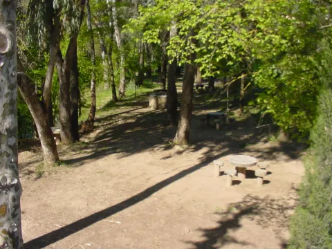
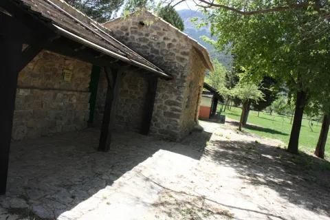
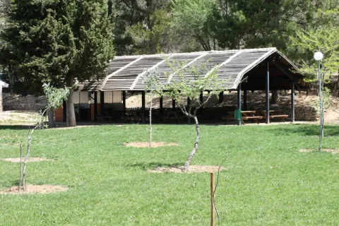
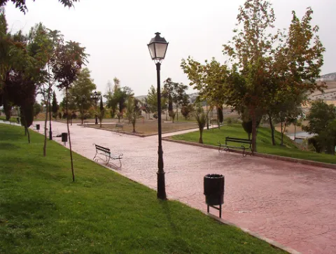
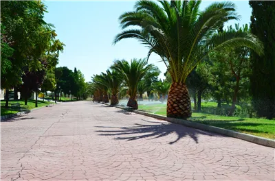
The great appeal of this park lies in its views and the large number of benches for resting, along with its function as an eco-park, allowing visitors to exercise on its outdoor gym equipment, although access to these is over uneven ground. The park has a children's play area that is not accessible, as it has a step of around 12 cm.
Breve descripción
A park located in the highest part of Fuerte del Rey, from where almost the entire town can be seen. At the main entrance there is a slight side incline that makes access more difficult.
Telecomunicaciones
Teléfono de contacto
953 37 60 11 / 953 37 61 17
Correo electrónico
ayuntamiento@fuertedelrey.es
Ubicación
Código Postal
23180
Latitud
37.87573
Longitud
-3.88143
Dirección
C/ Antonio Machado, nº 20
Distrito
Municipio
Ubicación en el mapa
POINT (-3.88143 37.87573)
Tipos de punto de interés
Imágenes carrusel
imagen
Image
Parque%20Municipal%20Fuerte%20del%20Rey2.jpg
Imagen principal
Desactivado
Imágenes cabecera
imagen
Image
Parque%20Municipal%20Fuerte%20del%20Rey.jpg
Imagen principal
Activado
Loading map
Preparing points of interest and routes...
Parque de las Eras

Submitted by brandcode_deweloper on
Id
8113062
Descripción
Breve descripción
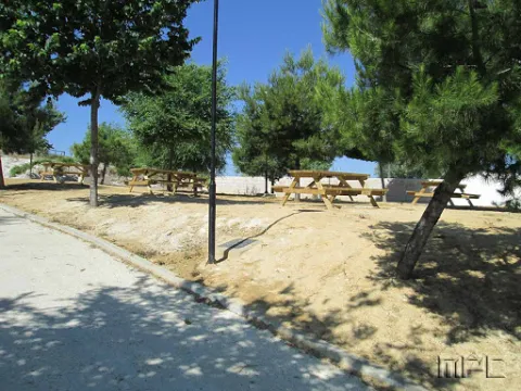
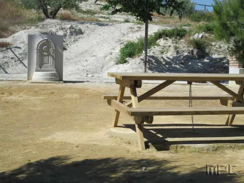
Located in the upper part of the town. It has wooden benches, a fountain and large shaded areas for relaxing and enjoying a wonderful day outdoors.
Telecomunicaciones
Teléfono de contacto
953 37 60 11 / 953 37 61 17
Correo electrónico
ayuntamiento@fuertedelrey.es
Ubicación
Código Postal
23180
Latitud
37.87327
Longitud
-3.88616
Dirección
C/ las Eras.  Fuerte del Rey
Distrito
Municipio
Ubicación en el mapa
POINT (-3.88616 37.87327)
Imágenes carrusel
imagen
Image
Parque%20de%20las%20Eras%2C2.jpg
Imagen principal
Desactivado
Imágenes cabecera
imagen
Image
Parque%20de%20las%20Eras%2C.jpg
Imagen principal
Activado
Loading map
Preparing points of interest and routes...
La Iruela

Submitted by brandcode_deweloper on
Id
918750
Descripción
Descripción larga

Next to the castle you will find the ruins of the Church of Sto. Silos Sunday. The legend tells that it was built on the place where the Arabs held captive Christians in prison and there was Santo Domingo doing his job. In the building there are traces of the disciples of Vandelvira. It's a must-see for any lover of history.

The Iruela was part of Cazorla until 1370, when Archbishop D. Gome Manrique gave it independence, power and shield. His political and territorial position has allowed him to preserve an important heritage: the Conistory House - a proud building in the Mudejar style of Toledan - and the Church of the Immaculate Conception are part of this legacy.

The population has a core worth visiting. The streets are steep and narrow, with crouched houses and flowers on the balconies. In the center there is a beautiful fountain from which several roads arise to surround the village. From here you can go up to Temple Street on a beautiful stone road accompanied by fig trees and cypresses.

We suggest:

  • About five minutes from La Iruela you will find Burunchel. Come to know the Hermitage of San Julián and the temple of the Holy Spirit among other attractions of this pedany.
  • On August 27, during the summer parties of the village you will see a curious pyrotechnic show, in which the castle is also the protagonist.
Breve descripción

The road that goes up to the saw from Cazorla borders this small, but amazing population. Its best known profile is due to the castle, a legendary fortress that became owned by the Templars and dominates the Guadalquivir Valley. The need to defend itself has given rise to this fortification which, because of its most abrupt aspect, is inexortable. But the Iruela is more attractive.

Ubicación
Latitud
37.920351
Longitud
-2.994140
Municipio
Ubicación en el mapa
POINT (-2.99414 37.920351)
Tipos de punto de interés
Imágenes carrusel
imagen
Image
iruela.jpeg
Imagen principal
Desactivado
Imágenes cabecera
imagen
Image
La-Iruela-Jaen-nuevo-municipio-turistico-de-Andalucia-foto-de-Junta.jpg
Imagen principal
Activado
Loading map
Preparing points of interest and routes...
Marcas de calidad

Astroandalus, Viajes, Astronomía y Turismo Cientifico

Submitted by brandcode_deweloper on
Id
PUN-0001
Descripción
Descripción larga
AstroAndalus.com is born with the intention to propose to them an offer of tourist packages around culture, knowledge, exclusivity and personal enrichment through discovery, to know curiosities that still present in our day to day abscess us of the same laws. They rule the physics of our universe, from the shell of a snail in our garden to the giant arms of a galaxy like ours. It is the first travel agency to specialize in tourist experiences related to the science, knowledge, relaxation and contemplation of our own environment, with the intention of satisfying that deep human instinct that is the curiosity to respond to our reality. AstroAndalus.com wants your eyes to shine with emotion at the sight of the firmament, your senses to tremble at the clean smell of the mountain and the sound of the wings of the eagles cutting the wind. We want you to feel small in the face of geological history, or privileged in understanding the mathematics with which those old sages were able to impregnate the rocks they sculpted, rich in details and perfect in geometry. If you want to know instead of travel, if you want to discover rather than see, if you want to feel, experience or understand, AstroAndalus.com is waiting for you to offer a tourist experience full of emotions. .
Breve descripción
AstroAndalus.com is the first travel agency specialized in astronomical and scientific tourism, but what exactly is this?. Observe the Milky Way from virgin natural sites, enter the history of the rocks, discover the hidden mathematics in the geometry of some urban monuments or enjoy observing the faunistic jewels of our natural heritage are some of the proposals that this new online travel agency wants to offer you. .
Telecomunicaciones
Sitio web
http://www.astroandalus.com/
Teléfono de contacto
953 150 050 / 615 933 717
Correo electrónico
info@astroandalus.com
Ubicación
Nombre
Astroandalus, Viajes, Astronomía y Turismo Cientifico
Código Postal
23009
Latitud
37.791830
Longitud
-3.791490
Dirección
Ronda de los Olivares, 23.
Distrito
Municipio
Ubicación en el mapa
POINT (-3.79149 37.79183)
Tipos de punto de interés
Imágenes carrusel
imagen
Image
DSC00483-2.jpg
Imagen principal
Desactivado
imagen
Image
DSC06091.jpg
Imagen principal
Desactivado
Horario
Monday to Friday: 08: 00 - 15: 00.
Loading map
Preparing points of interest and routes...
Interés

Recreational Zone río San Juan

Submitted by brandcode_deweloper on
Id
1909649
Descripción
Descripción larga

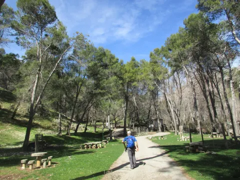
It is a very quiet area, surrounded by endless olive fields, where there are fountains with drinking water, barbecues, tables and seats. In the river you can practice, in season, fishing of the common trout and the barb, or practice swimming.

Breve descripción

This recreational area is located in the area known as the Palomillas Bridge

Ubicación
Latitud
37.540246
Longitud
-4.039030
Dirección
Carretera comarcal JV-2236 de Sabariego a La Rábita, en su cruce con la carretera N-432 Granada - Badajoz.
Distrito
Municipio
Ubicación en el mapa
POINT (-4.03903 37.540246)
Imágenes carrusel
imagen
Image
4%20%281%29.jpg
Imagen principal
Desactivado
imagen
Image
1%20%281%29.jpg
Imagen principal
Desactivado
imagen
Image
10.jpg
Imagen principal
Desactivado
Imágenes cabecera
imagen
Image
3%20%281%29.jpg
Imagen principal
Activado
Microsite al que pertenece
Loading map
Preparing points of interest and routes...

Recreational Zone La Cañada

Submitted by brandcode_deweloper on
Id
4691127
Descripción
Breve descripción

It is a perfectly equipped road that has an interesting look, a water source and an information panel on landscape interpretation.

Telecomunicaciones
Sitio web
www.pinademontalgrao.es/content/complejo-la-canada
Teléfono de contacto
953 781 500
Correo electrónico
ayuntamiento@larva.es
Ubicación
Código Postal
23591
Latitud
37.758500
Longitud
-3.200520
Dirección
C/ Conde Torrerando, 22
Distrito
Municipio
Ubicación en el mapa
POINT (-3.20052 37.7585)
Tipos de punto de interés
Imágenes carrusel
imagen
Image
Area%20Recreativa%20La%20Ca%C3%B1ada.jpg
Imagen principal
Desactivado
Imágenes cabecera
imagen
Image
9085_0nw5ulj32ahczt4o.jpg
Imagen principal
Activado
Horario
24 h.
Microsite al que pertenece
Loading map
Preparing points of interest and routes...
Mágina Peaks and Miramundos Zone

Submitted by brandcode_deweloper on
Id
5846349
Descripción
Breve descripción

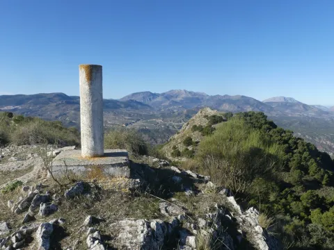
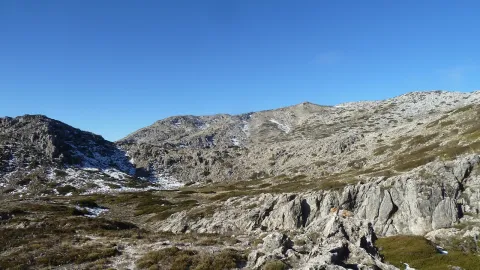
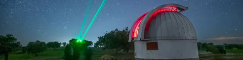
In this summit crest is the roof of the province: the Pico Magina, with 2,167 meters of height, which is the third highest altitude of Andalusia, after the massizos of Sierra Nevada and the Sierra de Baza. The vegetation and conditions are typical of the high Mediterranean mountain.

Ubicación
Latitud
37.730270
Longitud
-3.445830
Distrito
Ubicación en el mapa
POINT (-3.44583 37.73027)
Tipos de punto de interés
Imágenes carrusel
imagen
Image
17%20Magina.JPG
Imagen principal
Desactivado
imagen
Image
naturaleza_14268337_20191208114422%20%281%29.jpg
Imagen principal
Desactivado
imagen
Image
9788440Master%20%282%29.jpg
Imagen principal
Desactivado
Imágenes cabecera
imagen
Image
P1240066%20%282%29.jpg
Imagen principal
Activado
Microsite al que pertenece
Loading map
Preparing points of interest and routes...

Hondacabras Camping Area

Submitted by brandcode_deweloper on
Id
2980330
Descripción
Descripción larga

The landscape surrounding this equipment, located on the rest of a pecuary road, is typically olive-growing and invites hiking. The facilities, with a capacity for a hundred people, have areas for tents, roofed dining, kitchen, toilets and showers.

Breve descripción

It is accessed from the JA-1107 road that goes from Torres to Albanchez de Magina; after walking about two km, in the middle of a curve, to the right, it connects a lane that, with a total length of one kilometre, leads us directly to this camping area of the Sierra Magina Natural Park called Hondacabras.

Telecomunicaciones
Sitio web
www.juntadeandalucia.es
Teléfono de contacto
953 363 011
Correo electrónico
informacion@juntadeandalucia.es
Ubicación
Código Postal
23540
Latitud
37.768770
Longitud
-3.495980
Dirección
Carretera JA-3107
Distrito
Municipio
Ubicación en el mapa
POINT (-3.49598 37.76877)
Tipos de punto de interés
Imágenes carrusel
imagen
Image
acampada%20Hondacabras.jpg
Imagen principal
Desactivado
imagen
Image
acampada%20Hondacabras%202.jpg
Imagen principal
Desactivado
imagen
Image
acampada%20Hondacabras%203.jpg
Imagen principal
Desactivado
Imágenes cabecera
imagen
Image
acampada%20Hondacabras%204.jpg
Imagen principal
Activado
Microsite al que pertenece
Loading map
Preparing points of interest and routes...
Roman Villa of Bruñel

Submitted by brandcode_deweloper on
Id
919543
Descripción
Descripción larga

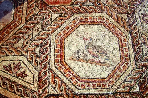
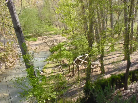
Most of these buildings are based as a second residence during the High Empire, although with the crisis of the third century and the insecurity of the cities many great aristocrats withdraw to their villages. As the residence becomes, the luxury and refinement of which the rich mosaics and the beginning of the walls of the different rooms are preserved as a testimony. Next to the Palaciega area there were other units with stables, with forges, alfares and, ultimately, everything necessary to be self-sufficient away from the city. Over time, the cities lost their importance, had to wafer to avoid dangers and the cultural spotlights that had gone out.

If we know nothing about the inhabitants of these luxurious rooms, we know less about those people who left the city to take refuge in these villas. They helped defend property in exchange for being able to cultivate a piece of land with which to get what is necessary to feed. Here is the origin of what would be the vasalage in the Middle Ages. Nor do we know how the craftsmen made these great mosaics, nor their living conditions, would they know that they represented the images they reproduced with the tesels? and the last inhabitants at the end of the fourth century?

Breve descripción

The villa of Bruñel represents the typical model of Roman villa that begins to extend during the Lower Empire.

Ubicación
Latitud
37.842982
Longitud
-3.066921
Municipio
Ubicación en el mapa
POINT (-3.066921 37.842982)
Tipos de punto de interés
Imágenes carrusel
imagen
Image
Mon167.jpg
Imagen principal
Desactivado
imagen
Image
quesada.jpg
Imagen principal
Desactivado
Imágenes cabecera
imagen
Image
DQxszNiU8AAV39W.jpg
Imagen principal
Activado
Loading map
Preparing points of interest and routes...
Marcas de calidad

Valley of the Segura

Submitted by brandcode_deweloper on
Id
914042
Descripción
Descripción larga

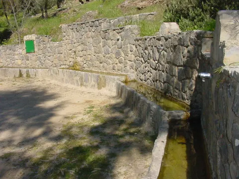
The inhabited cores around the valley were able to take advantage of the river's passage by creating small channels and waterfalls. You will see great walnuts and some orchards by the villages, irrigated with a pure crystalline water. At this point, the river still has the presence of the common trout, a species that only lives in especially clean waters.

After Las Anchuricas the valley goes to Las Juntas de Miller, where the Segura receives its second tributary, the Zumeta River. Together they cross the provincial limit that is located there, entering the province of Albacete. In this place a hydroelectric power plant was erected in the 1950s to take advantage of the flow of these two rivers.

The valley offers pleasant visits around it that will allow you to get to know the Sierra de Segura in depth. Among others, we recommend:

  • Visit the village of La Toba, a place where water is the great protagonist. If the cold water does not impress you, you can go up to the birth of La Toba, which is found in a curious cave well known in the region.
  • Rest next to the reservoir of Las Anchuricas. The water and the high mountains have created this peaceful place, of which you will surely have to leave.
  • Walk around some of the nearby villages such as La Fuente del Esparto, La Peguera del Madroño or Las Gorgollitas. The latter offers an exciting view of the valley.
  • Seating water in the impressive fountain of The Four Caños, between the Anchuricas reservoir and Miller's Boards.
Breve descripción

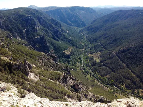
In the village of Huberga Utrera, the Segura River receives its first tributary, the Madera River. From this point on the Segura, with an already important flow, goes through its valley through bridges - one of them built by the Romans - and visiting villages that were born on its bank and thanks to it survived. The road goes parallel to the river, and on its sides there are impressive calares with magnificent views of the Sierra. As you pass the village of La Toba, the river falls into the charming reservoir of Las Anchuricas.

Ubicación
Latitud
38.298857
Longitud
-2.651877
Distrito
Ubicación en el mapa
POINT (-2.651877 38.298857)
Tipos de punto de interés
Imágenes carrusel
imagen
Image
valle.jpg
Imagen principal
Desactivado
Imágenes cabecera
imagen
Image
valle-del-segura.png
Imagen principal
Activado
Loading map
Preparing points of interest and routes...