Saltar al contenido principal

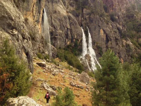
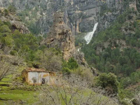
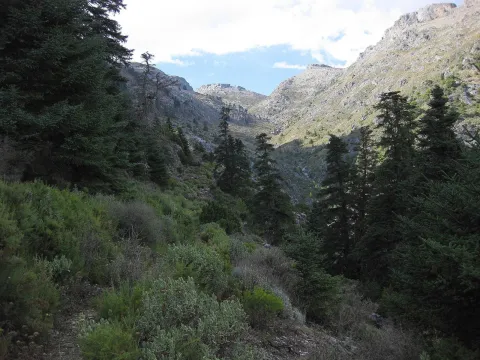
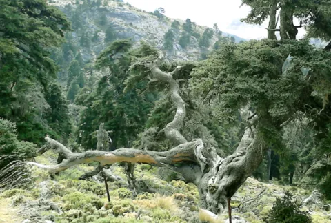
Juniper Forests of Sabina Mora

Submitted by brandcode_deweloper on
Id
881711
Descripción
Descripción larga

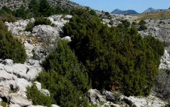
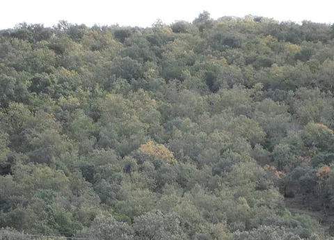
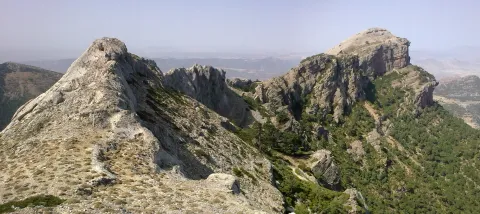
One of the most important plant formations of the park is the Sabinar of Sabina mora or simply of Sabina (Juniperus phoenicea). It is very important for its extension, for the habitat it occupies - rocks and dolomitic sandals - and for the large number of endemic species that it houses, including the most emblematic, the Cazorla violet (Viola cazorlensis) and the endemism of the Serra de Segura Jasione crispa seguridad. This training is therefore declared a Habitat of Community Interest in Natura 2000 Network.

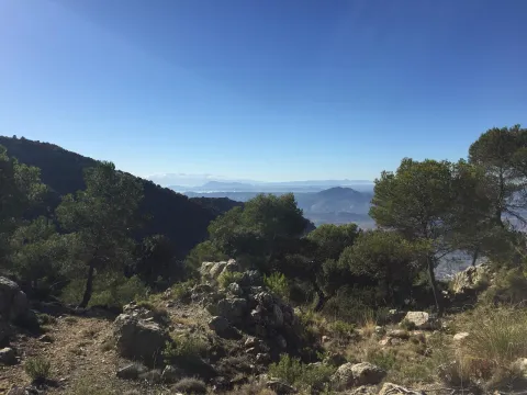
It is presented to us in the form of clear sketches, where the black savina is the dominant plant element. We can find it in many areas of the Park, colonizing those places where other trees have not been able to develop, rocky, dry, wind-beat and with strong solar irradiation. You can say that sabina is the essence of hardness. We can also find it in isolation in almost all the forest formations of the Park, missing only in the high summits, so in many places we can see small sabinars more or less dense or scattered.

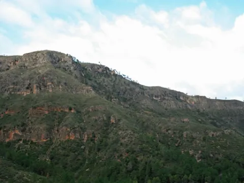
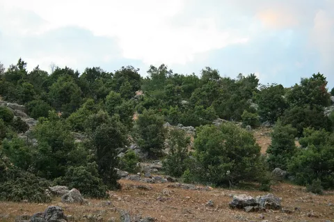
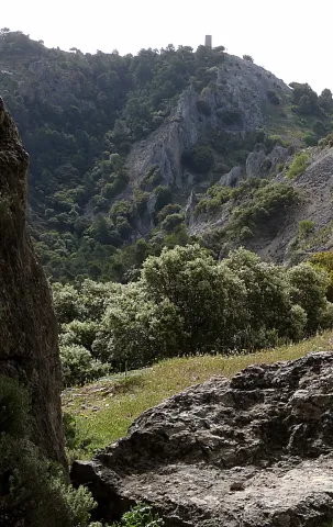
Inside Las Villas, on any side we will find sabinares. We've chosen the Wolf's boat. Once on the Sloth Hill, we will walk on the side of your left, according to the direction of the march. It is populated by savannas, juniperus oxicedrus, salgary and black pines (Pinus nigra salzmannii and Pinus pinaster), in a sparse and scattered manner, complaints and oinas (Quercus faginea and Quercus ilex ballota), thorns of dyes (Rhamnus saxatilis) and piorns (Erinacea anthyllis and Echinospartum boissierii). We are on this hill at the foot of the Blanquillo, the highest summit of the Las Villas saw.

Of the same characteristics as the one described - sabinar en rota - but with more cornicabra, are the sabinars of the Zumeta River, which extend throughout the left side in the sense of the waters. The sabinar is also seen from the other side, on the side of Albacete. We will see it from further, but in return we are compensated with the panoramic view of the Old Age reservoir.

LOCATION OF THE LOBO

We take the road that goes from the reservoir of Aguascebas to the Recreative Area of Gil Cobo. A little before we reach this area, we take a crossing that comes to our right, preferably on foot. We followed the track to a detour and took the one from the left, in gentle ascent, until we reached the Collado del Perenoso. To our left is the great lapiaz of the Lobo Boat.

ZUMETA LOCATION

In the village of Vites you have to head towards the Cortijo del Torcal.

Breve descripción

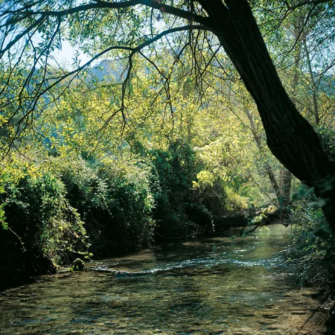
Lobo boat and Zumeta river
Ubicación
Latitud
37.912893
Longitud
-3.003887
Municipio
Ubicación en el mapa
POINT (-3.003887 37.912893)
Tipos de punto de interés
Imágenes carrusel
imagen
Image
622_img.png
Imagen principal
Desactivado
imagen
Image
unnamed.jpg
Imagen principal
Desactivado
Imágenes cabecera
imagen
Image
2%20%281%29.jpg
Imagen principal
Activado
Loading map
Preparing points of interest and routes...

Jandulilla River

Submitted by brandcode_deweloper on
Id
8114425
Descripción
Descripción larga

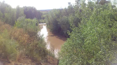
Former Xandulilla. Influent on the left bank of the Guadalquivir River. Collect the waters from the northeastern face of the Sierra Magina massif. The associated valley is given the same name. Unwind in the Guadalquivir River, in the area of Ubeda the old one. The Arab geographer Al-Zuhrí, mentions him by the name of Wadi-l-Ard, or Rio de la Tierra.

He named the former population of Xandulilla, of which there are many archaeological remains of great importance spread throughout the area. In the 17th century it was known as "Villa de Felix" with its own jurisdiction. It is a river with a normally low and variable flow rate and without regulatory structures. It is born under the Port of the Gallardos, also known in its first stretch as Rio Huelma, its main tributaries, both on the left are the Gualijar River and the Garganton River that are born in the main massif of Magina and after a very short journey they result in the Jandulilla, apart from numerous intermittent rags and ramps.

Breve descripción

The Jandulilla River is a short river in the south of Spain, tributary to the left bank of the Guadalquivir River that runs through the province of Jaén and collects the waters of the northeastern face of the Sierra Magina massif. The associated valley is given the same name. Unwind in the Guadalquivir River, in the area of Ubeda la Vieja.

Telecomunicaciones
Teléfono de contacto
953 390 210
Ubicación
Código Postal
23560
Latitud
37.650300
Longitud
-3.459550
Distrito
Municipio
Ubicación en el mapa
POINT (-3.45955 37.6503)
Imágenes carrusel
imagen
Image
r%C3%ADo%20Jandulilla%202%20%281%29.jpg
Imagen principal
Desactivado
Imágenes cabecera
imagen
Image
r%C3%ADo%20Jandulilla.jpg
Imagen principal
Activado
Microsite al que pertenece
Loading map
Preparing points of interest and routes...

Río Guadalimar

Submitted by brandcode_deweloper on
Id
4528704
Descripción
Descripción larga
It crosses the Sierra de Cazorla, Segura y las Villas, collecting the waters of numerous smaller streams and rivers: its course receives water from the Onsares, Guadalmena, Guadalén, Cortillas, Frío, Carrizas, Morles and Trujala rivers. The river and its main tributaries have a gentle slope and a rather limited flow, but among its streams are spots of spectacular beauty. Its waters slow down at the Giribaile reservoir, the second most important reservoir in the province, where barbel, carp, largemouth bass and pike can be fished. It marks the boundary of the Torreblascopedro district along its entire north-eastern side, giving rise to a typical riparian ecosystem and creating a fertile plain characterised by cotton and wheat farming. It is accessible via the JV-3003/4 and must be crossed via its bridge to reach Linares from our municipality.
Breve descripción
The Guadalimar river rises at the foot of the Almenara hill, at an altitude of 1,200 m, in the Sierra de Alcaraz, in Albacete, and flows towards the Natural Park of the Sierras de Cazorla, Segura y las Villas, joining the Guadalquivir river within the municipal district of Torreblascopedro. It takes its name from the colour of its waters, as "Guadalimar" derives from wad al-Ihmar, "red river".
Ubicación
Municipio
Imágenes carrusel
imagen
Image
guadalimar.jpg
Imagen principal
Desactivado
Imágenes cabecera
imagen
Image
4%20%281%29.jpg
Imagen principal
Activado

Guadalén River

Submitted by brandcode_deweloper on
Id
6552251
Descripción
Descripción larga

It receives from the right to the rivers Onsares, Guadalmena and Guadalén. On the left to the rivers Cotillas, Arroyo Frio, Carrizas, Morles, Trujala and the creek of Peñolite. On its way through the Sierra de Segura.

In Roman times it was called the Tago, Tagus or Tugio River, just as its birth was the Sierra de Tugia. Its Arabic name "wad al-ihmar" means "red river," which is curiously as it is called in the area, by the red color of its waters.

Breve descripción

The Guadalimar River is a river in the south of Spain, a tributary of the Guadalquivir River that is born at the foot of the Sarga peak (1770 m.), in the Alcaraz Sierra, in the province of Albacete, resulting from the confluence of several streams in the surroundings of Villaverde de Guadalimar. It provides its waters to the Guadalquivir in the municipality of Jabalfifth (Jaén province).

Ubicación
Latitud
38.180950
Longitud
-3.427055
Distrito
Municipio
Ubicación en el mapa
POINT (-3.427055 38.18095)
Imágenes carrusel
imagen
Image
7e0b619bb599cba0f135d1f24a105a0f.jpg
Imagen principal
Desactivado
imagen
Image
00945f1.jpg
Imagen principal
Desactivado
Imágenes cabecera
imagen
Image
5678744Master.jpg
Imagen principal
Activado
Microsite al que pertenece
Loading map
Preparing points of interest and routes...

River Aguamulas

Submitted by brandcode_deweloper on
Id
913807
Descripción
Descripción larga

The forest track, 9 km long, is very pleasant to travel and has no loss, as it is only to follow right, and is also marked as GR-7. It always runs by the river, with very little level, except in a section where it is separated by forming several elevation curves.

It is not necessary to travel throughout to enjoy these places, but if you arrive at the end you will find a lookout with unforgettable views of the Reco del Aguamulas. It is the rocky amphitheatre where this river is born, on whose base there are abandoned meadows and gardens.

You will also see the cords - already ruin - of La Fresneilla. In them lived the last inhabitant of these valleys, called Máximo Fernández Cruz, nicknamed "the Cojo de la Fresnedilla." This serrano character fought for thirty years not to leave the land he was born, from which were expelled the close to a hundred neighbors of the Aguamulas environment who suffered expropriation when the National Cote of Hunting was created in 1960. In 1982, Maximo paid for his resistance with the prison.

We suggest...

  • Be attentive to see some example of the dark green Valverde lizard, endemic to the Park and discovered in 1958 very close to here.
  • Continue beyond the lookout and take a walk in the La Fresnedilla area. If the water abounds, you will see the waterfalls of the birth of the Aguamulas.

In the campsite Llanos de Arance (road A-319) you have to take the forest track that crosses the Guadalquivir. At 3 km, after wading the Aguamulas, the crossing is taken to the right and followed 1 km to the barrier in the forest house of Los Bonal, where you can leave the car.

Breve descripción

The Aguamulas is a small tributary of the Guadalquivir that runs one of the most beautiful valleys of the park, forming numerous rapids and pozas. It is enjoyed walking through a nice forest track between pine trees, in the shadow of which is developed a thick Mediterranean vegetation with oaks, madroños, lentils and cornicabra. At the bottom are the impressive walls of the Banderillas, whose summit is about 2,000 m high.

Ubicación
Nombre
Casa forestal Los Bonales
Latitud
38.044880
Longitud
-2.794950
Ubicación en el mapa
POINT (-2.79495 38.04488)
Tipos de punto de interés
Imágenes carrusel
imagen
Image
nacimiento-aguasmulas.jpg
Imagen principal
Desactivado
imagen
Image
aguasmulas.jpg
Imagen principal
Desactivado
Imágenes cabecera
imagen
Image
natu001%20%281%29.png
Imagen principal
Activado
Loading map
Preparing points of interest and routes...

Gall Oak and Oak Forests

Submitted by brandcode_deweloper on
Id
881625
Descripción
Descripción larga

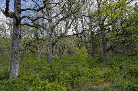
The Barrio del Guadalentín is one of the best complaints forests in the park. Among the complaints, on the other side of the ravine, the Poyos de la Carilong rise majestic. The whole set, whimsical, river and rocky fleshly make this walk a true enjoyment of our nature.

In other times, one of the most widespread forest formations in the mountains was the deniigal, embedded in deep soils, with abundant organic matter and quality. In this forest the dominant tree is the whine (Quercus faginea). In the colonization of the saw the human being occupied these rich and fertile soils for use, cutting the forest and taking advantage of its offal as fuel and material for construction. Later on it was the naval industry that was supplied with the wood of the Robledals or Robledals. In our days, the robledal, as it is named in the saw, survives in areas that are short-lived, in bright slopes and in the bottom of valleys like rodents or bosquets.

The complaints (Quercus faginea) are accompanied by some salgarean pine (Pinus nigra salzmannii) and some oaks (Quercus ilex ballota). In the forest, we find trees such as cereals (Prunus mahaleb) and pespejones (Sorbus torinlis), and shrubs such as majuelos (Crataegus monogina), skirmishes (Rosa spp.), laureolas (Daphne laureola), thorns (Berberis vulgaris australis). And by covering the ground, we find a herbaceous entourage among which we highlight grasses such as Brachypodium sylvaticum, Brachypodium phoenocoids, Festuca arundinacea, Dactylis glomerata, and Piptaterum meliaceum. Other species that we find in the complaint are the gold button (Geum sylvaticum), violets (Viola odorata), primaveras (Primula vulgaris), consueldas (Prunella grandiflora, P. laciniata, P. vulgaris), filippines (Filipendula vulgaris), eléboros (Helleborus foetidus), narcissos (Narcissus triandrus pallidulus) and wild jacintos (Scilla paui).

LOCATION

To access, we follow the road from Vadillo Castril to the San Pedro Navy. At the height of Los Collados it becomes a ground track, but with good firm. As we overcome the San Pedro Navy, we will be waiting for the second detour to our right. It is a closed track to the traffic of vehicles that is located a few meters from the old forest house of Fuente Steel, which is currently abandoned, but is kept standing and seen from the track. As we pass through it, about 200 meters away we find the detour, where we park and walk along the track. We will soon begin to enter a splendid forest of complaints.

Breve descripción

Environ del Barranco del Guadalentín

Ubicación
Latitud
37.702695
Longitud
-2.935057
Municipio
Ubicación en el mapa
POINT (-2.935057 37.702695)
Tipos de punto de interés
Imágenes carrusel
imagen
Image
837034Master%20%281%29.jpg
Imagen principal
Desactivado
imagen
Image
los-quejigales%20%281%29.png
Imagen principal
Desactivado
imagen
Image
Natu224.jpg
Imagen principal
Desactivado
Imágenes cabecera
imagen
Image
1200px-Robledal_de_Arabarko.jpg
Imagen principal
Activado
Loading map
Preparing points of interest and routes...

Gall Oak Forest of the Collado de los Jardines

Submitted by brandcode_deweloper on
Id
4554494
Descripción
Descripción larga

With regard to the faunistic species that inhabit the environment, mention the wolf, the lince, the otter, the imperial eagle, the royal eagle or the azor.

Location: To the north-east of the town, in the heart of the Natural Park of Despeñacolos.

Distance: 16 km.

Medium: Tourism vehicle.

Access route: Departing from the village by the highway of Andalusia in the sense of Madrid and taking, to the right and after going about 6 km, the road J-6.110 towards Aldeaquemada.

Breve descripción

This enclave, which belongs to the Natural Park of Despeñacolos, stands out for its biodiversity; thus, among the plant species present, there are complaints, alcornoques, maples and other typical of the humid Mediterranean forest.

Ubicación
Código Postal
23213
Latitud
38.390302
Longitud
-3.494124
Dirección
Carretera Aldeaquemada, km. 6,6
Distrito
Municipio
Ubicación en el mapa
POINT (-3.494124 38.390302)
Tipos de punto de interés
Imágenes carrusel
imagen
Image
quejical.png
Imagen principal
Desactivado
Loading map
Preparing points of interest and routes...

Pass of Tíscar

Submitted by brandcode_deweloper on
Id
913726
Descripción
Descripción larga

From the watchtower we will be able to contemplate a panoramic that will help us to know the environment better. Looking south a large ravine, which is named after the port, communicates the hill with the stepparian Valle del Guadiana Menor. The ravine is narrowed at the end in a rocky portico, which served for the Arabs to build the fortin of the Castle of Peña Negra. Once the Muslims were expelled, the new occupants raised the Tícar Sanctuary over the walls of the fortress. Looking to the west, the Peña de las Carboneras, one of the summits of the smallest and colecte orographic unit of the mountain massif, stands at the front: the Quesada saw, which houses numerous rock paintings of the Levine art, considered by UNESCO as the World Heritage Site.

To the north our view is lost in the olive sea of the Jiennense countryside, which as waves in a time, is aggressive in the slopes of the Cazorla saw, whose alignment is clear to the right of the olive tree. As we look east, our view inevitably stops at the Rayal Picon (1,834 m of altitude), the first important elevation of the Sierra de Cazorla from the south and impressive limestone mole that has a vertical cut on its north face. The name Rayal was synonymous with the border in the Middle Ages and the torreon in which we are located reminds us that this space was a border with the Nazareth Kingdom of Granada for almost three centuries.

We suggest...

  • It is recommended to carry binoculars and to track with them the limestone crestons that are seen, above all, in the northern half of the area, because it is quite easy to observe the montane goat. It is also a good point to see rapacious birds in flight.
  • Right in the same port is the Fuente de las Carboneras, a good place to refresh us. If the pipe was dry, the usual circumstance in the summer, following the lane that leaves from the same source, we arrive at the Forest House of Las Carboneras and, after the building, we will find another spring.

The Port of Tiscar is the highest point on the road A-6206, the winding mountain road that unites Quesada with the two southernmost villages of the Natural Park: Pozo Alcón and Hinojares. To get to this beautiful hill, if we leave from Quesada, at the exit we will continue straight, avoiding to the right the detour to Huesa (there is an indicator to the Port of Tíscar), until the rise, about 8.5 km later, where we find a signal indicating the location and altitude. From Hinojares (18 km) and Pozo Alcón (23 km) you have to take the A-6206 inverse to the previous one, always direction to Quesada at all the crosses.

Breve descripción

The Port of Tíscar is not only the mountain barrier to be saved to go to the Sanctuary of Our Lady of Tíscar, the historical patron of the advance of Cazorla and now of Quesada, and one of the most emblematic religious symbols of these mountains. It is an agribusiness area, with spectacular views, where it is easy to see the mountain goat, a corner full of history and nature. Leaving the vehicle in the parking areas in the same port, taking a small walk we arrive to a medieval watchtower, the Atalaya del Infante Don Enrique (14th century), an excellent lookout, with views to which for nothing in the world we must give up if we are there.

Ubicación
Latitud
37.865164
Longitud
-3.068421
Municipio
Ubicación en el mapa
POINT (-3.068421 37.865164)
Tipos de punto de interés
Imágenes carrusel
imagen
Image
tiscar.jpg
Imagen principal
Desactivado
imagen
Image
CazPuertoDeTiscar1.jpg
Imagen principal
Desactivado
Imágenes cabecera
imagen
Image
22072009_006_stitch.jpg
Imagen principal
Activado
Loading map
Preparing points of interest and routes...

Bridge over El Guadalimar

Submitted by brandcode_deweloper on
Id
919236
Descripción
Descripción larga

The work of the pineers, called hooks in other areas, was hard and dangerous. We can imagine in the town square the group of piners with hooks and other equipment to start driving. The group would be very large, more than fifty people, and sometimes several hundred. There were some children to learn the trade, mules, dogs and the essential objects for a several-month journey.

When organizing the driving the responsible was the river master, the person who with his experience had acquired that condition and that allowed him to go next to the mayoral of the front to the front of the driving. Next to this mayoral there were two others in the center and in the back, and their mission was to direct the work of the pineers' bands.

The river master was the one who decided if it was necessary to do any channelling or other work made with the same wood to facilitate the driving and transport of the parts by the river.

We must think of harsh living conditions for people who spent much of the year outside their homes and that this activity was the only way to make a living. There is now an annual exhibition of wood driving in Yeste (Albacete) and another of following hasheros in Siles.

Breve descripción

This was a point of passage of some of the many wood that over the centuries have led the wood of the forests of the Natural Park to Seville and other places, for the construction of ships and large civil and religious buildings, so many historical facts we know would not have been possible without the small history of the wood.

Ubicación
Latitud
38.087695
Longitud
-3.640179
Distrito
Municipio
Ubicación en el mapa
POINT (-3.640179 38.087695)
Tipos de punto de interés
Imágenes carrusel
imagen
Image
Uno_de_los_ojos_del_puente_Mocho.jpeg
Imagen principal
Desactivado
imagen
Image
rio-guadalimar-3-1-jpg
Imagen principal
Desactivado
Imágenes cabecera
imagen
Image
segura.jpg
Imagen principal
Activado
Loading map
Preparing points of interest and routes...
Interés

Mocho Bridge

Submitted by brandcode_deweloper on
Id
919194
Descripción
Descripción larga
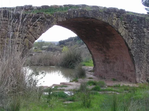
Puente Mocho constitutes an example of Roman architecture. The Romans carried out large civil constructions to guarantee communications within the different provinces that made up their domains and the mobility of the troops stationed in the different territories. In fact, in many cases it was the legionaries themselves who built some of the constructions that are preserved today, especially in the period known as the Pax Romana, in which there were no succession problems between the emperors and there was effective border control.
Breve descripción
Puente Mocho constitutes an example of Roman architecture. The Romans carried out large civil constructions to guarantee communications within the different provinces that made up their domains and the mobility of the troops stationed in the different territories. In fact, in many cases it was the legionaries themselves who built some of the constructions that are preserved today, especially in the period known as the Pax Romana, in which there were no succession problems between the emperors and there was effective border control.
Ubicación
Latitud
38.252679
Longitud
-2.890872
Distrito
Municipio
Ubicación en el mapa
POINT (-2.890872 38.252679)
Tipos de punto de interés
Imágenes carrusel
imagen
Image
Puente-Mocho-768x600.jpg
Imagen principal
Desactivado
imagen
Image
638_img.png
Imagen principal
Desactivado
Imágenes cabecera
imagen
Image
02-grand-01.jpg
Imagen principal
Activado
Loading map
Preparing points of interest and routes...