Saltar al contenido principal

Mountain Range of Campillo

Submitted by brandcode_deweloper on
Id
4555300
Descripción
Descripción larga

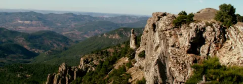
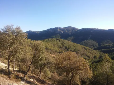
Mediterranean mountain area, also called Sierra de Alta Coloma, with high-value geological and vegetable formations such as oaks, complaints, junips and savannas. The following enclaves are highlighted: the Monastery ravine, the Quebrajano reservoir, the Valdecarazos river, the Palo Stone, the Netherlands Prados cortijo or the Alberquilla lookout.

Location: Sector west of the municipal term.

Distance: 3-7 km.

Medium: by all-terrain vehicle, by bike and on foot.

Access route: By the JV-2.228, which leaves directly from the urban centre, and through agricultural and forestry roads.

Ubicación
Latitud
37.555995
Longitud
-3.635602
Distrito
Municipio
Ubicación en el mapa
POINT (-3.635602 37.555995)
Tipos de punto de interés
Imágenes carrusel
imagen
Image
sierracampillo1.jpg
Imagen principal
Desactivado
Imágenes cabecera
imagen
Image
sierracampillo.jpg
Imagen principal
Activado
Microsite al que pertenece
Loading map
Preparing points of interest and routes...

Small Mountain Range of Pegalajar

Submitted by brandcode_deweloper on
Id
5848471
Descripción
Breve descripción

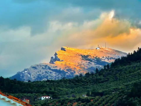
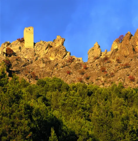
Landscape of high interest to be located in the vicinity of Pegalajar, where the cave house district is located, some of them for rent. On the northern side there are stunning views of the capital, Jaén, and the Guadalquivir River countryside. To the south the Serrezuela looks at the massif of Sierra Magina and the valley of the Guadalbullion River.

Ubicación
Latitud
37.742398
Longitud
-3.661094
Distrito
Municipio
Ubicación en el mapa
POINT (-3.661094 37.742398)
Tipos de punto de interés
Imágenes carrusel
imagen
Image
serrezuelapegalajar1.png
Imagen principal
Desactivado
Imágenes cabecera
imagen
Image
serrezuelapegalajar.png
Imagen principal
Activado
Microsite al que pertenece
Loading map
Preparing points of interest and routes...

Small Mountain Range of Bedmar

Submitted by brandcode_deweloper on
Id
5845460
Descripción
Breve descripción

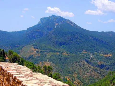
A very steep limestone formation that is located east of the town of Bedmar and above it. On the other side of these scarves is the neighbouring town of Jódar. The climbing lovers will find here magnificent ways to practice their favorite sport. In the center of it you can see an obscene with an Arab wall known as the Air Cave.

Ubicación
Latitud
37.832416
Longitud
-3.423530
Distrito
Municipio
Ubicación en el mapa
POINT (-3.42353 37.832416)
Tipos de punto de interés
Imágenes carrusel
imagen
Image
serrezuelabedmar1.png
Imagen principal
Desactivado
Imágenes cabecera
imagen
Image
serrezuelabedmar.png
Imagen principal
Activado
Microsite al que pertenece
Loading map
Preparing points of interest and routes...

Jurassic-Lower Cretaceous Series of Navalperal

Submitted by brandcode_deweloper on
Id
877361
Descripción
Descripción larga

The total power of the section is over 150 m. On a few sucrose dolomies attributed to the lower and medium Jurassic we find materials from the upper Kimmeridgian; they are limeals with large gastropods and corals that end up on an erosive surface with a crusts of iron oxides.

The following are limestones, locally sandy and margas, with various levels of interspersed calcrets; these materials are being decrified and dolomitised, giving way to stoned dolomies with abundant carbonous remains; this whole set of materials is of the age Hauteriviense- Barremiense. The lower Aptiense is characterized by the presence of sands, calcareous sandstone and sandy limestone with laminations and cross stratifications as well as orbitolins at various levels. The materials of the upper Aptiense have abundant rudists and orbitolins. The Albibe is represented by dolomies with black songs and ghosts of rudists.

Source: Inventory of Georresources of Andalusia. Environmental Council. Junta de Andalusia.

Breve descripción

Navalperal

Ubicación
Latitud
38.298857
Longitud
-2.651877
Distrito
Ubicación en el mapa
POINT (-2.651877 38.298857)
Tipos de punto de interés
Imágenes carrusel
imagen
Image
1%20%285%29.jpg
Imagen principal
Desactivado
imagen
Image
561_img.png
Imagen principal
Desactivado
Imágenes cabecera
imagen
Image
561_img.png
Imagen principal
Activado
Loading map
Preparing points of interest and routes...

Jurassic-Cretaceous Series of El Yelmo

Submitted by brandcode_deweloper on
Id
877317
Descripción
Descripción larga

From the view of Segura de la Sierra you have a magnificent panoramic view of the relief of El Yelmo (its northern slope), one of the most emblematic of the Sierra de Segura. This relief has a synchronal structure, with a rich succession of marine and continental sedimentary rocks of Jurassic-Cretaceous age.

In addition to vertical succession, there are important side changes in the stratigraphic architecture, observable in the panorama, which consist of remarkable changes of powers, culminating in the coining of formations. These exceptional characteristics are due to the paleogeographical position on the margin of a marine basin (sudiberic paleomargen) during the Mesozoic. The observations on the northern side of the Yelmo are complemented, from the same viewpoint, by that of the "Segura de la Sierra Court," which shows a section covering the Jurassic and Cretaceous, and which is accessible by the asphalt forest track that leads inside the Segura Sierra from the Segura de la Sierra population.

Source: Inventory of Georresources of Andalusia. Environmental Council. Junta de Andalusia.

Breve descripción

Jurassic Series - El Yelmo Cretaceous

Ubicación
Latitud
38.298857
Longitud
-2.651877
Distrito
Ubicación en el mapa
POINT (-2.651877 38.298857)
Tipos de punto de interés
Imágenes carrusel
imagen
Image
1%20%285%29.jpg
Imagen principal
Desactivado
imagen
Image
2%20%284%29.jpg
Imagen principal
Desactivado
imagen
Image
Natu204.jpg
Imagen principal
Desactivado
Imágenes cabecera
imagen
Image
560_img%20%281%29.png
Imagen principal
Activado
Horario
Monday's closed. Tuesday to Friday: 10: 00 - 13: 00 and 18: 00 - 21: 00. Saturday: 10: 00 - 14: 00 and 18: 00 - 21: 00. Sunday and holidays: 10: 00 - 14: 00.
Loading map
Preparing points of interest and routes...

Cretaceous Series of the southern Yelmo

Submitted by brandcode_deweloper on
Id
877273
Descripción
Descripción larga

The stratigraphic section of the South Yelm is a magnificent example of the materials of the Aptiene-Ambient of the Prebetic. The Aptiense is essentially represented by limestone, of facies that vary between lacustre / palustres (carbonous) and of somere platform, both protected (lagoon), and open (coral reef).

The Albibe is made up of an alternation of carbonates (limestones and dolomies) and terrogenes (margas, clays and sands), from coastal to shallow marine environments. The faces represented are very rich and varied, at certain levels with a very well developed cyclicity. The content in fossils is extraordinarily rich, both in marine fauna and corals, lamelibranchios (rudists and ostreides), foraminiferous (e.g. orbitolinides), as well as fresh water (caraceous algae).

Source: Inventory of Georresources of Andalusia. Environmental Council. Junta de Andalusia.

Breve descripción

South Yelm Cretaceous Series

Ubicación
Latitud
38.298857
Longitud
-2.651877
Distrito
Ubicación en el mapa
POINT (-2.651877 38.298857)
Tipos de punto de interés
Imágenes carrusel
imagen
Image
2%20%284%29.jpg
Imagen principal
Desactivado
imagen
Image
1%20%285%29.jpg
Imagen principal
Desactivado
Imágenes cabecera
imagen
Image
sur-yelmo.png
Imagen principal
Activado
Loading map
Preparing points of interest and routes...

Segura de la Sierra

Submitted by brandcode_deweloper on
Id
919387
Descripción
Descripción larga

These lines correspond to the Treaty of the Mountain, studied by the Duke of Almazan, a document that some researchers attribute to Jorge Manrique. To talk about the 15th century in the Sierra de Segura is to talk about the Manrique family and the border period. A situation in which attacks and responses by Christians and Muslims were frequent. This danger and the border situation can only be seen by entering Segura de la Sierra: remains of walls, towers, entrance doors and on top of the hill, the watchful castle.

The Visits Books of the Order of Santiago described in the late 15th century the castle of Segura de la Sierra as a military compound with weapons to face a siege or, if necessary, to organize a village to attack the enemy. We cannot forget that in 1434 Rodrigo Manrique organized a village to conquer Huécar in the Altiplano granadino.

In Segura de la Sierra, taking advantage of this privileged position and under the security offered by its walls is where Jorge Manrique was raised under the care of his mother, Mrs. Mencía de Figueroa, in the house that still today is preserved five hundred years later.

Breve descripción

A candle on an oak table, a tintero with a pen and a half-write piece of paper. A figure draws attention to the rest of the room dedicated to the Manrique family on the second floor of the tower of tribute in the castle of Segura. Jorge Manrique is a character closely linked to Segura de la Sierra. If we were to imagine the poet in front of the paper, we might think that the text might start like this: "remind me to be very noble, Mr. Brother, having once said, in they are closer to mockery, you will see if you wanted me to write you something about the work of the Montaria."

Ubicación
Latitud
38.298857
Longitud
-2.651877
Distrito
Ubicación en el mapa
POINT (-2.651877 38.298857)
Tipos de punto de interés
Imágenes cabecera
imagen
Image
1517663098_978370_1517663226_noticia_normal.jpg
Imagen principal
Activado
Loading map
Preparing points of interest and routes...

Santa Catalina

Submitted by brandcode_deweloper on
Id
2190698
Descripción
Descripción larga

The predominant geology is the secondary limestone that causes soils of generally poor characteristics and occupied by populations of Pinus halepensis (Pino carrasco), performed during the 1950s.

This is a natural space that traditionally provides a public service for leisure activities, especially to the municipality of Jaén.

Breve descripción

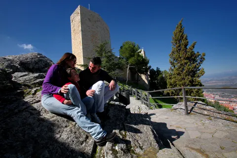
The Santa Catalina peri-urban park has an area of 196.85 hectares and is located on Mount Santa Catalina, El Neveral, La Imora and the Almendral, of the municipality of Jaén, which is owned by the City of Jaén, although it is consonated with the Environmental Council.

Ubicación
Latitud
37.768770
Longitud
-3.807000
Distrito
Municipio
Ubicación en el mapa
POINT (-3.807 37.76877)
Tipos de punto de interés
Imágenes carrusel
imagen
Image
Natu162.jpg
Imagen principal
Desactivado
imagen
Image
castillo_santa_catalina3.jpg
Imagen principal
Desactivado
Imágenes cabecera
imagen
Image
Natu307.jpg
Imagen principal
Activado
Microsite al que pertenece
Loading map
Preparing points of interest and routes...
San José Salt Flats

Submitted by brandcode_deweloper on
Id
4885101
Descripción
Breve descripción

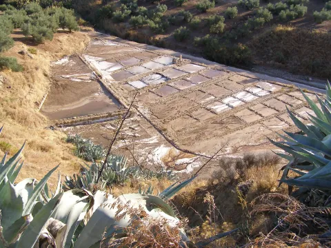
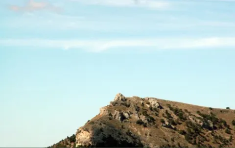
Old saline exploited from the Roman era to well in the 1990s. They are now out of activity.

Ubicación
Código Postal
23600
Latitud
37.757460
Longitud
-4.003260
Distrito
Municipio
Ubicación en el mapa
POINT (-4.00326 37.75746)
Tipos de punto de interés
Imágenes carrusel
imagen
Image
Salinas-de-San-Jose.jpg
Imagen principal
Desactivado
Imágenes cabecera
imagen
Image
3%20%284%29.jpg
Imagen principal
Activado
Microsite al que pertenece
Loading map
Preparing points of interest and routes...

Juniper and Savin Forests rastreros

Submitted by brandcode_deweloper on
Id
923306
Descripción
Descripción larga

When we enter the fields of Hernán Pelea we are open to the landscape, and we will discover true vegetable monuments that charge a large extent of soil.

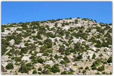
The rake savannas colonize the rocky soils, so we find them in the scarves and cresteries, as well as in the highest of the summits. On the contrary, rake juniors prefer more developed soils, although it is not difficult to see them together. They are very long-lived species, being able to reach 1000 years of age. They do not raise much from the ground, rarely more than a meter high, but a single example can extend more than 20 m ².

They are almost mono-specific plant formations, that is, of a single dominant species, to which only some salgarean pine (Pinus nigra salzmannii), thorns (Berberis vulgaris australis) and on the slopes some maple (Acer granatense) or mustard (Sobus aria) are accompanied. But in the summit areas, the rareras are the queens of the landscape, competing with piornal and lastonar.

These two species came to our saws with the glaciations of the Quaternary. Today, with a more arid climate, they only survive in the highest and coldest of the mountains. Their regeneration is difficult and scarce, and they are also used as food by herbivores, so their future is not the most flattering.

LOCATION

Following the track that goes into the fields of Hernán Perea from Don Domingo, we take the one that goes through the rample of Juan Fría, in which is the Galapan pine, we overcome it and as we pass through the cortijo of the Pinadilla, we are opened a splendid sabinar rastrero.

Breve descripción

Campos de Hernán Pelea

We cannot speak of the high mountains, their summits, their stony slopes and cresteries, without mention of one of their most emblematic inhabitants, the hillbillies or chaspines (Juniperus sabina) and the hillbillies (Juniperus comunnis hemisphaerica), true vegetable monuments of our mountains, to which can be given the qualification of The Elders of the Summits. They are plants that cover our summits in dark green and give shelter to a number of animals.

Ubicación
Latitud
37.772886
Longitud
-3.788329
Ubicación en el mapa
POINT (-3.788329 37.772886)
Imágenes carrusel
imagen
Image
4.png
Imagen principal
Desactivado
Imágenes cabecera
imagen
Image
86746483001_5836777155001_5826845296001-vs.jpg
Imagen principal
Activado
Loading map
Preparing points of interest and routes...