Saltar al contenido principal

Gall Oak Forest of the Collado de los Jardines

Submitted by brandcode_deweloper on
Id
4554494
Descripción
Descripción larga

With regard to the faunistic species that inhabit the environment, mention the wolf, the lince, the otter, the imperial eagle, the royal eagle or the azor.

Location: To the north-east of the town, in the heart of the Natural Park of Despeñacolos.

Distance: 16 km.

Medium: Tourism vehicle.

Access route: Departing from the village by the highway of Andalusia in the sense of Madrid and taking, to the right and after going about 6 km, the road J-6.110 towards Aldeaquemada.

Breve descripción

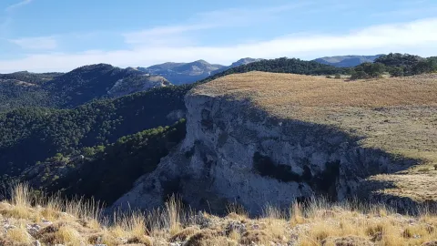
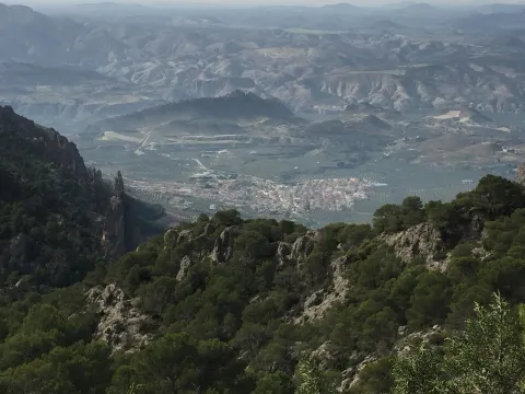
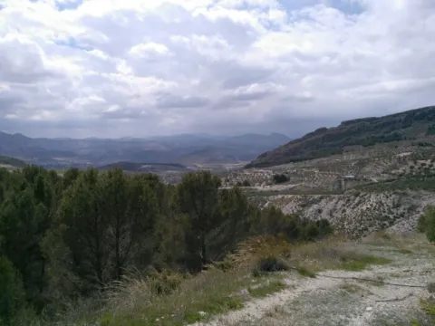
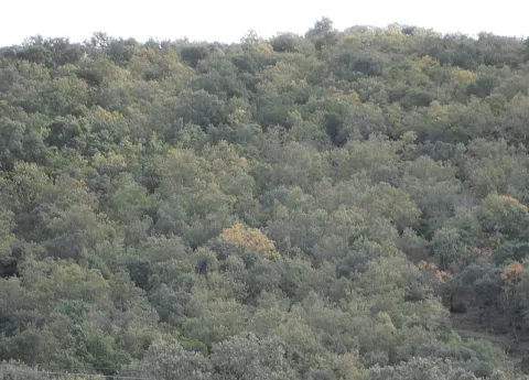
This enclave, which belongs to the Natural Park of Despeñacolos, stands out for its biodiversity; thus, among the plant species present, there are complaints, alcornoques, maples and other typical of the humid Mediterranean forest.

Ubicación
Código Postal
23213
Latitud
38.390302
Longitud
-3.494124
Dirección
Carretera Aldeaquemada, km. 6,6
Distrito
Municipio
Ubicación en el mapa
POINT (-3.494124 38.390302)
Tipos de punto de interés
Imágenes carrusel
imagen
Image
quejical.png
Imagen principal
Desactivado
Loading map
Preparing points of interest and routes...
Pass of Tíscar

Submitted by brandcode_deweloper on
Id
913726
Descripción
Descripción larga

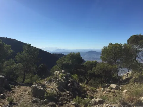
From the watchtower we will be able to contemplate a panoramic that will help us to know the environment better. Looking south a large ravine, which is named after the port, communicates the hill with the stepparian Valle del Guadiana Menor. The ravine is narrowed at the end in a rocky portico, which served for the Arabs to build the fortin of the Castle of Peña Negra. Once the Muslims were expelled, the new occupants raised the Tícar Sanctuary over the walls of the fortress. Looking to the west, the Peña de las Carboneras, one of the summits of the smallest and colecte orographic unit of the mountain massif, stands at the front: the Quesada saw, which houses numerous rock paintings of the Levine art, considered by UNESCO as the World Heritage Site.

To the north our view is lost in the olive sea of the Jiennense countryside, which as waves in a time, is aggressive in the slopes of the Cazorla saw, whose alignment is clear to the right of the olive tree. As we look east, our view inevitably stops at the Rayal Picon (1,834 m of altitude), the first important elevation of the Sierra de Cazorla from the south and impressive limestone mole that has a vertical cut on its north face. The name Rayal was synonymous with the border in the Middle Ages and the torreon in which we are located reminds us that this space was a border with the Nazareth Kingdom of Granada for almost three centuries.

We suggest...

  • It is recommended to carry binoculars and to track with them the limestone crestons that are seen, above all, in the northern half of the area, because it is quite easy to observe the montane goat. It is also a good point to see rapacious birds in flight.
  • Right in the same port is the Fuente de las Carboneras, a good place to refresh us. If the pipe was dry, the usual circumstance in the summer, following the lane that leaves from the same source, we arrive at the Forest House of Las Carboneras and, after the building, we will find another spring.

The Port of Tiscar is the highest point on the road A-6206, the winding mountain road that unites Quesada with the two southernmost villages of the Natural Park: Pozo Alcón and Hinojares. To get to this beautiful hill, if we leave from Quesada, at the exit we will continue straight, avoiding to the right the detour to Huesa (there is an indicator to the Port of Tíscar), until the rise, about 8.5 km later, where we find a signal indicating the location and altitude. From Hinojares (18 km) and Pozo Alcón (23 km) you have to take the A-6206 inverse to the previous one, always direction to Quesada at all the crosses.

Breve descripción

The Port of Tíscar is not only the mountain barrier to be saved to go to the Sanctuary of Our Lady of Tíscar, the historical patron of the advance of Cazorla and now of Quesada, and one of the most emblematic religious symbols of these mountains. It is an agribusiness area, with spectacular views, where it is easy to see the mountain goat, a corner full of history and nature. Leaving the vehicle in the parking areas in the same port, taking a small walk we arrive to a medieval watchtower, the Atalaya del Infante Don Enrique (14th century), an excellent lookout, with views to which for nothing in the world we must give up if we are there.

Ubicación
Latitud
37.865164
Longitud
-3.068421
Municipio
Ubicación en el mapa
POINT (-3.068421 37.865164)
Tipos de punto de interés
Imágenes carrusel
imagen
Image
tiscar.jpg
Imagen principal
Desactivado
imagen
Image
CazPuertoDeTiscar1.jpg
Imagen principal
Desactivado
Imágenes cabecera
imagen
Image
22072009_006_stitch.jpg
Imagen principal
Activado
Loading map
Preparing points of interest and routes...
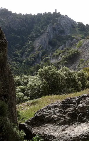
Bridge over El Guadalimar

Submitted by brandcode_deweloper on
Id
919236
Descripción
Descripción larga

The work of the pineers, called hooks in other areas, was hard and dangerous. We can imagine in the town square the group of piners with hooks and other equipment to start driving. The group would be very large, more than fifty people, and sometimes several hundred. There were some children to learn the trade, mules, dogs and the essential objects for a several-month journey.

When organizing the driving the responsible was the river master, the person who with his experience had acquired that condition and that allowed him to go next to the mayoral of the front to the front of the driving. Next to this mayoral there were two others in the center and in the back, and their mission was to direct the work of the pineers' bands.

The river master was the one who decided if it was necessary to do any channelling or other work made with the same wood to facilitate the driving and transport of the parts by the river.

We must think of harsh living conditions for people who spent much of the year outside their homes and that this activity was the only way to make a living. There is now an annual exhibition of wood driving in Yeste (Albacete) and another of following hasheros in Siles.

Breve descripción

This was a point of passage of some of the many wood that over the centuries have led the wood of the forests of the Natural Park to Seville and other places, for the construction of ships and large civil and religious buildings, so many historical facts we know would not have been possible without the small history of the wood.

Ubicación
Latitud
38.087695
Longitud
-3.640179
Distrito
Municipio
Ubicación en el mapa
POINT (-3.640179 38.087695)
Tipos de punto de interés
Imágenes carrusel
imagen
Image
Uno_de_los_ojos_del_puente_Mocho.jpeg
Imagen principal
Desactivado
imagen
Image
rio-guadalimar-3-1-jpg
Imagen principal
Desactivado
Imágenes cabecera
imagen
Image
segura.jpg
Imagen principal
Activado
Loading map
Preparing points of interest and routes...
Interés

Mocho Bridge

Submitted by brandcode_deweloper on
Id
919194
Descripción
Descripción larga
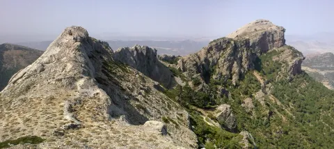
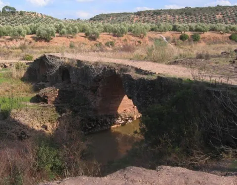
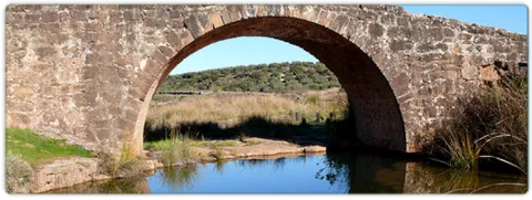
Puente Mocho constitutes an example of Roman architecture. The Romans carried out large civil constructions to guarantee communications within the different provinces that made up their domains and the mobility of the troops stationed in the different territories. In fact, in many cases it was the legionaries themselves who built some of the constructions that are preserved today, especially in the period known as the Pax Romana, in which there were no succession problems between the emperors and there was effective border control.
Breve descripción
Puente Mocho constitutes an example of Roman architecture. The Romans carried out large civil constructions to guarantee communications within the different provinces that made up their domains and the mobility of the troops stationed in the different territories. In fact, in many cases it was the legionaries themselves who built some of the constructions that are preserved today, especially in the period known as the Pax Romana, in which there were no succession problems between the emperors and there was effective border control.
Ubicación
Latitud
38.252679
Longitud
-2.890872
Distrito
Municipio
Ubicación en el mapa
POINT (-2.890872 38.252679)
Tipos de punto de interés
Imágenes carrusel
imagen
Image
Puente-Mocho-768x600.jpg
Imagen principal
Desactivado
imagen
Image
638_img.png
Imagen principal
Desactivado
Imágenes cabecera
imagen
Image
02-grand-01.jpg
Imagen principal
Activado
Loading map
Preparing points of interest and routes...
Poyos de La Mesa

Submitted by brandcode_deweloper on
Id
913611
Descripción
Descripción larga

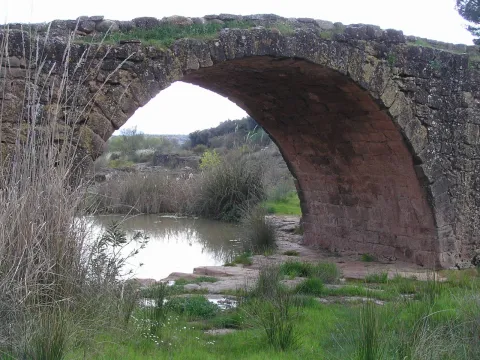
Although it is possible to reach the Poyos de la Mesa from different places, we propose to do it from the track it leads to the Nava del Espino. From this point comes a path marked as PR-A 315 that in an hour and a half leads you to the top of this mountain.

Once at the summit you will discover a wavy landscape of limestone eroded by the passage of time and covered with green meadows and larive pines. It is a formidable place to see the great herbivores of the Park that pasture to pleasure the juicy grass of these heights. It was also one of Felix Rodríguez de la Fuente's favorite places to shoot some of his famous wild scenes.

Now you have to enjoy the landscape around you and identify the many peaks you can see: The Banderillas, the Cabañas, the Empanadas rope, or the Pico Giillo are some of the most emblematic mountains of the Natural Park.

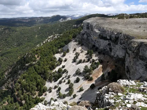
In these saws, it is known as "poyos" to the high plateaus surrounded by cliffs cut to peak, like huge teeth. The Poyos de la Mesa is one of the most spectacular. From its edges you can see a good panorama of the head of the Guadalquivir and if you look at the slices or poyos that name this mountain.

We suggest:

  • Once located in the Poyos you should not leave the opportunity to approach the area of the Marchante Prairie, by the bank of the Gualay Tornillo stream.

In Cazorla take the Sierra road (A-319) until the crossing known as the Empalme del Valle. Turn right on the JF-7092 road and after passing the bridge over the Guadalquivir River (4 km from the Empalme) follow the left track (JF-7091). Continue this track to the Nava del Espino in km 21 of the road signs, where you will find a milestone that points to the rise to the Poyos.

Breve descripción

Going up the way of the Navas demands our attention in a powerful way a huge mountain surrounded by cliffs that fall on the pine forests surrounding it. They're the Poyos of the Bureau. Something mysterious makes us stop our way to observe it. It is distinguished from the other hills by their peculiar forms that invite you to meet her...

Ubicación
Latitud
37.772886
Longitud
-3.788329
Ubicación en el mapa
POINT (-3.788329 37.772886)
Tipos de punto de interés
Imágenes carrusel
imagen
Image
poyos.jpg
Imagen principal
Desactivado
Imágenes cabecera
imagen
Image
poyos-mesa.png
Imagen principal
Activado
Loading map
Preparing points of interest and routes...
River Folds of Borosa

Submitted by brandcode_deweloper on
Id
877125
Descripción
Descripción larga

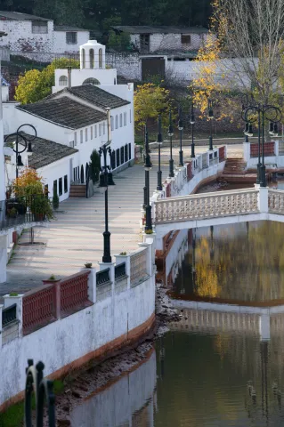
The route of the Borosa River, between the Piscifactory and the Cerrada de Elias, allows to observe a varied set of folds. The structure of the Sierra del Pozo, in which the Borosa River is located, is characterized by the presence of folds and NNE-SSW direction failures. The general geological structure of this Sierra is controlled by two large synchlinals: the birth of the Guadalquivir River and the Cabañas River.

In the four initial kilometers of the itinerary that part of the Piscifactory, folds associated with those of a regional character are observed, the size of which ranges from 1 meter to several tens of meters. These are developed in Cretaceous materials of Urgonian facies and their orientation determines the course of neighboring streams, with the concordant relief of the Arroyo de las Trout valley controlled by a spectacular sinchinal. As an example of anti-linear, the best fold is found in the Los Caracolillo Bridge.

Source: Inventory of Georresources of Andalusia. Environmental Council. Junta de Andalusia.

Breve descripción

Plizas del Río Borosa

Ubicación
Latitud
38.298857
Longitud
-2.651877
Distrito
Ubicación en el mapa
POINT (-2.651877 38.298857)
Tipos de punto de interés
Imágenes carrusel
imagen
Image
1%20%285%29.jpg
Imagen principal
Desactivado
imagen
Image
2%20%284%29.jpg
Imagen principal
Desactivado
imagen
Image
Natu249.jpg
Imagen principal
Desactivado
Imágenes cabecera
imagen
Image
558_img.png
Imagen principal
Activado
Loading map
Preparing points of interest and routes...
Small Square of the Armas

Submitted by brandcode_deweloper on
Id
6550232
Descripción
Descripción larga

Located between La Mella and Jabalcuz, Mount Almodóvar is famous for its crest, visible almost from any point in the city of Jaén. With 992 meters in height, this hill does not stand out for its altitude, but it does stand out for hosting very close places for the Jiennans, such as the Fuente de la Peña or the Plazoleta de las Armas. The Plazoleta de las Armas is a small plain surrounded by almonds, majolets and pines that offers beautiful views of the city. Place of play, walk and "bulls" of several generations of jiennenses, this square - which is accessed from the district of the Gloriet - remains a special place worth visiting.

Breve descripción

From almost any point in the city of Jaén are visible the spectacular crest of Cerro Almodóvar. Located between La Mella and Jabalcuz, the Almodóvar is 992 meters high and houses places much loved by the Jiennenses, such as the Fuente de la Peña or the protagonist of this report. The Plazoleta de las Armas is a small plain surrounded by almonds, pines and majolets where several generations of jiennenses have grown between games. Located just above the Glorieta district, it is worth taking a walk through and looking at the wonderful views it offers.

Ubicación
Latitud
37.757478
Longitud
-3.800935
Distrito
Municipio
Ubicación en el mapa
POINT (-3.800935 37.757478)
Tipos de punto de interés
Imágenes cabecera
imagen
Image
_G8Y2454.jpg
Imagen principal
Activado
Microsite al que pertenece
Loading map
Preparing points of interest and routes...
Square de Santa María

Submitted by brandcode_deweloper on
Id
918485
Descripción
Descripción larga

The Church of Santa Maria was the most important monument of the advance of Cazorla. As a Renaissance, his inspiration is attributed to Andrew of Vandelvira or one of his disciples. It is built on the Cerezuelo River, taking advantage of the vault that covers the river and crosses the entire Plaza.

It is not the only unique building we find there: the House of the Clérigos, the Thematic Center of Threatened Species, the old Conistorial Houses (in an alley above the square) or the Fountain of the Chain (built in 1605) are some of the many visits we can make here.

In the square we also find nice restaurants that offer a great sample of local cuisine. To enjoy these dishes in the quiet dusk is one more reason to often go to this suggestive square.

We suggest:

  • Visit the ruins of Santa Maria, know its history and its curious construction. You can order information from the tourist office (953 71 01 02).
  • Up by the river Cerezuelo, passing the ruins of Santa María in the direction of the castle of La Yedra, and walking along one of the small routes that begin in this area. An information panel will help you to better know this area of the city.

In Cazorla, we leave the Plaza de la Constitución, in the center of the village. From here follow Doctor Muñoz Street to La Corredera Square. At the end of this, we turn right and immediately left, following the signs to the Castle of La Yedra. After passing by the balcony of Zabaleta and crossing the street José Salcedo Cano - a narrow and steep street with numerous pots in its balconies - we reached the Plaza de Santa María.

Breve descripción

Reaching the Old Square or Santa Maria Square through the old town of Cazorla is a surprise for the walker. The open space with the high slopes of the Peña de los Halcones, the Gilillo peak or the castle of La Yedra make it difficult for you to see what you have at your height. But at your height there is a beautiful square full of history and charm, where the ruins of the Church of Santa Maria demand the attention of the many travelers who come to this place.

Ubicación
Latitud
37.912893
Longitud
-3.003887
Municipio
Ubicación en el mapa
POINT (-3.003887 37.912893)
Tipos de punto de interés
Imágenes carrusel
imagen
Image
6%20%282%29.jpg
Imagen principal
Desactivado
Imágenes cabecera
imagen
Image
7%20%281%29%20%281%29.jpg
Imagen principal
Activado
Loading map
Preparing points of interest and routes...
Marcas de calidad

Rock Paintings in Santiago-Pontones

Submitted by brandcode_deweloper on
Id
650155
Descripción
Descripción larga

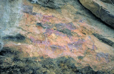
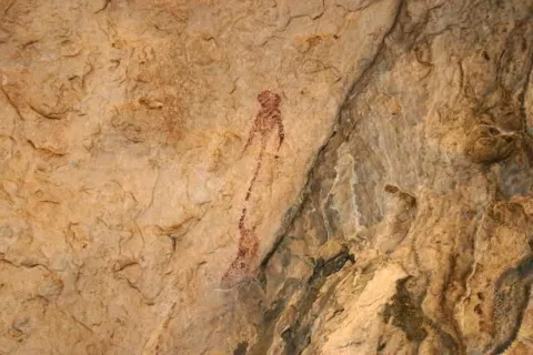
The simple fact of seeing a seed germinate and growing plants, or of observing animals and the birth of women, made these people wonder about the origin of life. These thoughts were those that moved to the walls of the caves as a representation of facts related to daily life and its world of beliefs. We can imagine one of the inhabitants of the Cave of Birth preparing the pigments, mixing them with animal fat, improvising a brush with animal hair and getting ready to paint a scene. I'd be thinking of painting a composition with a hunting scene, fight, dance trying to tell a moment, a scene of life.

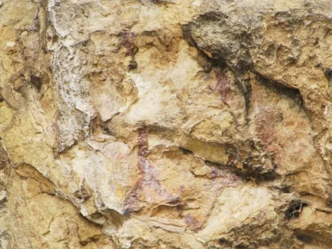
The rock paintings represent one of the most important cultural manifestations of prehistory, as they have helped to know some aspects of these societies to learn a little more about their life forms, fauna, flora and the world of their beliefs. What reasons could lead our ancestors to translate the manifestations of daily life and their beliefs into caves and coats? Maybe they were sanctuaries?

Breve descripción

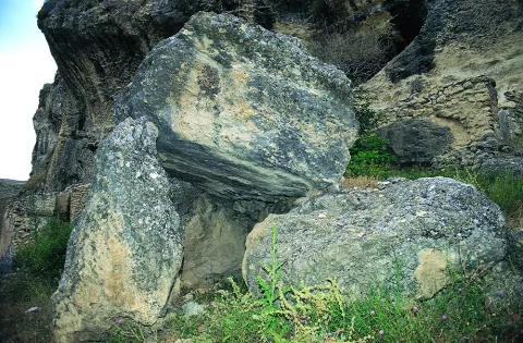
In the saws of Segura and Cazorla there are numerous coats and caves with rock paintings that are part of what is known as the Rupéstre Levino Art and which have been declared a World Heritage Site. We are talking about a very remote time, about 10,000 A.E. We must think of the inhabitants of the Caves of the Engarbo or the Cave of the Birth, for example, the latter being one of the few excavated and allowing to know the passage from Paleolithic to Neolithic. It is a time of great changes in the way of life in which human beings move from being a predator to domesticating vegetables and animals to getting plenty of food and storing it to avoid moving continuously.

Ubicación
Latitud
37.772886
Longitud
-3.788329
Ubicación en el mapa
POINT (-3.788329 37.772886)
Tipos de punto de interés
Imágenes carrusel
imagen
Image
Mon149.jpg
Imagen principal
Desactivado
imagen
Image
Natu149.jpg
Imagen principal
Desactivado
imagen
Image
pinturas_rupestres.jpg
Imagen principal
Desactivado
Imágenes cabecera
imagen
Image
IMG_4324-1.jpg
Imagen principal
Activado
Loading map
Preparing points of interest and routes...
Peaks of the Guadiana

Submitted by brandcode_deweloper on
Id
913424
Descripción
Descripción larga

The Guadiana Menor is a very young river from the geological point of view. Until about 10,000 years ago, its basin was a large salty lake, to which it provided its waters and sediments numerous streams from Sierra Nevada, Filabres and the Macizo de Cazorla and Segura. Its current course arose in an accidental and violent way, perhaps due to the breaking of one of the margins of the lake produced by an earthquake, excavating deep ravines, leaving out the yermas clays, loaded with plaster and salts, rolling edges and marine sands, a means that makes it difficult to survive the living beings that inhabit them.

The depression that bears its name from this river is the most arid area in the province and one of the driest in Europe, recording annual rainfall that very rarely exceeds 250 mm. The consequence is that of a semidesertic, rotational and beautiful landscape, populated by highly specialized Stepparian vegetables to the middle, most herbs and small matas. Its biological uniqueness is enormous, having an endemic character (very small geographical area) more than half of the species present in the area. This proportion is only comparable to the biological exclusivity of the high betic mountain, where we find most of the most well-known endemisms in the Natural Park.

We suggest...

  • Make the Desert Route, described in the Tourist Guide of Hinojares.
  • Visit the Mirador del Lirio, with stunning views of the valley and the desert of the Natural Park. It is accessed (it is signposted) from the village of Fontanar, which is located about 5 Km from Pozo Alcón.
  • Other unique points of this recommended visit are the necropolis ibera de los Castellones de Ceal, next to the village of Ceal, and the Salinilla de Chillar, located very close to Hinojares.

To visit the Picos del Guadiana and to visit the subdesert area of the Natural Park that corresponds to the Valle del Guadiana Menor, we will use the road section of the A-315 that links Bone with Pozo Alcón and Hinojares. The view of the Picos is at the beginning of these, in an enranche of the previous way, about 14 km from Hinojares and 19 km from Pozo Alcón.

Breve descripción

The geoforms of the valley of the Minor Guadiana, originating from the slow and inexorable erosive processes, are extremely striking. An enclave of great geomorphological interest, proposed as a natural monument: the Picos del Guadiana, stands out. It is a limestone crest where the petreous strata, arranged vertically, emerge from a cone of soft clays, forming a rocky alignment that resembles the teeth of a saw. The most imaginative say that it is the fossil of a colossal dinosaur that died by the river, without considering that there was no such channel in the Jurassic and that some of those prehistoric animals were huge, but not so much.

Ubicación
Latitud
37.702695
Longitud
-2.935057
Municipio
Ubicación en el mapa
POINT (-2.935057 37.702695)
Tipos de punto de interés
Imágenes carrusel
imagen
Image
picos.jpg
Imagen principal
Desactivado
Imágenes cabecera
imagen
Image
8040409Master.jpg
Imagen principal
Activado
Loading map
Preparing points of interest and routes...