Saltar al contenido principal

Tower of the Tercia

Submitted by brandcode_deweloper on
Id
4539204
Descripción
Descripción larga

Historical data

The data relating to the medieval Génave are scarce, but it must have been one of the many foothills that populated the Sierra de Segura. A fortification or tower was probably built between the 11th and 13th centuries in the face of the advance of Christian armies.

After the Christian conquest, between 1235 and 1239, Géave and the whole Sierra de Segura were controlled by the Order of Santiago's Order and they had to endure the raison and attacks of intimidation of Saracena troops, so this and other torreons acted as a parapet in these war skirmishes and as a shelter for the population.

The chronicles written at the end of the Middle Ages, such as those of Don Francisco de León in 1468 or the Relations of Philip II of 1575, speak of the tower without any reference to a castle or enclosure of important dimensions, so it had to replace the ancient Islamic fortress.

Until 1551 Génave was the village of Segura de la Sierra, from that year on he received the privilege of Villa de orden de Felipe II.

In 1575 Génave is included in the Chancellery district of Granada, it depends on the archbishopric of Toledo and the Kingdom of Murcia before the Cortes, although it is directly under the governorate of Segura de la Sierra.

Description

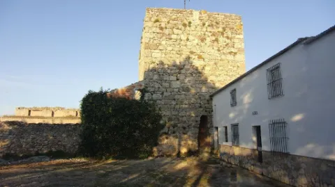
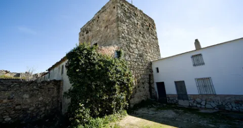
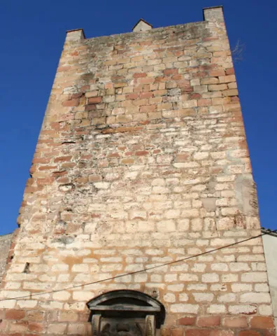
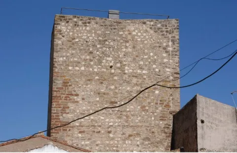
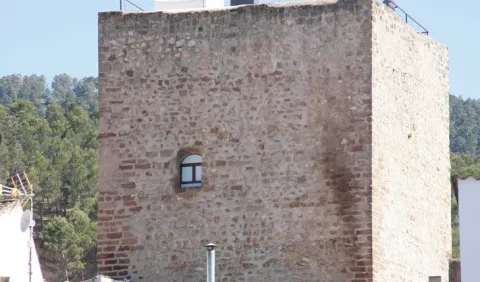
This tower, surrounded by buildings that cover its bottom, is built in irregular masonry.

It has a square floor of 10.50 m on its side, and in its interior two overlapping rooms are kept covered with half-canyon vaults. To access each of them, as well as the roof, there is a staircase embedded in the thickness of the walls covered with the same type of vault.

The access is now made through a building that houses the Adult Center of the town and which was previously the seat of the City Council.

The tower was declared in 1985 Good of Cultural Interest.

Breve descripción

Génave is located on a hillside, near the wide valley in which the foothills of Sierra Morena and Sierra de Segura converge, on the road to Levante, a natural step that goes back to the Guadalimar River, connecting the Guadalquivir with the Peninsular Levant.

The only rest of the missing Génave castle is the so-called Torreon de la Tercia built by Christians at the end of the 13th century. It has an impressive cubic structure and is located in the center of the population.
Ubicación
Latitud
38.430300
Longitud
-2.733180
Dirección
C/ Tercia, 17
Distrito
Municipio
Ubicación en el mapa
POINT (-2.73318 38.4303)
Tipos de punto de interés
Imágenes carrusel
imagen
Image
11.jpg
Imagen principal
Desactivado
Imágenes cabecera
imagen
Image
12.jpg
Imagen principal
Activado
Loading map
Preparing points of interest and routes...

Tower of the Muña

Submitted by brandcode_deweloper on
Id
4873576
Descripción
Breve descripción

Located at the top of a small ameseado, it is defined as a fortification under medieval (XIV-XV century), several wall canvases and a magnificent square-floor tower, built in masonry and structured in two rooms covered with pointed vaults.

Telecomunicaciones
Sitio web
www.torredelcampo.es/index.php?option=com_content&task=view&id=134&Itemid=135
Teléfono de contacto
953 568 649
Ubicación
Nombre
Cortijo de la Muña
Código Postal
23640
Latitud
37.831870
Longitud
-3.942100
Distrito
Municipio
Ubicación en el mapa
POINT (-3.9421 37.83187)
Tipos de punto de interés
Imágenes carrusel
imagen
Image
t.%20de%20la%20mu%C3%B1a%202.jpg
Imagen principal
Desactivado
Imágenes cabecera
imagen
Image
unnamed.jpg
Imagen principal
Activado
Microsite al que pertenece
Loading map
Preparing points of interest and routes...

Tower of the Fuente Sorda

Submitted by brandcode_deweloper on
Id
6232212
Descripción
Breve descripción

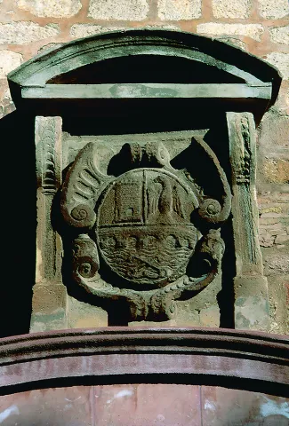
Old deaf, tower of the Almohad wall, which in the 15th century was lined with silery. The shield of the city that decorates the central front is from the 16th century. It is made of stone, on cut and timbrated hides. Above it is a curved fronton held by two mencapsules as a baking. The source below must be of later chronology.

Telecomunicaciones
Sitio web
www.turismodeandujar.com
Teléfono de contacto
953 504 959 / 953 508 200
Correo electrónico
turismodeandujar@andujar.es
Ubicación
Código Postal
23740
Latitud
38.036330
Longitud
-4.057340
Dirección
C/ Alcázar, 5D
Distrito
Municipio
Ubicación en el mapa
POINT (-4.05734 38.03633)
Tipos de punto de interés
Imágenes carrusel
imagen
Image
Mon488.jpg
Imagen principal
Desactivado
imagen
Image
Mon491.jpg
Imagen principal
Desactivado
Imágenes cabecera
imagen
Image
10325717824_6a02e248a0_z.jpg
Imagen principal
Activado
Horario
24 h.
Microsite al que pertenece
Loading map
Preparing points of interest and routes...

Tower of the Cabeza

Submitted by brandcode_deweloper on
Id
4658496
Descripción
Breve descripción

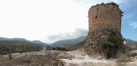
It is a cylindrical masonry turret with a monitoring and communication function. It was built in its current state by the Constable Miguel Lucas de Iranzo between 1462 and 1470, although it is likely to rise on the ruins of another previous one. In fact, this tower is part of a set of them that crossed the province in the North-South direction. At this one, there were two more towers today in meltdown.

Telecomunicaciones
Sitio web
www.ayto-pegalajar.org
Teléfono de contacto
953 360 003
Correo electrónico
pegalajar@promojaen.es
Ubicación
Código Postal
23110
Latitud
37.712700
Longitud
-3.641780
Distrito
Municipio
Ubicación en el mapa
POINT (-3.64178 37.7127)
Tipos de punto de interés
Imágenes carrusel
imagen
Image
torre-de-la-cabeza-2.jpg
Imagen principal
Desactivado
Imágenes cabecera
imagen
Image
torre-de-la-cabeza.jpg
Imagen principal
Activado
Microsite al que pertenece
Loading map
Preparing points of interest and routes...

Tower of Calígula

Submitted by brandcode_deweloper on
Id
4444587
Descripción
Descripción larga

This castle reached the second-rank level at the time of the Constable Iranzo, played an important role in taking sides, like Andújar, on the realistic side when in 1465 the king's enemies placed Jaén, and became famous when, six years later, the warden Diego Frías stopped and ordered a rival of the Constable, Don Fernando de Acuña, son of the Count of Buendía and no less than nephew of the Archbishop of Toledo, to be locked in his tower.
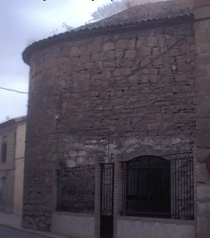
In fact, the castle, of small dimensions, was formed by a cylindrical tower with an almond parapet, as Martin drew it from Ximena Jurado. A stone from the upper tower seems to have an inscription, probably Arabic. There is no trace of this tower in the village. However, the head of the church presents a lock that could correspond to the remains of the castle. This solid semicircular wall of masonry could be reused from a large round tower, sister of those of the Rus and El Marmol castles, in the lands of Baeza.
This turret was declared Good of Cultural Interest in 1985.

Breve descripción

The so-called Torre de Caligula, a semicircular turret of the old castle, is preserved in the parish church.

Telecomunicaciones
Sitio web
www.cazalilla.es
Teléfono de contacto
953 537 131
Correo electrónico
castalla@cazalilla.es
Ubicación
Nombre
Torre de Calígula
Código Postal
23628
Latitud
37.984160
Longitud
-3.881890
Distrito
Municipio
Ubicación en el mapa
POINT (-3.88189 37.98416)
Tipos de punto de interés
Imágenes carrusel
imagen
Image
torre%20caligula.jpg
Imagen principal
Desactivado
Microsite al que pertenece
Loading map
Preparing points of interest and routes...

Iberian Sanctuary el Pajarillo

Submitted by brandcode_deweloper on
Id
4652660
Descripción
Breve descripción

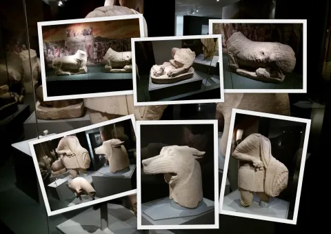
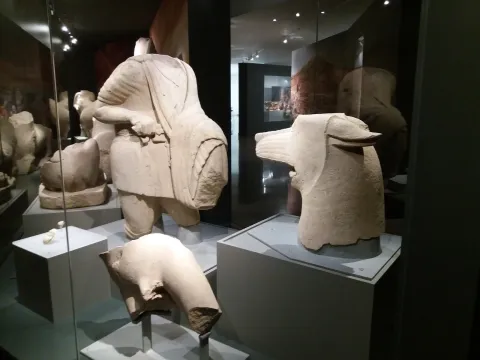
TheSanctuaryHeroic of ElDuck, inHuelma, is the place where the well-known sculptural ensemble in which a wolf and a hero are faced, surrounded by other animals such as lions and taps and placed on a stone tower, in sum in a monumental context of great importance.

Telecomunicaciones
Sitio web
www.redjaen.es
Ubicación
Código Postal
23560
Latitud
37.647300
Longitud
-3.455180
Distrito
Municipio
Ubicación en el mapa
POINT (-3.45518 37.6473)
Tipos de punto de interés
Imágenes carrusel
imagen
Image
el%20santuariodel%20pajarillo.jpg
Imagen principal
Desactivado
Imágenes cabecera
imagen
Image
santuario.jpg
Imagen principal
Activado
Microsite al que pertenece
Loading map
Preparing points of interest and routes...

Iberian Sanctuary of the Collado de los Jardines

Submitted by brandcode_deweloper on
Id
4554285
Descripción
Descripción larga

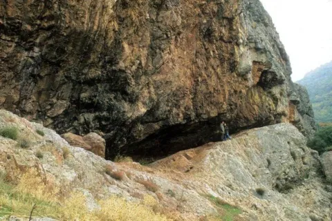
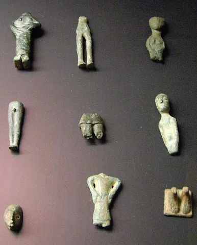
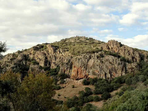
The original place of worship would be made up of a grotto in the rocky massif and a source; in front of that it is possible to emerge at different times, successive buildings of worship; for the oldest one it is kept news of its rectangular plant, and it is suspected a chronology of the centuries V- IV BC; for the most recent the dating managed would place it in the first century or perhaps before; the Shrine would already work from before the construction of the first building and would continue to do so, at least until the fourth century, after the destruction of the second building towards the third century AD. It seems that the exvotes, in the vast majority or in their entirety bronze figures, "Fury primitivement dépossées dans la caverne, et jetées de temps a autre sur la pente, mais jamais aucune fosse ne fut creusée pour les recevoir," which prevents the existence of a reliable strategy, which is aggravated by the precarious conditions of the excavation, at the beginning of the century, of the site. It is not unlikely, as one of the excavators suggested, that the religious whole should also be completed with a sacred forest, from whose branches the devotees would hang part of the offerings.

Breve descripción

Located in the area that could have been by way (although not surely of the most important before the 18th century) between Alta Andalucía and the Plateau, is this Sanctuary of which almost all that is known are its bronze exvotes (about 2,200 from the official excavations) that the Oretan peoples offered to the gods.

Telecomunicaciones
Sitio web
www.santaelena.es
Teléfono de contacto
953 664 010
Ubicación
Nombre
Cueva de los Muñecos
Código Postal
23213
Latitud
38.388204
Longitud
-3.498567
Distrito
Municipio
Ubicación en el mapa
POINT (-3.498567 38.388204)
Tipos de punto de interés
Imágenes carrusel
imagen
Image
Santuario%20Collado%20de%20los%20Jardines3.jpg
Imagen principal
Desactivado
imagen
Image
Santuario%20Collado%20de%20los%20Jardines2.jpg
Imagen principal
Desactivado
Imágenes cabecera
imagen
Image
dsc03816.jpg
Imagen principal
Activado
Loading map
Preparing points of interest and routes...

Sanctuary of the Saints and Sacred Relics

Submitted by brandcode_deweloper on
Id
5620622
Descripción
Descripción larga
Eslava Galán presented her work The Conquest of America told for skeptics here. The Saints are characters of great importance in The Templar Tomb in the search for the enigma that Solomon's Table treasures, appearing as a clear Templar symbol as they are dual saints, in the image of the Order's shield, a couple that rides on the same horse: (…) I also bring here some news from Arjona: at the top of the hill on which the town is located, a scholar and archaeologist from the 17th century, Martín de Jimena Jurado, carried out some excavations from which the bones of many martyrs allegedly came to light, among them those of the patrons Bonoso and Maximiano. Two employers? – Isabel was surprised. As in all Calatrava towns, two patrons - Íñiguez corroborated - (...)
Breve descripción
The sanctuary was erected during the bishopric of Moscoso and Sandoval to guard the supposed remains of the martyred saints Bonoso and Maximiano, found in this town at the beginning of the 17th century, as well as the remains of more than 3,000 martyrs of the first Christians during Roman times. It was built between 1617 and 1619 with stone from Santiago de Calatrava and, as planned by Juan de Aranda y Salazar, who also worked on the Jaén cathedral, two churches were superimposed. A chamber was drilled in the lower part to be seen from the outside, like a crypt, with access through the Saints cemetery. It presents a polychrome plaster altarpiece, baroque decoration, which was not completed until the mid-19th century, tombstones with the stories of the martyrs and a plateresque doorway. The upper part has its entrance from Plaza de Santa María, through a doorway from 1659, and its floor plan is a single nave covered with a barrel vault with lunettes and architraved pilasters that support semicircular arches. The upper floor was intended to house the stone images of San Bonoso y San Maximiano, which were never placed. In the year 1843, with the Confiscation of Mendizábal, the images were moved to the Santa María church, and the relics of the martyrs were moved to the upper floor. Leaving the lower floor without functionality. Currently this space houses the Museo Religioso of the Arjona parishes where a good part of the brotherhood's heritage is exhibited, as well as old drawings and photographs.
Ubicación
Código Postal
23760
Latitud
37.935860
Longitud
-4.054210
Dirección
Plaza Sta. María
Distrito
Municipio
Ubicación en el mapa
POINT (-4.05421 37.93586)
Tipos de punto de interés
Imágenes carrusel
imagen
Image
Mon295.jpg
Imagen principal
Desactivado
imagen
Image
santuario-de-las-sagradas.jpg
Imagen principal
Desactivado
imagen
Image
vista%20gral%20santuario%20%28I%29.jpg
Imagen principal
Desactivado
Imágenes cabecera
imagen
Image
img-20190429-125144-largejpg.jpg
Imagen principal
Activado
Microsite al que pertenece
Loading map
Preparing points of interest and routes...

Sanctuary of the Virgen de la Fuensanta

Submitted by brandcode_deweloper on
Id
12131034
Descripción
Descripción larga

Today we see olive trees around the sanctuary but we must think of forest areas with some clear for cultivation, highlighting on the high Iznatoraf as the most important villa of the advance to the north of the Guadalquivir.

Little by little this situation of danger is disappearing, new inhabitants arrive and places are beginning to live outside the walls of the villa until it is necessary to disconnect them from the municipality. The inhabitants of the Moraleja in 1396 knew the autonomy with respect to Iznatoraf, going on to be called since then Villanueva del Archbishop.

It tells an ancient legend that in Muslim times there was a group of MozArabs in Iznatoraf with a great devotion to the virgin Mary. The king's wife showed some interest in the Christian religion by helping them in all that she could. When her husband, known as Alimenon, found out, he ordered that they take his wife into the forest and cut off her hands and take her eyes out to die in the most absolute solitude. The woman called on the virgin Mary, who presented herself and made a fountain sprout to wash her wounds. Miraculously he healed and the virgin ordered him to go up to her husband so that, being aware of the miracle, they would be baptized in the fountain and set up a temple in his honor.

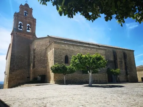
The Sanctuary and the virgin of the Fuensana is one of the oldest in Spain and it is known that it existed in 1291 already as an important pilgrimage center on the border lands. The building is of three Gothic-style ships, although there are still some Romanesque reminiscent, such as a beautiful medieval mudejar tile. The virgin of the Fuensana is sold in a baroque shrimp of the 17th century.

Breve descripción

Contemplating the sanctuary building comes to mind memories of border life. The almenada tower and the robustness of the walls refer to other times when the danger of war was present in the daily lives of the people who lived in the village of the Moraleja. Without ever losing sight of Iznatoraf as a villa from which the different places that have ended up giving rise to the Sierra de las Cuatro Villas were torn.

Telecomunicaciones
Sitio web
https://villanuevadelarzobispo.es/turismo/
Teléfono de contacto
607 184 628
Correo electrónico
turismovillanuevadelarzobispo@gmail.com
Ubicación
Código Postal
23330
Latitud
38.163020
Longitud
-2.994220
Ubicación en el mapa
POINT (-2.99422 38.16302)
Tipos de punto de interés
Imágenes cabecera
imagen
Image
1604769448440107388872821794175587.jpg
Imagen principal
Activado
Horario
May - ago: Wednesday to Saturday 09: 00 - 14: 00 and 18: 00 - 21: 00, Sunday 10: 00 - 13: 00. Sept - abr: Wednesday to Saturday 10: 00 - 14: 00 and 16: 00 - 20: 00, Sunday 10: 00 - 13: 00.
Otros servicios
Guided tours under reservation in Tourist Office
Loading map
Preparing points of interest and routes...

Sanctuary of Cuadros

Submitted by brandcode_deweloper on
Id
7974744
Descripción
Descripción larga

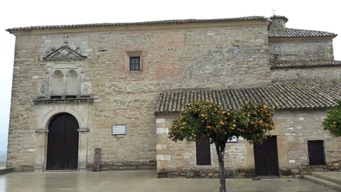
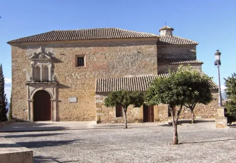
u external appearance is low stylized but viscous by its volumetric contrasts. Made of masonry, the cover framed by molded cornice opens with a half-point arch on imposts with smooth transdotes. On its axis is raised a high swordsman of two bodies, the lower one with two arches also of half point and the upper one with one, triangular front and vases. It keeps a cover in a carved stone that belonged to the Marquis de la Cueva palace.

Its plant is rectangular and consists of a single ship covered with false plaster canyon vault, with false fajon arches that are based on arquitrabed pilasters. Both the ship and the presbyterium - which is accessed by a reduced spinal arch and covered with a half-orange vault on the breast - are decorated with geometric and plant thematic motifs. The choir stands at the feet and is supported by two columns with shoes. The shrimp has a polygonal plant, was built in the early 18th century and has undergone various reforms and modifications.

It is possible that the devotion to the Virgin of Cuadros may be extended to the Middle Ages as it corresponds to a very active region militarily in the Christian conquest and with a primarily agricultural activity. The relaunch of his worship was based on the model of popular religiosity promoted by the Council of Trent and on the ecclesiastical policy carried out in the province by Bishop Dávila. The importance of both the process and the claim of the pilgrimage of rosemary of the Sanctuary of the Virgin of Cuadros exceeds its artistic and monumental value.

Breve descripción

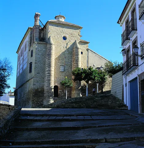
In the relations of Philip II, 1575, the great devotion felt in the region by the Virgin of Cuadros, whose sanctuary, five kilometres from Bedmar, was raised in 1615, forming together with a medieval turret and mill.

Telecomunicaciones
Sitio web
www.bedmargarciez.es/el-municipio/patrimonio-historico.html
Ubicación
Código Postal
23537
Latitud
37.790090
Longitud
-3.408750
Dirección
JV-3222
Distrito
Municipio
Ubicación en el mapa
POINT (-3.40875 37.79009)
Tipos de punto de interés
Imágenes carrusel
imagen
Image
santuario%20de%20cuadros%20bedmar2.jpg
Imagen principal
Desactivado
Imágenes cabecera
imagen
Image
santuario%20de%20cuadros%20bedmar.jpg
Imagen principal
Activado
Microsite al que pertenece
Loading map
Preparing points of interest and routes...