Saltar al contenido principal

Úbeda RV Parking Area

Submitted by brandcode_deweloper on
Id
11767010
Redes sociales
Facebook
https://www.facebook.com/ubeda.turismo
Descripción
Breve descripción

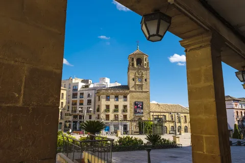
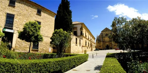
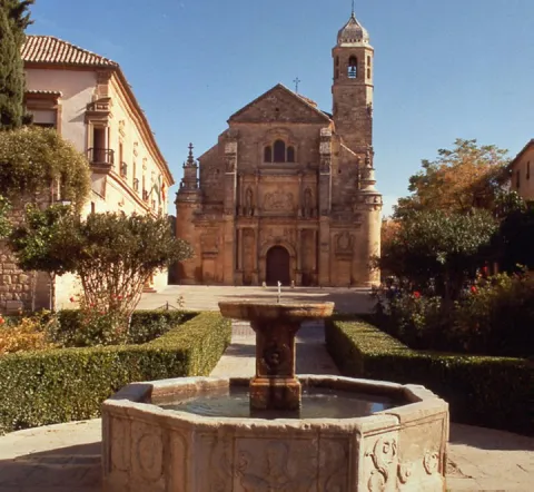
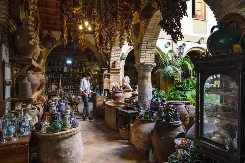
The city (World Heritage) has 48 notable monuments and over a hundred buildings of interest (Renaissance, Arab, Baroque and Gothic). Very important your Holy Week. A must visit to the Museum of the pottery and the Centre for the interpretation of the olive and oil.

Información de contacto
Teléfono
953 779 204
Sitio web
www.turismodeubeda.com
Correo electrónico
promocion@ubeda.es
Ubicación
Código Postal
23400
Latitud
38.006390
Longitud
-3.379440
Dirección
Travesía del Comendador Messía, s/n
Municipio
Ubicación en el mapa
POINT (-3.37944 38.00639)
Tipo de alojamiento
Imágenes
imagen
Image
visita-ubeda-baeza-individuales.jpg
Imagen principal
Activado
Horario
24 h
Qué ofrece

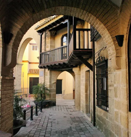
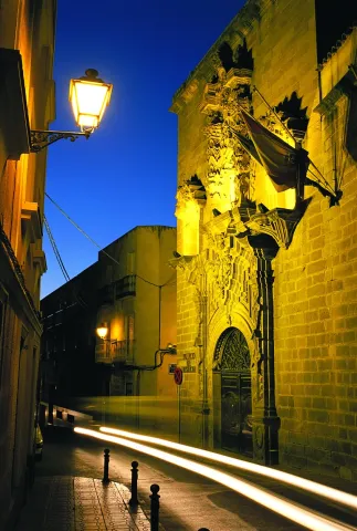
Ubeda has a beautiful monumental and cultural heritage that makes it a fundamental destination for those interested in the Renaissance architecture.

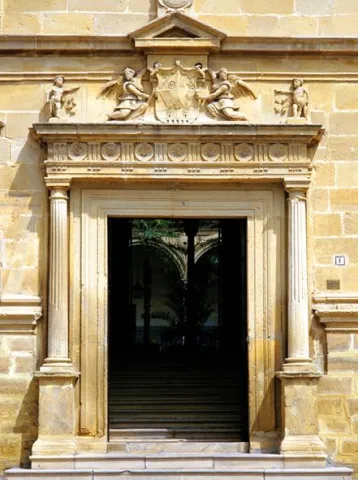
From its heritage we will highlight the excellent degree of conservation of many of its buildings, which still keep details of the time as can be the doors of claveted wood, the iron aldabas, the lanterns and the bars.

Loading map
Preparing points of interest and routes...
El Hotel

Free parking. Maximum stay, 48 hours. It is not allowed to remove chairs, tables, or other camping elements. All services and the historic centre are about 800 m away.

Number of places: 10 places.

Maximum permanence:Two nights.

Services included:

  • Empty of grey water

  • emptying of black water

  • Water filling

Úbeda

Submitted by brandcode_deweloper on
Id
785118
Perfil de redes sociales
Facebook
https://www.facebook.com/pages/Turismo-de-%C3%9Abeda/173591095987915
Twitter
https://twitter.com/Turismodeubeda
Descripción
Breve descripción

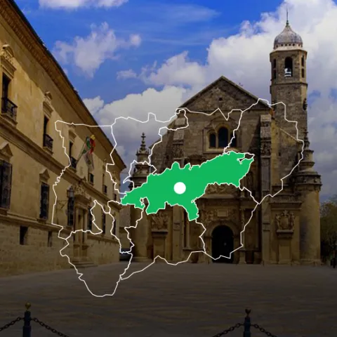
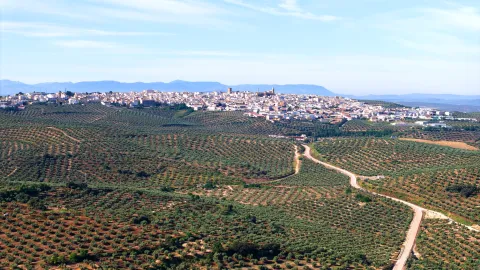
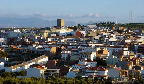
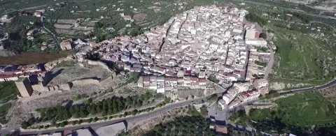
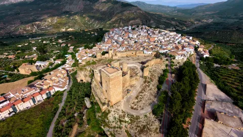
This important city, settled on the hills of its own name, is located in the centre of the province of Jaénand is the capital of the region called La Loma.

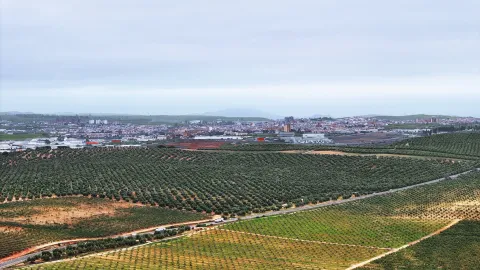
Surrounded by a landscape of an extraordinary natural beautyin which the flat grounds for the cultivation of the cereal are alternated, with the smooth slopes of olive trees, seems to summarize the essence of the province of Jaén.

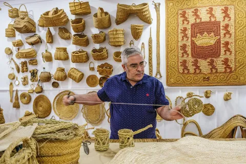
It is very important, within its varied economy, the crafts, with numerous workshops of pottery and ceramics, of forge, size, glass, tapestries, spartum, singing, etc.

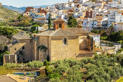
As we walk through its lordship streets to admire the monuments, churches, palaces and lordship houses, we move virtually to the times of the historical splendor of this city.

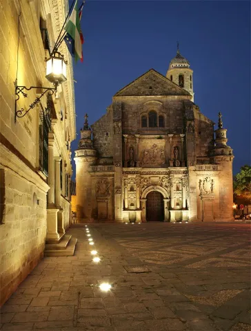
Ubeda is known as "the city of the Andalusian Renaissance"for the quantity and quality of the monuments of this artistic age.

Together with Baeza, it has been declared World Cultural Heritage by Unesco on 3 July 2003.

Telecomunicaciones
Teléfono
953 779 204
Sitio web
www.turismodeubeda.com
Correo electrónico
promocion@ubeda.es
Ubicación
Nombre
Úbeda
Latitud
38.012640
Longitud
-3.371590
Municipio
Ubicación en el mapa
POINT (-3.37159 38.01264)
Imágenes
imagen
Image
4799c128-4243-ddbe-4c6c-d5f7ee6541a5?t=1603983703047
Imagen principal
Desactivado
imagen
Image
b990224c-93ea-e0df-74c2-b7e6183a3016?t=1603984517266
Imagen principal
Desactivado
imagen
Image
751f0349-5ec0-e737-56cf-235536e32ce7?t=1603983703075
Imagen principal
Desactivado
imagen
Image
6ddd0085-05f6-e8ef-366a-1963e112a78f?t=1603983703173
Imagen principal
Desactivado
imagen
Image
079eab40-54b9-462f-9652-50503cdb19b9?t=1585914434000
Imagen principal
Desactivado
imagen
Image
658dab1d-a8b7-6142-60d7-be18c41b4400?t=1620124630064
Imagen principal
Desactivado
imagen
Image
783f65fe-f295-0ac3-a5f1-c8a445f97f9d?t=1603987184323
Imagen principal
Desactivado
imagen
Image
a1c2cc59-155f-b35e-3797-8753b948883f?t=1603987072290
Imagen principal
Desactivado
imagen
Image
d514a2f2-df93-6914-23d0-4a2d3d8def54?t=1585914433864
Imagen principal
Desactivado
imagen
Image
96a361d6-abc7-8d8a-ac2d-39d7b956fb9a?t=1585914432211
Imagen principal
Desactivado
imagen
Image
34223fac-9819-3cc8-ab77-1ea66239de9c?t=1585914433058
Imagen principal
Desactivado
imagen
Image
897fc220-a1c5-8dc7-21a7-f794bb4b5ab1?t=1585914432869
Imagen principal
Desactivado
imagen
Image
fd162935-02a3-19d4-6d0a-e70d45e30088?t=1585914432724
Imagen principal
Desactivado
imagen
Image
c31acbfe-c818-2117-4875-2a38f23fdadd?t=1585777415890
Imagen principal
Desactivado
imagen
Image
a3df8019-f7c4-818f-49a7-812719c7627e?t=1585914432622
Imagen principal
Desactivado
imagen
Image
d66bcf17-80e3-b88c-1e2b-9e0c440410ed?t=1602853416998
Imagen principal
Desactivado
imagen
Image
ac732a47-55b6-b0eb-e42d-53cde4d8d4b5?t=1602853581698
Imagen principal
Desactivado
imagen
Image
5f1448d6-c40c-9c82-d042-dffbb558575d?t=1602853977830
Imagen principal
Desactivado
imagen
Image
8e10cba1-a64b-07b1-57ea-fa3bbbc174a1?t=1602854679588
Imagen principal
Desactivado
imagen
Image
a370e5d1-865a-9977-a663-e2feb66503c8?t=1602854760846
Imagen principal
Desactivado
imagen
Image
8f29648a-eadd-6fcc-1d1c-72ed12871101?t=1602858438953
Imagen principal
Desactivado
imagen
Image
d91d519d-ed0d-52aa-15a1-d61aeea22169?t=1602858557129
Imagen principal
Desactivado
imagen
Image
ec2bae3a-6a55-0359-e557-f51383218c1d?t=1602858895450
Imagen principal
Desactivado
Información adicional
Curiosidades

Oficina De Turismo De Úbeda
Plaza Andalucía, 5, 23400 Úbeda, Jaén
http://turismodeubeda.com/index.php/es/

Imágenes cabecera
imagen
Image
f6f7b606-a62a-fa14-8ad1-f8933a23bfde?t=1611066284336
Imagen principal
Desactivado
Datos de interés

Tourist area: Ubeda / Baeza
Distance to the capital (km): 56
Altitude over sea level (m): 757
Extension (km ²): 404
Number of inhabitants: 34345
Gentilicon: Ubetens
Postal code: 23400

Videos
Video file
Cultura

Ubeda has a beautiful monumental and cultural heritage that makes it a fundamental destination for those interested in the Renaissance architecture.

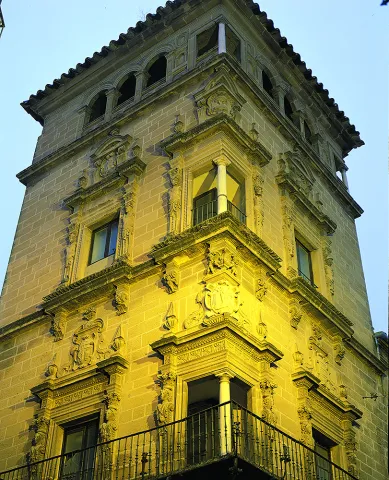
From its heritage we will highlight the excellent degree of conservation of many of its buildings, which still keep details of the time as can be the doors of claveted wood, the iron aldabas, the lanterns and the bars.

It covers such a number of monuments, churches, palaces and master houses, that it would be difficult for us to list them here to the full. Among its most notable monuments of Ubeda are the following:

Historical center:

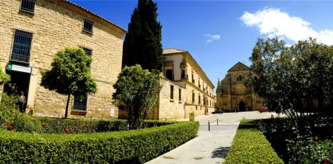
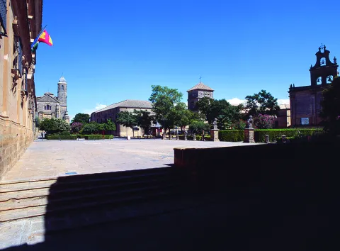
  • Plaza Vázquez de Molina
  • Sacra Capilla Funeraria de El Salvador del Mundo
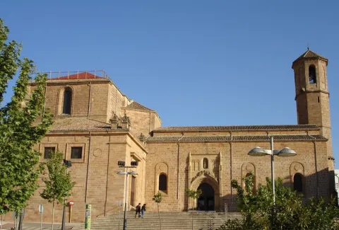
  • Basilica of Santa Maria de los Reales Alcázares
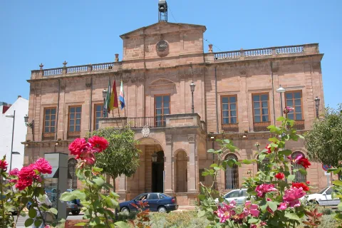
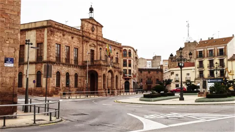
  • Palace of Vázquez de Molina or Palace of the Chains. Current City Hall and houses the Andrés de Vandelvira Interpretation Center
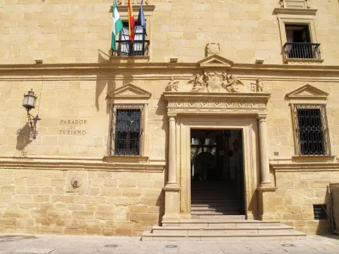
  • Deán Ortega Palace. Current National Tourism Parator
  • Hospital de los Honrados Viejos de El Salvador
  • Palace of the Marquis de Mancera
  • Vela de los Cobos Palace
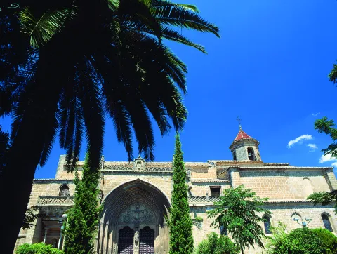
  • Church of San Pedro
  • Church of St. Paul. Located at 1 May.

Barrio del Alcázar, San Lorenzo and Santo Domingo:

  • Casa de Las Torres
  • Palace of the Medinilla
  • Church of San Lorenzo
  • Church of Santo Domingo

San Isidoro district:

  • Santiago Hospital
  • Palacio del Marqués de la Rambla
  • Church of San Isidoro
  • Church and Convent of the Most Holy Trinity

Barrios de San Pablo y San Nicolás:

  • Church of San Nicolás de Bari
  • Convent of the Immaculate Conception. It houses a museum.
  • Casa de la Tercia - Olivar and Oil Interpretation Center

Barrios de San Millán y Santo Tomás:

  • Valencia Street. Numerous craft workshops to visit.
  • Church of San Millán
  • Palacio Francisco de los Cobos

Route of San Juan de la Cruz:

  • Convent of San Miguel and Oratorio of San Juan de la Cruz

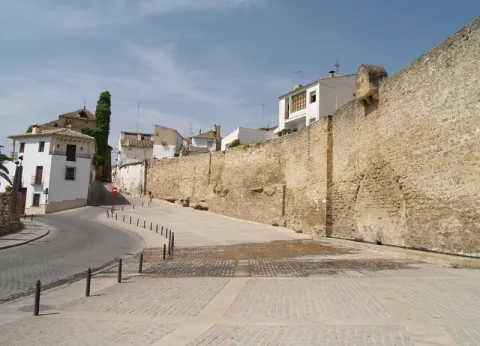
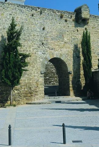
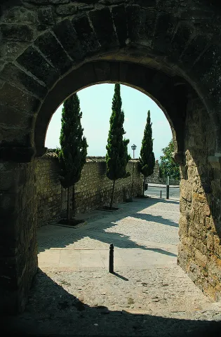
In addition to these interesting attractions, we suggest a visit to the walls to contemplate the extraordinary panorama obtained from them.

Naturaleza

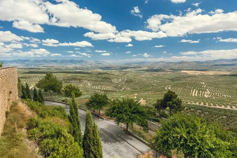
It is the main center of the region called La Loma. Ubeda is located on a hill at 750 m of altitude, and is surrounded by the valleys of the Guadalquivir and the Guadalimar.

Very close, around it, are the Natural Parks of Despeñacolos, Sierra Magina and Sierras de Cazorla, Segura and Las Villas.

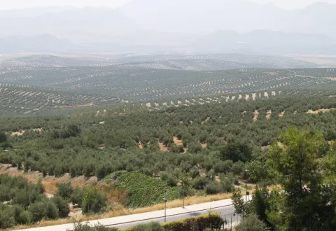
The landscape is very characteristic because it is composed of a "sea of olive trees," as the poet Antonio Machado wrote.

Fiestas y Eventos

The city of Ubeda presents a mosaic of cultural activities, festivals, fairs, romanias... Events all very deeply rooted in the population and with a very consolidated organization, which makes visitors from all parts of Spain participate.

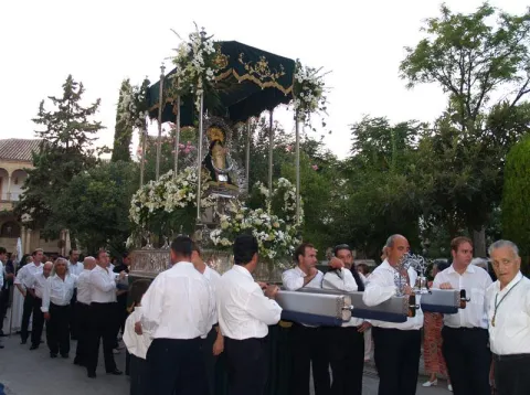
It is worth the celebration of the Holy Week, one of the most popular parties in Andalusia, being declared a National Tourist Interest Party.

On May 1, the Romeria de la Virgen de Guadalupe, patron of Ubeda and known as the "Great Romery." That day the Virgin moved from her sanctuary to the village of Santa Eulalia.

Typical are also the San Antón fires"the lumbres." On January 16, fires are made in the different neighborhoods, where sardines are roasted or the cobbled.

Special emphasis party of San Isidro Labradoron 15 May, farmers' employers and who enjoy much devotion among the olive workers.

Together with the neighbouring city of Baeza, the Festival of Ancient Music. And in the last months of the year, the puppet and tale festivals take place.

And we cannot stop quoting the San Miguel Fairon September 29, the city's patron party. And during the days of this fair the Autumn Theatre Show takes place, as well as high-quality musical activities and children's activities for all ages.

Other relevant events highlight theFlamenco and Mestizo Festival "City of Ubeda" or Exhibition of Autumn Theatre of Ubeda.

+ INFO

Gastronomía

The ubetense cuisine is basically Mediterranean, with influences both manchegas, alumina and Andalusian root.

The table includes legumes, game meat and products derived from the "slaughter of the pig," and, of course, virgin olive oil and table olives. Among the most outstanding dishes would be:

  • The crumbs (reminiscent of the shepherds in transhumanism).
  • The ointment, an olive oil cake.
  • The slick.
  • Potage of beans with eggplants.

The bars and canteens are the traditional meeting point of the ubetens. If you visit the city in September you can attend the Fiesta de la Tapa.

We cannot forget the "Gourmet days of the Renaissance". They take place from January to March in the most emblematic restaurants, where both lunch time and dinner are accompanied by shows.

Historia

The latest archaeological research shows that the first settlements of Ubeda date back to the Copper and Bronze Age (III and II millennium A.C), being the "oldest city in Europe" scientifically documented.

In search of product exchanges the Greeks will arrive and later the Carthaginians, who would be defeated by the Romans. It is under the Roman Empire, from the battle of Llipa in 206 BC, when the old city is romanized and will be known as the Betula.

The city takes on importance with the arrival of the Arabs, in particular with Abdeleran II, in the S. IX, who overlooks it with the name of Ubbada or Ubbadat Al-Arab (Ubeda "of the Arabs"). As a Muslim city it was surrounded by walls and became one of the most important cities of Al- Andalus, due mainly to its crafts and trade.

In the S. XI it will be conquered by the alparavids. And the definitive Christian conquest was carried out in 1234 by King Fernando III.

A number of factors, such as the geographical location, its extensive and rich jurisdiction, as well as the presence of an increasingly powerful nobility, would lay the foundation for the splendor that Ubeda reached in the 16th century.

The economic development of the city based on agriculture and on the feral livestock, the rotations of the forests that represented an increase in the land of cultivation, and having a mesta of its own, will base the greatest splendor of the city, which was a demographic increase to reach 18,000 inhabitants.

In addition to the ubetense nobility and the Orders of Cavalry, we found a group of neighbors who have prospered (doctors, tailor, scribes, bots...) that will lead to an incipient bourgeoisie.

To highlight the role of Francisco de los Cobos, secretary of Charles I, who, with his interest in art and under the advice of the architect Andrés de Vandelvira, fills the city with palaces. In Ubeda, take root the humanist currents of the Renaissance. It will be Juan Vázquez de Molina, Secretary of Charles I and Philip II, who will continue with the planning initiated by his predecessor.

Declive:
The 17th and 18th centuries are of decline for the city, as Spain is in a general crisis. The bad crops, the unfair pressure of taxation to cover the cost of wars, corruption, the power of the clergy, the expulsion of the Moorish, will be factors that contribute to the loss of that splendor that characterized this city.

Later, in 1820 and 1836, ecclesiastical disamortizations, Carlist wars, Civil War and post-war will come.

Recovery:
It will be in the 1960s and 70s of the last century, thanks to the development pull, when slowly it was the "Florence of Alta Andalucía" go to the present place and become a provincial reference point, head of the region of La Loma and a centre of industry and services of increasing importance.

Otra información

Known people born in Ubeda:

  • Antonio Muñoz Molina, writer and member of the Royal Academy of Language.
  • Joaquín Sabina, singer.

In Ubeda dies San Juan de la Cruzon 14 December 1591.

The popular saying of leaving or "walking on the hills of Ubeda," has its origin in the conquest of the Almohades of the Jienese city of Ubeda in 1234. It seems that one of the most important captains of King Fernando III "the Holy," disappeared moments before entering into combat, and that he appeared after the city was conquered. Asked where he had been, he replied that he had been lost by the hills of Ubeda.

Loading map
Preparing points of interest and routes...
Imagen principal
imagen
Image
9bbdff4c-5e18-d227-f40c-7c89c56fd0d7?t=1603979510184
Imagen principal
Activado
Literatura

These reasons are further enriched by the fact that San Juan de la Cruz died here, having been brought to the city to recover from a slight fever, and by the fact that it is the birthplace of Antonio Muñoz Molina, winner of the Premio Planeta and the Princess of Asturias Award for Literature.

You must come to Úbeda and venture into its streets and monuments, discovering them through the eyes of these authors. Without doubt, a different way to enjoy this monumental city.

Torredonjimeno

Submitted by brandcode_deweloper on
Id
751667
Perfil de redes sociales
Facebook
https://www.facebook.com/aytodetorredonjimeno/
Twitter
https://twitter.com/ATorredonjimeno
Youtube
https://www.youtube.com/@ayuntamientodetorredonjimeno
Instagram
https://www.instagram.com/aytotorredonjimeno
Descripción
Breve descripción

The municipality of Torredonjimeno is located to the southwest of the province of Jaén, 17 km. to the west of the provincial capital.

It is not administratively included in the Sierra Sur region, but is considered a bridge head towards the countryside and therefore initiator of another route. However his history and art are so linked to the rest, always by the common denominator of the Order of Calatrava.

Torredonjimeno is an olive town with a certain industrial development. It is characterized by the development of agricultural activity, where olive trees constitute 97% of the cultivated land.

The industry is on the rise in recent years. On the outskirts of Torredonjimeno is the industrial polygon "Mirabueno," where most industries are located: workshops, upholstery, textile fibres... There are companies dedicated to the construction, highlighting the crafts of metal, the forge and especially a factory of casting of bells, which has been in existence since 1881, being the only one in Andalusia following traditional artisanal techniques and performing works that in many cases go beyond the national level, to be exported to other continents.

It is quite linked to the capital by its closeness and excellent road communications.

This city offers us corners, monuments and places, culminating in a city centre full of attractions.

Telecomunicaciones
Teléfono
953 571 950
Sitio web
www.tosiria.com
Fax
953 341 326
Correo electrónico
secretaria@tosiria.com
Ubicación
Nombre
Torredonjimeno
Latitud
37.765769
Longitud
-3.958760
Distrito
Municipio
Ubicación en el mapa
POINT (-3.95876 37.765769)
Imágenes
imagen
Image
e001aa8c-ca72-9178-b82d-e3fa54956708?t=1621473670658
Imagen principal
Desactivado
Información adicional
Curiosidades

Casa Municipal de Cultura.

Telfs.  953 572 202 – 620 525 273

cultura@tosiria.com

culturatorredonjimeno@gmail.com

Horario de atención: 

Invierno:

De lunes a viernes: 9:00h. - 14:00h. / 16:00h. - 21:00h.

Verano: 

De lunes a viernes: 9:00h. - 14:00h. / 17:00h. - 21:00h

Imágenes cabecera
imagen
Image
Torredonjimeno
Imagen principal
Desactivado
Datos de interés

Tourist area: Sierra Sur and Campiña de Jaén

Distance to the capital (km): 17 '3

Altitude over sea level (m): 587

Extension (km ²): 157 '68

Number of inhabitants: 13,696

Gentilicon: Toxirians

Postal code: 23650

Videos
Video file
Cultura

The declaration of Historical set It is justified in 2005 by the presence of several monumental buildings in the old town, as well as by the medieval route.

We highlight the following monuments:

Civil architecture:

  • Castle (12th and 13th centuries). The castle of Torredonjimeno was built by the Arabs to protect the population from a small rural house. It was a rectangular fortress, of medium size, which after the reconquest was widely reformed by the Order of Calatrava. The Fortaleza, of a mannerist style, is one of the most important monuments of the historical and archaeological heritage of Torredonjimeno. As a matter of curiosity, the castle served as an accommodation for Fernando III in one of his perils and, according to tradition, in the room of which he was Torre del Tribute, the commando of the Order of Calatrava wrote the first book of which the art of the bullfighting is recorded. From this book, printed in the 16th century, only one preserved copy is known in the Salamanca Library. At the end of the Middle Ages the castle became a church residence. Inside the compound we can see part of that 16th century palace house in which several of its dependencies are highlighted with polychrome potters of Mudejar style. After its restoration, the castle has become a cultural center in which much of the activity of Torredonjimeno is developed and which also houses the Visigode Treasury Interpretation Centre which was found in the surroundings of the municipality fortuitous in the early 20th century. Considered the second most important visible legacy of the Peninsula after the one found in Guarrazar (Toledo), its original pieces are today distributed by several Spanish museums. Declared Good of Cultural Interest with the type of Monument in 1985 (BOE 29 / 06 / 1985).
  • San Sebastián Bridge. On one side of the missing Gate of Martos and on the other side with the pillar of the same name and it rises on the way of the Salado River.
  • City Council (17th century, mannerist). Of elegant and proportionate facets, typical of the classicism of the 17th century. The facha is divided into two floors, the one below has in the center a cover and on the double sides of the intellized windows. The superior presents a gallery with 11 arches of half points supported on double columns. The open character of the gallery contrasts with the solid and sober underfloor in the style of the Italian palaces. Declared B.I.C. in 1983.
  • Cube mill. It is a fortified flour mill that takes the name of the stream of the cube, is built by the Order of Calatrava in 1437. It is the largest and best preserved fortified mill built by the South Peninsular Military Orders. In this place, down to the river of the Cube, we find an area of high ecological and landscape value.
  • Torres- Fortress. In the municipal term of Torredonjimeno there are numerous towers such as: Castle of the Fucovert, Castle of Torre Venzala and Castle of Torre Alcázar.

Religious architecture:

  • Church of Santa Maria.Built in the early 16th century, in late Gothic style. It is a temple dedicated to the Mystery of the Immaculate Conception of Mary, of one ship, with two chapels on each side, flat tester and tower at the feet. The ship is divided into three sections, with star gothic vaults separated by pointed arches. The main facade, at the foot of the temple, stands out on the volume of the whole by the body of the torre-bell tower attached to the wall, has a small furnace flanked by two shields of the Order of Calatrava.

    The first extension of the temple is in 1671, consisting of a chapel next to the presbytery for the Most Holy. The second enlargement, in the first third of the 18th century, is dedicated to Our Lady of the Dolores. It is worth noting the Camarín, which is accessed from the sacristy. Declared B.I.C. with the type of Monument in 2010 (BOJA 9 / 11 / 2010. p. 50).

  • Church of St. Peter the Apostle (S. XVI), Renaissance style, designed by Francisco del Castillo "El Mozo" and built in 1592. It is divided into three ships by sober columns of Tuscan order that support a Mudejar artisan: that of the right dedicated to the Virgin of the Angustias, that of the left is occupied by the Christ of Love and at the bottom the Chapel of the Virgin of Carmen. On the presbyterium is the fourth-sphere vault, on pechines, covered with frescoes of the Celestial Glory. The altarpiece, from the first third of the 17th century, originates from a convent of Valladolid. It also highlights the large number of pictorial works of Easter.
  • Convent of Our Lady of the Piety (16th century), popularly known as "Las Dominicas." Founded by Don Jerónimo de Padilla and Pacheco around the year 1540, belonging to the Order of Santiago and with a triple function: to house a convent of Dominican nuns, to be a family pantheon for the founders and to serve as a school for homemade maidens. The church presents one ship divided into three sections, with side chapels embedded in the wall. It has double choruson the feet and on the side of the presbytery. The altarpiece is baroque from 1728. The ship is divided into three sections with star Gothic vaults and separated by half-point arches, columns and capitals. The profusion of santiaguine shells and the general composition of late and Renaissance Gothic elements are a decorative element. In the interior of the convent you can highlight the double floor cloister, you cannot visit it as a closing convent.
Naturaleza

The municipal term of Torredonjimeno has a surface area of 157, 68 km ²and is at an average altitude of 587 m. over sea level.

The municipal term is characterized by the abundance of hills and a shortage of very flat areas. The altitude of the term varies between 300 m from the lowest areas to the west to 800 m in the south-east, being a transition area between the Sierra Sur and the Campiña.

Although there are no notable geographical accidents, there are many natural spaces and attractions who will make the delights of lovers of nature. It is these places that make nature in this municipality a real sign of identity.

The indigenous vegetation corresponding to the term is made up of oats, a small forest with different species such as lentils, retama, zarzas, rosemary, madroño and thorn.

The fauna the species that have been able to adapt to these lands without almost forest area: sedentary birds, jellyfish, greens, partridges. Migratory birds coming from the African continent, such as the tortola, the cuckoo, the swallow and the victor, who come to these lands to feed and reproduce. They also abound in the Tusrian rabbit field, hares and all kinds of rodent animals.

We highlight the following areas:

  • Las Quebradas Park. Frondosa grove in the old town of Torredonjimeno where there is an area conditioned for leisure and free time consisting of a children's park and a picnic area.
  • Calvary. It's one of the local lungs. Located to the south-east of the city centre, it is a hill where there is pine mixed with oak and Mediterranean bushes. Through a wide and soft sidewalk, along which there are several stone crosses, you reach the top where you find the San Cristobal hermitage. On this path, at the evening of Holy Monday, the crucified Christ is processed. From here we'll have some Exceptional panoramic views of the helmet of Torredonjimeno.
  • The site of the Cube Mill. It is located 3 km away. from the town and near the Green Way of Oil. It is an area with a high ecological and landscape value. There is the Cube Mill, a fortified flour mill of the 15th century. Here we can observe various water jumps and the riverside vegetation.
  • Salinas de San José. Old saline exploited from the Roman era to well in the 1990s. They are now out of activity.
  • Paqua source. Small area 2.5 km from the town, crossed by the Arroyo del Barranco. We can discover the river vegetation and the Mediterranean forest. The best way to get to this place is through the Green Way.
  • Laguna de la Casilla and Laguna de las Navas. They are seasonal lagoons located in the western part of the municipality. Since 2007 they have been registered in the inventory of wetlands in Andalusia. These two lagoons are ideal for the observation of aquatic and amphibian birds at some times of the year.
  • Green Way of Oil.It is presented as a new and attractive offer of indoor tourism based on the use and recovery of the old Jaén- Campo Real railway (Córdoba) as green corridor, ideal for the practice of cycling, hiking and other sports in contact with nature. Built between 1882 and 1893, this railway belongs to the line Linar- Puente Genil, and was dedicated for much of the 20th century to the transport of different metals from the mines of Liares and especially from the abundant olive oil produced in the region. It was finally closed in 1985, to passengers and goods. It was possibly called "Oil train.". The tour begins in the sports "Las Fuentezuelas" of the jienese capital, continues by Torredelcampo, Torredonjimeno, Martos and concludes the jienese part of the Green Route, on the great iron bridge over the Guadaljoz River, right in the tail of the Vadomojón swamp, in the municipal term of Alcaudete. On his way through Torredonjimeno, right in the km. 15, the Green Way of Oil is in a 120 m tunnel. After passing by the site of the station (km 15.5), a gentle rise of about 5 km is started. La Vía directed her path to the imposing Peña de Martos, with a winding track, crossing through a lower step (km 20) and two new metal walkways, the A-316.

Gastronomía

The gastronomy of Torredonjimeno is very linked to the products obtained from the orchards, to the animals that were raised in the corrals and to the minor game animals. Simple and easy to prepare dishes, where virgin olive oil is never missing. Among the most prominent are:

  • Pipirrana: is a salad whose basic ingredients are onion, tomato, green pepper and cucumber. Sometimes it is added cooked egg, some kind of fish, meat priet or even sausages.
  • Gazpacho: It is a drink with several ingredients such as olive oil, vinegar, water, bread, raw vegetables, usually tomatoes, cucumbers, peppers, onions and garlic.
  • Migas and gachas. They argue that the crumbs are made with bread and the gaches are made with flour. It was the breakfast of the quadrillas on the long days of the olive collection. They were added, grapes, chorizo, morcilla, eggs, cod... As far as possible.
  • Cucumbers: Owner of Holy Week, where the main ingredient is cod.
  • Handmade French fries, product "Degusta Jaén" as a sign and distinctive of quality.

Warehouse: rosquettes, meringues, coffins, saintly bones and pestions.

Drinks:

  • Pitch: It is the general term for a wide variety of cocktails, alcoholics or not, that may contain fruit or juices, and other estival drinks such as crow, turf, lemonade and different types of bleeding.
  • Coffee solution

Historia

The the geographical location of Torredonjimeno, located in an area of fertile land and in a crossing of roads that links the lands of Jaén with the Cordobese countryside, has allowed the presence of human communities throughout history.

The oldest data retract us to the existence of an Iberian population called Cosiria (hence the Gentile applied to the inhabitants of Torredonjimeno, of "the Syrians").

After Roman conquest, joined to Martos gets the rating of a colony with the name Augusta Gemina.There is little news about the Spanish-Muslim stage. To highlight inclusion as part of Martos.

In 1224 he became part of the Spanish crown, and years later Fernando III would grant this entire territory of the countryside to the Military Order of Calatrava, so that it would repopulate and defend it as a border until well advanced in the 15th century.

This border condition will determine the lifting of a good number of watchmen to defend the territory: Tower of the Foncada, Tower of the Alcázar and the existing one in Venzala

From this time it is born its current name which refers to the existence of a military enclave (Tower) and the name of one of its first warlords, D. Ximene of the Raya.

Around 1369, in the middle of the border in the area, Torredonjimeno, already has a walled enclosure that defended the whole city.

By 1526, when the Emperor Charles I went to Seville to marry Isabel of Portugal, he stayed in the palace of Gonzalo de Villalta.

The Year 1558 will be decisive for the history of Torredonjimeno, as, this year, the Princess Joan of Austria, governor of the kingdoms of the Monarchy in the absence of Philip II, grants independence to the villa, definitely taking her away from the dependence of Martos.

The 15th century will be a stage of expansion and prosperity. However, the XVII will know the bad crops, epidemics, hunger, the fall of the population... Despite this, in 1637, the construction of one of the most beautiful buildings is started: the City Council.

In 18th century, it starts a recovery in the style of the new illustrated society promoted by Charles III. During these years, cultivated areas are growing, and olive trees will replace other arable crops in many places.

The years of drought and poor crops, as well as the periods of war and emigration to industrial cities, meant that people were lost in these localities.

In year 2005is declared by the Council of Culture of the Junta de Andalucía, Good of Cultural Interest in the category of Historical set, in recognition of the historical and urban values of the city.

Loading map
Preparing points of interest and routes...
Imagen principal
imagen
Image
Torredonjimeno
Imagen principal
Activado

Porcuna

Submitted by brandcode_deweloper on
Id
749735
Perfil de redes sociales
Facebook
https://www.facebook.com/AyuntamientoDePorcuna/
Twitter
https://twitter.com/aytoporcuna
Instagram
https://www.instagram.com/ayuntamientoporcuna/
Descripción
Breve descripción

Among large plains of green olive trees is a noble atalaya in which is found Porcra, a universe in stone carved through its six thousand years of history.

Canteros of all times recorded in their walls the mark of an illustrious past, leaving for eternity the echo of their master's. In it the sculptural set of Cerrillo Blanco was modeled; the solid foundations of the Roman Obulco were raised; it served as the custody of an Andalusian bulwark and was the site of matres and calatraves.

Its golden stone carved by hand looks majestic in monuments and squares that open to the astonishment of those who contemplate it.

Our earth, changing in appearance, but unchanging spirit, has traveled through time wrapped in names that narrate the same essence: Ipolca, Obulco, Bulkuna... Porcella.

Today, Porcilla invites you to enter into its charms, to lose you through its serene streets, to feel the closeness of its people and to taste, without haste, the truth of its gastronomy. Because here, every stone tells a story and every story awaits you.

Telecomunicaciones
Teléfono
953 544 004
Sitio web
www.porcuna.es
Fax
953 544 606
Correo electrónico
ayuntamiento@porcuna.es
Ubicación
Nombre
Porcuna
Latitud
37.871140
Longitud
-4.183990
Distrito
Municipio
Ubicación en el mapa
POINT (-4.18399 37.87114)
Imágenes
imagen
Image
img_5364-jpg
Imagen principal
Desactivado
imagen
Image
2531-0120-1-jpg
Imagen principal
Desactivado
imagen
Image
2438-1439-jpg
Imagen principal
Desactivado
imagen
Image
_mg_3740-jpg
Imagen principal
Desactivado
imagen
Image
img_9531b-jpg
Imagen principal
Desactivado
imagen
Image
2241-0082-jpg
Imagen principal
Desactivado
imagen
Image
04-1-jpg
Imagen principal
Desactivado
imagen
Image
img_7925-jpg
Imagen principal
Desactivado
imagen
Image
02-1-jpg
Imagen principal
Desactivado
imagen
Image
img_6720-2-jpg
Imagen principal
Desactivado
imagen
Image
foto-parroquia-jpg
Imagen principal
Desactivado
imagen
Image
img_9364-jpg
Imagen principal
Desactivado
imagen
Image
1657-0934-jpg
Imagen principal
Desactivado
Información adicional
Curiosidades

Oficina de Información Turística

Plaza de Andalucía, 3

Tlf.: 953 545 130

oficinaturismo@porcuna.es


Imágenes cabecera
imagen
Image
Porcuna
Imagen principal
Desactivado
Datos de interés

Tourist area: Sierra Sur and Campiña de Jaén

Distance to the capital (km): 42

Altitude over sea level (m): 427

Extension (km ²): 174.5

Number of inhabitants: 7,055

Gentilicon: Porcunenses

Postal code: 23790

Videos
Video file
Cultura

Ibero site of White Crow

The pale tone of its rocks gives meaning to the name of this small hill located two and a half kilometres from the urban core of Porcra: White Crow.

Archeologically involved during the 1970s of the last century, the process of human use of the field is delimited in three moments.

First, during the tartesic period, there is a distinction between an inhumation necropolis dated around the 7th century BC. There are twenty-four individual graves and a double-chamber grave.

From a second epoch, around the 5th century BC, is the largest Iberian sculptural ensemble of the national territory. A thousand three hundred fragments among which are more than thirty sculptures. The warrior of double armor, symbol by anthonomasia of the Iberian world in general, stands out.

Finally, necropolis continued to be used for such purposes from the 5th century BC to the 1st century BC, changing the first rite of imhumation to the rite of incineration.

Roman Amphitheatre of Obulco

The Roman Amphitheatre of Obulco was one of the largest show buildings of the Roman Hispania, an example of the enormous magnitude of the ancient Ibolca-Obulco police. It was the largest of the cities of the Protohistoric and Roman Iberia in the time of Julius Caesar.

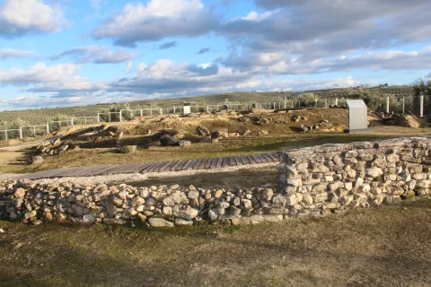
This amphitheater shows the imposing archaeological reality of Municipality Pontificensis Obulconensis in the 1st century BC, when it was raised about five hundred meters from the walls.

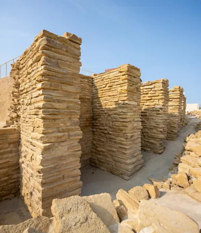
After the last great intervention of this colossal amphitheatre, its monumental remains, of more than one hectare of surface, have been managed to size and integrate in harmony with the existing neighborhood, allowing its visitors to walk through a large section of the southern façade with its imposing counterstrong of piled chairs in the Hellenistic style, see the doors and volitories, the outer access routes and the large falls of cyclopeia blocks, then be able to enter the cavies or steps, and come down from the wall of the podium to the space of the sand and carcerwhere to appreciate the dimensions and panorama that the old gladiators who fought in the seaweed or games.

Cisterna Romana de La Calderona

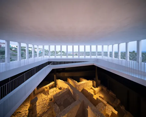
The Roman Cistera de La Calderona is a colossal underground hydraulic complex of the Pontifical Municipality of Obulco, intended to store water, which has been in use for more than two millennia and has arrived to this day in exceptional state of conservation.

It was accidentally rediscovered by one of the neighbors of the three contemporary houses that are available over it and intended for air-raid in the Spanish War of 1936. It was originally a large public water tank with several years of rainwater collection and three catchment wells.

The project has been completed by building a contemporary building of access through ramps to the complex and with the excavation of approximately 500 m ² of the large Roman neighborhood of the poniente, where part of a cross-sectional enlisted street have been exhumed, three houses organized around patios, a shop and a butcher-carnage, which allow to qualify this block of the neighborhood as a handicraft and commercial sector of the city.

Boabdil Tower

In an era of invasions and conquests, during the Middle Ages, two names express the same reality. The Muslim Bulkūna and the Christian Porcella live together and share the same territory.

On the remains of an Andalusian bulwark, which in turn was erected on Roman vestiges, the Castle of Porcra is fortified with new defenses to become a Christian alcazar.

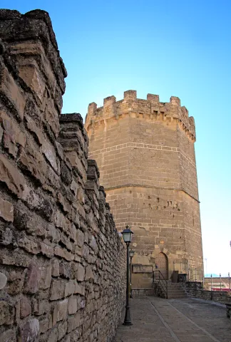
Ten are the towers that make up the castle's walled enclosure and one of them, the last to be built, which is maintained until today. The New Tower was raised during the first half of the 15th century by the precept of the Calatravo gentleman Don Luis de Guzmán.

It is also called the Tower of Boabdil for what happened in 1483 when the last sultanate of the Nazarí Kingdom of Granada, Boabdil, was taken as a prisoner to that tower after being arrested in the Battle of Lucena.

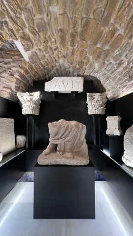
The tower is octagonal base, is 28 meters high and has an ochavada shape. Its interior, of two floors and a terrace, will house the medieval rooms of the Archaeological Museum Municipal Obulco.

Church of Santa Ana

The first data that are held from the hermitage of Santa Ana are from the late 15th century although its exact origin is unknown, being able to be reassembled at the end of the 13th century.

Santa Ana is drawn like a hermitage of a ship, with several adjacent dependencies such as the house of the santera and some corrals. During the later centuries the whole is spread and consolidated until in the 19th century it is closed to worship. In the 20th century, the property is sold to the Juárez family for use as a bread oven.

The recent intervention carried out by the City of Porcra has involved the restoration and recovery of the original building. These works have brought to light important findings: unique pavements, numerous burial or wall paintings in the altar area.

Today, the ancient church of Santa Ana has become the Visitors' Reception Centre.

Royal meat stores

This is one of the most modest buildings, which was mentioned in the 15th century, next to the organization of the square: the carnage of the villa, the Church Mayor and the Cabildo.

The Royal Carniceries, called for the Crown's control over meat, supplied the population with beef and sheep for more than five hundred years, from the Middle Ages to the Second Republic.

From this moment on, the city's library is located in the building and, in addition, the work-bag functions are performed there, to be, before its restoration, the Comarcal Court.

In 2015 this space was opened after the rehabilitation and value that the City Council of Porcilla carried out, hosting, there, the municipal services of Historical Archives and Tourist Information Office.

There are some of the vestiges that can be seen inside the building. It is also worth the attention to stop and observe its inclinated facade witness to the Lisbon earthquake of 1755.

The Royal Posite of Charles IV. City Council

In the square of Andalusia was built in the Enlightenment of the King Charles IV in 1798 the Royal Po'sito, that is, a public warehouse of grain for consumption and sowing. It is a functional building offacade of silleri ́ a with beautiful classic cover, which consistsof three ships, one main and two lateral, separated by stone arches on which the deck rests. The building is accessed after climbing a step, an element that allows to generate a lower level or ventilation gallery.

After the Civil War contest, the building was ruined and a major reform had to be made.Although the works were directed by Ramón Pajares Pardo, the project is due to the architect and National Architecture Prize José Luis Fernández del amo, the first project he signed.

The building currently houses the headquarters of the City of Porcra. The large "glass yard" is a bright space that acts as a distributor of the entire ground floor and also functions as a main public service room.

Galleries of the Royal Posite of Carlos IV. Municipal Archaeological Museum of Porcilla

This is abouta space located under the building of the Royal Posite, current City Hall.In its day were the ventilation galleries and prevented the moisture from reaching the grain store. In origin they had no direct access from the outside, only one registration trap. Over time, several entry doors were opened, allowing this place to take different uses, from construction materials storage to dungeon or hardware shop.

Following the major reform in 2017, the space was restored and opened to the public. During the intervention, archaeological remains of Roman and medieval times, now integrated into the journey, came to light. The vaults system used in its construction is particularly noteworthy.

In 2023, two museum rooms were incorporated into the whole, which greatly enrich the understanding of the past of Porcra: one dedicated to the world of the Turdulum and the other to the Roman period. Both offer a clear and accessible journey through the cultures that left a deep mark on the ancient Obulco.

Ntra Parish. Sra. de la Asunción

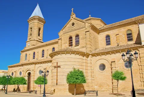
The Parish Church of Our Lady of the Assumption of Porcilla, concluded in the early 20th century thanks to a popular subscription, rises on the site of the ancient Church of Santa Maria la Mayor. The building, wide and bright, has a Neo-Byzantine style and is articulated in three ships covered with cross vaults. The sacristy, attached to the head, belongs to the temple of the 17th century and is connected to the rectoral house, which houses the residence of the parish priest, the archive, the office and the parish hall.

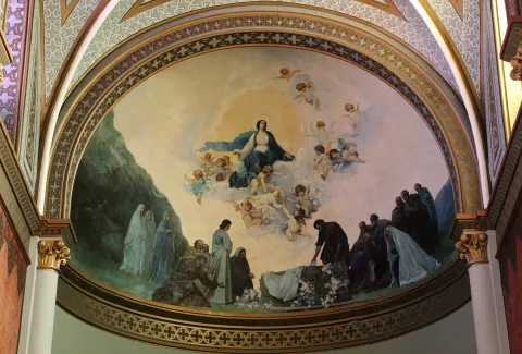
After the construction of the new temple, Julio Romero de Torres was commissioned to paint the vault of the apse, where the artist represented the Assumption of the Virgin, surrounded by a chorus of angels. The work was so impressed that he was asked for two new murals for the capels of the cruise. In one of them he made the Holy Supper, showing the apostles attentive to the moment when Jesus instituted the Eucharist. On the other, he represented The Holy Family in a serene sunset, with the Child Jesus in Mary's arms and the silent presence of St. Joseph. In addition, the temple retains five more works of the painter: an oil of St. John the Baptist in prayer and four canvases of the evangelists located in the pechines of the cruise.

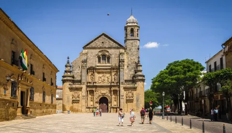
House of the Stone

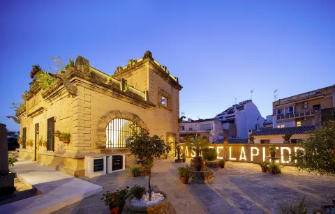
Summary of the millennial craftsmanship of the stone in Porcra. The bartender and marmolist Antonio Aguilera Ruedas (1896-1980) built it in the middle of the 20th century for 30 years with considerable personal effort and firm mastery.

Its extravagant and eclectic combination of solutions, techniques and decorations exalt the work of the stone. Their personal and unusual explanations that portray in an unusual way the complex parallel trajectory between building and author draw attention.

In August 2018 it was reopened following the reforms that the City Council of Porcilla made. After an important work of cleaning and restoring the stone a sophisticated lighting system is chosen to bring all the beauty to the craftsmanship of the stone. At the same time, an extensive set of ramps, built in marble concrete, gives access to a glass elevator, a unique dissonant element but that will allow access to the entire building.

Naturaleza

The natural environment of Porcilla forms a unique environmental heritage, modelled by thousands of years of history, a marked Mediterranean climate and the constant presence of the olive tree as an identity element of the landscape.

Geological description

The municipality is based on extensive margous formations of the Mioceno Medio-Superior, shaping a homogeneous and gently undulating relief, characterized by rounded hills and looms. In a timely way, the spurs and rocky outflows of sand-calcareous litology, more resistant to erosion.

Edaphology

The soils of the municipal term are mostly limestone and little or medium-evolved. Clear margas, with shallow but fertile profiles, and a slightly basic pH that promotes the development of crops characteristic of the countryside, predominate.

Climate

The climate of Porcilla is continental-temperate Mediterranean. The average annual temperature is around 17 ° C and precipitation is 563 mm, with marked annual irregularities and long periods of drought. Winters are temperate, with diurnal peaks close to 13 ° C, while in summer they are easily reached 40 ° C, with few rains.

Hydrogeology and hydrology

The municipality is located on two aquifers: the Porcra aquifer, which occupies almost the entire municipal area, and the Aluvial aquifer of Guadalquivir, located to the north. The term is integrated into the Guadalquivir watershed, and its main channels are the Salado stream, which crosses the municipality from southwest to northwest to the Guadalquivir, and the Saladillo stream, its main tributary.

Flora and vegetation

Porcula is integrated into the Mediterranean region, and has a dry climate with mild temperatures in winter and hot summers.

The olive tree is today the dominant agrosystem and a true monoculture that occupies almost the entire territory, although there are also areas with natural herbaceous species. Porcilla also houses four endemic species of great biological value: Hispanic, Betic, Ibero-Atlantic Mediterranean-Maghreb and Bético-Maghreb.

Fauna

Agricultural activity conditions the availability of habitats, but the olive tree offers a plant cover that allows the presence of a diverse fauna. Birds, small mammals, reptiles and invertebrates find in this ecosystem an enabling space for their food and shelter.

In it we can observe species such as: the green and the green; and in winter the capirate curved, the red petrored and the common zorzal.

The biodiversity of the olive tree is very much increased when, together with it, streams with riverbank forests or Mediterranean bushes, made up of carrizos, adelfas and tarajes. And so we find: sparrows, pinches, jilgueros, nightingale, cogs, cordnices and cornejas. Amphibians: common toad, green frog, salamander; reptiles: rib, lizard and lizards; mammals: hares, rabbits, foxes, badges, jinetas...

Some areas are highly recommended where we can look at the nature we have described in that paragraph:

  • Jesus' walk. We're in front of the big garden of Porcra. It is an extensive public park with a large grove built in the late 19th century. It is the center of the city's playful and social life as it brings together the important parties of Porcra, from the Real Fair to the Oil Fair. This important green space with countless botanical species is populated by monuments or unique elements of the city's heritage, such as the church of Jesus, the house of the Stone or the important viewpoint of the round, a place from which you can see the beautiful landscape of the olive tree, as well as various villages neighbouring the countryside to the Subbetic Sierra of Córdoba and Jaén.
  • Llano de Alharilla. The village of the Alharilla located just 4 km from Porcilla is characterized by a large plain surrounded by ancient olive houses, many of them today become cozy recreational houses. A lush tree offers shade and freshness, creating an ideal environment for rest and coexistence. In addition, the space has a road, making it an ideal place for family recreation or to enjoy a field day in full nature.
  • Pillars and aljibes.The current pillars have their origin in the fountains or springs whose waters were channeled in time and date, perhaps protohistoric, to collect it in receptacles, the pillars, in order to have it available so that the cattle could easily be watered, for use in laundry or in pools for the irrigation of the many gardens that were established in their way. Taking as a driving thread the pillars and sources, you can make a hiking and visiting route: the pillar of La Galga, María Cotilla, the Great Source, the Girl Fountain, Uncle Pago and the Fuenhot, among others.

Fiestas y Eventos

Ride de Reyes (5 January).On the night of January 5, the streets of Porcra are filled with magic and illusion for the coming of His Majesties the Kings of the East. A variety of carrots, parades and musics make it shine, au ́ n ma's if it fits, tonight so special.

Day of Andalusia (28 February). The City Hall of Andaluci ́ a, an autonomous festival, is held in Porcra an institutional event in which the City Council holds the Concession of Honours and Distinctions to different personalities related to this city.

Carnival (February).Its tradition in this town dates back to the dawn of the 20th century, although it has been more recently when it has become particularly relevant. On the one hand, in the Cine- Teatro "Mari ́ a Bellido" a Carnival Gala takes place in which the letters and chords of different carnival groups intermingle with the rhythms of three by four of the local murgas. On the other hand, during the afternoon of the carnival season, there is a spectacular passage in which hundreds of people gather to show the elaborate work carried out for months. The color, music and dance flood everything, and the diversity takes hold of all those who encourage themselves to contemplate it.

San Benito, Patron de Porcilla (21 March).The devotional to San Benito in Porcra dates back to the 13th century and we have been aware that such religious functions have been carried out since the 16th century. It is therefore not to be removed that the veneration of the Holy Patro is so rooted among its neighbours. On March 21 of each year, a solemn celebration of the Eucharist takes place in its honor and subsequent process of the image, which is accompanied by the local music bands.

Holy Week.During Lent, Porcella is filled with tradition and solemnity. The streets of Porcra make up an exceptional framework for the processing of their cofradi'as that, with their knowledge of being, they move us to an environment or a nico of sobriety, devotion and beauty. Ten are the cofradi ́ as and hermandades that process in Porcra from Palm Sunday to Resurreccio Sunday.

San Marcos (25 April).In honor of this evangelist, a religious and later process is held to end with a popular verbena from the same neighborhood to which it gives name. It is worth noting the curious tradition of the "Spark of San Marcos." This is the realization of fires that traditionally light up in squares and high places, with wood and old things that were discarded and that the young people stacked for their subsequent burning. This tradition was carried out in order to invoke San Marcos Evangelista to bring rain beneficial to agriculture. At present, one of these fires continues to be made next to the hermitage.

May Crosses (first weekend of May).In various squares, streets and neighborhoods of the village, gilded with care for the occasion, the traditional Cruces de Mayo, a holiday that inundate each rinco with a festive air full of color, are raised. The streets are dressed in floral motifs and personal details, self-reflective of the life and traditions of the place, while the neighbors, with dedication and pride, compete to create the most beautiful and striking cross.

Romeria de Alharilla. Tourist interest party of Andalusia.The second Sunday of May takes place in Porcra one of the most important romeri's of Andaluci, which is celebrated in honor of the Santi-sima Virgen de Alharilla, Patrona and Alcaldessa Perpetua of the town. The previous week, the municipality is set up and its streets are filled with people to celebrate the holiday in honor of its patron. Among others, they highlight the spectacular ride of horses, in the afternoon of the evening, with riders and carriages that spread through the main streets. On Sunday, say great, thousands of devotees and rosemary gather to live a day of deep faith, culminating in the longed process of the Virgin, carried in paths between the two and the prayers.

Bervena de San Benito (11 July).San Benito de Nursia, patro ́ n de Porcra and de Europa, has a second holiday in July in which, following the religious feast, a popular verbena takes place in the neighborhood with its same name.

MiaqueFest (first weekend of August).This is one of the largest music festivals in the province of Jae'n. With an open and diverse spirit, the festival does not focus on a specific musical style, but rather accommodates a wide range of ideas in which consolidated figures from the national musical landscape are combined with others that begin to unpoint.

San Lorenzo (10 August).Following the celebration of the Holy Mass, the San Lorenzo process takes place on the main streets of the town. Subsequently, one of the popular verbenas is held with the most raigambre of Porcilla.

Real Fair (September).The so-called "Real Fair" unio ́ la devocio ́ n by San Benito and the Virgin of Soledad, miraculous intercesors in the face of a great storm, with the tradition of holding an annual cattle fair granted by Queen Elizabeth II to the City of Porcra. At present, these parties are held in the first days of September and it is worth noting its Flamenco Besana, Porcra Electronic Night, the young night with musical performances or the parade of giants and heads.

Oil Fair (last weekend of October). This is a holiday celebrated around olive oil, the main economic engine of the town, which had its orien in 2007. At the Porcilla Oil Fair there is a wide exhibition of agricultural machinery, numerous places where to taste the gastronomy, to you, crafts, conferences, oil tasting... All this closed on Sunday with the taste of the traditional hole of bread with extra virgin olive oil and olive harvested in our land.

Gastronomía

On horseback between Jaén and Córdoba, Porcella brings together in its kitchen the best of each of these provinces, always with its star ingredient: extra virgin olive oil. This liquid gold, the fruit of the extensive olive trees surrounding the municipality, not only permeates its recipes of an unmistakable taste, but also becomes the symbol of a tradition that defines its culinary essence.

At the table of Porcilla, the piirranas and the jiennese sparragados with the flaminquins and the Cordobese salmorejo live together in a perfect balance that enriches its gastronomic heritage. However, it is in his native recipes that the true essence of this land is found.

Among its most peculiar dishes are the rape, a small square cake that is formed by folding a wafer over a spicy minced meat filling. This craftsmanship dish becomes an essential for those who seek to taste something unique and authentic.

On the other hand, chicken in milk It surprises both his name and his history. This typical sweet, similar to the mazapan and the alfajor, evokes with its almond aroma an Andalusian past that has been recorded in the gastronomic memory of Porcella.

For lovers of the good table, the visit to Porcra would not be complete without testing these specialties, which represent a bridge between the past and the present, between tradition and innovation. In addition, local restaurants and bars offer the opportunity to enjoy these delights in a welcoming atmosphere, surrounded by the hospitality that characterizes the porcunenses.

Historia

The origins of Porcra go back to a group of villages of the Final Neolithic located in its surroundings. In the Copper Age (3rd millennium BC) the area becomes a nuclear centre of the countryside. Archaeological research has discovered on the hill of the Alcores one of the oldest fortifications documented in the Alto Guadalquivir, with double walled fence surrounded by circular cabins. Another similar village is located on the hill of Albalate and both remained during the Bronze Age (II millennium BC).

In the 7th and 6th centuries BC the Iberian culture was formed on these lands and so, on the hill of the Alcores, there appears a new urban planning, of geometric layout, with rectangular houses of adobe walls that are raised on stone zócalos, sometimes covered with mud. The area maintained its status as a great center of the countryside and in this Iberian era an aristocracy emerged with heroic political models, as did other Mediterranean regions. This elite, to perpetuate its stretch, represented its exploits and its origins, by passing on to us the wonderful sculptural ensemble of the warriors of Cerillo Blanco, who are already emblem of this culture. These sculptures were in a sacred enclosure on the hill of the Alcores, but shortly after their erection they were buried in the necropolis of Cerillo Blanco.

The Roman Obulco was the origin of the current Porcula, confirmed by the epigraphic findings and texts of Plinio, Ptolomeo and Estrabón. During the republic and the first Empire the city was of great importance and enjoyed some autonomy, as it coined its currency.

When the second civil war between Caesar and Pompey was about to end, a uprising led by the children of Pompey broke out on the Peninsula. In the face of this situation, Caesar was forced to quickly mobilize his legions towards the rebel areas. The chronicles report that it took only 27 days to travel the distance between Rome and Obulco, an example of the impressive logistics capacity of the general.

Once in Obulco, Caesar reorganized and concentrated his troops there before marching towards Córdoba, where the famous battle of Monda would take place. The triumph in this confrontation definitely consolidated its power.

Otra información

Water Footprint

The Water Hole is a road through Porcra and its surroundings, whose main thread is the water, that is, the water system in Porcra from early times to the present. It is proposed, therefore, a tour of the missing water tank of San Cristóbal and the current one of the street of the Cross; the so-called El Albercón street; Maria Bellido and his role in the Battle of Bailén (1808); the Roman Cisterna de la Calderona, as well as the different pillars and aljibes located, these already, outside the urban town of the Pilar, the Pilar, the Pilar and the Pilar, the Pilar, the Pilar, the Pilar, the Pilar and the Pilar.

Route of the Stone

The Route of the Stone proposes a tour of one of the most unique and defining elements of Porcilla: its golden sandstone. This rock, which has been taken from the local quarries for over 6,000 years, has been the leading thread in the history of the municipality, since with it the most emblematic monuments have been raised from the Iberian era to the present.

The quarry in Porcra is a millennial trade that has never been interrupted. Already the Iberians of the ancient Ipolca-Obulco used this stone for their sculptures, such as the well-known pieces of the set of White Cerrillo, which show an extraordinary technical domain. In Roman times, the local sandstone was again a protagonist in public buildings, foundations, decorative elements and hydraulic conductions. Later, during the Middle Ages and Modernity, it continued to be used in walls, churches, noble houses, civil spaces and hydraulic works, becoming the material identity of the city.

The route invites you to know the historical quarries, where still today the stone is extracted in a artisanal way, maintaining techniques that have passed from generation to generation. There you can see how you cut, size and prepare this material that has shaped Porcra for millennia.

Loading map
Preparing points of interest and routes...
Imagen principal
imagen
Image
Porcuna
Imagen principal
Activado

Mengíbar

Submitted by brandcode_deweloper on
Id
747223
Perfil de redes sociales
Facebook
https://www.facebook.com/aytomengibar
Twitter
https://twitter.com/aytomengibar
Descripción
Breve descripción

Mengibar is located to the north of the Jiennense capital, between the Guadalquivir, Guadalumillon and Guadalimar rivers, land covered with olive trees and cereal and fruit fields. Its location next to the E-902 or A-44 motorway (Bailén-Motril) has helped to maintain a balance between the dedication to agriculture, industry and services. When you reach Mengíbar el Guadalquivir, your flow rate is amused, and you start a quiet middle course, allowing for better use of the water. Mengibar was highlighted river port, on the banks of the Guadalquivir, for its good geographical location, especially for the transport of wood from the Sierra de Segura.

The city centre, which is located on a soft hill of fertile lands, both dry and irrigated, has in its interior buildings and monuments of interest, such as the Renaissance Church dedicated to Saint Peter the Apostle, a beautiful and slender Christian Tower, the Conistory House and the House of the Palace.

The Iberian oppidum of Iliturgi, located in Cerro La Muela, and the famous Roman city of Iliturgi, in Cerro Machiz, have been discovered nearby.

The centre of Mengibar, of irregular layout and Arab influences, has expanded in the east, west and north direction, crystallizing in a wide and rectilinean road, with apples of considerable size in the ensanches closest to the old town and with smaller apples on the periphery of the core.

Telecomunicaciones
Teléfono
953 370 025
Sitio web
www.aytomengibar.com
Fax
953 372 535
Correo electrónico
info@aytomengibar.es
Ubicación
Nombre
Mengíbar
Latitud
37.968410
Longitud
-3.809080
Distrito
Municipio
Ubicación en el mapa
POINT (-3.80908 37.96841)
Imágenes
imagen
Image
bd9dd7c4-7f1e-0dba-0fd2-8ac8158bc6af?t=1676572188698
Imagen principal
Desactivado
imagen
Image
edb57e81-d17d-24a3-406b-ca287562ea61?t=1676572793978
Imagen principal
Desactivado
imagen
Image
8040c949-bac6-38f8-6440-6aa202fca8a5?t=1676572794051
Imagen principal
Desactivado
imagen
Image
e78df582-3ef0-8b51-20e5-ca72c6a31f77?t=1585758946143
Imagen principal
Desactivado
imagen
Image
36f6f987-4a88-2b73-e598-6e017b5c9459?t=1676572794144
Imagen principal
Desactivado
imagen
Image
c584628f-6dbd-68b3-3ad6-64da50dbc967?t=1676572863592
Imagen principal
Desactivado
imagen
Image
3d0828e3-c321-a256-617e-56fbfc9c1992?t=1676899290872
Imagen principal
Desactivado
Información adicional
Curiosidades

Por teléfono: 677 222 285

Por correo electrónico:

turismo@aytomengibar.com

https://mengibarturismo.com/

Imágenes cabecera
imagen
Image
men
Imagen principal
Desactivado
Datos de interés

Tourist area: Campiña and Jaén
Distance to the capital (km): 25
Altitude over sea level (m): 315
Extension (km ²): 62,3
Number of inhabitants: 10,068
Gentillo: Mengibarians or Mengibarians
Postal code: 23620

Videos
Video file
Cultura
  • Mengibar Tower, is the tower of homage of the old castle of Mengibar raised in the 13th century, being the only thing that has been preserved from it. It was restored in 1982. Its height is higher than 25 meters and has vaulted rooms inside. In 1985 she was registered as BIC.
  • Arc de Jano Augusto (Ianus Augustus), a milestone in the landscape, which marked the border between the Roman provinces Betica and Tarraconense. Declared Good of Cultural Interest, the Arc de Jano Augusto (1st century BC and 1st century AD) had dimensions of 14.80 meters in length, almost 5 meters in width and a single central vain of 5.15 meters. The arc was the starting point of the Augusta Way in the Betica. It has been BIC since 2019.
  • House of Inquisition, property that is included in the General Catalogue of the Andalusian Historical Heritage. Located on Jaén Street, there is a very late classic cover dating back to the second half of the 17th century. The most important thing about the building is the main two-storey facade. It's interesting your forging grate.
  • Hydroelectric Central and dam on the Guadalquivir River, the work of the architect Antonio Palacios, represents a remarkable exhibition of industrial architecture. The plant and dam are part of the ambitious project for the development of the Guadalquivir River of the MENGEMOR company.
  • Parish Church of Saint Peter the Apostlenear the Tower, an architectural jewel of the Renaissance, despite the reform of 1970. Its main façade is south-facing and built in the first half of the 16th century. The other facade, facing the north, has different dependencies such as the sacristy, chapels and salons throughout the different reforms. It obeys the Vandelvirian model of three-ship temple separated by pillars and vaults. In front of its construction, Francisco del Castillo, the old man, and Alonso Barba, intervened.
  • The Hermitage of the Lord of the Rainof small dimensions, it is made up of three narrow ships. The centre is of canyon vault, while the sides are intellized. The ships are separated thanks to two large arches of half-point brick seen. The exterior, with a stone view, has a simple front front cover, as a templet, on which a circular window is located and overlooks a revered bell swordsman. It is the only one in the municipality that is preserved from the 18th century. It is now called "Lord of the Rain," for it is venerated by a crucified Christ whom the Mengibarians have traditionally entrusted in the years and periods of drought.
  • The Hermitage of Santa María Magdalena was opened and blessed on 14 July 1990 outside the municipality of Mengibar, very close to the Roman city of Iliturgi. It is located in the Cerro de Machiz, where the ancient 16th century hermitage was erected. It has a simple half-point arch cover with two small side voids, as saetas. At the top we find a hornadine with the image of Mary Magdalena and, on a side, a small body of swordsman. Since its opening, the Romeria de Santa María Magdalena is held annually.
  • Oppidum ibero de Iliturgi and archaeological site of the Roman Iliturgi. Since 2016, the University of Jaén and the City of Mengibar have been working together to rescue the past of the municipality. In Cerro de la Muela, the ibero oppidum of Iliturgi (6th and 3rd centuries BC) was located, with an area of more than 14 hectares. Here, many archaeological remains have been found, which have made it possible to document the siege and destruction of the oppidum in 206 BC by the Roman army. After this event Tiberio Sememonio Graco would founded the Roman city of Iliturgi in the area of Maquiz, about 700 metres from the city destroyed. Since the mid-19th century, a large number of remains of the Roman city have been removed, most of which now form the Iliturgi Collection, which is preserved in Casa Palacio.
  • Mengibar rolls, picotas and bakers. They are part of the history of their formation as a people with their own jurisdiction. The origin of the rolls was found in 1574, when the villa managed to emancipate itself from the city of Jaén. The title, granted by Philip II, allows him to have full jurisdiction, made symbolized by the presence of rolls and picotas. While the former reflect the new administrative and legal status, picotta is the place where the prisoners were punished. The hornaces, on the other hand, are similar to holes made in walls and crowned by a reduced arc. A votive image was placed in them, thus being a sample of the popular fervor of the municipality.
  • The House Palace is a building dating from the 15th century, located in the central area of the historical artistic complex, next to the Torre del Tribute. The property has not always been a single house. From the 13th century, houses are being built very close to the castle wall. It would be a small fortification around the large tower located inside. With the coming of the centuries Casa Palacio has had distinguished owners. It has also been the scene of important historical events. It has also had functions beyond domestic. The building has now become a hotel. One of the first to build their houses on the house occupied by the palace was Mr Pedro Méndez de Sotomayor, Lord of Mengibar and Rider of Jaén, in order to keep the cattle and the cereals of their crops. This has now become the Hotel Palacio de Mengibar, which has a unique spa built in an Arab aljibe and decorated in the style of the Roman era.
  • Interactive Museum of Olive Oil and Sustainability Terra Oleum. It offers a modern exhibition space made up of unique architectural spaces, including its Caja Aurea and a natural environment presided over by the olive forest. For the dissemination of knowledge related to olive cultivation, oil production technology and Mediterranean diet. It has been selected as a reference centre by the European Union for the dissemination of the olive oil culture. The Terra Oleum Museum extends over a total area of more than 11,000 square metres. It is the largest area of knowledge planned in the Mediterranean basin for a food product.
Naturaleza


The municipal term of Mengibar is also spread between the herbaceous crops and the olive tree, with virtually all its irrigated surface, highlighting the vegas of the Guadalquivir and those of the Guadalbullion.

The dominant crops are: the olive tree, sunflower, cotton and cereals (wheat, barley and maize). The beautiful landscape of the Mengibareña countryside is interrupted to the north with Sierra Morena, and to the south with Sierra Mágina and Jaén, passing the rest between soft and undulations without great heights. This beautiful landscape is complete by the gallery forests on the banks of the three rivers that cross its term: the Guadalquivir and two of its tributaries, the Guadalbullón and the Guadalimar. In the autumn the trees of a caduca leaf paint a color brush in the landscape.

The lands of Mengibar offer the traveller various enclaves of natural interest. Among them is the Cerro Albariza, natural lookout from which magnificent views are obtained from the Guadalquivir valley or the Guadalbullón delta located next to the Cañada Real de Torreblasphcopedro, about three kilometres from the urban centre. Its abundant coastal vegetation gives it botanical interest.

The Mengibar dam on the Guadalquivir River, opened in 1916 by King Alfonso XIII, puts a color note to the landscape. The olive tree predominates, but next to the river line we find white alms, mumberas, tarais, black alms, as well as other species of bushes. The fauna is the same as the Jienese countryside: hares, rabbits, perdices, deer, linches, boars, foxes, quails... Also, they are easy to see the storks and a wide variety of prey birds. Without forgetting the fauna that dwells next to the rivers and in the vicinity of the reservoir.

Fiestas y Eventos


In Mengibar, as in the villages of Andalusia, people look forward to popular parties because they know that they will become days of joy and fun, for both the neighbors and visitors. In addition to the Christmas, Carnival and Easter celebration, the following parties are held in Mengibar:

  • San Antónwhich is held on 17 January. The night before the streets are filled with "luminaires," where people around them sing, chorizos, chops and sardines.
  • Holy Week of Mengibarthe Holy Thursday, its preaches and the Sunday of Resurrection, stands out.
  • May Crossthe Holy Cross is celebrated on May 3. On this day Mengibar is dressed as a party, its streets and neighborhoods are covered with crosses, flowers, light and colorful. Every year more visitors come to witness them.
  • Romeria de "La Malena". In honor of Santa María Magdalena, patron of Mengibar, is celebrated on the second Sunday of May. The image is taken that day to his hermitage, accompanied by rosemary on foot, in carrots or on horseback.
  • Fair and Festival of the "Malena"from July 22 to 25, the heat of these days is faced with the joy of the parties in honor of the patron. There is no lack of religious acts but a comprehensive programming of activities for all the public.
  • The Rosaries of the aurora. Mengibar prays singing in the auroras on Sundays, from the last of August to the first of October. It's a custom dating back to the 17th century. The Brothers of each involved fellowship summon their people to rise up and go to the Rosary on their own Sunday. On the afternoon of that day the procession of the title image of the brotherhood takes place. On the first Sunday the Virgin of Fatima is processed, on the successive Sundays of September the Virgin of the Head, Jesus Nazarene, the Virgin of the Dolores and the Virgin of Carmen. It ends the feast, with the procession of the Virgin of the Rosary.
  • Historical recreation of the funeral court of Isabel I de Castilla, La Católica. On November 26, 1504, the queen died in Medina del Campo (Valladolid) and, following her wishes, took a way to the city of the Alhambra where she asked to be buried. On the banks of the Guadalquivir, on its way through Mengibar, a storm forced the funeral court to turn from its route to Granada to take refuge in the Church of St. Peter the Apostle. Since 2015, the third Saturday of November is commemorated with a theatrical historical recreation. More than 220 people participate in it (horse guards, royal guards, drummers, Franciscan monks, nobles, cars of beings and plain people, among others).
Gastronomía


In the culinary culture of Mengibar are present two aspects, one is olive oil, and the other is the use of the products of its gardens that become part of the ingredients of these dishes. From its varied gastronomy, we will highlight the following:

  • Pipirrana, which uses peppers, tomatoes, garlic, onions and olive oil. A refreshing dish that can't be missed in summer.
  • Migas of bread with chorizo, radishes, herring and cod.
  • Tomato fish and pepper (typical of fair days).
  • Cod meatballs, a typical Lent meal.
  • Panoil, on a slice of bread the oil that can be accompanied with tomato and cod is spread.
  • From their pastries are delights such as wine roses, honey flakes, pestins and bienmesabe.
Historia

The history of Mengibar begins to be written on the banks of the Guadalquivir River, approximately 6,000 years ago, in the Neolithic. The traces of this period correspond to the denominated settlement of the Vega Baja. The largest milestone of Iberian occupation of the municipal term of Mengibar corresponds to the oppidium of Iliturgi and the different necropolis associated with this important population core.

Until very recently it was considered that this town would have risen in the area known as Cerro Machiz or Las Torres, a place very close to the confluence of the Guadalbullion River with the Guadalquivir. Recent archaeological excavations demonstrate the exact location of the Iberian city in the site known as "Plaza de Armas del Cerro de la Muela."

This site would be besieged by Roman General Publio Cornelio Scipion, the African. Tito Livio narrated how the city was attacked, burned and massacred. In the 2nd century BC, Rome would founded a new Iliturgi in Cerró Maquiz, an enclave located on the opposite bank of the Guadalbullion River, 700 metres from the old ibero oppidum.

These remains are preserved in Mengibar from the Almohad period. In 1225, Fernando III, the Holy Conquest Mengibar, granted the land of Machiz to the Order of Santiago, leaving the Place under the jurisdiction of Jaén.

The word "MENXIBAR" first appears in the conquest of Jaén, which shows that there must have been a fortress that was occupied by Christian troops. Conquistada Jaén, the king anexiona to this city, on which it will depend until 1574, year in which Philip II, by paying 22,500 ducats, makes it Villa.

On July 16, 1808, a glorious event took place in Mengibar: the defeat of French troops, who fled to Bailén, where days later they would be defeated by General Castaños.

Loading map
Preparing points of interest and routes...
Imagen principal
imagen
Image
Mengibar
Imagen principal
Activado

Martos

Submitted by brandcode_deweloper on
Id
747103
Perfil de redes sociales
Facebook
https://es-es.facebook.com/AytoMartos/
Twitter
https://twitter.com/aytomartos?lang=es
Descripción
Breve descripción

Martos is located to the north of the Sierra Sur region, being the largest municipality and population of this region. There are other populations that are part of the municipality, such as Monte Lope Álvarez, Las Casillas, La Carrasca and Villarbajo.

Its municipal term is essentially olive tree, in its landscape of countryside the olive tree is the protagonist, extending to the horizon. Because of the great quantity and quality of olive oil produced in the city, it is called the "Olivar Cot." Around it has developed an important olive industry that together with the automotive-related factories and their auxiliary industries are the engine of employment and wealth for the municipality and its region.

It has an important historical heritage, among other monuments we quote: the Old Cárcel and Cabildo, Castles of the Peña and the Villa, Puente Romano, Urban Wall, Castle of the Endowment, Pilar of the New Source; with respect to the religious architecture: Royal Parish Church of Santa Marta, Sanctuary of Mary Most Holy of the Villa, Monastery of the Most Holy Trinity, Ermita of San Bartolomé, parish of San Amador and Santa Ana, etc.

This is the cultural wealth and beauty of its historical ensemble, which since 2003 has had the status of Good Cultural Interest.

Telecomunicaciones
Teléfono
953 210 000
Sitio web
https://turismo.martos.es/
Fax
953 553 309
Correo electrónico
turismoycomercio@martos.es
Ubicación
Nombre
Martos
Latitud
37.722260
Longitud
-3.970320
Distrito
Municipio
Ubicación en el mapa
POINT (-3.97032 37.72226)
Imágenes
imagen
Image
7470103a-fede-6cf5-54b2-edb356074e03?t=1603121821734
Imagen principal
Desactivado
Información adicional
Imágenes cabecera
imagen
Image
Martos
Imagen principal
Desactivado
Datos de interés

Tourist area: Sierra Sur and Jaén
Distance to the capital (km): 24
Altitude over sea level (m): 753
Extension (Km2): 259
Number of inhabitants: 24520
Gentillo: Marteños
Postal code: 23600

Videos
Video file
Cultura

Old Jail and Cabildo. Building built in the 16th century, considered a masterpiece of Spanish mannerism. It is currently the City Hall of the city.

In his spectacular main façade We can highlight the huge, dogrous columns with piled armchairs, the sculptures of Justice and Prudence, (both were beheaded), the great doors and their bronze aldabones and a great shield of the Austrians crowning the whole. It was declared a National Historical Monument in 1931. Below the City Hall, the Convent of the Trinitarian, work of the late 16th century, and on the same street, but in the opposite sense the Hospital of San Juan de Dios, of baroque bill of the 18th century. All this high part of the intramurous historical centre is of great quaint and from it you can enjoy beautiful panoramic.

  • Santa Marta Parish Church. It rose in the 13th century, in the years following the taking of the city by Fernando III the Holy, on an Arab mosque. It is consecrated to the patron of the city and has the title of Real since 1617. Gothic Mudejar style. The Baptisterium, the Major Chapel, was later built and embellished with the slate-cross vaults and a large cover of the isabelin Gothic. In the 16th century the interior is expanded and remodeled, raising large columns of Tuscan order and building the original Bell Tower with three bodies.
  • Pilar of the New Source. Ornamental source located in the Manuel Carrasco Municipal Park. It was built in the 16th century, reflecting the most new and outstanding aspects of the Manier architecture. The set stands out for its monumental beauty and austerity. It consists of an abrevadero pillar and a smaller one in which two lions make water pipes. In the center is the Austrian shield, and on the sides is the shield of Martos and that of Governor Aboz Enríquez.
  • The hermitage of San Bartolomé. Located in the skirts of the Peña de Martos, dates from the 14th century and houses the venerated image of Mary Most Holy of the Victory, Queen and Lady of the Peña.
  • Roman Bridge of Martos. Important engineering work, built in the Roman era on the Salado stream in the vicinity of Martos to facilitate the passage between the two shores.
  • Sanctuary of Mary Most Holy of the Villa. Temple in which Mary Most Holy of the Villa, known as "La Labradora," is sold. It was built on dates near the delivery of Martos to the Kingdom of Castilla. In the 16th century the temple was remodeled and a bell tower was built. This sanctuary was burned and destroyed during the Spanish Civil War. The current was rebuilt in the 1940s of the last century, in a Neobaroque style. The Torre-Campanario dates from the 16th century, is separated from the main building and is the only original element of the ancient Sanctuary. It has a square floor with half-point arches.
  • The ruins of Castillo de la Peña which we know today are not those built by Muslims but correspond to the strength that the Calatravos built from 1340. The floor of the castle is trapezoidal adapted to the surface of the plateau on which it sits and its entrance, for security reasons, marked a zigzag drawing. The compound was divided into alcázar and a courtyard of weapons protected by a walled enclosure. The alcázar, where the tower of tribute is raised, takes advantage of a natural podium that lifts it about three meters above the courtyard of weapons, separated by a wide, also natural.

  • Castle of the Villa. It was an alcazaba or citadel surrounded by canvases of almenada wall, as well as passageways and towers, leaving the central space for the construction of administrative and religious buildings: church of Santa Catalina, headquarters of the governorate, cavalries, tahonas, lagores, aljibes, etc. According to evidence from an inspection carried out by the Visitors of the Order of Calatrava in the 16th century in order to repair the deficiencies of the Lower Fortress.

Naturaleza

The orography of the municipal term of Martos is characterized by being quite accidental, with plenty of mountain grounds above all the southern part, instead the north-western part corresponds to soft reliefs and plain characteristic of the Guadalquivir depression, which extends in the west and north of Martos.

Among the greatest levels are the Sierra de la Caracola, with 1340 m., located in the south and to the north is located the Sierra de La Grana with 1254 m. and this is the extension of the Sierra de Jabalcuz, and we would like to mention the well-known Peña de Martos with its 1003 m. on whose slopes the city of Martos is located.

The hydrographic network is composed of a set of rivers and streams which are used for both human consumption and irrigation.

They are two rivers the main ones that pass through the municipality: Eliche Riverwhich is born by the saw of the Grana, and the river Víboras which is born in the term of Valdepeñas de Jaén. The channel of this river is used in the a reservoir of the same name, next to the pastry of Las Casillas.

The flora of the term is dominated by the olive, located in a large percentage of the land of the municipality. It also exists indigenous vegetation of the Mediterranean forest in the mountain areas, where we see species such as: the oak, coscoja, white jara, complaining and abundant number of aromatic plants such as lavender, rosemary or thyme.

In the banks of the river Víboras coexist riverside species as they can be: white, strawberry, elves, olms, zarzamoras and carrizos.

In the fauna exists a great diversity of species, from rapacious birds, both diurnal and nocturnal; aquatic birds, paseriforms, reptiles, amphibians and minor-game mammals.

For nature lovers, Martos offers an interesting natural offer to make different routes, climb to the top of the Peña, offers unparalleled views of the countryside landscape and the surrounding mountains.

Other very interesting routes are also the rise to the Sierra de la Grana, the Sierra de la Caracolera and the setting that forms the reservoir of the Víboras River and the Víboras Castle.

Fiestas y Eventos

Among the main festive celebrations of Martos are:

  • Romeria in honor of the Virgin of Victory. The last weekend of May is held. The festivities begin on Friday with the departure of the procession of the image from the hermitage of San Bartolomé to the Church of Santa Marta with the streets where it passes adorned with flags, reunions, retamas, altars and rosemary in typical suits. The next day the Virgin leaves the parish to go to the hermitage of the Virgin of Peña followed by carts, chariots and horsemen. On Sunday, the day of the rosemary, the virgin returns to her hermitage carried on a cart thrown by oxen and accompanied by gilded carrots with floral ornaments and various decorations. During the tour the atmosphere is fun and cheerful. They sing songs, they eat cheese, ham and rebujito. Once in the Peña, the solemn mass is celebrated and at the end of the rosemary they prepare to eat in the surroundings of the hermitage. This party is declared the Festival of Tourist Interest of Andalusia.
  • Fair and parties in honor of San Bartolomé. At the end of August, Martos is preparing for the largest celebration. Many and many different activities are organized during the days of pre-fair and fair, such as concerts, theatre, cultural and sports activities, horseback riding, pasacalles and taurinos (traditional the brandy torillo). The festivities begin with the official turn on of the cover and the fun is centralized in the fairgrounds, where various musical performances are offered.
  • Olive party. Typical celebration of Martos that symbolizes the official start of the olive collection campaign and pays tribute to the olives that work in the campaign. It takes place during several days of December with the celebration of many cultural activities related to the olive grove. The brooch of party end takes place on December 8, with the most outstanding events: reception of authorities at the City Hall, followed by a floral offering at the Monument to the Olives and the invitation to the attendees of a olive hole (bread, oil, cod and olives). And to put the final point to the party, the Martos' almazara teachers extract the first olive oil of the year.Declared holiday of Tourist Interest of Andalusia.
  • Holy Week. It is one of the most important popular and religious manifestations of Martos. The existence of co-fradies in the 16th century is recorded. Part of its Reciprocity in the narrow, tortuous and very considerate streets for which the hermandades run. All this linked to the incomparable frame offered by the millennial city of La Peña and the beauty of the images and thrones. It has been declared Tourist Interest Festival of Andalusia in 2002.
Gastronomía

In the gastronomy of Martos, extra virgin olive oil is a fundamental ingredient.

  • HoyoIt's bread and oil.

It retains two salads with origins of the Arabian-Andalusian cuisine: The orange chopper and the granate salad, where other vegetables are accompanied by orange or seasoned grenade grains.

  • Potage of beans and eggplants.

Meat dishes:

  • The rabbit with olives, which is prepared in the pastry of Las Casillas from which is found its replica in North Africa.

Dishes attached to the festive cycle:

  • Carnival filling, onions of Easter, the Sweet peas typical of the holiday of All Saints.

The of the Trinity mothers like the crotch or the buds, among many others.

Many traditional Martos dishes are shared with the rest of the Mexican cuisine Like, crumbs, gazpacho, pipirrana, white...

Historia

The origins of Martos they go back to Prehistory. Its strategic location, the existence of springs and the natural defense it offered were factors that caused the human settlement in the area.

There is evidence of different lytic materials belonging to the Paleolithic, however, the oldest documented statements are from the Neolithic. Remains of this period have been found in "El Molinillo," "Huertas Viejas" and "La Alberquilla." They are underground housing, funeral and defensive structures.

The city is known from very old, the Iberians named it Tucci and an important Iberian oppidum located in the upper part of the Peña is cited in the works of Ptolemy. There will be many settlements around Martos, such as Castlejo de Belda, La Atalaya, El Alamillo...

The Iberian city of Tucci, being occupied by the Romans, it became a colony that was named after Augusta Gemella Tuccitana. Many remains of this time are preserved such as mosaics, coins, ceramics, weapons, marble portraits..., the most important being the collection of Roman tombstones exposed on the façade of the Casa Consistorial de Martos.

From the visigode period, the paleocristian sarcophagus which is preserved in the Provincial Museum is the most important archaeological piece appeared in the town.

In the year 711 The Visigodic monarchy on the Iberian peninsula ends with the arrival of Muslims. Since the 9th century it was a very disputed border city. From this time are the castle of the Peña, the walls and torreons of the castle of the Villa. In 1225, Martos became part of the kingdom of Castilla, which King Fernando III will donate to the Order of Calatrava.

From the 13th century it acquired great splendor that will be increased with King Fernando the Catholic and the arrival of settlers from Castile and the Moorish of the Alpujarras.

The 16th century was a stage of economic, social expansion and of great transformation of the villa with the construction of new buildings, the remodeling of others and the expansion of the urban town.

During the 20th century, With the development of the olive grove, the arrival of the railway and the road there was a great population growth that decreased in the decades of the 50 and 60 of the last century caused by emigration.

The urban, social and demographic development of the city has now been increased by industrialization, being considered as one of the main industrial centres of Andalusia.

Loading map
Preparing points of interest and routes...
Imagen principal
imagen
Image
Martos
Imagen principal
Activado

Mancha Real

Submitted by brandcode_deweloper on
Id
12460525
Perfil de redes sociales
Facebook
https://www.facebook.com/aytomanchareal/?tn-str=k*F
Descripción
Breve descripción

The population of Mancha Real is located east of the capital, in the foothills of Sierra Magina and more specifically at the foot of the Eagle Peña. It's only 19 km. from the city of Jaén.

Its municipal term, a long strip of land, is one of the most industrial municipalities of the province, extending from the foothills of Sierra Mágina, to the south, to the Guadalquivir River, to the north.

To the south of the term are the forest lands of the municipality, descending from here to the Guadalquivir River and becoming an olive countryside.

The town of Sotogordo also belongs to Mancha Real.

In addition to having a great olive tradition, it was one of the industrial cores the most powerful of the province, especially the sectors of wood, the information technology with the manufacture of computers and industry of manufacturing of tools and agricultural machinery.

To the southwest of the town, just 3 km. of the urban core, next to the Natural Park of Sierra Magina, is the Eagle Peña, an area of great environmental interest.

The church stands out from its architectural heritage Parish of San Juan Evangelista, the Old Convent of the Barefoot Carmelites, the Torre del Risquillo and the Castle of Riez, the last two in the municipal term.

Telecomunicaciones
Teléfono
953 350 157
Sitio web
www.manchareal.es
Fax
953 350 539
Correo electrónico
ayuntamiento@manchareal.es
Ubicación
Nombre
Mancha Real
Latitud
37.786400
Longitud
-3.612540
Distrito
Municipio
Ubicación en el mapa
POINT (-3.61254 37.7864)
Imágenes
imagen
Image
manchareal1-jpg
Imagen principal
Desactivado
imagen
Image
mon249-3-jpg
Imagen principal
Desactivado
imagen
Image
mon382-jpg
Imagen principal
Desactivado
imagen
Image
_mg_1185-jpg
Imagen principal
Desactivado
imagen
Image
natu171-jpg
Imagen principal
Desactivado
Imágenes cabecera
imagen
Image
Mancha Real
Imagen principal
Desactivado
Datos de interés

Tourist area: Sierra Magina

Distance to the capital (km): 19

Altitude over sea level (m): 770

Extension (km ²): 97

Number of inhabitants: 11,264

Gentillo: Manchegos or Mancharealeños

Postal code: 23100

Videos
Video file
Cultura
  • Parish Church of San Juan Evangelista, is the most important monument in the town. Declared Good of Cultural Interest in 1983, it was built in various phases between the 16th and 18th centuriesThe names of the most prestigious architects such as Andrés de Vandelvira, a master in the construction of the Jaén Cathedral, are linked to the building. The trail presents a temple of three ships with the flat header, columnary and sacristy supports, with vaulted vaults on the side and spherical ships at the central. The main coverof extraordinary bill and beautiful composition, mannerist, made of stone and structured as an altarpiece. Its most striking elements are the half point arc that opens the door, the double Ecstasy columns that flank her, ornamental grounds as diamond tips or structuressuch as pilasters and semicircular parties. The tower and with the first body without decoration to whom they point strong foothills; second body with balconies with a half-point arc on imposts, crate pilasters and triangular front with shield on the eardrum; body of bells, presents vases on the four corners on which the octagonal body is raised, which it holds, in turn, a pyramidal chapitel.
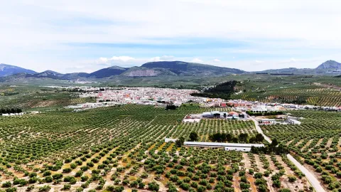
  • Convent of the Barefoot Carmelites of Real Mancha. From this convent, founded by San Juan de la Cruz in 1586, is preserved a small part of the facade, a canvas divided into three sections by pilasters, the smooth sides and the central with the door. It consists of a half-point arch on imposts with highlighted key and jambas supported in the zócalo. The axis of the pilassas is crowned with pyramidal pinacles.
  • Torre del Risquillo. They are remains of a bajomieval tower (tower of the homage of the old castle), probably from the 13th century that conserves 4 m high and is located on a small hill a few meters from Cortijo Risquillo.
  • Castle of Ríez. It is integrated into the Cortijo de Ríez, and is an ancient fortress existing in the Auringi countryside. It is erected next to the Roman road from Guadix to Catulus. This fortress was destroyed by the northern barbarians who left only the foundations. In the time of Fernando III, the Holy One was rebuilt by the Arabs and looted and burned. He protected Baeza's path with Jaén.. At the foot of the remains of the enclosure are various archaeological pieces such as a mill and a catapult bullet. It's been declared Good of Cultural Interest.
Naturaleza

The municipal term of Royal ink consists of 98.78 km2 surface, with a height of 757 m above sea level. In general terms, we can say that it is an agricultural municipality, right on the border between Sierra Mágina and the southern countryside of Jaén, where the areas covered by the crops, mainly olive trees, dominate.

The highest altitude areas are located in the south of the municipality, in the foothills of Sierra Mágina, The Morron with 1540 m. and the White Mojon with 1495 m altitude, are the ceilings of the municipality. In the term of Real Mancha, they are distinguished four ecosystems:: forest and forest land, agricultural ecosystems, rivers and humid areas and modified ecosystems.

The forest ecosystem is located in the South of the municipality, where pine, oak, oaks and complaints predominate. In agricultural ecosystem the dominant species is olive, as well as other arable or cereal crops.

The wetlandsnear the river basin, in Mancha Real, have an extension lowwhich would be located to the north, near the Guadalquivir River.

The modified ecosystems would be made up of those areas where removed indigenous vegetation to dedicate it to olive crops or recreational areas.

The fauna of the term the small game cynetic species, hares, clumsy pigeons, rabbits, partridges, badges; olive fauna: carbonaries, cobblestones, owls, cernikals, hawks...; and reptiles: lizard, hocucuda viper, salamanchees, creams...

Eagle Peñaan area of environmental interest:

Although it is outside the limits of the Natural Park, the Peña del Eagle saw, it can be considered as entrance door to the Natural Park of the Sierra Magina.

With the recently conditioned access and trails, it offers us the possibility to make a circular route that will allow us to observe the fantastic panoramic of many points in the province, while we discover the vegetation that dominates this area.

On the rise we will crown The Morron and The White Mojónfrom where we can see El Almadén and El Aznaitín as representatives of Sierra Magina. A good choice is to get close. to the recreational area from where we'll get some spectacular views of the municipality from Real Mancha.

Fiestas y Eventos

The festival of Mancha Real is wide and unique, from which we highlight the following celebrations:

  • San Joséon March 19. The importance of the wood sector is felt the celebration of the day of San José, patron of the carpenters, and in its honor a monumental failure in the style of the Levine. A party that is considered to be of Regional Tourist Interest.
  • Holy Week. During Holy Week, the four cofradies of the town process through the streets of Mancharrealeña reminiscent of the Passion of Jesus.
  • San Marcoson April 25. Real Mancha pattern.
  • The "Monkeys." The 2nd and 3er September Sunday. A party with an ancient tradition in which there is no lack of procession. The night before they gather in the square and go all over the town singing some popular coffins (16th and 17th centuries), inviting people to participate the next day at the party.
  • Romeria and Feria in honor of the Virgin of the Rosary. The Romeria, which has no specific date, is held for a weekend. The people of the village go up to the hermitage and encampa all weekend in the surroundings of the sanctuary of the Virgin to accompany her. The Saturday Mass is held in the sanctuary to which all the rosemary people attend. The Sunday The transfer from the Sanctuary to the Church of the people takes place. After the Romeria, in the following days the Fair is held in on the 7th of October, day of the Virgin of the Rosary. In those days the "target" morning or the most diverse attractions for big and small.
  • The Immaculate Conceptionon December 8. It's the Patrona de Mancha Real.
Gastronomía

In the municipality the industry of making sausages, where natural products preserved in oil have been processed, stands out. One of the most popular is the morcilla. The basic ingredients are: pork butter, onion and pig blood; and the main fences: sweet pimenton, cinnamon, nutmeg, nail, caravan, salt, oregano and optionally the thyme.

The typical dishes coincide with those of the Sierra Magina region and all of them revolve around olive oil:

  • The Calandrajos. They have as ingredients water, flour and salt for wafers. In the frying pan a saffrito of tomato, garlic, onion, green pepper, a little spicy and rabbit, hare or partridge. When cooked the meat is added the wafers and let be boiled. They're served in the same pan.
  • The Migas. It was a dish used to take advantage of hard bread. They are fried in a frying pan of garlic teeth, to which the bread is added until it is touched. The crumbs are usually served with fried peppers, torreznos, sardines, grapes and melon.
  • Pipirrana: a salad in which tomatoes, cooked eggs, green peppers, onions, tuna are chopped...
  • Gazpachos, which carry almost the same ingredients as the piirfrog, but are batted and left with the liquid presentation.

In the pastry shop:

  • The Sweet Gachas. They are made from roasted flour, bread, milk, cinnamon, sugar, olive oil and matalahúva or anis. They're typical of All Saints Day.
  • The Boring. Made with a bread made of oil and egg cooked in the center. It's consumed on Easter.
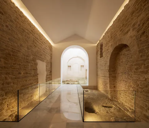
  • The Drinks. Oil, wine, flour, a little anise and sugar.
  • Other: Roscos, gusanillo...
Historia

The first signs of human presence on the lands de Mancha Real go back to Paleolithic, in the settlement of the Soguero. In Neolithic, V and IV millennium BC and the Bronze age, III millennium BC, there was a proliferation of settlements in the area, including those of Piedras Gil, Cerro Moreno, Cerro Alcalá and Peñaflor.

From the Iberian stage has been recorded in the settlements of El Toril and Las Casicas. From the Roman times is located in Cerro Alcalá la Ossigi Latonium.

During Islamic period the area was populated by small villages or houses; one of them is that of Peñaflora which had between 20 and 30 houses.

After the Christian conquest, this population was kept scattered around control towers, including Peñaflor, Requillo, the Sordo Tower, etc.

The current core population was founded by Carlos V in 1537 and the villa took the name of The Jaén Manchuelafor being dependent on this city. The reason for its foundation is in the process of repopulating these lands after the completion of the Reconquista for the defense of the roads.

The boom and consolidation of the population, determined the struggle for Jaén's independence. Philip II, 1557, granted the title of villa and thus the independence of the city of Jaén, not without having paid the amount of 58,000 reais.

The importance that La Manchuela de Jaén acquired is a testimony to the stop on the regio journey of Philip IV in 1653which led the jurists of the village, in thanks to the king for his visit, to decide that they will henceforth be called e Real-time.The population continued to develop to 11264, and today it is a people, for its industry and agriculture, with a hopeful future.

Loading map
Preparing points of interest and routes...
Imagen principal
imagen
Image
Mancha Real
Imagen principal
Activado

Linares

Submitted by brandcode_deweloper on
Id
741239
Perfil de redes sociales
Facebook
https://www.facebook.com/TurismodeLinares
Twitter
https://twitter.com/TurismoLinares
Youtube
https://www.youtube.com/user/turismolinaresofi
Descripción
Breve descripción

This popular and important city is located to the north of the province of Jaén, in the first foothills of Sierra Morena and close to the depression of the high Guadalquivir. It enjoys a privileged geographical location as a road crossing close to the main roads of the south peninsular.

Linares has amining heritageof the most important and best preserved in Spain. In their lands it is common to see remains of chimneys and other industrial vestiges, silent witnesses of a past of mining splendor that left in Linares an architecture linked to industry and to bourgeois and proletarian society.

The basilica of Santa María la Mayor, a mixture of Gothic and Renaissance style, or the Marquis hospital, of a neo-Gothic style, are two good samples of its artistic heritage.

Especially interesting is the archaeological legacy of the archaeological ensemble of the Iberian city of CatulusJust five miles from the city. It was in Roman times one of the ten most important cities of the Peninsula, thanks to its mines of lead and silver, of which today there remain vestiges as important as the mosaic of the Amores, the mosaic of the Octogones, a palleocrist of glass of the 4th century or the sculpture of the Lion, of the IIa centuries. C.

On the other hand, Linares owns a remarkable monumental ensemble, as well as the owner of an accused and musical character. The bullring square of Santa Margarita, located on the side of the emblematic promenade of Linarejos, has witnessed great afternoons and tragedies such as the death, in 1947, of the right hand Manolete. In addition, the city in which the famous guitarist Andrés Segovia was born has a long musical tradition linked to the taranta, a flamenco song born around mining.
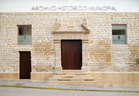
The La Garza golf course is the only one in the province of Jaén. It is located a few kilometers from the city, in a privileged enclave with the mining landscape as a backdrop.

Telecomunicaciones
Teléfono
953 648 810
Sitio web
www.ciudaddelinares.es
Fax
953 648 813
Correo electrónico
ayuntamiento@aytolinares.es
Ubicación
Nombre
Linares
Latitud
38.092880
Longitud
-3.635550
Distrito
Municipio
Ubicación en el mapa
POINT (-3.63555 38.09288)
Imágenes
imagen
Image
717b4559-d8aa-43fd-4c6c-9c08a1541fd7?t=1620666050927
Imagen principal
Desactivado
imagen
Image
e4f5be42-25eb-8780-b90c-b1581819c8ba?t=1620666050609
Imagen principal
Desactivado
imagen
Image
39d78aac-4357-f5c4-91ae-a3d9d63960dd?t=1585838352419
Imagen principal
Desactivado
imagen
Image
703abb91-4bea-1ffb-3037-438af2c5bb18?t=1585838354473
Imagen principal
Desactivado
imagen
Image
42160d5d-b5b9-5fa8-da43-ff885202d248?t=1620666050784
Imagen principal
Desactivado
imagen
Image
5cb04542-9fff-58cb-7826-c022d4be2e83?t=1620666050980
Imagen principal
Desactivado
imagen
Image
278f0651-1ac2-64cb-c271-07d8e3a236e0?t=1585838353321
Imagen principal
Desactivado
imagen
Image
d28ffb7b-e8b5-2882-e0d7-b55f650ecb22?t=1620666050684
Imagen principal
Desactivado
imagen
Image
4a291902-03f8-1724-b60a-6cf3613c0eec?t=1620666050832
Imagen principal
Desactivado
imagen
Image
c7bc271c-c88c-b709-bb90-1ee3ea569ef8?t=1585777337631
Imagen principal
Desactivado
imagen
Image
de6c8ca4-32fa-3650-f257-539779c5466c?t=1603125039699
Imagen principal
Desactivado
imagen
Image
0e513dc5-1b59-8502-fbbe-4fb055c3a80f?t=1620666051035
Imagen principal
Desactivado
imagen
Image
663b4497-8d8e-f89e-2699-1b166c9c5197?t=1603138489292
Imagen principal
Desactivado
Información adicional
Curiosidades

ÁREA DE TURISMO
Iglesia, 5 – 23700 Linares, Jaén
Tel.: 953 10 01 83
http://www.turismolinares.es/
Email: turismo@aytolinares.es

Imágenes cabecera
imagen
Image
Linares
Imagen principal
Desactivado
Datos de interés

Touristic area: Sierra Morena / Jaén Toro Culture / Linares- La Carolina / Sierras de Andújar and Despeñacolos
Distance to the capital (km): 49
Altitude over sea level (m): 419
Extension (Km2): 196
Number of inhabitants: 57,414
Gentilicon: Linarians
Postal code: 23700

Videos
Video file
Cultura

Linares has a varied set of buildings (churches, palaces, solariegal houses) of different styles and times, from the simplicity of the Romanesque to the preciosism of the modernist buildings of the 19th and 20th centuries linked to their past of mining splendor.

The Basilica of Santa Maria la Mayorbuilt during the 13th to 15th centuries, with a mixture of Gothic and Renaissance styles, it has a beautiful silver altarpiece.

The city of Cástulo It has a historical trajectory of more than 4000 years, a history in which the presence and influences of Mediterranean cultures have been reflected, which have left their mark on the site and its territory. Cástulo offers us a heritage that we gradually recover from archaeological research, a legacy that we must know and protect.

The city has also not wanted to forget what its past was, good proof of it are the museums we found in it: Archaeological Museumin which the remains of previous civilizations that occupied these lands are preserved, and the Centre for the Interpretation of the Mining Landscapewhere we find samples of the mining works, pieces and videos on the location of the mining heritage in the region. And with the statue of the Miner, the inhabitants want to pay tribute to the generations who laid the foundations of the city that today is Linares.

The Casa - Museum of Andrés Segoviaor Raphael MuseumWe are reminded of illustrious people who took the name of Linares all over the world.

Naturaleza

As it is located in the first foothills of Sierra Morena, Linares has a beautiful natural location and enclaves.

The spaces of greatest landscape value are found to the north of its municipal term. The best example of this is the natural monument of "The Bat.". To the spectacular tour of the river Guarrizas during its high course, the beauty of the Roman bridge of Vadollane, which is part of the Via Augusta.

Linares enjoys an extensive network of trails of a small route duly marked that they travel part of their natural and mining heritage, and that they can be visited on foot, on horse or by bike, adding one more incentive to the visit of this area. Sendas that complement with "Green routes"whose tracks take advantage of the old railway tracks.

The set of plant species in the municipality of Linares is distributed in three well-defined spaces:

  • The countryside, on which much of the surface is intended for olive trees and dried cereals.
  • The dehesas, for livestock use and in which the tree species that stands out is the oak.
  • The pastures, little or no trees, which are used for cattle pasture or grasses or forage.

Next to the rivers Guadalimar, Guadiel and Guarrizas we find the vegetation called the riverside: strawberries, willows, white wings...

Fiestas y Eventos

Among the most rooted parties in the tradition of the Linarians, we have:

  • Holy Week, declared as the National Tourist Interest Party of Andalusia, a week with a mixture of party and veneration.
  • San Agustín Fairalong with Holy Week is Linares' most important holiday. They take place between August 27 and September 1. Among the most diverse activities, there are also bullfighting in the Santa Margarita.
  • Ibero-Roman Festivals of CatulusMay. A wide range of programming and activities immerse the city of Linares and the Archaeological Set of Catulus in its Ibero-Roman past. Historical recreations of a Roman circus, camps, workshops, parades, combat tactics, gastronomy, guided tours and gladiator struggles, among others, are the sign of identity of this tourist-cultural event.
  • Santa Barbaraon December 1. In these days Linares wants to remember his past mining with different demonstrations of trades in the mine and other activities for all ages that includes a multititling road through the mining district.

In addition to these most named, the May Crosses, Christmas, Carnival and the party of VoteIt's next to the hermitage of Linarejos.

Gastronomía

Linares has made the Tampoo a delicious sign of identity and one of the city's greatest attractions. Tabernas and bars fine-tune their ingenuity to make the exquisite tapas culinary miniatures that never fail to accompany the drink for free.

The Spanish gastronomy is very linked to the gastronomy of the province: olive oil as a common denominator of its peas and salads, not to mention sour olives, which are common as an appetizer. Among the most traditional are: gazhas, migas, gazpacho, andrajos, pipirrana and anis roses.

It also has others of clear mining descentsuch as potatoes with cod, potatoes with pimenton, mining and soaking based on orange salad, cod, olives, onions and olive oil.

In the letters of the Linarian restaurants, tradition, variety and innovation are given hand, and the most intense flavors are made of. It stands out among its local creations, the characteristic white sweet chachepol, a delicious biscuit soaked in syrup and spirit.

Historia

The history of Linares has always been very linked to the mining. The lead filons of their lands attracted different peoples and cultures to this enclave. It was a claim for the Tartessa, Greek, Phoenician, Carthaginian, Visigodic and Arab peoples. Of all of them, archaeological vestiges have been found in the area.
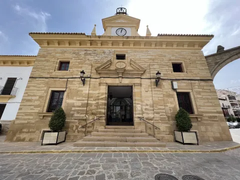
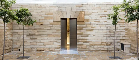
Within the municipal term was founded in the 6th century BC the Iberian city of Catuluswhich would later become the capital of Oretania (a large territory that also included areas of Ciudad Real and Albacete) with great mining, agricultural and flourishing trade wealth.

They would also exploit these mines for the extraction of lead and silver. To ensure control of the main mining sites, General Anibal took the Princess Ibera Homily (born in Catulus), but without success, as the Carthaginians were defeated.

The Romans will magnify this city through all kinds of privileges (such as the continued coining of their own currency), making Catulo a city with first-class infrastructure such as hot springs, aljibes and even a forum and an amphitheater. The wealth of Catulus was such that chronists of the size of Estrabón, Polibio, Plinio el Viejo or Tito Livio speak of it in their writings. With the wars, Cástulo disappeared, and the population took refuge in the atalaya of the mines, becoming dependent on Baeza. The current city owes its name to a place close to Cástulo, called Linarium.

Liners it does not appear in the historical archives until 1155, reign Alfonso VII, which at that time was a village that depended on Baeza. In the mid-16th century, thanks to agriculture and livestock, commercial activity and the population are increasing, giving Philip II the title of villa. During the 17th and 18th centuries, mining activity increases considerably and focuses on lead extraction.

As early as the 19th century, the city is considered one of the most important centers in the province of Jaén. With the arrival of the new machinery and mining techniques, as well as the development of the rail as a means of transport of the mineral, Linares reaches its further progress. The intense mining activity attracts migrants to the new jobs generated by mining and makes the population more than six-fold in a short time. In 1875, King Alfonso XII granted him the title of city.

The mining area Liners - The Carolina would become the first producer of lead of the world. The first labour movements are emerging as a result of wage inequalities between workers and employers.

But in the 20th century, mining activity is beginning to decline to the point where all mines are closed. In parallel, a powerful industry, of which Santana Motor It's the flagship.
With the arrival of the 21st century and the end of Santana Motor, the activity of the city is focused on the services as one of its main economic axes.

Otra información

There are many people born in the city of Linares who have had an outstanding career in their professional activity:

  • Andrés Segovia, guitarist and composer.
  • Raphael, singer.
  • Sebastian Palomo Linares, bulldozer.
  • Carmen Linares, flamenco singer
  • Francisco Baños, plastic artist.
  • Miguel Ángel Belinchón Bujes, Belin, plastic artist (grapher).
Loading map
Preparing points of interest and routes...
Imagen principal
imagen
Image
Linares
Imagen principal
Activado

La Guardia de Jaén

Submitted by brandcode_deweloper on
Id
739432
Perfil de redes sociales
Twitter
https://twitter.com/laguardiadejaen
Instagram
https://www.instagram.com/LaGuardiadeJaen/
Descripción
Breve descripción

Small municipality located in the west of the Sierra Mágina region, a few kilometres from the capital. The urban core, located at the eastern end of the Cerro de San Cristóbal, looking at the Guadalbullion River, conserves the tipism of its white houses and its steep and narrow streets.

Among the natural enclaves of interest of La Guardia are the Cerro de San Cristóbal, whose summit is repopulated with pine trees, and the Vega of the Guadalbullón river itself, which continues to preserve an abundant riverside vegetation.

La Guardia offers many possibilities for walking, horse or bicycle excursions, such as the Cañada del Santo or the banks of the Guadalbullion River. Of archaeological interest are the settlements of Guadaola (period of emiral), the Roman villa of the Yuca, or the different Ibero-Roman necropolis of Las Eas de San Sebastián and Barranquillo.

The castle, of Arab origin, which was remodeled as a palacio-citadel by the Messias in the 14th and 15th centuries, is the main architectural jewel of the town, along with the parish Church of the Assumption, a work of the 16th century that was originally convent of the Dominicans.

Telecomunicaciones
Teléfono
953 327 100
Sitio web
www.laguardiadejaen.com/
Fax
953 327 100
Correo electrónico
ayuntamiento@laguardiadejaen.es
Ubicación
Nombre
La Guardia de Jaén
Latitud
37.742970
Longitud
-3.695140
Distrito
Ubicación en el mapa
POINT (-3.69514 37.74297)
Imágenes
imagen
Image
9f2f7fe1-a2e3-2526-e4c0-a2eb7280a6c5?t=1619533436230
Imagen principal
Desactivado
imagen
Image
8b59eaa2-d788-aed5-41ef-2192c85235ad?t=1619533436351
Imagen principal
Desactivado
imagen
Image
14f0c086-e569-5556-8020-16841cd1ee8e?t=1619533436430
Imagen principal
Desactivado
imagen
Image
9207c7d4-f324-733d-8c04-aefef5419649?t=1619533436560
Imagen principal
Desactivado
imagen
Image
f2cc53fd-32de-a38a-bb84-c117db911ddb?t=1619533436616
Imagen principal
Desactivado
imagen
Image
2a63b17a-f270-00f3-7dee-1fc530826cce?t=1585673921591
Imagen principal
Desactivado
imagen
Image
4f197d68-aa37-4f2a-a768-56d87694e115?t=1585673920649
Imagen principal
Desactivado
Imágenes cabecera
imagen
Image
la guardia
Imagen principal
Desactivado
Datos de interés

Tourist area: Jaén and Environment
Distance to the capital (km): 10
Altitude over sea level (m): 645
Extension (Km2): 38
Number of inhabitants: 4465
Gentilicon: Guards
Postal code: 23170

Videos
Video file
Cultura

The most important monuments of La Guardia are:

  • Castle of the Jaén Guard. It is a fortress of considerable dimensions, settled on Iberian vestiges. Most of its defensive structure was built in the period of Al-Ándalus, with subsequent remodeling, mainly of the alcázar to serve as a church or palaciega residence in the 15th and 16th centuries. From the Tower of Tribute a stunning panoramic that shows us Sierra Magina, Sierra Morena and the fields of La Loma.
  • Old convent of Santo Domingo. The church is the best preserved building of the Old Convent of Santo Domingo de La Guardia, the rest being in advanced state of ruin or hidden by the reforms of the last century when it is occupied by an almazara. After the deamortization and abandonment of the church of Santa Maria on the grounds of the castle, the church of the convent was converted into Parish of Our Lady of the Assumption.Decoratively, the temple is of a pure classicist style, typical of the Vandelvira of the second half of the 16th century, hired in 1542 by the Dominicans for its project and execution. With a one-ship Latin cross plant, respecting the patterns of the Dominican order, it stands out its header, in which the date of 1556 is recorded. A Renaissance work of great beauty that has been declared Artistic Historical Monument, protected as Good of Cultural Interest in 1975.
  • Public laundry of the Second Republic. A place with a special charm, in which it still seems to be impregnated by the atmosphere that the people occupied in daily hygiene created every day. The utensils they used and which have been donated by the neighbors can still be seen in it. On the first floor is the Fountain Lavadero Museum.
  • Set Plaza Isabel II. It's another major enclave in La Guardia. The historical set was built to illustrate the greatness of the Marquise granted by King Philip II in 1556 to the first Marquis of La Guardia, Gonzalo Messia Carrillo de Fonseca.

The square concentrates several monuments concerning the 16th century and the Renaissance:

  • The Source of the five years, they are bronze and they used the water of a local spring.
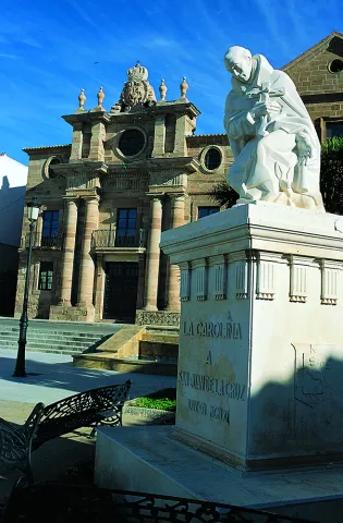
  • The Source of Mary Magdalena, a central fountain topped with a sedent virgin that belonged to the ancient convent of the Dominicans.
  • Sole house of the Ochoa familywhich was built in 1813 and which seems to preside over the square.
Naturaleza

The Jaén Guard is a town on horseback between Sierra Sur and Sierra Mágina.

Since privileged area at 635 m altitude The Guadalbullan River is dominated in its search for Guadalquivir, Sierra Morena, Sierra Mágina and the fields of the region of La Loma, most of which are populated by olive trees.

Its vegetation in the high area, slopes and top of Cerro San Cristóbal, is the one of the Abrupt and steep land, highlighting the repopulation pines on the top and slopes of the hill, as well as shrubs and aromatic plants. The rest of the land is colonized by olive trees except for the area of the Vega del Guadalbullón on whose fertile land fruit trees, cereals, maize and vegetables grow.

The fauna is the characteristic of the small hunt: hares, rabbits, partridges, foxes and numerous rapacious birds nesting on the steep rocks of the hill. In the area near the river, the typical avifauna of the gallery forests.

The best way to get to know this area and discover the living nature is to walk one of the many paths that are serpentating for its municipal term. One of the most representative and best panoramic on the region is the so-called "San Cristobal Hill Path."

The path ascends by the area of Monte Prieto, and descends by the vicinity of the Peña de San Cristóbal, the point of beginning and ending being the municipality of La Guardia itself. We will find the impressive coat of Cave, with remains of human occupation from the Neolithic. At the flat summit of the Cerro de San Cristóbal you can enjoy a pleasant walk between the pines. The north and south slopes have spectacular views, being authentic natural views of the mountain reliefs of the south and the province of Jaén.

Fiestas y Eventos

The set of parties held in La Guardia, the Guardeños are grouped into two blocks: the major parties (San Sebastián and Divina Pastora), and, on the other hand, the rest of events and celebrations.

  • Celebrations in honor of San Sebastián. He is the patron of La Guardia and are the most loved by the neighbors, and especially by those who emigrated and return to their own in these days of feast. The 20 January and last from the 19th to the 22nd. It is a feast of agricultural origin, and the tradition consisted of taking the image of the saint to the ages, the place where the harvest was torn.
  • Fair and Festivals of Our Lady The Divine Pastor. The day is celebrated 10 August and its origins are related to the world of agriculture and the blessing of crops and crops.
  • Fair and Festivals of our Patron Our Lady of the Rosary. They take place around the first Sunday of Octoberand are characterized by one of the oldest traditions: the Song of the Aurora Or just La Aurora. It consists of the departure of a group of people, the "auroros"in the early morning, accompanied by musical instruments, they go through the streets of La Guarda singing to call the brothers of the brotherhood to the prayer.
  • Romeria de San Sebastián. The Third Sunday of May in honor of the patron saint, a tradition of more than four centuries. It is held in the natural area and recreational area called "Allanadas del Santo." The rosemary begins with the transfer of the image of the saint to his hermitage, located in this place. In the morning the Mass is held, and in the afternoon the saint is processed in the surroundings of the hermitage.
Gastronomía

La Guardia's gastronomy presents a wide variety of flavors, textures and ingredients, whose secret lies in the Arab reminiscent of typical recipes. A whole culinary mosaic that has been enriched throughout history to this day.
Among the most typical dishes, we highlight:

  • Wigs: is a stew made with wheat cakes, clams, bowels, meat and different vegetables.
  • Cod, a typical dish that is consumed especially at Easter.
  • CatsThe bread is added chorizo, ham, peppers... and other ingredients that change depending on the time of year.
  • Pomegranates.

They are also made sweets that are typical of this locality:

  • Pumpkin, the dessert par excellence of La Guardia. It is made with pumpkin, pepper and sugar.
  • Gusanillo, a typical gardena confectionery.
  • Sweet peas, which are consumed on the Day of All Saints, on November 1.
  • Other: fried rosses and Peach punch.
Historia

The San Marcos slope The Guard is a strategic enclave, a silent witness to the different peoples and cultures that have passed through this place. The remains that have been found thus attest to it from the Neolithic to the present. For this reason, La Guardia is known as "Cult Gate."

Apart from its important border role between Castile and Granada, what really distinguishes La Guardia from other border areas is the location of a ancient and illustrious population settled in the current location For centuries. The Guard was an important Iberian oppidium called Bastia lie About 1500 years ago.

During the Roman era it will reach its highest splendor. He was known as the Great Mentess. A strong, economic, social and political city. With a population that reached 5000 mentesans. They exploded the gold from their mines, which came to Rome, and coined coins.

With the Muslim invasion In the eighth century, the city was looted and burned. It will be during this century when the construction of the castle's defensive structures begins.

In 1244, Fernando III El Santo conquered the city and again became a defensive bastion of Castile in the Guadalbullion Valley until the conquest of Granada.

With the taking of Granada and the loss of value as a strategic and defensive position, it begins its stage of peace and immerses itself in the Modern Age.

Family Messiah is established here in the 16th century, modifying the castle to adapt it as a palaciega residence, reusing the existing tower as a church dedicated to Santa Ana. The bell tower is built on it and will be the Parish church until the mid-19th century.

Also in the 19th century, the Ochoa family sits in the municipality and decides to build a solarium house next to the fountain of the Pilar de los Messia.

Little remains of the glory of Mentesa, since since the 19th century its main sustenance was agriculture and oil and flour mills, an economy that precipitates the migrations of the people during the post-war period.

At present, its situation near the capital has encouraged the revitalization of the municipality.

Loading map
Preparing points of interest and routes...
Imagen principal
imagen
Image
Castillo La Guardia
Imagen principal
Activado

La Carolina

Submitted by brandcode_deweloper on
Id
739288
Perfil de redes sociales
Facebook
https://www.facebook.com/AyuntamientoLaCarolina
Twitter
https://twitter.com/aytolacarolina
Youtube
https://www.youtube.com/channel/UCBY6A3TaSP3JqhViYdshufw
Instagram
https://www.instagram.com/ayto_la_carolina/
Descripción
Breve descripción

La Carolina is a city at the foot of Sierra Morena and the Caraway, natural mountain port that links Castilla with Andalusia.

Its area is made up of extensive olive trees, but also the dehesas and the half-mountain areas populated by oak and pine trees. It is easy to find abandoned mine chimneys, clear signs of their past related to this activity.

It was the capital of the New People of Sierra Morena, a political project by the enlightened king, Charles III, in 1767. The main objective was to colonize and take advantage of the lands of Sierra Morena and to provide security to the mountain port, as it was a very unsafe place, where bandits and malefactors were camping. The population is made of settlers who came from central Europe, France and Germany mainly. A close collaborator of King Charles III, Pablo de Olavide, would be appointed responsible for the project, with the title of Superintendent of the New Populations of Sierra Morena.
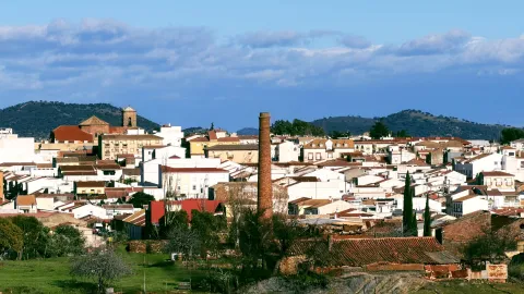
The municipality of La Carolina is composed of five population centres: La Carolina, as main, Navas de Tolosa, La Fernandina, la Isabela and the Guindo. It is surrounded by natural areas such as the nearby Natural Park of Despeñacolos, the Fernandina reservoir or the small urban nucleus of the Guindo, which evokes its mining past.

In its artistic heritage are: The Palace of the Intendente Olavide, in Baroque style; the parish church of the Immaculate Conception, the seat of the ancient Carmelite foundation of San Juan de la Cruz, the Torrecillas del Molino de Viento and the Torres de la Aduana.

Telecomunicaciones
Teléfono
953 660 034
Sitio web
www.lacarolina.innovasur.es
Fax
953 681 626
Correo electrónico
info@lacarolina.es
Ubicación
Nombre
La Carolina
Latitud
38.274240
Longitud
-3.615270
Distrito
Municipio
Ubicación en el mapa
POINT (-3.61527 38.27424)
Imágenes
imagen
Image
f91faa0d-bd7e-a921-740d-33c048ef2e8f?t=1619532688353
Imagen principal
Desactivado
imagen
Image
1aacd6bf-6d2b-6336-9456-d95923815de8?t=1594142871900
Imagen principal
Desactivado
imagen
Image
9e49b509-9667-17c5-697b-fc861d03bf8c?t=1619532688419
Imagen principal
Desactivado
imagen
Image
e2b43921-6f14-e958-7cb1-de980f088f48?t=1594142869986
Imagen principal
Desactivado
imagen
Image
131f904e-ba6e-379c-daec-e19a7d0d88b4?t=1619532826514
Imagen principal
Desactivado
imagen
Image
4b85bd84-f1c0-34bb-d56a-a343c5bea6c1?t=1619532688547
Imagen principal
Desactivado
imagen
Image
07cad3d1-017c-774f-16d7-c166133050a9?t=1619532688596
Imagen principal
Desactivado
imagen
Image
fc7e8a03-c91f-3245-be11-c83899c22fe4?t=1603128351869
Imagen principal
Desactivado
Información adicional
Imágenes cabecera
imagen
Image
La Carolina
Imagen principal
Desactivado
Datos de interés

Tourist area: Sierra Morena / Sierras de Andújar and Despeñacolos
Distance to the capital (km): 66
Altitude over sea level (m): 595
Extension (km ²): 201
Number of inhabitants: 15,261
Gentilicon: Carolinenses
Postal code: 23200

Videos
Video file
Cultura
  • The municipal term of La Carolina is full of archaeological vestiges from Prehistory. Places like La Calera, El Minado or El Ochavo, so they testify. We met with Rupéstre art fields like Dona Lady, the Puntal or the Guindo. And also former mining holdings, mainly Roman, like Fountain Spis, or El Guindo.
  • The Church of the Immaculate Conception, built as a church of the convent of the barefoot Carmelites of the Peñuela, after the Colonization it is extended to serve as a parish to the nascent population. It has undergone several reforms over the years, and in 1899 the tower was built.
  • Palacio del Intendente Olavide, which was the residence of Mr Pedro Olavide, executive of the Sierra Morena Repopulation project. It was built in 1775, in neoclassical style and is located in the center of the village, right next to the parish church.
  • La Carolina Museum,The Centre for the Interpretation of the History of Mining in the New Populations of Jaén, integrated in the majestic building of the Palacio del Intendente Olavide, offers countless possibilities of knowledge, culture, history and research of the city, with the latest technologies, an unbeatable infrastructure and a human team that make it an inescapable cultural and tourist resource when visiting the city.
  • The Customs Towers, neoclassical style and airy architecture flank the main entrance to the city coming from Madrid.
  • Castillo de Navas de Tolosa: For more than two hundred years, it served as a defense and vigilance for the Muslim kingdom of what we know today as the passage of Despeñacolos, once Paso del Muradal. Today the silhouette of its tower stands out in a typical Sierra Morena dehesa in which you can also see braves.

Other monuments of interest are:

  • Hermitage of San Juan de la Cruz.
  • Monument to San Juan de la Cruz.
  • Old jail.
  • Monolitos de la Fundación.
  • Monument to the Battle of the Navas de Tolosa.
  • Mining heritage.
Naturaleza

Its enclave at the foot of Sierra Morena and at the limits of the Natural Park of Despeñacolos, makes La Carolina a municipality especially attractive to nature lovers. The visitor has the opportunity to enjoy a landscape full of contrasts, with steep mountains and wide dehesas, on which it is easy to see majestic birds.

The cultivated land represents only 10% of its extent, mostly dedicated to olive trees. The main agricultural activities are the cultivation of olive trees, livestock and hunting, greater and lesser. It also highlights its mining landscape, heritage of an industry that supported the life of the Carolinians: remains of abandoned mines, lavatories, remains of smelters...

The vegetation is very abundant and heterogeneous: olive, oak, cork, chestnut, eucalyptus, alms and oaks. The fauna, both in larger game animals (boar, goose, cords, reels...) and smaller (rabbits, hares, parrots, quail) is very abundant. There are also cattle of wild cattle, sheep and goats.

Part of the term La Carolina covers the mountains of Sierra Morena to the north, while towards the south the landscape becomes adhesitated, thus offering beautiful and contrasting landscapes. In the area of saw, the highest peak of the mountain range, La Estrella, with 1,300? m altitude. The nearby Natural Parks of Despeñacolos to the East and the Sierra de Andújar to the West.

To the South, the Embalse de La Fernandina allows sports fishing and presents beautiful images of the Mediterranean forest, being an ideal place for the development of a rich extensive livestock.

The villages abound in their term as well as the natural sites, making La Carolina a municipality of special human and natural appeal. It has three urban cores or pedanias, these being:

  • The village of Los Guindos, to the north of the term and in the surroundings of the saw, evokes its mining past.
  • Aldea La Fernandina: presents one of the simplest traces of the New Populations, of rectilinear and orthogonal design.
  • Aldea La Isabela: The route of this village, presents reminiscent of the European city of the Enlightenment.
Fiestas y Eventos

In addition to the Christmas and Carnival celebrations, the most rooted celebrations in the town are as follows:

  • Festivals of the Foundationthey are held from 3 to 5 July, in an attempt to link present and past from La Carolina, to value in a fun way its history, traditions and origin. The acts include the reading of the court and the tribute to the Colonoan act to claim the persons who still keep foreign surnames.
  • May Fair, has its origin in a cattle party that is very famous and that competed with the most important in Spain. A Selected livestock morphological competition (berrenda cow, seaweed sheep and serrana goat)
  • Festivals of San Juan de la Cruz, Patron from La Carolina. The last weekend of November is held. The tradition of Shake a live pig after the celebration of the Eucharist.
  • San Carlos Borromeo, which is celebrated on November 4 and is also co-patron of the city.
  • Romeria de San Isidroon the 15th of May, and is celebrated with a Romeria to the natural area of La Aliseda, a beautiful recreational area that is located in the village of Santa Elena, at the foot of Despeñacolos.
  • Carnivals, of the most renowned in the province of Jaén.
Gastronomía

Hunting is very present in the local gastronomy, so among the most traditional dishes we have:

  • Monkey meat, first adobada and then stew in sauce.
  • Pate of perdiz, typical Jaén dish that was born on these lands.
  • Scattered perdiz, a dish that can get cold.
  • Chickpeas, which is consumed preferably in Lent.
  • Migas and Pipirrana.
  • Jars with hare.
  • Trick asparagus.
  • Cod wet.

In the pastry shop, the following are typical:

  • Sweet gazes of the holiday of All Saints.
  • Summer gazhas: with fish and peppers, according to the recipe of the miners who came from Almería and Granada.
  • Oil nuts, Rice with milk, fried milk and drunks.
Historia

In the 18th century, the enlightened king Carlos III and its ministers (Aranda, Jovellanos and Campomans) decide to create the New Populations in Sierra Morena. At the head of the repopulation he put the Superintendent Pedro Olavidewho would be responsible for the settlement of settlers from France, Germany, the Netherlands and Switzerland.

In 1767, the The strength of the New Populationsestablishing the regulations and rules governing these new settlements, different from those of the rest of the country. This year, and near La Peñuela, a former Carmelite convent, La Carolina is founded, which would be the capital of all the new settlements in Sierra Morena.

The beautiful city of La Carolina is the best example of the city of Enlightenment. It is known as the City Jewel of the Holy Kingdom. This was designed as a Roman camp; that is, following two axes that are crossed, one from N to S, which is called cardo and another called decumano, from E to O that in the City Hall square is where they are, indicating this crossing the city center, according to the design of Simon Desnaux, supervised by Olavide. The avenues of Las Huertas and Juan Carlos I are the main lines for the division of the land. The result of its urbanization is an orthogonal mesh that divides it into squares, with streets and straight and wide avenues.

In the mid-19th century, La Carolina began the exploitation of its rich Argentine lead filons. Previous mining work already existed, but it will now be when a large-scale exploitation begins that will lead you, in the early and mid-20th century, to become the world's largest Argentine lead producer along with the nearby Linares, under the territorial delimitation of Linares- La Carolina mining district.

This led to a strong immigration of workers from nearby provinces that significantly changed their demography and sociology, even to the birth of populations around these farms such as El Centenillo or El Guindo.

But the mining crisis meant the closure of all the mines in the 1970s. Thus today, the buildings linked to this activity have become part of the landscape as witnesses to its industrial past, being inscribed in the catalogue of the Institute of Historical Heritage of Andalusia.

For a few decades, La Carolina has been in the industrialization sector and is now a city full of future.

Otra información

The village of The Guindsbecause of its geographical location it is a great place to make astronomical observations, especially in the autumn and winter months. In fact, it is included as a Mirador within the "Reserve Certification and Starlight Tourist Destination of Sierra Morena."

Loading map
Preparing points of interest and routes...
Imagen principal
imagen
Image
La Carolina
Imagen principal
Activado