Saltar al contenido principal
icon-intereses-cultura

Hamlet of Miller

Submitted by brandcode_deweloper on
Id
659933
Descripción
Descripción larga

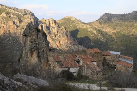
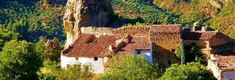
The first written data of Miller dates back to the 12th century, when the Arabs occupied these lands. Since then there has been an intense rural life here, which has been providing various vestiges and constructions. Although it is known that our species walked through these places already at the bronze age.

In the village there was a strong house or castle from which a three-storey tower and a forty-meter long wall by six height are still preserved. It was built by the Arabs to defend itself from the Alphavars in the 12th century. The people of Miller have taken advantage of their structure to build houses or corrals around it.

Life in the villages was made possible by the participation of all the inhabitants in community work and tasks. Not only in terms of basic food and water infrastructure; Miller's church, for example, was built by the villagers themselves in 1857.

We suggest:

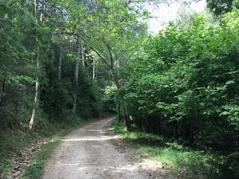
There is a circular path around the village in about an hour and twenty minutes. This small route will give you a complete view of the village and its inhabited cores.

LOCATION

From Santiago de la Espada you have to go along the JF-7038 road towards Las Juntas de Miller that are 22 kilometers away. Once there and before crossing the bridge we take a road on the left where the "central and Miller" are indicated. After 2 km you reach the town of Miller.

Breve descripción

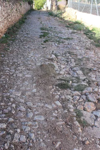
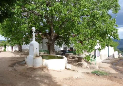
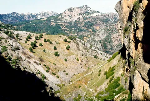
This little village surrounded by green gardens, walnuts and pines is a spring in itself. At least twenty births of water can be found, making the rumor of the waterfalls, fountains and jets almost constant as they walk through it. In its streets you will discover loaves of bread, almazaras, mills, public laundry. An important sample of ethnic heritage that has allowed many generations to survive in this beautiful, though hard, landscape.
Ubicación
Latitud
38.221520
Longitud
-2.473400
Ubicación en el mapa
POINT (-2.4734 38.22152)
Tipos de punto de interés
Imágenes carrusel
imagen
Imagen
522_img.png
Imagen principal
Desactivado
imagen
Imagen
Segura-Cazorla_1976_49.jpg
Imagen principal
Desactivado
Imágenes cabecera
imagen
Imagen
castillo-miller.jpg
Imagen principal
Activado
Loading map
Preparing points of interest and routes...

Hamlet of los Onsares

Submitted by brandcode_deweloper on
Id
3965005
Descripción
Descripción larga

Next to the tributary channel, covered by a thick riverside vegetation, the small gardens of Onsares, between centenary chopos and olive plantations, extend. The village is surrounded by the forest peaks of the Segura mountains, framed by the highest mountains of the territory.

Even it is accessed from Villarrodrigo through a road that crosses the Port of Onsares between the peaks of La Atalaya and El Morrón.

Next to Onsares are the recreational area of the Dehesa del Bear and the imposing Peña del Cambrón, natural view of the saws of Segura and Alcaraz.

Breve descripción

The village ofOnsarsis located in one of the most idyllic landscapes of Villarrodrigo. The river of the same name passes south of the municipal term a bright valley where its traditional farmhouses are scattered.

Ubicación
Código Postal
23393
Latitud
38.458870
Longitud
-2.604820
Distrito
Municipio
Ubicación en el mapa
POINT (-2.60482 38.45887)
Tipos de punto de interés
Imágenes carrusel
imagen
Imagen
onsares.jpg
Imagen principal
Desactivado
Imágenes cabecera
imagen
Imagen
onsares%202.jpg
Imagen principal
Activado
Loading map
Preparing points of interest and routes...

Hamlet of Los Guindos

Submitted by brandcode_deweloper on
Id
2854730
Descripción
Descripción larga

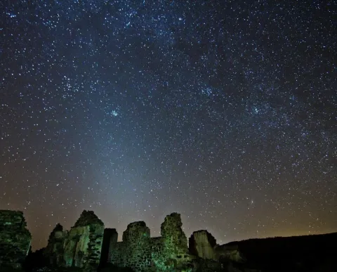
The village of Los Guindos, in the town of La Carolina, has a spectacular north and west horizon, where on winter nights it is possible to observe the elusive zodiacal light.

Especially recommended in the autumn and winter months with the arms of Perseus and Orion hiding in the west.

With easy access and very close to the A-4 motorway, we are facing a magnificent enclave from which to enter into the wonders of the universe within the framework of the Reserve and Starlight Tourist Destination of Sierra Morena.

Breve descripción

The ancient mining complexes in the northern province of Jaén are magnificent observation sites, the presence of ancient mineral loading and discharge structures offer the possibility to install our telescopes in large, barrier-free vents.

Ubicación
Latitud
38.308570
Longitud
-3.683200
Distrito
Municipio
Ubicación en el mapa
POINT (-3.6832 38.30857)
Tipos de punto de interés
Imágenes carrusel
imagen
Imagen
JJG_1255.jpg
Imagen principal
Desactivado
Imágenes cabecera
imagen
Imagen
Aldea de Los Guindos
Imagen principal
Activado
Microsite al que pertenece
Loading map
Preparing points of interest and routes...
Marcas de calidad

Hamlet of Fuentefría

Submitted by brandcode_deweloper on
Id
8146351
Descripción
Descripción larga

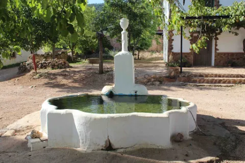
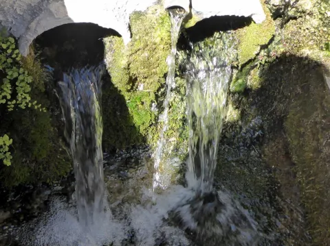
We highlight the source that is located in the centre of the village, where you can reach a track in good condition that leaves south from Collado Mahón (on the road from Torres de Albanchez to Villarrodrigo). The source of the work and with two years pours to two semicircular pillars. The water is the toima of a spring in an olive grove about 300 m south-west.

Breve descripción

In this village we will have the opportunity to contemplate beautiful views of the Natural Park. Near the settlement we can visit the Fucofría fountain, a water spring located at the foot of Mount La Cordera.

Telecomunicaciones
Teléfono de contacto
953 494 005
Ubicación
Código Postal
23391
Latitud
38.415062
Longitud
-2.676886
Dirección
Carretera de Torres de Albanchez
Distrito
Ubicación en el mapa
POINT (-2.676886 38.415062)
Tipos de punto de interés
Imágenes carrusel
imagen
Imagen
fuente%20de%20Fuenfr%C3%ADa3.jpg
Imagen principal
Desactivado
imagen
Imagen
fuente%20de%20Fuenfr%C3%ADa2%20%281%29.jpg
Imagen principal
Desactivado
Imágenes cabecera
imagen
Imagen
fuente%20de%20Fuenfr%C3%ADa%20%281%29.jpg
Imagen principal
Activado
Horario
is
Loading map
Preparing points of interest and routes...

Adelfar del Río Cuadros

Submitted by brandcode_deweloper on
Id
5845551
Descripción
Breve descripción

The natural adelfal of the Cuadros River is probably one of the largest and most important of the Iberian peninsula. In this case they form a curious gallery forest.

Ubicación
Latitud
37.790160
Longitud
-3.407520
Distrito
Municipio
Ubicación en el mapa
POINT (-3.40752 37.79016)
Tipos de punto de interés
Imágenes carrusel
imagen
Imagen
unnamed.jpg
Imagen principal
Desactivado
imagen
Imagen
rio-cuadros-bedmar-garciez_14676034_20200923133251.jpg
Imagen principal
Desactivado
Imágenes cabecera
imagen
Imagen
727_ss_01-1-jpg
Imagen principal
Activado
Microsite al que pertenece
Loading map
Preparing points of interest and routes...

Aqueduct

Submitted by brandcode_deweloper on
Id
4540839
Descripción
Descripción larga

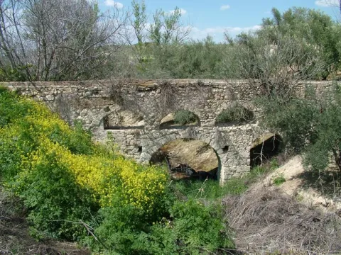
In Hornos de Peal, one of the pedanias of Peal de Becerro, is still in operation an old aqueduct, which has been built by Roman, which continues to challenge the passage of time and that of a river that crosses it below by deteriorating it.

Ubicación
Código Postal
23460
Latitud
37.913500
Longitud
-3.112890
Municipio
Ubicación en el mapa
POINT (-3.11289 37.9135)
Tipos de punto de interés
Imágenes carrusel
imagen
Imagen
acueducto.jpg
Imagen principal
Desactivado
Imágenes cabecera
imagen
Imagen
Monumentos7AcueductodeHornosdePeal.jpg
Imagen principal
Activado
Loading map
Preparing points of interest and routes...

Holly and Lauroid Forests de alta montaña

Submitted by brandcode_deweloper on
Id
919588
Descripción
Descripción larga

By withdrawing the ice, the Azebos undertook a migration to the contrary, reconquering to the north the lost territory, so we can say that all the Azebos of Europe are descendants of ours. So, when we enjoy this forest, let us remember that these stalks are waiting for the next glaciation... so that, after it, Europe will again have stalks.

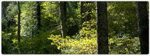
This forest is accompanied as a vault by a canopy of salgary pines and a tapestry of ferns (Pterydium aquilinum) and herbaceas (Dactylis glomerata, Poa nemoralis, Festuca nevadensis, Brachypodium sylvaticum, Viola kitaibeliana, Bellis perennis, Sanicula europea) and others better known as the wild strawberry (Fragaria vesca), the tears of David or the seal of Solomon (Polygonatum), and the greater (Pallatago (Pallatago).

LOCATION

We take the road that leaves a mile from Siles in the direction of the Azebeas. We follow it until we reach a crossing that comes to our right, is wide and has a barrier and a sign that announces us the public use path of Navalperal. It is only necessary to walk half a mile before reaching the forest house of the Azebeas. Both to our right and to our left is a splendid forest of steels accompanied by hazelnuts.

Breve descripción

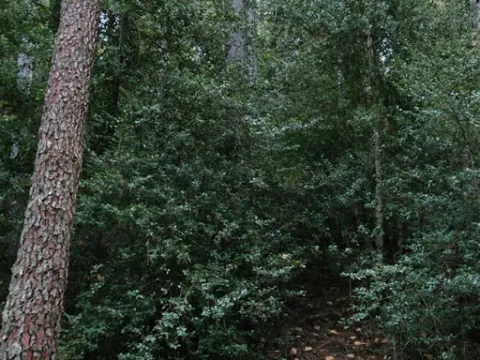
The acebedas, where the dominant tree or bush is the acebo (Ilex aquifolium), is such a closed formation that it does not allow the development of sotoscala. Finding a forest like this in the south, in Andalusia, is a luxury. These forests extend through the center and north of the Peninsula, and the ones we have here are a vegetable jewel. These balls came here thousands of years ago, pushed south by the cold and ice of the last glaciation.

Ubicación
Latitud
38.387861
Longitud
-2.582637
Distrito
Municipio
Ubicación en el mapa
POINT (-2.582637 38.387861)
Imágenes carrusel
imagen
Imagen
604_AR_01.jpg
Imagen principal
Desactivado
imagen
Imagen
Acebedas-2.jpg
Imagen principal
Desactivado
imagen
Imagen
Acebedas.png
Imagen principal
Desactivado
Imágenes cabecera
imagen
Imagen
acebeas.jpg
Imagen principal
Activado
Loading map
Preparing points of interest and routes...

Layer Fan Stratification en Hinojares (Arroyo Turrillas)

Submitted by brandcode_deweloper on
Id
660720
Descripción
Descripción larga

This set of layers is an angular discord with expansive overlaps over materials of triatic age. This is a magnificent example of the filling of an alluvial fan, fed by the prebetic reliefs immediately to the north.

Source: Inventory of Georresources of Andalusia. Environmental Council. Junta de Andalusia.

Breve descripción

In the Arroyo Turrillas flora a powerful unit of conglomerates, limos, and clays with carbonates of continental origin, which form a spectacular range of layers.

Ubicación
Latitud
37.715542
Longitud
-2.998754
Municipio
Ubicación en el mapa
POINT (-2.998754 37.715542)
Tipos de punto de interés
Imágenes carrusel
imagen
Imagen
P1080987.JPG
Imagen principal
Desactivado
imagen
Imagen
P1080773.JPG
Imagen principal
Desactivado
Imágenes cabecera
imagen
Imagen
P1090156.JPG
Imagen principal
Activado
Loading map
Preparing points of interest and routes...

Transport Rivera Bus

Submitted by brandcode_deweloper on
7087086
Descripción larga

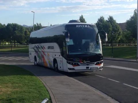
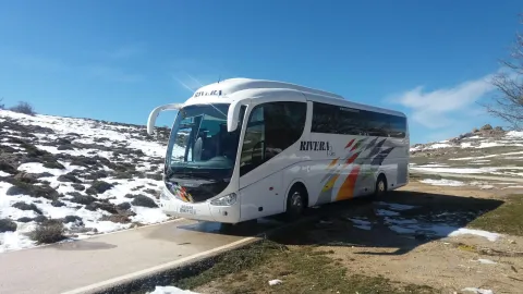
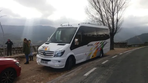
Rivera bus is a company specialized in the transport of passengers by road with more than 30 years of experience in the sector and that stands out for its: varied and modern fleet of vehicles,
high level of reliability in the provision of services, excellent value for money, excellent and close to the customer.

Teléfono
629 531 494 / 629 071 624
Sitio web
https://www.riverabus.es/
Correo electrónico
jrivera@riverabus.es
Código Postal
23600
Latitud
37.708910
Longitud
-3.968220
Dirección
Av. Príncipe Felipe, 144
Distrito
Municipio
Ubicación en el mapa
POINT (-3.96822 37.70891)
imagen
Imagen
bus9.jpg
Imagen principal
Activado
imagen
Imagen
bus2.jpg
Imagen principal
Desactivado
imagen
Imagen
bus6-57pn7v.jpg
Imagen principal
Desactivado

Friends

icon-intereses-amigos

Adventure

icon-intereses-aventura

Culture

icon-intereses-cultura

Culture of the Bull

icon-intereses-cultura-del-toro

Sport

icon-intereses-deporte

For couples

icon-intereses-en-pareja

Family

icon-intereses-familia

Gastronomy

icon-intereses-gastronomia

Municipality

icon-intereses-municipio

Nature

icon-intereses-naturaleza

Business

icon-intereses-negocios

Seniors

icon-intereses-senior
Loading map
Preparing points of interest and routes...

Santiago García. Vintage vehicle rental

Submitted by brandcode_deweloper on
7058284
Descripción larga

A recognized trajectory in the sector for years in which Santiago García is involved in each case in the final rescue which involves relaunching a historical vehicle, including the legal and administrative part of its start-up.

Thanks to the daily effort, there are many vehicles that are redocumented year after year and they recover the power to return to our streets and roads.

For years we have been engaged in restoration and this has allowed us to have a wide knowledge of the history of the automotive.

For all this, we can now offer you from:

- Processing of vehicle documentation.

- Vehicle reports.

- Sale of old and classic vehicles.

- Rental of vehicles for cinema, TV, advertising spots, etc.

- Rental of vehicles for weddings, events, etc.

Teléfono
609 230 955
Sitio web
http://www.sgclasicos.com/
Correo electrónico
info@sgclasicos.com
Código Postal
23200
Latitud
37.772886
Longitud
-3.788329
Dirección
Carretera Madrid-Cádiz, Km. 267,6
Distrito
Municipio
Ubicación en el mapa
POINT (-3.788329 37.772886)
imagen
Imagen
logo-Top.png
Imagen principal
Activado
imagen
Imagen
shutterstock_1445554379.jpg
Imagen principal
Desactivado

Friends

icon-intereses-amigos

Adventure

icon-intereses-aventura

Culture

icon-intereses-cultura

Culture of the Bull

icon-intereses-cultura-del-toro

Sport

icon-intereses-deporte

For couples

icon-intereses-en-pareja

Family

icon-intereses-familia

Gastronomy

icon-intereses-gastronomia

Municipality

icon-intereses-municipio

Nature

icon-intereses-naturaleza

Business

icon-intereses-negocios

Seniors

icon-intereses-senior
Loading map
Preparing points of interest and routes...