Saltar al contenido principal
icon-intereses-cultura

Former Civil Guard Barracks

Submitted by brandcode_deweloper on
Id
8103250
Descripción
Descripción larga

Located in the northern part of the population, at the beginning of it.

Breve descripción

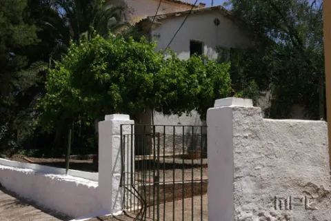
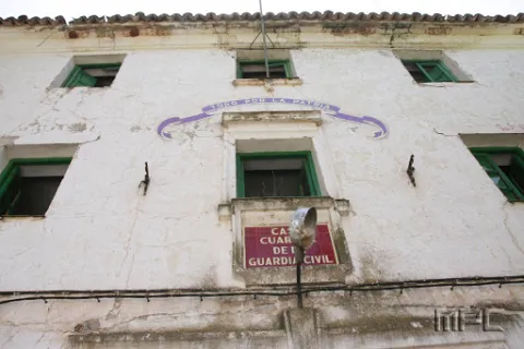
Today abandoned building, it retains on its facade the emblem of the civil guard. It highlights the greenish color of its main door and windows.

Telecomunicaciones
Correo electrónico
ayuntamiento@carboneros.es
Ubicación
Código Postal
23211
Latitud
38.232766
Longitud
-3.630393
Dirección
C/ Escolástica, 8
Distrito
Municipio
Ubicación en el mapa
POINT (-3.630393 38.232766)
Tipos de punto de interés
Imágenes carrusel
imagen
Imagen
Antiguo%20Cuartel%20de%20la%20Guardia%20Civil%202.jpg
Imagen principal
Desactivado
Imágenes cabecera
imagen
Imagen
Antiguo%20Cuartel%20de%20la%20Guardia%20Civil.jpg
Imagen principal
Activado
Loading map
Preparing points of interest and routes...
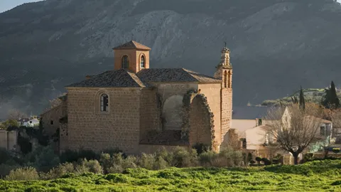
Former Convent of Santo Domingo

Submitted by brandcode_deweloper on
Id
910634
Descripción
Descripción larga

The Former Convent of Santo Domingo, in La Guardia de Jaén, is one of the most distinctive landmarks of the Renaissance of the South. Declared a Historical Monument in 1975, it preserves the former conventual church — today the Parish of the Assumption —, part of the cloister, and the remains of the conventual palace, forming an ensemble of great historical and artistic interest.

Founded in the 16th century by Don Rodrigo Messía Carrillo and Doña Mayor de Fonseca, lords of La Guardia with ties to Salamanca, the Dominican convent began construction in 1538. From 1542 onwards, the work took on a new dimension with the involvement of Andrés de Vandelvira, one of the great masters of the Andalusian Renaissance, who introduced innovative architectural solutions in the main chapel and the transept.

The main chapel, with its octagonal floor plan, follows models found in Alonso de Vandelvira's Libro de las Traças (Book of Designs) and is structured through a carefully applied Classical order. The transept is covered by a domed vault with a lantern, resting on four corner piers, creating a space of great balance and clarity. Inside, a remarkable iconographic programme is preserved, with coffered ceilings decorated with Dominican saints, prophets and apostles, as well as reliefs by Juan de Reolid depicting the Passion and Resurrection of Christ.

The ensemble reflects the dialogue between Castilian influences — stemming from the Salamanca background of its founders — and the mastery of the Jaén Renaissance, in collaboration with other stonemasons such as Domingo de Tolosa and Francisco del Castillo. Despite the transformations brought about by the disentailment (desamortización) and its later uses, the former convent still retains Renaissance coffered ceilings, remains of mural painting, a sacristy with a 1547 wooden ceiling (alfarje), and an 18th-century black jasper washbasin.

The Former Convent of Santo Domingo is today part of the Renaissance of the South Route, standing as an outstanding example of religious architecture linked to the figure of Vandelvira and to the artistic splendour of the 16th century in the province of Jaén.

Calle Escuelas, 11. 23170, La Guardia de Jaén 
Information and bookings
953 32 71 00

Breve descripción

A space where Vandelvira's architecture converses with five centuries of memory

Telecomunicaciones
Teléfono de contacto
953 327 100
Ubicación
Código Postal
23170
Latitud
37.744720
Longitud
-3.693890
Dirección
C/ Escuelas, 11
Distrito
Ubicación en el mapa
POINT (-3.69389 37.74472)
Tipos de punto de interés
Imágenes carrusel
imagen
Imagen
thumb%20%281%29.png
Imagen principal
Desactivado
Imágenes cabecera
imagen
Imagen
Convento_Santo_Domingo_La_Guardia.jpg
Imagen principal
Activado
Loading map
Preparing points of interest and routes...
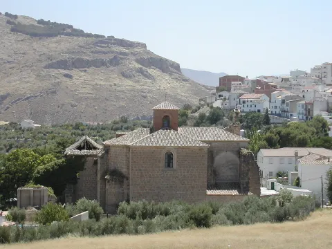
Former Convent of Capuchinos

Submitted by brandcode_deweloper on
Id
1913837
Descripción
Descripción larga

From 1835, with the arrival of the deamortizations, it passed into private hands and became houses and oil factory. The original facade was modified in the 20th century with the construction of a double-step artistic and large windows. From the interior, only the basic structure of the church is maintained, which consists of a single ship with side chapels and a lobby at the feet.

It currently houses the Historical Archive and the Public Library.

Breve descripción

At the southern end of the Paseo de los Alamos is located this ancient convent, built in the mid-17th century.

Telecomunicaciones
Sitio web
www.alcalalareal.es
Teléfono de contacto
953 583 506
Ubicación
Código Postal
23680
Latitud
37.460750
Longitud
-3.921570
Dirección
C/ Obispo Ceballos, 1
Distrito
Municipio
Ubicación en el mapa
POINT (-3.92157 37.46075)
Tipos de punto de interés
Imágenes carrusel
imagen
Imagen
FOC29443.jpg
Imagen principal
Desactivado
Imágenes cabecera
imagen
Imagen
Alcal%C3%A1%20la%20Real%20Poblaci%C3%B3n%207.jpg
Imagen principal
Activado
Horario
Monday to Friday: 10: 00 - 14: 00 and 16: 00 - 20: 00. Saturday: 10: 00 - 14: 00.
Microsite al que pertenece
Loading map
Preparing points of interest and routes...
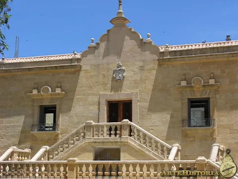
Former Town Hall of Larva

Submitted by brandcode_deweloper on
Id
8088700
Descripción
Descripción larga

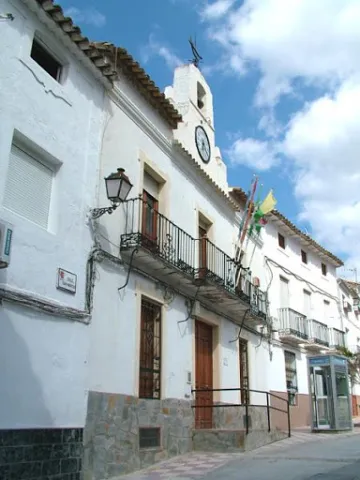
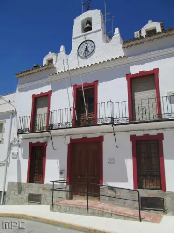
Among the Caserio de Larva is the old Town Hall, located in an altozano, with narrow walls, large symmetrical and verticalized voids, adapted to the slight level of heights of the street, and which is distinguished from the typology of the houses surrounding it by a prismatic, higher fronton, which hosts a watch and a small bell, following the model of the consistory houses of the illustrated colonization.

Breve descripción

The lands of Larva have been populated since the oldest prehistory, a town sponsored by its location near the Guadiana Menor, on the communication road that joined the Alto Guadalquivir with Levante. One kilometre from the city centre is the Iberian settlement of Cerro de Castellón, dated between the 2nd and 1st century BC. It is a fortified enclosure located at the top of a hill isolated in the middle of the plain, which remained occupied in Roman times.

Telecomunicaciones
Sitio web
www.larva.es/el-municipio/patrimonio-historico.html
Teléfono de contacto
953 781 500
Ubicación
Código Postal
23591
Latitud
37.759340
Longitud
-3.201280
Dirección
Paseo de Andalucía, s/n
Distrito
Municipio
Ubicación en el mapa
POINT (-3.20128 37.75934)
Tipos de punto de interés
Imágenes carrusel
imagen
Imagen
Antiguo%20Ayuntamiento%20larva2.jpg
Imagen principal
Desactivado
Imágenes cabecera
imagen
Imagen
Antiguo%20Ayuntamiento%20larva%20%281%29.jpg
Imagen principal
Activado
Microsite al que pertenece
Loading map
Preparing points of interest and routes...
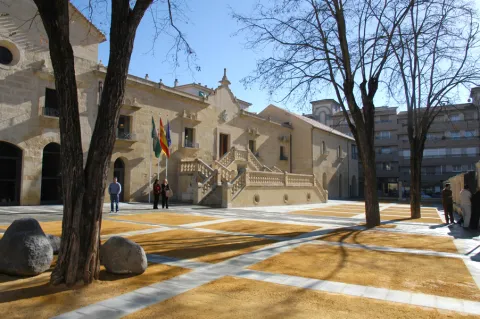
Former Town Hall of Escañuela

Submitted by brandcode_deweloper on
Id
8089950
Descripción
Descripción larga

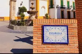
Own building of the late 19th and early 20th century.

Breve descripción

Archaeological remains found in the surroundings of Escuela have seen the human presence in this municipality since the 3rd millennium BC. In the place known as Pozo de Marisancho there appeared remains of dark ceramic belonging to this period of the Copper Age. From its Iberian past several places of remarkable interest are known; in the same well of Marisancho, Iberian ceramics decorated with geometric motifs of bands or circles were collected.

Telecomunicaciones
Sitio web
www.escanuela.es/el-municipio/patrimonio-historico.html
Teléfono de contacto
953 345 101
Ubicación
Código Postal
23657
Latitud
37.878700
Longitud
-4.033380
Dirección
Plaza de la Constitución, C/ Maestra, 1
Distrito
Municipio
Ubicación en el mapa
POINT (-4.03338 37.8787)
Imágenes carrusel
imagen
Imagen
ayuntamiento%20esca%C3%B1uelas2.jpg
Imagen principal
Desactivado
Imágenes cabecera
imagen
Imagen
ayuntamiento%20esca%C3%B1uelas.jpg
Imagen principal
Activado
Loading map
Preparing points of interest and routes...
Old Butcheries

Submitted by brandcode_deweloper on
Id
2293082
Descripción
Descripción larga

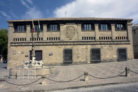
As the original building was larger than the space it was going to occupy, the solution was to "fold" the ends and fold them on the sides. The building consists of two bodies. In the first body there is a door and three windows, to the right we find the shield of the corridor, and to the left that of the city. The second body is formed by a lookout with square pillars interrupted in the center by the shield of Charles V.

The butcher's shop had a slaughterhouse on the ground floor and a sale on the top. Its uses have varied over time: municipal slaughterhouse, skin dryer, municipal archive, museum etc. It is currently the seat of the courts.

Breve descripción

The building was built in 1547 during the reign of Charles V. Originally it was in extramueros, but in the middle of the S. XX it moved to the Plaza del Populo to complete its configuration.

Telecomunicaciones
Sitio web
www.baeza.es
Teléfono de contacto
953 740 150
Ubicación
Código Postal
23440
Latitud
37.991740
Longitud
-3.470330
Dirección
Plaza del Pópulo, s/n
Municipio
Ubicación en el mapa
POINT (-3.47033 37.99174)
Tipos de punto de interés
Imágenes carrusel
imagen
Imagen
Mon207.jpg
Imagen principal
Desactivado
imagen
Imagen
unnamed.jpg
Imagen principal
Desactivado
Imágenes cabecera
imagen
Imagen
Baeza-Antigua_Carniceria-20110918.jpg
Imagen principal
Activado
Horario
External visit.
Loading map
Preparing points of interest and routes...
Alto de la Pandera

Submitted by brandcode_deweloper on
Id
2853258
Descripción
Descripción larga

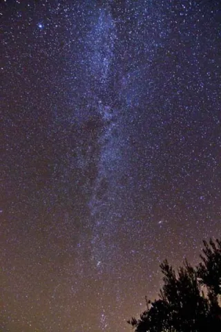
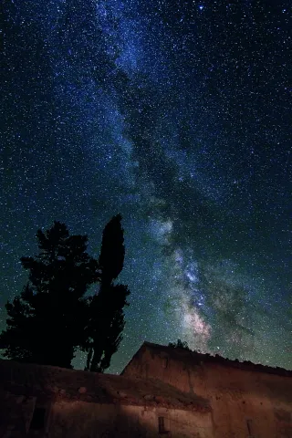
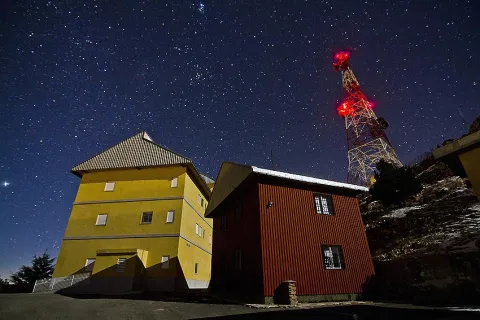
The northern horizon is impractical due to the proximity of the city of Jaén, however, looking east and south we find a true spectacle. It is a highly recommended place for those most expert fans who not only seek dark conditions but also good looking conditions, and is that at more than 1,800 meters high the atmospheric transparency is excellent, being one of the best points for planetary observation and photography.

To arrive there is only to take the detour on the road that links Los Villares with Valdepeñas de Jaén and ascend to the heliport, located on the top.

Note: some days of laminar air flow may occur in which case it is preferable to observe in the explanade that is next to the buildings rather than in the heliport.

Breve descripción

The old military base of La Pandera is the highest point in the Starlight Reserve of the South Sierra de Jaén and an emblematic place for the observation of the firmament. At its top there is a great explanade where in the past there have been important remains of astronomy fans that brought together hundreds of people.

Ubicación
Latitud
37.630386
Longitud
-3.774541
Distrito
Ubicación en el mapa
POINT (-3.774541 37.630386)
Tipos de punto de interés
Imágenes carrusel
imagen
Imagen
24.jpg
Imagen principal
Desactivado
imagen
Imagen
Astroturismo1.JPG
Imagen principal
Desactivado
Imágenes cabecera
imagen
Imagen
alto-pandera.jpg
Imagen principal
Activado
Loading map
Preparing points of interest and routes...
Marcas de calidad

Hamlets of Trujala

Submitted by brandcode_deweloper on
Id
659348
Descripción
Descripción larga

There is another much more spectacular one when crossing the Trujala River from the Batan and known as the Moro Bridge, a construction of armchairs and of great monumental.

It is a must visit the track of land that goes parallel to the river, until its connection to the stream of the Yeros, where a small Roman bridge indicates the way to the cortijo of Romilán.

Breve descripción

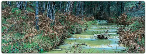
Around the Trujala River, in a landscape of olive groves and carrasco pine pines, a number of villages are very close to each other: the Cortijo del Soto, the Porche and the Batan. All of them are currently inhabited and celebrate their holidays on the first weekend of May. At the Cortijo del Soto you will see next to the new bridge an old one already in disuse, which combines in its construction the brick and the stone.

Ubicación
Latitud
38.298857
Longitud
-2.651877
Distrito
Ubicación en el mapa
POINT (-2.651877 38.298857)
Tipos de punto de interés
Imágenes carrusel
imagen
Imagen
592_img.png
Imagen principal
Desactivado
imagen
Imagen
PARQUE_NATURAL_CAZORLA%2C_SEGURA%2C_LAS_VILLAS._SIERRA_DE_SEGURA.jpg
Imagen principal
Desactivado
Imágenes cabecera
imagen
Imagen
Sierra-Cazorla.jpg
Imagen principal
Activado
Loading map
Preparing points of interest and routes...
Marcas de calidad

Hamlets of Río Madera

Submitted by brandcode_deweloper on
Id
917729
Descripción
Descripción larga

In the Prados de la Mesta, the gardens surrounding the houses are still cultivated, although at present only a few times of the year are inhabited. This way, the GR 147 is in the direction of the Anchos and we can see some examples of traditional architecture, forging bars, gilded walls or wooden doors burned by the sun.

A little below you can stop at Arroyo Canales, a place known as Rio Madera. You can't miss the last weekend of August to the San José parties with a small procession, music, dance and of course a mountain bowling.

Breve descripción

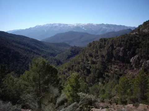
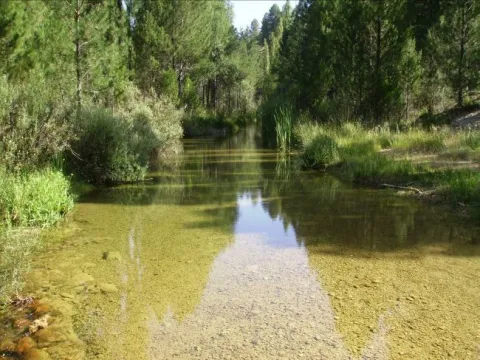
Surrounded by the best pine larice pines in Spain, we find the cortijos and villages of the valley of the river Madera. Of the set we can highlight two: Prados de la Mesa and Arroyo Canales, because they are the most significant, although along the road you can see more cortijos and houses with meadows in which you will see farm animals and even some other pig, fed, all of them, naturally.

Ubicación
Latitud
37.772886
Longitud
-3.788329
Ubicación en el mapa
POINT (-3.788329 37.772886)
Tipos de punto de interés
Imágenes carrusel
imagen
Imagen
madera.png
Imagen principal
Desactivado
Imágenes cabecera
imagen
Imagen
9cee250ec7c0d5ebe5c0fe13d56c8eff.jpg
Imagen principal
Activado
Loading map
Preparing points of interest and routes...
Marcas de calidad

The Goldines Hamlet

Submitted by brandcode_deweloper on
Id
917554
Descripción
Descripción larga

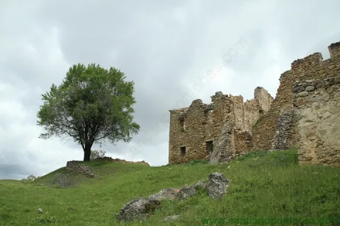
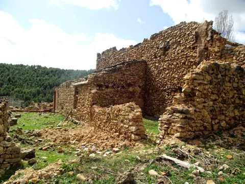
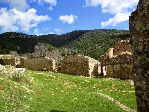
The creation of the National Cazorla-Segura Hunting Coto in 1960 was a change in the use of a large area where there were population centres whose inhabitants had to vacate. The Goldines is one of these villages, of which today only the ruins of the expropriated houses are preserved. Silence involves the visitor, who is only able to intubate the final chapter of a long and black history of injustice.

But the Godines were not, much less, the only village that was forcibly depopulated during the 20th century, the result of abusive State interventions in these mountains. During the construction of the Tranco reservoir, some populations such as San Miguel de Bujaraiza and the Chorreón ceased to exist and this led to the displacement of its inhabitants to other areas of the province of Jaén. The yellow rain of time and oblivion, which gave title to Julio Llamazares' tearing novel on a similar case in the Aragonese Pyrenees, also fell mercilessly on Los Centenares, Las Canalejas or Los Archites, in the Segura saw. Today they're just rubble and names, but they won't be forgotten.

Breve descripción

The overwhelming environment of desolation in the village of Los Goldines, easily accessible and located in a very beautiful place, helps us to intubate the terrible drama that many serrans suffered and still remember. It was the result of despotic actions by public administrations that were not afraid of any protest, as they enjoyed the impunity given them by the Franco dictatorship.

Ubicación
Latitud
37.772886
Longitud
-3.788329
Ubicación en el mapa
POINT (-3.788329 37.772886)
Tipos de punto de interés
Imágenes carrusel
imagen
Imagen
Los%20Goldines%20020.JPG
Imagen principal
Desactivado
imagen
Imagen
goldines.JPG
Imagen principal
Desactivado
Imágenes cabecera
imagen
Imagen
los-goldines.JPG
Imagen principal
Activado
Loading map
Preparing points of interest and routes...
Marcas de calidad